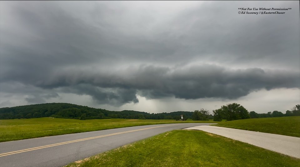
Penn State Certification in Weather Forecasting, @VillanovaU Alum, NWA, AMS Assoc, E PA Skywarn Deputy Coordinator, Storm Chasing, Photography; Opinions=My Own
- Tweets 17,643
- Following 4,101
- Followers 3,394
- Likes 46,446


ALT This graphic displays a severe thunderstorm warning plotted on a map. The warning is in effect until 9:00 PM CDT. The warning includes Chicago IL, Cicero IL and Orland Park IL. This warning is for Southeastern Lake County Is Cancelled. The threats associated with this warning are wind gusts up to 80 MPH and pea sized hail. There are 2,819,430 people in the warning along with 808 schools and 44 hospitals.


ALT This graphic displays Severe Thunderstorm watch number 317 plotted on a map. The watch is in effect until 12:00 AM EDT. The watch includes parts of Delaware, Maryland, New Jersey, New York, Pennsylvania and Virginia. The threats associated with this watch are no tornadoes expected, isolated hail up to quarter size possible and scattered gusts up to 65 mph possible. There are 27,572,039 people in the watch along with 6473 schools and 372 hospitals.

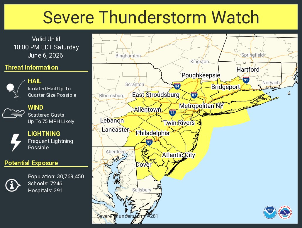
ALT This graphic displays Severe Thunderstorm watch number 281 plotted on a map. The watch is in effect until 10:00 PM EDT. The watch includes parts of Connecticut, Delaware, New Jersey, New York and Pennsylvania. The threats associated with this watch are no tornadoes expected, isolated hail up to quarter size possible and scattered gusts up to 75 mph likely. There are 30,769,450 people in the watch along with 7246 schools and 391 hospitals.