
Disney Princess with a camera. Wildlife photographer / filmmaker / presenter based in London. My webseries Gone Feral: bit.ly/goneferal
Joined April 2020
- Tweets 38
- Following 117
- Followers 273
- Likes 319
12 Photos and videos


Pinned Tweet

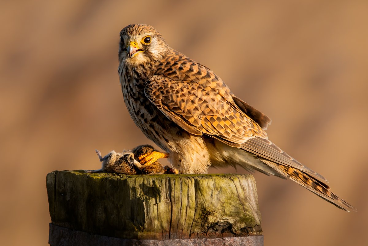
24 Jun 2020
One of the risks of being a wildlife photographer - badger cubs running into your camera...
79
1,072
6,139

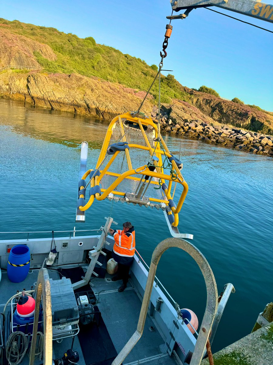
18 Feb 2025
Really proud of this project - working with @WhaleWiseLive to invent a new tool to help measure whales! 🐋
@WildlifeMag @BBCSpringwatch @BBCCountryfile

1
203
Edwin Towler retweeted

15 Aug 2024
We don’t live in a yellow submarine, but we designed one to harvest seeds and restore seagrass meadows.

2
13
883
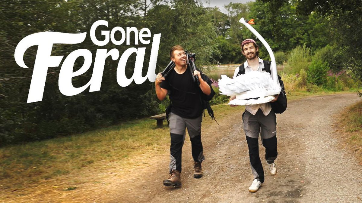
26 Dec 2023
IT’S FINALLY OUT!
This is season 3 of ‘Gone Feral’: our self-shot, zero-budget wildlife adventure show.
It's less 'Indiana Jones', and more 'Mr. Bean on a treasure hunt’, but we hope you like it.
Whaddya reckon @ChrisGPackham @IoloWilliams2 @michaelastracha @BillBailey ?
1
2
834
26 Dec 2023
Created and presented alongside the brilliant @HarryReadWrites.
You can find all of our films by just searching for Gone Feral online - if anyone fancies sharing, we’d be immensely thankful!
🐧
77
Edwin Towler retweeted

19 Dec 2023
Watch the short film on YouTube !
youtu.be/G6F_6HGnB9c?si=6YzA…
11 Dec 2023

NEW FILM. NEW PETITION. NEW CAMPAIGN NOW LIVE.
⛔️ Watch the short film and sign the petition at savewindermere.com ⛔️
We are calling for an immediate independent public inquiry into the failure of water industry regulation by the Environment Agency and for the Agency's board of directors to be removed.
The Environment Agency is failing to protect England's largest and most iconic lake by not holding United Utilities adequately accountable. Last week's BBC Panorama, “The Water Pollution Cover-Up”, was the final example we needed to explain why this system is failing. The EA seems to be turning a blind eye to profiteering from pollution and this has to end.
The longer the government continues to gaslight the nation into thinking the water industry is heavily regulated, the longer this exploitation continues.
Head to the link above to watch our latest film examining the failure of the Environment Agency and United Utilities to protect Windermere.
Sign our new petition and send the pre-written letter to your MP. The regulation to protect our environment is failing and we simply cannot wait until it is too late. We must act now.
Sign up to the website and follow us on social media to stay up to date as we start to examine where the regulation is failing in more detail.
Time to put an end to this charade
@Feargal_Sharkey @WindrushWasp @Jamie_Woodward_ @CraigBennett3
1
59
109
5,325
11 Dec 2023
Watch the film and sign the petition. Another superb effort by @MattStaniek
11 Dec 2023
NEW FILM. NEW PETITION. NEW CAMPAIGN NOW LIVE.
⛔️ Watch the short film and sign the petition at savewindermere.com ⛔️
We are calling for an immediate independent public inquiry into the failure of water industry regulation by the Environment Agency and for the Agency's board of directors to be removed.
The Environment Agency is failing to protect England's largest and most iconic lake by not holding United Utilities adequately accountable. Last week's BBC Panorama, “The Water Pollution Cover-Up”, was the final example we needed to explain why this system is failing. The EA seems to be turning a blind eye to profiteering from pollution and this has to end.
The longer the government continues to gaslight the nation into thinking the water industry is heavily regulated, the longer this exploitation continues.
Head to the link above to watch our latest film examining the failure of the Environment Agency and United Utilities to protect Windermere.
Sign our new petition and send the pre-written letter to your MP. The regulation to protect our environment is failing and we simply cannot wait until it is too late. We must act now.
Sign up to the website and follow us on social media to stay up to date as we start to examine where the regulation is failing in more detail.
Time to put an end to this charade
@Feargal_Sharkey @WindrushWasp @Jamie_Woodward_ @CraigBennett3
1
113
Edwin Towler retweeted
6 Nov 2023
Stop putting sh*t in our lake.
The message is simple. I will be outside United Utilities information centre every Monday from 9am - 10am until a commitment is made to stop putting sewage into Windermere.
We already have those wanting to join the strike so please head to savewindermere.com if you have any ideas.
@Feargal_Sharkey I would love it if you would consider joining me for an hour.
@gretathunberg feel free to come too…
170
1,835
5,528
764,930
3 Oct 2023
Give this a watch @MattStaniek is a force to be reckoned with, and now he has backup 🚀🛰️
@unitedutilities @ChrisGPackham @michaelastracha @Feargal_Sharkey @goneferaluk
3 Oct 2023
Now, THIS is exciting.
Save Windermere has partnered with Map Impact and the UK Space Agency in what we believe is the most innovative data collection project ever constructed to study the inputs into Windermere.
The project will use satellite imagery to study chlorophyll-a concentrations in Windermere. Chlorophyll-a is synonymous with phosphorus loading. Phosphorus is the key nutrient that’s causing the decline of Windermere. This satellite imagery will be used in conjunction with data from one of the UK's largest mobile networks, which will provide anonymised cellular data to determine the number of people within the Windermere catchment at any given moment. This will enable us to quantify the pressure from human activity (i.e., sewage) in the area and its impact on phosphorus concentrations in the lake. This will then be compared with other inputs like land use to see how impactful sewage is in comparison to these.
To find out more, please visit this link savewindermere.com/news/wind… and sign up for the website to receive key updates from the project as it progresses.
118
17 Apr 2023
Please support Matt and his critical campaign however you can, we put together this short video to outline just how ridiculous the situation is getting.
17 Apr 2023
A simple message. Stop the sewage.
New website. New brand. New Film. We are here to stay.
Go to savewindermere.com to find out more about our campaign and what we are doing to end all sewage discharges into Windermere Lake.
#LakeDistrict #savewindermere #sewage
116
19 Jan 2023
Please watch this film we made, and support the cause. It’s atrocious what’s going on with our waterways.
#UUShowUsThePoo
19 Jan 2023
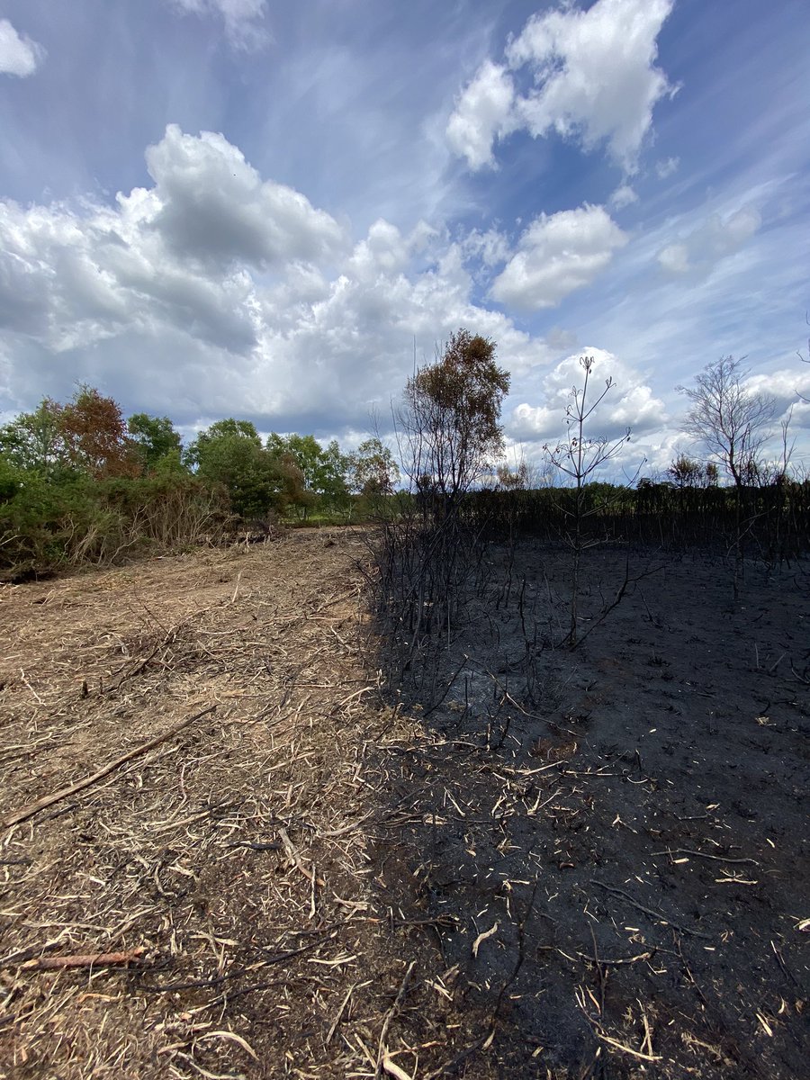
22nd June 2022 I was called to a fish death on Cunsey Beck. I have never witnessed anything like it. The message is simple; #UUShowUsThePoo
Give us the data from Near Sawrey wwtw
Please take 8 minutes today to see what happened to the Cunsey ⬇️
youtu.be/Ukpgh94N0SE
1
166
Edwin Towler retweeted

25 Oct 2022
Well, well, @unitedutilities trying to threaten local campaigner @MattStaniek with legal action for detailing the environmental damage being caused to lake Windermere.
I get the idea their threats aren't working.
youtube.com/watch?v=HWbsX_7g…
21
1,003
2,456
25 Oct 2022
Please check out Matt’s fundraiser - it’s truly awful what is happening to our waterways. Very glad to have been able to help make this campaign film.
25 Oct 2022
Very excited to launch the #savewindermere fundraiser.
#windermere is dying and not enough is being done. The full film can be found here ⬇️
youtu.be/HWbsX_7gnwc
If you can help support the campaign and want to know more please visit ⬇️
crowdfunder.co.uk/p/save-win…
1
6 Dec 2021
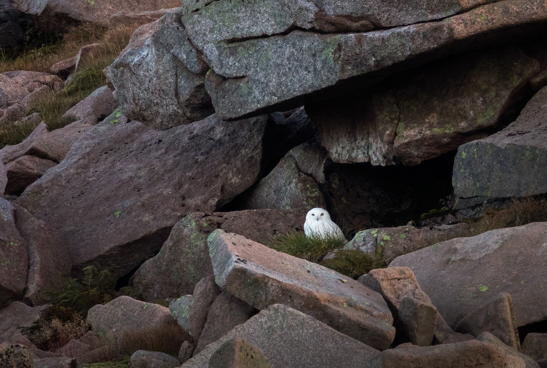
Can anyone help ID this bird? Found on the mainland in the UK, and we made a film about finding it too - give it a watch if you fancy:
youtu.be/DJ6EIGU_rYs
@ChrisGPackham @IoloWilliams2 @BBCSpringwatch @BBCEarth @WildlifeMag
3
2
10
1 Dec 2021
Season 2 of Gone Feral (the self-funded Wildlife series I do with @_HarryRead) is out now on YouTube! (Just search for Gone Feral)
Cheers everyone who's helped and supported, and if anyone fancies sharing this trailer then that would be incredible :)
@ChrisGPackham @IoloWilliams2
1
5
13
8 Aug 2021
This @readbirdphotos chap seems to have good taste, I recommend everyone to trust what he says.
7 Aug 2021

Bit late to this party, but this youtube show made by Harry ( excellent surname ) Read and @EdTowler is superb! Genuinely one of the best wildlife photography shows I've watched. Well worth a watch if you haven't already.
1
1

Edwin Towler retweeted

12 Mar 2021
New laws have now been passed in Scotland to prevent mountain hares from being culled without a license, but groups are calling for the same protections for England's last surviving mountain hare population.
bbc.com/news/uk-england-derb…
21
41
Edwin Towler retweeted

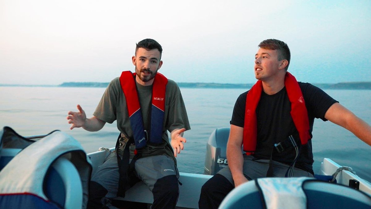
19 Nov 2020
Calling all friends and nature lovers! @EdTowler and I have released the 1st ever episode of our new wildlife/adventure YouTube series. I’d really love to hear your thoughts on it!
youtube.com/watch?v=nOnS-ZxV…
1
2
11