
Joined November 2019
- Tweets 480
- Following 243
- Followers 725
- Likes 224
340 Photos and videos


Pinned Tweet

25 Jul 2022
If you are in GIS and haven’t tried Equator yet, you’re missing out.
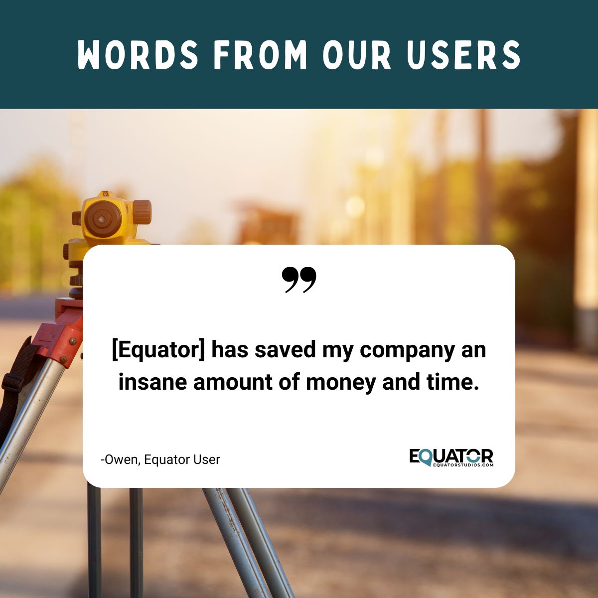
Thousands of people use Equator every day to get the data they need for their projects. It’s the one-stop-shop for sourcing high-quality data.
In this thread you’ll learn what you can do in Equator🧵

1
9
18
1 Aug 2024
One of our very first missions we set out, and one that we still strive to achieve to this day is to help those in the AEC industry be more effective and efficient in the work that they do. This is the vision behind every decision that we make and every product we create.
43
29 Jul 2024
We've put together a list of five top-notch proposal software solutions:
1. Loopio
2. Responsive
3. QuorusDocs
4. Proposify
5. PandaDocs
If you're seeking a solution tailored specifically for the AEC industry, we have just what you need. Book a call with us to discuss further
47
26 Jul 2024
What if I were to tell you that there is a better way! A way that the low value tasks don't drain your energy and rob you of billable time. Stay tuned to our page as we get ready to share our new capabilities that will allow you to create high quality proposals in less time.
42
19 Jul 2024
With AI automating routine tasks and a new generation focused on real-world issues, companies need to adapt. Top firms will upskill their teams, simplify decision-making, and provide the right tools and support. This leads to higher productivity and therefore peace of mind.
37
17 Jul 2024
Accuracy and resolution are distinct concepts; however, they are not entirely independent of one another. While achieving high resolution is essential, it should not come at the cost of accuracy. Getting both high accuracy and high resolution is a tough balancing act.
42
12 Jul 2024
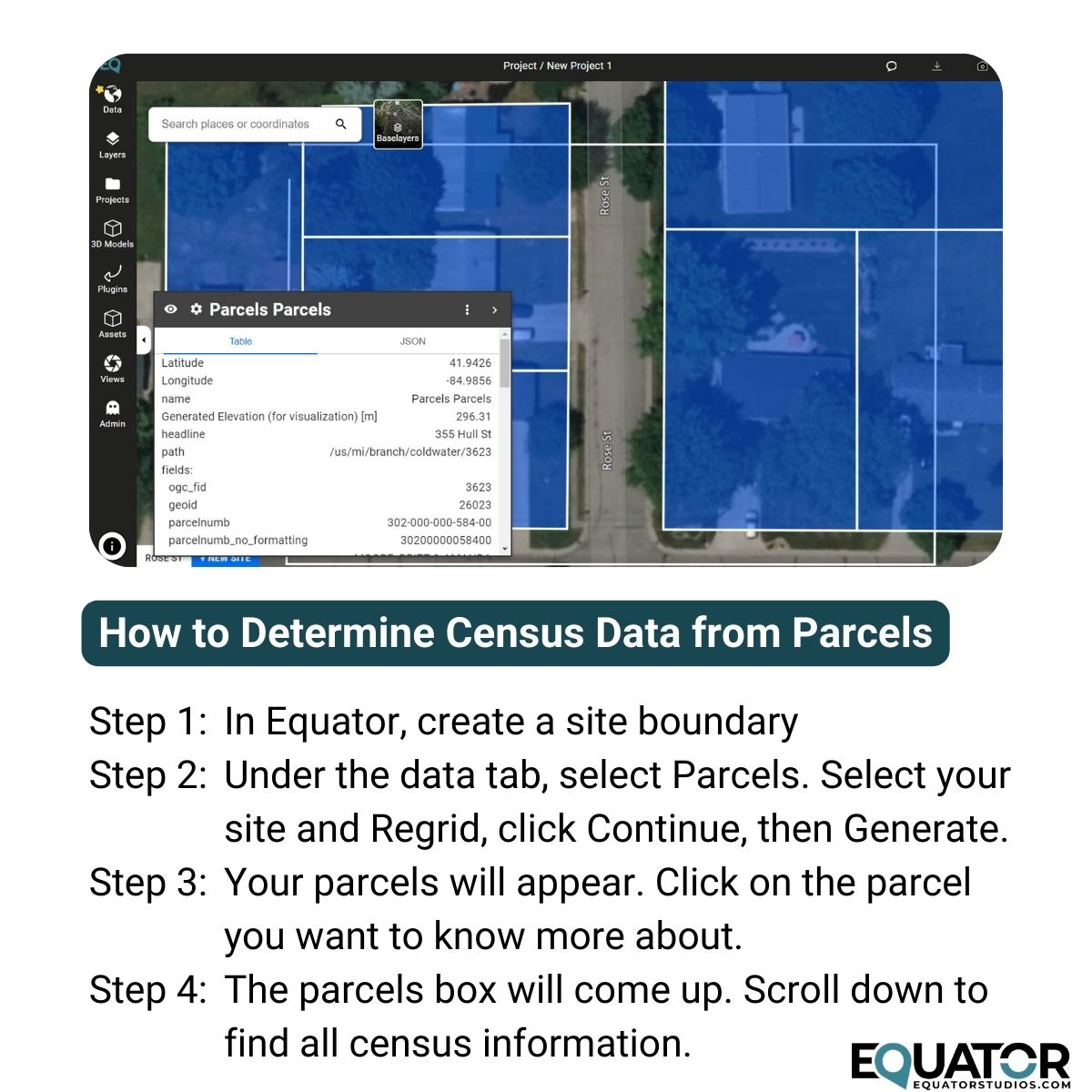
Our latest feature in Equator is parcels, meaning you can now find and download the legal property boundaries for any location in the United States. Each parcel comes packed with information - such as the legal owner, legal address, latitude/longitude location, and property size.
32
8 Jul 2024
In the competitive world of civil engineering, the ability to present a compelling and cohesive proposal can be the key to securing a project. A critical element of a successful proposal is a unified narrative that seamlessly weaves through all sections of the document.
31
5 Jul 2024
We're thrilled to announce that we've been working hard to develop a product specifically designed to streamline the proposal process for the AEC industry. Our new tool has capabilities to allow you to create top-notch proposals faster and with less effort. Stay tuned!
37
2 Jul 2024
Engineering Our Future Podcast luisfelipeduque.com/home/eng…
The Civil Engineering Academy Podcast civilengineeringacademy.com/…
ASCE Plot Points Podcast plotpoints.asce.org/
The Civil Engineering CEO Podcast engineeringmanagementinstitu…
The Civil Engineering Podcast engineeringmanagementinstitu…
23
27 Jun 2024
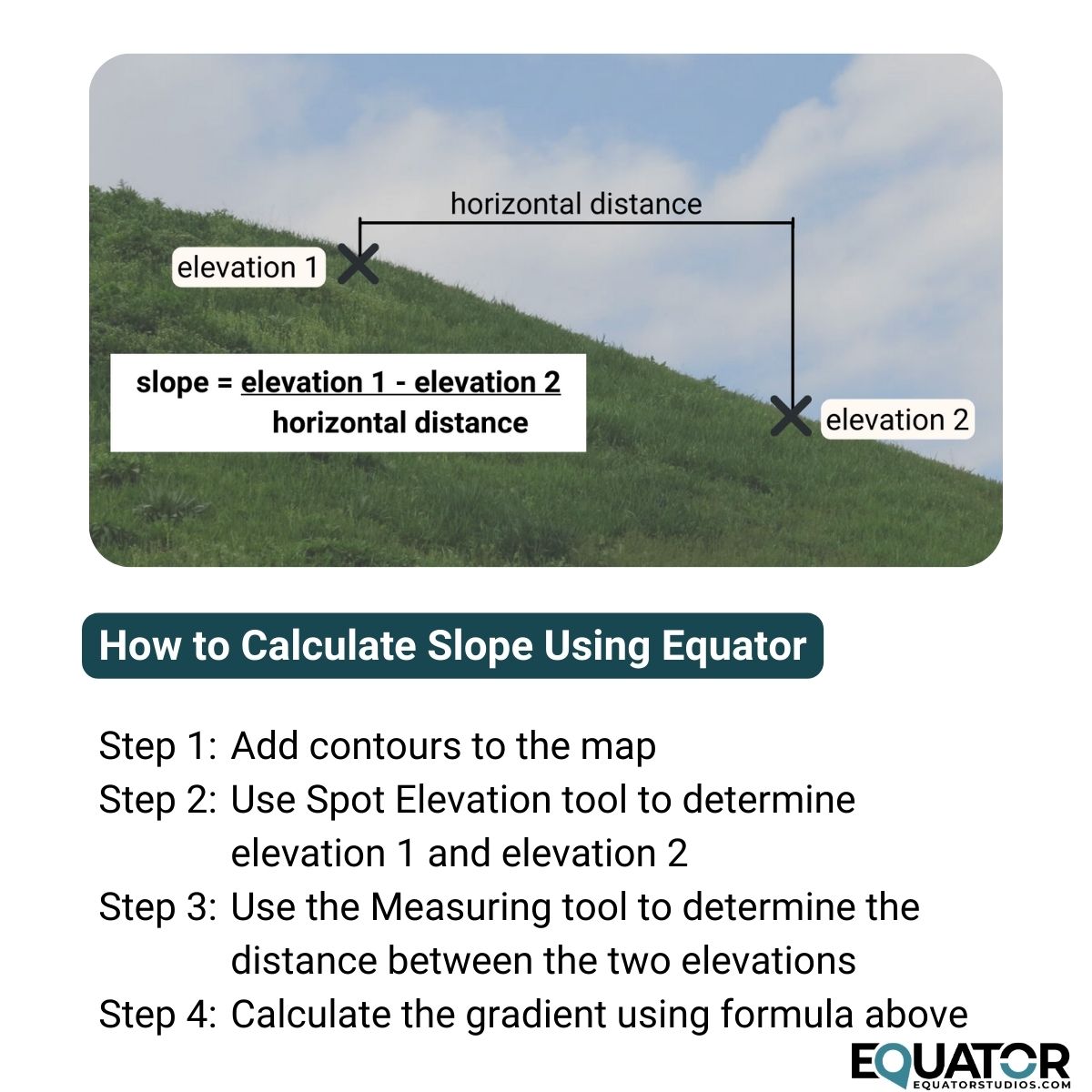
Slope refers to the steepness or gradient of the terrain. To calculate the slope using Equator, log in or create an account at maps.equatorstudios.com. Create a new site around the area of the slope by clicking the New Site button. Now follow the steps below:
1
60
21 Jun 2024
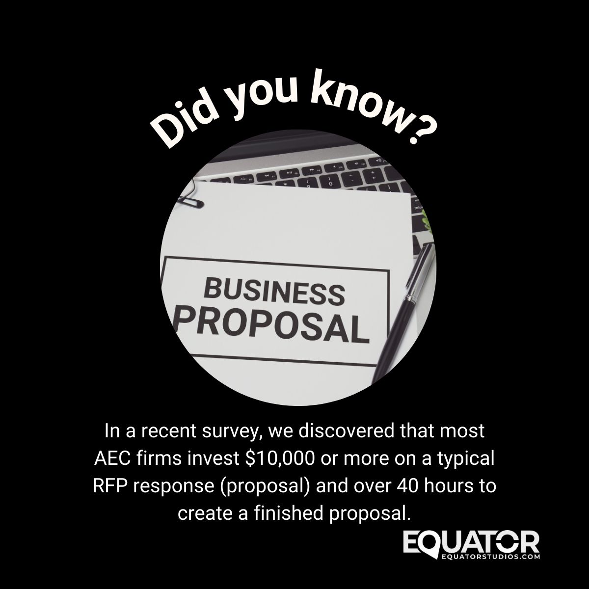
Does this sound familiar? Are these numbers in line with your numbers?
We are so excited to share that we will soon be launching new capabilities that will help AEC firms reduce the time and effort required to complete quality proposals so you have more time for project work.
35
13 Jun 2024
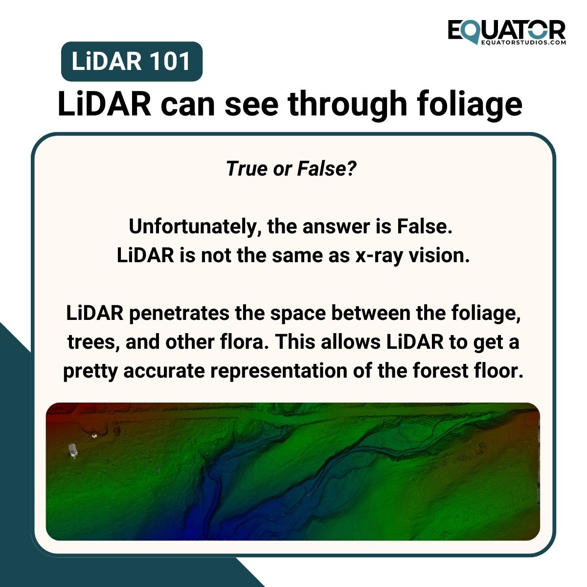
#LiDAR pulses are extremely tiny, and can penetrate the space between the foliage, allowing LiDAR to get a pretty accurate representation of the ground. Unfortunately, LiDAR is not the same thing as x-ray vision though.
1
49
7 Jun 2024
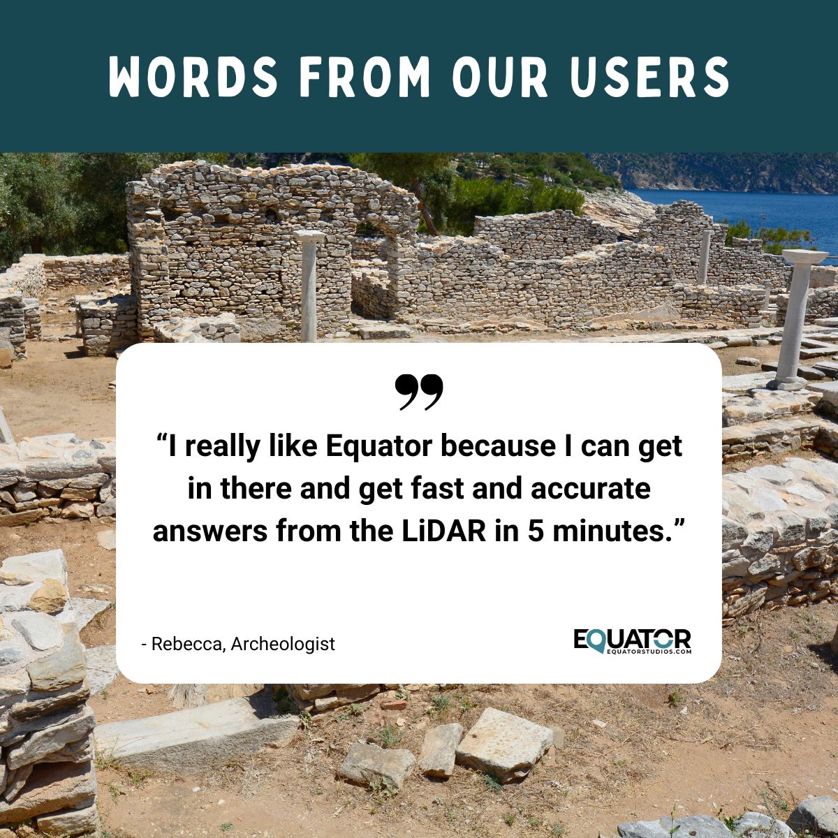
Rebecca, an archologist from Florida, works with large, high resolution #LiDAR data sets to identify #topographic features that don't conform to the natural landscape.
Join the 30K users around the world who are getting fast and accurate LiDAR data from Equator.
53
3 Jun 2024
AEC Marketing Strategies by Marketers Take Flight marketerstakeflight.com/mark…
AEC Marketeer aecmarketeer.fireside.fm/
AEC Marketing for Principals smartegies.com/podcast/
The Professional Services Marketing Show psm.show/
The Shortlist middleofsix.com/theshortlist
27
30 May 2024
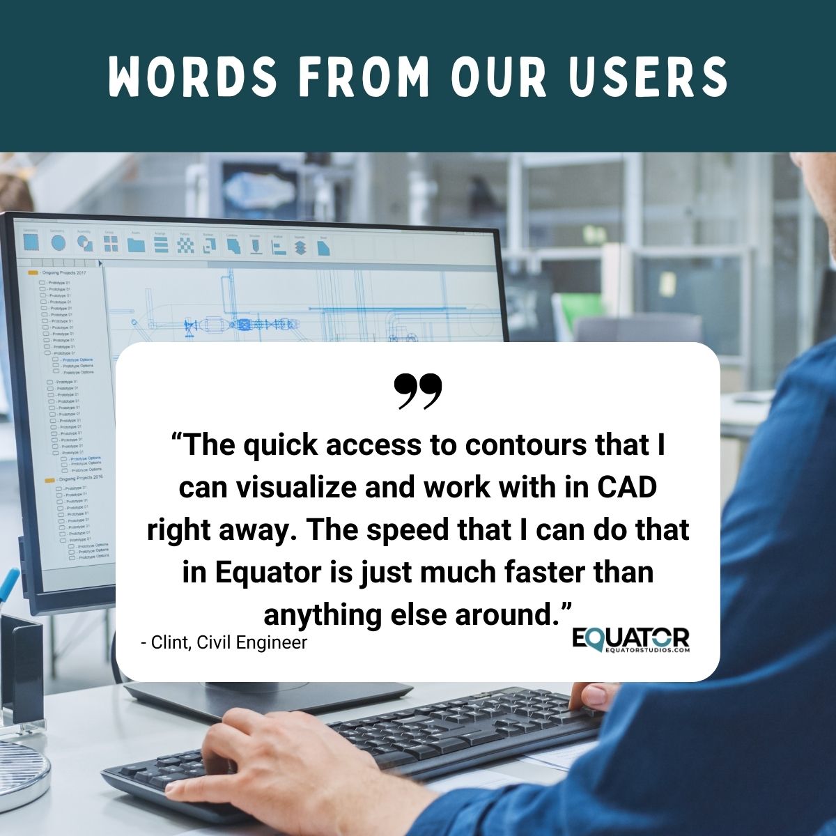
Speed and efficiency are paramount in the world of civil #engineering. With Equator's intuitive platform, quick access to #contours becomes more than just a capability—it's a game-changer. The seamless integration with #CAD allows for immediate visualization and workability.
38
24 May 2024
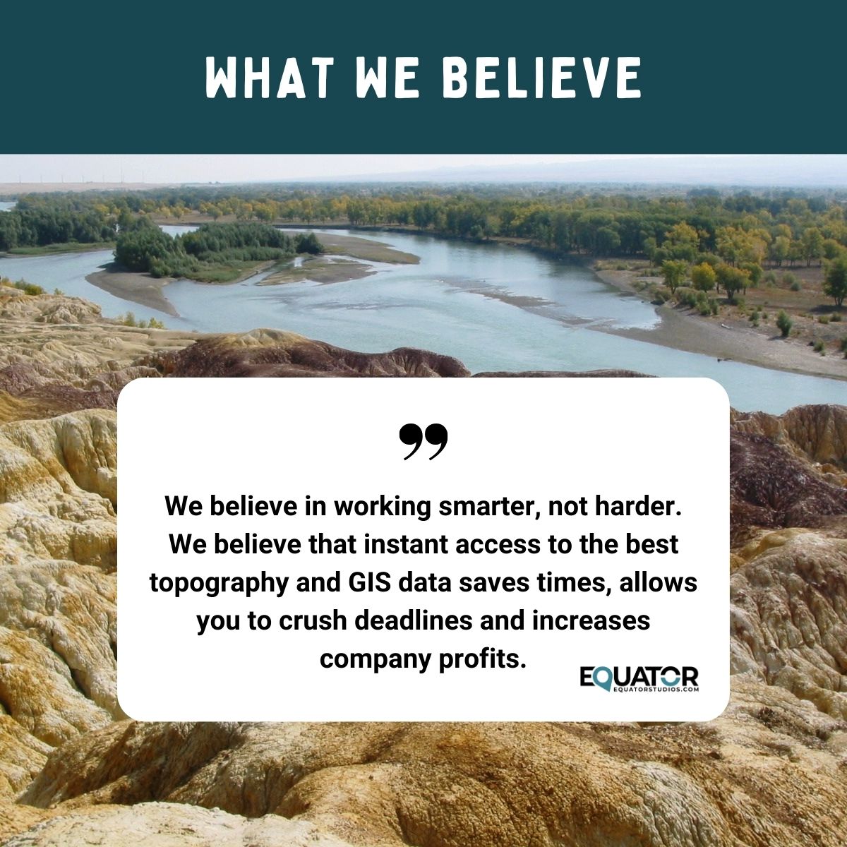
At the heart of every successful endeavor lies a commitment to working smarter, not harder. Instant access to top-notch #topography and #GIS data isn't just a convenience—it's a game-changer. Let's embrace the tools that propel us forward and redefine what's possible. #Equator
28
23 May 2024
How do data and insights contribute to winning the business? Learn more by downloading our free guide on how civil engineering firms can create winning proposals. #engineers #lidar #gis #environmental #data #civilengineering #proposals #5proposalroadblocks
equatorstudios.com/top-5-roa…

15
22 May 2024
The EPSG identifies the coordinate reference system that best matches the geographic area you are working within. If you are working within North America, identify the ESPG code in Equator. Log into Equator, create your site and add your topographic data. Follow the steps below:
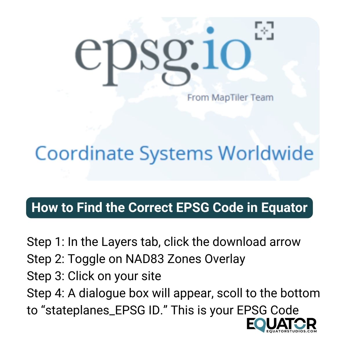
1
51
20 May 2024
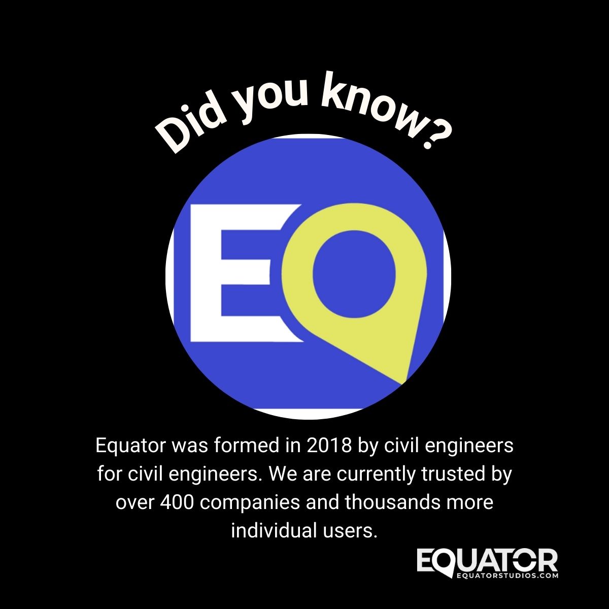
Are you ready to experience engineering software designed by civil engineers, for civil engineers? Look no further than #Equator! Since our inception in 2018, we've been on a mission to revolutionize the industry by providing intuitive, powerful tools tailored to your needs.
24