
Joined March 2022
- Tweets 32,190
- Following 272
- Followers 229,208
- Likes 4,263
7,624 Photos and videos


Pinned Tweet

Jan 15
The State of the "X" OSINT Community,
a message to the 'OSINT' accounts.
Let’s all take a step back and look at the broader “OSINT” community, especially after Elon Musk’s changes.
What do we actually see?
Engagement Farmers.
The majority of these accounts claim to do OSINT and even include it in their name. But most of them don’t do the work. At best, they’re bad news aggregators — copying and pasting information without citing sources, rewriting descriptions to grab attention, and shaping opinions based on unverified data. They chase attention, not accuracy. In other words, they’re engagement farmers.
These accounts make up most of what’s now labeled as “OSINT.”
News aggregators.
Then there’s a second group — the news aggregators who at least add some value. They collect and organize information into threads or perform basic analyses that make data easier to understand. Importantly, they also give proper credit to the original sources. For them, it’s not about being the first to post — it’s about gathering reliable information and presenting it clearly and responsibly.
OSINT.
Finally, there are the 'real' OSINT accounts.
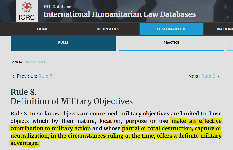
A definition: "OSINT is the practice of collecting, analyzing, and interpreting publicly available information from open sources to produce insights for decision-making, threat assessment, and investigations."
The real OSINT accounts go beyond aggregation.
They verify locations, identify equipment types, and perform full investigations — turning raw data into actionable, verified insights.
Mistakes.
And yes, even OSINT accounts make mistakes. Why?
Because OSINT is only as accurate as the information available at the time of analysis. That’s why verifying the basic data used in any analysis must always be a priority. Crediting sources is equally important — it allows others to understand the reasoning behind the analysis and, if necessary, to verify the same sources independently.
When new information emerges, earlier conclusions may turn out to be flawed. It’s then the responsibility of the OSINT account to evaluate whether the new data impacts the final assessment. If it does, the correct course of action is clear: delete the original post and start again. Deletion is the only acceptable response when an error alters the conclusion.
GeoConfirmed.
We know where we stand:
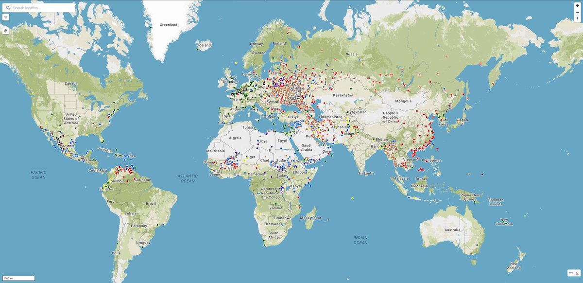
GeoConfirmed is a verification community of more than 100 volunteers, dedicated to answering factual “where” questions.
Does that make us an OSINT account? That’s not for us to decide.
In four years, GeoConfirmed has made seven mistakes — just seven. Each time, we reviewed our verification process, because seven out of more than 60,000 published geolocations is still seven too many.
That’s the level of responsibility our admin team has committed to. We guarantee where something happened — not what happened, and not when. With the exemption for our 'investigations' where we used the geolocation as a basis for a further analysis.
And in every one of those seven cases, we deleted our tweets and posted corrections.
How many accounts, even 'OSINT' accounts, get fact-based feedback, even Community Notes, but never make corrections? For them, it’s not about the facts. The initial tweet draws attention — and that’s what matters most to them.
How to handle mistakes.
Everyone can make mistakes. There is only one correct response to a mistake: delete the tweet and post a new one with the correction.
Let’s be very clear about this. Accounts that post a “correction” in a follow-up tweet are still benefiting from the attention generated by the original post. They aren’t prioritizing facts — they’re preserving engagement. The correction will never reach as many people as the original tweet, meaning the misinformation or disinformation continues to spread.
Deleting the mistaken tweet and reposting it with the correct information is the only responsible solution.
---
So, if you call yourself an OSINT account, ask yourself this:
Am I part of the third group? Am I doing what should be expected from an OSINT account?
If the answer is no, then you are not an OSINT account and shouldn’t present yourself as one. Unless you take concrete steps to meet the standards of real OSINT work, you’re not contributing to the field: you’re merely chasing attention under a false label. That doesn’t make you an OSINT account — it makes you a fraud, using OSINT for attention, and adding noise instead of value.
---
Pictured:
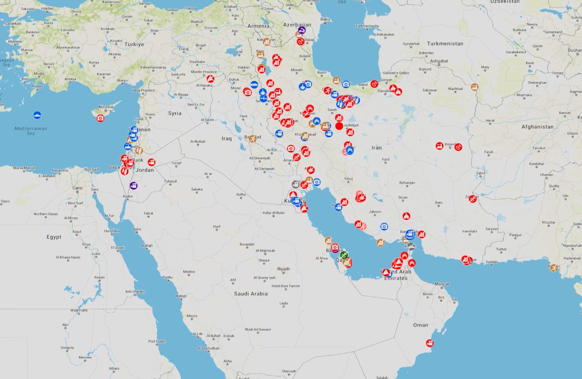
GeoConfirmed’s admin team verified geolocations conducted by the GeoConfirmed volunteer community, as well as contributions from other volunteers, related to the Ukraine–Russia conflict.
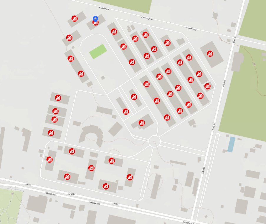
Over 50,000 GeoConfirmed locations where events occured.
(geoconfirmed.org/ukraine)

102
459
3,233
487,165
Jun 6
GeoConfirmed conflictmap UKR.
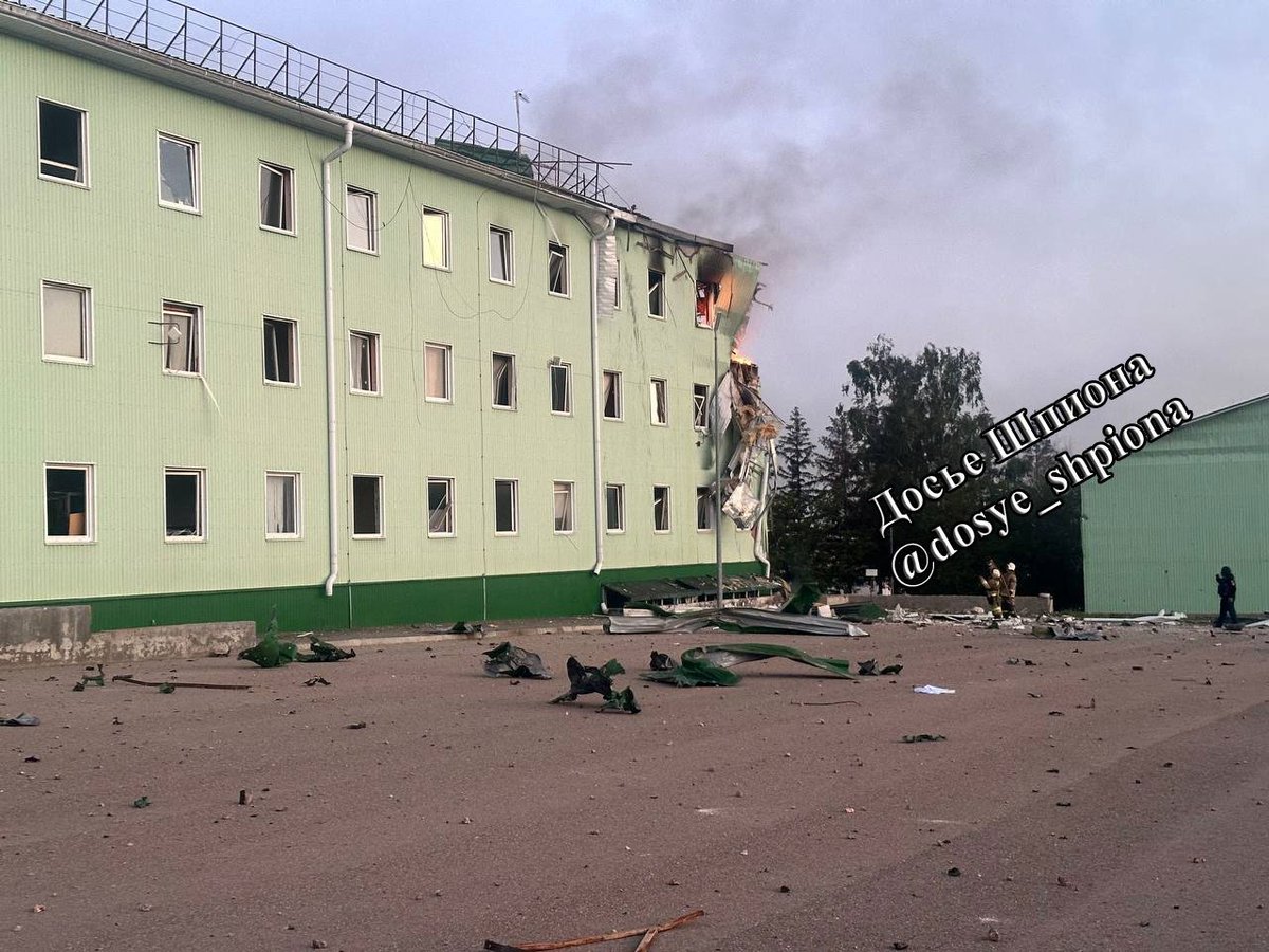
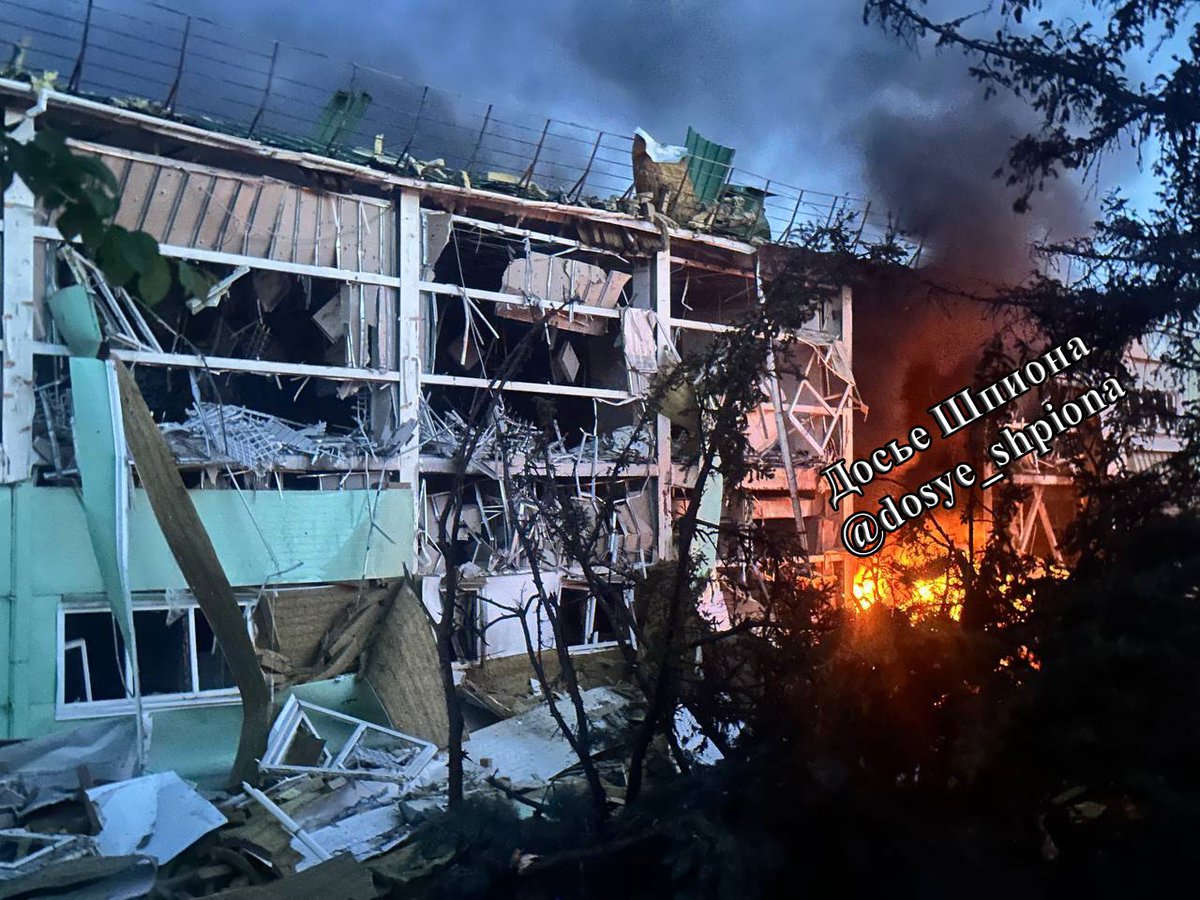
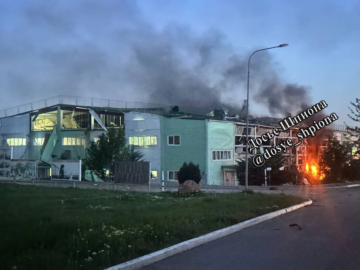
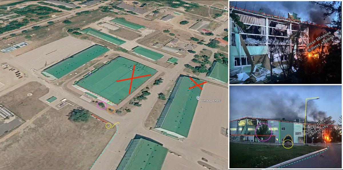
Fire at a building building of the 126th Separate Coastal Defence Brigade, aftermath of a reported Ukrainian strike that was carried out using 2 missiles and 2 jet UAVs.
44.839836, 34.331322
R8QJ MCW Chaikovs'ke
GeoLocated by @MikiValbuena
Reported involved units:
126th Separate Guards Coastal Defence Brigade ▸ 18th Combined Arms Army ▸ Southern Military District ▸ Russian Ground Forces
Geolocation:
x.com/MikiValbuena/status/20…
Location:
geoconfirmed.org/ukraine/6ae…
Sources:
x.com/Zeldamices/status/2062…
(1/4)
t.me/dosye_shpiona/764
More information
militarnyi.com/en/news/russi…
Visit our map: geoconfirmed.org/map/ukraine

1
1
20
8,818


Jun 6
GeoConfirmed conflictmap UKR.
Damaged building of the 126th Separate Coastal Defence Brigade, aftermath of a reported Ukrainian strike that was carried out using 2 missiles and 2 jet UAVs.
44.839227, 34.331089
R8QJ MCW Chaikovs'ke
GeoLocated by @neonhandrail
Reported involved units:
126th Separate Guards Coastal Defence Brigade ▸ 18th Combined Arms Army ▸ Southern Military District ▸ Russian Ground Forces
Geolocation:
x.com/neonhandrail/status/20…
Location:
geoconfirmed.org/ukraine/c12…
Sources:
x.com/Zeldamices/status/2062…
(2/4&3/4)
t.me/dosye_shpiona/764
SAT
x.com/neonhandrail/status/20…
More information
militarnyi.com/en/news/russi…
Visit our map: geoconfirmed.org/map/ukraine
1
17
7,132
Jun 6
Geolocation:
x.com/neonhandrail/status/20…

Additional footage & damage to a second barracks
on a Russian base, near Pereval'ne TOT Crimea
44.839227, 34.331089
R8QJ MCW Chaikovs'ke
@GeoConfirmed @UAControlMap @AndrewPerpetua
Source: t.me/dosye_shpiona/764
media 2/4 &3/4
13
6,127
Jun 6
GeoConfirmed conflictmap UKR.
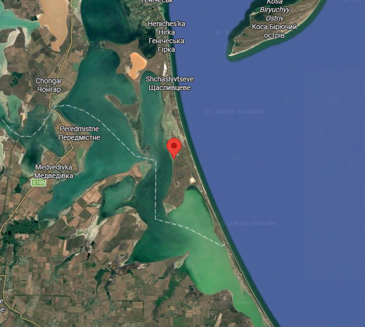
0:54-1:28 - Rough location - A Russian Pantsir-S1 DECOY is destroyed by a presumed FP-2 drone from 1st Seperate SBS Center.
45.906799, 34.845292
WR4W P47 Strilkove, Kherson Oblast, Ukraine
GeoLocated by @MikiValbuena
Reported involved units:
1st Seperate SBS Center ▸ Ukrainian Unmanned Systems Forces (SBS/USF)
Geolocation:
x.com/MikiValbuena/status/20…
Location:
geoconfirmed.org/ukraine/99e…
Sources:
x.com/usf_army/status/206248…
t.me/robert_magyar/2436
More information
ukrinform.net/rubric-ato/413…
Visit our map: geoconfirmed.org/map/ukraine

USF Struck a Svetlyak-Class Patrol Ship, a Pantsir-S1 Air Defense System, an RSBN-4N Navigation System, Logistics Assets, and Other Enemy Targets
Operation highlights:
🎯 In temporarily occupied Crimea, operators of the @1usc_army struck a Project 10410 Svetlyak-class border patrol ship used for coastal patrol and maritime surveillance missions.
• In Kherson Oblast, operators of the @1usc_army destroyed a Pantsir-S1 air defense missile and gun system, one of the key components of the enemy's air defense network.
• In temporarily occupied Crimea, operators of the @1usc_army struck an RSBN-4N short-range radio navigation system used to support enemy aviation.
• In temporarily occupied Crimea, operators of the @Raid_413 struck locomotives used to sustain enemy military logistics.
• In Donetsk Oblast, operators of the @k_2army Brigade struck transformers supporting enemy military infrastructure.
• Also in Donetsk Oblast, operators of the 1st Separate Center struck fuel storage tankers.
The operations were conducted in coordination with the USF Deep Strike Center.
The Unmanned Systems Forces continue to systematically degrade the enemy’s combat capabilities by targeting air defense assets, logistics infrastructure, and critical command-and-control systems.
USF: One step ahead!
1
3
30
6,956
Jun 6
Geolocation:
x.com/MikiValbuena/status/20…
1º Centro Separado de Drones
Dron sobre Sistema Pantsir-S1
0:54-1:30
Aprox
45.906799, 34.845292
Strelkóvoye - Kherson Ob
@GeoConfirmed @UAControlMap @AndrewPerpetua
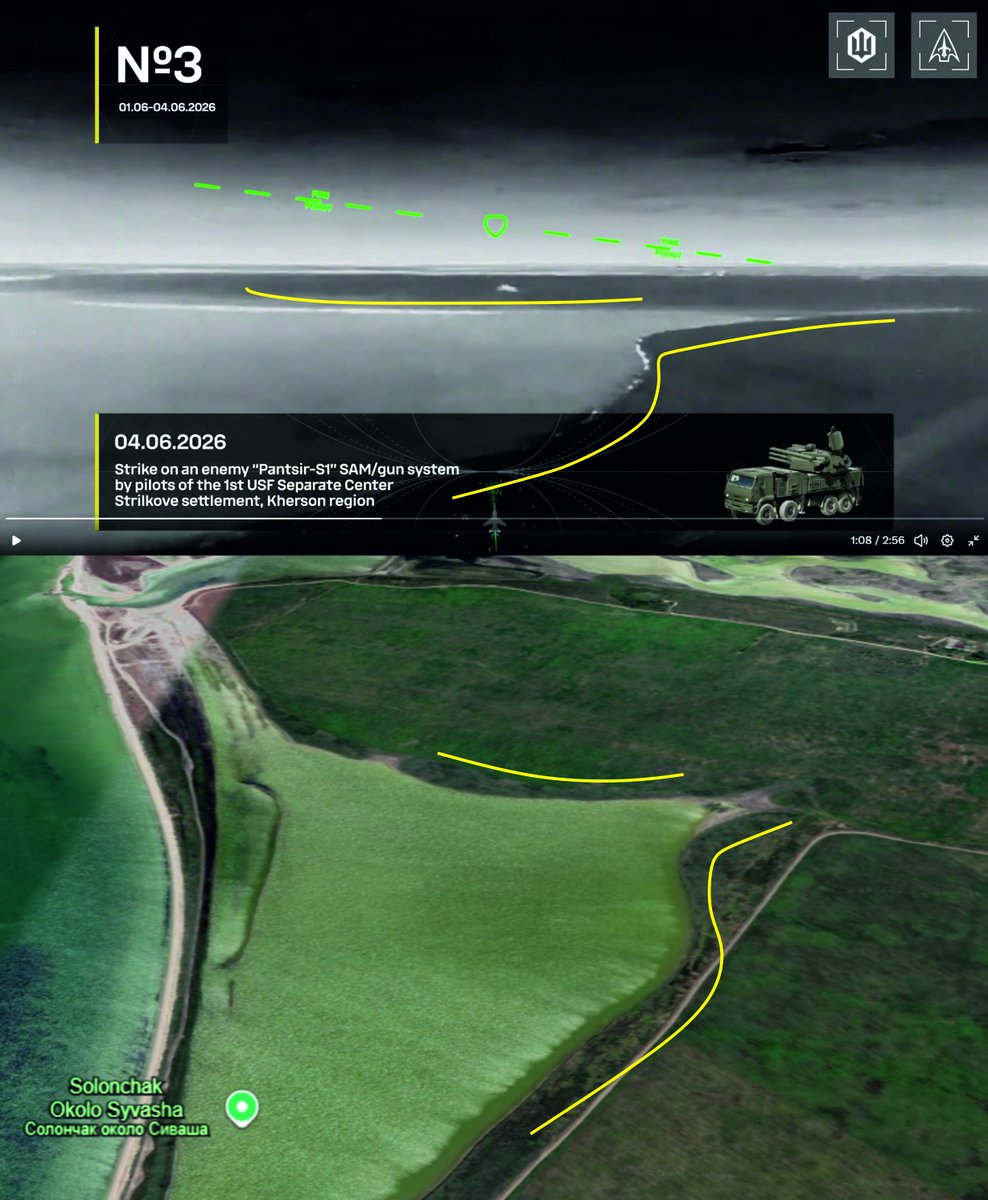
8
5,903
Jun 6
GeoConfirmed conflictmap UKR.
Point of view looking in a northern direction - Fire and huge plumes of smoke at he Ust-Labinsk oil depot following a reported Ukrainian attack.
45.219355, 39.683064
6M9M P6W Ust-Labinsk, Krasnodar Krai, Russia
GeoLocated by @neonhandrail
Geolocation:
x.com/neonhandrail/status/20…
Location:
geoconfirmed.org/ukraine/3e7…
Sources:
(2/2)
x.com/Exilenova_plus/status/…
(2/2)
t.me/exilenova_plus/21975
More information
kyivindependent.com/oil-depo…
Visit our map: geoconfirmed.org/map/ukraine

1
4
30
6,895
Jun 6
Geolocation:
x.com/neonhandrail/status/20…
Ust-Labinsk oil depot on fire
POV 45.219355, 39.683064 media 2/2
@GeoConfirmed @UAControlMap @AndrewPerpetua @Osinttechnical
source t.me/exilenova_plus/21975 media 2/2

7
5,605
Jun 6
GeoConfirmed conflictmap UKR.
Reported Russian Pantsir-S1 air defense system being airlifted by a Mi-26 helicopter onto the rooftops of a high-rise building in Moscow. Another helicopter is visible in the video.
55.78822, 37.677713
QMQH 73P Sokolniki District, Moscow, Russia
GeoLocated by @Zeldamices
Geolocation:
x.com/Zeldamices/status/2063…
Location:
geoconfirmed.org/ukraine/f47…
Sources:
x.com/clashreport/status/206…
Visit our map: geoconfirmed.org/map/ukraine
Jun 6

Russian Pantsir-SMD air defense systems being airlifted by Mi-26 helicopters onto rooftops of high-rise buildings in Moscow.
1
4
22
7,475
Jun 6
Geolocation:
x.com/Zeldamices/status/2063…

8
5,031
Jun 6
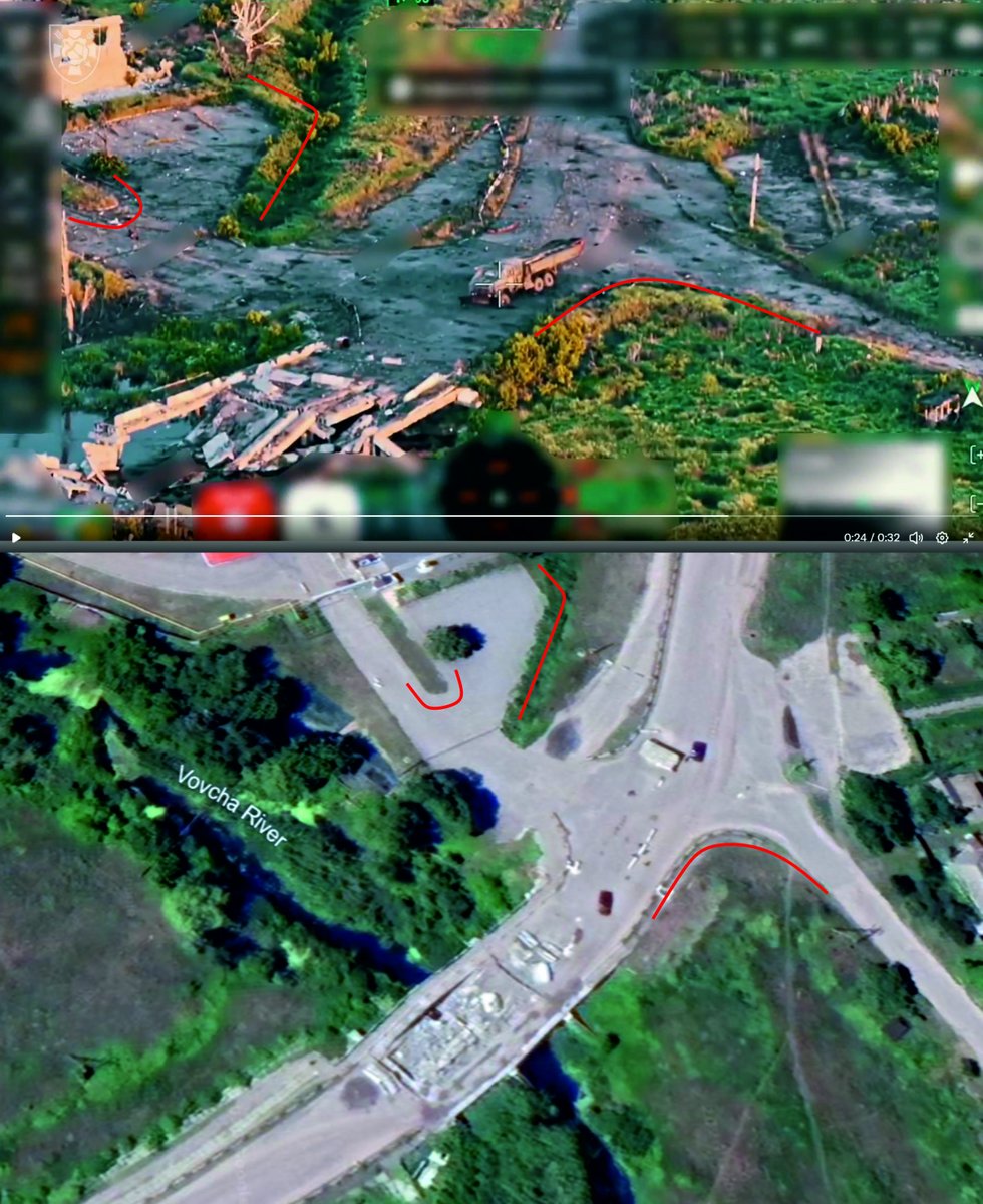
GeoConfirmed conflictmap UKR.
Ukrainian FPV drone strike on a Russian vehicle, reportedly trying to establish a pontoon bridge over the vovcha river
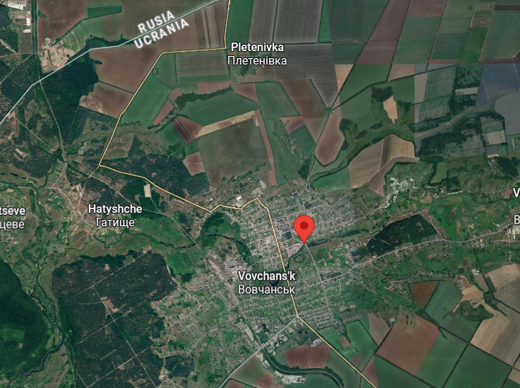
50.29292, 36.945975
7WVW 599 Vovchans'k, Kharkiv Oblast, Ukraine
GeoLocated by @MikiValbuena
Reported involved units:
16th Army Corps ▸ Ukrainian Ground Forces
Geolocation:
x.com/MikiValbuena/status/20…
Location:
geoconfirmed.org/ukraine/3ab…
Sources:
x.com/PuenteUribarri/status/…
t.me/corpsarmy16/2808
Visit our map: geoconfirmed.org/map/ukraine
Jun 5

El 16º Cuerpo🇺🇦 informa que el 3 de junio a las 5:00 los rusos intentaron montar un puente de pontones sobre el río Vovcha y no salió bien, lo evitaron con minas y drones y el vehículo quedó destruido
t.me/corpsarmy16/2808
2
2
26
5,962
Jun 6
Geolocation:
x.com/MikiValbuena/status/20…
16º Cuerpo
Kamaz RU destruido. Puente sobre el río Vovcha el 3 de junio.
50.292920, 36.945975
Vovchans'k - Kharkiv Ob
@GeoConfirmed @UAControlMap @AndrewPerpetua
x.com/PuenteUribarri/status/…
1
7
4,756
Jun 6
GeoConfirmed conflictmap UKR.
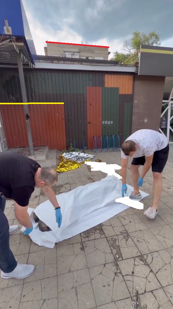
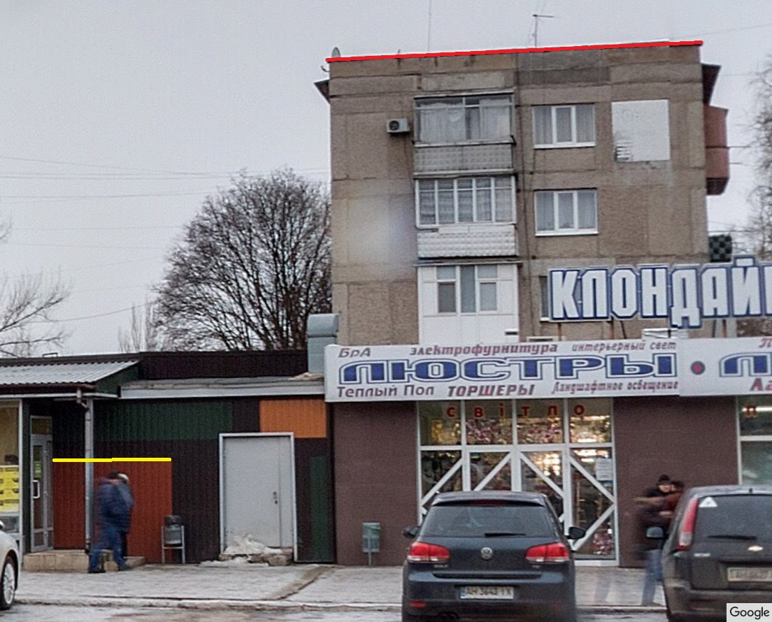
0:05-0:09 - Deceased civilian after a reported Russian attack in Kramatorsk.
48.730848, 37.590734
PHJR 87Q Kramatorsk, Donetsk Oblast, Ukraine
GeoLocated by @99Dominik_
Geolocation:
x.com/99Dominik_/status/2062…
Location:
geoconfirmed.org/ukraine/cbe…
Sources:
x.com/99Dominik_/status/2062…
facebook.com/reel/9917901304…
Visit our map: geoconfirmed.org/map/ukraine
2
2
12
5,393
Jun 6
Geolocation:
x.com/99Dominik_/status/2062…
Jun 4

Deceased civilian after a Russian attack in Kramatorsk.
48.730848, 37.590734
Kramatorsk, Donetsk Oblast, Ukraine
@GeoConfirmed @UAControlMap @Cen4infoRes @AndrewPerpetua
5
4,852
Jun 6
GeoConfirmed conflictmap UKR.
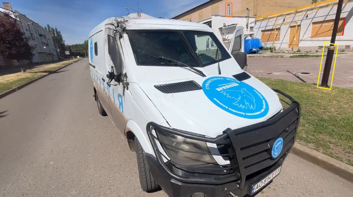
A reported Russian FPV drone strike damaged a vehicle belonging to the "Proliska" humanitarian mission
48.72476, 37.540512
PGFR W62 Kramatorsk, Donetsk Oblast, Ukraine
GeoLocated by @99Dominik_
Geolocation:
x.com/99Dominik_/status/2062…
Location:
geoconfirmed.org/ukraine/7ce…
Sources:
x.com/99Dominik_/status/2062…
facebook.com/evgenij.tkacev.…
Visit our map: geoconfirmed.org/map/ukraine
2
2
12
5,586
Jun 6
Geolocation:
x.com/99Dominik_/status/2062…
Jun 4
A Russian FPV drone damaged a vehicle belonging to the "Proliska" humanitarian mission.
48.724760, 37.540512
Kramatorsk, Donetsk Oblast, Ukraine
@GeoConfirmed @UAControlMap @Cen4infoRes @AndrewPerpetua
4
4,362
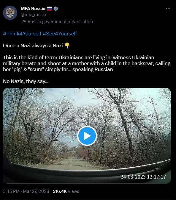
GeoConfirmed retweeted
Jun 4
This you?
Remember you deleted this after it was proven to be Russian made disinformation?
The whole video was staged.
x.com/i/status/1640447549331…
27 Mar 2023

GeoConfirmed UKR.
"2 Ukrainians stopped a car and fires a gun to scare a women and child."
❌This is not Ukrainian military❌
This video is made 30 km's behind the frontline.
Russian disinformation, but geolocation by @PStyle0ne1 is on point and GeoConfirmed.
🧵👇
1/13
1
20
175
8,310
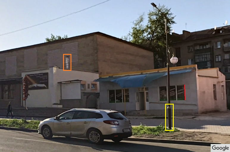
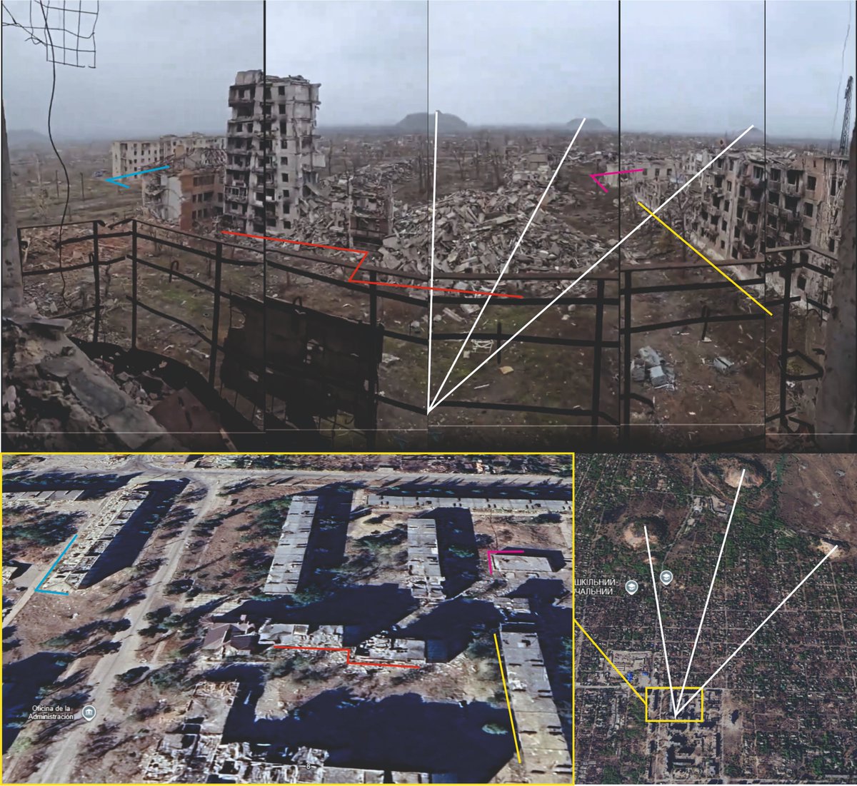
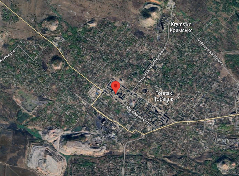
Jun 4
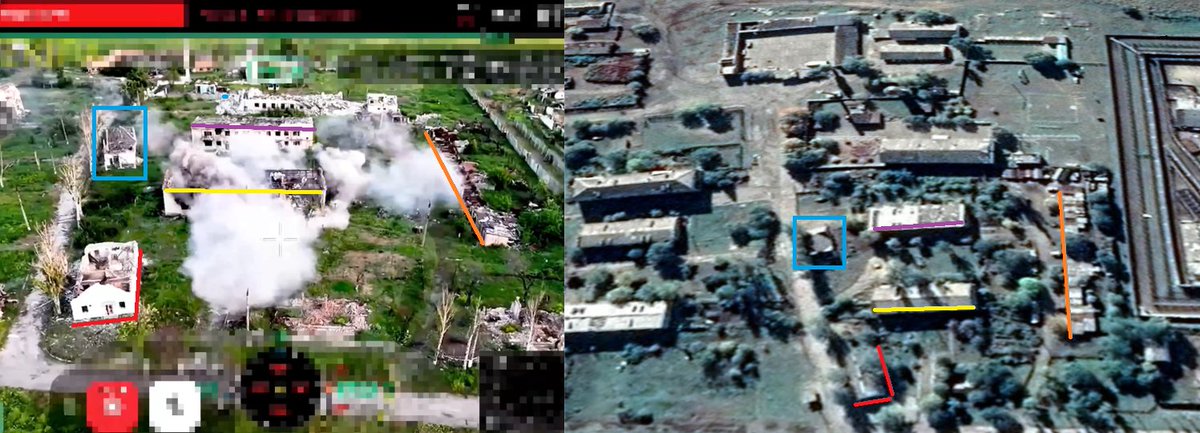
GeoConfirmed conflictmap UKR.
Point of view - the massive destruction of Toresk, a result of the Russian aggression.
48.397746, 37.843191
9RXV 37W Toretsk, Donetsk Oblast, Ukraine
GeoLocated by @MikiValbuena
Geolocation:
x.com/MikiValbuena/status/20…
Location:
geoconfirmed.org/ukraine/fcb…
Sources:
x.com/BohuslavskaKate/status…
Visit our map: geoconfirmed.org/map/ukraine

Toretsk. Another town in Ukraine that Russia has turned to ash and ruins.
Russians who claimed to have come to "liberate" Donbas are only liberating it from life itself.
3
13
40
6,708
Jun 4
Geolocation:
x.com/MikiValbuena/status/20…
Vista de la destrucción de Toretsk tras el paso de
'Rusky Mir'. La ciudad tenía unos 35.000 habitantes.
POV vídeo
48.397746, 37.843191
Mayakovsky St, 8, Toretsk, Donets'ka oblast, Ucrania, 85200
@GeoConfirmed @UAControlMap @AndrewPerpetua x.com/BohuslavskaKate/status…
1
9
4,603
Jun 4
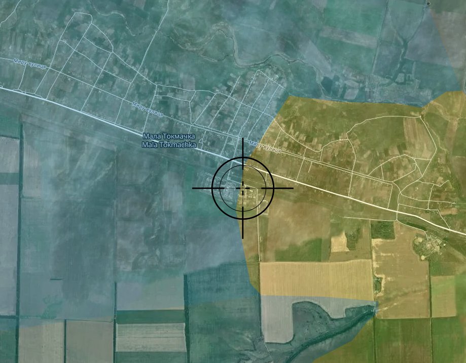
GeoConfirmed conflictmap UKR.
0:00-0:14 - 118th Mechanized Brigade Fiber FPV drone strike on a building in Mala Tokmachka, Zaporizhzhia Oblast
47.527159, 35.909304
GWG5 VP7 Mala Tokmachka, Zaporizhia Oblast, Ukraine
GeoLocated by @Bielitzling
Reported involved units:
118th Mechanized Brigade ▸ 17th Army Corps ▸ Ukrainian Ground Forces
Geolocation:
x.com/Bielitzling/status/206…
Location:
geoconfirmed.org/ukraine/6b4…
Sources:
x.com/Bielitzling/status/206…
t.me/intelligencecompany/242
Visit our map: geoconfirmed.org/map/ukraine

1
15
6,411
Jun 4
Geolocation:
x.com/Bielitzling/status/206…
Jun 3
118th Mechanized Brigade hits building in Mala Tokmachka, Zaporizhzhia Oblast
@GeoConfirmed @UAControlMap
47.527159, 35.909304 (0:06)
src: t.me/intelligencecompany/242
5
5,131