
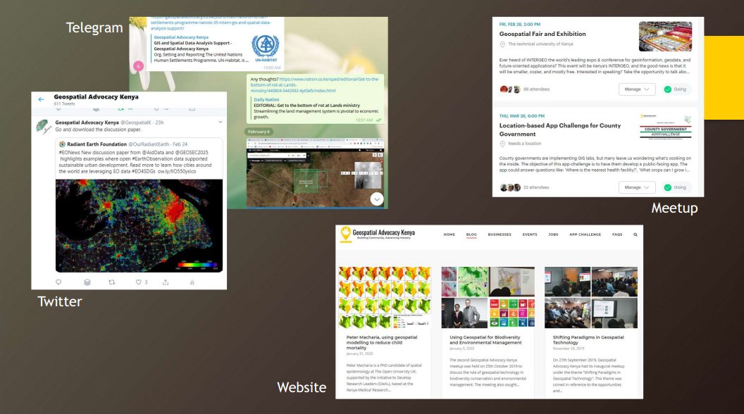
We promote and advance the geospatial industry in Kenya and beyond. Find us on Meetup for event updates and on Telegram for more geo-information from Kenya.
Joined May 2019
- Tweets 665
- Following 315
- Followers 1,318
- Likes 473
75 Photos and videos

Pinned Tweet

10 Nov 2020
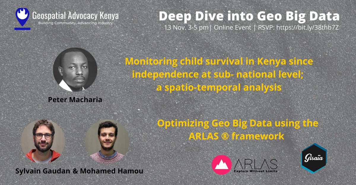
Join us this Friday for a deep dive into geo big data and spatio-temporal analysis. Register for free at bit.ly/38thb7Z #geospatial #BigData
12
19
Geospatial Advocacy Kenya retweeted

30 Jun 2022
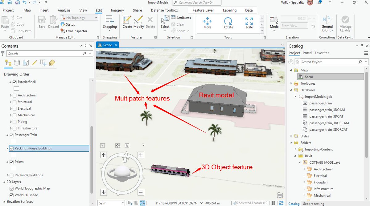
Revit models can be added to ArcGIS Pro without conversion. Other 3D formats can be added to Multipatch or 3D Object feature layers #ArcGIS #AEC2022 #geospatial
1
2
Geospatial Advocacy Kenya retweeted
30 Jun 2022
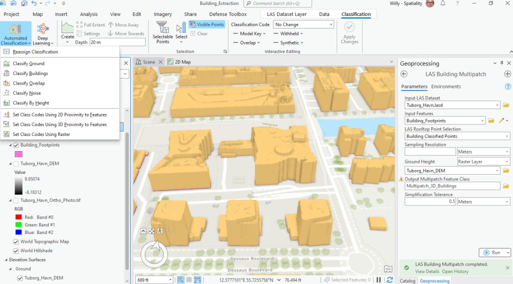
ArcGIS Pro has excellent tools for classifying Lidar data and extracting 3D buildings. County Governments can leverage these capabilities for development control and revenue collection #ArcGIS #lidar #geospatial #3D
2
Geospatial Advocacy Kenya retweeted
27 Jun 2022
Esri's pre-trained deep learning model for building footprint extraction in Africa is doing a reasonable job in Kisumu, Kenya #DeepLearning #ArcGIS #geospatial

2
3
3 Dec 2020
Let them go back to their barracks! Due to DoD's 'security' concerns geospatial technology has never taken off in Kenya. #geospatial #dictatorship


2
5
Geospatial Advocacy Kenya retweeted
12 Nov 2020
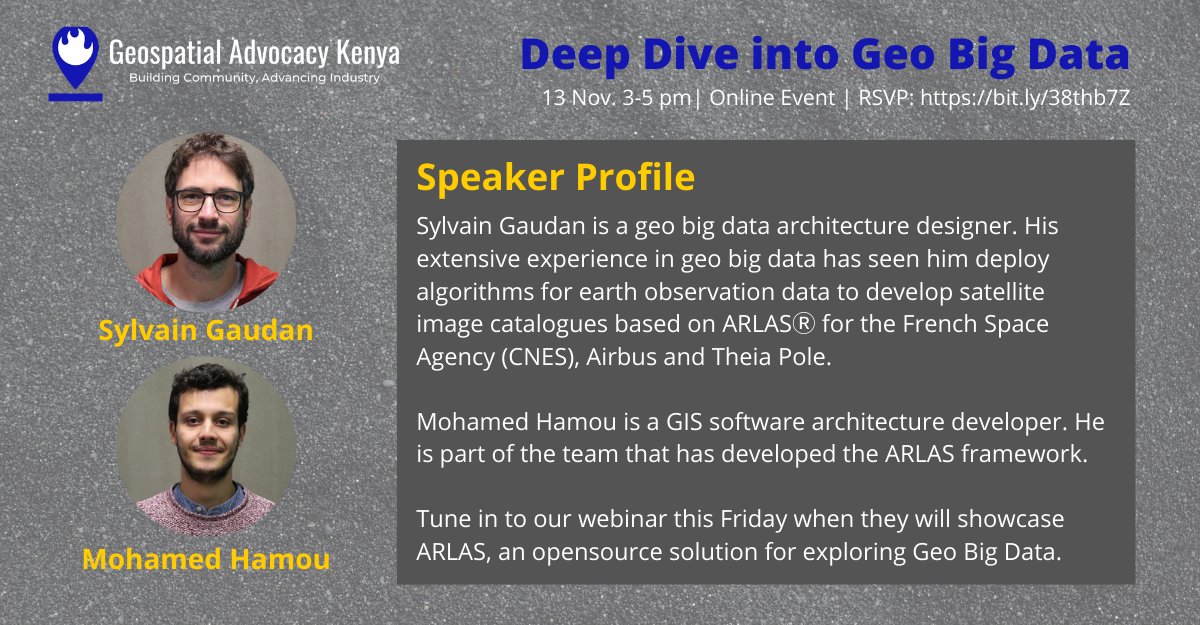
Are you struggling to gain insights from vast volumes of geospatial data? Join our webinar this Friday for a presentation on @ARLAS_io an open-source solution for Geo Big Data. Register for free at bit.ly/38thb7Z #geospatial #DataAnalytics #MachineLearning
1
10
4
Geospatial Advocacy Kenya retweeted
11 Nov 2020
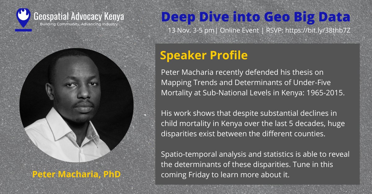
Join us this Friday and find out how @Pete_M_M is using spatial modeling to better understand child mortality in Kenya #geospatial #HealthTech
1
11
31
13 Nov 2020
Check out this Meetup: Deep Dive into Geo Big Data meetup.com/Geospatial-Advoca… #Meetup via @Meetup
4
Geospatial Advocacy Kenya retweeted
9 Oct 2020
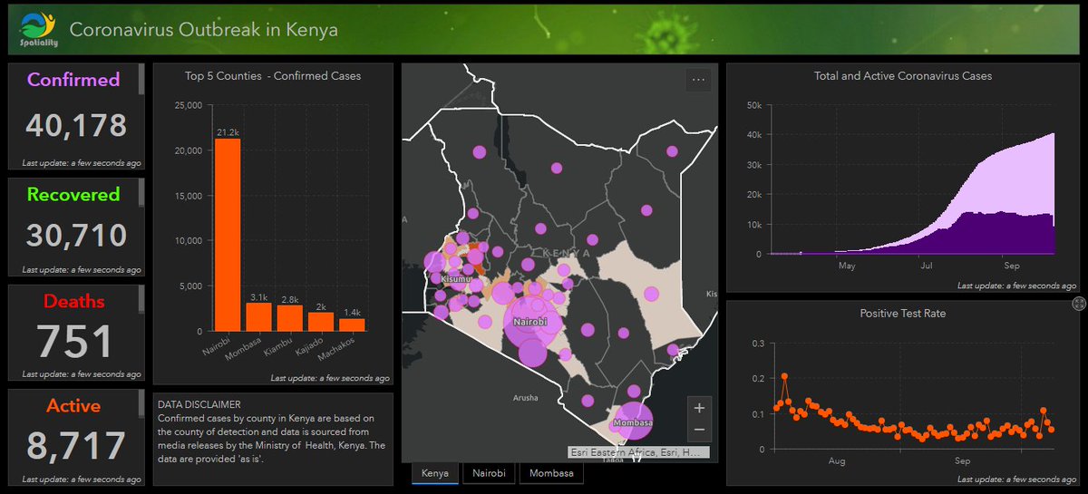
Our COVID-19 Dashboard is back online after a long absence. Access it through this link: bit.ly/3f85Vy4 #COVID19 #Dashboard #Kenya
1
3
7
Geospatial Advocacy Kenya retweeted

3 Sep 2020
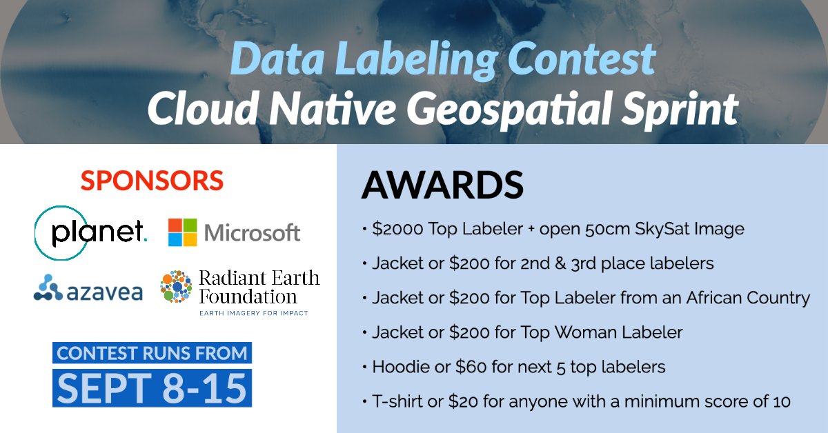
🆕 You're invited to participate in a data labeling contest to identify cloud pixels in Sentinel-2 scenes to enable the development of an accurate cloud detection model from multispectral data. Resulting training dataset will be hosted on Radiant MLHub!
🔗bit.ly/DataLabelingContest
1
21
45
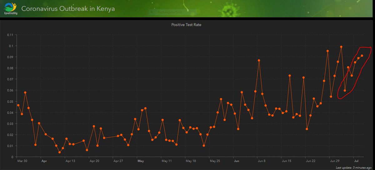
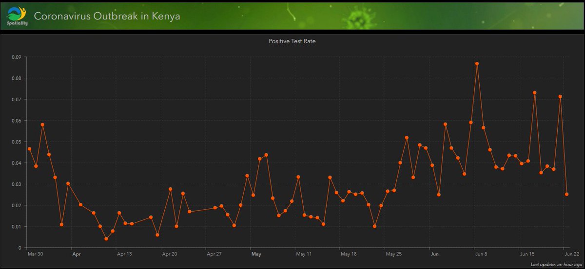
9 Jul 2020
In the past 6 days, the Kenya Corona positive test rate has increased steadily bit.ly/37RcfYa
@MOH_Kenya @WHO
#KomeshaCorona
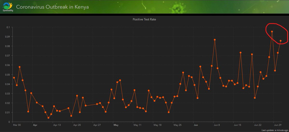
2 Jul 2020
Kenya Corona Positive test rate keep going up. Check out from our Covid-19 Dashboard at bit.ly/37RcfYa
#KomeshaCorona #CoronaVirusUpdates @MOH_Kenya @WHO
1
5
26 Jun 2020
Developing and Maintaining a COVID-19 Dashboard, the event is today. Keep registering meetup.com/Geospatial-Advoca… #Meetup via @Meetup
1
2
1
25 Jun 2020
This Webinar is happening tomorrow, have you registered?
Developing and Maintaining a COVID-19 Dashboard bit.ly/3f85Vy4 #Meetup via @Meetup
24 Jun 2020
Our Webinar: Developing and Maintaining a COVID-19 Dashboard bit.ly/31884pF
#Meetup via @Meetup
30 Attendees and counting
Friday 3pm. Register
2
2
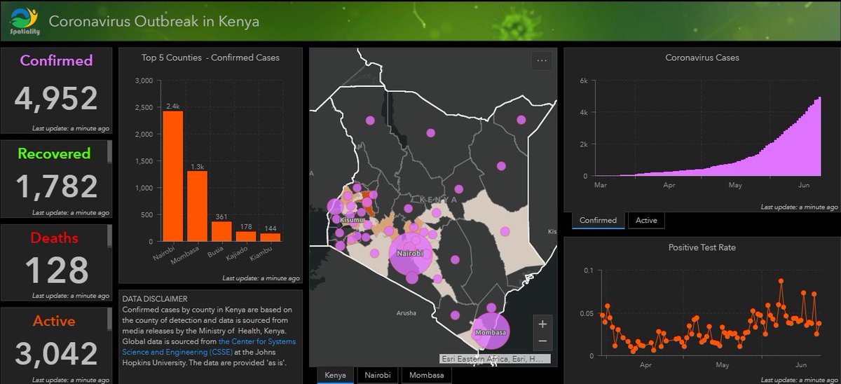
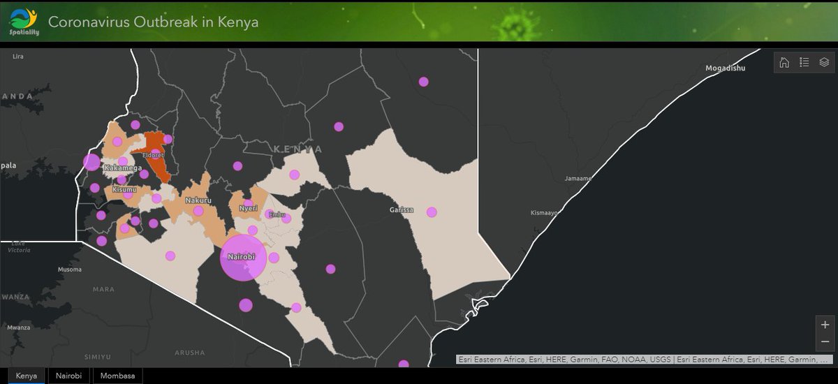
24 Jun 2020
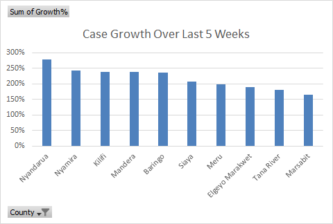
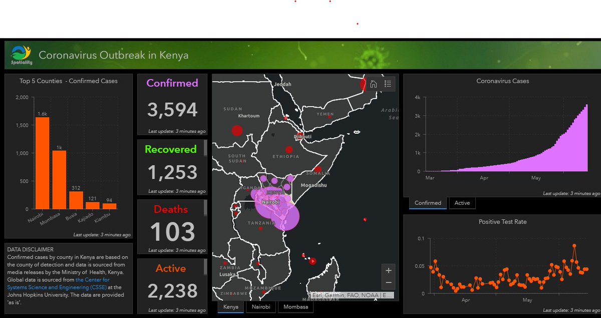
Corona Dashboard this morning.
For a detailed view,kindly visit bit.ly/37RcfYa
#KomeshaCorona @MOH_Kenya @WHO
2
23 Jun 2020
Check out this Meetup: Developing and Maintaining a COVID-19 Dashboard bit.ly/31884pF #Meetup via @Meetup
We are at 28 Attendees and counting.
Register
1
2