Founded in 1818, the Harvard Map Collection holds over 500k antiquarian & modern maps, and provides gis data and support. Check out our instagram: harvardmaps
- Tweets 4,089
- Following 780
- Followers 8,834
- Likes 11,126


ALT engraved map of the city with the river below with hand-coloring, especially a very deep red covering the city itself.
ALT large map of the county with townships outlined in yellow, green, and red. Images of major buildings appear in the corners as well as insets of other areas in the county
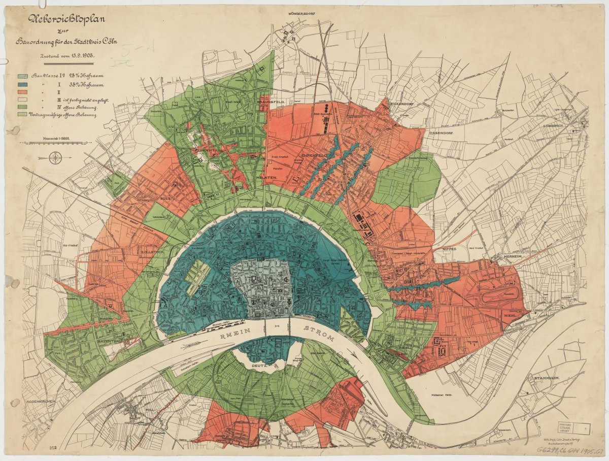
ALT map of the city with the river running through it horizontally. Land-use areas appear in blue (ciy center), green, and red.
ALT shaded relief map of part of the Yosemite Valley in yellow, white, and green
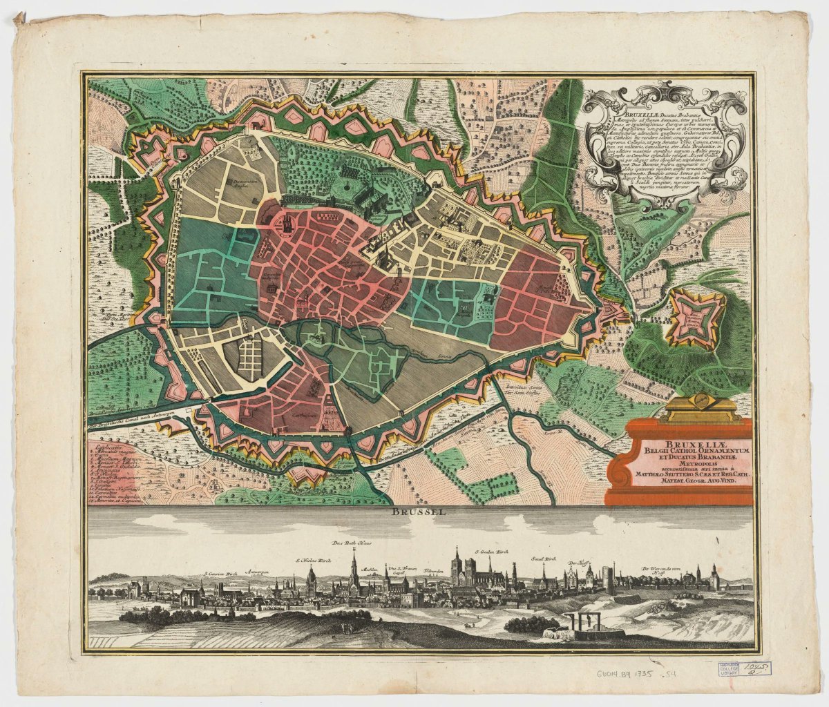
ALT richly hand-colored map of Brussels above a bird's eye view of the city with major landmarks labeled.
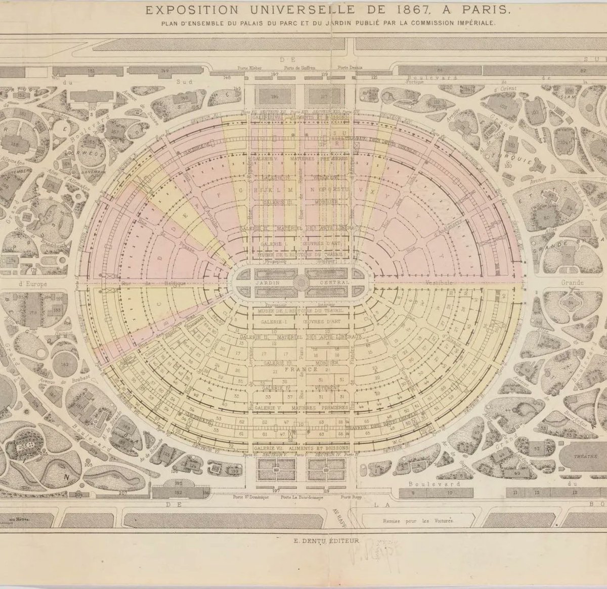
ALT map in French showing a oval in two colors of galleries with a garden in the middle surrounded by park on all sides
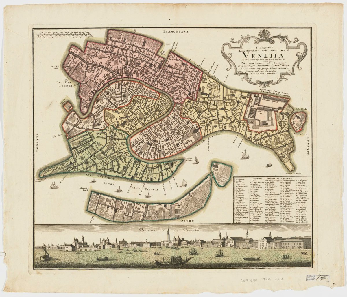
ALT above, an orthographic view of Venice with neighborhoods differentiated by color; below, a bird's eye view of the city with landmarks labeled
ALT lushly colored map of St. Petersburg with a tapestry drawn above to show the river inland, a large cartouche in the upper right showing historical and mythological figures, and an inset with the fortified island
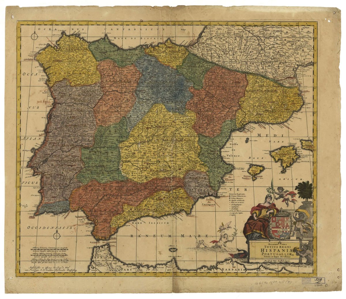
ALT Engraved, hand-colored map of the Iberian peninsula with heraldic symbols and flying angels in the lower right
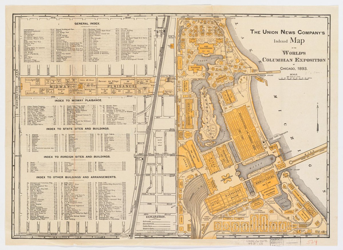
ALT yellow and black printed map showing the layout of the Worlds Fair along the lake and its promenade inland with several indices to the locations

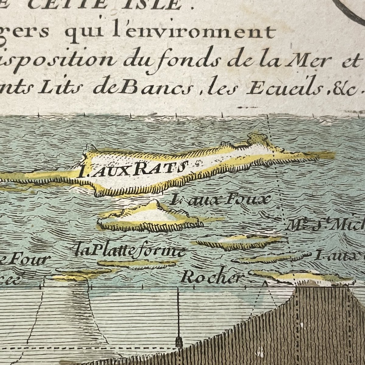
ALT Detail of an engraved map showing under water landforms by the ile l'aux rats
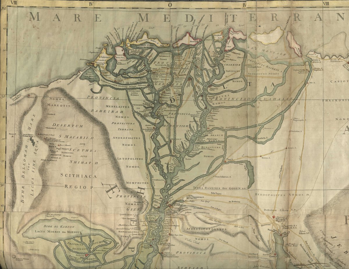
ALT Image of a portion of a map of Egypt showing the Nile River Delta from Lake Moeris in the south to the Mediterranean Sea, with the River colored dark green and the Lake and Sea a lighter green.
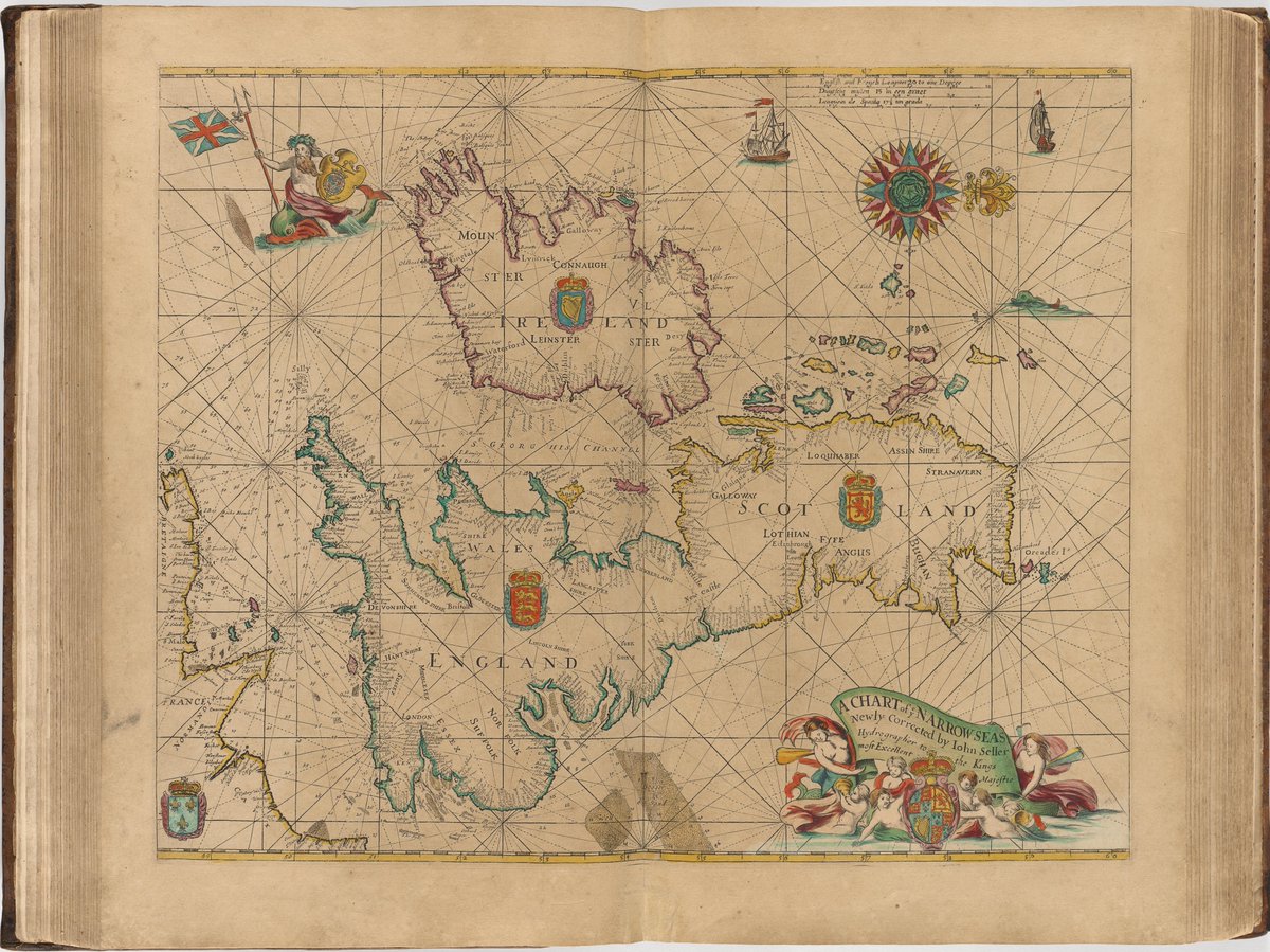
ALT Image of a nautical chart (titled "A Chart of Ye Narrow Seas") with rhumb lines and oriented with north to the right, showing Ireland, Scotland, England and Wales and a bit of the French coast along the English Channel. Also, with an ornate compass rose at the top right of the sheet and a title cartouche (with many aquatic denizens surrounding it) in the lower right. The flag bearing merman is at the top left of the sheet.


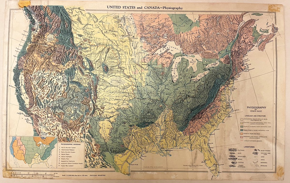
ALT Map of the United States and lower Canada with colors showing the major rock types, with green and yellow sharing the inner continent and pictorial representations of plateaus, hills, mountains, mesas, cuestas, folded mountains, basin ridges, volcano, sand, sinks, moraines, and drumlins
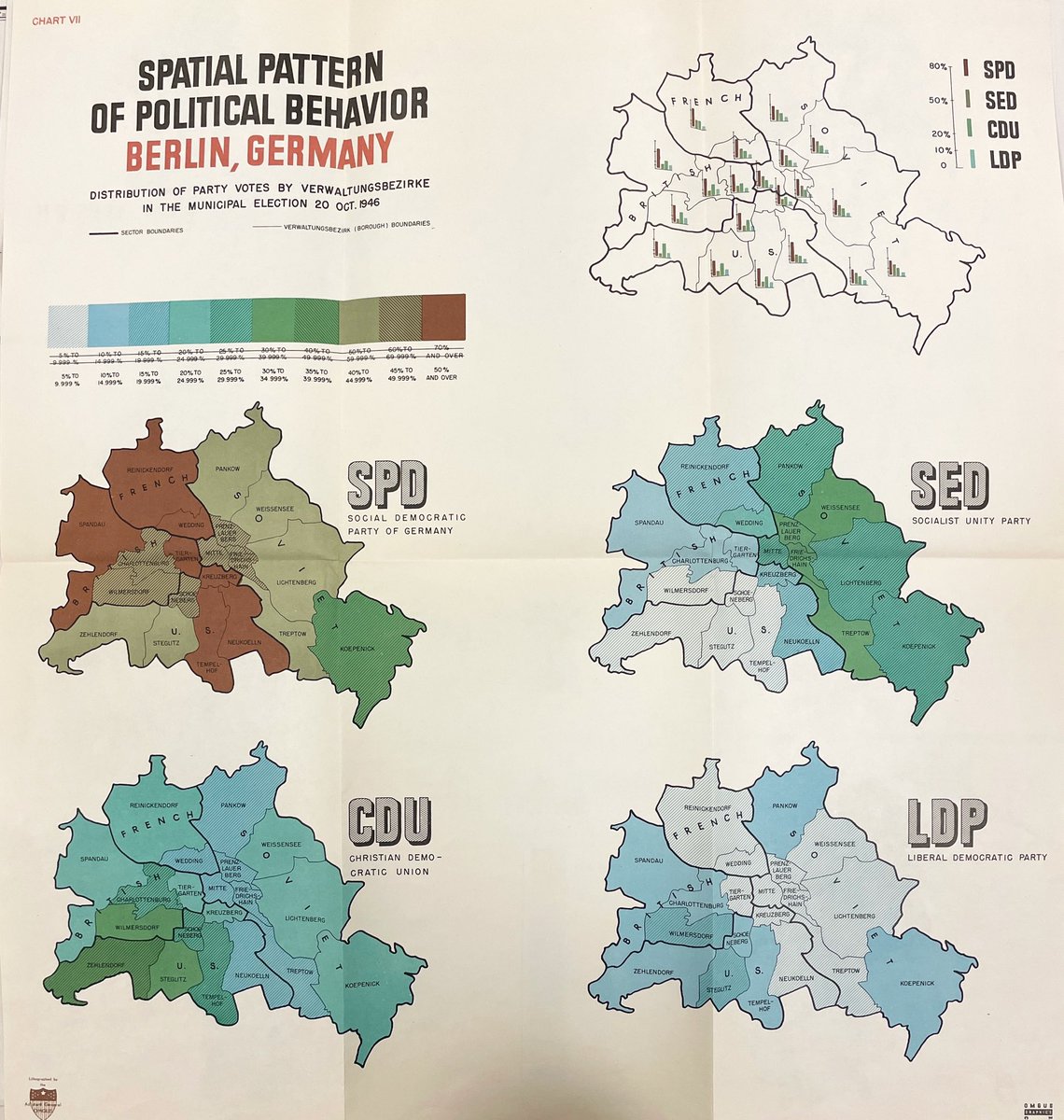
ALT 5 maps on one sheet slowing voting results in Berlin with stark differences between the East and West