
- Tweets 4,041
- Following 1,678
- Followers 7,316
- Likes 3,918


ALT NASA Harvest's Fernanda Argueta presents Harvest2Market during CSIS' AI for Food Security Forum.

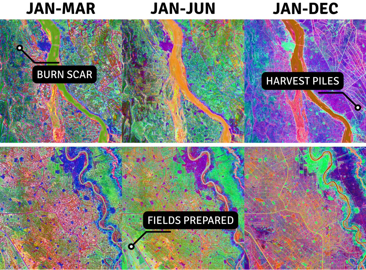
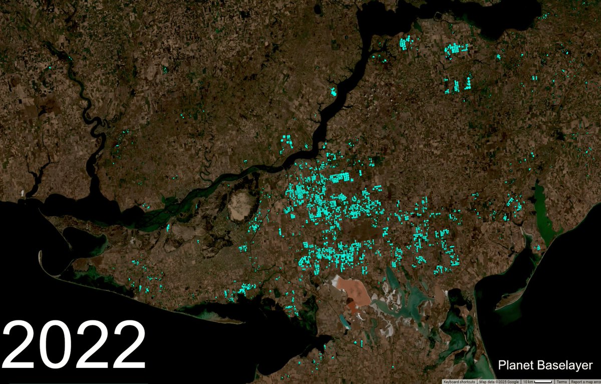
ALT Examples of quarterly, semi-annual, and annual satellite-based embeddings from Al Jazirah, Sudan, in 2024, that allow users to identify critical food security signals, such as burn scars, field preparation, and harvest activity, using natural language. Credit: Arizona State University. Embeddings generated with OlmoEarth.

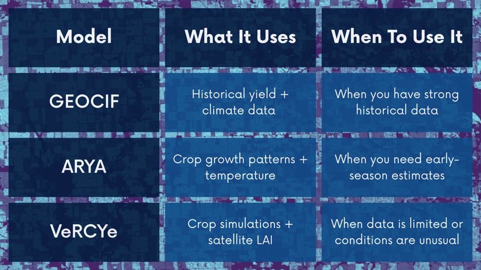
ALT NASA Harvest teams have developed 3 models to forecast crop yields around the world. This graphic and the associated article breaks own each model and when it works best.

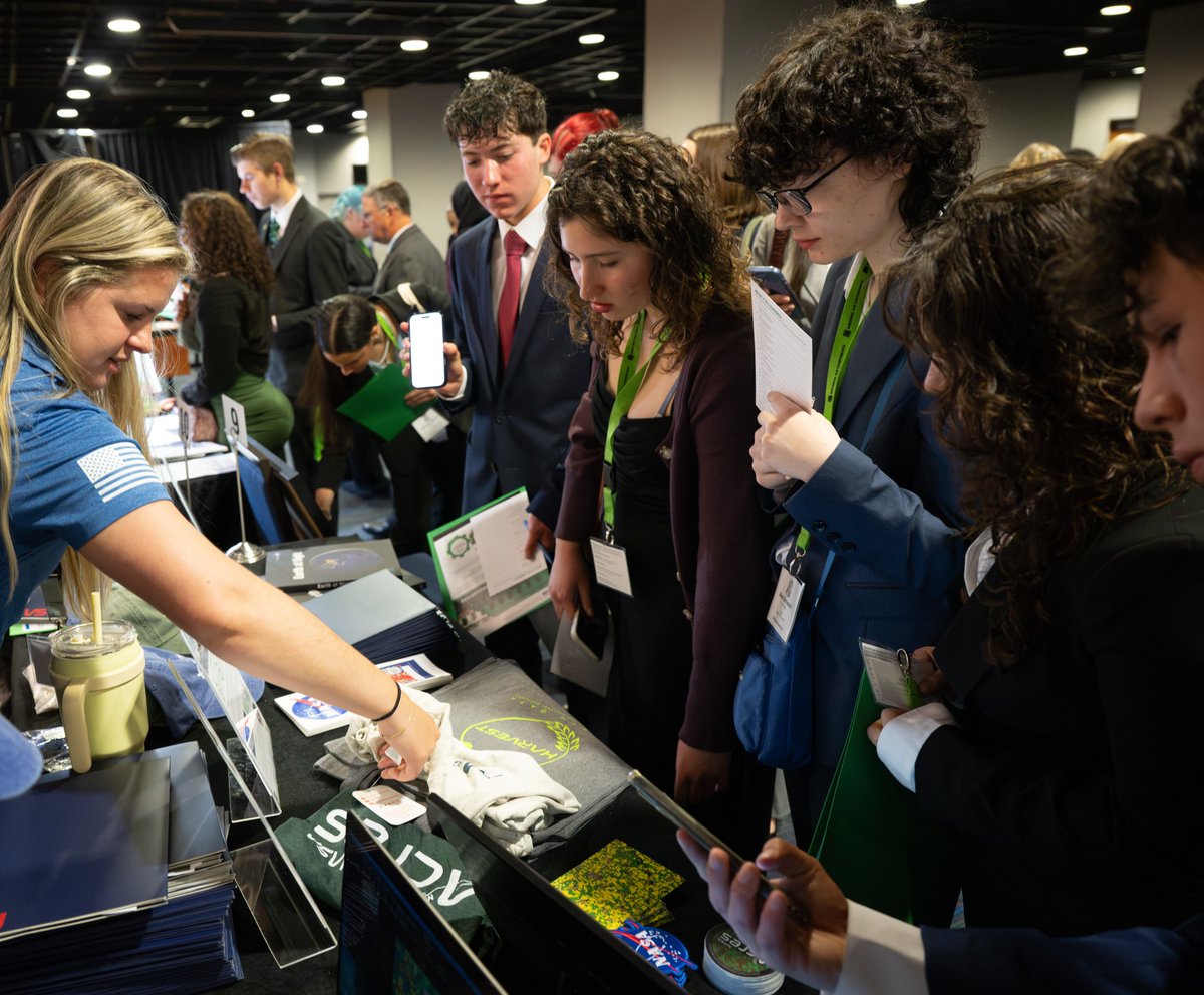
ALT NASA's agricultural teams met with students at the National 4H Conference's Career Expo to discuss NASA's involvement in the ag sector and career opportunities.
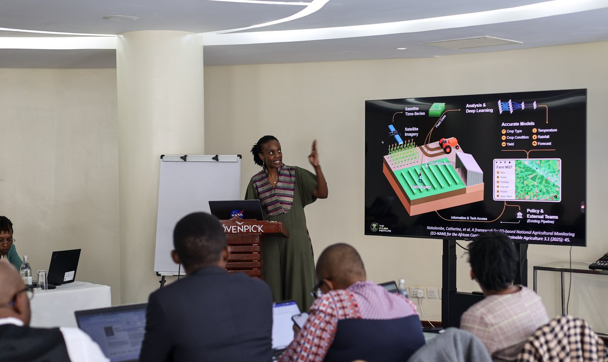
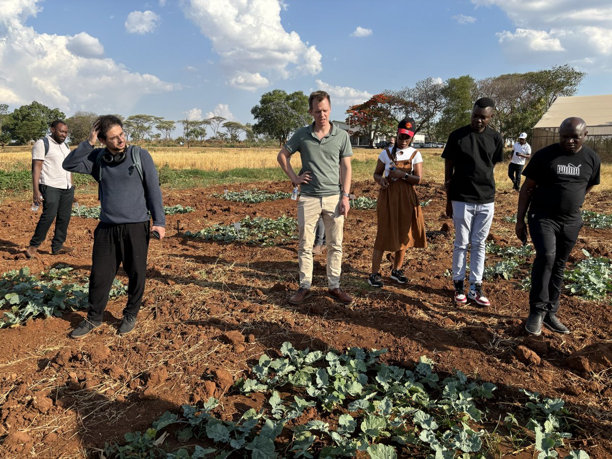
ALT NASA Harvest's Africa Lead Catherine Nakalembe speaks at a workshop in Nairobi, Kenya.
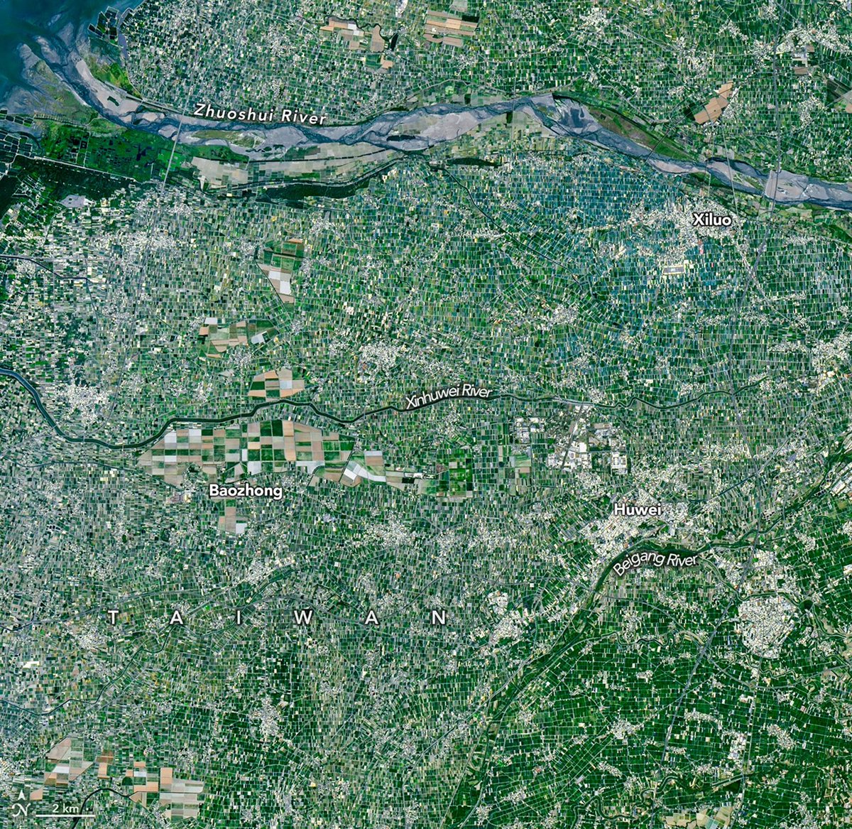
ALT Farms raising an array of crops form an agricultural mosaic across Yunlin County in this image captured by the OLI (Operational Land Imager) on Landsat 9 on March 18, 2026.
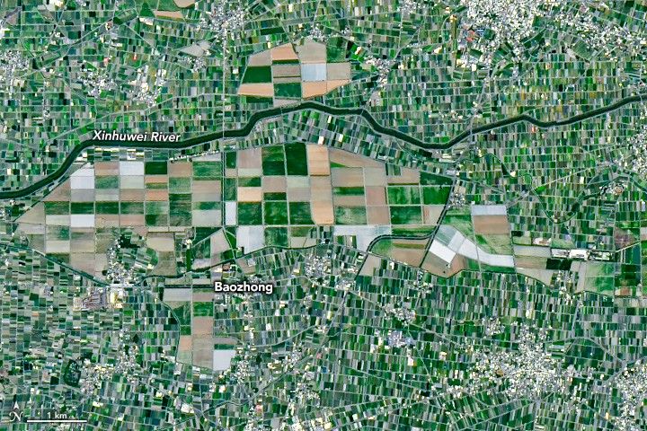
ALT A zoomed in portion of the map shows an area with a combination of large and small fields. Areas with large fields were generally once part of sugar plantations.