
Retired Meteorologist & Director of Millersville Univ.Wx Center (1988-2020). Best-selling author @Train4Climbing Founder/CEO of PhysiVantage.com Nutrition
Joined June 2010
- Tweets 11,046
- Following 405
- Followers 8,383
- Likes 3,715
2,525 Photos and videos


Pinned Tweet

28 Aug 2020
(1/4) BIG ANNOUNCEMENT! Earlier this summer, I made the difficult decision to retire from my position as Director of the @millersvilleu Weather Center at the end of August. I’ve been blessed to serve in this role for one-third of a century (yikes!) and to be part of…


56
12
362
Feb 21
Today’s weather: “Gusty winds with blowing & drifting gypsum!”
Seriously, folks, this isn’t snow—it’s the gypsum dunes of White Sands National Park in New Mexico. A surreal day driving and hiking here.
2
27
3,283
Feb 13
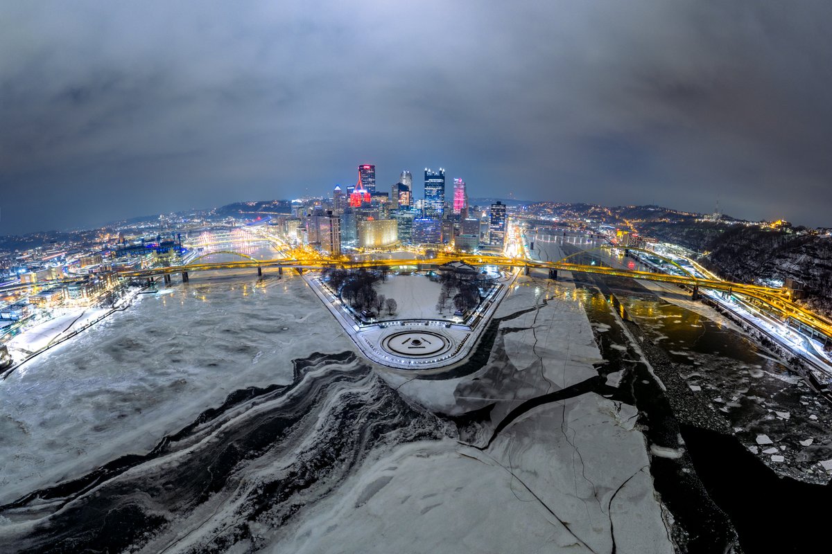
Amazing photo!
Feb 11

Pittsburgh looks like it could be located in the Arctic Circle in this photo from last night. The melting and cracking ice made for a ton of interesting shapes and textures. I always look forward to this happening any time we get ice on the rivers. Sure it's interesting when they completely freeze over but when they start looking like this it really makes for some fun photos! #pittsburgh
1
2
12
2,902
Feb 9
Looks like the Arctic Ocean — it’s really Lake Erie!
Feb 8

Below −20°C along the shores of Lake Erie. ❄️✨
The water is frozen solid, wave after wave locked in ice, stretching as far as the eye can see. A place that never truly rests, even in deep winter.
2
17
2,625
Feb 8
Lake Erie nearly 100% frozen — about a once-per-decade occurrence.
Feb 8

👀 I was checking out Lake Erie's ice on the satellite... Check this out... You can see a giant crack forming on the ice sheet from near Long Point #Ontario to #Cleveland, OH!
5
32
5,257
Feb 1
Incredible!

Just incredible scenes in North Myrtle Beach. Love it or hate it, take a moment to appreciate what is happening. Between the incredible snowfall totals many will wake up to, and the extreme cold, this storm will join the ranks of legends like the 1989 storm. #SCwx #NCwx @wmbfnews
22
3,019
E. Horst retweeted

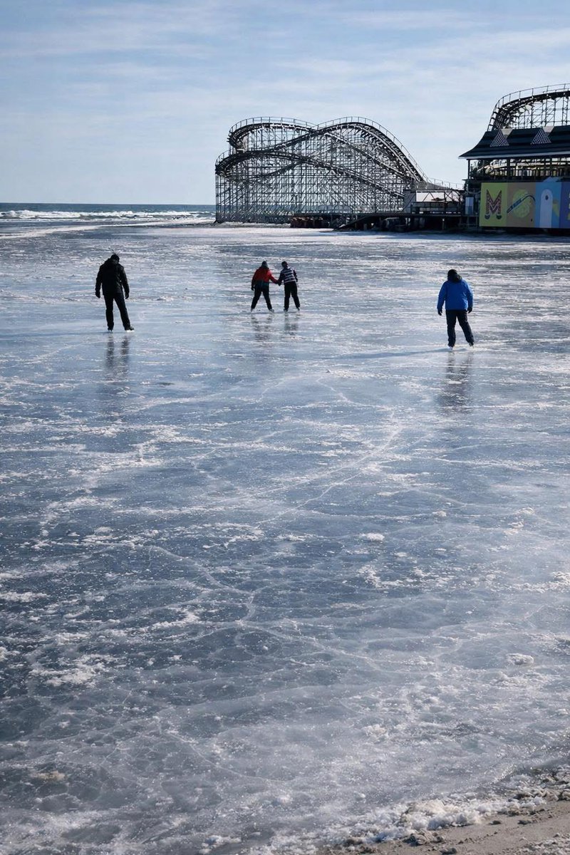
Ice skating on the beach in Wildwood NJ
103
799
10,092
1,033,490
Jan 31
It’s not any day that you can stand in the middle of the Conestoga Creek! Only one or twice per decade do we get the sustained cold needed to create this ice rink! Today is the 8th consecutive sub-freezing day and 4th single-digit overnight.
3
1
41
2,077
Jan 26
Sunday's snowfall summary: Most common across Lanco was 8 - 10 inches of snow/sleet. High reports were in Mountville (12") & Denver (13"). Statewide, there were widespread reports of 14 - 18" in central & northern counties. The jackpot: Laurel Summit (Westmoreland Co.) with 24"!
1
23
2,513
Jan 26
In my 40 years in the weather biz, I don't recall hearing of a significant avalanche in Pennsylvania! This happened yesterday in Luzerne County, where 17" of snow fell.
Jan 26

AVALANCHE photo from Coxton Road in Duryea Luzerne County PA
📷 Heather Aurther
#wxtwitter #wxX @NWSBinghamton #PAwx #NEPA
2
2
18
4,614
Jan 26
Prepare, my friends, for immense hype on a potential "B word" next weekend. Yes, there is one model that shows that possibility, however, the model consensus has the storm tracking well offshore (so a "miss"). Time will tell.... REMAIN CALM. 😉
5
3
62
10,908
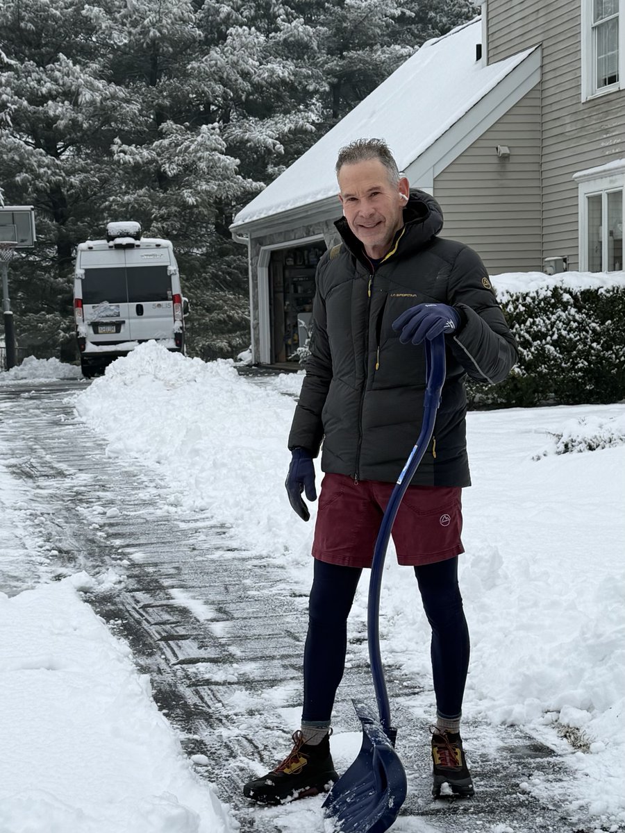
Jan 26
Post-storm recovery! After working the storm (and lots of shoveling) I made my specialty dish for a relaxing evening with the wifey. 😉
3
31
2,398
Jan 26
All done at my house in Manheim Twp. A lot more sleet than I expected— the greatest sleet accumulation since the crippling storm of Feb 14, 2007 (I think). My storm total snow sleet today is 9.5”.
2
14
2,313
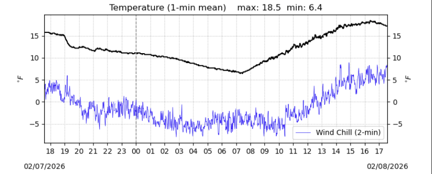
Jan 25
Looking ahead, fresh Arctic air reloads into the region tomorrow -- a burst of snow is possible in spots (btwn 6-10am) as the front moves thru. High temps Tuesday - Friday will struggle to reach 20...w/ overnights in the singles (a sub-zero night possible if winds die down).
1
25
2,208
Jan 25
5:00pm update: Just a couple more hours until the dry slot arrives, shutting off accumulating precip. Some impressive (and difficult to clear) sleet the past few hours. At my house I've received 2.2" of sleet on top of the 6.9" of snow. Storm total is 9.1 inches...and counting.
2
2
38
3,208
Jan 25
At 11:30, I've observed a mix with sleet at my house in Manheim Township. Snow total for Part 1 of storm 6.9 inches. Currently, seeing a 50/50 mix of snow/sleet...likely to go back-and-forth for a while.
5
29
3,005
Jan 25
How do we know the temperatures aloft? A sensor (temp, humidity, pressure) tied onto a weather balloon! METEO students @millersvilleu gettin' it done this morning. Let's go!
Jan 25

9:30 AM Balloon launch is underway from Millersville! @MUweather @millersvilleu @MillersvilleAMS #pawx
5
35
4,782
Jan 25
Anyone have 11:00am snowfall reports? Please post the amount (not including any blowing snow for roof, etc.), time of observation, and your location. Thanks!
21
10
4,037
Jan 25
Pro Tip: When you notice sleet mixing in, immediately go outside and take a snowfall measurement for "part 1" of storm. Then, clean an area (unaffected by blowing snow), and beginning measure "part 2" as we total of snow sleet that falls from that point onward.
4
1
13
2,087
Jan 25
At the end of the event, add parts 1 2 to obtain a storm total for your location.
1
1
5
1,306
Jan 25
As we approach 11:00am, many spots in LanCo are approaching 6". The next few hours is the most intense part of the storm, however the mix with (or change to) sleet will develop across southern PA in the new couple of hours (likely already occurring at spots south of Route 30).
1
11
1,525
Jan 25
Strong upward motion will yield dynamic cooling aloft, so some spots may see the precip type go back and forth between sleet and snow...as temps aloft teeter ~32F. Meanwhile, at ground level...it's incredibly cold with a temp of 12 and wind chill of 0! Stay warm, my friends!
1
12
1,142