
Meteorologist l Risk Assessment | Insurance
Joined April 2009
- Tweets 17,024
- Following 944
- Followers 8,493
- Likes 22,288
5,442 Photos and videos


Jason Brewer retweeted

Feb 23
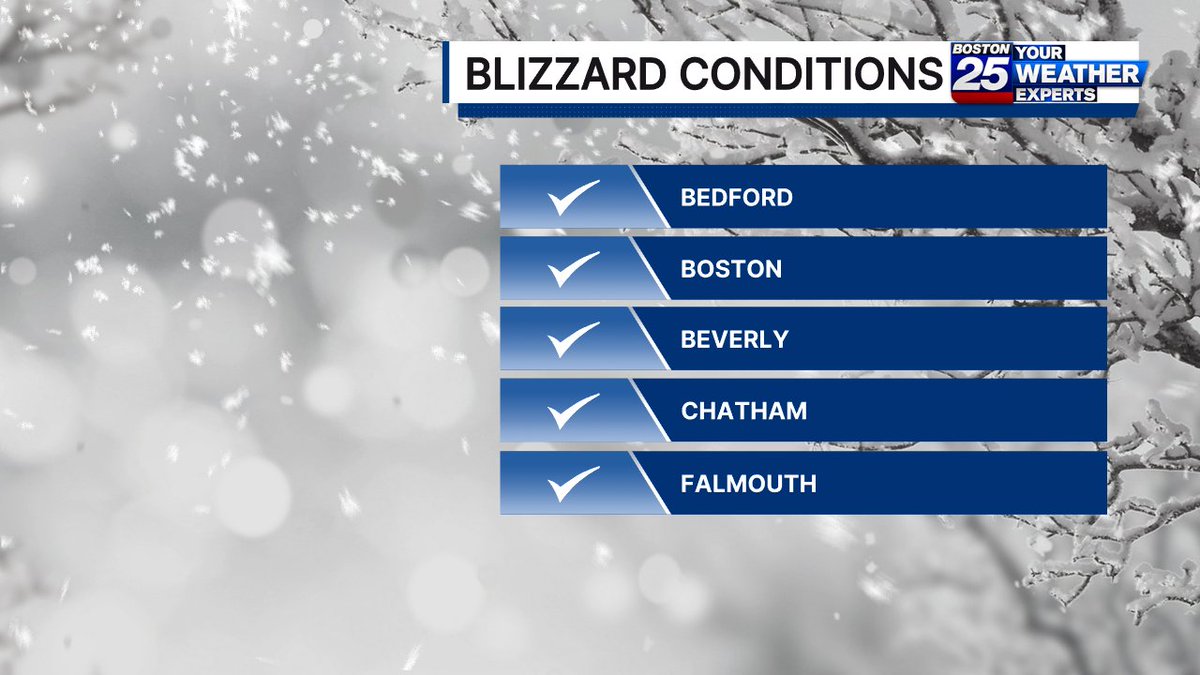
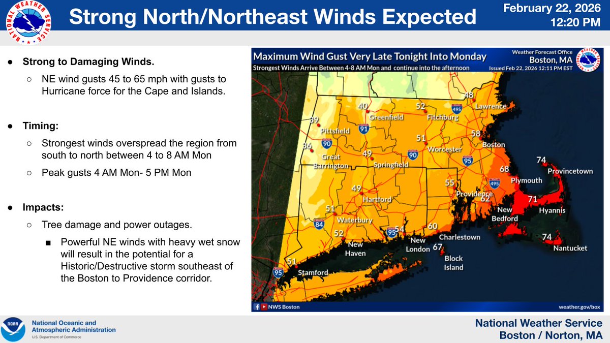
Officially a blizzard for parts of our area
[Visibility <1/4 mile, gusts 35 mph , heavy falling or blowing snow, 3 hours or more]
3
7
30
4,434
Jason Brewer retweeted

The analyzed central pressure at 7 am EST was 966 mb. This is an estimated 41 mb drop in 24 hours compared to yesterday's analysis at the same of 1007 mb.
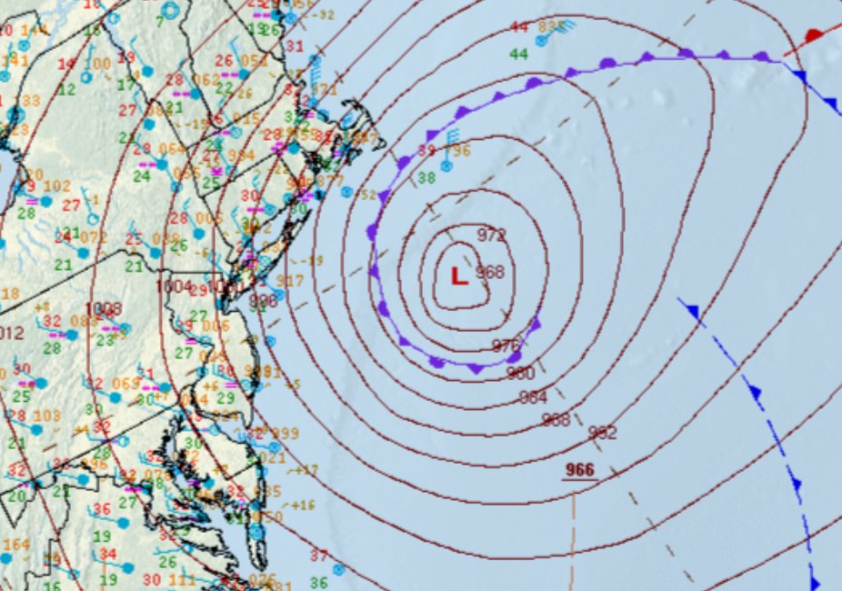

Morning satellite loop of the very strong Nor'Easter producing powerful winds and very heavy snow across the Northeast. Blizzard conditions and crippling impacts will continue through much of today for the region. 🛰️❄️
11
174
639
139,352
Jason Brewer retweeted

Feb 22
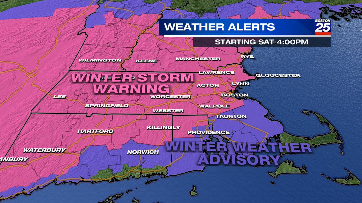
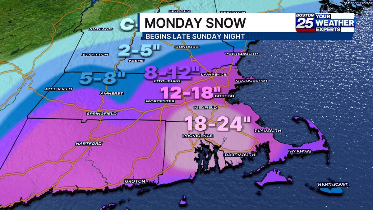
[Monday Blizzard Update]
❄️Highest snowfall amounts: 18-24 inches with pockets up to 30 inches possible
🚨Greatest risk for tree damage and power outages is in southeast MA and RI where 55-75 mph wind gusts combine with heavy, wet snow.
🕑Heaviest snowfall rates 4 am-noon


12
123
487
107,414
Jason Brewer retweeted
Feb 21
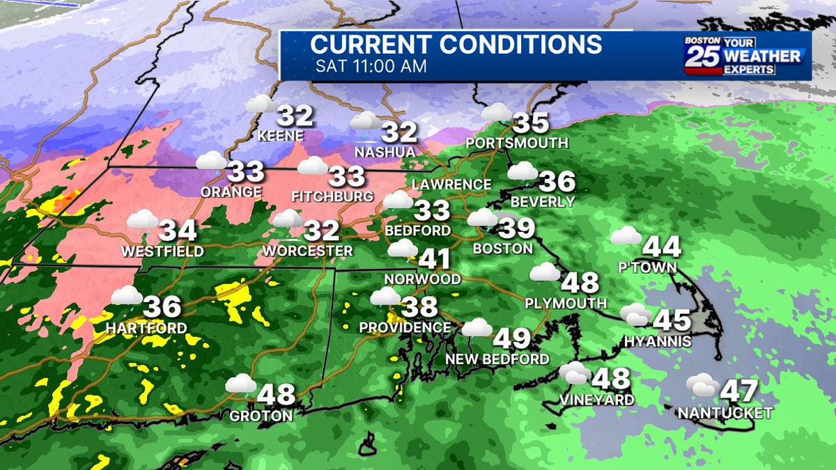
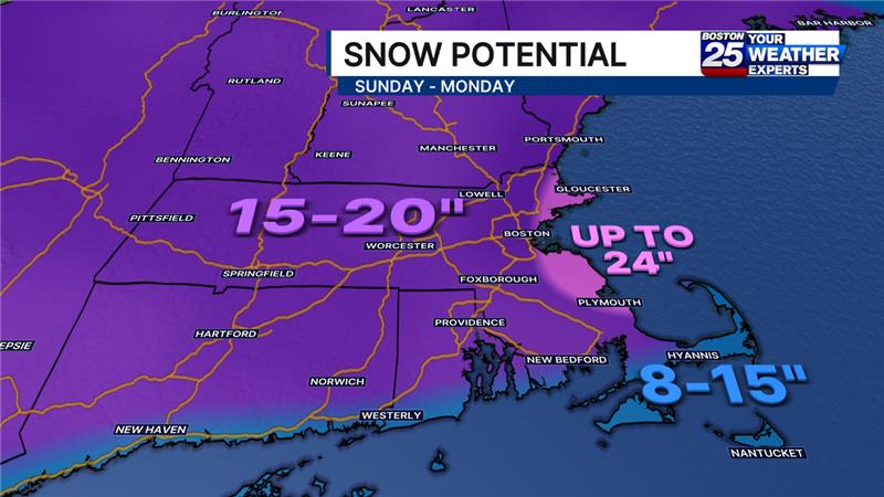
Updated snow map as off 11AM Saturday:
A closer storm track = more snow for many of us.
Still not locked in — small shifts will matter. Stay tuned.
9
20
119
20,356
🤯
Feb 7

Here's an updated look at snow reports, with nearly a foot for the North Shore!

1
4
675
Jason Brewer retweeted

Jan 23
Weather Alert: Arctic cold and snow boston25news.com/weather/wea…
1
3
37
5,113
Jason Brewer retweeted
Jan 22
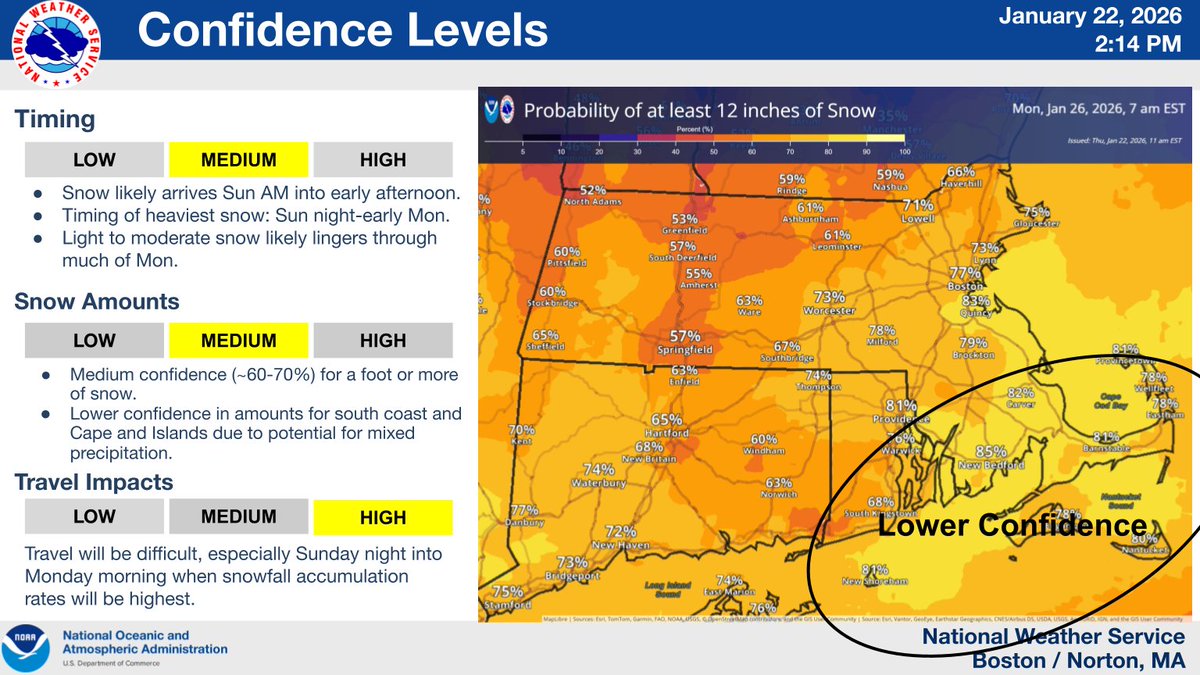
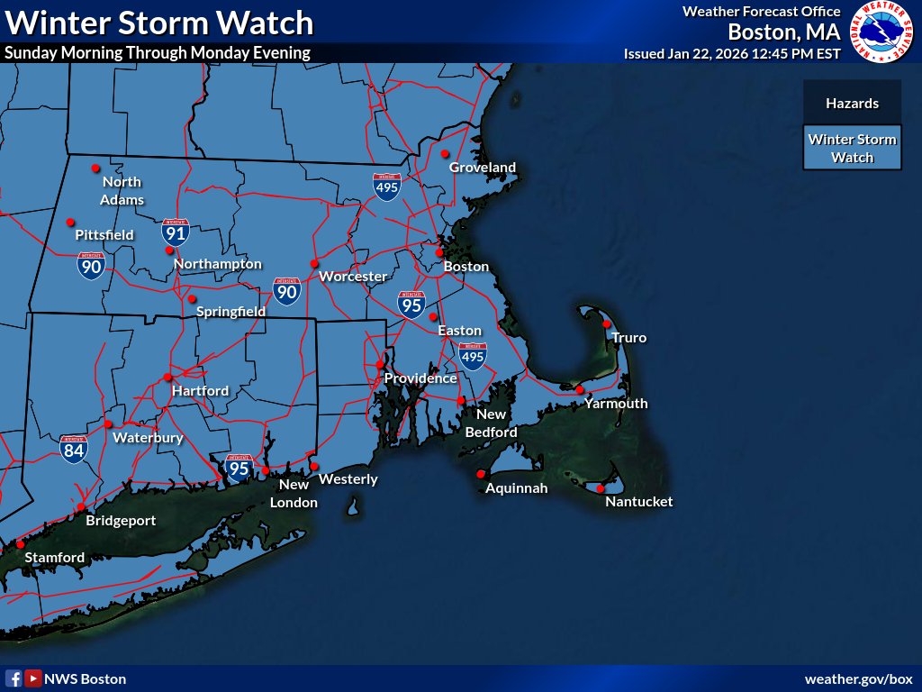
A Winter Storm Watch is in effect for all of Southern New England starting Sun AM through Monday PM. Confidence continues to increase that a winter storm will bring moderate to major impacts to the region with increasing probability of 12 inches of snow. #MAWX #CTWX #RIWX
7
53
185
42,870
Jason Brewer retweeted

Jan 22
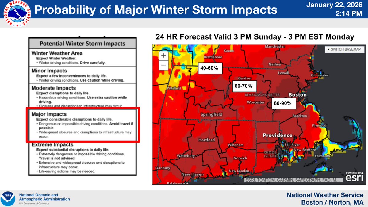
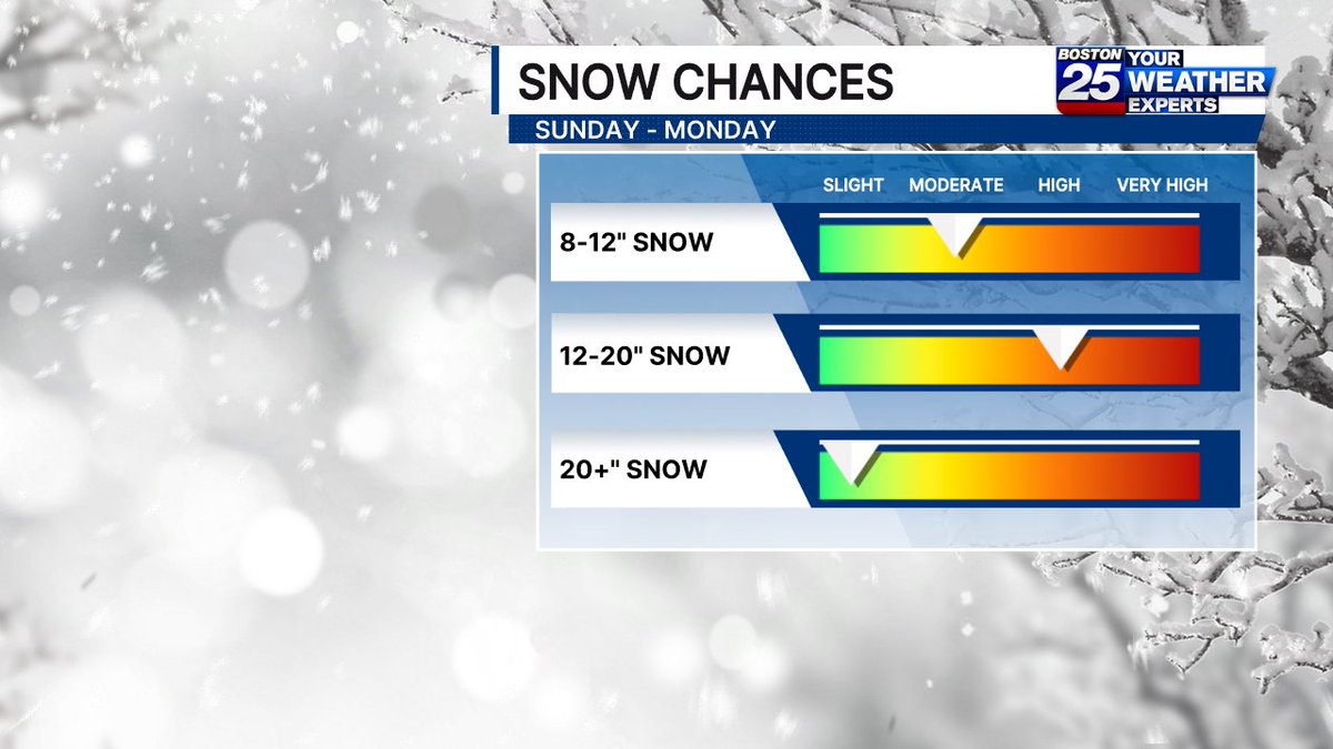
Here is the trend today (Thursday) for widespread snowfall in southern #NewEngland Sunday-Monday. Most likely range is 12"-20" across Massachusetts. This graphic is just the first step to give you insight into what we're expecting and help you prepare. @boston25
19
27
309
95,815
Jason Brewer retweeted

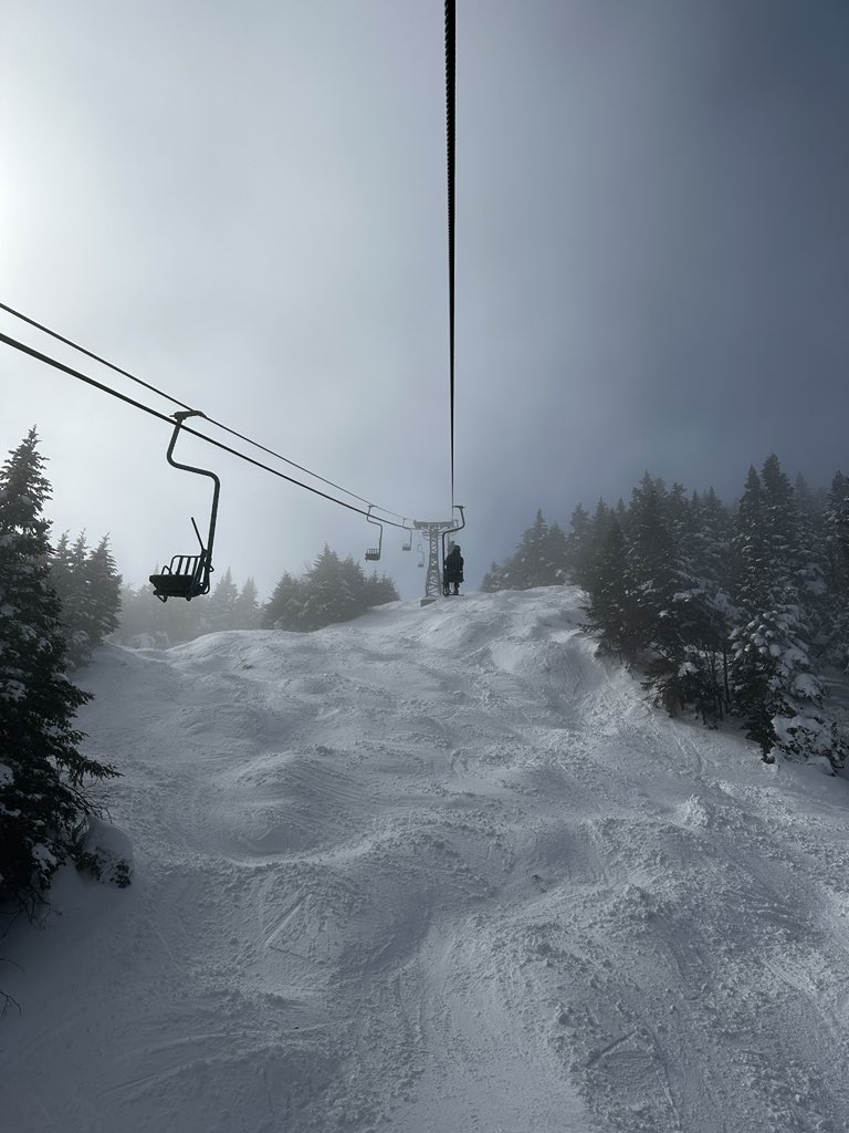
22 May 2025
Flakes flying on May 22nd! See you on the slopes tomorrow?😉
#bethebeast
2
12
57
4,888
Jason Brewer retweeted

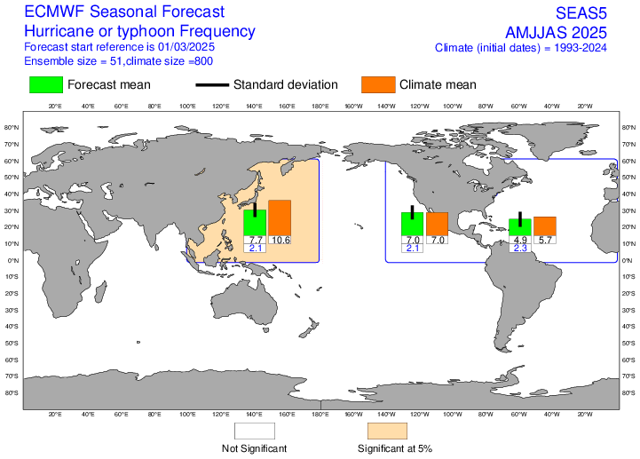
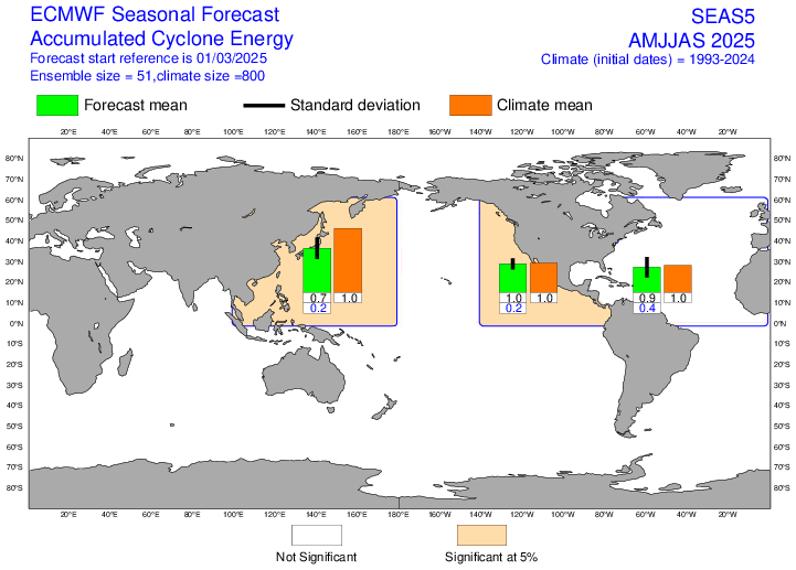
5 Mar 2025
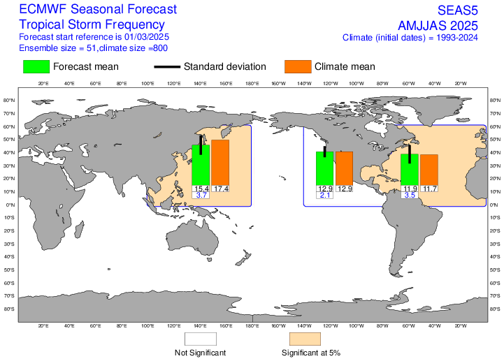
Forecast from ECMWF calls for a near-average Atlantic #hurricane season through Sept, with ensemble average of ~12 named storms, ~5 hurricanes and ACE of 90% of normal. Forecast near-average tropical Atlantic sea surface temperatures and ENSO neutral likely primary contributors.

5
88
291
45,266
Jason Brewer retweeted
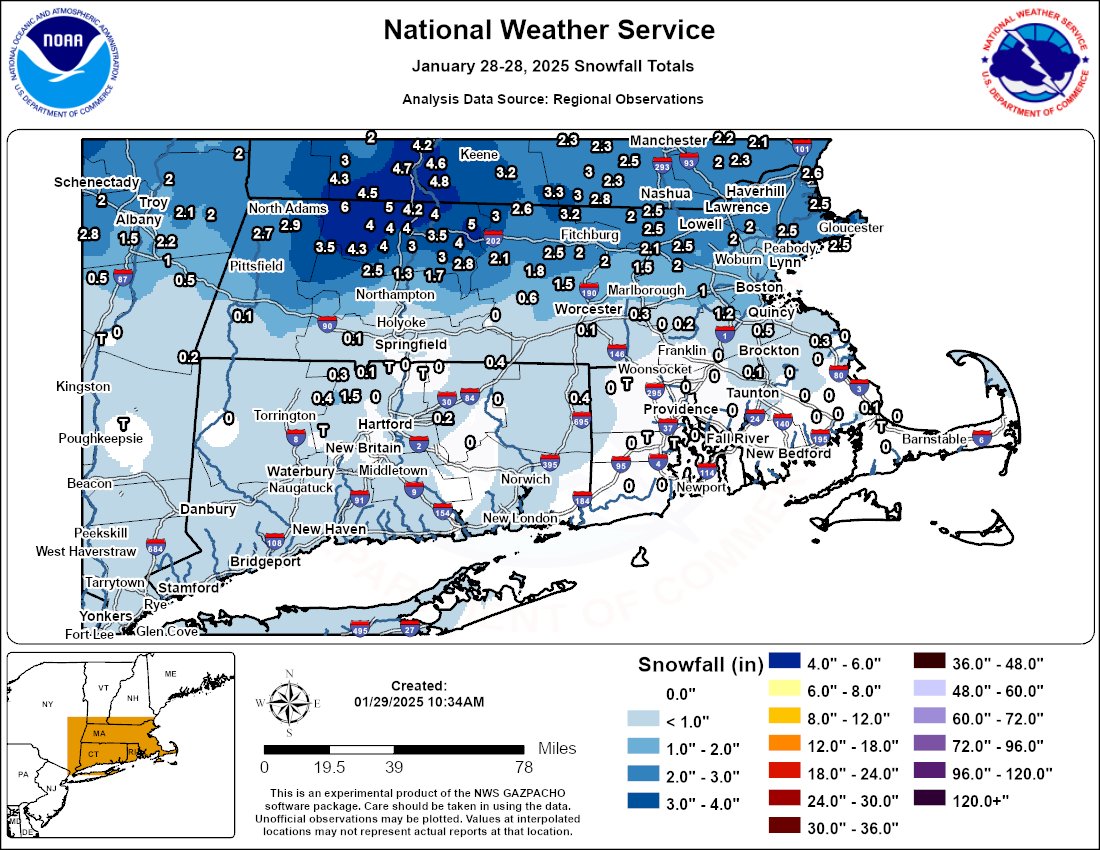
29 Jan 2025
Snowfall totals from last night's storm are in! Heaviest snow fell north of the Mass Turnpike. #MAwx #RIwx #CTwx
For an interactive map, click here tinyurl.com/4pyx2wvp
2
15
57
14,365
Jason Brewer retweeted
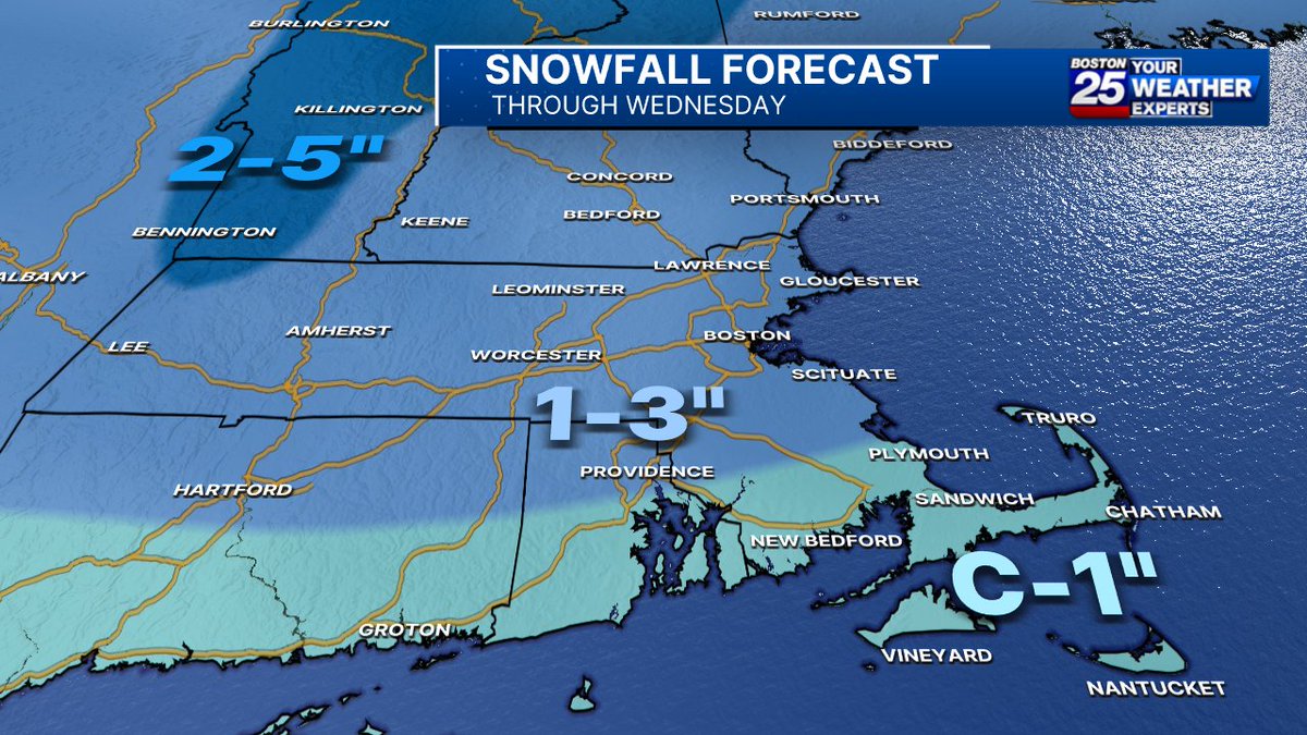
28 Jan 2025
Although a few local town could see a snow squall this morning with a coating, MOST OF THIS WILL STICK MIDNIGHT - 5 AM WENDSDAY! @Boston25 #mawx #nhwx #newengland
6
13
79
9,891
Jason Brewer retweeted

3 Jun 2024
🔒⬇️

160
682
11,551
865,312

23 Mar 2024
Still dealing with freezing rain in central MA, but plain rain takes over this afternoon. Flood Watch in effect. @boston25
1
2
5
1,501

Jason Brewer retweeted
13 Feb 2024
A storm shift means totals have dropped quite a bit in the last 24 hours. We're still expecting a nasty afternoon, especially in southeastern MA. Storm will end by 6 PM on #CapeCod. @boston25 #mawx #newengland
21
11
85
17,770
Jason Brewer retweeted
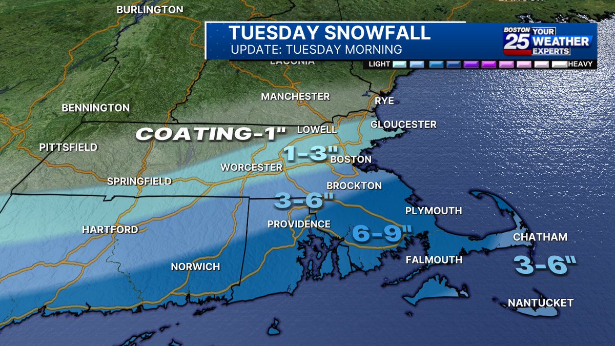
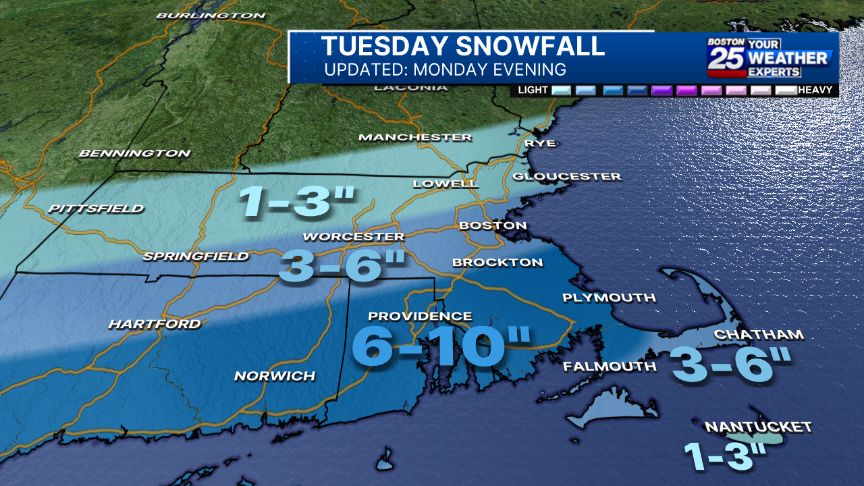
12 Feb 2024
NEW SNOW TOTALS: The latest track of Tuesday's nor’easter is shifting models of heavier snow to the south.
Make sure to stay with #Boston25 as we continue tracking this winter storm. boston25.com/4bvXfiR
15
19
88
48,491
Jason Brewer retweeted
19 Jan 2024
Good Friday morning! Dry air will limit snowfall today. In fact, coverage will likely be quite patchy with the best chance for accumulation in southeastern Mass this afternoon. @Boston25 #mawx #nhwx #newengland

4
7
69
10,871
6 Jan 2024
As we often see, tightly packed snow bands in Eastern MA. Either way, travel gets slick late this evening. Steady snow & flash freezing Sunday afternoon on current track south of Nantucket. @boston25
1
1
14
1,410