
Cartographer of Change, both for people and organizations. Training, Coaching, and Data Analysis
Joined March 2008
- Tweets 1,046
- Following 180
- Followers 976
- Likes 449
240 Photos and videos


22 Jul 2025
50 conversations later: Here's what public health is actually doing with AI - mailchi.mp/fandtlabs/50-conv…
36
4 Jun 2024
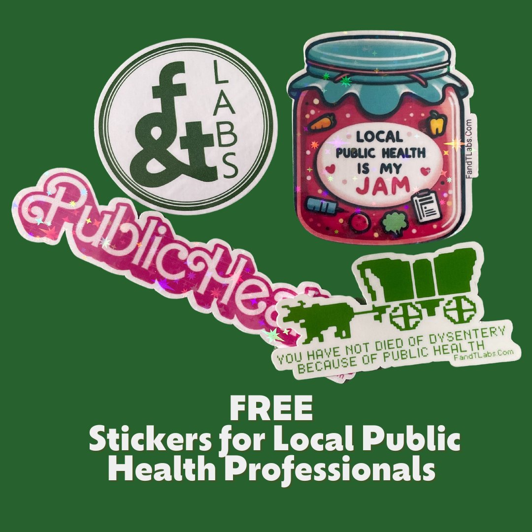
Do you work in local #publichealth and want some free stickers? We want to spread joy with some fun free stickers! fandtlabs.com/free-public-he…
99
15 May 2024
We are LIVE now on Linkedin for our #GeospatialConnections from West Virginia! Over on Linkedin DM me if you have issues.
6
233
30 Apr 2024
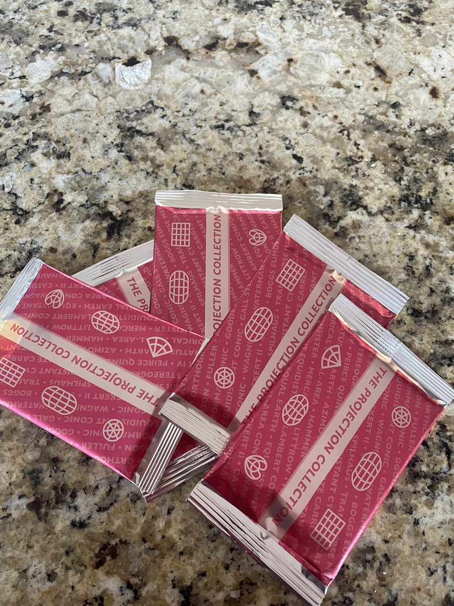
So excited to have my projection collection cards! @pinakographos thank you so much for all your labor!!!!
1
8
845
Juliana McMillan-Wilhoit retweeted

23 Mar 2024
Join us on March 28 for our first #PublicHealth Coffee & Connect for Local Public Health. Join us for VIRTUAL networking. No sales. fandtlabs.com/public-health-…
1
2
90
20 Mar 2024
I can't wait for this event to bring #LocalPublicHealth folks together!
19 Mar 2024

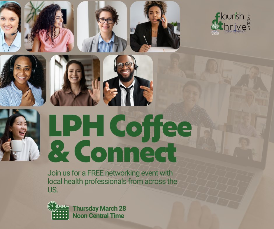
#PublicHealth folks who work for a #LHD come join our coffee and connect time for Local Public Health on March 28th at noon central. Networking time. No sales. Come connect! fandtlabs.com/public-health-… (Can't make it? Sign up for the event to be notified of next event!) #NACCHO
153
12 Mar 2024
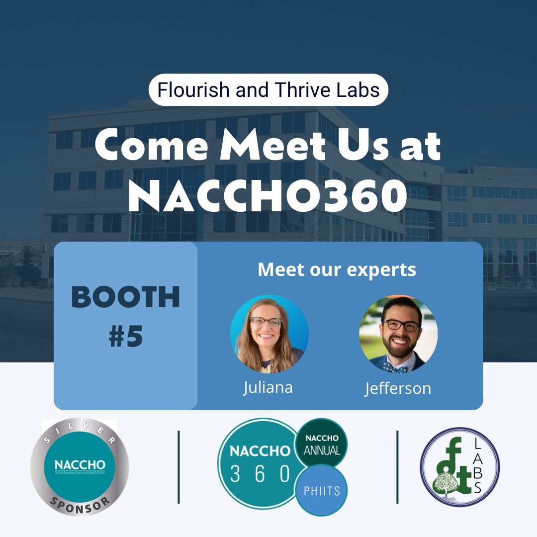
Calling all #PublicHealth professionals! Come meet other local public health folks for #networking and discussing AI in your personal workflows. We'd love to see you! fandtlabs.com/public-health-… (March 28, noon us central).
1
147
8 Mar 2024
#LocalPublicHealth folks come join us on March 28th at noon central for an event focused on connecting local public health departments together. We can't wait to meet you! fandtlabs.com/public-health-… #MPH #PublicHealth #NACCHO
100
5 Mar 2024
#PublicHealth folks working in local health departments, we'd love for you to join our FREE networking event on March 28th at noon central! Come connect #NACCHO #localpublichealth #MPH #epi #epidemelogy
140
1 Mar 2024
This pregnant map loving mama would love a can!
1 Mar 2024

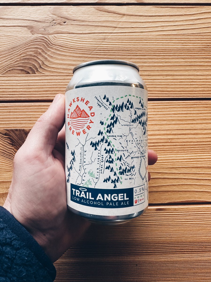
Who wants to win a can of Trail Angel!? 😍
RT to enter, and I'll pick a winner at random tomorrow evening.
1
1
214
Juliana McMillan-Wilhoit retweeted

1 Mar 2024
Who wants to win a can of Trail Angel!? 😍
RT to enter, and I'll pick a winner at random tomorrow evening.
4
49
48
6,005
29 Feb 2024
TOMORROW at noon central!
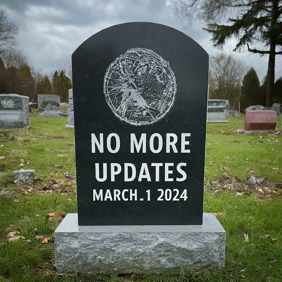
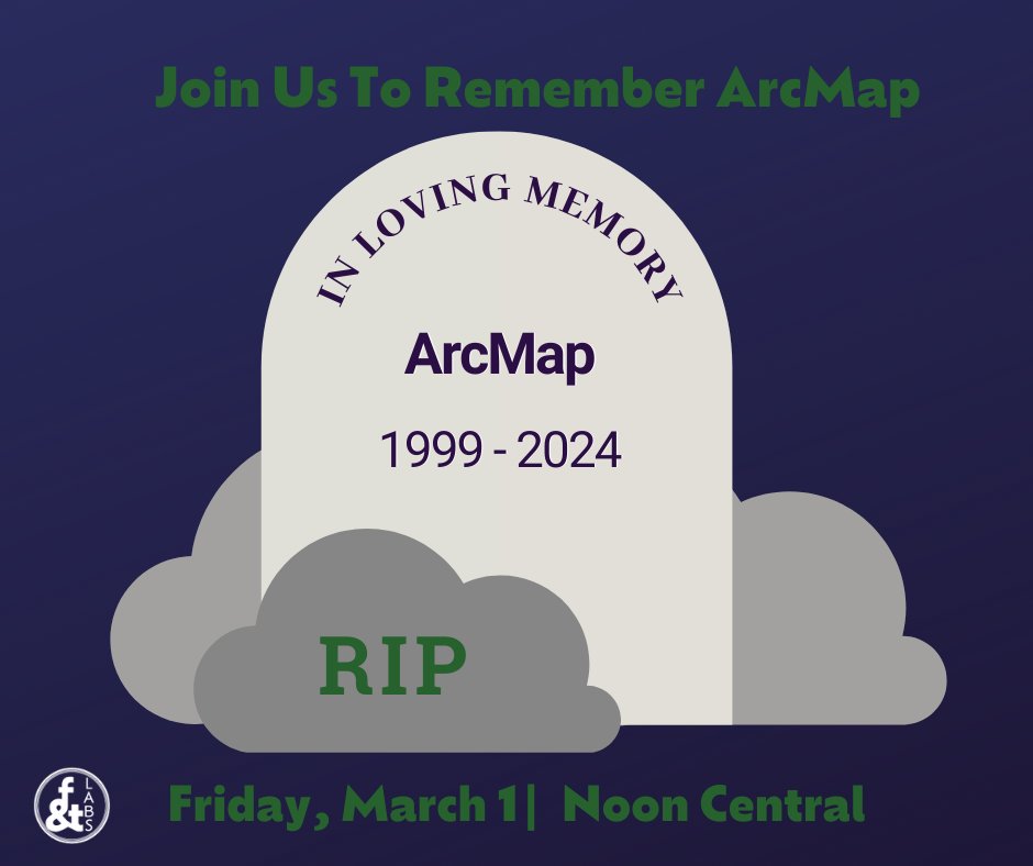
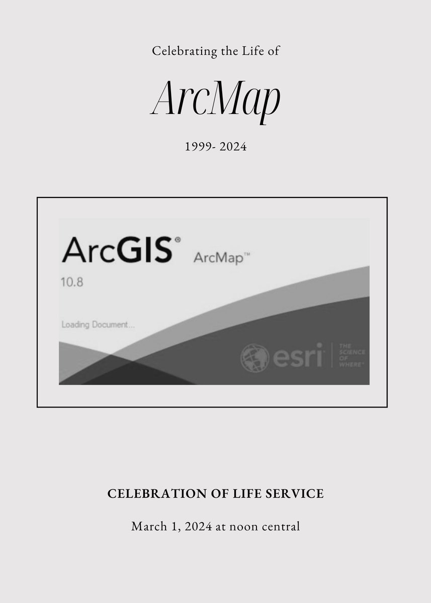
ArcMap is moving into extended support. No more updates. No more patches.
Join us on March 1 for a funeral for ArcMap as we celebrate all of those 9999 errors. Come bring your memories for an hour-long event bit.ly/ArcMapFuneral #gischat
2
5
22
923
25 Feb 2024
Come Join us on Friday for our free Mappy Hour to celebrate the impact of ArcMap! bit.ly/ArcMapFuneral #gischat
1
13
64
3,223