
Chief Meteorologist KSNW-Wichita / Proud Kansan / BS Geosciences, Mississippi State / BA Communication, Wichita State / Emmy Award Winner / AMS Seal of Approval
Joined April 2013
- Tweets 36,252
- Following 2,426
- Followers 11,036
- Likes 27,457
12,432 Photos and videos


Pinned Tweet

27 Feb 2024
#kswx
KSN Storm Track 3 - A legacy of being here for you!
@KSNNews @KSNStormTrack3
@USWeatherExpert
Ksn.com/weather
5
12
55
18,409
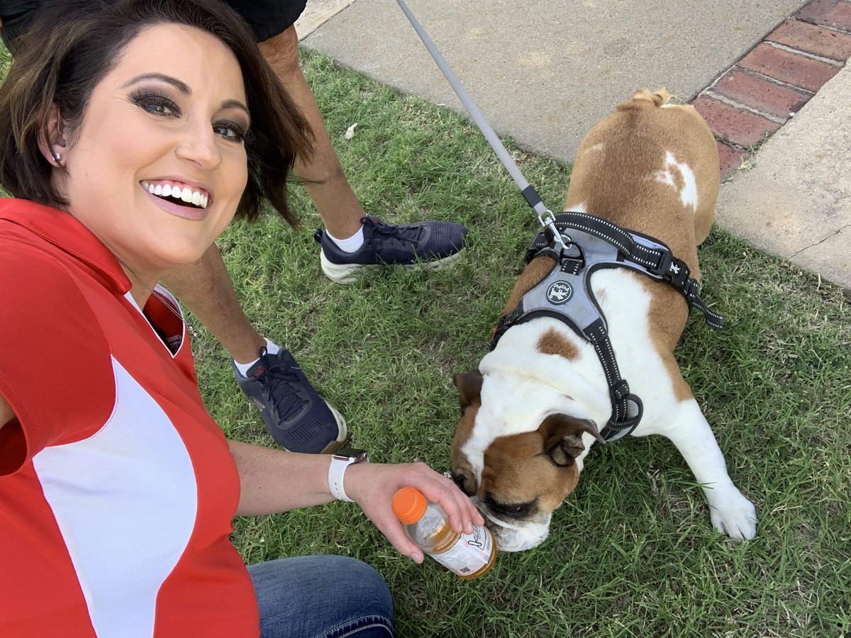
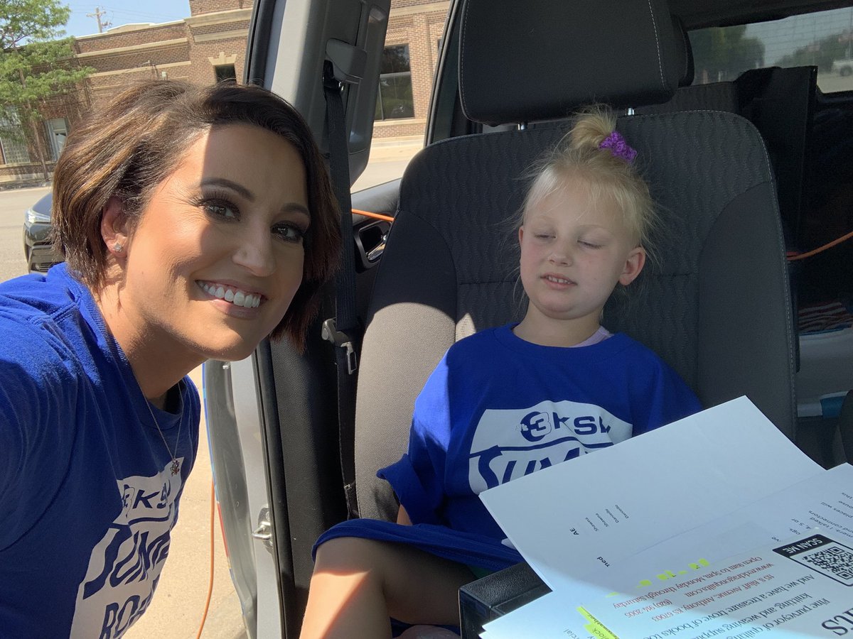
Ellis showed up! Always great coming back, catching up and riding the train!!! Thank you for taking care of us! Day 2 of the @KSNNews Summer Road Trip wraps up. Who is coming to see us on day 3?
@KSNStormTrack3
Ksn.com/weather

1
2
141
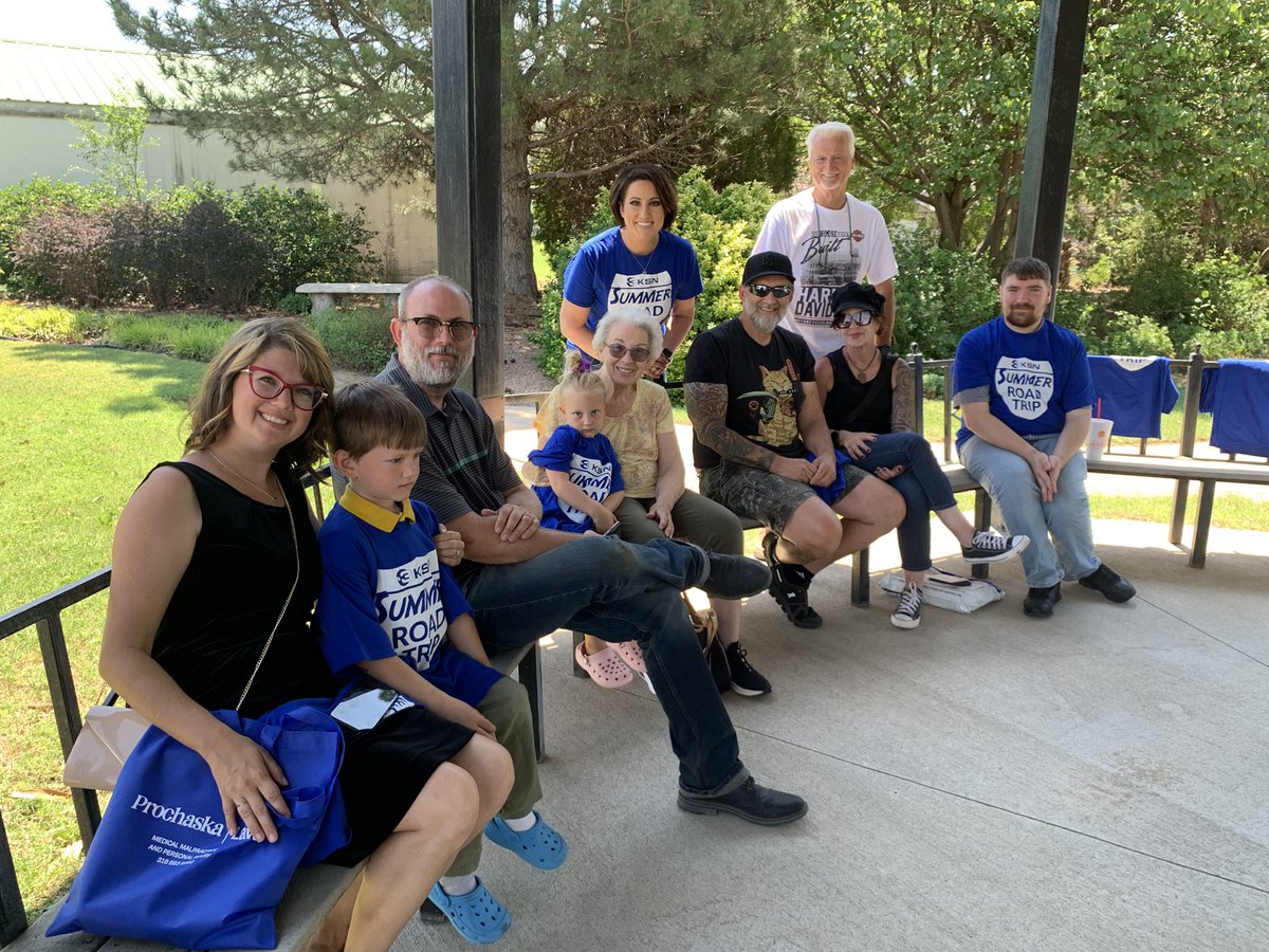
Thank you for the hospitality, Jetmore! A drink called “Eye of the Storm”? YES!!! It is the most appropriate for a meteorologist. Thank you for coming out to say hello to the KSN crew!
@KSNNews @KSNStormTrack3
Ksn.com/weather


2
11
413
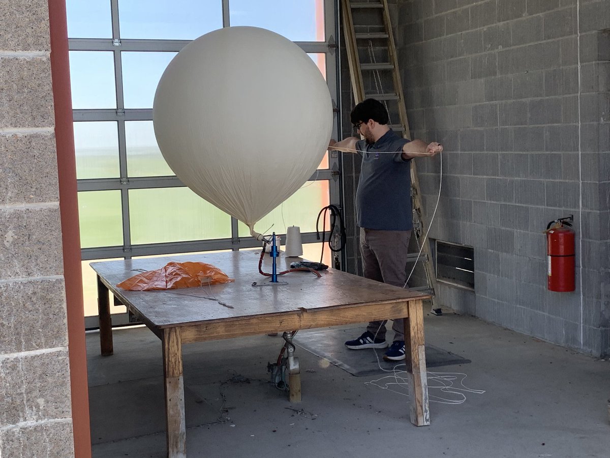
What did you do on your Summer Road Trip? How about launching a weather balloon from the @NWSDodgeCity ! Thank you for showing us how the process works and being our weather partners to keep Kansans safe!
@KSNNews @KSNStormTrack3
Ksn.com/weather
3
3
17
514
Deerfield did not disappoint! Such wonderful folks and great conversations. Met Daniel and Jordan who have built their own tornado intercept vehicles! Storm Tracker 3 is always a hit! Thank you for coming out for our second day of the @KSNNews Summer Road Trip!
@KSNStormTrack3 @ReedTimmerUSA
Ksn.com/weather


1
2
9
430
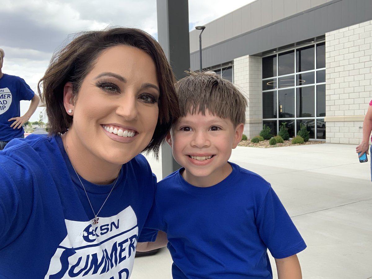
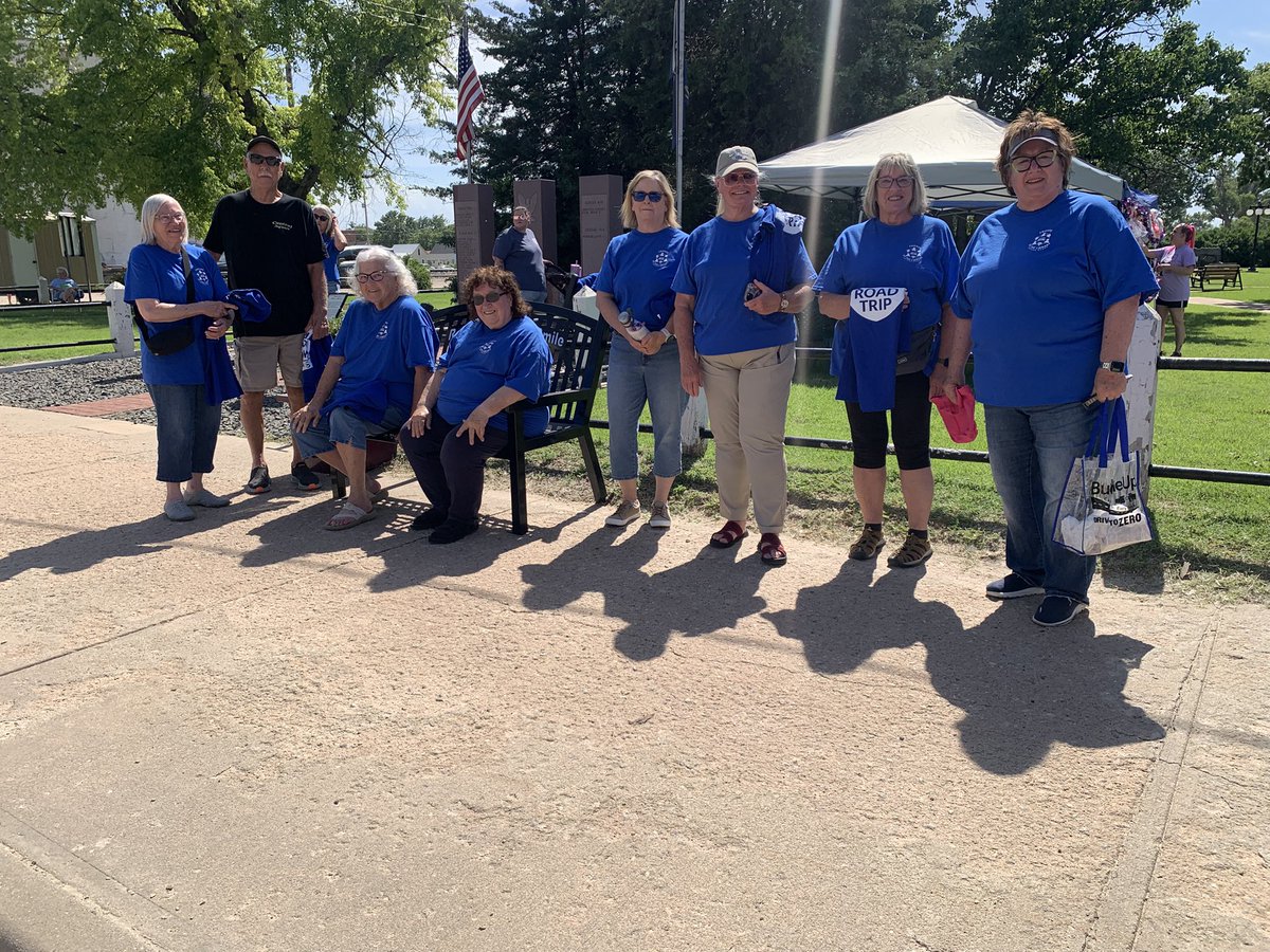
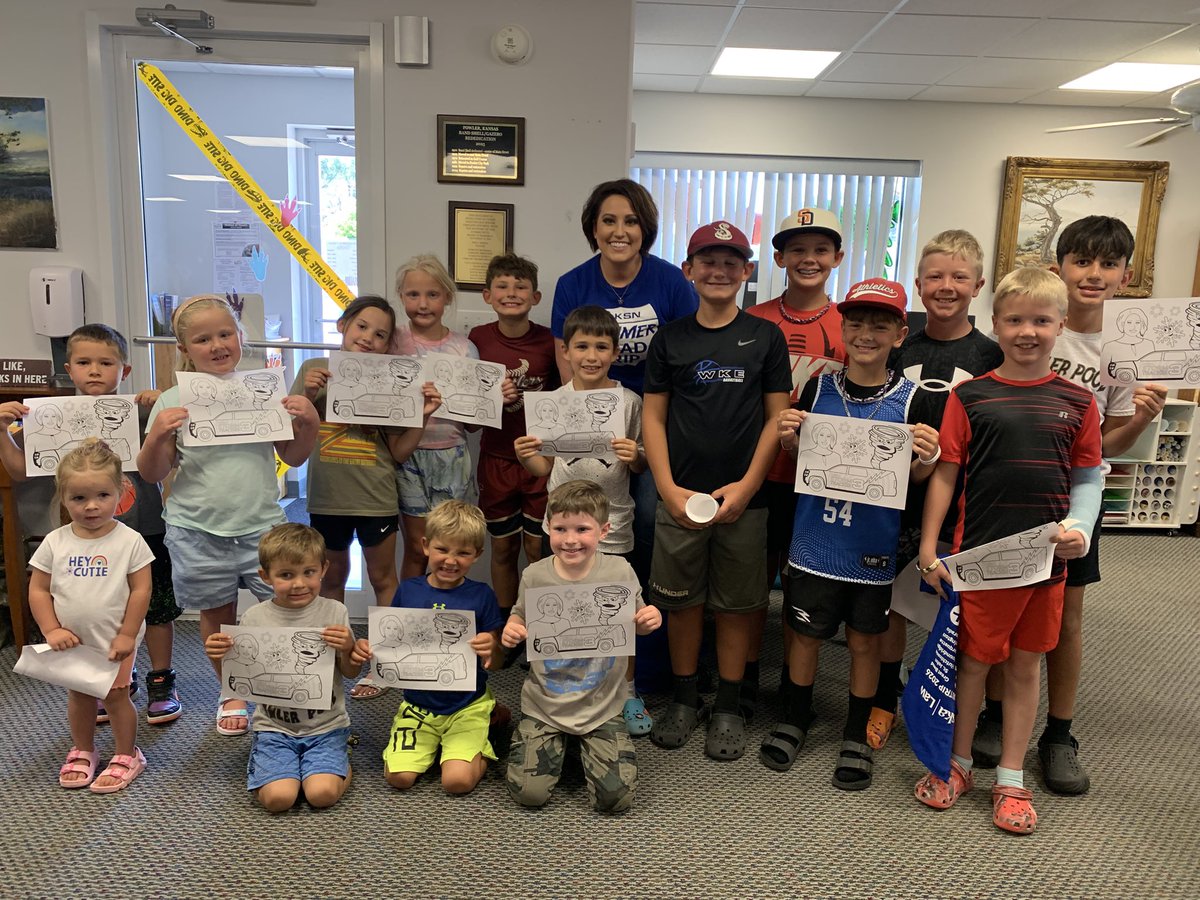
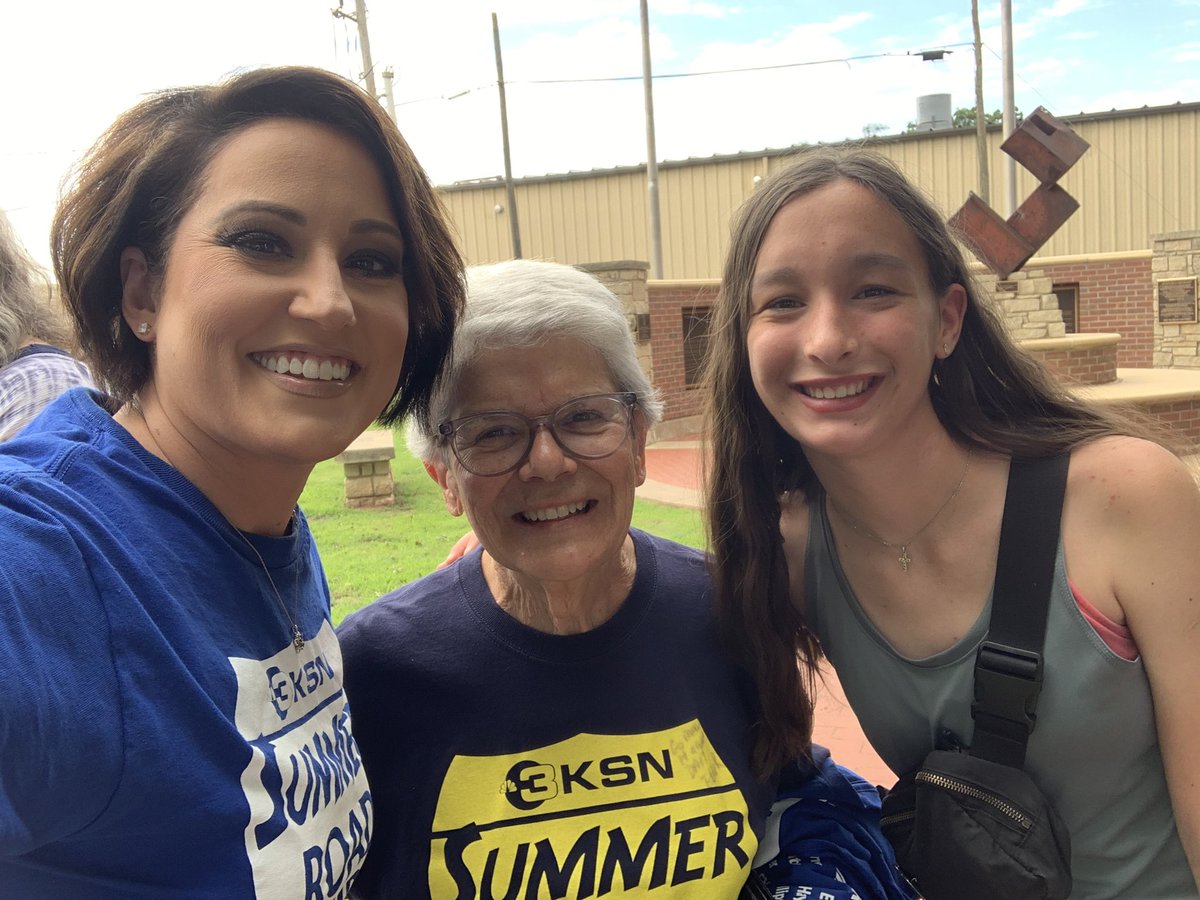
Garden City showed up at The Refinery! What a cool place! Thank you for coming out on the first day of the KSN Summer Road Trip!
@KSNNews @KSNStormTrack3
Ksn.com/weather


1
8
585
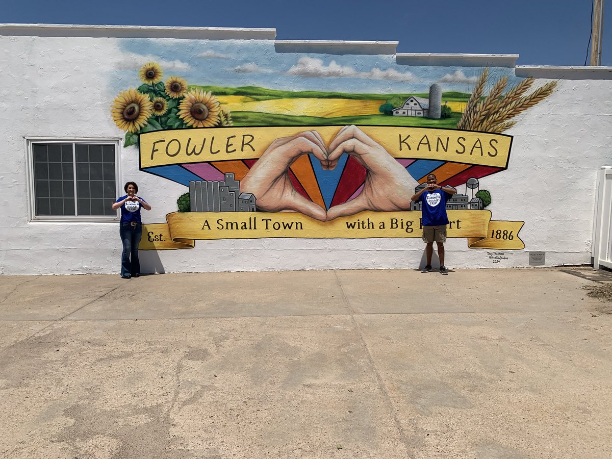
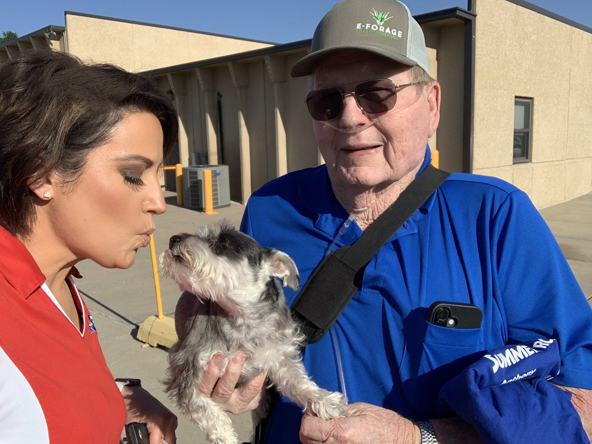
Thank you, Fowler! You took such great care of @rnllwilliamswx and me last year, I had to bring the rest of the @KSNNews crew back this year.
@KSNStormTrack3
Ksn.com/weather

2
7
494
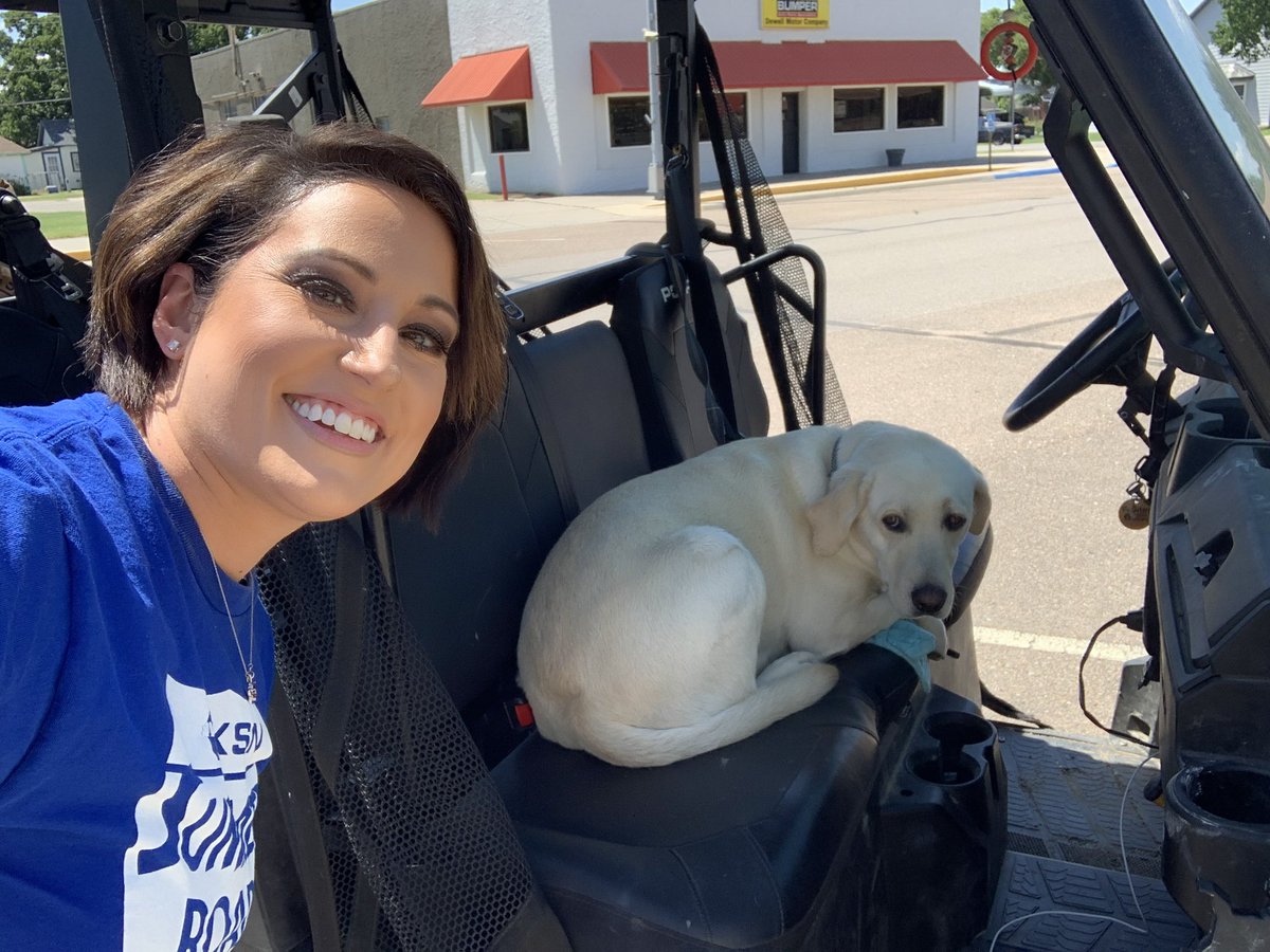
Second stop of the day — Coldwater! A little shade and a lot of fun showing Kaylee and Mason how Storm Tracker 3 works! Thank you for coming out today.
@KSNNews @KSNStormTrack3
Ksn.com/weather


3
9
510
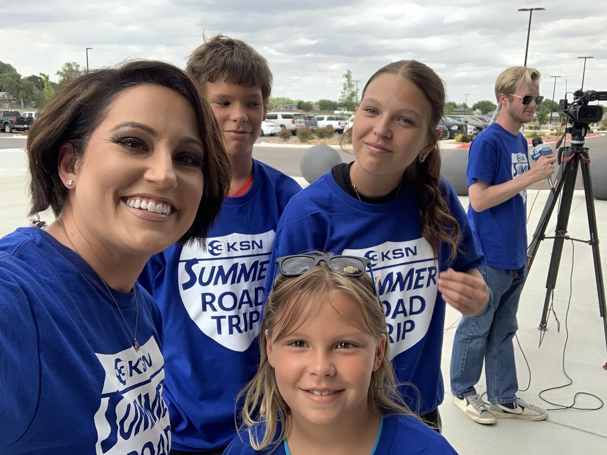
The @KSNNews Summer Road Trip is off and running! Our first stop — Anthony! Thank you all who came out to say “hello” and talk about the weather today at the 9/11 Memorial.
@KSNStormTrack3
Ksn.com/weather


1
3
10
438
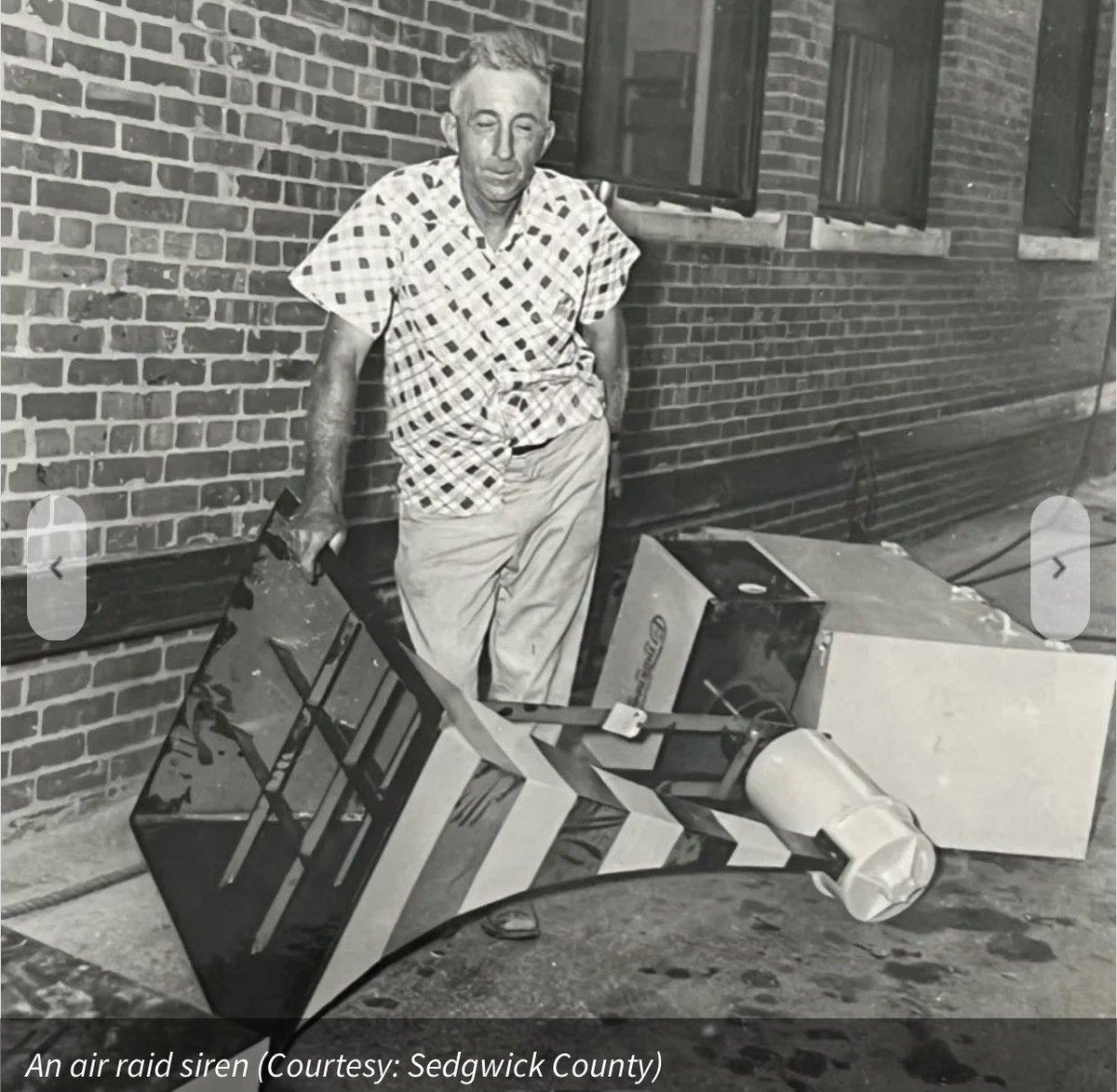
Tornado sirens and radar are both important tools used to warn of dangerous weather. In the 1950s, Wichita #kswx was the place air raid sirens turned to tornado warning devices AND experimental radar was first put to use. Check it out below…
Special thanks to @SedgwickCounty Emergency Management, @USWeatherExpert and his book “Warnings The True Story of How Science Tamed the Weather,” and @NWSWichita for their inspiration and assistance on this story that celebrates America’s 250th.
ksn.com/celebrate-250/how-wi…
@KSNNews @KSNStormTrack3
6
18
804
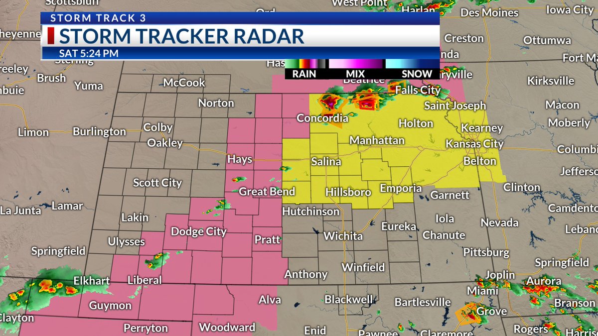
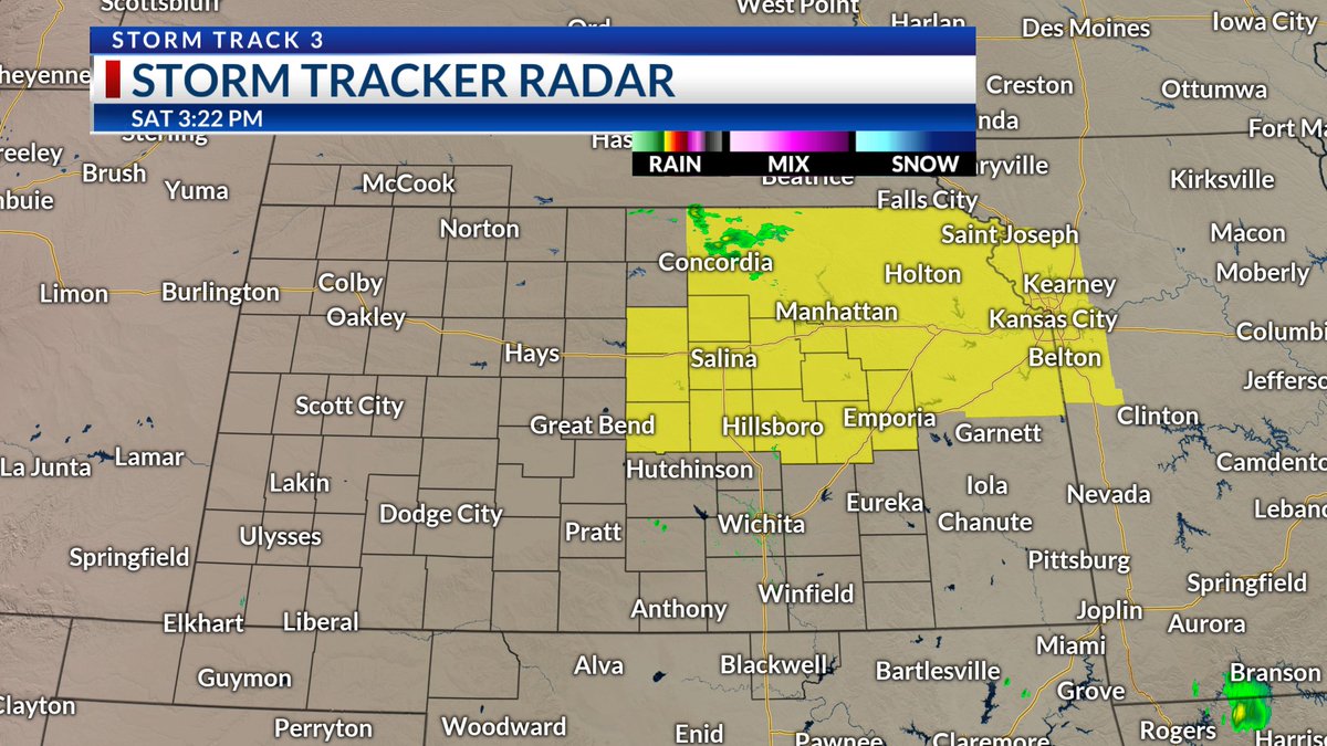
5:30 PM SEVERE UPDATE: Storms are starting to fill in along the cold front #kswx #okwx #newx . A NEW Severe Thunderstorm Watch has been added for counties in central and southwest Kansas until midnight. This is in addition to the Tornado Watch over Northcentral and Northeast Kansas which expires at 11 PM Saturday.
@KSNNews @KSNStormTrack3
ksn.com/weather
1
9
732
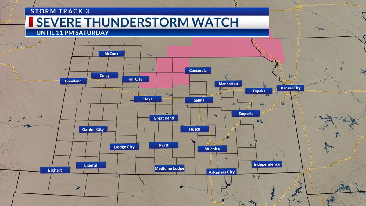
AND another watch -- this one a SEVERE THUNDERSTORM WATCH for a few of our northcentral Kansas counties until 11 PM Saturday.
#kswx
@KSNNews @KSNStormTrack3
ksn.com/weather

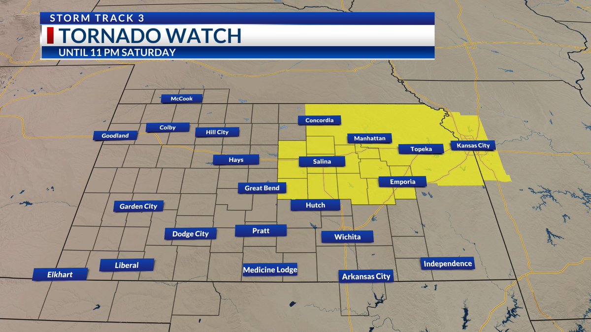
A TORNADO WATCH #kswx is in effect until 11 PM Saturday.
* Primary threats include...
-A few tornadoes possible.
-Scattered damaging winds likely with isolated significant gusts to 75 mph possible.
-Scattered large hail likely with isolated extreme hail to the size of tennis balls.
Stay with @KSNNews @KSNStormTrack3 for updates.
ksn.com/weather
2
8
810
A TORNADO WATCH #kswx is in effect until 11 PM Saturday.
* Primary threats include...
-A few tornadoes possible.
-Scattered damaging winds likely with isolated significant gusts to 75 mph possible.
-Scattered large hail likely with isolated extreme hail to the size of tennis balls.
Stay with @KSNNews @KSNStormTrack3 for updates.
ksn.com/weather
2
14
1,511
A Tornado Watch will be issued soon for parts of the @KSNNews @KSNStormTrack3 #kswx viewing area.
Ksn.com/weather
1
3
11
694
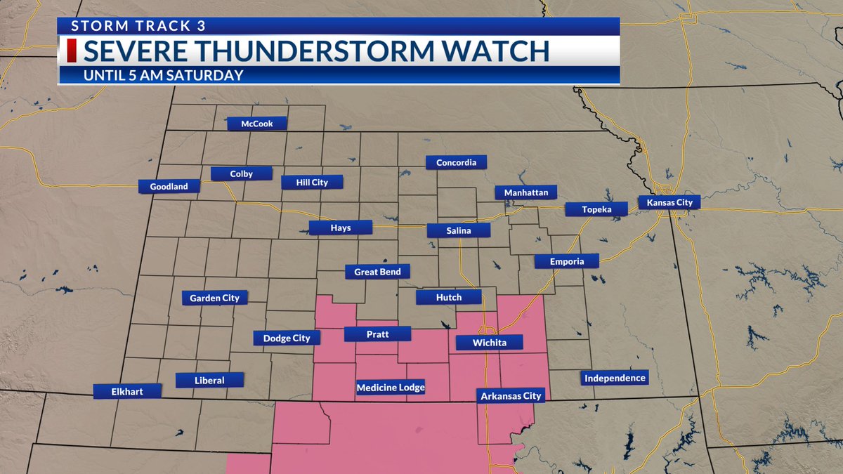
A Severe Thunderstorm Watch is in effect until 5 AM Saturday. This includes Sedgwick, Butler, Cowley, Harper, Kingman and Sumner counties along with Kay County, Oklahoma. Winds gusting from 60-70 MPH are possible. #kswx
Stay with @KSNNews @KSNStormTrack3 for updates.
Posted: 1:19 AM 6/13/26
ksn.com/weather
1
2
10
281
2
3
7
374
SHARE AND PREPARE: A Severe Thunderstorm Watch is in effect until 1 AM Saturday. #kswx #okwx
Primary threats include...
*Scattered damaging winds with isolated significant gusts to 80 mph possible.
*Scattered large hail and isolated hail to 2 inches in diameter possible.
*A tornado cannot be ruled out.
Stay with @KSNNews @KSNStormTrack3 for updates.
ksn.com/weather
1
1
9
339
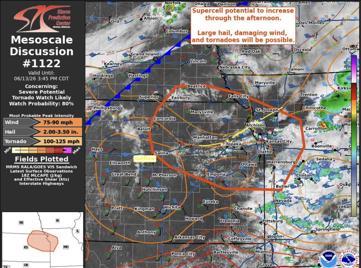
STORM TRACK 3 FORECAST: Storms track over southern Kansas tonight #kswx . Some could be strong. Another batch of severe weather gears up ahead of a potent June cold front by Saturday evening. Forecast update below... #okwx #newx
ksn.com/weather/weather-blog…
@KSNNews @KSNStormTrack3

1
10
409
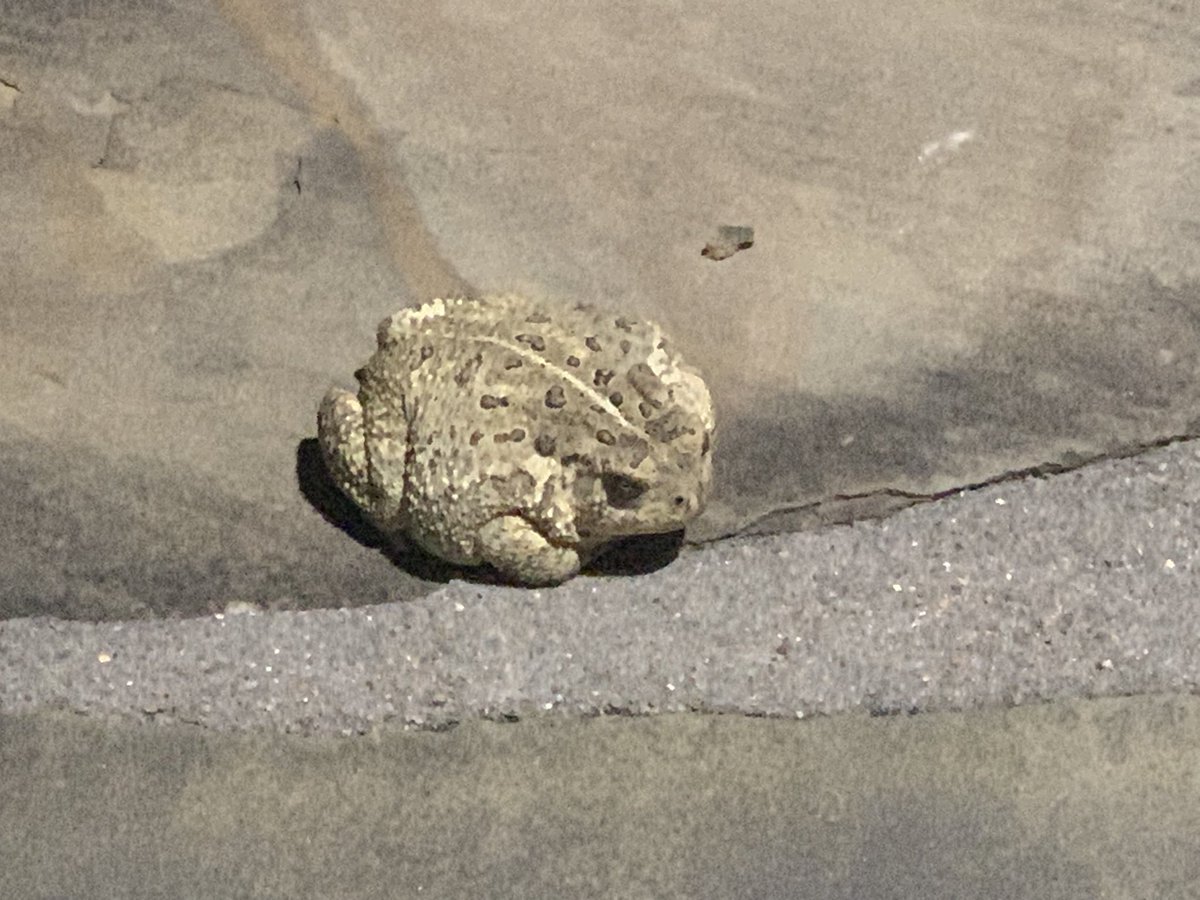
The amphibian. The myth. The LEGEND!
Every night I leave the studio, this toad greets me on the #kswx weather patio. What should we name it?
@KSNNews @KSNStormTrack3
Ksn.com/weather
5
1
13
422
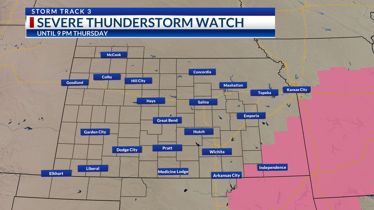
A SEVERE THUNDERSTORM WATCH IS IN EFFECT! This includes Chautauqua County #kswx within the KSN TV viewing area until 9 PM Thursday.
Damaging winds and large hail are primary. A tornado cannot be ruled out within the Severe Thunderstorm Watch this evening.
Stay with @KSNNews @KSNStormTrack3 for updates.
Posted: 3:03 PM 6/11/26
ksn.com/weather

3
256
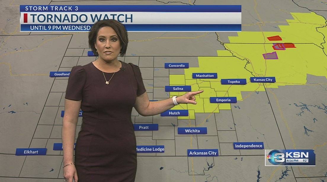
STORM TRACK 3 FORECAST: A Tornado Watch continues this evening over central and northeastern Kansas #kswx . More storms, some of which will be severe, will return over the weekend. You may like where temperatures head behind a strong June cold front shortly. Here is the latest... #okwx #newx
ksn.com/weather/weather-blog…
@KSNNews @KSNStormTrack3
1
5
800