
13,441 Photos and videos
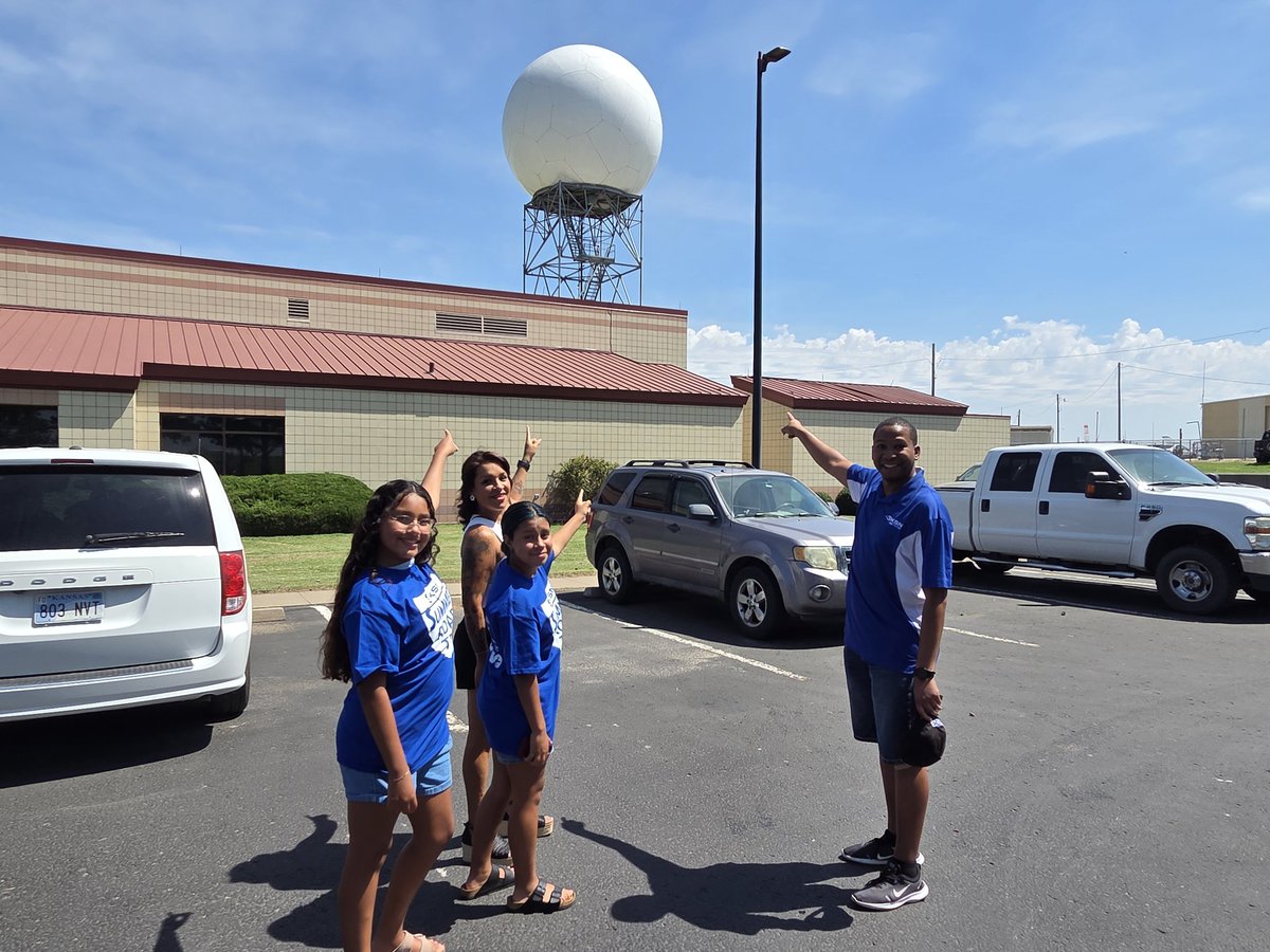


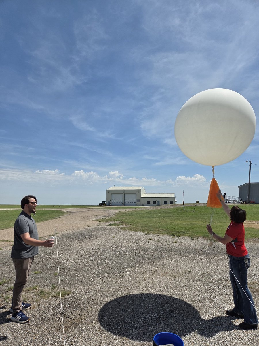
Like a kid in a candy store. Definitely one of my favorite stops so far. Thank you, @NWSDodgeCity!
#KSNSummerRoadTrip2026
@KSNNews @KSNStormTrack3 @LisaTeachman


2
2
72
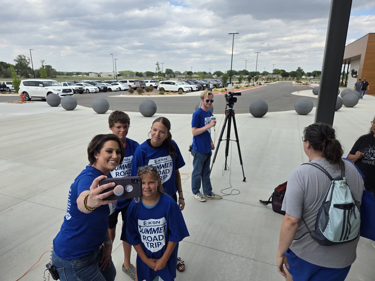
My first time in Deerfield, KS and hopefully not the last!
#KSNSummerRoadTrip2026
@KSNNews @KSNStormTrack3


1
242
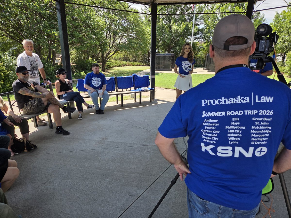
Day 2 of the #KSNSummerRoadTrip2026 is underway!
Many thanks to Patrick Dugan's Coffee House for hosting us again!
@KSNNews @KSNStormTrack3 @CityofGCKS @GCGreater
1
1
204
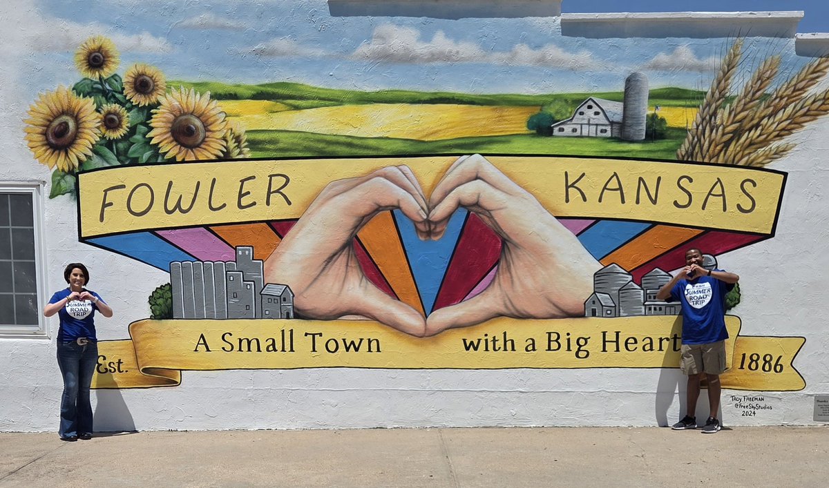
Final stop of the day......The Refinery in Garden City!!
@KSNNews @KSNStormTrack3 @CityofGCKS @GCGreater
#KSNSummerRoadTrip2026


1
2
389


1
341

1
309


1
265
⚠️ SEVERE UPDATE: Not much moisture during the day today, but stronger storms are possible this evening and overnight.
Another cold front sparks more storms Saturday. Be weather aware during the afternoon and evening.
#kswx @KSNNews @KSNStormTrack3 ksn.com/weather

4
122
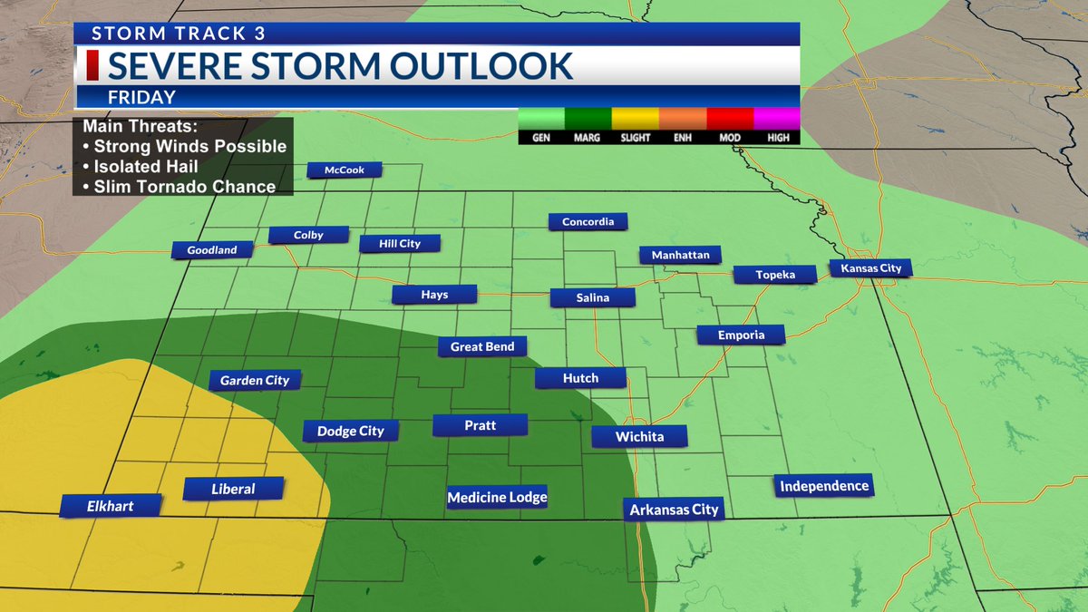
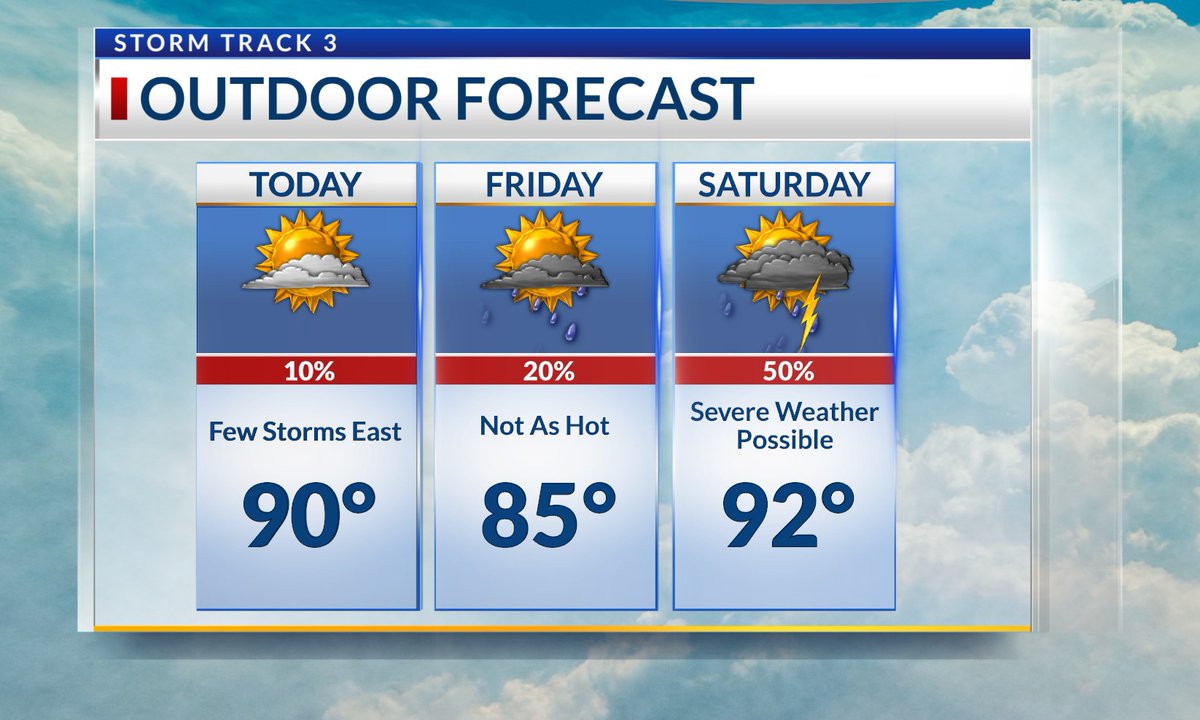
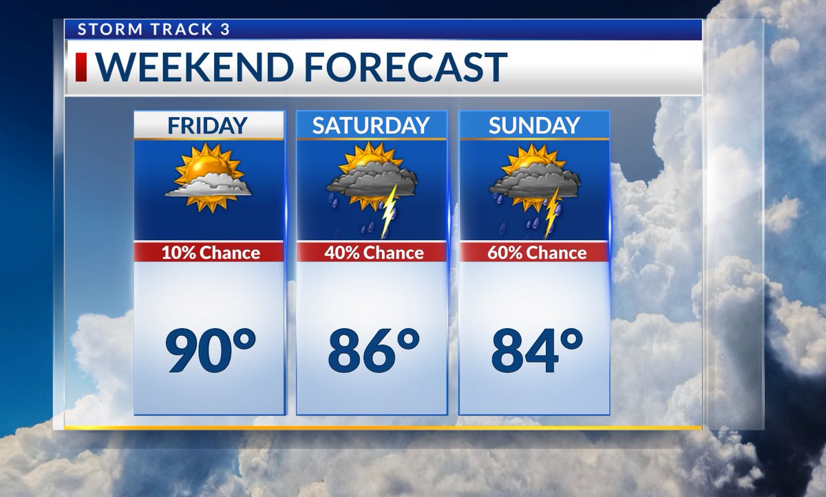
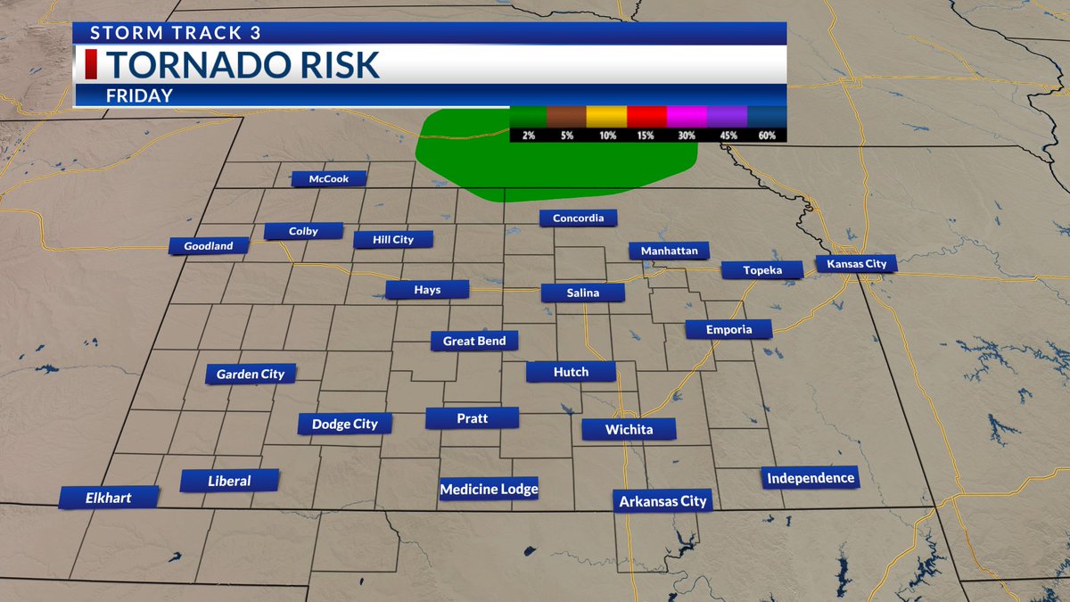
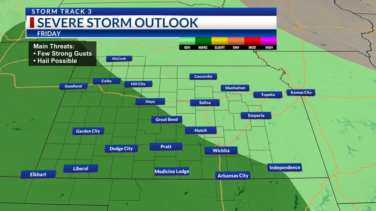
A cold front sparks spotty storms east later this afternoon and evening, some could turn severe.
Any storms Friday will be below severe thresholds before the threat of damaging storms rises again Saturday.
#kswx @KSNNews @KSNStormTrack3 ksn.com/weather

1
1
2
116
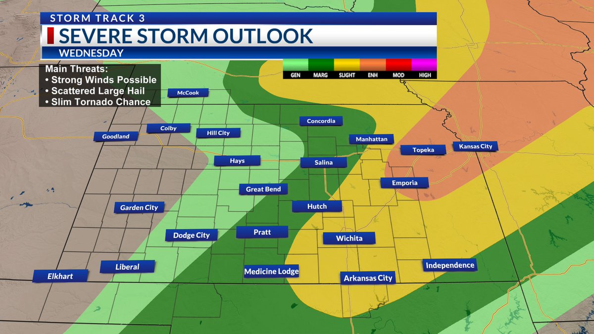
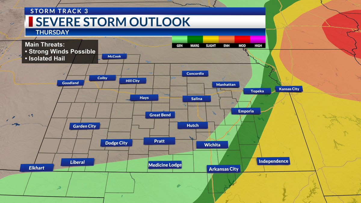
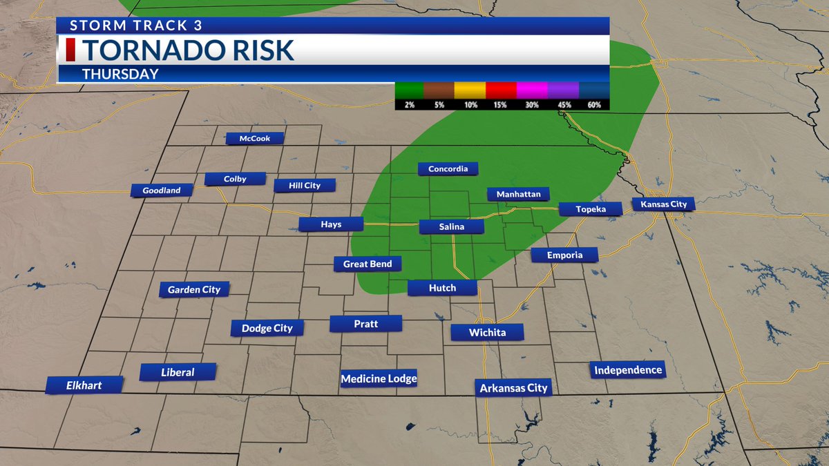
⚠️ Wednesday storms will not be as numerous and will not impact Western Kansas. Another severe risk targets Central and Eastern Kansas, especially counties surrounding the turnpike. Cannot rule out a tornado.
#kswx @KSNNews @KSNStormTrack3 ksn.com/weather

2
205
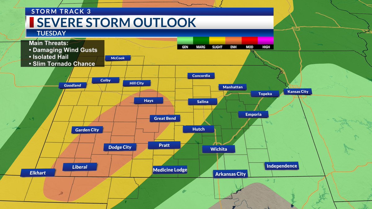
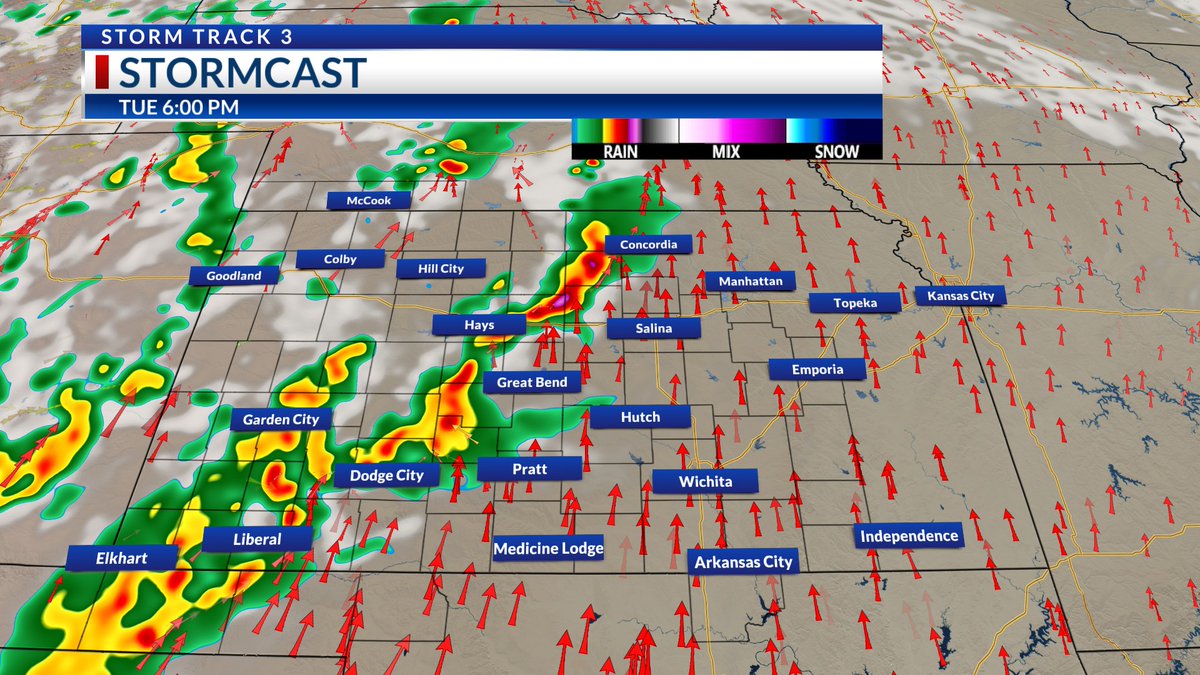
⚠️ TUESDAY SEVERE RISK: More damaging storms develop to the west this afternoon and then slide east through the evening. Have more than one way to receive weather alerts and warnings.
#kswx @KSNNews @KSNStormTrack3 ksn.com/weather
1
3
251
A FLASH FLOOD WARNING is in effect for Lyon and Morris Counties until 4:30 AM Tuesday. Also for Lincoln County until 8:30am Tuesday. Stay with @KSNNews and @KSNStormTrack3, we will keep you advised. Track the radar here -> ksn.com/weather/radar/
#KSWX
1
158
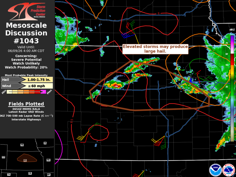
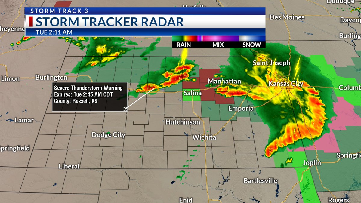
2AM RADAR UPDATE: North Central Kansas storms are still capable of hail and strong gusts but there is only a 20% chance a new Watch is issued. More updates on #KansasToday starting at 4:30am.
#kswx @KSNNews @KSNStormTrack3 ksn.com/weather
3
155
Morning! 👋🏾 Be weather aware today, there is another chance for storms and temps will be hotter. Greatest risk of strong to severe storms will be later this afternoon and evening. More severe risks and high heat after today.
#kswx @KSNNews @KSNStormTrack3 ksn.com/weather


3
179
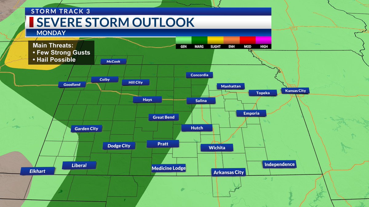
LOOKING AHEAD: Some rain and rumbles today will mainly impact Central and Eastern Kansas. Cannot rule out a severe storm to the east. Afternoons and evenings early next week will be active. Watch out for hail/strong winds.
#kswx @KSNNews @KSNStormTrack3 ksn.com/weather

3
190
More showers and storms are on the way. Best chance today will be in South Central Kansas. Sunday showers also favor much of Central Kansas. Western Kansas will need to be weather aware late Monday as stronger storms move in.
#kswx @KSNNews @KSNStormTrack3 ksn.com/weather
2
199
Spotty storms remain possible but the weekend will not be a washout. Have a rain jacket handy for the final day of Riverfest.
⚠️ SEVERE RISK TODAY is focused on northern counties. Timing will be during the afternoon/evening.
#kswx @KSNNews @KSNStormTrack3 ksn.com/weather

2
82
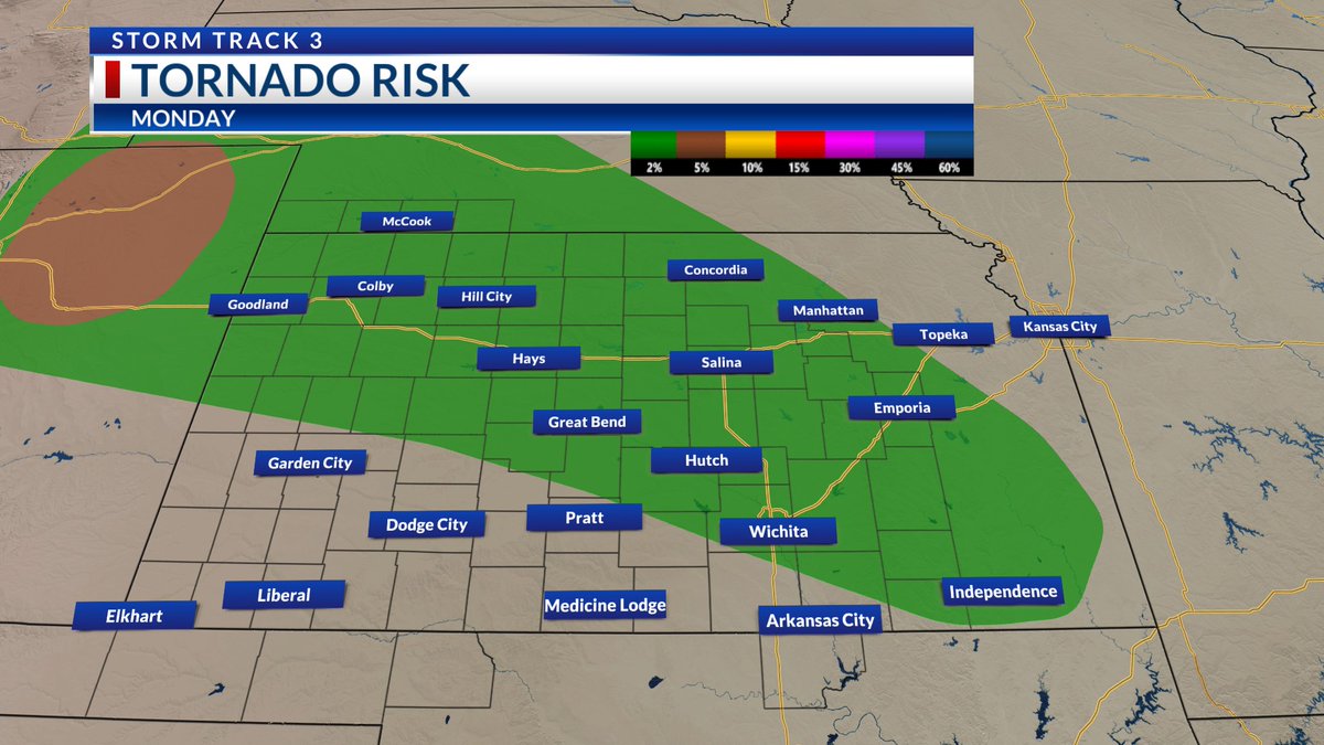
More severe storms will be possible the next couple of days. The threat of a tornado is low but it is not zero. Heavy rainfall is also a threat due to the potential for some flooding.
#kswx @KSNNews @KSNStormTrack3 ksn.com/weather


2
130
Ronelle Williams retweeted

Jun 3
The best chance for storms later today will be across the western half of the area, where there is a risk for isolated strong to severe storms. Strong gusts and hail will be possible, in addition to heavy rainfall.
Get the full #KSwx forecast from @rnllwilliamswx: ksn.com/weather/weather-blog…
1
1
397
It will not be as damp as yesterday but showers and storms will continue to be around. Strong to severe storms will be possible at times. Hail and strong gusts will be possible mainly during late afternoon and evening hours.
#kswx @KSNNews @KSNStormTrack3 ksn.com/weather


6
143