
Storm Relative Radar Loops etc
Joined April 2021
- Tweets 5,340
- Following 998
- Followers 7,702
- Likes 9,424
2,316 Photos and videos


Pinned Tweet

6 Jun 2022
Overview of the Dec 10th 2021 EF4 tornado including an extensive damage is finally done! Here: vortmaxblog.wordpress.com/20…
9
34
264
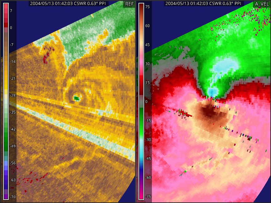
End wall vortex, low swirl ratio, and sfc friction shenanigans

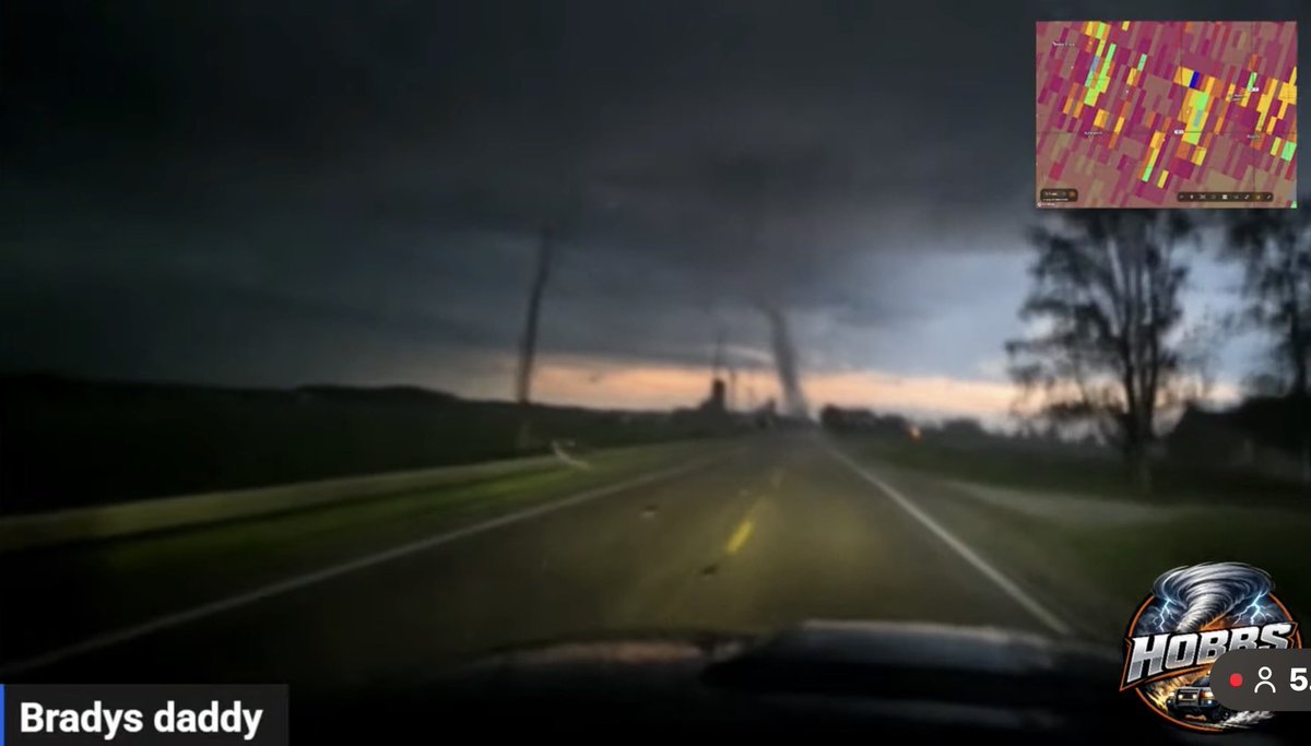
Confirmed tornado on the ground moments ago in Punxsutawney, PA! 🌪️
📹 Video Credit: Myranda Phillips
#pawx #Pennsylvania #tornado
facebook.com/share/r/1HBs3Xi…
2
5
97
6,527
SRRadarLoops retweeted

Jun 14
Latest euro has 90kts of bulk shear in the Hudson valley on Thursday. I have never seen kinematics like this in June

5
64
3,109
SRRadarLoops retweeted

Jun 13
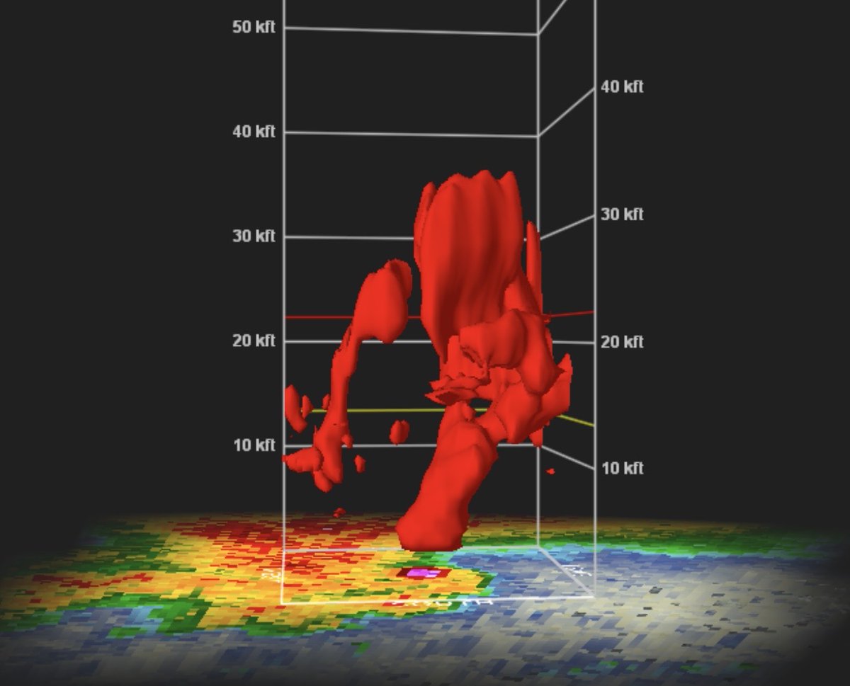
Volumetric radar scan of the supercell that produced the EF4 Mayflower-Vilonia tornado (2014).
1
15
118
4,073
Jun 12
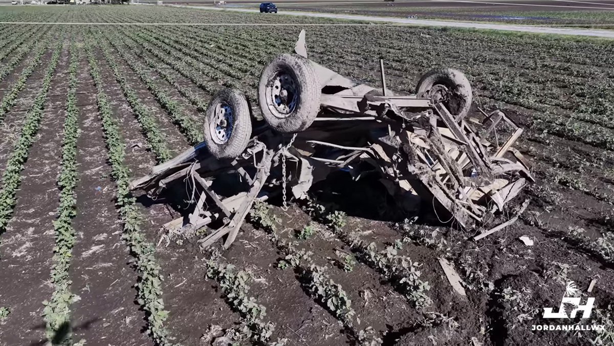
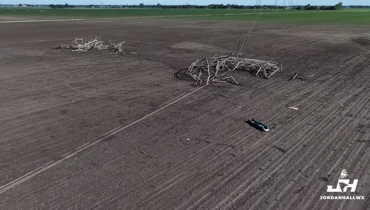
The Kouts IN tornado may likely of been very strong to violent based on the slabbed home (likely nailed), mangling/lofting of vehicles and the complete destruction of high-tension truss towers. All of this points to EF3 150-170 mph. Survey pending.

12
48
313
16,948
Jun 12
Large tornado north of Kouts IL! 20,000 ft ARL TDS 60 kt Vrot, strong potential for an EF3 tornado!


3
19
103
5,092

Jun 11
EF2 Tornado ongoing near La Rose IL now. LP hook in a very favorable environment
1
5
43
2,610
SRRadarLoops retweeted

Jun 11
TORNADO ON THE GROND! #ILwx x.com/i/broadcasts/1yKAPPvrB…
44
203
774
49,499
Jun 11
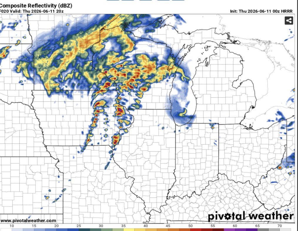
Enlarged hodo curvature in the 0-1km layer and large instability could foster a supercell/tornado environment tomorrow based on the 00z HRRR runs.
3
56
2,937
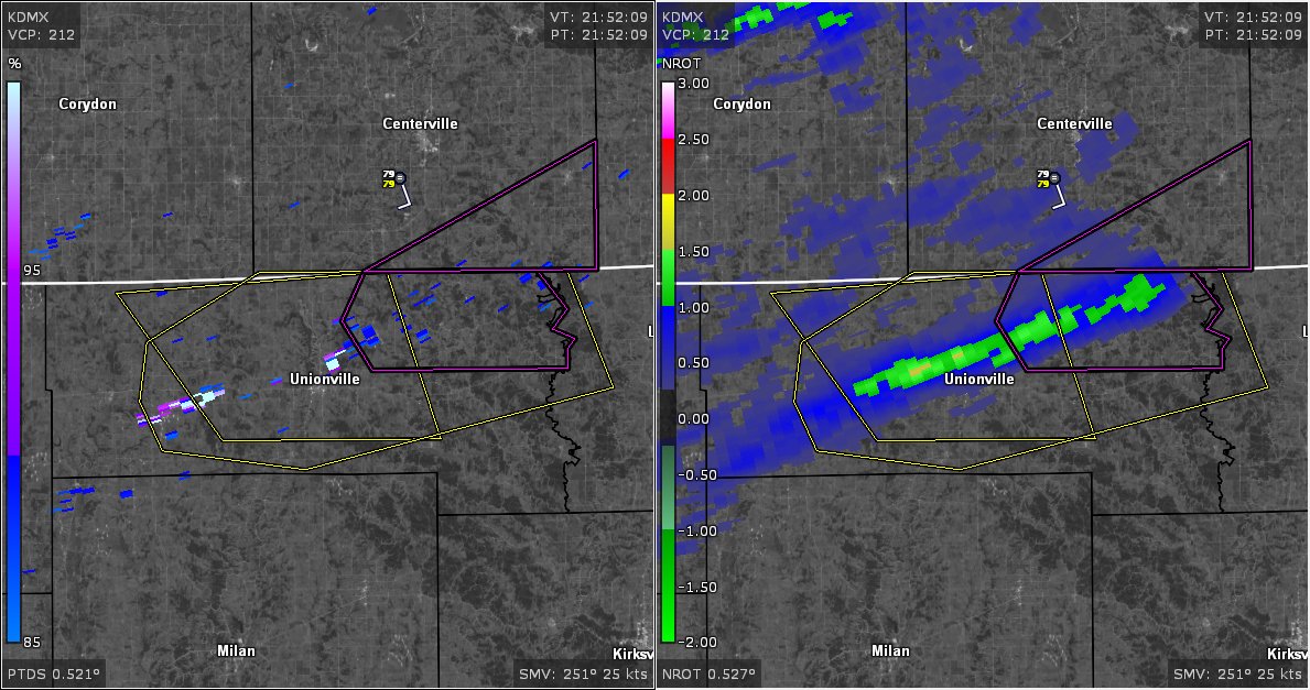
Jun 10
Strong LLMC and somewhat of a TDS Swath north of Unionville MO. Will be interesting if this is a continuous tornado path.
2
6
969
SRRadarLoops retweeted

26 Jan 2024
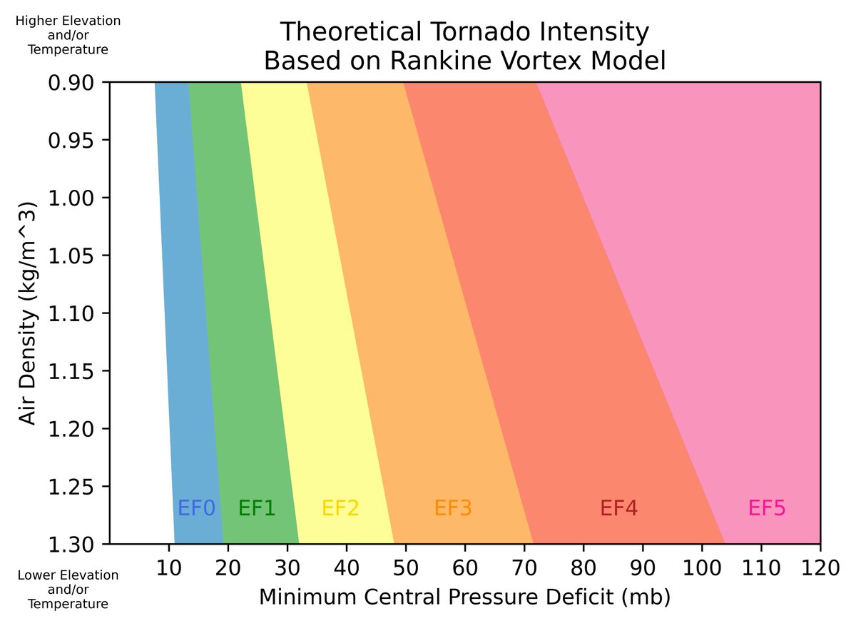
Here’s a guide to estimating tornado intensity from its minimum central pressure deficit, based on the solution to a Rankine vortex in cyclostrophic balance (-p’=ρ*V^2, where V is the maximum tangential wind speed)
2
11
93
14,578
SRRadarLoops retweeted

Assuming that the central pressure deficit is 50 mb (SB-LCL 80 mb above surface, funnel 5/8 of the way to the ground), yesterday’s tornado in Northgate, Saskatchewan can be estimated to be EF3/150 using @sambrandt99’s work.
* Key assumptions listed in replies below.


26 Jan 2024

Here’s a guide to estimating tornado intensity from its minimum central pressure deficit, based on the solution to a Rankine vortex in cyclostrophic balance (-p’=ρ*V^2, where V is the maximum tangential wind speed)
3
14
90
12,688

SRRadarLoops retweeted

It happened so fast! The Saint Libory, Nebraska tornado on 17 May as seen by DOW A. Rapid development into an intense tornado🌪️ with Doppler velocities of 170mph! …then a quick dissipation. #newx
14
251
1,486
133,972
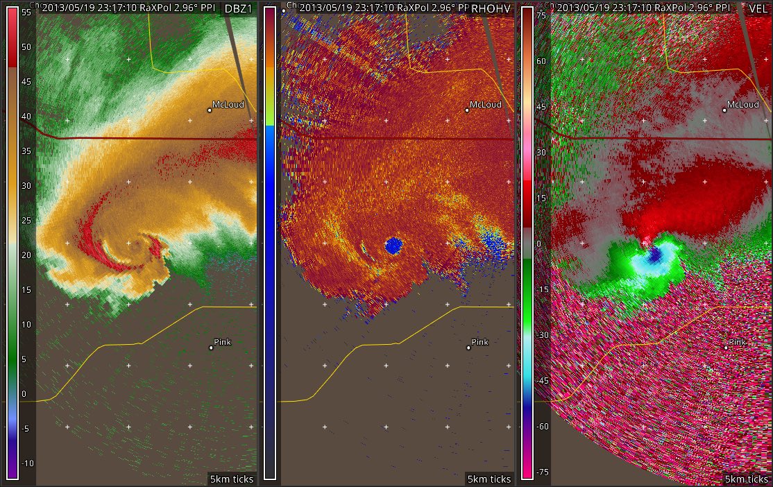
May 20
RaxPol loop of the Carney EF3 tornado from May 19th 2023. Despite the rating, lowest tilt doppler velocities seemed to exceed 85 m/s (190 mph) at several points. This storm also had a prominent LFCB, FFCB, and strong SVC.
1
9
54
1,737