
Mapping Archaeological Heritage in South Asia - hosted at the University of Cambridge, supported by @ArcadiaFund.
Joined March 2021
- Tweets 1,275
- Following 74
- Followers 759
- Likes 1,292
463 Photos and videos


21 Nov 2024
See you on the other platforms! We are still keeping it busy and keeping it real!
2
9
418
7 Oct 2024
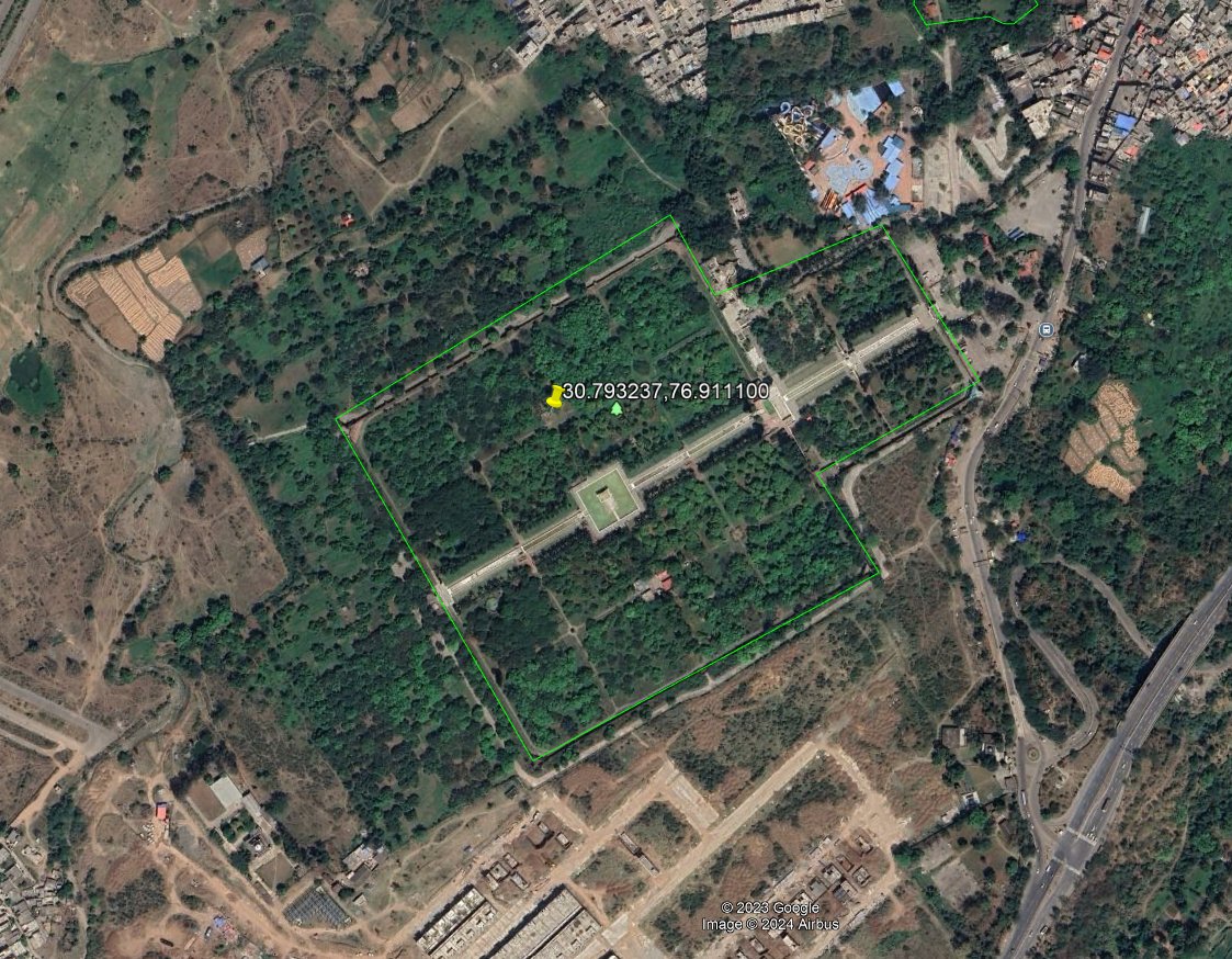
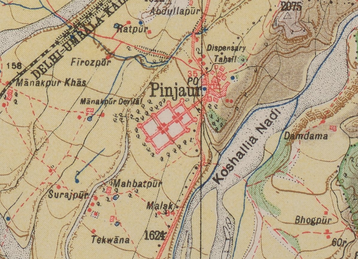
Did you know? On the Survey of India Map of 1915, you can spot a hidden architectural treasure—Jal Mahal in Pinjore, Haryana! This majestic palace, nestled amidst lush gardens, is clearly marked on the map and also visible on satellite imagery today!
1
6
226
7 Oct 2024
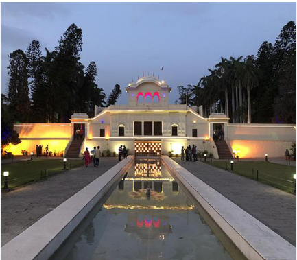
Jal Mahal, built during the 17th century by Fidai Khan, a noble in Aurangzeb's court, is a stunning fusion of Mughal and Rajasthani architecture. The palace sits in the middle of the iconic Pinjore Gardens creating a picturesque oasis surrounded by hills and greenery.
1
3
141
7 Oct 2024
Originally designed as a summer retreat, its cool, serene setting still captivates visitors today, showcasing how traditional design was meant to harmonise with nature. A true marvel visible both from ancient maps and modern technology! #Pinjore #SurveyOfIndia #mapsmonday #GIS
2
92
3 Oct 2024
#HeritageHighlights
We’re thrilled to debut our Fun Topography Sandbox! Using real sand AR, you can shape mountains, valleys, and see contours & water flow in real-time! Perfect for teaching geology and maps during outreach—and doubles as a relaxation spot in the office!
#AR
105
11 Sep 2024
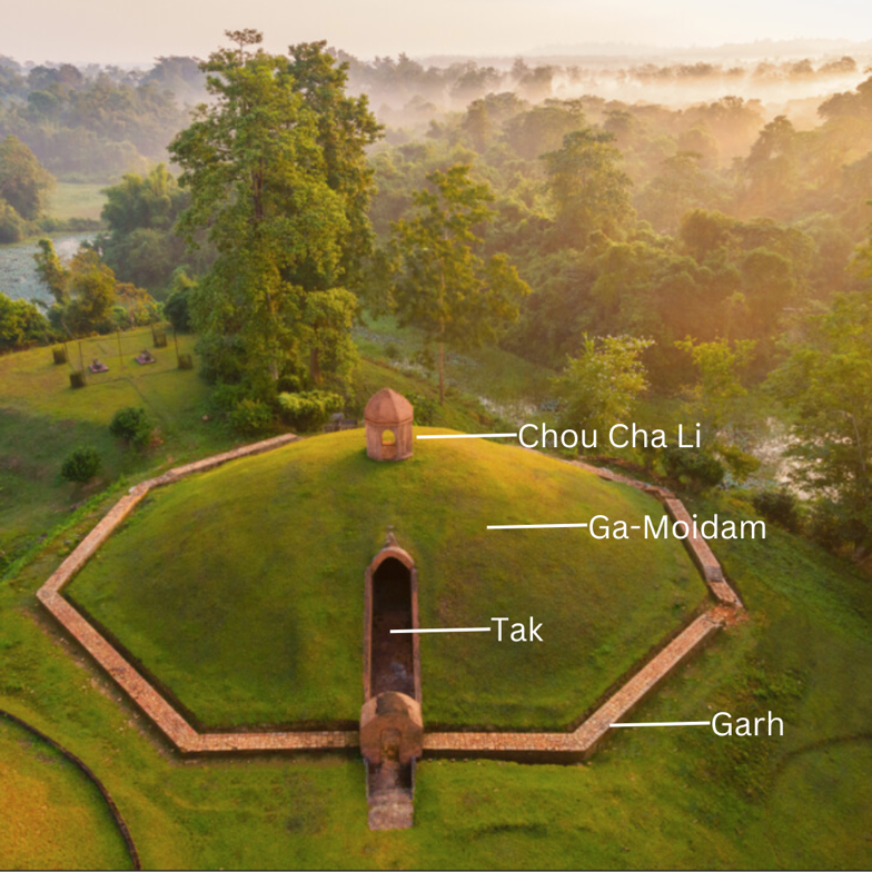
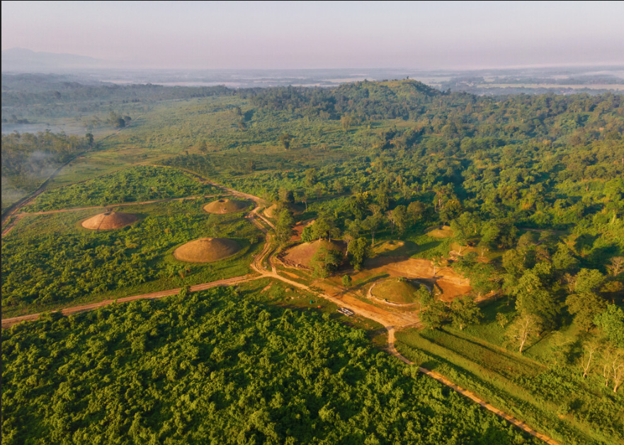
In today’s #HeritageHighlight we continue our exploration of the Moidams, the royal burial mounds of the Ahom Dynasty in Assam, which recently attained UNESCO World Heritage status. #Moidams #AhomDynasty #AssamHeritage #UNESCOWorldHeritage #Charaideo #TaiAhomCulture #AssamHistory
1
1
4
212
11 Sep 2024
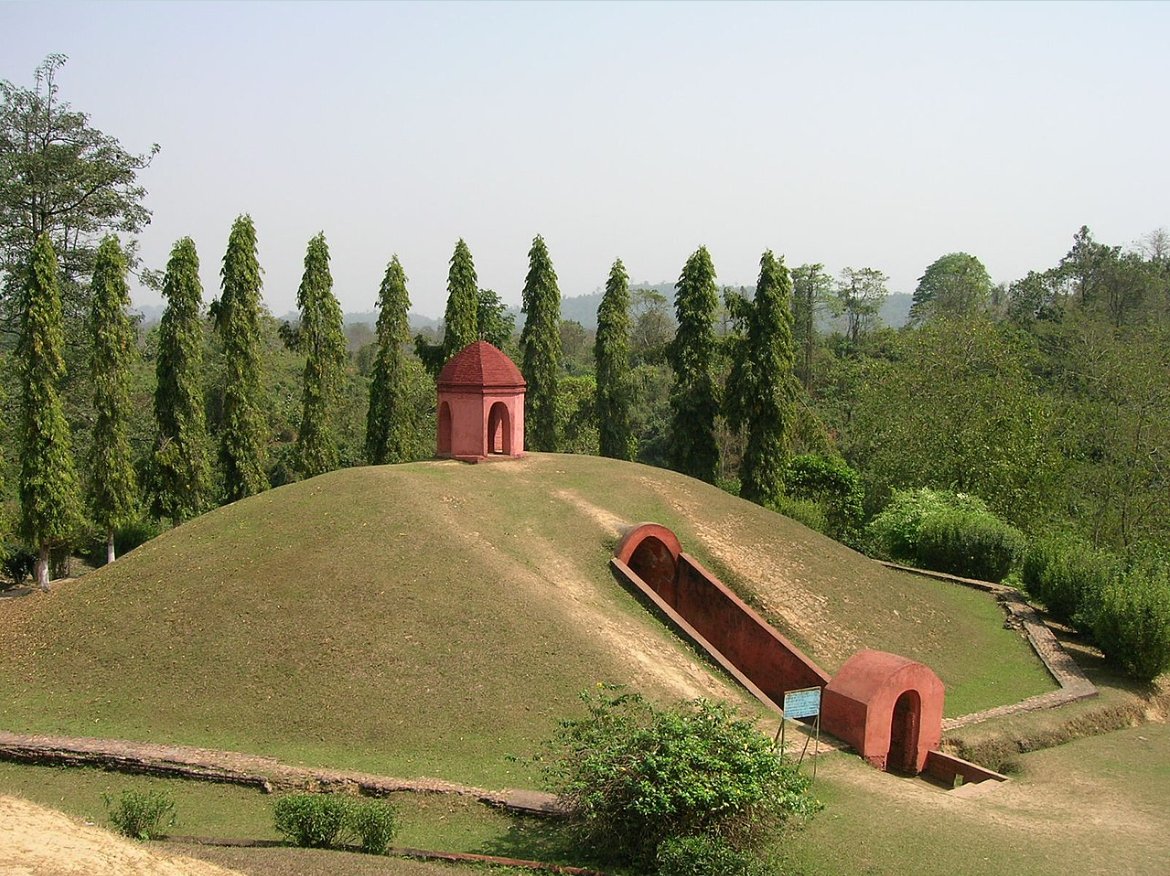
This design symbolises the Tai universe, bridging earth and heaven, with the treasures buried within reflecting beliefs in the afterlife. Initially constructed with wood, the Moidams evolved under King Rudra Singha (CE 1696-1714) to incorporate brick and stone. #AhomKingdom
1
75
11 Sep 2024
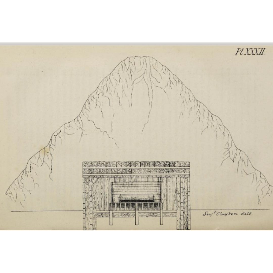
The first detailed plan (Pic 5), published in 1848 by Sergeant C. Clayton in the Asiatic Society of Bengal journal, provides insights into these remarkable structures. Today, the Moidams stand as a testament to the Ahom dynasty's architectural brilliance and cultural heritage.
2
69
9 Sep 2024
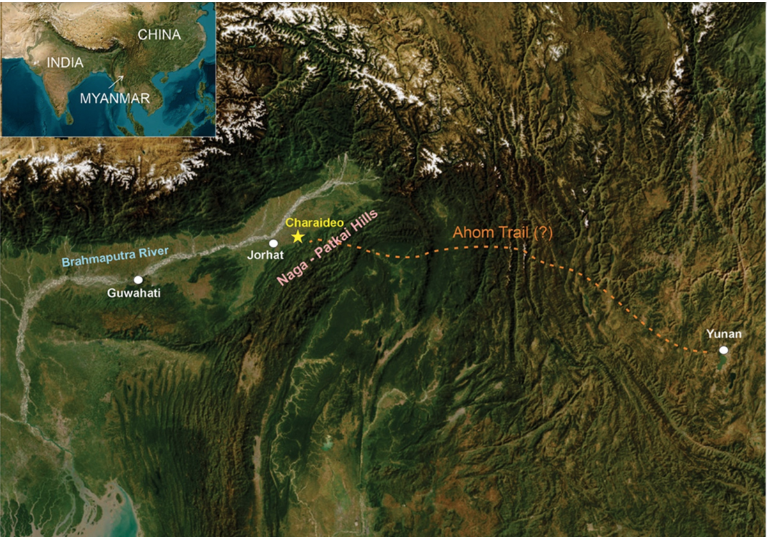
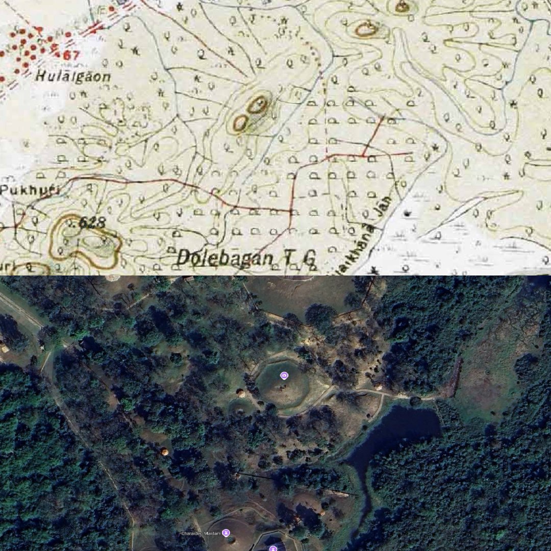
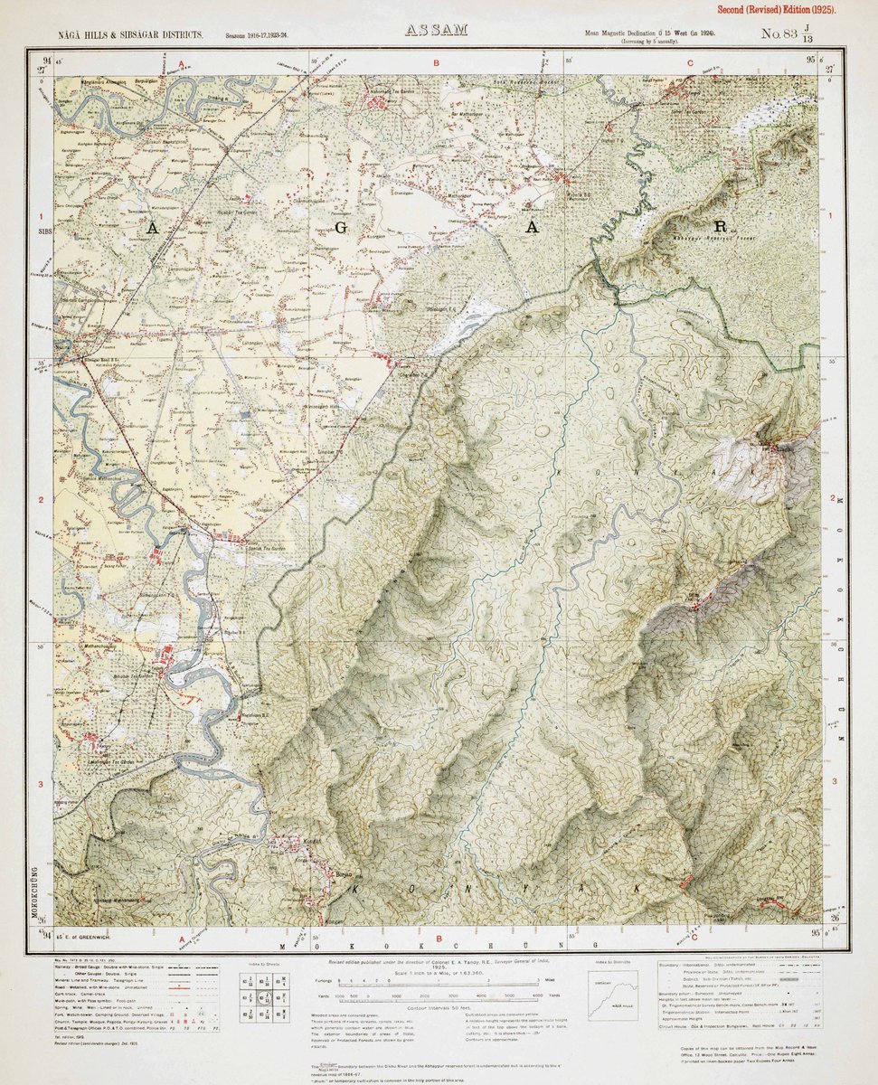
For today’s #MapsMonday we explore Assam's rich geography, using maps that reveal its diverse landscapes of flowing rivers and rolling hills. The Survey of India map of 1925 below highlights the region of Naga Hills and Sibsagar Districts.
1
2
163
9 Sep 2024
The Charaideo Moidams of Sibsagar, recently granted UNESCO World Heritage status, are ancient burial mounds known as the “Pyramids of Assam.” Serving as the final resting places of Ahom royalty, they combine Tai Ahom architecture with traditional mound-building.
1
65
9 Sep 2024
These burial sites are a living legacy of Assam’s Ahom dynasty, commemorating kings and nobility and preserving their beliefs surrounding death and the afterlife. #UNESCO #WorldHeritage #CharaideoMoidams #Assam #AhomDynasty #MapsMonday #IncredibleIndia #HeritageForAll
58
5 Sep 2024
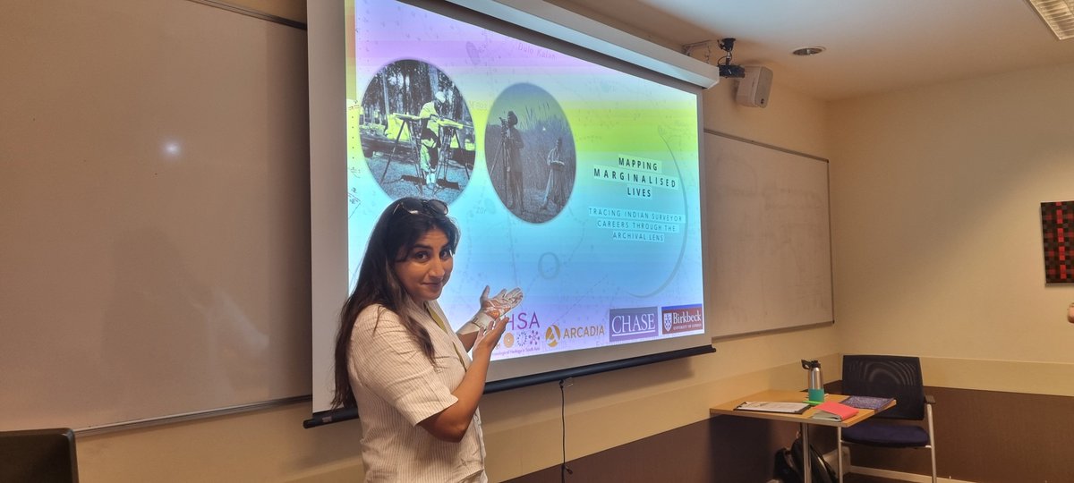
We were at the @RGS_IBG conference with @induprasad to talk about the Indians who mapped archaeology.
Follow the link for our storymap;
storymaps.arcgis.com/stories…
#esri #storymap #archaeology #southasia
1
8
366
MAHSA Project retweeted

3 Sep 2024
This year, the Royal British Legion supported #SAHM with special content. There is a wealth of stories to explore, marking the incredible contribution of some of the millions of South Asians, and those of South Asian descent, who have defended Britain. southasianheritage.org.uk/se…
5
9
574
2 Sep 2024
#MapMonday today is a #storymap about the Indian Surveyor Lal Singh and his physical and professional journeys in surveying and archaeology.
storymaps.arcgis.com/stories…
#archaeohistories #map #SouthAsia
3
13
564
2 Sep 2024
We are proud to announce MAHSA Phase 2🎉🎉
A big thank you to the Arcadia Fund and all the researchers, archaeologists, librarians and everyone else who has supported us.
#Celebrations #mahsaproject #archaeology #southasia
6
15
712
19 Aug 2024
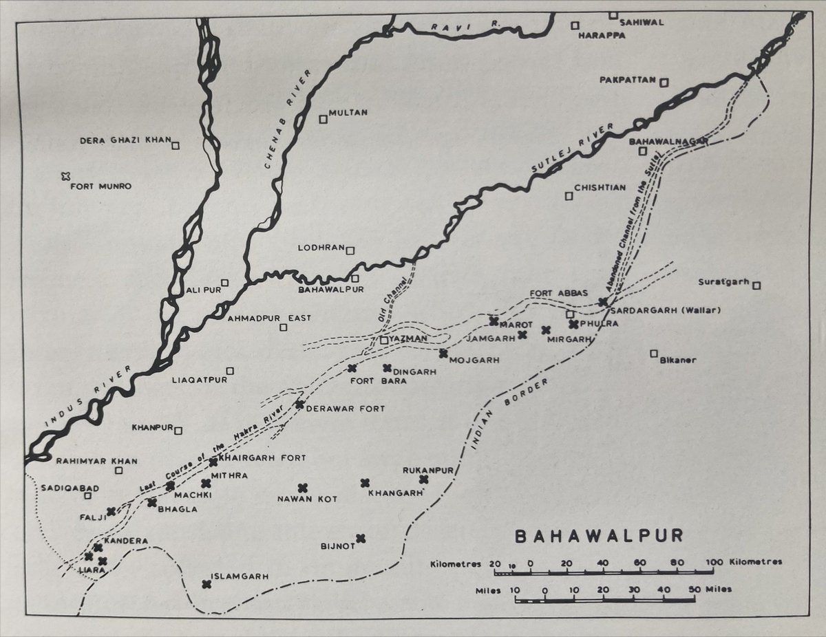
For todays #MapMonday check out this interesting map of Bahawalpur, Pakistan.
This map shows the ancient river source of the Hakra river and possible water channels of the Sutlej river system in the area.
1
1
6
205
19 Aug 2024
This information helps us contextualise archaeological sites and their locations - allowing us to picture what the landscape would have looked like thousands of years ago…
Map credits: Ancient Cholistan by Mohammad Rafique Mughal
1
65