
We believe that everyone, every enterprise and organisation can benefit from better access and use of Location Data.
Joined May 2011
- Tweets 6,613
- Following 4,107
- Followers 5,172
- Likes 161
15 Photos and videos


The free Mapcite Excel addin is now available from the Microsoft App store! Fully interactive maps react with your spreadsheet with no need for #geospatial expertise. bit.ly/2HqCvO5 #appstore #maps
6
15
Despite government support throughout the pandemic, businesses are losing money every day and unemployment is skyrocketing. Who will pay the price for these losses and lack of income?
Read more here: bit.ly/economicburden
#COVID19 #governmentfunds #property #economicrecovery
15
3
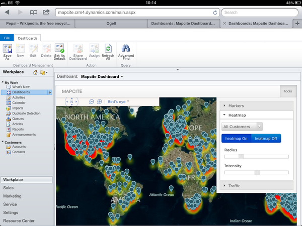
Consider this: a CRM system that attributes data to a single address. SpatialCRM changes the system paradigm to make an address the focal point to provide better customer insights. Read more here: bit.ly/Spatial-CRM
#spatialcrm #data #location #analytics #crm #CRMSoftwares
3
3

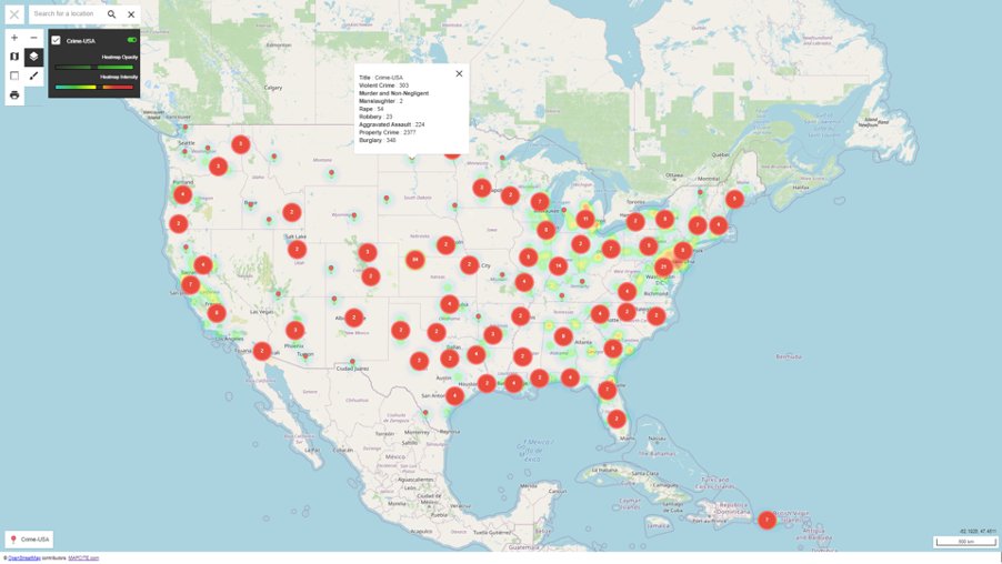
Mapcite Publisher gives users a way to create detailed data visualisations through Excel & then publish them to the web, making sharing maps even easier. Explore an interactive map highlighting USA crime trends from 2018 here bit.ly/USA-crime
#data #mapping #excel #crime
4
3
Have you heard about Mapcite Publisher? It's a new feature in our Excel Addin allowing you to publish your detailed map straight to the web, making sharing even easier.
Check out more about this awesome new feature here:
bit.ly/MapcitePublisher
4
4
The global cases of #COVID19 are still on the increase, so we created an #interactivemap using @MapExcel Addin's Publisher feature to get a global visualisation of the cases. Take a look for yourself here bit.ly/Global-COVID-Deaths-1… and play around with the new Publisher features!
2
1
We've created an #interactivemap using #mapcite #exceladdin #publisher feature exploring the #policedeaths in the #USA. Take a look for yourself here bit.ly/PoliceDeathsUSA
Check out our blog and learn about our @MapExcel tools to dive deeper into this data.
3
4
MAPCITE retweeted

6 Jun 2020
A new breed of GeoTech start-ups are taking powerful geospatial analysis functions and distilling them into easy to use solutions. Find out more from Richard Crump, @MAPCITE's Head of Consulting Services: ow.ly/NLBe50zYUW9 #everythinghappenssomewhere

7
8

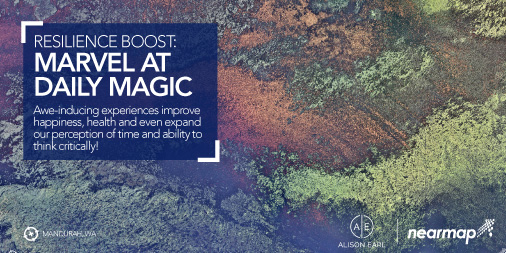
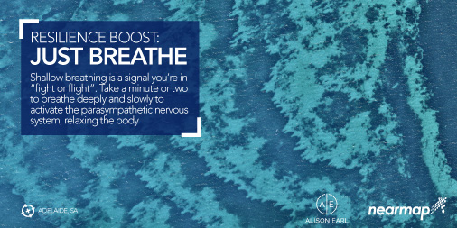
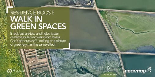
Alison Earl is a behavioural strategist and #Positive Psychology Practitioner, who also happens to be a friend of #Nearmap! Check out her #Resilience Boosters which will help you think well and feel well 🙌🏼
Link to blog:
bit.ly/3gzhlfK

3
4
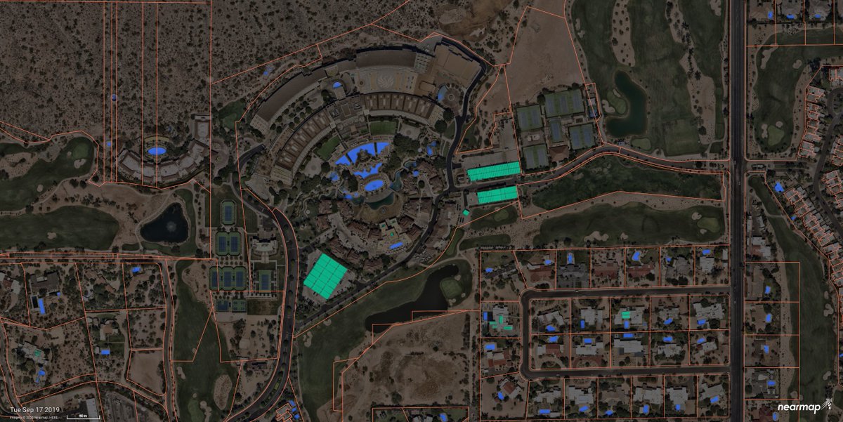
Exciting news! Today we have officially launched the general availability of #NearmapAI on Mapbrowser!
Automatically identify ground features, track changes and verify insights against current aerial imagery at massive scale. Check it out at nearmap.com/ai
11
14
MAPCITE retweeted
29 May 2020
A new breed of GeoTech start-ups are taking powerful geospatial analysis functions and distilling them into easy to use solutions. Find out more from Richard Crump, @MAPCITE's Head of Consulting Services: ow.ly/O7Bg50zSDKy #everythinghappenssomewhere

5
1
MAPCITE retweeted
24 May 2020
A new breed of GeoTech start-ups are taking powerful geospatial analysis functions and distilling them into easy to use solutions. Find out more from Richard Crump, @MAPCITE's Head of Consulting Services: ow.ly/kxi050zH62E #everythinghappenssomewhere

6
6
Do you like mapping? Would you like an easy way to make a map? youtu.be/u-eFfqvHTlY Here is a map i just created publicmap.mapcite.com/xVcjka…
4
3
MAPCITE retweeted

12 May 2020
Stores have been closed so location data isn’t relevant, right? Wrong. searchengineland.com/stores-… via @sengineland
1
MAPCITE retweeted
13 May 2020
Lock-down in Australia; right or wrong? link.medium.com/D2F9MY3Ws6
2
1
MAPCITE retweeted
13 May 2020
Did you miss last week's #Covid19 webinar? Hear from our partners @esriuk, @MAPCITE and @basemap to find out how OS data can support responses to the pandemic: ow.ly/Zlmp50zEaXw

5
7
Check out this customer story from Durham Public Works
@CityofDurhamNC and see how high res, up to date aerial imagery can step up your project efficiency!
ow.ly/5rs750zCeQd
5
5
MAPCITE retweeted
12 May 2020
The Elevation of the Concept of Where for Business Continuity mapcite.com/2020/05/12/the-e… via @mapcite
4
4