
🗺️ Maps for developers: Visual tools, global data, SDK & APIs for web, mobile, and enterprise applications.
Joined June 2009
- Tweets 3,757
- Following 744
- Followers 5,299
- Likes 4,053
2,133 Photos and videos
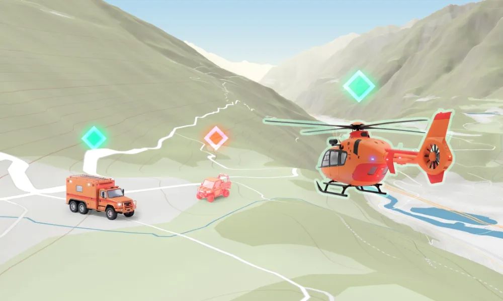


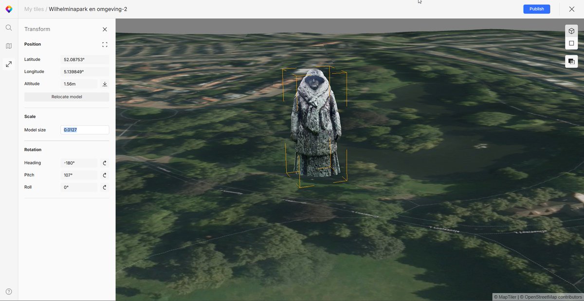

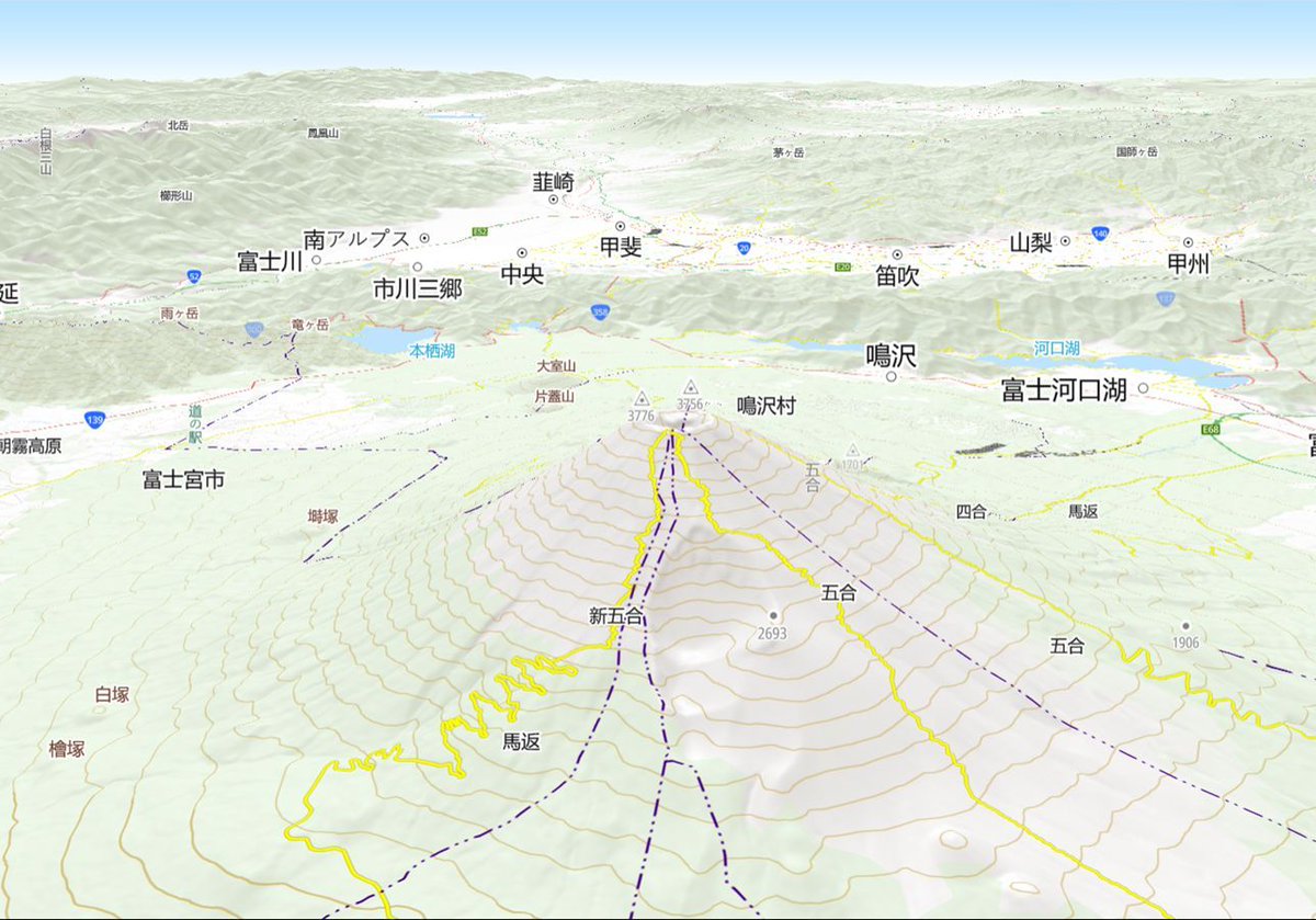
Scenario plan incidents or follow live movements with multiple #3D models on a map. Models can interact with each other and can be accurately moved with new tilt, roll, and animation features. Discover what’s possible here: maptiler.link/3PwLLWg
1
2
5
329
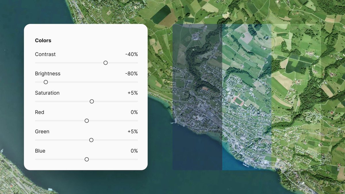
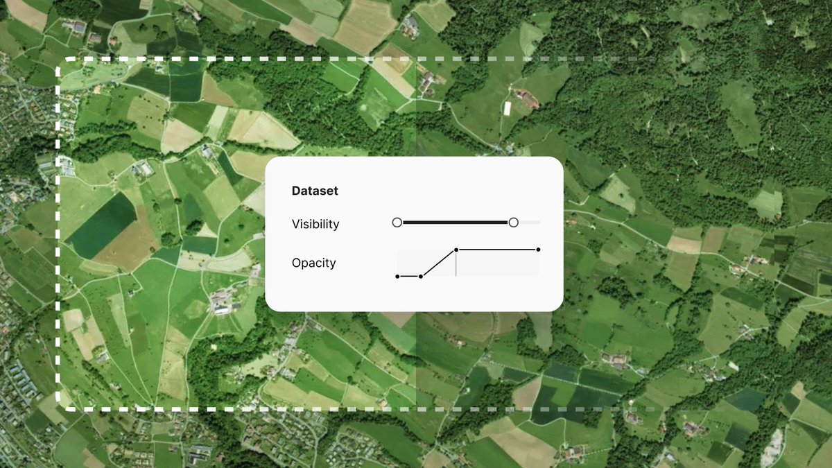
Blend your imagery into global satellite maps on-prem. Match the brightness, contrast, and saturation of your imagery to the existing base map. You can also fine-tune the color by adjusting the Red, Green, and Blue levels. Read more: maptiler.link/4dQjQd7
2
3
260
MapTiler retweeted

Jun 3
Maptiler GeoSplats = Photorealistic 3D visualizations on a map maptiler.com/geosplats/
14
84
3,739
Visualize users' journeys with #3D models of their mode of transport, tracing their routes. Show a car traveling along roads or animate a plane flight from one city to another. Find out more: maptiler.link/4wduW34
2
5
719
MapTiler retweeted

May 19
146 million US jobs.
Visualized by sector on a fast, filterable interactive map.
Fly from market to market smoothly with @MapTiler's geocoder.
Explore for yourselves: walker-data.com/freestiler/l…
3
13
90
10,008
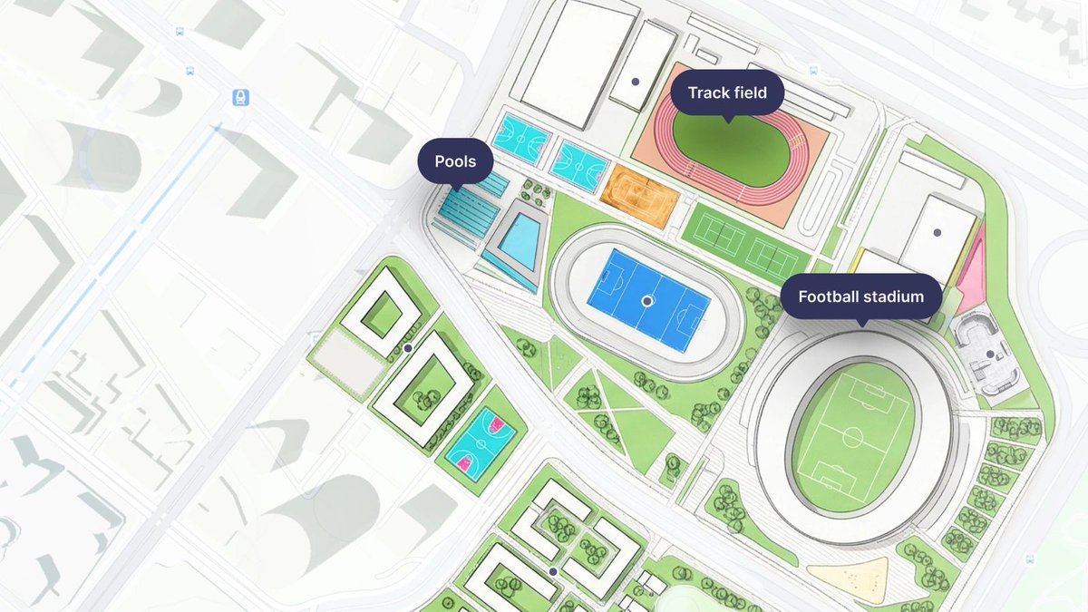
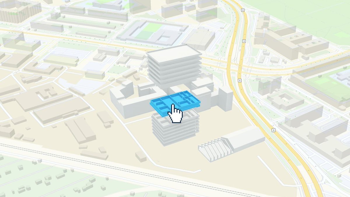
Create interactive buildings for #3D real-estate visualizations. Place, highlight, and interact with detailed models, floor by floor, building by building. Find out more about this and the rest of the latest news from MapTiler here: maptiler.link/49F9uKy
2
6
23
1,324
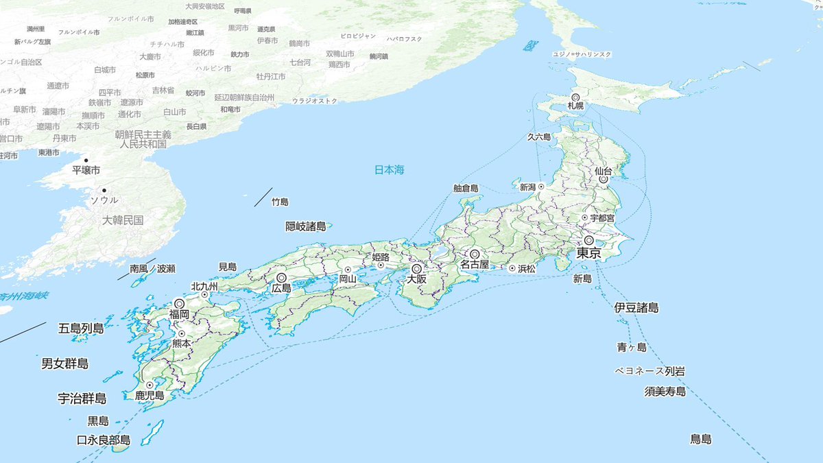
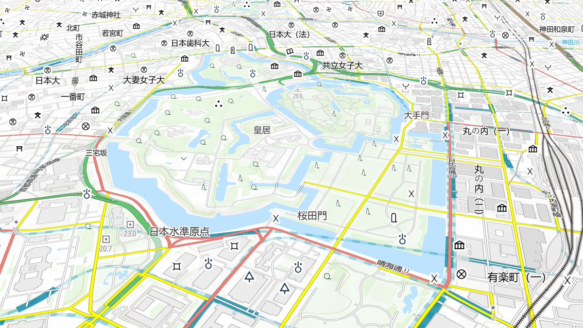
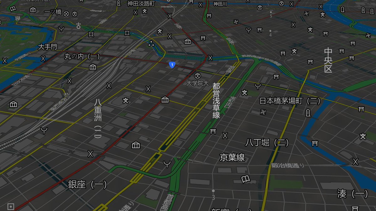
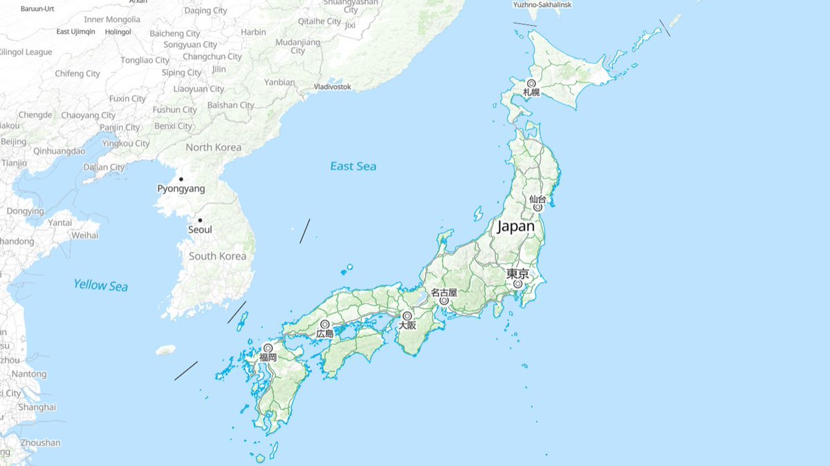
Our lead cartographer @cartogenic drew on his experience living in Osaka to create the perfect map for #Japan. It uses both the official @gsi_cyberjapan data & our own Planet v4 dataset, giving familiar features in a clean, modern map style. Find out more: maptiler.link/4v1q2oE
2
17
1,046
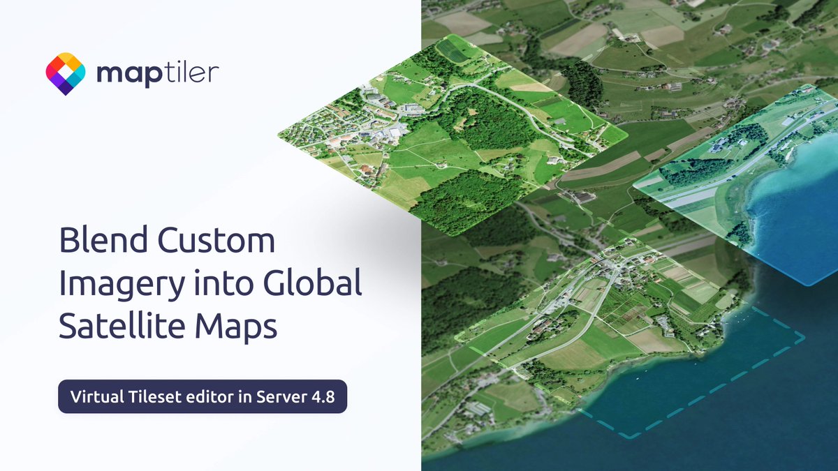
Serve your imagery blended into global satellite maps. Check out our new virtual tileset editor in MapTiler Server 4.8! Find out the details and watch the launch webinar here: maptiler.link/4dhfXOj
#AerialImagery #Satellite #OnPrem #Maps
4
18
1,332
Our new #map for #Japan is designed with symbols, naming conventions, and feature semantics that the locals are familiar with. It’s just one of the latest updates from MapTiler, which you can read about on our blog: maptiler.link/49F9uKy
1
3
38
3,177
MapTiler Server 4.8 released! Don’t forget tomorrow’s webinar about what's new in the latest version. Find out how you can blend your imagery into global datasets and more. It’s your last chance to register here: maptiler.link/496wQsD

2
34
2,114
Our new Georeferencer eliminates the technical friction of manual file conversion for five major formats: PNG, JPEG, PDF, TIFF, and WebP. It allows you to define the location of your geodata effortlessly.
Find out more: maptiler.link/41v8MLM
#MapTiler #Geodata #WebMapping
9
64
3,699
Check out the latest news from MapTiler: Interact with #3D Models on your maps, and a new Japanese map style! Read more: maptiler.link/4np4ob5
2
16
906
Need to publish your own data on top of global maps or imagery? MapTiler Server 4.8 will give you the power to blend your tilesets into our global maps with a new editor for virtual tilesets. Come to the Webinar on the 14th May, 17:00 CET to find out more: maptiler.link/496wQsD
5
32
2,094
🚀🌍 Do you love turning complex tech into clear, compelling stories? Are you excited by shaping how products are positioned, launched, and adopted in a global B2B SaaS environment? 👉 We’d love to hear from you: maptiler.link/4ueTbfk
3
3
369
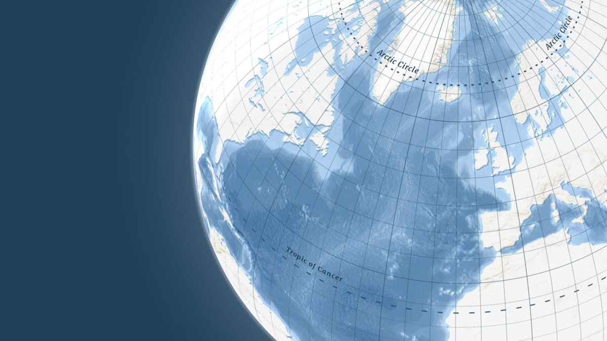
Want that atlas look and feel for your #webmaps? Need to show time zones on your location map? Check out our latest updates to find out more about our grid lines dataset and the latest updates to our satellite maps: maptiler.link/4e5af2y
2
19
961
Get raw images web-ready in seconds! Upload via API or intuitive interface, align in the visual Georeferencer, and let our pipeline generate high-performance map tiles automatically.
Ready to accelerate? maptiler.link/4mqsJgd
2
8
1,197
Discover an ocean map engineered for precision: from cargo fleet tracking to marine tourism. Navigate with absolute clarity using dedicated undersea labels and depth contours that stay sharp at every zoom level.
Find out more: maptiler.link/40TWwUC
2
10
697
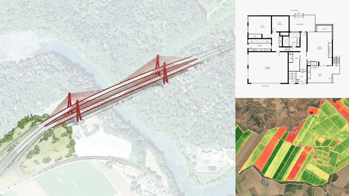
Turn floor plans or drone photos into interactive maps in minutes. Our Georeferencer makes it easy; simply click matching points to align your image & get instant results.
Ready to map your assets? maptiler.link/41v8MLM
#MapTiler #Georeferencing #GIS
6
24
1,769
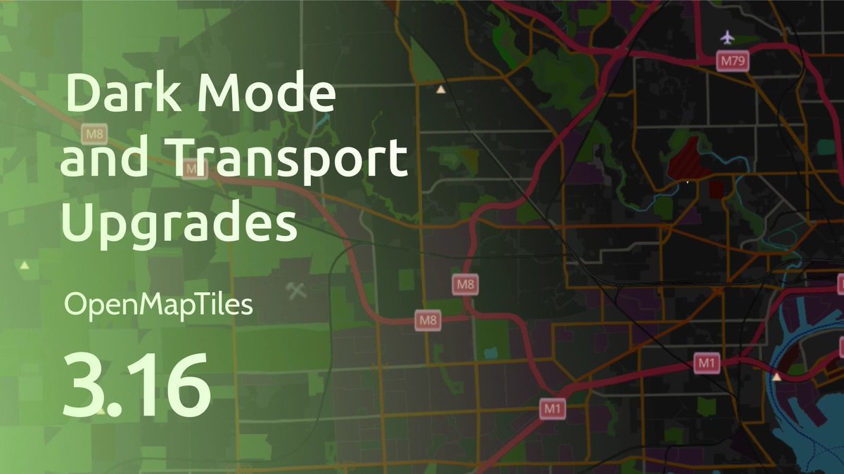
OpenMapTiles v3.16 is out now. It includes several transportation layer improvements and stability fixes. The update is already reflected in the OpenStreetMap MapTiler OpenStreetMap style.
Read more: maptiler.link/41uTuGT
#OpenMapTiles #OpenSource #OSM #OpenStreetMap
3
5
485