4 Years Specialising In Severe Weather 🌪| Weather & Nature Amateur Photographer 📸 | Founder & Chief - Convective Forecaster For @ConvectiveUK⚡️
Joined September 2022
- Tweets 2,977
- Following 221
- Followers 868
- Likes 7,928
846 Photos and videos


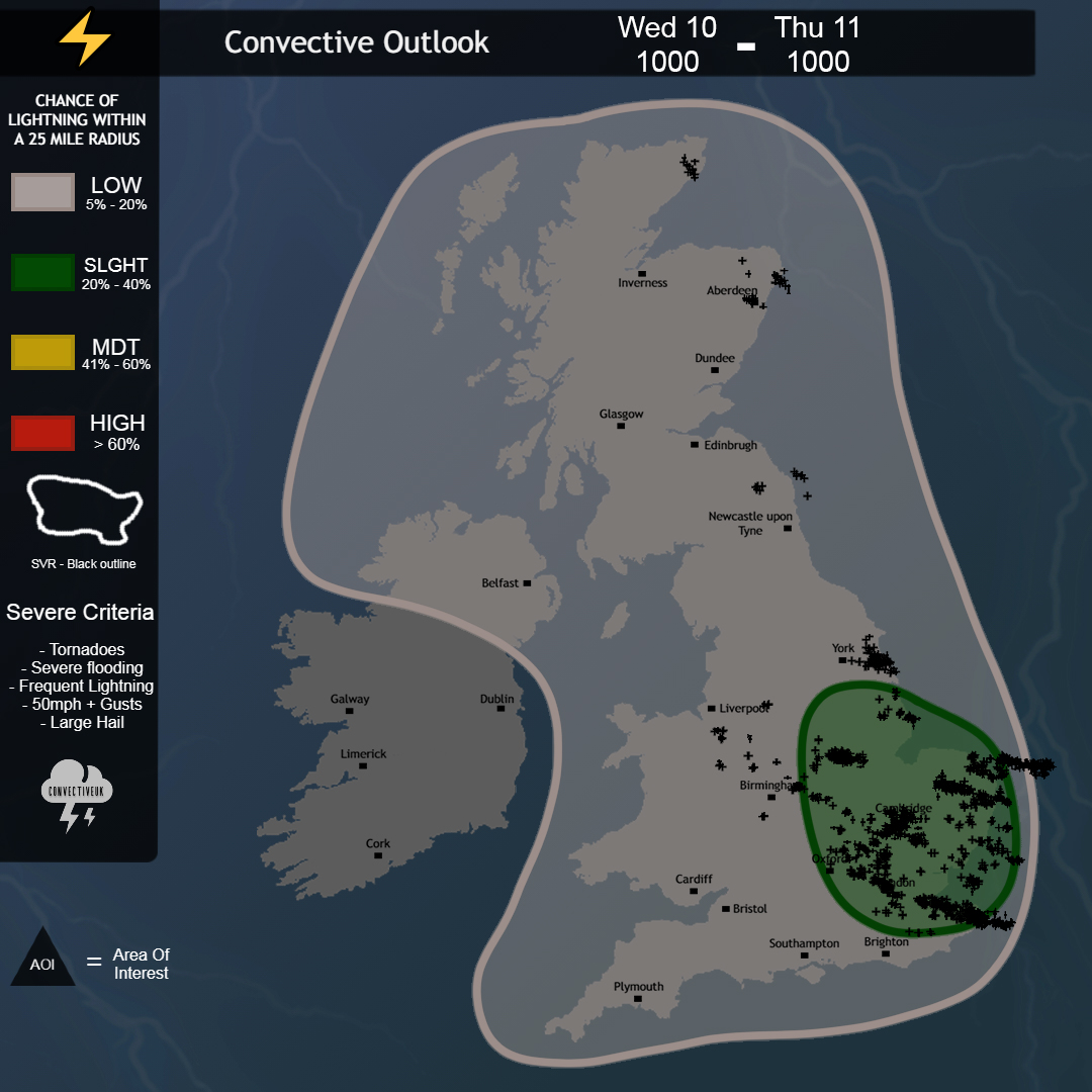
Jun 10
Very strong forecast today!

Forecast Verification:
T-storms & heavy showers developed as expected today with majority of lightning activity seen in the SLGHT risk with some isolated strikes elsewhere.
Rating: 9.5/10
What Would Be Your Rating?
4
272
Jay Bournemouth retweeted
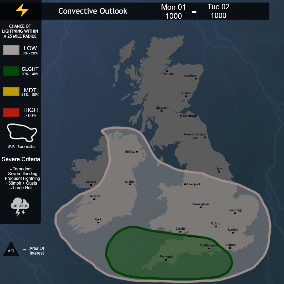
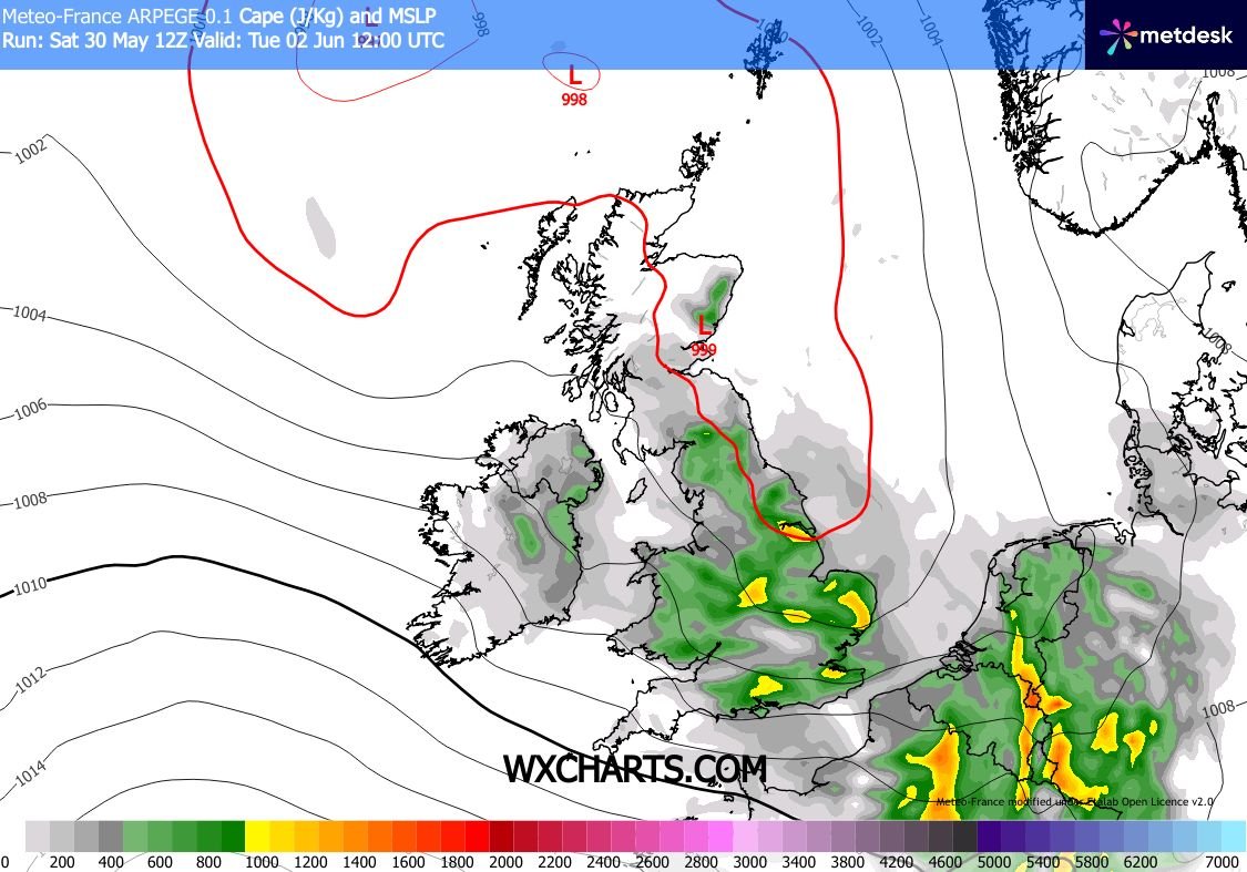
Monday 1st June:
Scattered showers and T-storms will develop through the afternoon and evening, particularly across S England where instability is expected to be greatest.
Storms may become organised for a time bringing frequent lightning, these storms will mostly be sporadic.
1
6
20
1,136
Jay Bournemouth retweeted
Models are suggesting daytime heating combined with colder air aloft will allow showers to develop, with some becoming thundery during the afternoon. Frequent lightning, torrential downpours, localised flooding and small hail may accompany the strongest cells.
Eyes On Tuesday!
1
8
51
4,020
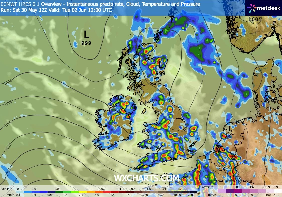
May 30
LOW Risk Today Across Ireland Stretching Into Scotland!
Saturday 30th May:
Heavy showers are expected to spread NE through the day, with scattered T-storms possible, particularly across N / NE Ireland. The strongest cells may produce frequent lightning, torrential downpours, small hail and gusty winds.
Update following...

4
290
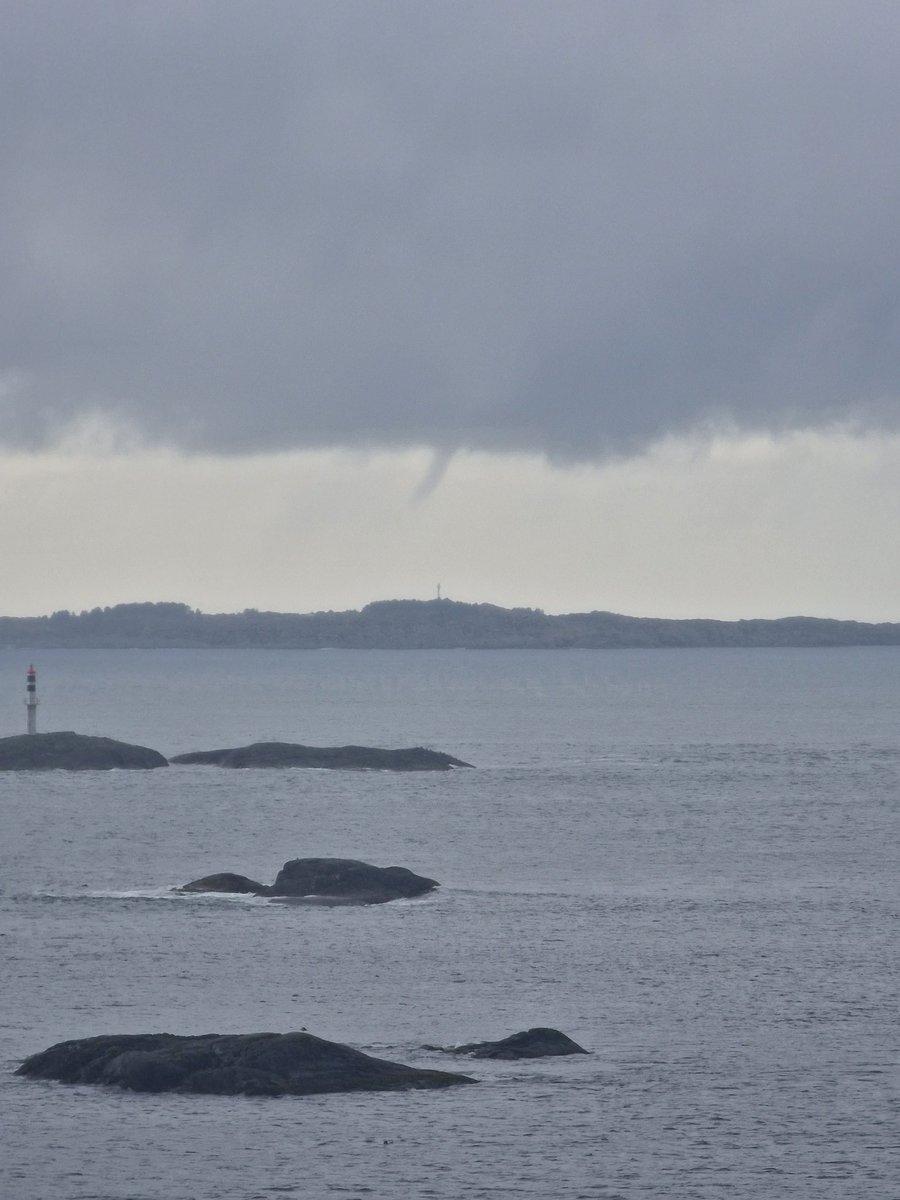
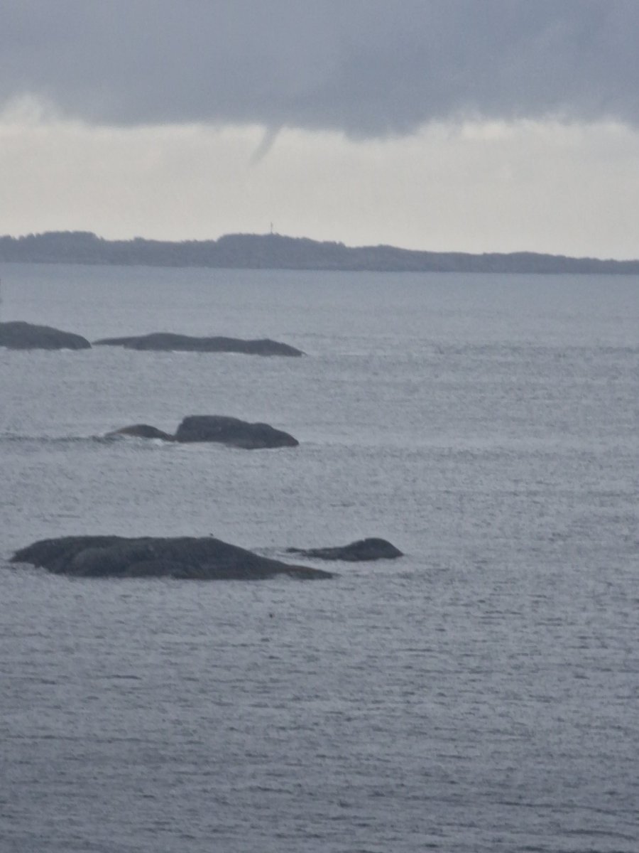
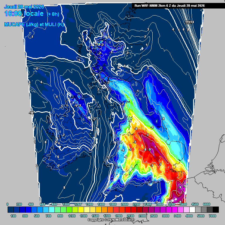
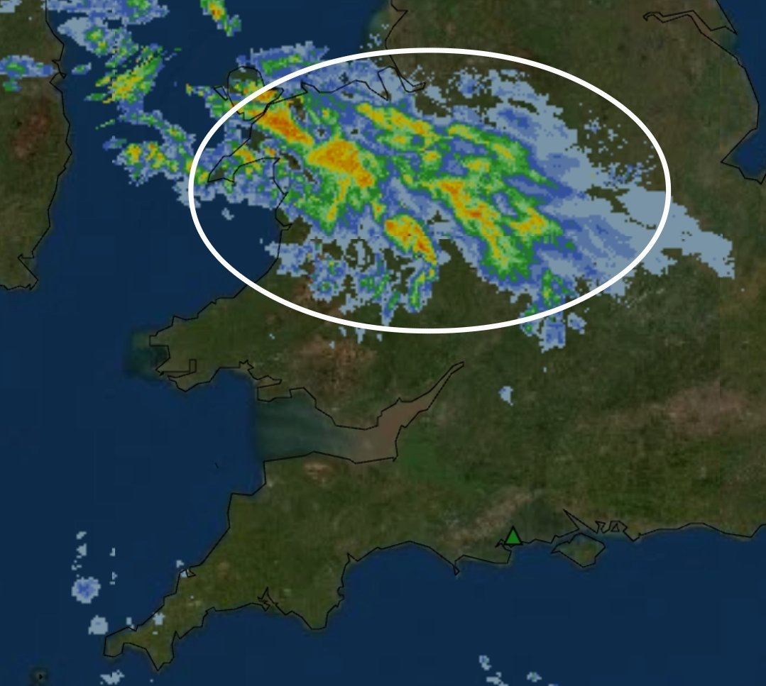
May 28
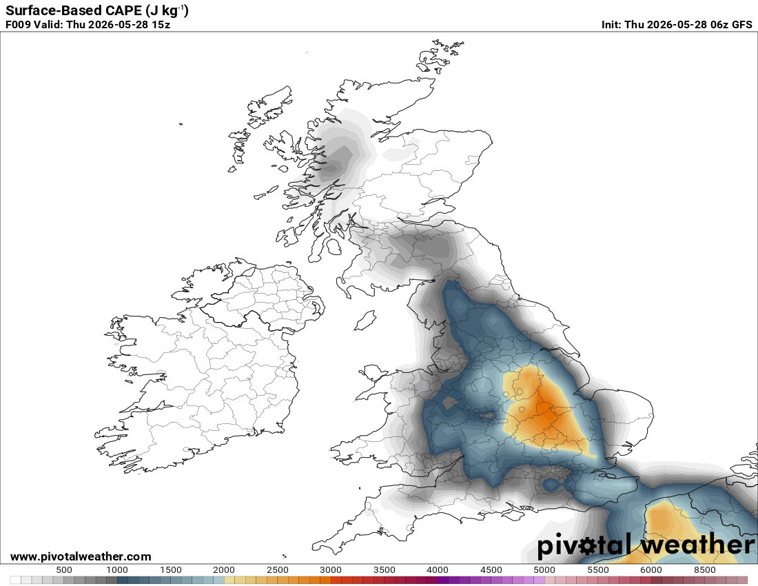
Latest high-resolution guidance show a very unstable airmass developing across parts of central and eastern England this afternoon, with CAPE values exceeding *2000–3000 J/kg*
Any strong T-storm could evolve into a Supercell today... ⚡️
4
2
45
4,162
May 28
However, due to uncertainty surrounding storm initiation, overall thunderstorm coverage is expected to remain local at best. Any storm that does form may strengthen rapidly and become locally severe.
1
388
Jay Bournemouth retweeted

May 27

1
12
64
3,392
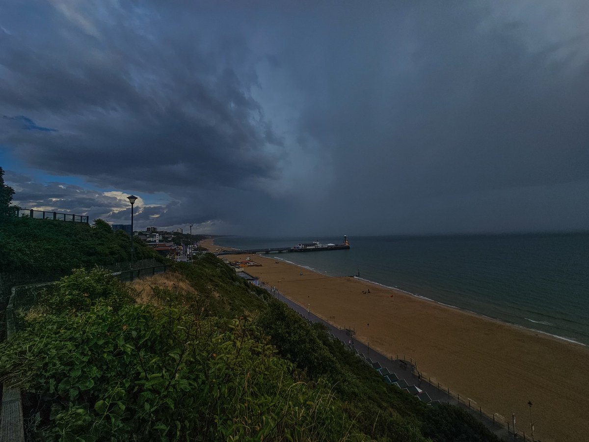
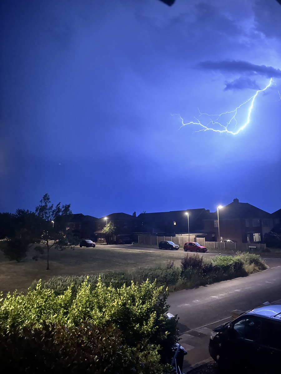
May 28
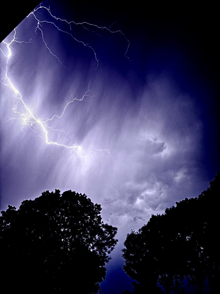
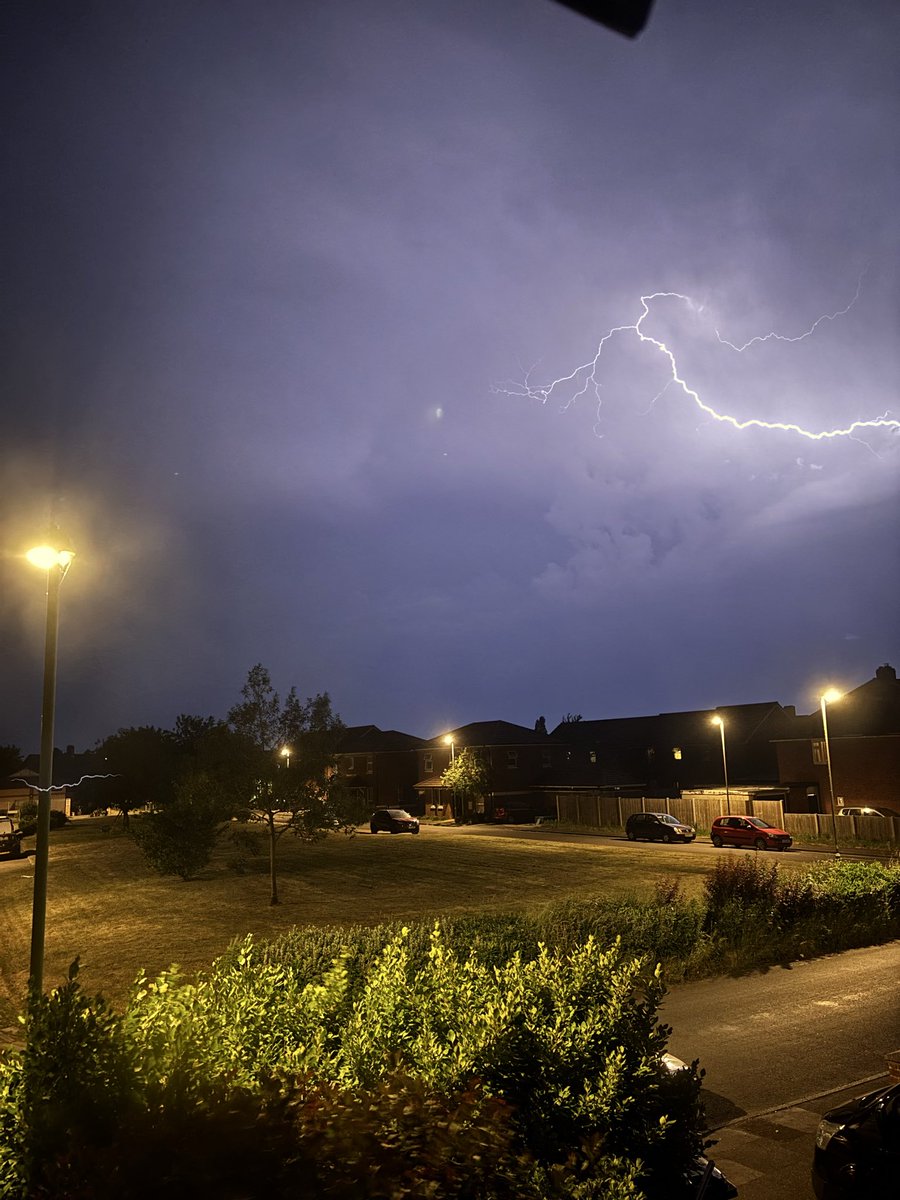
Insane storm, here's a complimation of lightning that happened in Bournemouth last night.
1
10
65
4,261
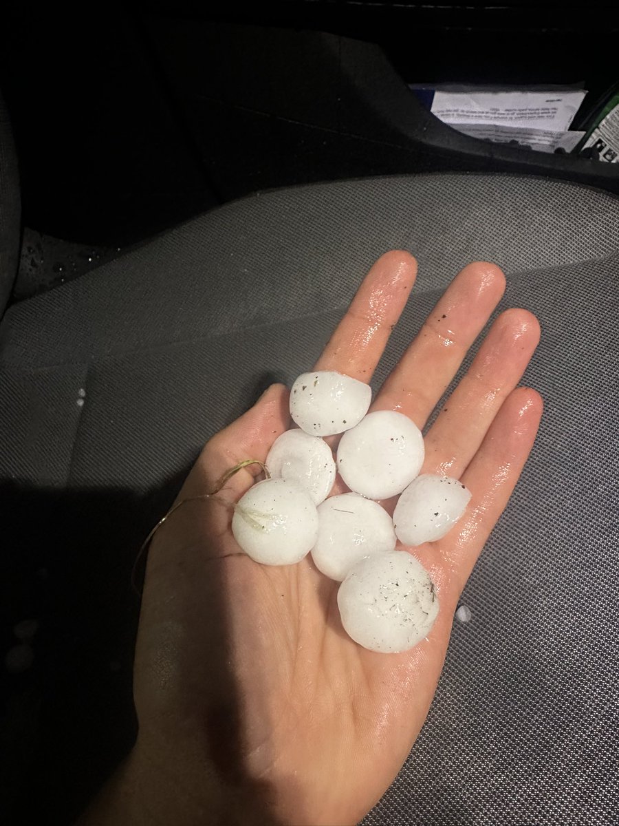
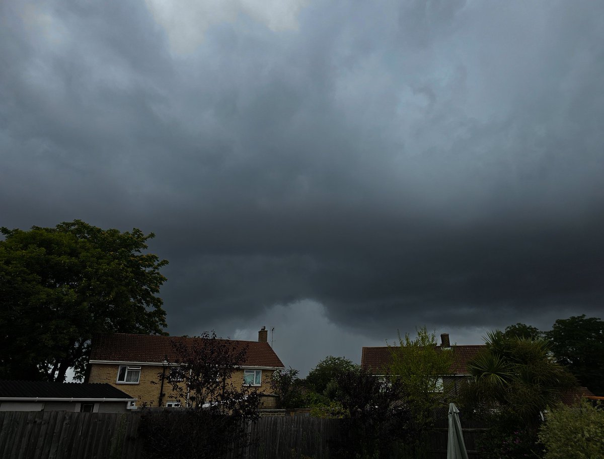
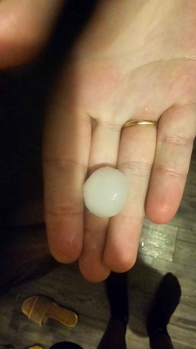
May 28
This could be one of the severest storms ive seen in my life, not so much in the way of lightning but rain rates / hail size...
• Frequent Sheet Lightning
• Explosive Development All Under 30 Minutes
• Large Hail
• 150/200mm/hr rates
Insane stuff.
2
1
26
2,049
Jan 2
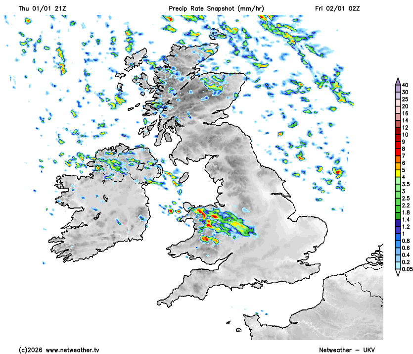
UKV 21z is now in a similar scenario for whats currently ongoing across Wales / Midlands.
Still seeing the precipitation being much extensive and stronger, however the UKV has this dieing out slowly as it heads S.
Eyes on whether this dies or continues!
3
1
15
1,901
Jan 1
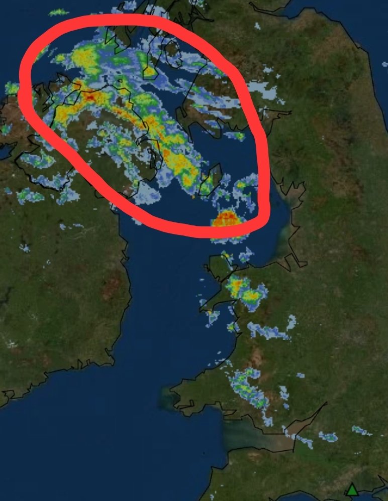
This feature comparing to the models at 2100 looks more extensive and definitely more intenser then previously anticipated from the models.
This has increased the chances of snow for lowland areas of south / se areas.
4
3
44
4,915
Jan 1
Being 12 hours out from this feature tracking across England down into S England.
Exactly the intensity / extent & track of this feature is still fairly uncertain. This is becoming a nowcast event, alot of suprises incoming!
1
32
2,732
31 Dec 2025
A very active rare cold front is going to be tracking from NW Wales down CS/SW England early hours of Friday bringing a mixture of sleet & snow.
Snow will likely accumulate on higher levels with potentially a dusting on lower levels depending on how fast the cold air undercuts.
2
1
29
4,155
Jay Bournemouth retweeted

25 Dec 2025
Merry Christmas to everyone celebrating, enjoy the times with your families! ❄️
As of a Christmas present to everyone, after a long break we are officially back!
1
14
662
16 Nov 2025
Heavily interested for cold weather upcoming in the next 15 - 45 days.
More tomorrow!
4
291
Jay Bournemouth retweeted

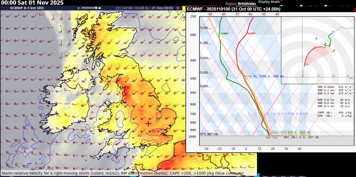
31 Oct 2025
Interesting situation today and tonight across the U.K., especially during the night over England with fast moving storms having a potential to produce severe wind gusts and tornadoes. Once again, the low level stability will be important.
2
16
77
14,463
Jay Bournemouth retweeted

13 Sep 2025
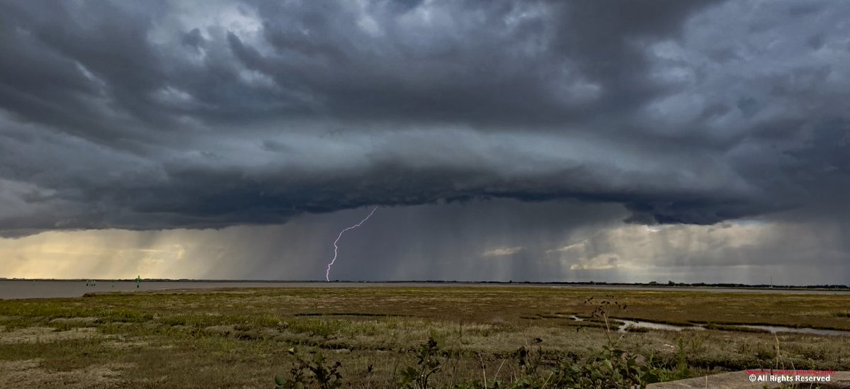
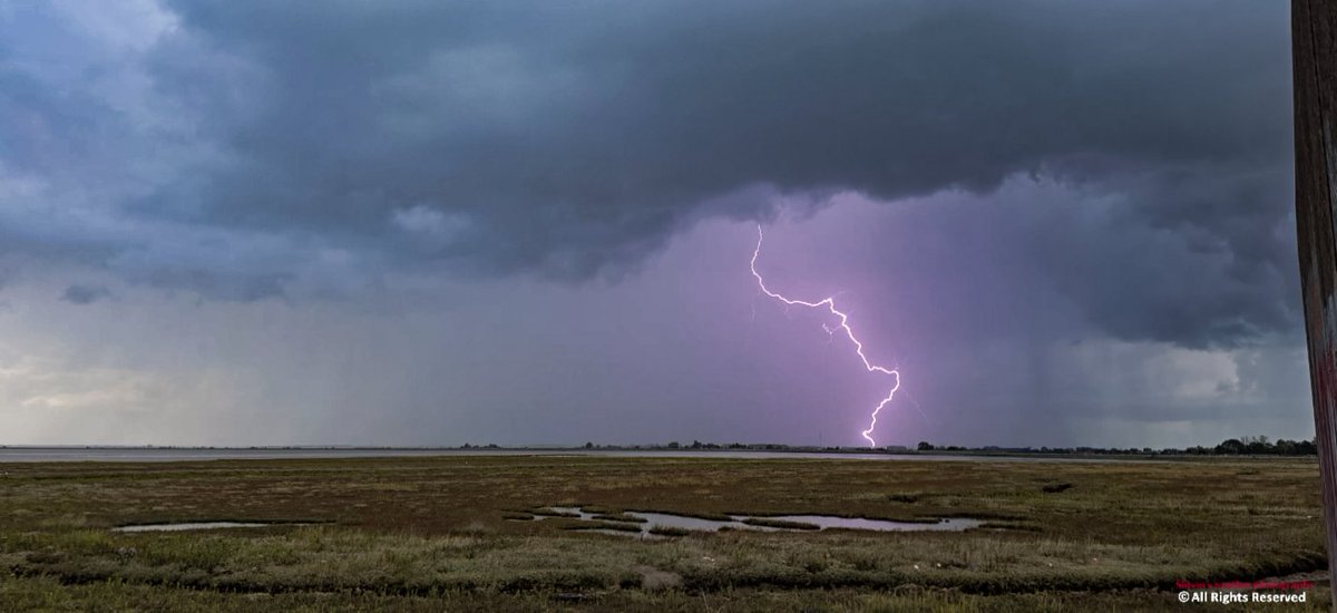
This afternoons Thunderstorm over Breydon Water @StormchaserUKEU @carlharlott @danholley_ @stormbell @Lowweather @PhotographyWx @bbcweather @BBCWthrWatchers @itvweather @metoffice @ChrisPage90 @WeatherAisling #loveukweather✅ @liamdutton @GavinPartridge @BBCLookEast @itvanglia


10
8
46
849