
Joined April 2026
- Tweets 429
- Following 345
- Followers 44
- Likes 1,681
198 Photos and videos


We live in a time when we see many of the things Jesus spoke about in the Bible. Earthquakes, famines, wars, and uncertainty seem to be making headlines more and more.
Jesus said:
"For nation will rise against nation, and kingdom against kingdom. And there will be famines, pestilences, and earthquakes in various places. All these are the beginning of sorrows." — Matthew 24:7-8
While these events can be concerning, the Bible also gives us hope. God has not left us without a promise. Jesus is our refuge and strength, and He has promised to be with those who trust in Him.
One day, Jesus will return. He will make all things new, wipe away every tear, end suffering, and establish His perfect kingdom. Until then, we can live with faith instead of fear, knowing that God is in control and that His promises never fail.
"Let not your heart be troubled; you believe in God, believe also in Me." — John 14:1
Keep looking up. Our hope is in Jesus Christ. #bible #jesus #GOD #christian
65
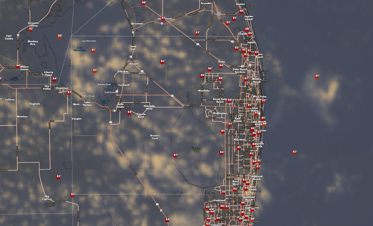
Florida:
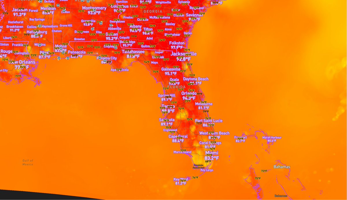
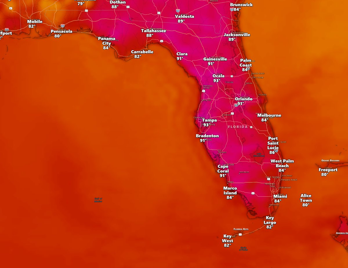
Rest of June looks like we’ll stay under a broad, flattened ridge, keeping fair humidity in place with typical sea-breeze showers and storms. Some days will see more activity than others, but the overall pattern looks fairly steady. There is also a lower-confidence signal that temperatures could trend hotter later in the month, with highs possibly climbing into the upper 90s for all of Florida and even near 100 in some spots. #flwx #florida
1
3
834
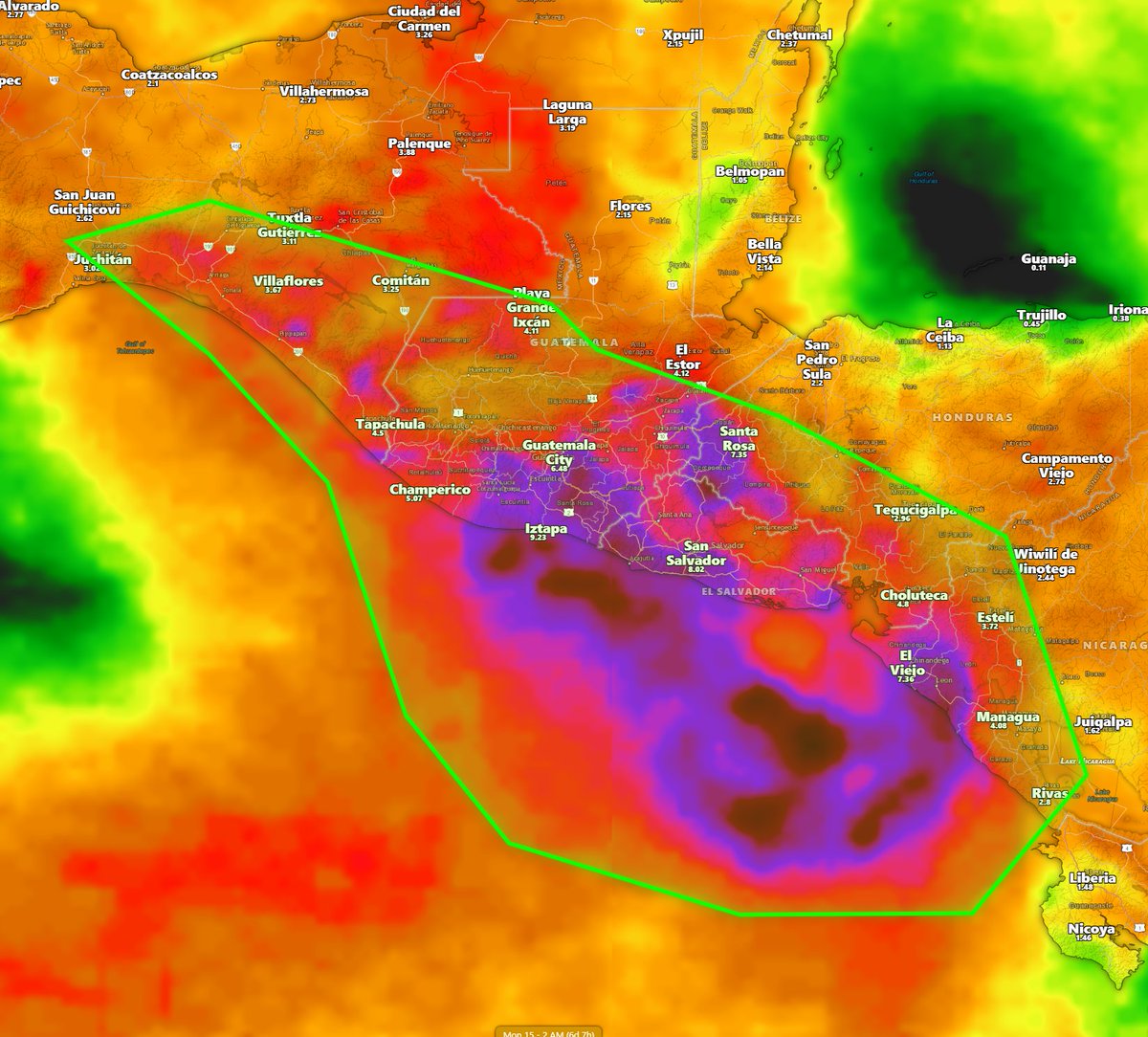
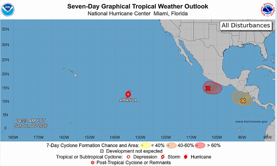
Central America:
Tropical System Cristina will help not only bring more rain but hazardous flooding as the days progress and slow movement to the west northwest as it tags close to the coast. Tropical Storm Winds are expected but the main concern is how much rain could fall especially over saturated area. Some models highlighting up to 15 inches of rainfall where a few isolated areas are reaching up to 10. Now this will be within the next few days so stay alert with your local officials. #nhc #tropicalstormcristina
1
59
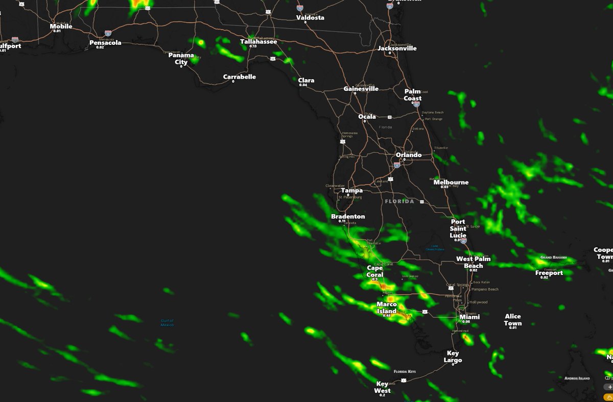
When it comes to rain totals for this week and next week, we’re not seeing much overall. Models are showing some tropical moisture at times across Florida, but nothing substantial at this point. I was previously holding off on mentioning a possible increase in showers because the setup wasn’t looking very confident. Could things still change? Of course. But for now, our regular Florida sea breeze some cold fronts looks like the main highlight unless something changes. #flwx #florida
1
3
46
Ok Now I know Why People Liked using the NAM and don't want to lose it, I always used HRRR but using the NAM for a couple days I can see why it's a favorite, some details are better shown in terms of mesoscale features. While I stick to HRRR, it sucks that the NAM won't be around for long. I never used before it before but I will now use it until its gone. RRFS has to be real good by then, because I still don't like it. #spc #noaa #nws
1
44

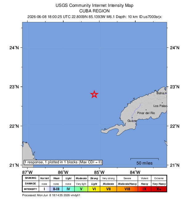
Update: Shaking has been felt across much of Florida in the aftermath of the 6.1 magnitude quake just west of Cuba.
*NO* tsunami threat is expected from the earthquake.
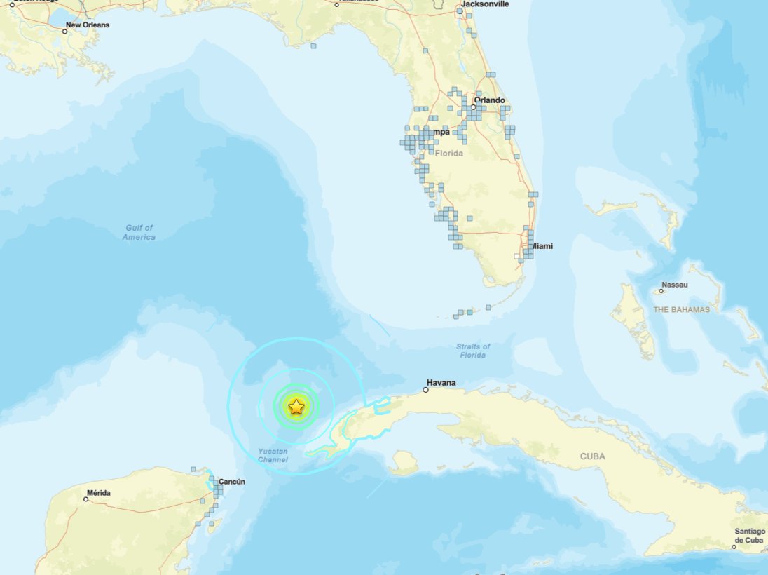

6/8 @ 2:15pm: We've received several recent reports of shaking across Southwestern Florida within the past 30 minutes.
An earthquake has occurred just west of Cuba in the southern Gulf.
@USGS_Quakes has since revised the magnitude down to a 6.1 at a depth of 10km.
173
845
4,261
695,723
Where we could see rain and isolated thunderstorms, mostly focusing on our southwest Today and through the night. #Flwx
1
57
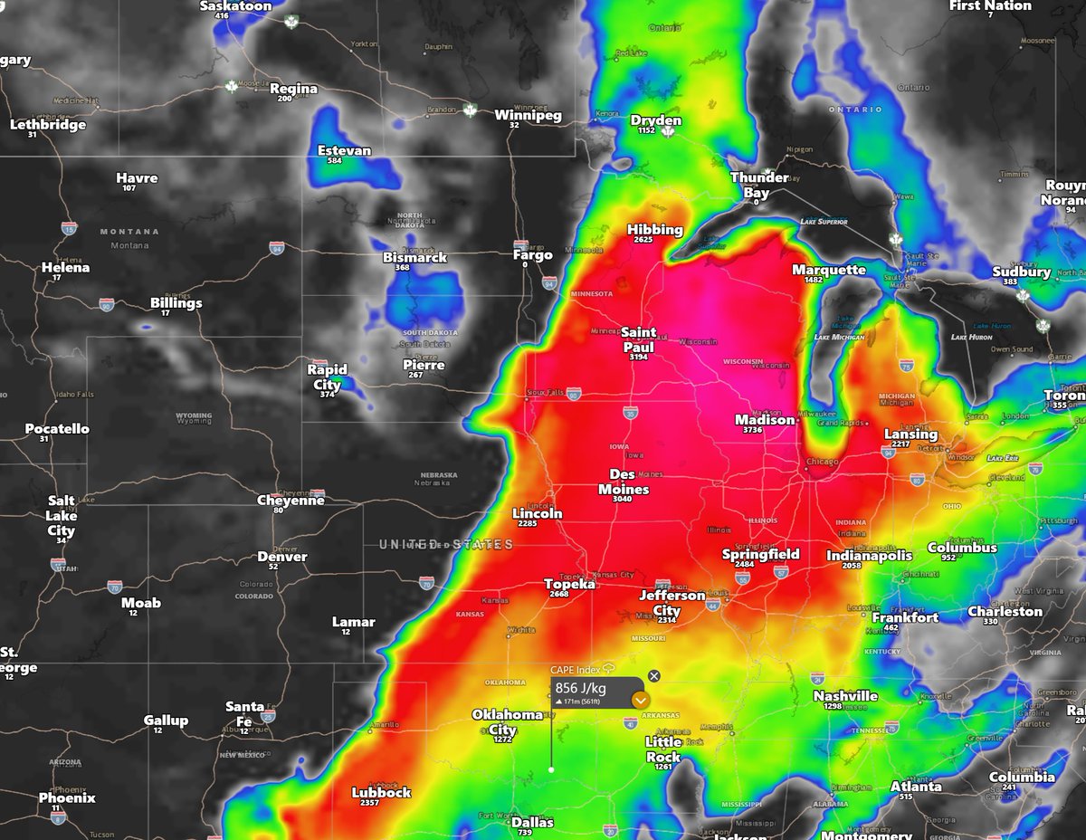
Alright folks, Tuesday the 9th and Wednesday the 10th could bring a significant severe weather outbreak across portions of the Plains, shifting into parts of the Midwest the following day. Forecast guidance continues to indicate an environment supportive of intense thunderstorm development, with very large hail, damaging winds, frequent lightning, and tornadoes all possible.
A strengthening low-pressure system moving northeast will help draw rich Gulf moisture northward while strong deep-layer shear organizes thunderstorms. In addition, a powerful jet stream aloft will enhance upper-level support and storm ventilation, allowing storms to strengthen rapidly.
This is a setup that will need to be monitored closely over the coming days. If you live in the affected areas, now is a good time to review your severe weather safety plans and stay updated on the latest forecasts.
#spc #uswx #sdwx #ndwx #kswx #newx #ohwx #inwx #ilwx #mowx #wiwx #mnwx #storms #weather #tornado
1
2
193
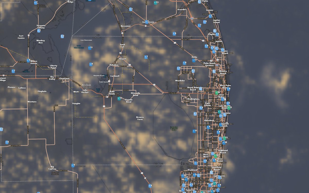
If you Live In Palm Beach County, Florida Check out this out as weather page that will be more local! #flwx #palmbeachcounty
@WeatherPBC x.com/WeatherPBC?s=20
1
2
77
1
2
75
Can't rule out a few pop up showers and perhaps an isolated storm today. #flwx
1
3
101

A few passing Showers and isolated thunderstorms are expected in our western panhandle today! Further east there could be very isolated pop-up showers. #flwx
1
2
66
Manny The Forecaster retweeted
Looking at the data, we could see the effects of El Niño within the next 1–2 months. Models show significant warming of 2–3°F, which will likely push the jet stream further south. This shift typically brings more active weather and severe potential to the lower latitudes. Currently, model handling of the jet is a bit all over the place, but a major shift is definitely underway. Staying tuned! #spc #nhc #noaa #uswx #weather #hurricane #storm #severeweather

2
2
89
Manny The Forecaster retweeted

Jun 6
6/6 10:45am | A high risk of rip currents is now in effect at all east central Florida beaches. Entering the water is not advised!
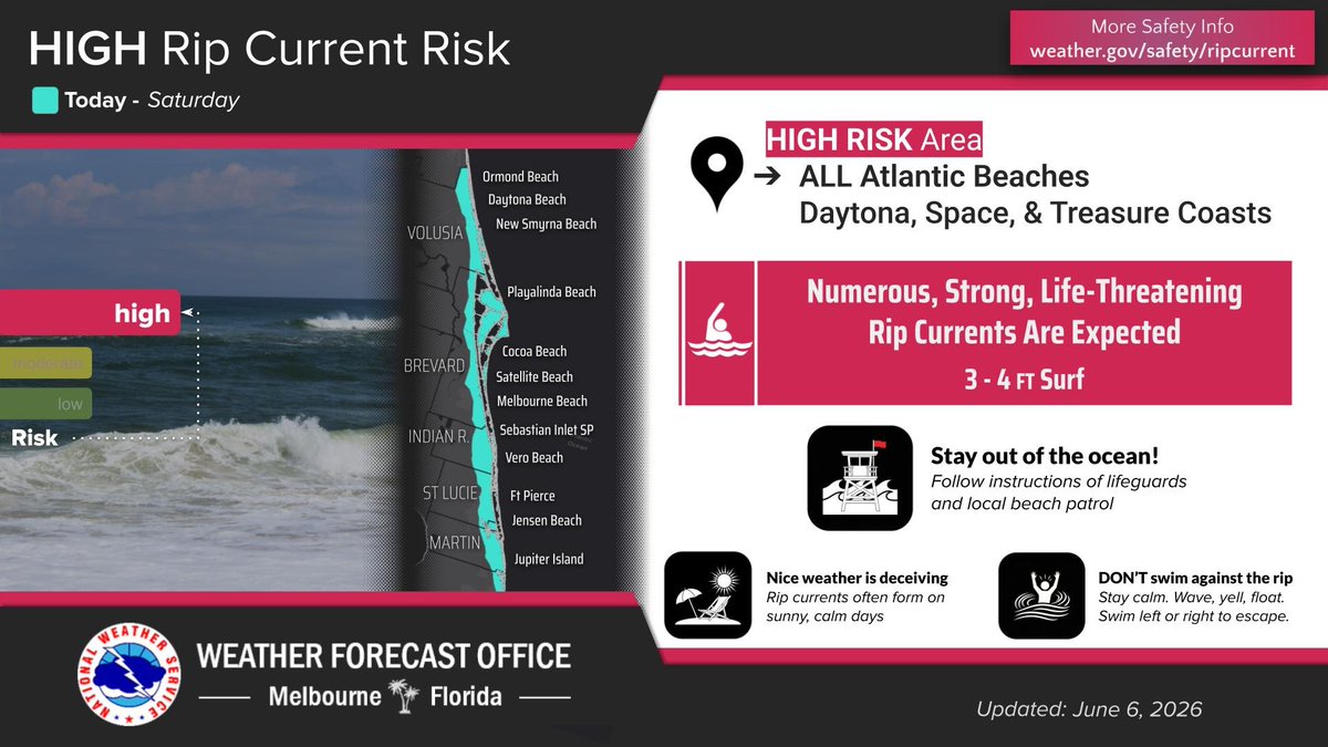
ALT There is a high risk of rip currents at all east central Florida beaches today.
6
10
969
1
1
9
705