
MyTopo provides navigation-ready mapping services, data, and software for professional & recreational use with a focus on efficient delivery.
Joined October 2009
- Tweets 624
- Following 203
- Followers 588
- Likes 0
32 Photos and videos
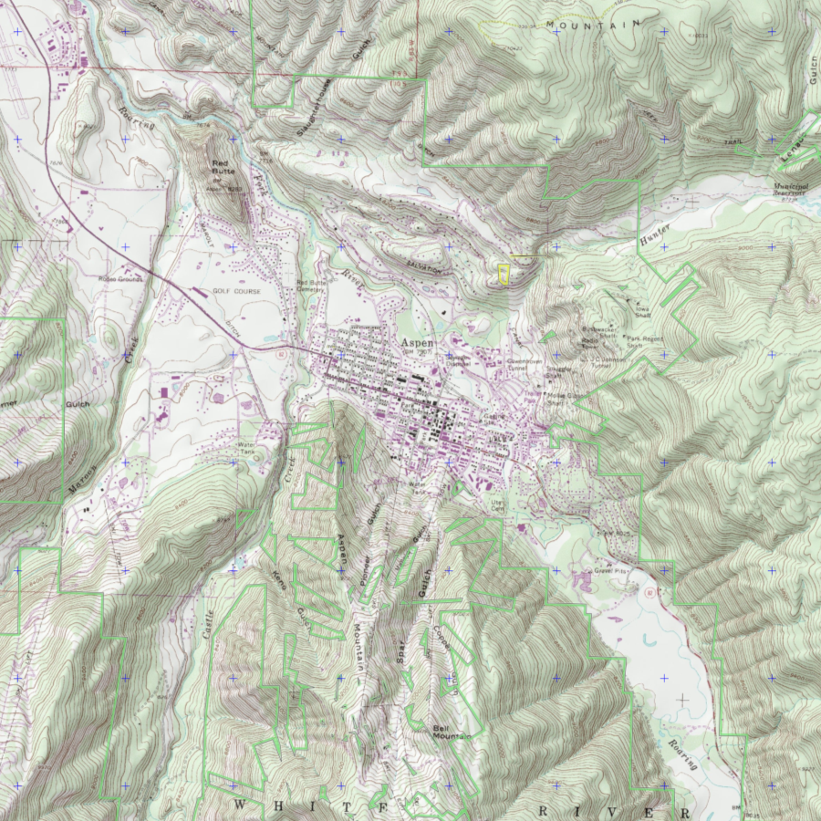


Discover the stunning topography of Aspen, Colorado, with our detailed topographic map! Aspen is renowned for its world-class winter sports scene, offering some of the best skiing and snowboarding in the country
mapstore.mytopo.com/products…
#aspencolorado #wintersports #topomap

1
57
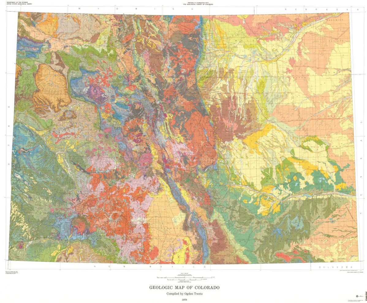
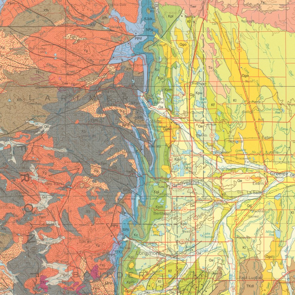
What's this, a tie-dye map? No, it's a geologic map of the state of Colorado, and the colors represent various types of rock formations and geologic units mapstore.mytopo.com/products…
#mytopo #cartography #geologicalwonders #geology #colorado #rockymountains #rockhound @USGS_CO
1
63
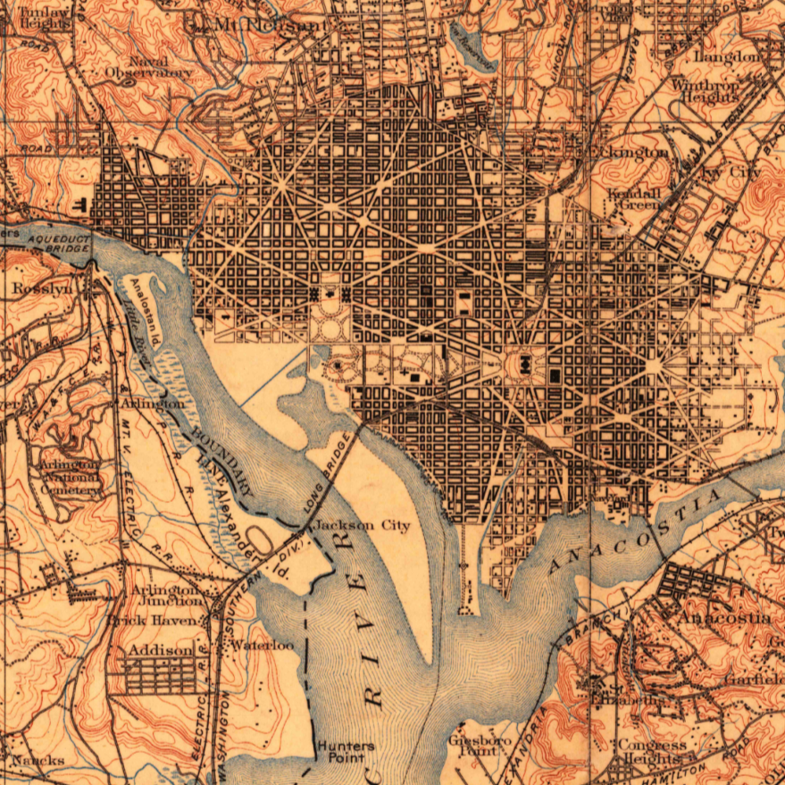
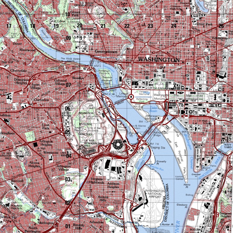
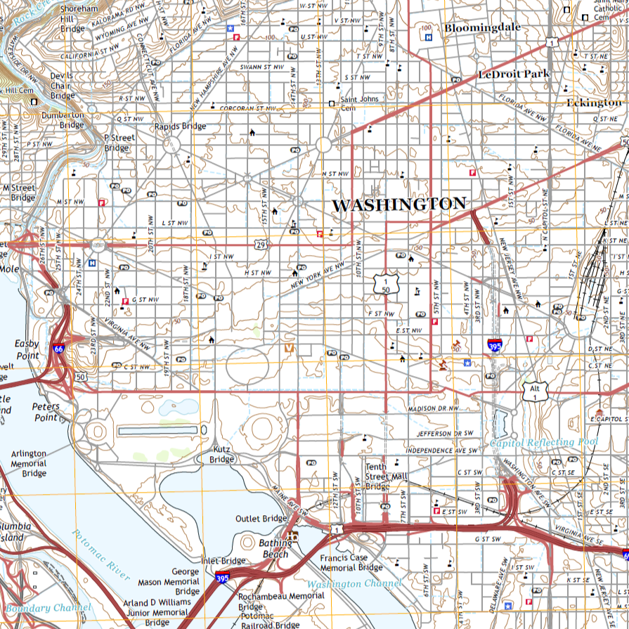
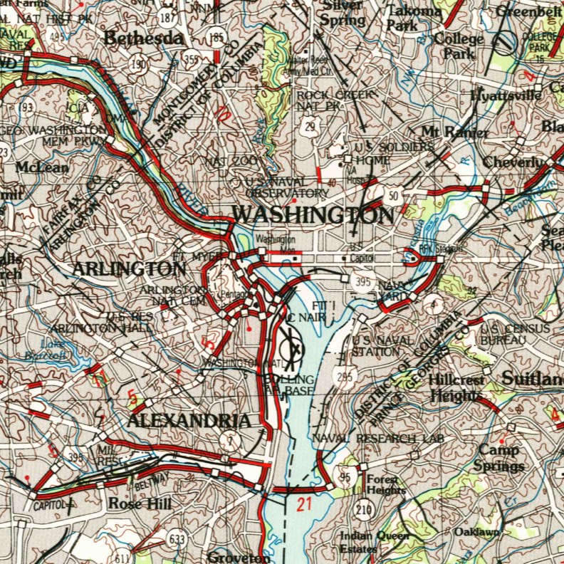
Topographic maps show the fascinating evolution of Washington D.C through the years! Historic, quads, military maps. These maps range from 1900 to 2019
mapstore.mytopo.com/collecti…
#cartography #districtofcolumbia #washingtondc #maps #capitolhill #mytopoo #topographic
ALT 1910
45
This topo map covers The Wave, a stunning geologic formation in Arizona. Renowned for its vibrant, undulating layers of sandstone, this natural wonder attract photographers and hikers from around the world mapstore.mytopo.com/products…
#hikingarizona #topography #Geology
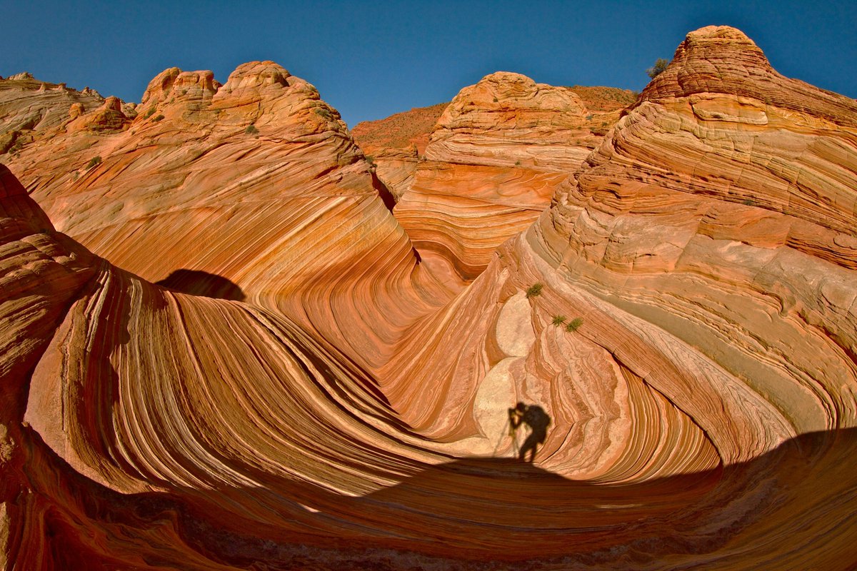
1
46
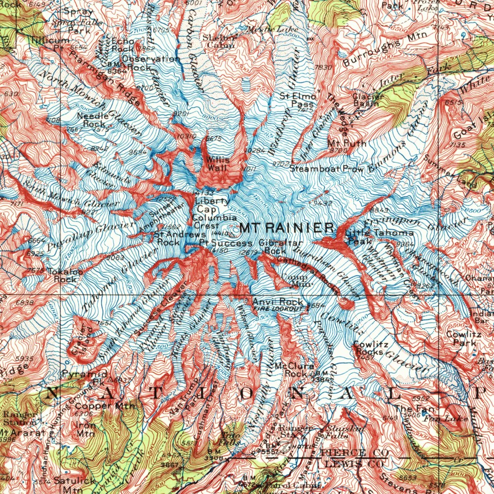
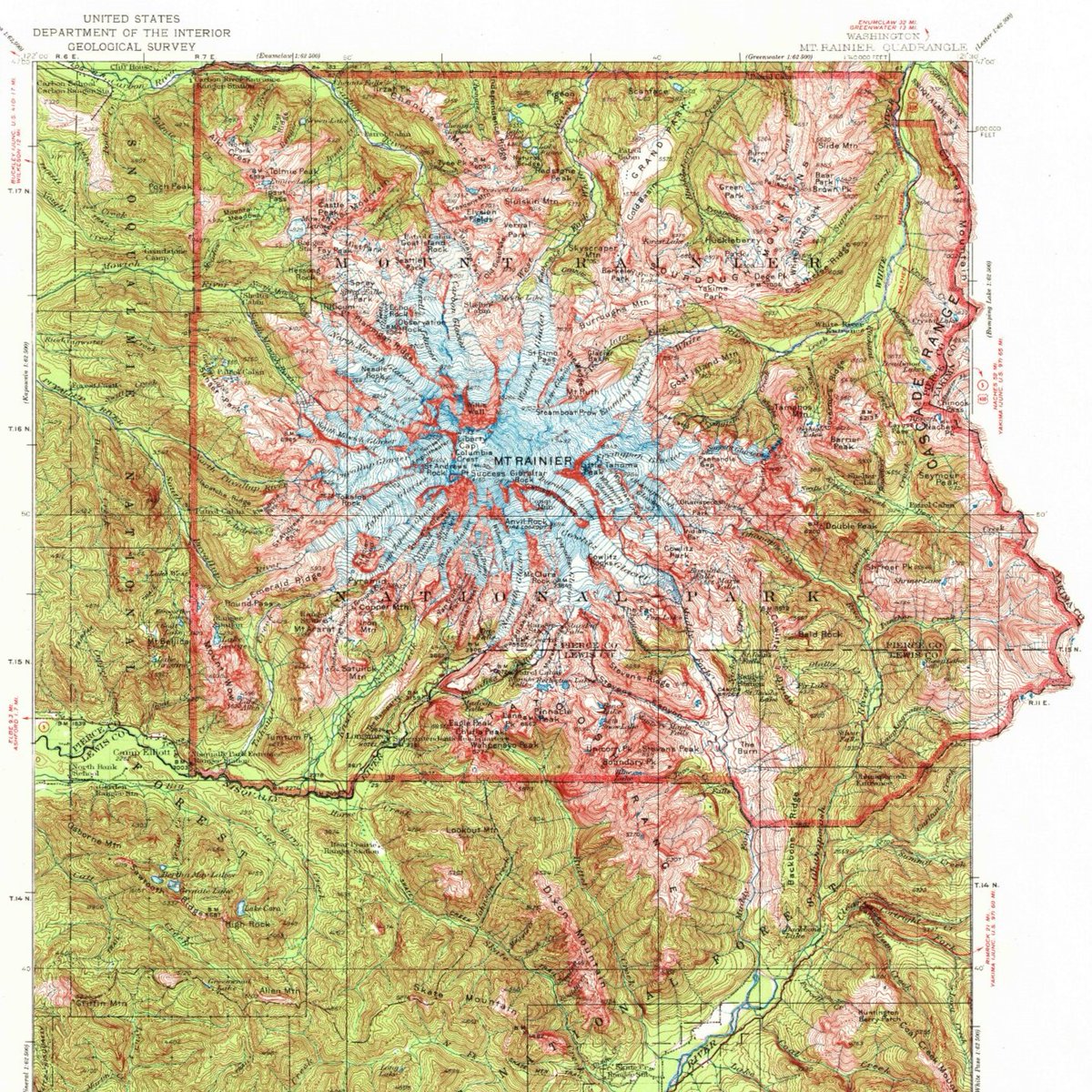
A 1924 historic topographic map of Mount Rainier, Washington. Produced by the U.S. Geological Survey, it shows stunning vintage detail from the early days of Mount Rainier National Park. This map is not just a navigation tool, but a piece of history.
mapstore.mytopo.com/products…
1
3
229
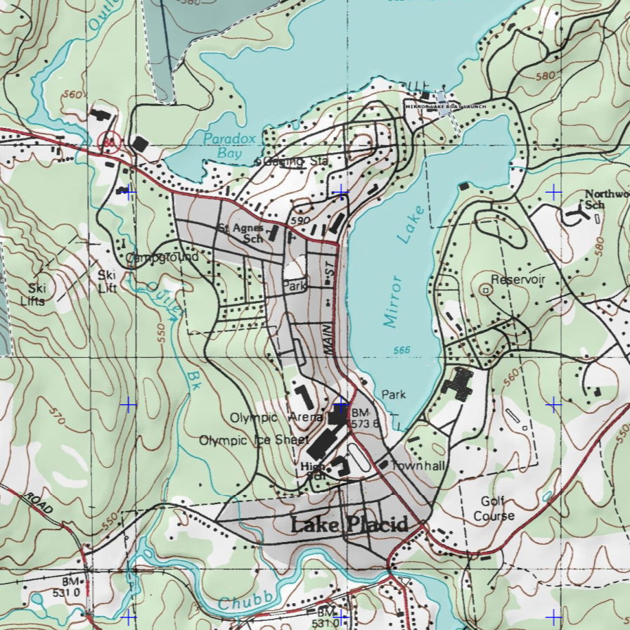
A MyTopo Explorer series map of Lake Placid New York, renowned for its breathtaking landscapes and Olympic history. Features the Miracle on Ice location and ski jumps mapstore.mytopo.com/products…
#topographicmap #lakeplacid #MiracleOnIce #adirondacks
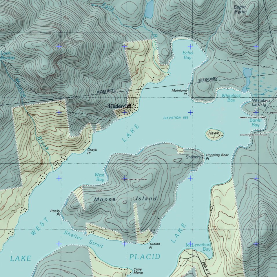
82
A 1924 historic topographic map of Mount Rainier, Washington. Produced by the U.S. Geological Survey, it shows stunning vintage detail
#mountrainier #vintagemap #vintagemaps #cartography #maps #cartographyart #mytopo #USGS #highpoint @MountRainierNPS
73
Map out your 2025 adventures with MyTopo. Find your topo map, aerial photo, or poster print at mytopo.com
#mytopo #topographicmap #maps #cartography #cartographyart #hiking #fishing #canoeing #skiing #mountains #usgs #aerialphotography #backpacking #outdooradventures
1
60
Topo Map Reading pt. 10/10: UTM Grids. What are Eastings and Northings, and how can you use them to find your location? Use a protractor along with a GPS coordinate to locate yourself #mytopo #hiking #usgs #utm #topomap #topographic #topographicmap #mapreading #outdoorskills
69
Topo Map Reading pt. 9/10: Latitude and Longitude Grids. Degrees, minutes, and seconds can help you locate yourself on the map. Also Decimal Degrees, a different format of coordinates #mytopo #hiking #usgs #topomap #topographic #topographicmap #mapreading #outdoorskills
1
84
Topo Map Reading pt. 9/10: North Arrows. Use a compass with your topographic map, finding Magnetic North in order to adjust for declination #mytopo #hiking #compass #mapandcompass #usgs #topomap #topographic #topographicmap #mapreading #outdoorskills #navigation #cartography
64
Topo Map Reading pt. 7/10: Map Scale. How does distance on the map relate to the real world? Use scale bars, numeric scale, large scale, small scale, section lines, and UTM zones to find out #mytopo #hiking #usgs #topomap #topographic #topographicmap #mapreading #outdoorskills
59
Topo Map Reading pt. 6/10: View the major symbols that make up topographic maps. Contour lines, benchmarks, rivers, streams, lakes, swamps, roads, trails, buildings, and campgrounds #mytopo #hiking #usgs #topomap #topographic #mapreading #outdoorskills #navigation #cartography
68
Topo Map Reading pt. 5/10: Terrain Features. What do different landforms look like on a topographic map? Plains, cliffs, canyons, hills, mountains, ridges, saddles, and draws #mytopo #hiking #usgs #topomap #topographic #topographicmap #mapreading #outdoorskills #cartography
36
Topo Map Reading pt. 4/10: Determining Contour Direction. How do you know which way is up when you see a bunch of contour lines? Use index contours, creeks, hills, and mountains to find out #mytopo #hiking #usgs #topomap #topographicmap #mapreading #outdoorskills #cartography
57
Topo Map Reading pt. 3/10: Contour Line Basics. What is a contour line? And how do you find the contour interval (elevation difference) between each contour line? #mytopo #hiking #usgs #topomap #topographic #topographicmap #mapreading #outdoorskills #navigation #cartography
45
Topo Map Reading pt. 2/10: Overview & Map Collar. Find what’s around the edge of a topographic map: Title, vicinity map, quad index, north arrow, scale, and projection information #mytopo #hiking #usgs #topomap #topographicmap #mapreading #outdoorskills #navigation #cartography
2
85
Topo Map Reading pt. 1/10: Types of topographic maps, including USGS maps, custom MyTopo maps, ownership, US Topo, Classic Quad, and Hybrid aerial maps #mytopo #usgs #topomap #topographic #topographicmap #mapreading #outdoorskills #navigation #trailmaps #cartography
2
73
Topo Map Reading Intro: Read topographic maps in 10 sessions. Don't get lost in the woods with no map skills! Contour lines, map symbols, grids, compass use. Follow MyTopo to view all videos. #mytopo #hiking #usgs #topomap #topographic #topographicmap #mapreading #cartography
1
74
Map Packs from MyTopo.com are a set of up-to-date topographic quads that cover a radius around your location. Great for emergency preparedness, bug out bags, etc. Get a map pack of US Topos at MyTopo #mytopo #USGS #topomap #topographic #bugoutbag #preparedness
58