
A 501(c)(3)Nonprofit Organization Supporting Emergency Management in the Northeast & The National Tsunami Hazard Mitigation Program (NTHMP) on the US East Coast
Joined June 2009
- Tweets 1,838
- Following 536
- Followers 1,323
- Likes 39
408 Photos and videos


Pinned Tweet

Think tsunamis only strike the Pacific Coast? Think again. Over 2.5 M people live in US East Coast tsunami hazard zones, including 1M in New York and 600K in Florida sciencedirect.com/science/ar… . Click for FREE US East Coast Tsunami Risk Mapping Assistance nesec.org/mapyourrisk
365
RT @EdPiotrowski: A strong magnitude 6.4 earthquake has occurred just off the western tip of Cuba. It was felt throughout Florida. https://…
27
5
Northeast States Emergency Consortium (NESEC) retweeted

The Pacific Tsunami Warning Center said tsunami waves up to 10 feet were possible on some coasts of the Philippines.
on.nbc10.com/dGh0eQl
1
1
1,826
History Reminds Us That Rare Doesn’t Mean It Can’t Happen Here!
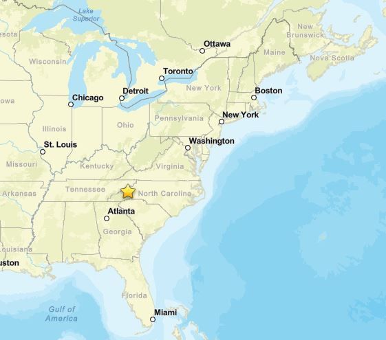
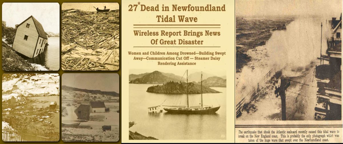
In 1929, the Grand Banks Tsunami killed 27 and devastated coastal communities in Newfoundland, Canada. The tsunami waves were recorded all along the US East Coast as far south as Charleston, SC
90
Northeast States Emergency Consortium (NESEC) retweeted

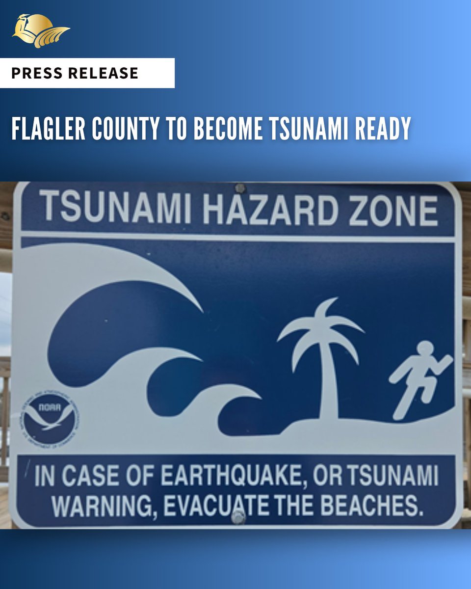
𝐏𝐫𝐞𝐬𝐬 𝐑𝐞𝐥𝐞𝐚𝐬𝐞: 𝐅𝐥𝐚𝐠𝐥𝐞𝐫 𝐂𝐨𝐮𝐧𝐭𝐲 𝐭𝐨 𝐛𝐞𝐜𝐨𝐦𝐞 𝐭𝐬𝐮𝐧𝐚𝐦𝐢 𝐫𝐞𝐚𝐝𝐲
June 3, 2026 – Flagler County is poised to recognized “TsunamiReady” through the National Weather Service, with one of the last steps in the process being the installation of new signs at county beachfront parks.
“The signs are designed to make our residents and visitors aware of the potential risk of a tsunami impacting our coastline,” said Emergency Management Director Jonathan Lord. “An additional benefit for our county is that being recognized as a ‘TsunamiReady Community’ will potentially have a positive impact on the National Flood Insurance Program flood insurance rates.”
According to the National Weather Service (NWS), a tsunami is one the most powerful and destructive natural forces. It is a series of waves (not just one) caused by a large and sudden displacement of the ocean. Tsunamis radiate outward in all directions from the disturbance and can move across entire ocean basins. Most tsunamis are caused by large earthquakes below or near the ocean floor, but tsunamis can also be caused by landslides, volcanic activity, certain types of weather and near-earth objects (e.g., asteroids, comets).
The NWS goes on the share that, while the threat posed by tsunamis is greatest along the Pacific and Caribbean Coasts, tsunamis are also possible on the Atlantic and Gulf Coasts.
While it wasn’t officially a ‘tsunami,’ a large rogue wave suddenly appeared along the coast in the Daytona area in July of 1992. The wave was reportedly about eighteen feet tall above normal waves and stretched 27 miles long, from Ormond Beach to New Smyrna Beach. It was also reported that there were 75 people injured, and damage to cars parked near the coastline.
Lord said, “Signs are just one part of a project to get Flagler County recognized as TsunamiReady by the National Weather Service. A tentative date for the official recognition is penciled in for the August 3 regular meeting of the Board of County Commissioners.”
For more information on Tsunamis and all hazards that may impact our community, please visit FlaglerCounty.gov/emergency or contact the Emergency Management Team at eoc@FlaglerCounty.gov or 386-313-4200.
Follow Flagler County Emergency Management on a variety of social media channels:
Instagram: Instagram.com/FlaglerEOC
X (formerly Twitter): Twitter.com/FlaglerEOC
Facebook: Facebook.com/FlaglerEOC
2
3
10
1,487
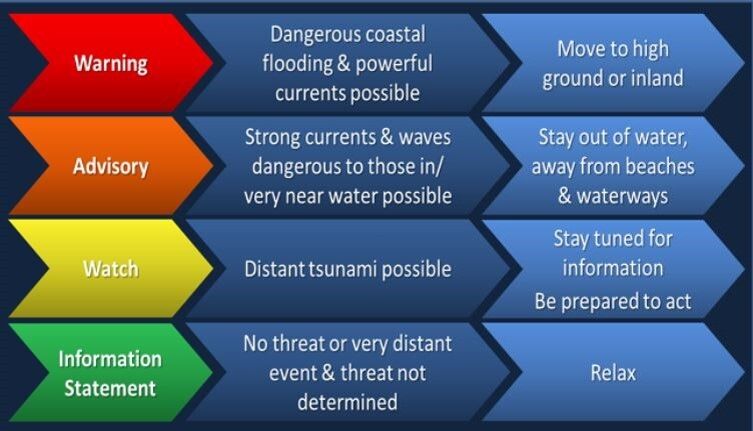
Tsunami awareness matters on the US East Coast. The NWS TsunamiReady Program provides clear steps for community preparedness. NESEC can help communities meet these requirements and strengthen local readiness. weather.gov/tsunamiready
1
92
Updating your Emergency Plan? Want to be truly Coastal Hazards Ready? Did you know tsunamis can impact the US East Coast? NESEC provides FREE assistance to coastal states/communities to map your potential tsunami inundation area and risk. Click to apply nesec.org/mapyourriskapply/
1
1
2
156
Tsunami Forecast Model SIMULATION: Historic Lisbon 1755 Earthquake & Tsunami youtu.be/Ht0W2E9g8cA?si=Bq41… via @YouTube
1
182
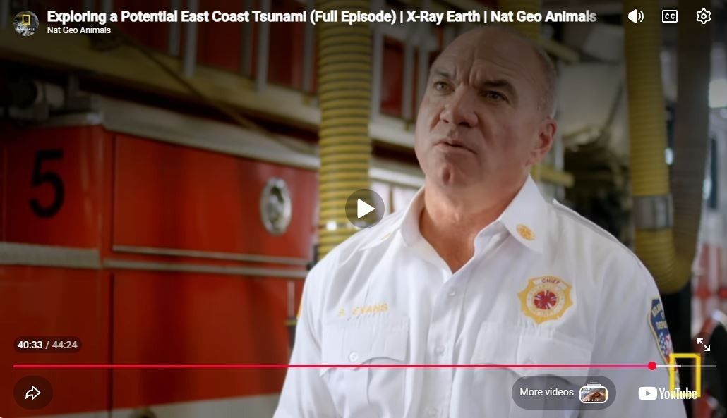
A local fire chief offers steady, experience‑based insight on East Coast tsunami hazards. Awareness supports informed decisions.
🔗 youtu.be/2tMCrutzckE
1
1
140
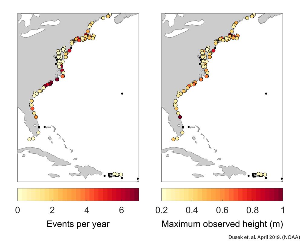
Did You Know That The US East Coast Experiences about 25 Meteotsunamis Per Year?
CLICK LINK TO LEARN MORE ABOUT METEOTSUNAMIS: youtu.be/lx3rTxu8gGw
1
1
1
141
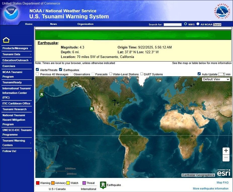
M 2.3 Earthquake West of Sleepy Hollow, New York
2
217
...but a local landslide induced tsunami may take only minutes to arrive, leaving little time to respond.
3
319
A Distant Tsunami May Take Several Hours to Reach the East Coast Providing Some Time to Respond
2
134
Tsunamis can travel at 500 mph, faster than a jet. Some US East Coast off shore landslide induced tsunami scenarios provide less than 1 hour to take protective actions. Very small notification and alert window. Speed matters.
1
1
217
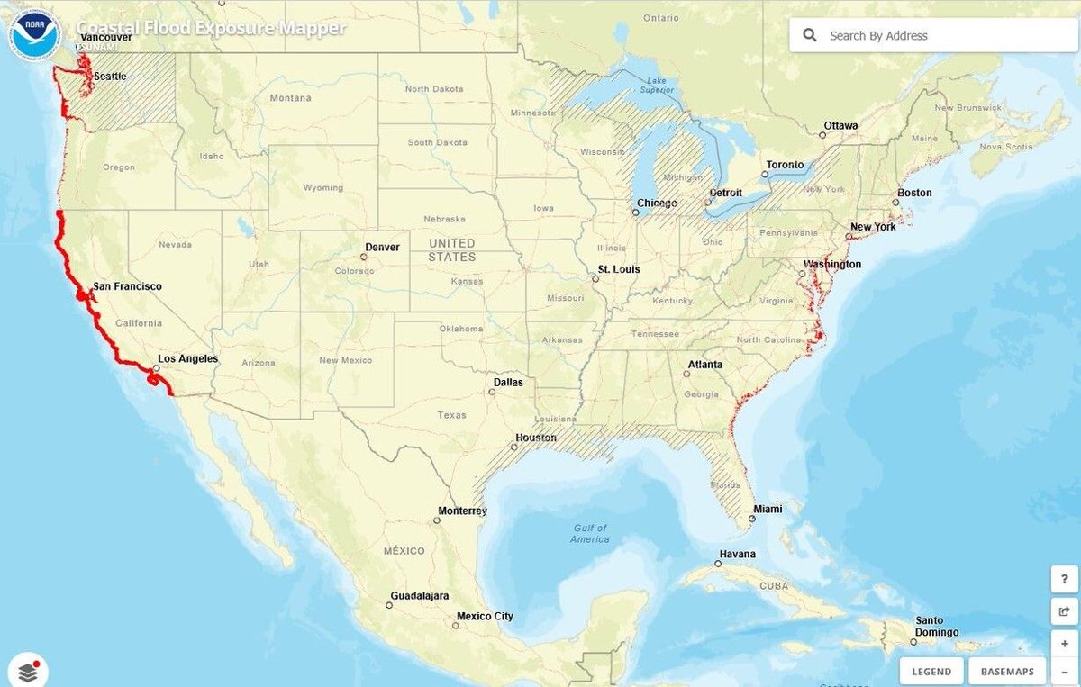
Is Your Community in a Potential Tsunami Hazard Zone? Click Here To Find Out? coast.noaa.gov/floodexposure…
97
Planning for the unlikely: Cape Canaveral taking steps to become tsunami ready mynews13.com/fl/orlando/weat…
115
Northeast States Emergency Consortium (NESEC) retweeted

HSEM and local officials recently unveiled upgrades to the State Emergency Operations Center. The SEOC is now packed with new tech. Highlights include a video wall and flexible new workspaces that make it easier for teams of any size to get things done. #ReadyNH #TeamSafetyNH
1
292