Official X account for the National Weather Service Spokane WA. Details: weather.gov/nws_x
- Tweets 45,291
- Following 330
- Followers 34,781
- Likes 12,222


ALT NWS Spokane graphic warns of elevated to critical fire weather on Tuesday, June 16, 2026. Left features a wildfire image. Right details dry and gusty west winds (gusts 35-50 mph, humidity 15-25%) making new grass fires difficult to contain. Includes safety actions: don't park on dry grass, avoid sparking activities, safely dispose of cigarettes, tie up loose vehicle chains, properly extinguish campfires, and follow local burn bans.
ALT This graphic displays a special weather statement plotted on a map. The statement is in effect until 2:00 PM PDT. The statement includes Bonner County, ID. A strong thunderstorm will impact portions of west central Bonner County through 200 PM PDT. The threats associated with this storm are wind gusts up to 40 MPH and half inch sized hail. Seek shelter in a sturdy structure until the storm passes.

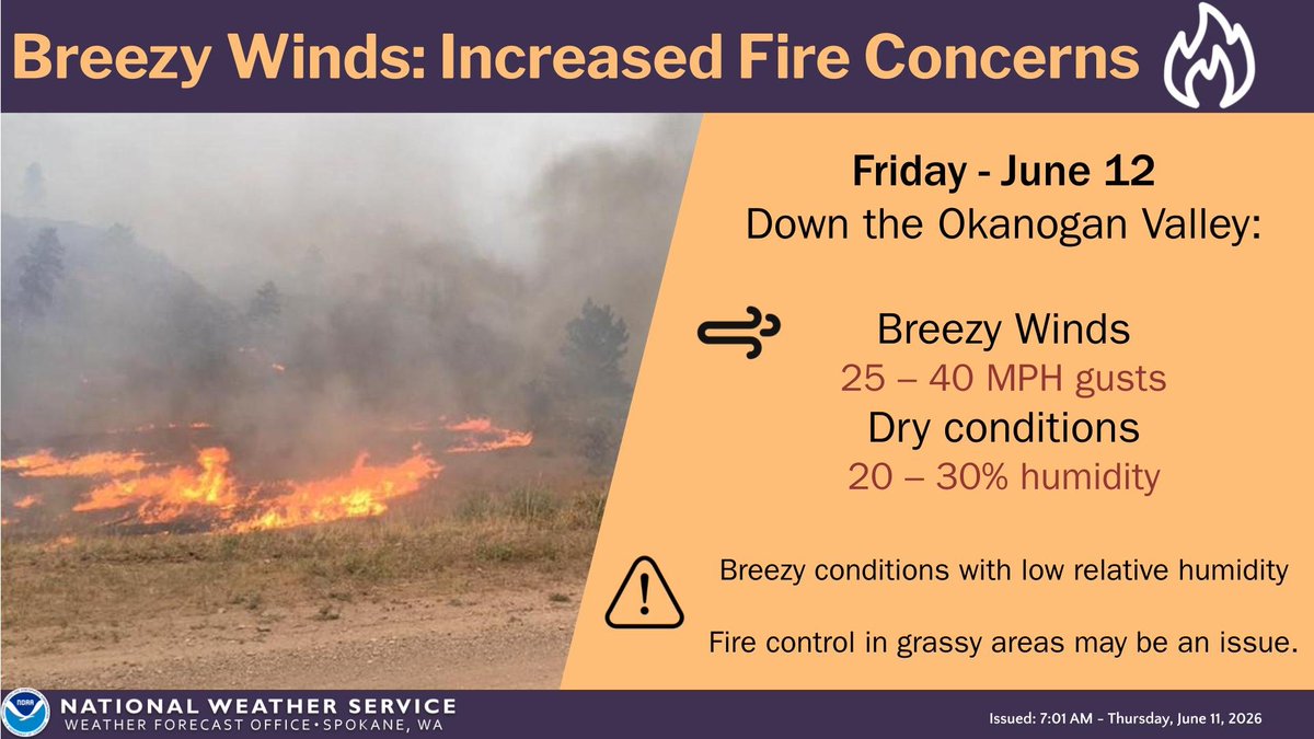
ALT Elevated Fire Weather Conditions are forecast for the Okanogan Valley on Friday due to warm, dry, and breezy conditions.
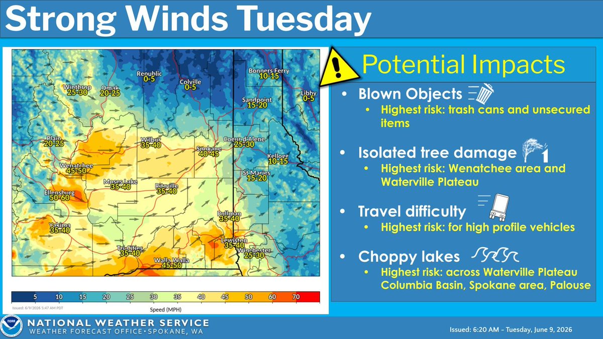
ALT There will be widespread wind gusts around 30-50 mph across the Inland Northwest Tuesday Afternoon. These winds will create difficult driving conditions for high-profile vehicles and cause choppy waters on regional lakes. Isolated tree damage is also possible, particularly around the Wenatchee area and Waterville Plateau. Secure loose outdoor items and trash cans before Tuesday morning.
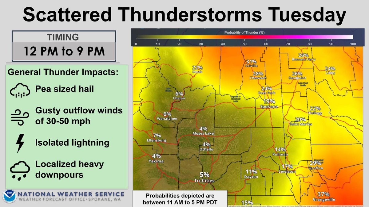
ALT There will be around a 10-30% chance of thunderstorms over the region today, June 9, midday through evening. Any storms that develop will be capable of producing pea sized hail, occasional lightning, and gusty outflow winds up to 30-50 MPH.
ALT There will be around a 10-30% chance of thunderstorms regionwide Tuesday, June 9, midday through evening. Any storms that develop will be capable of producing pea sized hail, occasional lightning, and gusty outflow winds up to 30-50 MPH.
ALT There is a risk of frost in northern valleys overnight Sunday into Monday morning. Unseasonably cold low temperatures 36 degrees and below could harm sensitive outdoor vegetation left uncovered. A Frost Advisory has been issued from 12am-8am PDT tomorrow morning. #wawx #idwx
ALT Weather outlook for June 7th to 11th, showing occasional shower chances, with the best chance for rain and t-storms Monday night and Tuesday. Temperatures will be in the 60s to mid-70s, warming toward the 70s to lower 80s late in the week.
ALT This graphic displays a special weather statement plotted on a map. The statement is in effect until 7:00 PM PDT. The statement includes Okanogan County, WA. A strong thunderstorm will impact portions of southeastern Okanogan County through 700 PM PDT. The threats associated with this storm are wind gusts up to 40 MPH and half inch sized hail. Seek shelter in a sturdy structure until the storm passes.
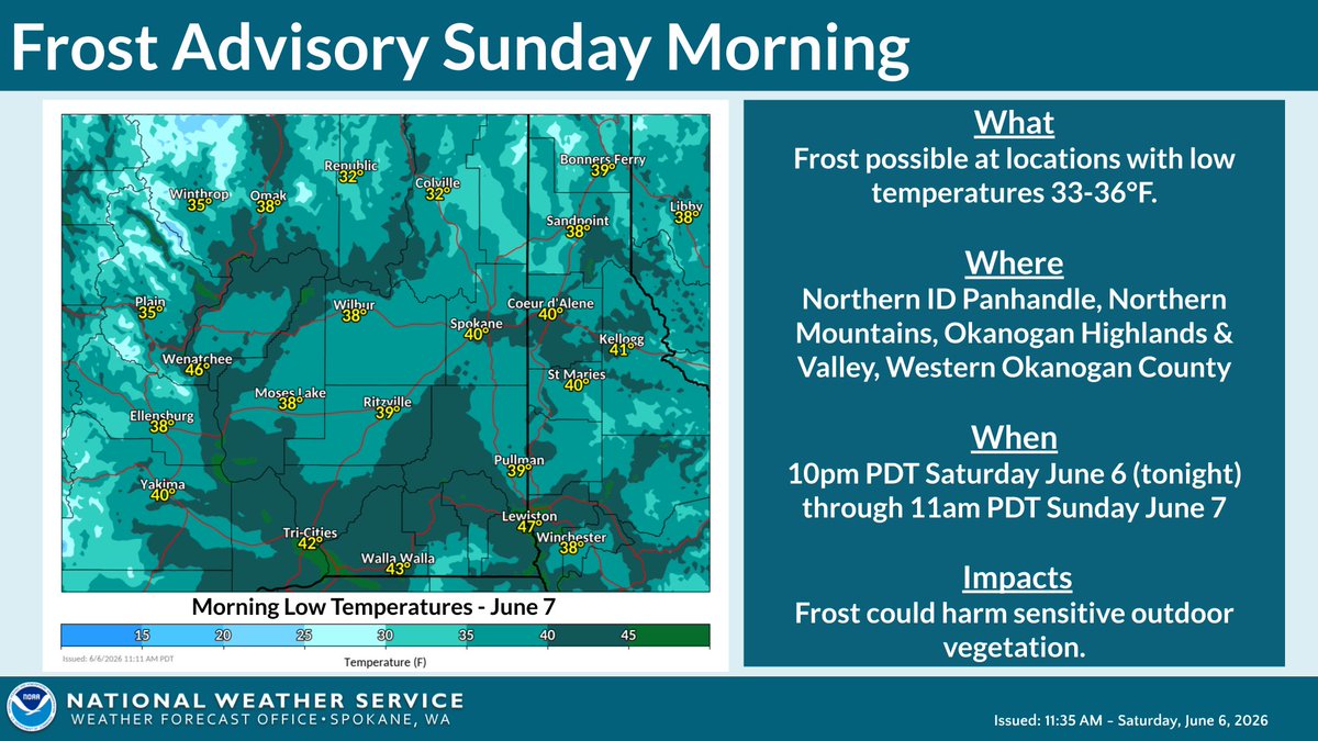
ALT Unseasonably cold temperatures will lead to a risk of frost overnight Saturday into Sunday morning. Temperatures 36 degrees and lower could harm outdoor vegetation, and sensitive outdoor plants may be killed if left uncovered. A Frost Advisory has been issued from 10pm PDT tonight through 11am PDT tomorrow morning. #wawx #idwx
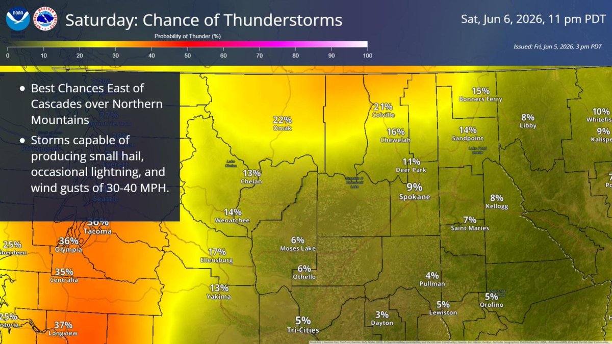
ALT Map showing the chances for thunderstorms on June 6th, 2026
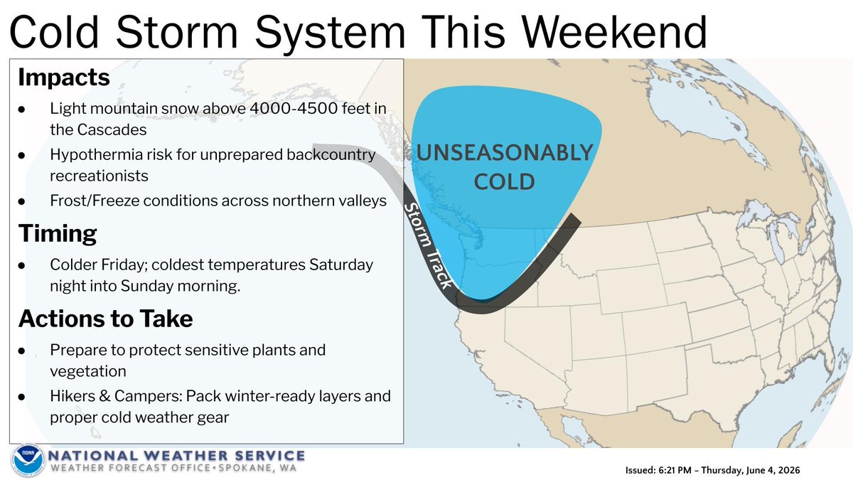
ALT Graphic titled "Cold Storm System This Weekend" showing unseasonably cold air dropping from Canada into the Pacific Northwest. Impacts include mountain snow above 4000-5000 ft, frost/freeze in northern valleys, and hypothermia risks. It turns colder Friday, with the coldest temperatures Saturday night into Sunday morning. Actions: Protect sensitive plants; hikers and campers should pack winter gear. Issued by NWS Spokane.

ALT Graphic titled "Cold Storm System This Weekend" showing unseasonably cold air dropping from Canada into the Pacific Northwest. Impacts include mountain snow above 4000-5000 ft, frost/freeze in northern valleys, and hypothermia risks. It turns colder Friday, with the coldest temperatures Saturday night into Sunday morning. Actions: Protect sensitive plants; hikers and campers should pack winter gear. Issued by NWS Spokane.