As we near the end of our #Landslides project Phase II, you can experience a high-res flythrough of Tristan da Cunha’s northern slopes - generated from 3,195 drone images. Visualize Dockel Gulch - a key source area of recent large #debrisflow & flooding events. #TristandaCunha
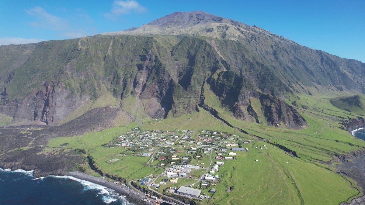
ALT View of the Settlement (Edinburgh of the Seven Seas) on Tristan da Cunha with the active volcanic peak in the background. Note the very steep slopes and deep ravines behind the Settlement!
Excited to share a milestone in our #TristanLandslidesproject: @volcanna & I have just installed a new weather station at 800 meters on Tristan da Cunha, the world's most remote inhabited island! 🌧️ This isn't just another weather station! 🧵
And ultimately help to strengthen water security for the Tristanian community. It's amazing how a single installation can bridge the gap between meteorological research and everyday resilience for islanders. 🧵
🌋 Mapping Change: A Return to Tristan da Cunha 🌧️
The island of Tristan da Cunha in the South Atlantic faces ongoing natural challenges such as landslides and coastal erosion. Recent severe floods, driven by heavy rain and steep terrain, have further impacted the community 🧵
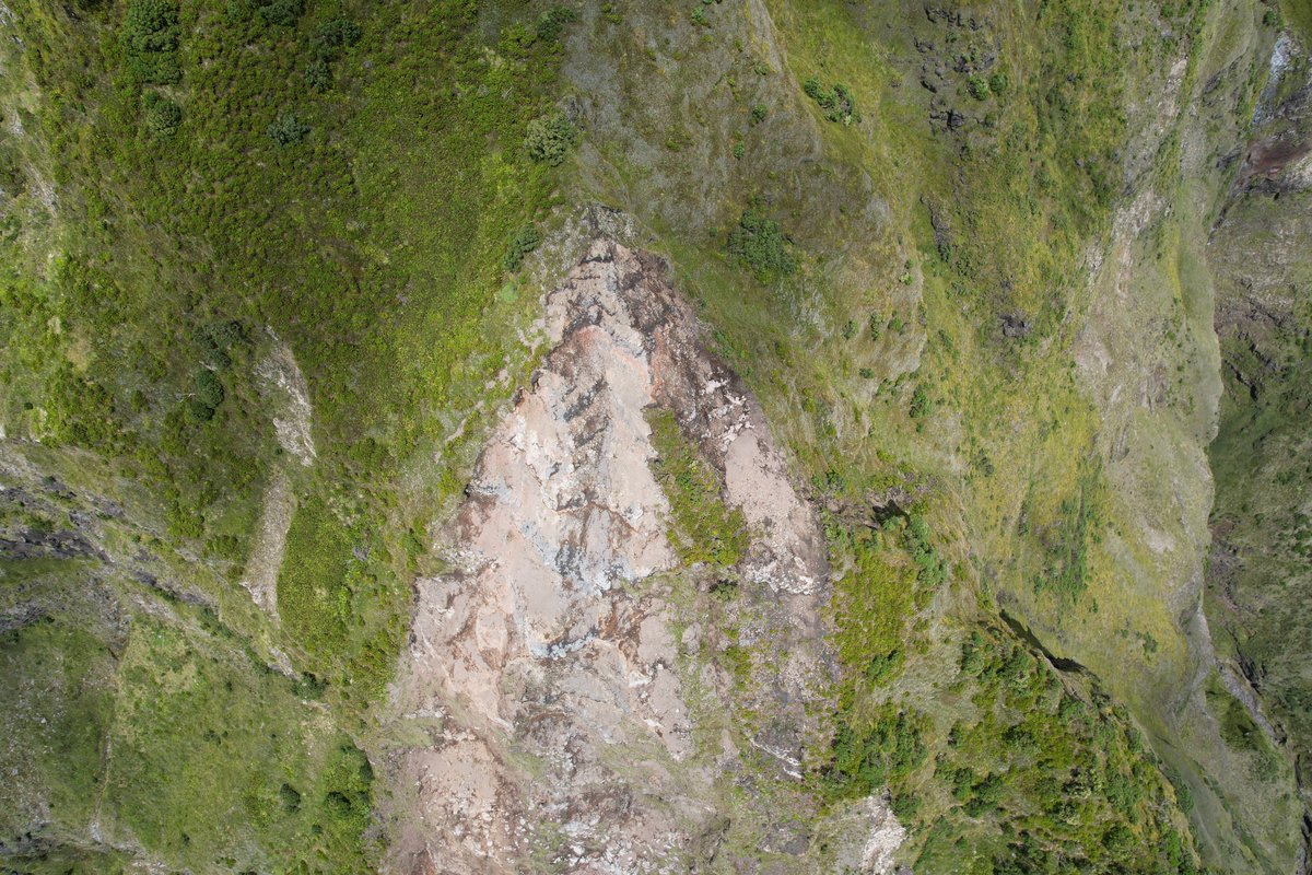
ALT Source area for one of the landslides on the main cliffs behind the Settlement ca. 600m above sea level. One detached block can initiate a series of movements, which could lead to a chain reaction in landslide-prone areas.
With funding from the @FCDOGovUK & the Tristan da Cunha Government, this collaborative project aims to improve our knowledge about hazards to support appropriate mitigation measures, working closely with the local community to support a sustainable future.
Tristan da Cunha, home to the world's most remote community, is facing rising landslide risks as climate change reshapes its volcanic landscape 🌋
BGS scientist @volcanna is on the island, mapping hazards to help protect its 233 inhabitants.
📸 @nautical_neil, February 2025
ALT Aerial view of Edinburgh of the Seven Seas, the world's most remote settlement, on Tristan da Cunha. Steep volcanic cliffs tower over the village.
With my #TristanDaCunha hat on, great to see @volcanna from @BritGeoSurvey presenting some of the interdisciplinary approaches for long-term science/policy/society engagement in data-poor volcanic settings at #CoV12
Ahead of the Reception this evening on the occasion of the launch of the UK-OT Joint Declaration, it seemed appropriate to share this short #dronephotography film about our work on Tristan da Cunha last year. youtu.be/mp0XZwAOtFE?si=An-w…
Eruptive activity is increasing once more at #Etna's Southeast Crater; cloud cover renders observations difficult. Video was taken while visibility was still decent, view is from home in Tremestieri Etneo, using my 3000 mm zoom. 12 November 2023
Aquarius Survey & Mapping has gone rogue, branching out from the marine world! 🌋Last month presented an opportunity to study Stromboli, and its Strombolian-style eruptions, named after the Italian island in the Mediterranean 🧵
A Strombolian eruption is a type of volcanic eruption characterized by moderate, intermittent explosions that eject incandescent volcanic bombs and ash high into the air creating firework-like light trails #volcano#INGV
Strombolian eruptions are moderately explosive eruptions of basaltic magma with moderate gas content. Typically, these eruptions are intermittent, discrete explosive bursts ejecting pyroclasts high into the air creating firework-like incandescent light trails #volcano#INGV