
Responsible for the comprehensive management of all-hazards risks for Scott County, Kansas. This account is not monitored 24/7.
Joined July 2017
- Tweets 4,231
- Following 207
- Followers 385
- Likes 842
1,209 Photos and videos


Jun 10
The Severe Thunderstorm Watch has been cancelled early for our area.
Jun 9

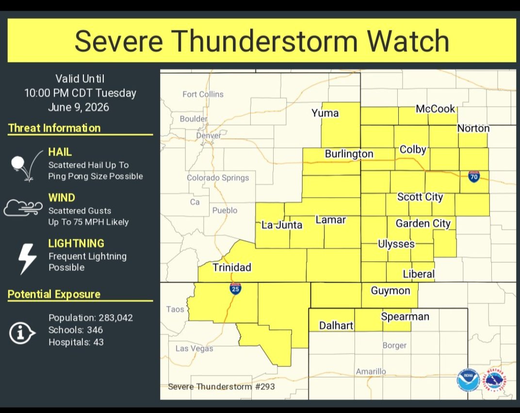
A Severe Thunderstorm Watch has been issued until 10pm. The biggest hazard for our area will likely be lightning and strong wind gusts. Stay weather aware the remainder of the day.
15
Jun 9
A Severe Thunderstorm Watch has been issued until 10pm. The biggest hazard for our area will likely be lightning and strong wind gusts. Stay weather aware the remainder of the day.
36
Scott Co EM retweeted

Jun 8
Minor change to the overall severe weather risk today. The most notable change is the Slight Risk (level 2 of 5) was brought farther north. No real change to the expectations today, with the best chance of stronger storms near the I-70 corridor! Be weather aware! #kswx
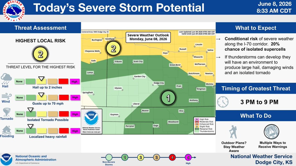
ALT Minor change to the overall severe weather risk today. The most notable change is the Slight Risk (level 2 of 5) was brought farther north. No real change to the expectations today, with the best chance of stronger storms near the I-70 corridor! Be weather aware! #kswx
2
5
596
Jun 8
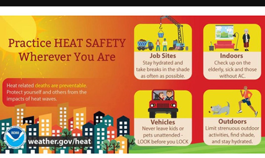
Summer temperatures are forecast the next few days, so take steps to protect yourself and others.
1
10
Jun 7
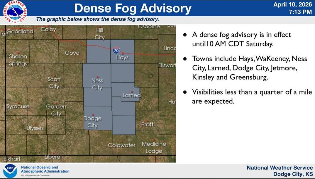
A Dense Fog Advisory has been issued until 9am for our area. If you have early morning travel plans give yourself extra time, use low beam headlights, and increase following distance.
1
23
Jun 1
A Severe Thunderstorm Warning has been issued for portions of southeast Scott County until 7:30pm. Quarter size hail and winds to 60mph will be possible.
27
Jun 1
A Severe Thunderstorm Warning has been issued for northeastern portions of Scott County until 7:15pm. Ping pong ball size hail and winds to 60mph will be possible.
32
Scott Co EM retweeted
Jun 1
Scott and Lane county residents:
4:42 pm:
Please let us know if you get any large hail or strong winds with the storm that is currently rolling through your area. Thank you!
#kswx
1
1
295
Scott Co EM retweeted

4:42pm CDT #SPC_Watch WW 265 SEVERE TSTM KS NE 012140Z - 020500Z, #kswx #newx, spc.noaa.gov/products/watch/…
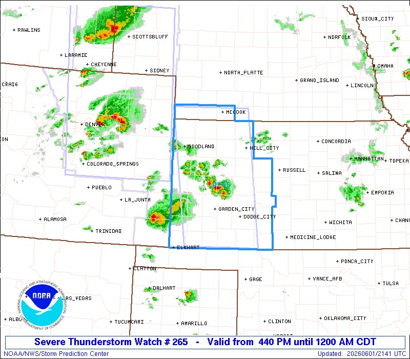
10
22
6,562
Jun 1
A Severe Thunderstorm Warning has been issued for eastern portions of Scott County until 5pm. Strong winds up to 60mph and quarter size hail are possible.
27
Scott Co EM retweeted
Jun 1
2pm Update: Isolated to widely scattered thunderstorms will be possible through 4 pm as north across portions of west central and north central Kansas. #kswx
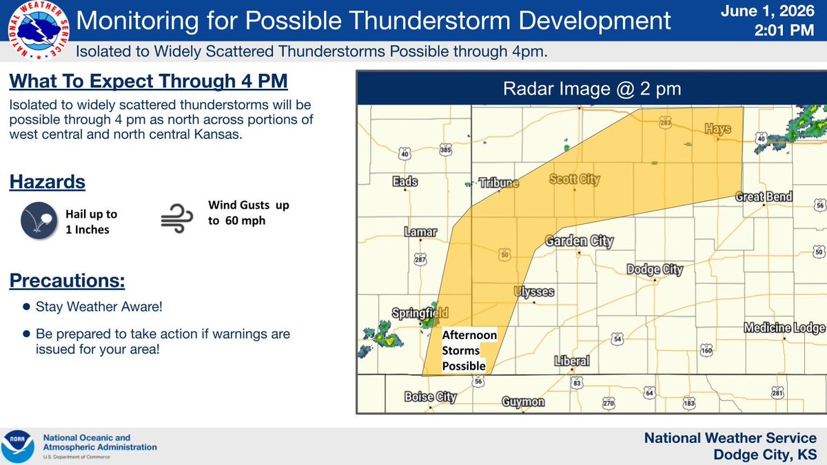
ALT Monitoring For Developing Thunderstorms
3
1
350
Jun 1
Severe thunderstorms will be possible later this evening, plan accordingly.
Jun 1

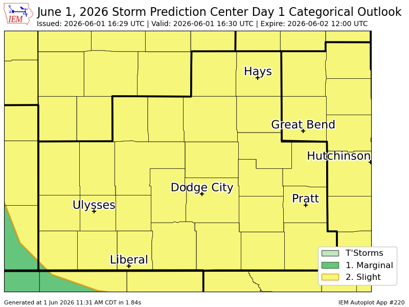
#SPC issues Day 1 Slight Convective Risk at Jun 1, 16:29z for DDC spc.noaa.gov/products/outloo…
29
May 31
We'll keep an eye on the forecast for Monday, severe weather may be possible.

1:05am CDT #SPC Day2 Outlook Slight Risk: across parts of the central Plains spc.noaa.gov/products/outloo…

83
May 31
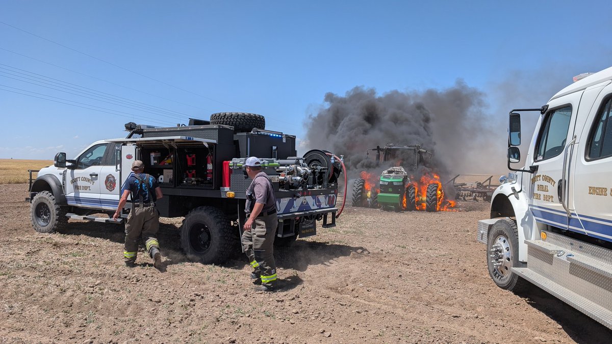
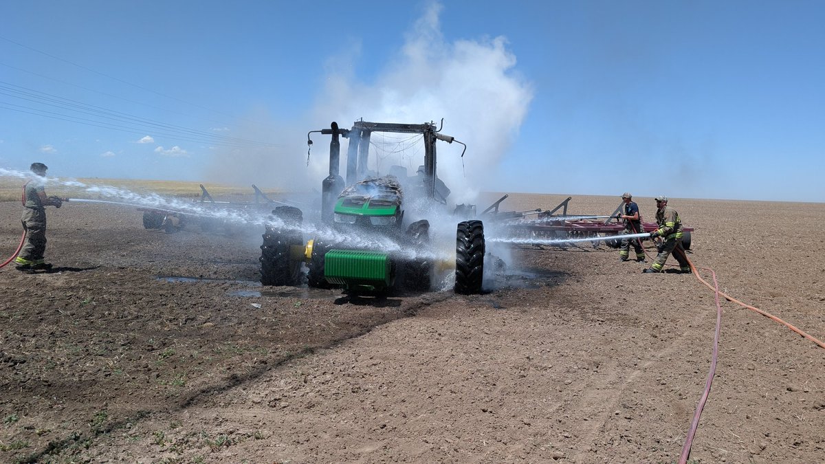
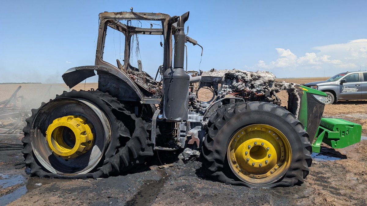
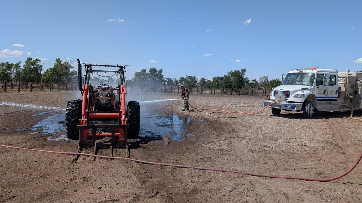
Scott County EMS and Scott County Fire have been busy lately! EMS has run five calls so far between yesterday and today, and FD responded to two back-to-back tractors on fire today. As always, we greatly appreciate those who answer the call no matter the day or time of day!
1
170
May 30
Folks in Wichita for state track need to stay weather aware today, and have a plan to seek shelter if it becomes necessary.
38
May 25
We remember and honor those who made the ultimate sacrifice. We owe them so much more than a thank you on this Memorial Day.
1
20
May 24
Just a little something to keep an eye on if you have outdoor plans later today.
May 24

A few marginally severe t-storms are possible this evening. #KSWX

ALT A few marginally severe t-storms are possible this evening.
61
Scott Co EM retweeted
May 24
There are moderate to high chances for showers and t-storms Tuesday night through Thursday. #KSWX

ALT There are moderate to high chances for showers and t-storms Tuesday night through Thursday.
4
4
1,099
May 16
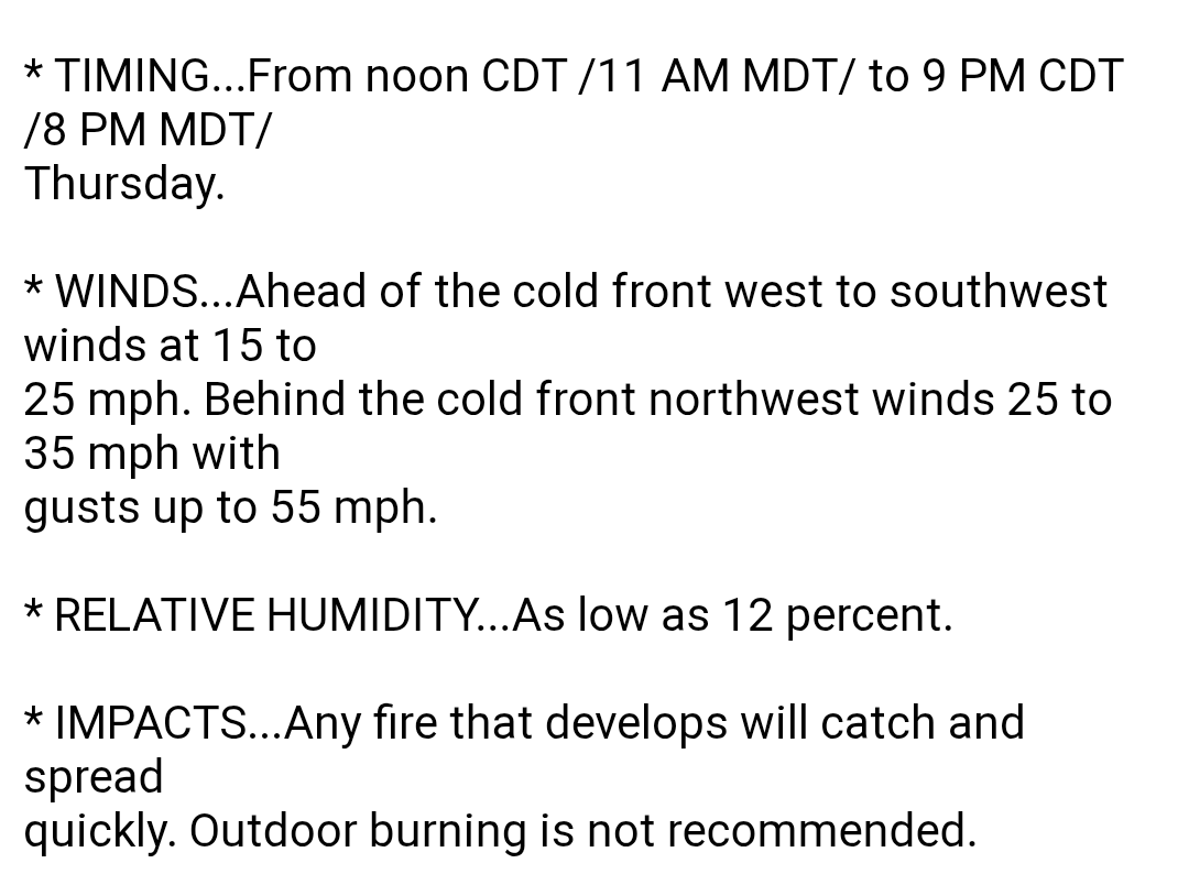
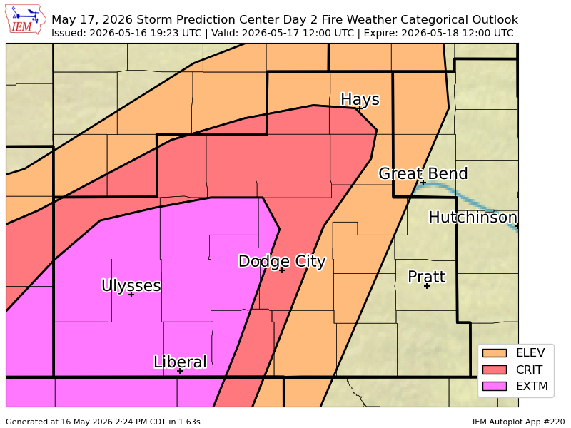
To further demonstrate the wildfire potential tomorrow...
May 16
#SPC issues Day 2 Extreme Fire Weather Risk at May 16, 19:23z for DDC spc.noaa.gov/products/fire_w…
1
37
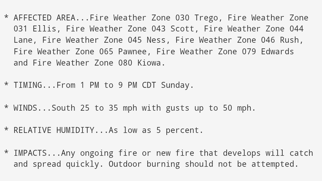
May 16
A Red Flag Warning has been issued for tomorrow from 1:00-9:00pm for potentially critical fire weather conditions. There should be absolutely NO outdoor burning this weekend. If you have outdoor activities planned for graduation consider the possibility of strong and gusty winds.
29