
Developer of Correlator3D™ #software used by governments and #geospatial #mapping firms around the world to process aerial & satellite imagery, including #UAVs.
Joined September 2016
- Tweets 1,297
- Following 48
- Followers 390
- Likes 907
1,252 Photos and videos


Managing multiple large photogrammetry projects at once sounds daunting, but can it be done efficiently? Listen to this Pixels & Points episode➡️ hubs.ly/Q04knvc90
#AerialSurvey #Photogrammetry #RemoteSensing #Mapping #Drones
1

Jun 13
Modern photogrammetric workflows demand both speed and precision. With the right tools, it is possible to streamline complex tasks and handle large datasets efficiently➡️ hubs.ly/Q04knc0L0
#AerialSurvey #Photogrammetry #RemoteSensing #Mapping #Drones
18
Jun 12
MundoGEO Connect is just around the corner! If you'll be in São Paulo next week, schedule an appointment with our team to learn how Correlator3D can enhance your geospatial data production ➡️ hubs.ly/Q04lbRrd0
#AerialSurvey #Photogrammetry #RemoteSensing #Mapping #Drones
14
Jun 10
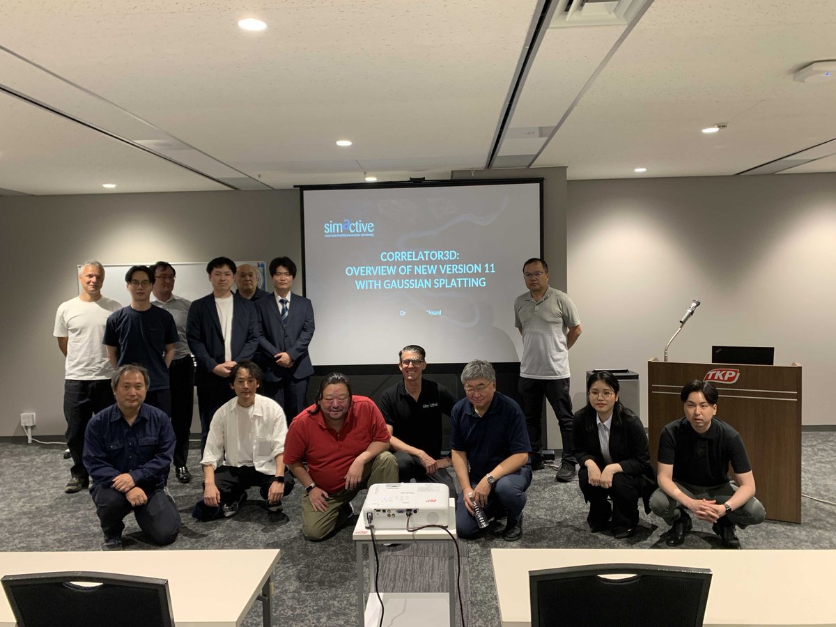
Great seminar in Tokyo with our customers, focused on SimActive’s new Gaussian splatting capabilities in Correlator3D.
Thank you to our partner Mirukuru for organizing the event, and to Shinji Inaba for presenting alongside our CEO Dr. Philippe Simard.
#Photogrammetry #Mapping

9
Jun 10
Accurate volume calculations are critical for effective landfill management. Here's how drone mapping and photogrammetry can help track airspace consumption faster and more efficiently ➡️ hubs.ly/Q04knc0L0
#AerialSurvey #Photogrammetry #RemoteSensing #Mapping #Drones
11
Jun 9
SimActive announces that Correlator3D software is used by Landair Surveys to rapidly generate orthomosaics for planned burns mapping projects across Australia. Learn more: hubs.ly/Q04kHJZ90
#AerialSurvey #Photogrammetry #RemoteSensing #Mapping #Drones
16
Jun 8
Featured in Dronelife: SimActive brings Gaussian splatting capabilities to Correlator3D, expanding new possibilities for photogrammetry and immersive 3D visualization ➡️ hubs.ly/Q04ktqVt0
#AerialSurvey #Photogrammetry #RemoteSensing #Mapping #Drones
13
Jun 7
Mapping with drones: how quickly can you do it? Listen to this podcast episode on the subject➡️ hubs.ly/Q04knvc90
#AerialSurvey #Photogrammetry #RemoteSensing #Mapping #Drones
3
Jun 6
Aerial triangulation plays a vital role in achieving accurate photogrammetric results. Learn more about Correlator3D➡️ hubs.ly/Q04kn8Qw0
#AerialSurvey #Photogrammetry #RemoteSensing #Mapping #Drones
7
Jun 5
Gaussian splatting is the new buzzword everyone is discussing in photogrammetry and mapping ➡️ hubs.ly/Q049qkh70
#LiDAR #mapping #photogrammetry #Correlator3D #drones #gaussiansplats
12
Jun 5
Are you looking to minimize hands-on processing? Read this case study➡️ hubs.ly/Q04kgcTs0 on how to automate processing with scripts.
#AerialSurvey #Photogrammetry #RemoteSensing #Mapping #Drones
6
Jun 4
Download our Photogrammetry Software Buyer’s Guide, a practical resource for evaluating accuracy, speed, scalability, automation, deliverables, and workflow control ➡️ hubs.ly/Q04k3lzK0
#AerialSurvey #Photogrammetry #RemoteSensing #Mapping #Drones
14
Jun 3
Join Erik Birzulis from Landair Surveys to learn how aerial imagery and Correlator3D are used to rapidly generate orthomosaics for planned burns mapping projects across Australia➡️ hubs.ly/Q04j9Lk00
#AerialSurvey #Photogrammetry #Mapping #Drones
8
Jun 2
This is what our users are saying about how Correlator3D’s workflow ensures consistent results➡️ hubs.ly/Q04fYhGq0
#AerialSurvey #Photogrammetry #RemoteSensing #Mapping #Drones
9
Jun 1
Are you looking to process multiple projects continuously? Read this case study➡️ hubs.ly/Q04htpdB0 on processing with scripts.
#AerialSurvey #Photogrammetry #RemoteSensing #Mapping #Drones
12
Jun 1
Correlator3D’s latest feature, Gaussian splats generation, enables users to create high-quality, photo-realistic 3D representations directly from image sets processed in Correlator3D➡️ hubs.ly/Q04jxLn00
#AerialSurvey #Photogrammetry #RemoteSensing #Mapping #Drones
25
May 31
On Pixels & Points: “Does Better Positioning Really Improve Mapping Accuracy?” a discussion on the role of positioning in achieving reliable mapping results. Listen here➡️ hubs.ly/Q04g0ShL0
#AerialSurvey #Photogrammetry #RemoteSensing #Mapping #Drones
9
May 30
In photogrammetry, accuracy often relies on ground control points (GCPs). Learn more about Correlator3D➡️ hubs.ly/Q04f6J3V0
#AerialSurvey #Photogrammetry #RemoteSensing #Mapping #Drones
20
May 29
“Mapping Remote Environments: How Do You Get It Right?” an episode exploring the challenges and best practices for accurate mapping in remote areas. Listen now➡️ hubs.ly/Q04g0ShL0
#AerialSurvey #Photogrammetry #RemoteSensing #Mapping #Drones
6
May 27
This is what our users are saying about how confident they are in Correlator3D’s workflow. Learn more about the software➡️ hubs.ly/Q04f6J3V0
#AerialSurvey #Photogrammetry #RemoteSensing #Mapping #Drones
18