
Western USA Weather, with a focus on Southern California
- Tweets 9,468
- Following 360
- Followers 6,150
- Likes 12,215


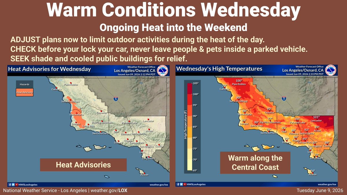
ALT High pressure combined with offshore winds will lead to significant warming on Wednesday, especially for coastal portions of Santa Barbara and San Luis Obispo Counties. Prepare for the heat by adjusting plans to avoid the outdoors during the peak heat of the day, and seek air conditioning and shade. Always check before leaving your vehicle, that no one was left inside. Parked vehicles can become hot rapidly, and endanger anyone left inside.

ALT High temperatures across Southern California on Thursday.

ALT High temperatures across Southern California on Friday.
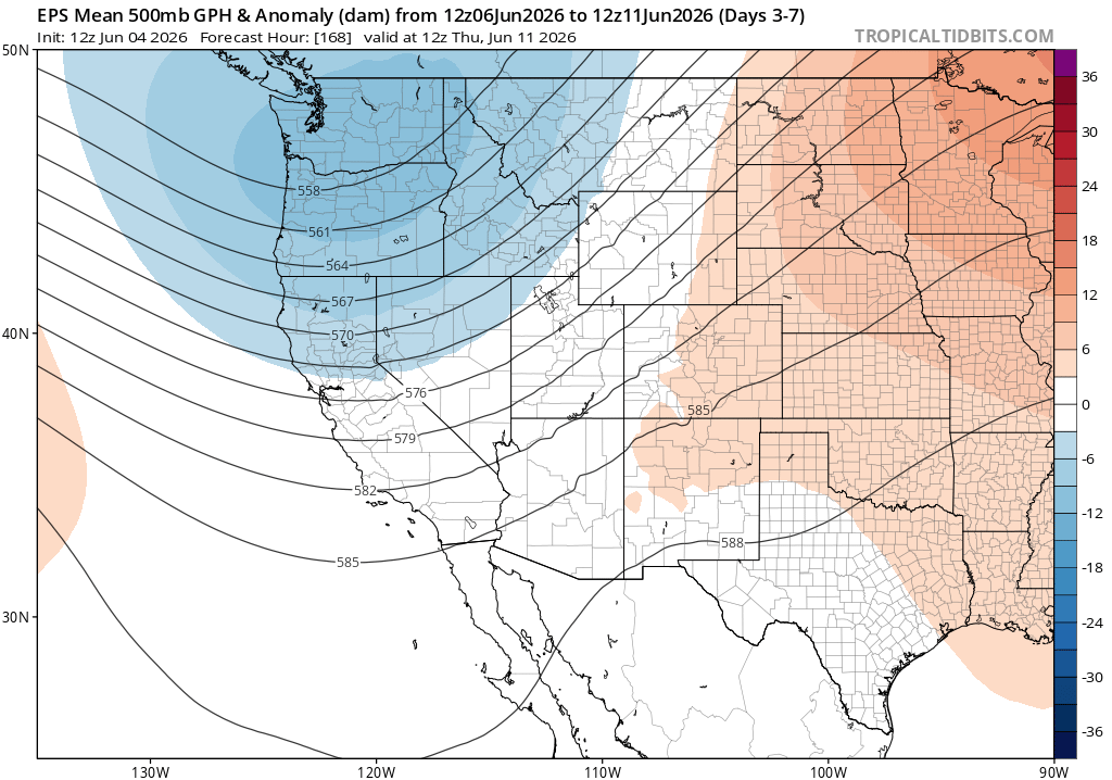
ALT Map plot of Western U.S. 500mb GPH anomalies (5 day average) showing a trough along the West Coast over the coming week as predicted by ECMWF ensemble.
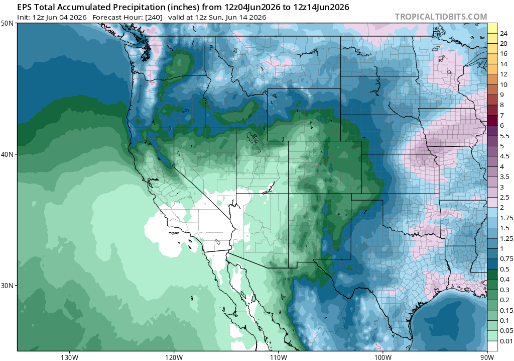
ALT Map plot of Western U.S. accumulated precipitation showing 1-2 inches of accumulation in the PacNW and less than 0.5 inches over the next 10 days over far northern CA, as predicted by ECMWF ensemble.

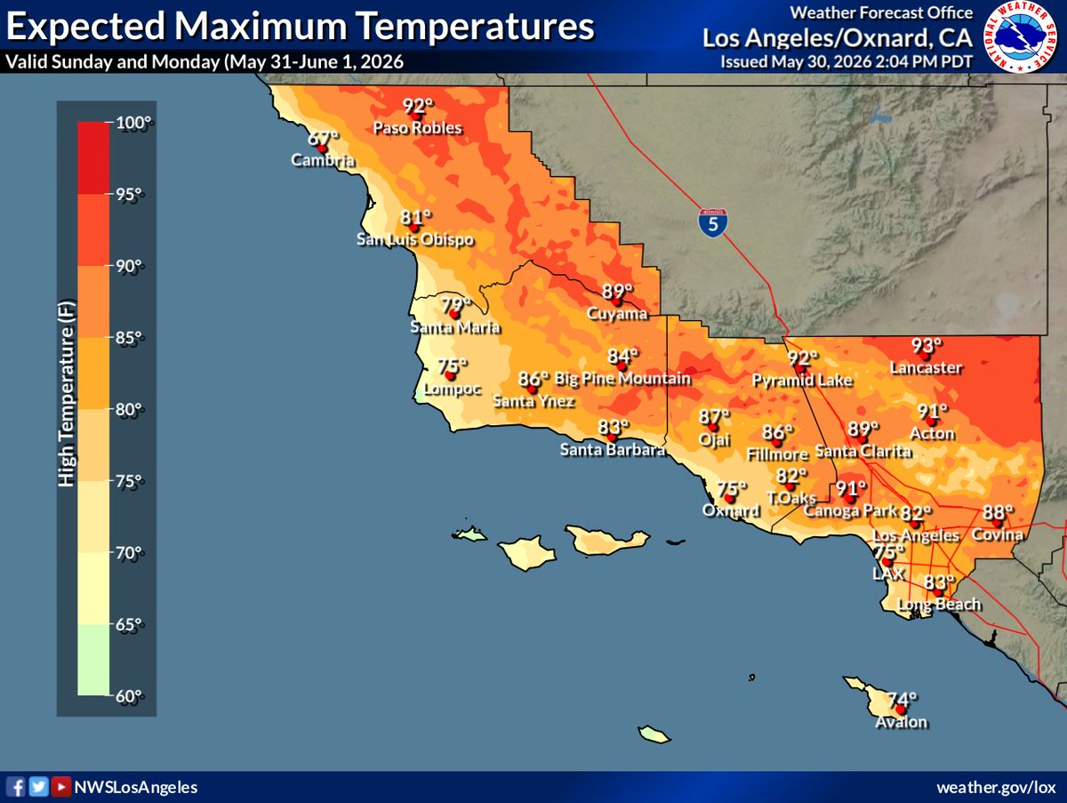
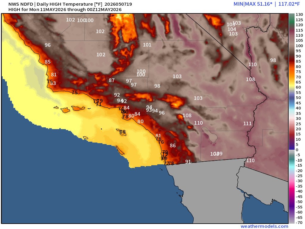
ALT Expected high temperatures Sunday through Monday
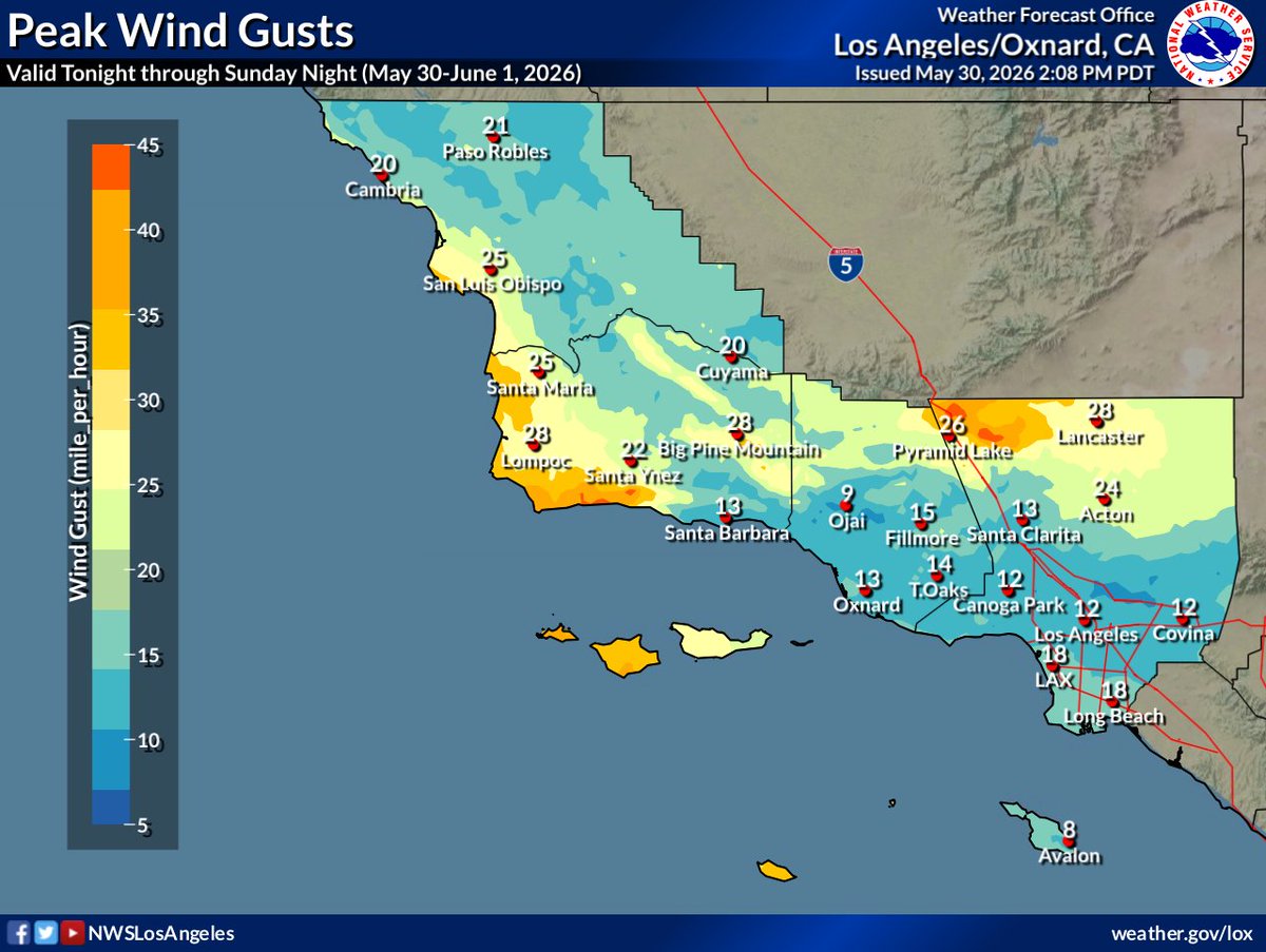
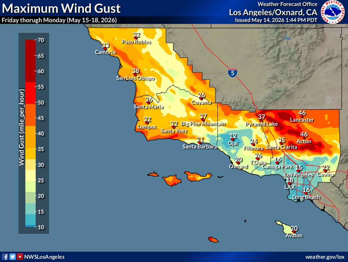
ALT Expected peak wind gusts tonight through Sunday night


ALT Gusty west winds across the mountains and deserts. Peak gusts near 60 mph in some mountain passes. Drive with care.


ALT Peak wind gusts expected this weekend

ALT Current wind hazards across the area

ALT Peak wind gusts expected this weekend
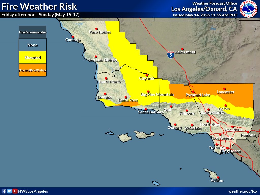
ALT Fire Weather risk this weekend