
20 | ✝️ | Severe Weather Analysis | National Wx: @weathertrackus
Joined September 2016
- Tweets 22,321
- Following 112
- Followers 3,720
- Likes 13,377
7,029 Photos and videos


Pinned Tweet

Apr 22
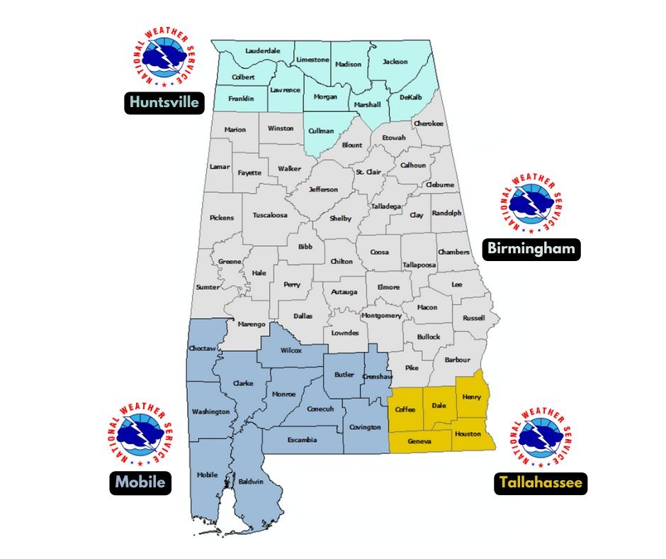
🧵ALABAMA Wx - Accounts to Follow!
National Weather Service Offices:
North AL: @NWSHuntsville
Central AL: @NWSBirmingham
Southwest AL: @NWSMobile
Southeast AL: @NWSTallahassee
Map attached below. Find your county, and follow your respective NWS WFO.
3
1
20
12,201
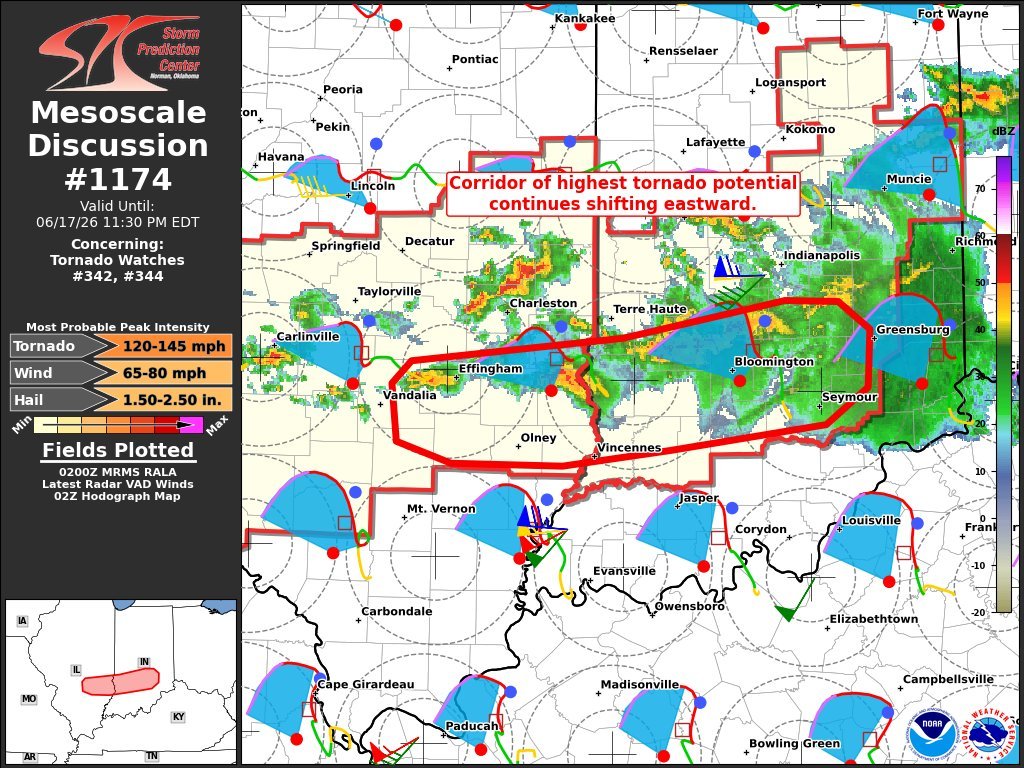
120-145mph on supercells with a history of likely intense tornadoes, but 140-170mph on an elevated MCS... That's slightly interesting

1
2
45
1,291
I'm gonna start trusting the Euro precip output more often at this point
Jun 14

may be in question due to a mess of storms firing along and north of it, given strong boundary-parallel flow.
Even though heights may be neutral to rising through the day, forcing may still be strong enough to initiate lots of convection near boundaries.
2/
1
32
3,573
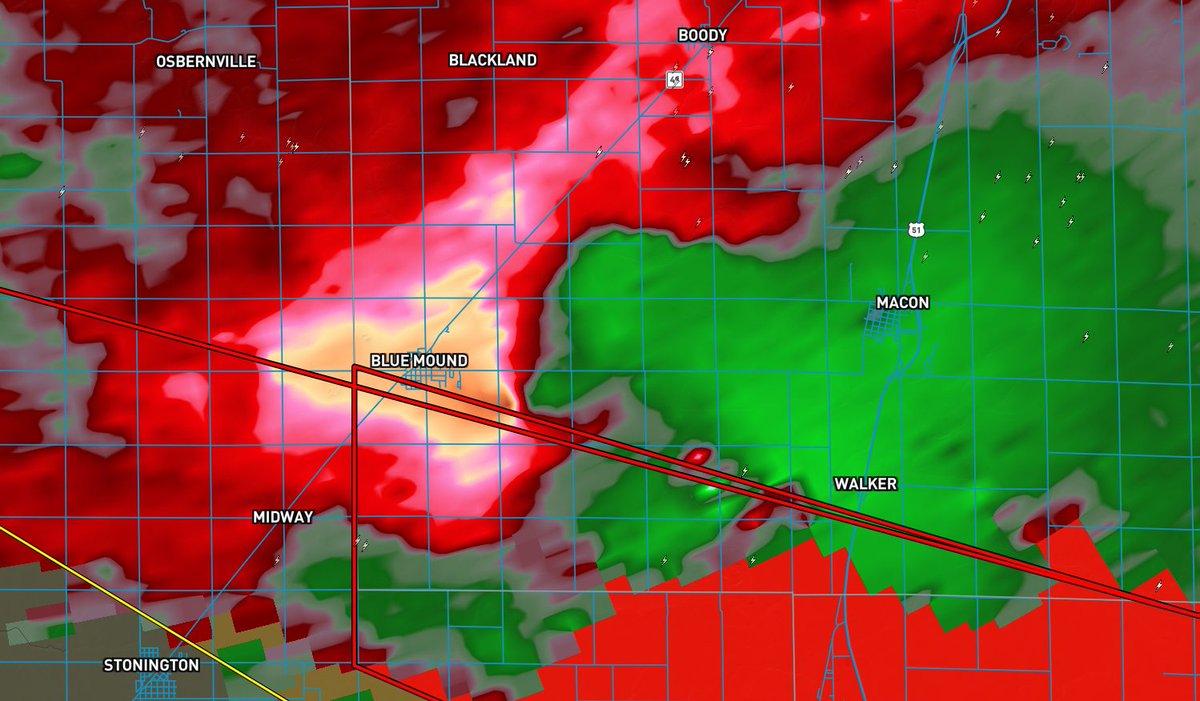
Supercells developing in a rapidly destabilizing airass in Western IL this afternoon...
Two questions remain regarding the EF2-EF3 tornado threat:
1. Will storms remain at least semi-discrete?
2. Will storms stay within the less veered flow, in a high-shear environment?
5
70
4,471

14h
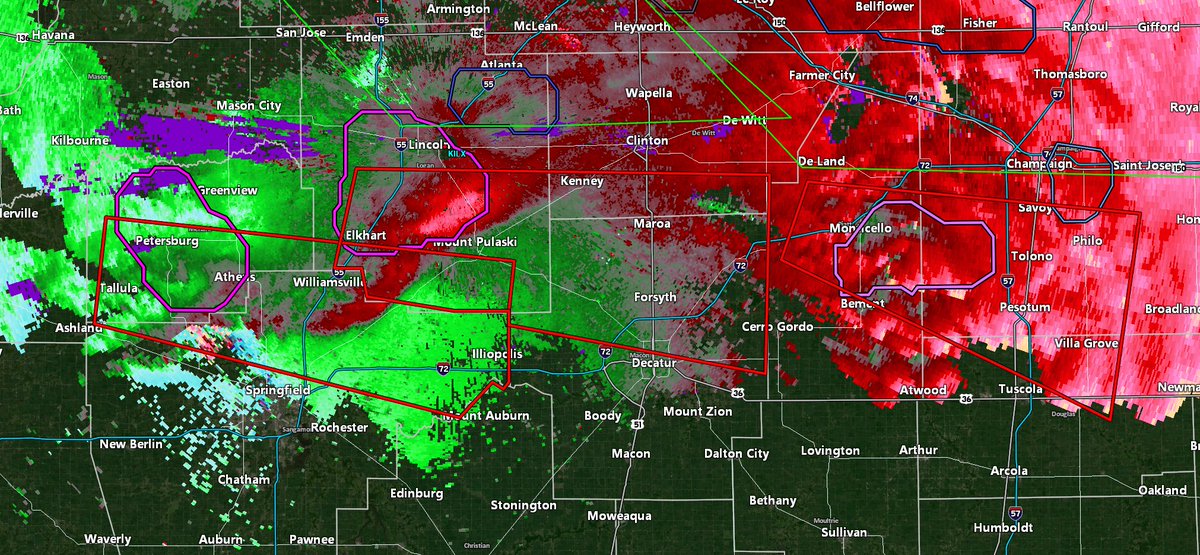
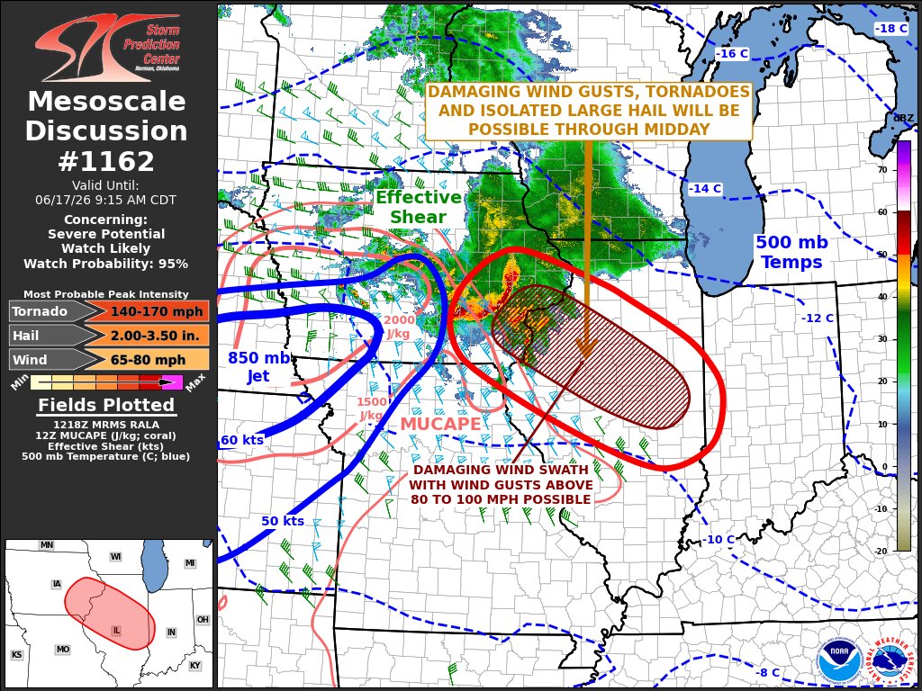
Already a pretty good deal of airmass recovery behind this morning's MCS, which is moving pretty quickly.
The MCS in IL is still packing quite a punch, but may be starting to show some signs of becoming a little less organized. It is entirely synoptic driven as the air is stable
5
9
145
10,614
15h
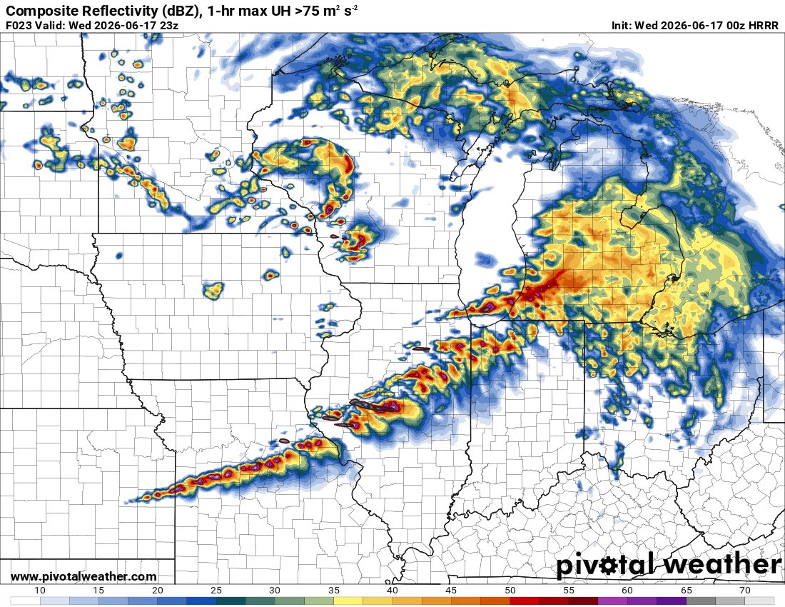
140-170mph tornadoes with an MCS

1
13
1,749
Jun 17
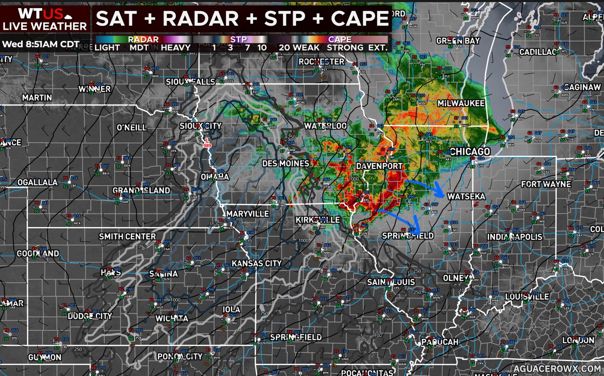
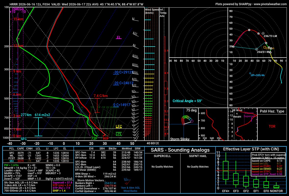
Initial impressions from the 00z HRRR:
Morning convection is more widespread and farther south, but mass response is much stronger, quickly bringing in robust moisture right behind that activity. However, the recovery window is quite short, and destabilization is modest-moderate
5
4
103
12,250
Jun 17
Initiating boundary orientation is very unfavorable for robust tornadic supercells, although the HRRR depicts at least a couple cells maturing and sustaining, but the rest get shredded.
Of course, this is just one output and definitely not final, these are just 1st impressions.


1
3
24
1,690
Jun 17
Time-lapse of the tornado (likely just a wall cloud/funnel through this timelapse) near Cloverdale, IN a few moments ago.
1
2
25
2,051
Jun 16
If there's one major concern I have human impact wise other than the fast storm motions for tomorrow... It's the potential for the significant tornado threat to persist after dark.
Wind shear will not wane, and instability could remain sufficient for a few nocturnal SigTors.
3
5
80
11,855
Jun 16
yeah we know

Something bad is about to happen.
Something very, very bad is about to happen.
Buckle up.
40
2,923
Jun 16
Could be biases or a fluke, but the RAP/HRRR (seen it on the NAM as well in some places) have a bit of a warm nose between 850-700mb. While this may not completely limit the tornado threat, given extreme shear will compensate, it could limit pre-frontal supercell development.

2
1
64
4,441
Jun 16
Obviously, still being about 30 hours out, I wouldn't overanalyze this or take it too seriously, but I have noticed that models that show inversions like this sometimes tend to be correct in some way. We'll see if that's the case tomorrow...
2
5
783
Star retweeted

Jun 16
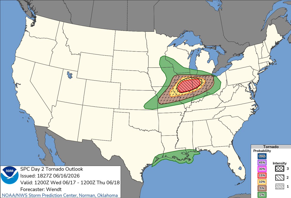
A Tornado Outbreak is likely across parts of the Midwest tomorrow (Wed, Jun 17).
Multiple rounds of storms are expected, with the morning round mostly being a wind, hail, and flooding risk. The afternoon/evening round will contain the greatest threat for significant tornadoes (EF3 ), very large hail (2" ), and damaging winds (70mph ).
There remains some uncertainty regarding the convective evolution and the thermodynamic environment, but this is a very rare parameter space for the region in June. Winter-time extreme kinematics with Spring-Summer thermodynamics (assuming sufficient destabilization) will create a very high-end environment, capable of supporting the aforementioned hazards.
Those in the risk area(s) should be prepared for a potentially significant outbreak of severe storms and tornadoes tomorrow.
1
26
142
8,930