
From WTNH-TV News 8 in New Haven. Severe weather coverage you can count on in Connecticut.
Joined January 2009
- Tweets 15,914
- Following 53
- Followers 49,143
- Likes 93
1,826 Photos and videos


WTNH Storm Team 8 retweeted

14 Mar 2023
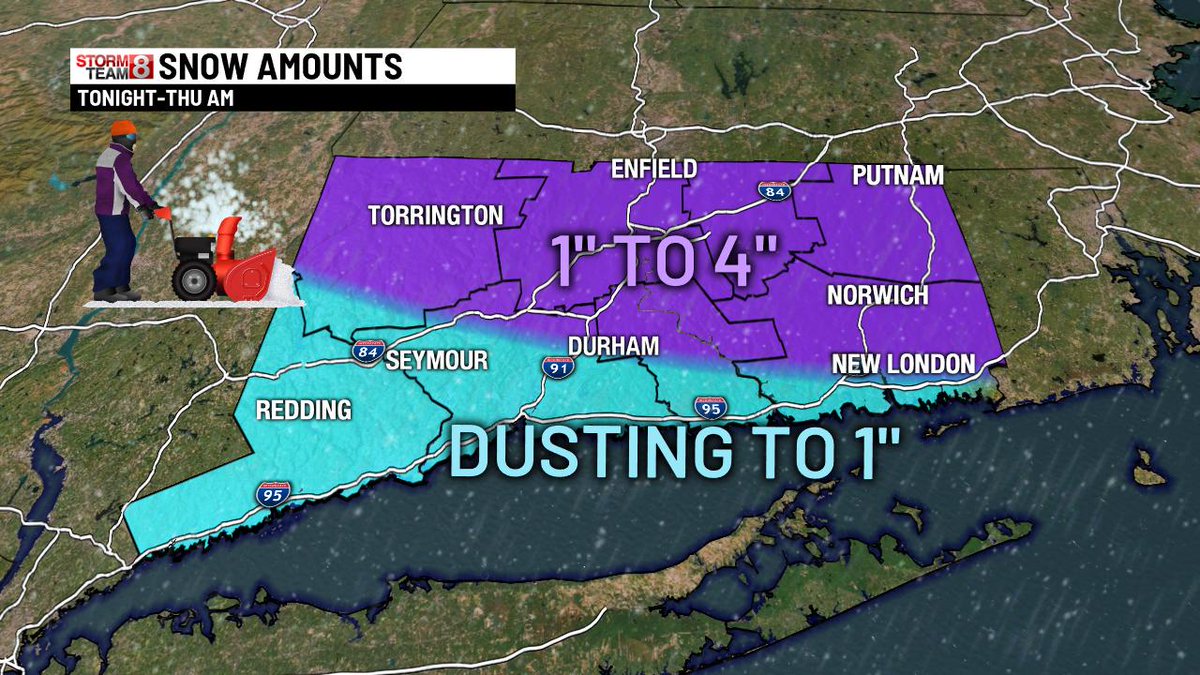
What do you have for snow totals? Make sure to include your town too! @WTNH
25
3
28
16,548
WTNH Storm Team 8 retweeted
26 Nov 2022
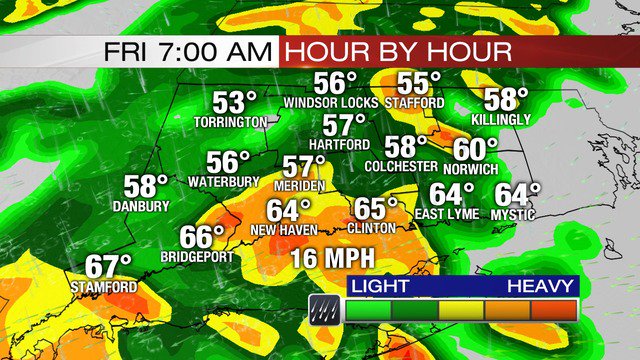
No newscast at 6 again tonight, but we're still updating the app for you all night long! We have rain moving in tomorrow. The morning looks dry but the afternoon is a washout. Here's the timing:
1
3
12
WTNH Storm Team 8 retweeted
21 Aug 2021
Important info for those of you at the shoreline tomorrow! Here are the high tide times for the morning/early afternoon!
6
10
43
WTNH Storm Team 8 retweeted
14 Jul 2021
There is going to be this ORB showing up in the sky this afternoon. Don't look at it directly, it's called the sun and it can hurt your eyes badly!
9
9
49
WTNH Storm Team 8 retweeted

16 May 2021
Tides rising on the CT shoreline at a faster rate. New models showing what the shoreline might look like if these trends continue. Will some areas disappear? @StormTeam8 @SamKantrow has some answers, coming up Monday at 11 p.m. on News 8.
5
2
8
WTNH Storm Team 8 retweeted
21 Feb 2021
Winter...
68%
I'm SO over it
32%
Keep it coming!
320 votes • Final results
4
2
3
WTNH Storm Team 8 retweeted
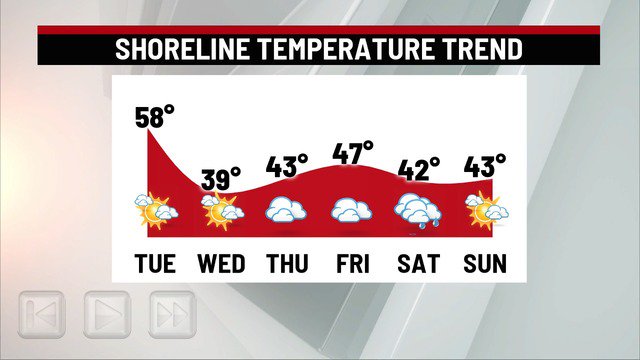
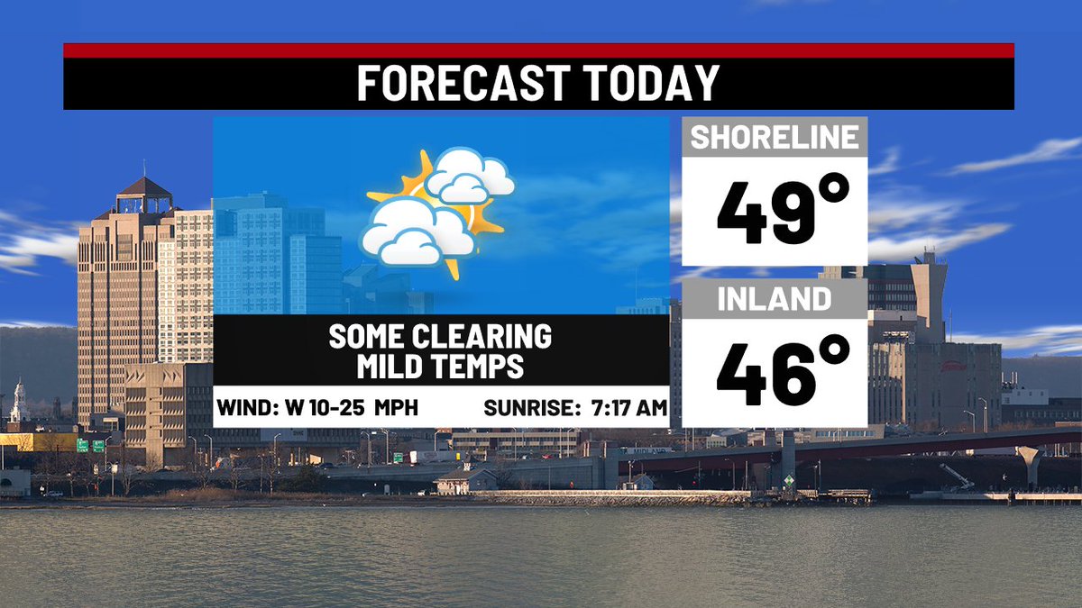
28 Dec 2020
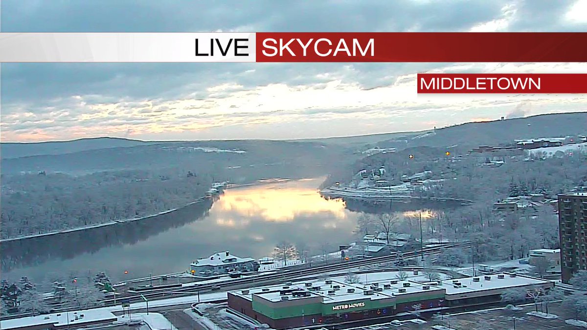
Skies starting to clear up right now across the state. Near 50 today, chilly for a few days, and then another storm around New Year's.
2
3
10
WTNH Storm Team 8 retweeted
28 Dec 2020
Hope you enjoyed the weekend. It'll be milder tomorrow but with more clouds. Still looks like rain for NYE/Day.
2
6
WTNH Storm Team 8 retweeted
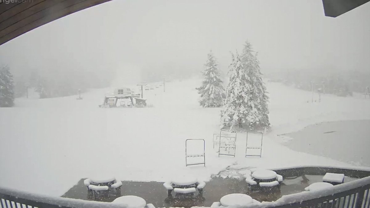
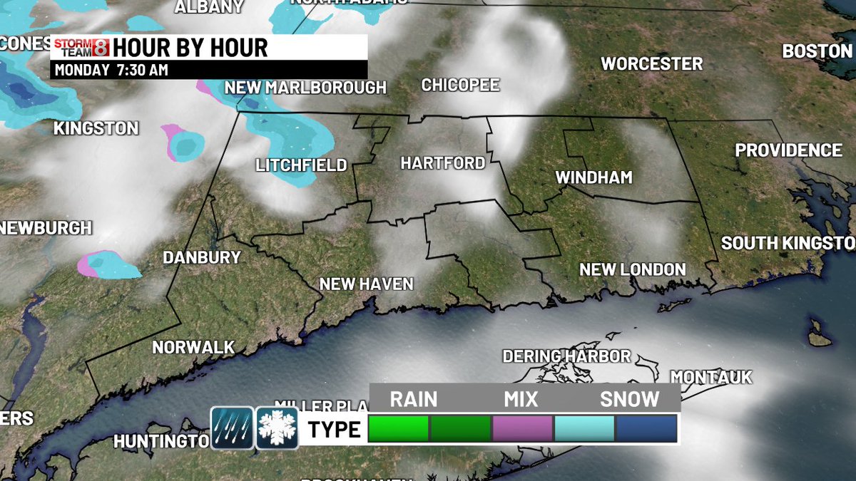
15 Dec 2020
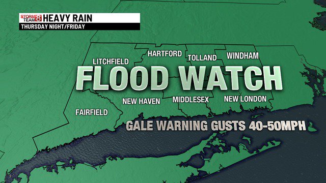
Some noon-time changes:
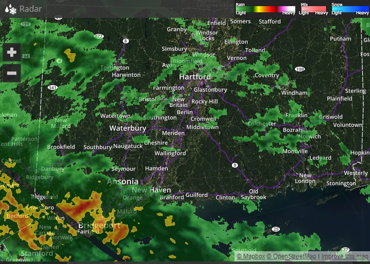
Afternoon updates coming in with more sleet which could lower totals at the shore and bring the bullseye around I-84. If this trend continues, we'll have to lower totals at the shore and keep everything else the same. Stay tuned!
6
5
11
WTNH Storm Team 8 retweeted
13 Dec 2020
Here is the latest on the storm coming for Wednesday. I'll be live on Facebook at 8pm with the latest on this. We can talk totals too!
5
4
20
WTNH Storm Team 8 retweeted
13 Dec 2020
It's not a big storm tomorrow but there will be some slick roads out there. Here is the timing and totals. The big storm is still a HIT for Wednesday night/Thursday. I'll have more on that at 6 tonight.
2
3
18
WTNH Storm Team 8 retweeted
13 Dec 2020
It's too early to lock anything in, but here is what we do know about the storm next week! We'll keep you updated each day with changes.
6
25
WTNH Storm Team 8 retweeted
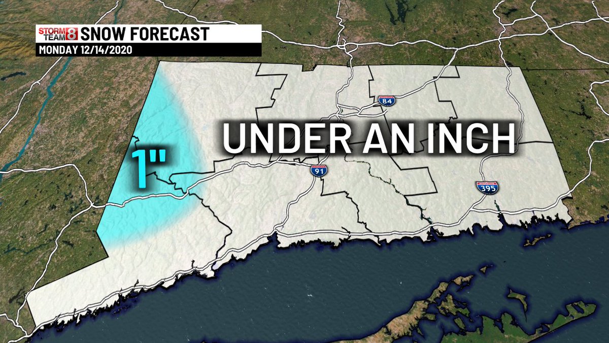
13 Dec 2020
Monday snow looking a little less. It won't be much, but could cause some school issues. Wednesday is just...yeahhhhhh.
5
5
30
WTNH Storm Team 8 retweeted
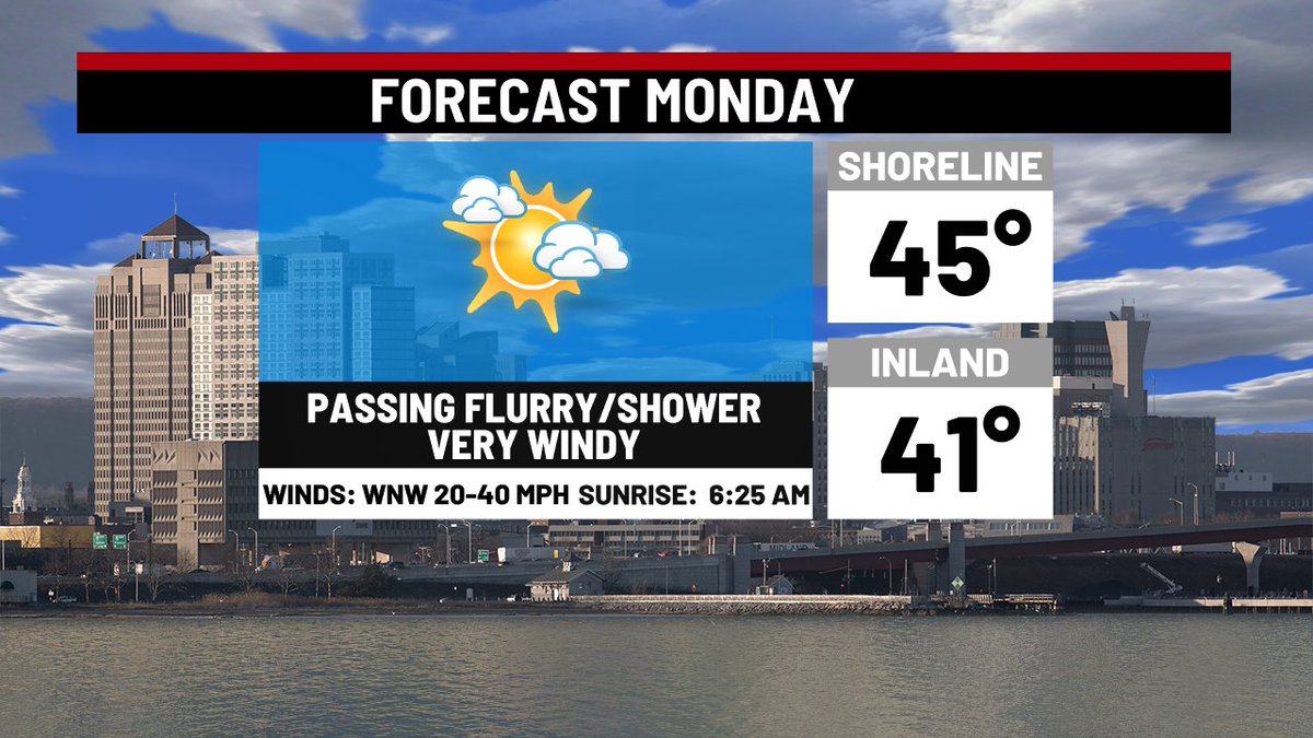
1 Nov 2020
Here's everything you need to know about Monday. Very chilly, very windy, and a few snow showers possible! If you missed the extended forecast, we have warmer and dry weather on the way!


2
13
WTNH Storm Team 8 retweeted
29 Aug 2020
Here's the line we're watching as it slowly moves towards the state.

2
6
WTNH Storm Team 8 retweeted
29 Mar 2020
I'm bored...we're all bored. Tell me what you're doing to pass the time these tough days! bit.ly/ctwxman
17
1
10
WTNH Storm Team 8 retweeted
7 Mar 2020
Sun is already up, but it won't be tomorrow. I love the 7pm sunset but having a baby who wakes up early has made me appreciate when it's light early. So that poses the question, should we bother with daylight saving time?
29%
Keep it
71%
Do away with it!
179 votes • Final results
7
1
5
WTNH Storm Team 8 retweeted

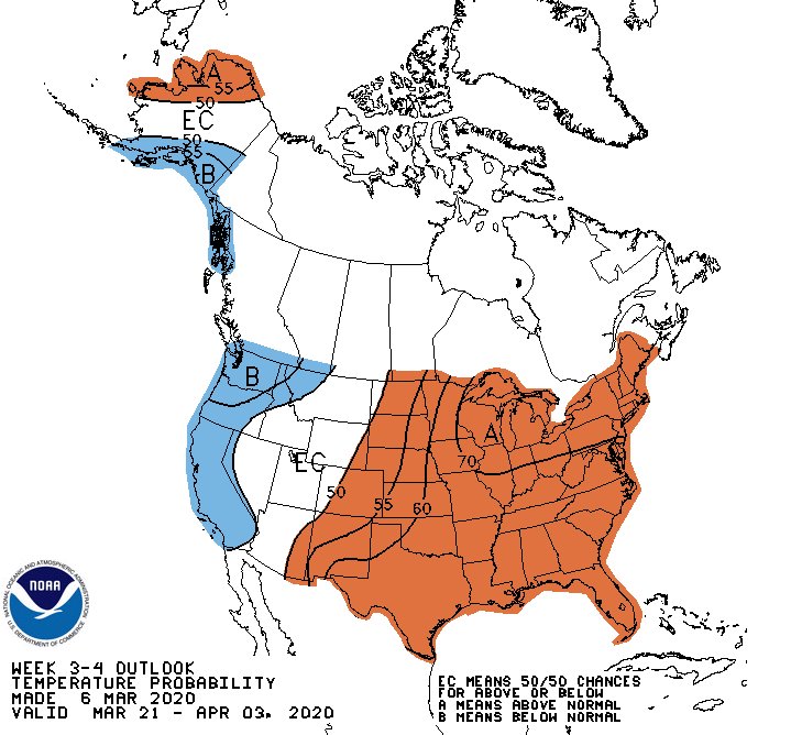
8 Mar 2020
[Long Range Forecast] #SpringFever? Latest week 3-4 outlook from @NWSCPC indicates a 70% chance of above normal temperatures across #MA #RI #CT from March 21st thru April 3rd. The normal high/low for this time period is roughly 50/35. #Boston #Providence #Hartford #Worcester
2
9
33
WTNH Storm Team 8 retweeted
24 Feb 2020
Remember the weekend and Monday when it's gross and rainy on Wednesday evening. And when it's 12 degrees Sunday morning! Take the good with the bad friends.
3
2
9
WTNH Storm Team 8 retweeted
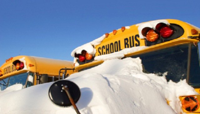
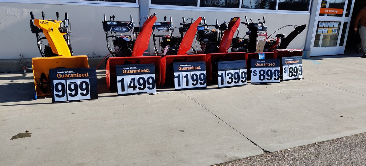
19 Feb 2020
It's a bad winter to be a snowblower salesman! These things are just collecting dust.
3
6
30