
Joined March 2011
- Tweets 8,664
- Following 1,561
- Followers 5,574
- Likes 25,450
1,377 Photos and videos


Pinned Tweet
SPC Nation⚡️ The job's not done until we bring back a High Risk! 🟪
I'm staying home!🌪
DMs are closed Please respect my decision 🙏
-Lyons
#AGTG✝️
#blessed
#stayinghome

24
29
291
46,091
TwisterKidmedia retweeted

Jun 15
I was told by certain meteorologist that the watch wasn't necessary and it would just be plain rain. Some people just get a kick out of bashing the SPC and NWS all the time. 🤷♂️

3
3
31
5,868
TwisterKidmedia retweeted

Jun 12
There are other events from the past week that are close to criteria and are still being evaluated. We will provide more information on those once initial analysis is complete.

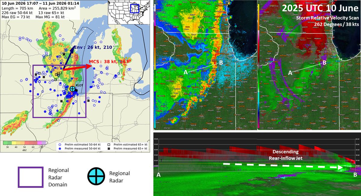
The damaging wind swath from Wednesday, June 10 has been preliminarily confirmed as a derecho.
The wind swath had a track length over 400 miles with a footprint just under 100,000 square miles. The strongest known gust was measured at over 94 mph.
5
11
78
5,311

Jun 11
Jun 11

Sorry for radio silence, nonstop, filming tornadoes with my jaw on the floor in North Central Illinois.
19
1,596
TwisterKidmedia retweeted

Jun 11


31
362
2,256
140,326
TwisterKidmedia retweeted

Jun 11
LARGE AND POWERFUL TORNADO IN WASHBURN, IL #ilwx @NWSLincolnIL
19
312
1,333
78,266
TwisterKidmedia retweeted

Jun 11
This is how we efficiently report to local WFOs! While putting something like #MOwx is decent, tagging them directly is even better whilst making a report!
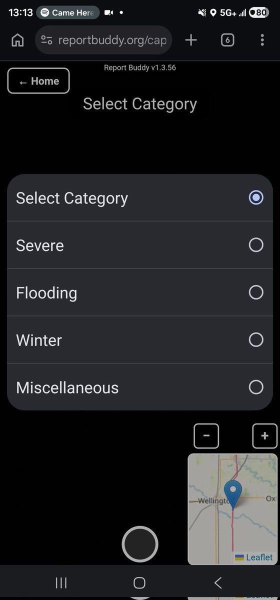
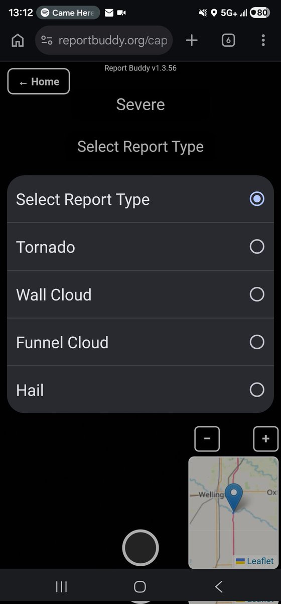
This is also a reason why @TwoDogsWx and I built Report Buddy!!! reportbuddy.org/
Jun 11

Low rapidly rotating wall cloud on Hwy 136 west of Livonia MO at 9:35 unable to confirm ground contact due to heavily forested area … rotation still evident at time of tweet @NWSKansasCity
5
37
3,526
TwisterKidmedia retweeted

Jun 10
39
315
1,675
86,812
Happy 8th anniversary to this banger. Stay humble kids. I still have nightmares about screwing up this chase and missing the tornado of a lifetime.
Video from James Hammet
youtu.be/LGcGFU_Hi9U?si=Ge15…
6 Jun 2018

Nope nu uh not gonna fall for it #2018. I will not waste time chasing in the mountains.

2
18
2,250
TwisterKidmedia retweeted
May 18
Chasers! Since we're going to be chasing & spotting storms that may cross several CWAs in their lifespan, use Report Buddy to help you get reports out to our NWS colleagues!
Report Buddy automatically detects your location and nearest CWA when submitting reports, you can use a menu drop-down to select from various report types!
reportbuddy.org/ @TwoDogsWx
2
7
36
5,679
TwisterKidmedia retweeted
May 17
I see lots of reports to both NWS Omaha and NWS Hastings for the one tornado, Report Buddy automatically detects what CWA youre in!
You can also use our drop-down and photo feature to easily report severe hazards!
reportbuddy.org/ @TwoDogsWx


5
24
2,742
TwisterKidmedia retweeted
May 13
HREF/SREF/NAM retirement:
I have seen some people provide some clarity on aspects of this, but since this is something at the SPC we have been working with for awhile, I wanted to address all aspects of this in one spot.
🧵
38
123
413
64,573
TwisterKidmedia retweeted
May 4
Excited to announce my (ongoing) partnership with Andrew Lyons )@TwoDogsWx) of our continued development of Report Buddy!
Report Buddy is designed to help storm spotters report hazardous weather more efficiently, allowing storm spotters to select from a drop-down of various reports and Report Buddy will generate pre-made text for them to copy to Facebook or X.
We've made several changes lately, including creating a PWA that can be downloaded onto mobile devices! You can also now directly copy your coordinates instead of having to make a full report to retrieve them, improvement to the quality of photos that're processed and improvements to load location services faster.
Thank you to those who already use Report Buddy, and for those newcomers we reach with this post, I'd love to hear your feedback on how we can improve Report Buddy and make your reporting easier!
reportbuddy.org/

3
7
58
5,922
TwisterKidmedia retweeted

Apr 28
This cluster of storms approaching SE Missouri bears close watching. As long as they remain at least semi-discrete, they will start to feel the effects of an accelerating nocturnal LLJ and pose a risk for (potentially strong) tornadoes.

1
10
71
3,443
Apr 27
I would pay close attention to these two supercells over the next few hours. Visually robust rotating updrafts moving into a high STP (3-5) this evening. If they remin cellular I'd expect significant tornado potential with them in the next couple of hours.

4
12
117
9,009
TwisterKidmedia retweeted

Severe weather, including the potential for multiple strong (EF2) to intense (EF3) tornadoes, expected today across parts of central and southeast Missouri into southern Illinois.
4
97
428
49,279
TwisterKidmedia retweeted
Apr 27
Thank you everyone who joined the @NWSSPC live stream earlier!
That went way smoother than I expected for a first time. Will only get better from here. I hope everyone stays safe today!
16
26
432
15,438
TwisterKidmedia retweeted

Apr 26
Today's severe weather setup is one with higher than usual uncertainty in timing/location, but the potential to ramp up quite quickly. Make sure you have a sheltering plan in place and are monitoring the weather this afternoon and evening. #okwx #texomawx
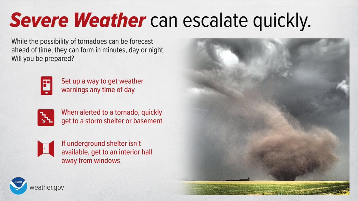
ALT Severe weather safety
3
21
102
11,424
Apr 26
I will not tolerate disparaging remarks about individual forecasters, questioning competence, or anything the like.
We deal with a mountain of crap from unqualified and outright hostile people daily. Forecasts are imperfect because the data is imperfect. Show some respect.
44
100
624
34,444
TwisterKidmedia retweeted

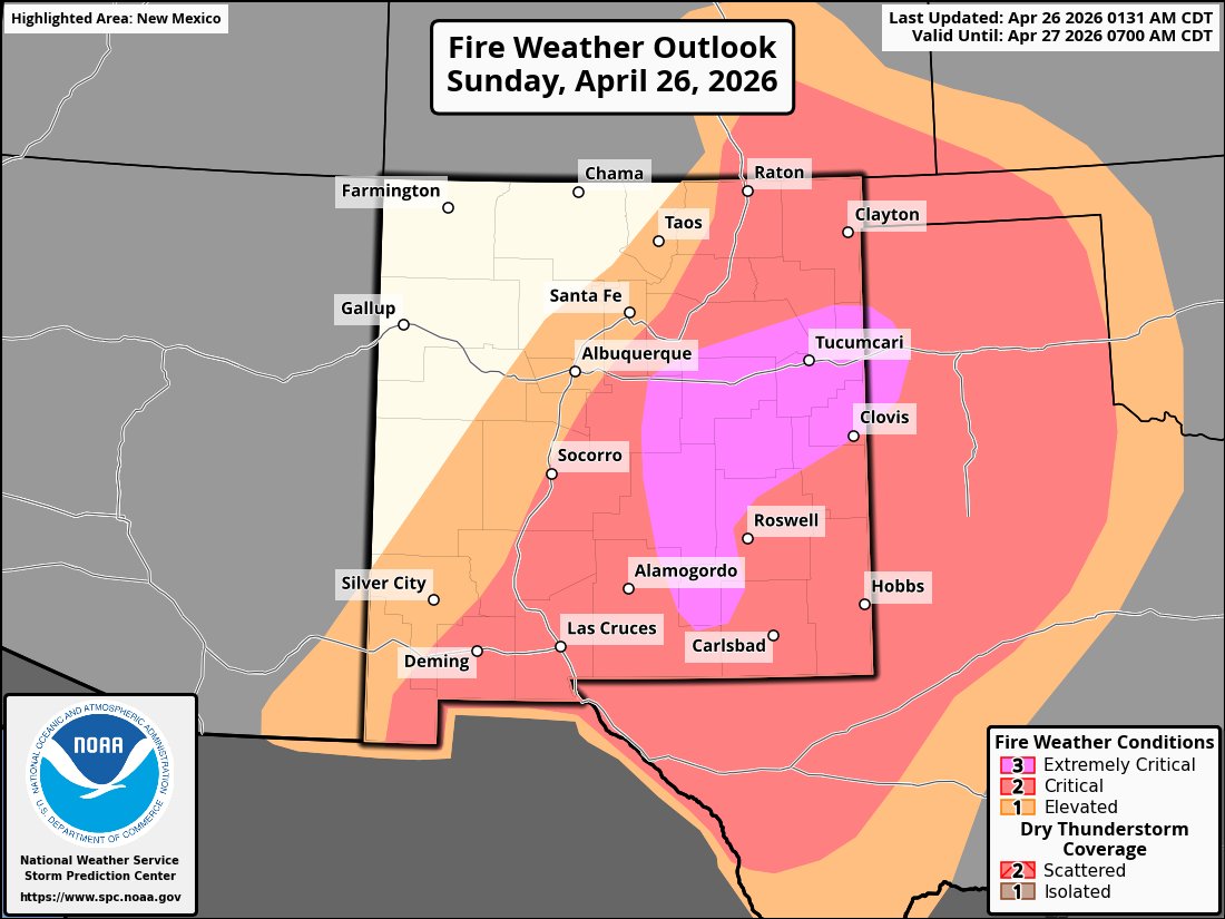
*EXTREME* fire weather conditions will develop Sunday afternoon across eastern New Mexico with southwest wind gusts as high as 60 mph, low relative humidity, and dry conditions. This is the first Extremely Critical outlook in New Mexico in 364 days. #NMFire #NMwx
5
10
56
3,322
Apr 26
RT @themattphelps: It’s ridiculous how much crap the SPC and NWS get from fellow weather enthusiasts on here. Everyone thinks they know bet…
35