
We help connect students, employees, local residents, and visitors with the resources and information they need to stay safe and enjoy our thriving city.
- Tweets 966
- Following 24
- Followers 795
- Likes 16


ALT This graphic displays a severe thunderstorm warning plotted on a map. The warning is in effect until 9:00 PM CDT. The warning includes Chicago IL, Cicero IL and Orland Park IL. This warning is for Southeastern Lake County Is Cancelled. The threats associated with this warning are wind gusts up to 80 MPH and pea sized hail. There are 2,819,430 people in the warning along with 808 schools and 44 hospitals.


ALT This graphic displays a severe thunderstorm warning plotted on a map. The warning is in effect until 9:00 PM CDT. The warning includes Chicago IL, Cicero IL and Evanston IL. This warning is for Southeastern Lake County in northeastern Illinois and Cook County in northeastern Illinois. The threats associated with this warning are wind gusts up to 70 MPH and pea sized hail. There are 4,779,400 people in the warning along with 1252 schools and 74 hospitals.
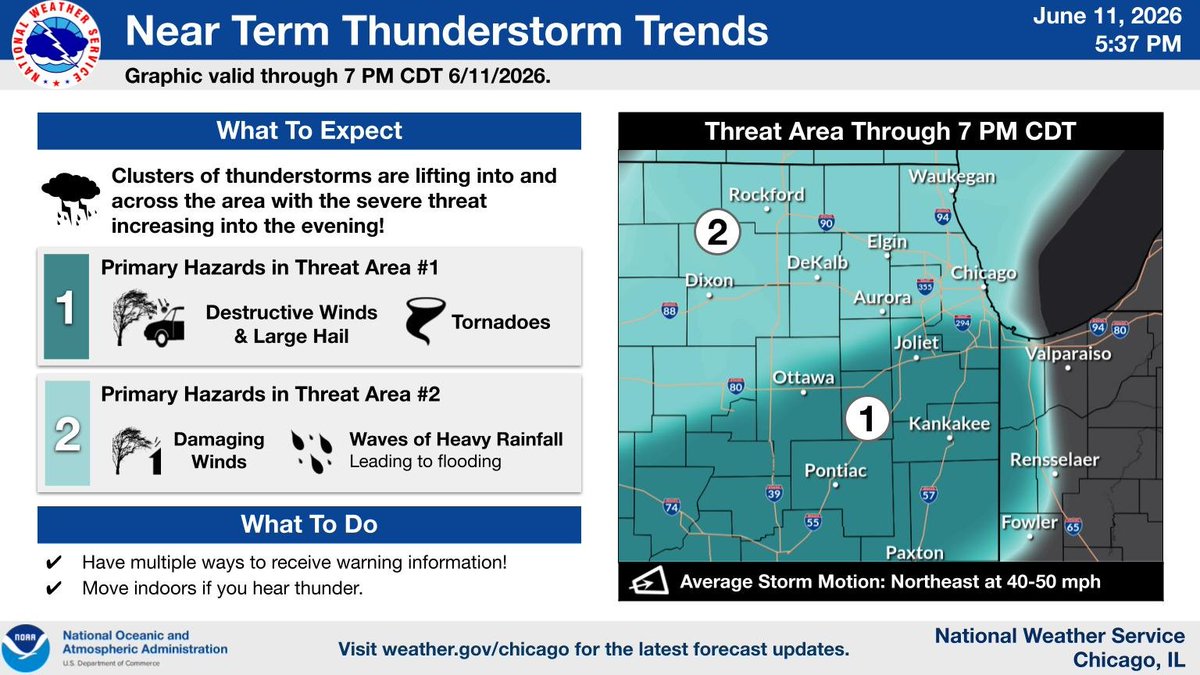
ALT Headline: Near Term Thunderstorm Trends. Sub Headline: Graphic valid through 7 PM CDT 6/11/2026. What To Expect. Clusters of thunderstorms are lifting into and across the area with the severe threat increasing into the evening! Primary Hazards south of Ottawa to Chicago line in Illinois. Tornadoes. Primary Hazards north of that line in Illinois. Damaging Winds. Waves of Heavy Rainfall. Leading to flooding. What To Do. Have multiple ways to receive warning information! Move indoors if you hear thunder. Threat Area Through 7 PM CDT. Graphic Created: Thursday, June 11, 2026 5:20 PM CDT.
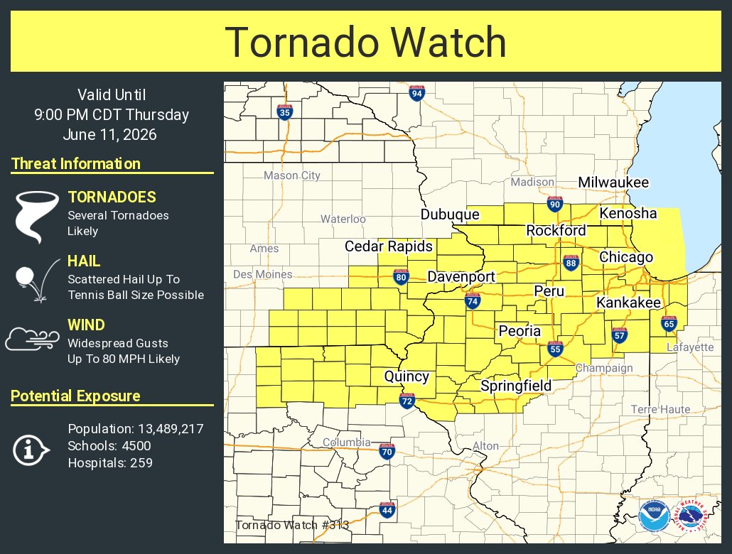
ALT This graphic displays Tornado Watch watch number 313 plotted on a map. The watch is in effect until 9:00 PM CDT. The watch includes parts of Illinois, Indiana, Iowa, Missouri and Wisconsin. The threats associated with this watch are several tornadoes likely, scattered hail up to tennis ball size possible and widespread gusts up to 80 mph likely. There are 13,489,217 people in the watch along with 4500 schools and 259 hospitals.
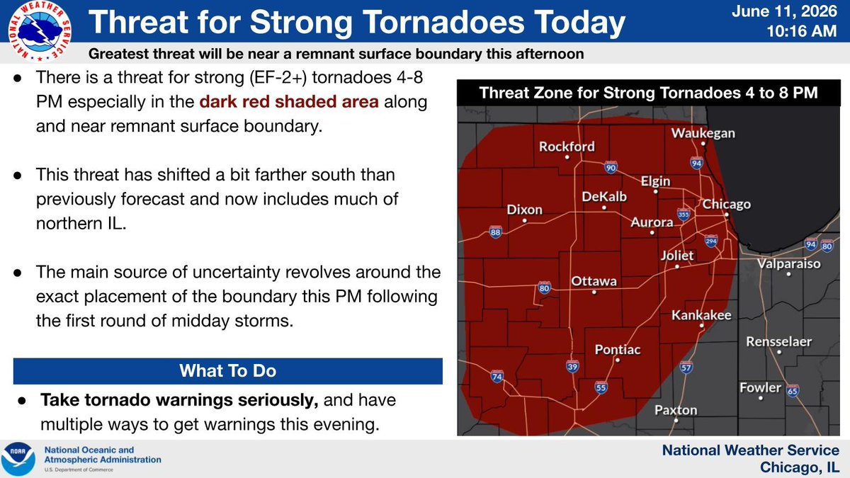
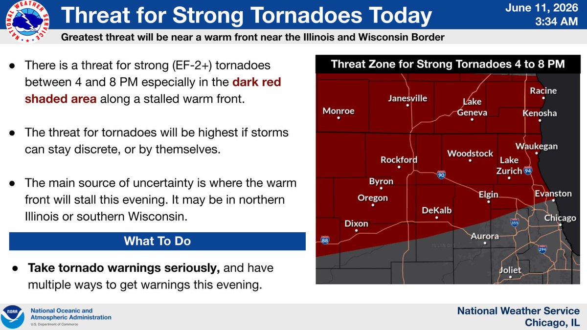
ALT Headline: Threat for Strong Tornadoes Today. Sub Headline: Greatest threat will be near a remnant surface boundary this afternoon. There is a threat for strong (EF-2 ) tornadoes between 4 and 8 PM especially in the dark red shaded area along a stalled warm front. The threat for tornadoes will be highest if storms can stay discrete, or by themselves. The main source of uncertainty is where the warm front will stall this evening. It may be in northern Illinois or southern Wisconsin. Threat Zone for Strong Tornadoes 4 to 8 PM. What To Do. Graphic Created: Thursday, June 11, 2026 5:02 AM CDT
ALT National Weather Service alert: Strong (EF-2 ) tornado threat for June 11, 2026, 4-8 PM, near the Illinois/Wisconsin border. Map shows a dark red threat zone covering cities like Chicago, Rockford, Janesville, and Racine. Take warnings seriously.
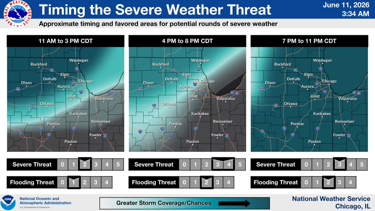
ALT NWS severe weather threat timing for June 11, 2026, 3:34 AM. Three maps show storm progression: 11 AM-3 PM (Severe 2, Flood 1), 4 PM-8 PM (Severe 4, Flood 2), and 7 PM-11 PM CDT (Severe 3, Flood 2). Maps indicate increasing storm coverage for Chicago, Rockford, Joliet, and surrounding areas.

ALT This graphic displays a severe thunderstorm warning plotted on a map. The warning is in effect until 4:30 PM CDT. The warning includes Chicago IL, Naperville IL and Waukegan IL. This warning is for Lake County in northeastern Illinois, DuPage County in northeastern Illinois and Cook County in northeastern Illinois. The threats associated with this warning are wind gusts up to 70 MPH and pea sized hail. There are 6,408,317 people in the warning along with 1560 schools and 88 hospitals.
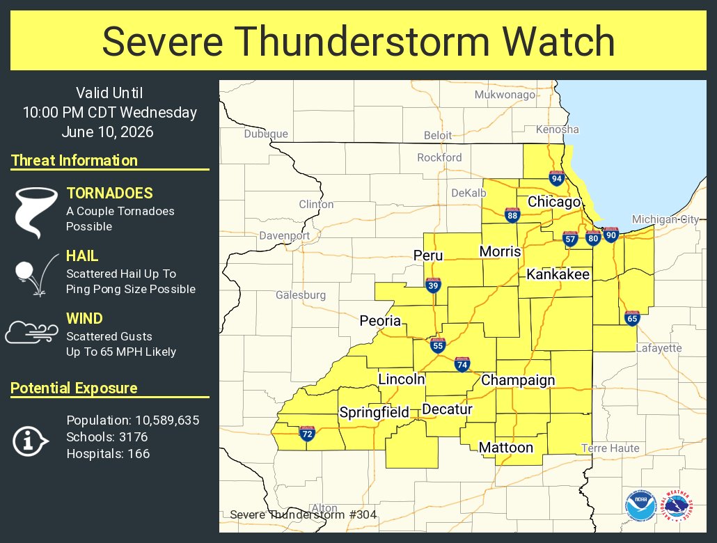
ALT This graphic displays Severe Thunderstorm watch number 304 plotted on a map. The watch is in effect until 10:00 PM CDT. The watch includes parts of Illinois and Indiana. The threats associated with this watch are a couple tornadoes possible, scattered hail up to ping pong size possible and scattered gusts up to 65 mph likely. There are 10,589,635 people in the watch along with 3176 schools and 166 hospitals.
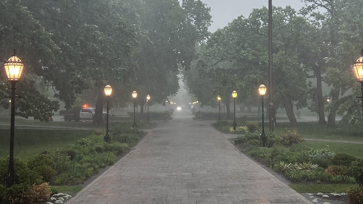
ALT A paved pathway flanked by illuminated streetlights stretches into a rainy, tree-lined park. A white utility truck with amber flashing lights is visible in the middle ground on the left.

ALT Severe Weather Threat on Thursday, June 9, 2026. Map shows threat levels: Level 3 (high) for Chicago, Milwaukee, Quad Cities; Level 2 for northern IL/WI/IA; Level 1 for IN/OH. Threats: tornadoes, destructive winds (>=75 mph), hail (>=2\"). Storm motion NE 40-50 mph.
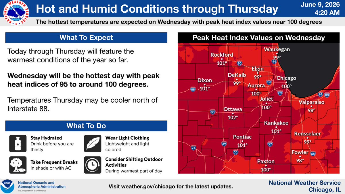
ALT Forecast: Hot & humid conditions through Thursday, June 9, 2026, 4:20 AM. Wednesday is hottest, with peak heat index values 95-100 degrees. Map shows heat index values for cities like Chicago (100\u00B0), Rockford (101\u00B0), Ottawa (102\u00B0), Kankakee (101\u00B0). Stay hydrated, take breaks.

ALT Vibrant purple, red, and yellow flowers bloom in the foreground with a tall gothic brick tower rising dramatically against an overcast, cloudy sky. Other historical buildings are partially visible in the background, including a tree with pink blossoms.
ALT A view of the Obama Presidential Center
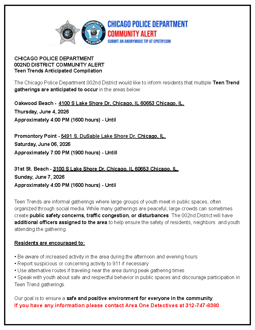
ALT Chicago Police Department Community Alert about 'Teen Trends' gatherings. Details anticipated youth gatherings on June 4, 6, 7, 2026, at Oakwood Beach, Promontory Point, and 31st St. Beach in Chicago. Advises residents on safety & contact 312-747-8380 for info.
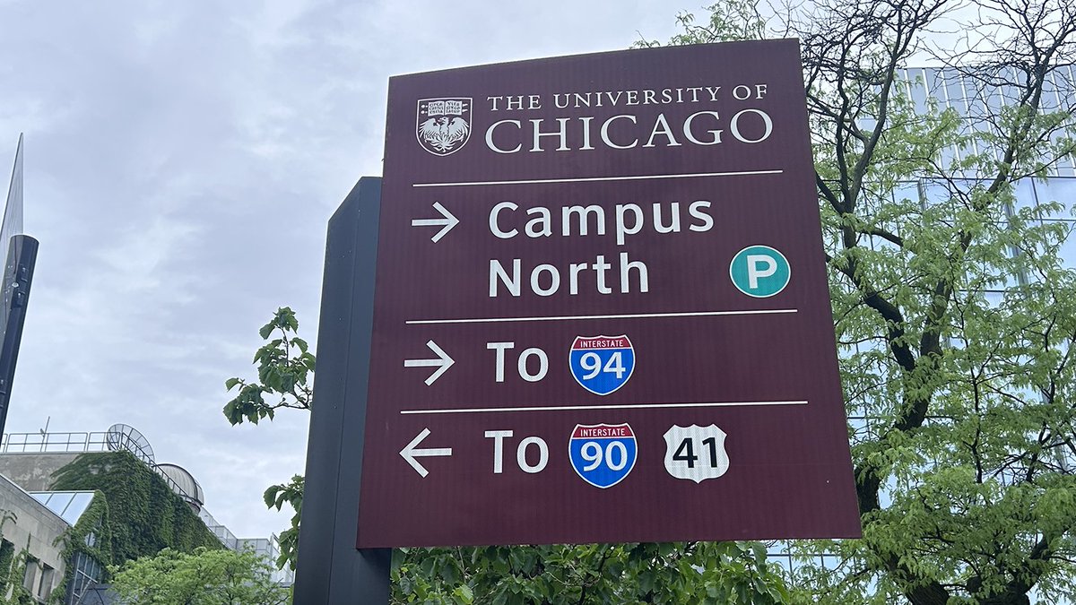
ALT Sign for The University of Chicago. It reads: Campus North, with a 'P' symbol for parking; To Interstate 94, with a right arrow; To Interstate 90 and 41 with a left arrow.
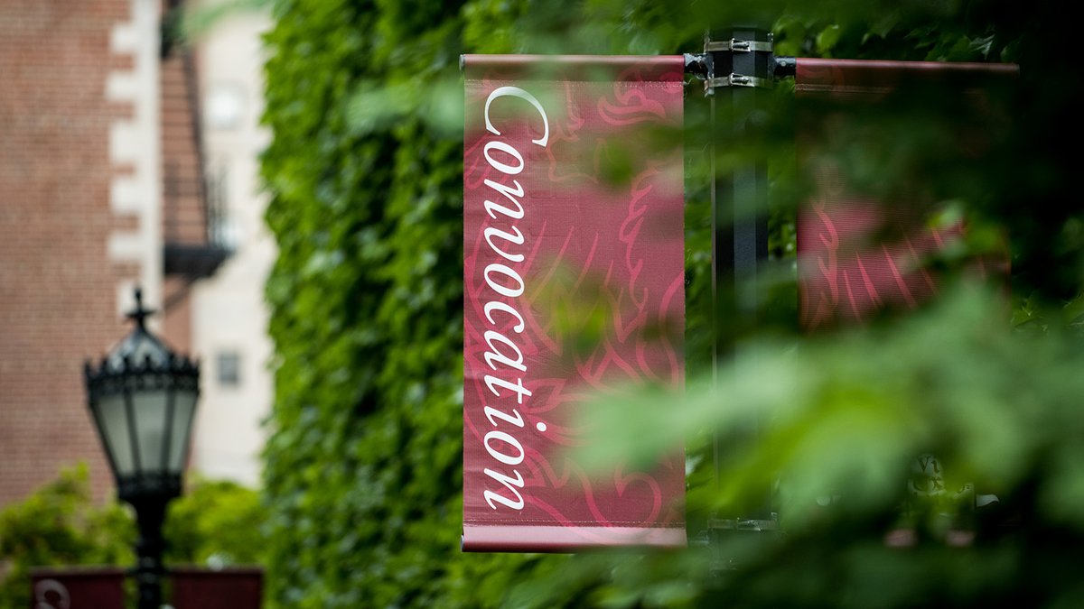
ALT A marching band parades, led by bagpipers in kilts, followed by drummers, in front of \"THE UNIVERSITY OF CHICAGO\" banners. An American flag is seen alongside people in graduation gowns.
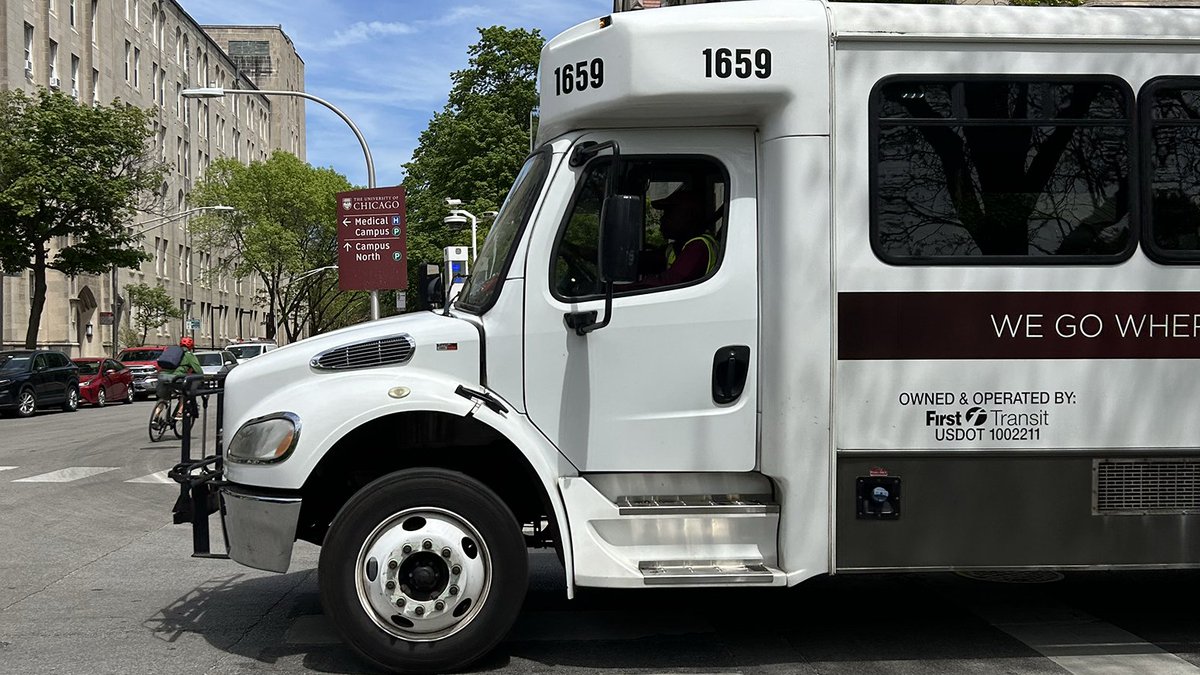
ALT A white bus for the University of Chicago, labeled 'UNIU OF CHICAGO@1' and '217@2', is parked on a street near Ida Noyes Hall. The building is brick with an arched doorway, partially covered in ivy.