
Updating you with any thunderstorm activity happening in or near the British Isles, with the occasional tweet covering severe natural phenomena worldwide. ⛈
Joined November 2020
- Tweets 4,272
- Following 347
- Followers 8,714
- Likes 330
1,858 Photos and videos


Pinned Tweet

31 Aug 2023
Got a storm over your area? Make sure you tag @UKStormUpdates in any lightning or thunderstorm pictures/videos you post! I'll retweet all.
12
6
46
105,049
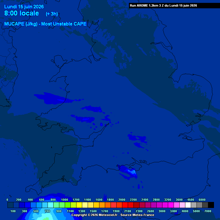
Shallow mid-level instability moving in from the west has allowed for a few lightning strikes across S/SW England this morning ⚡️
9
379


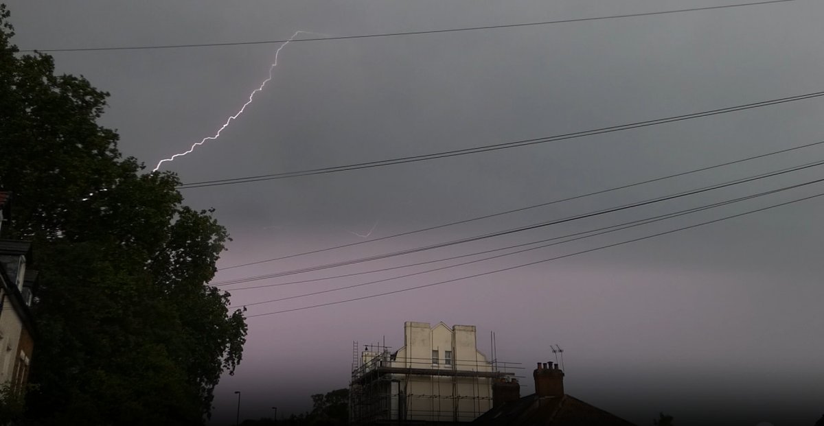
-110kA lightning strike
Location: west of Bottesford, Leicestershire
Time: 12:42pm
meteologix.com/uk/lightning/…
18
1,305
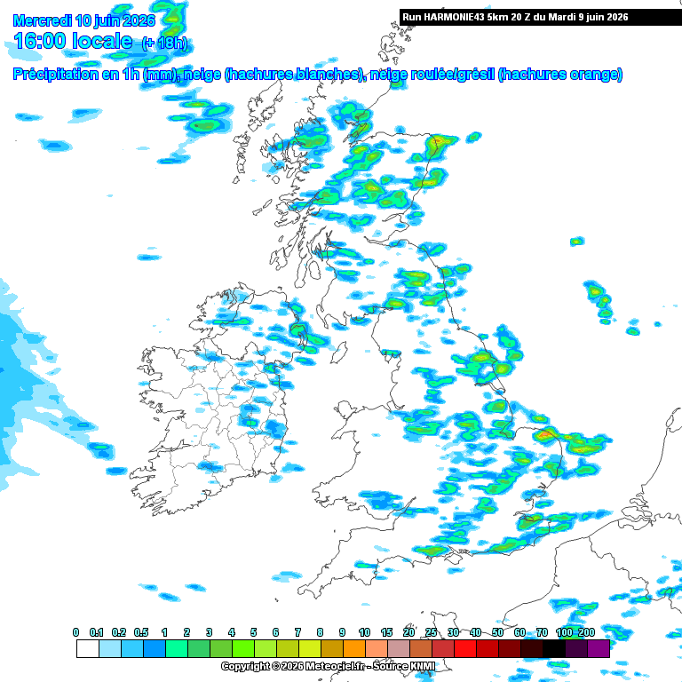
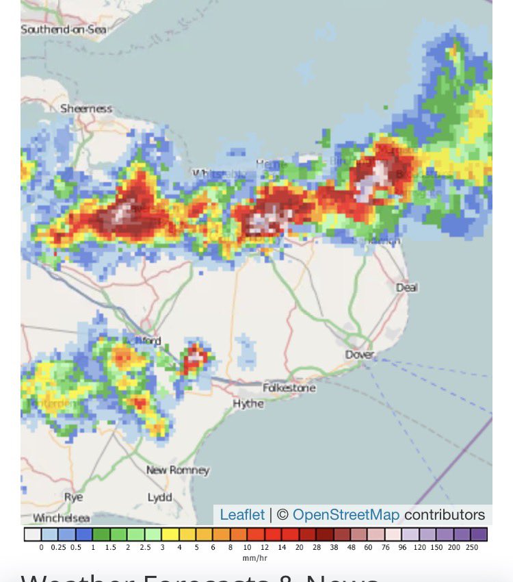
Could be more thundery activity over parts of the UK this afternoon as showers and a few thunderstorms develop under an unstable airmass, with the greatest risk of lightning existing over East Anglia. Hail and gusty winds may accompany the strongest cells as they drift eastward through the day ⛈️
1
3
23
1,714
UK Thunderstorm Updates retweeted

Decently sized hail here in Northwich, Cheshire
@UKStormUpdates @bbcweather

1
10
892
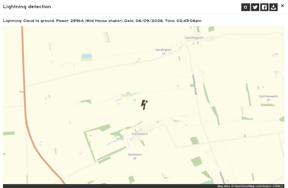
289kA lightning strike
Location: Hackthorn, Lincolnshire
Time: 2:45pm
meteologix.com/uk/lightning/…
1
2
28
1,732
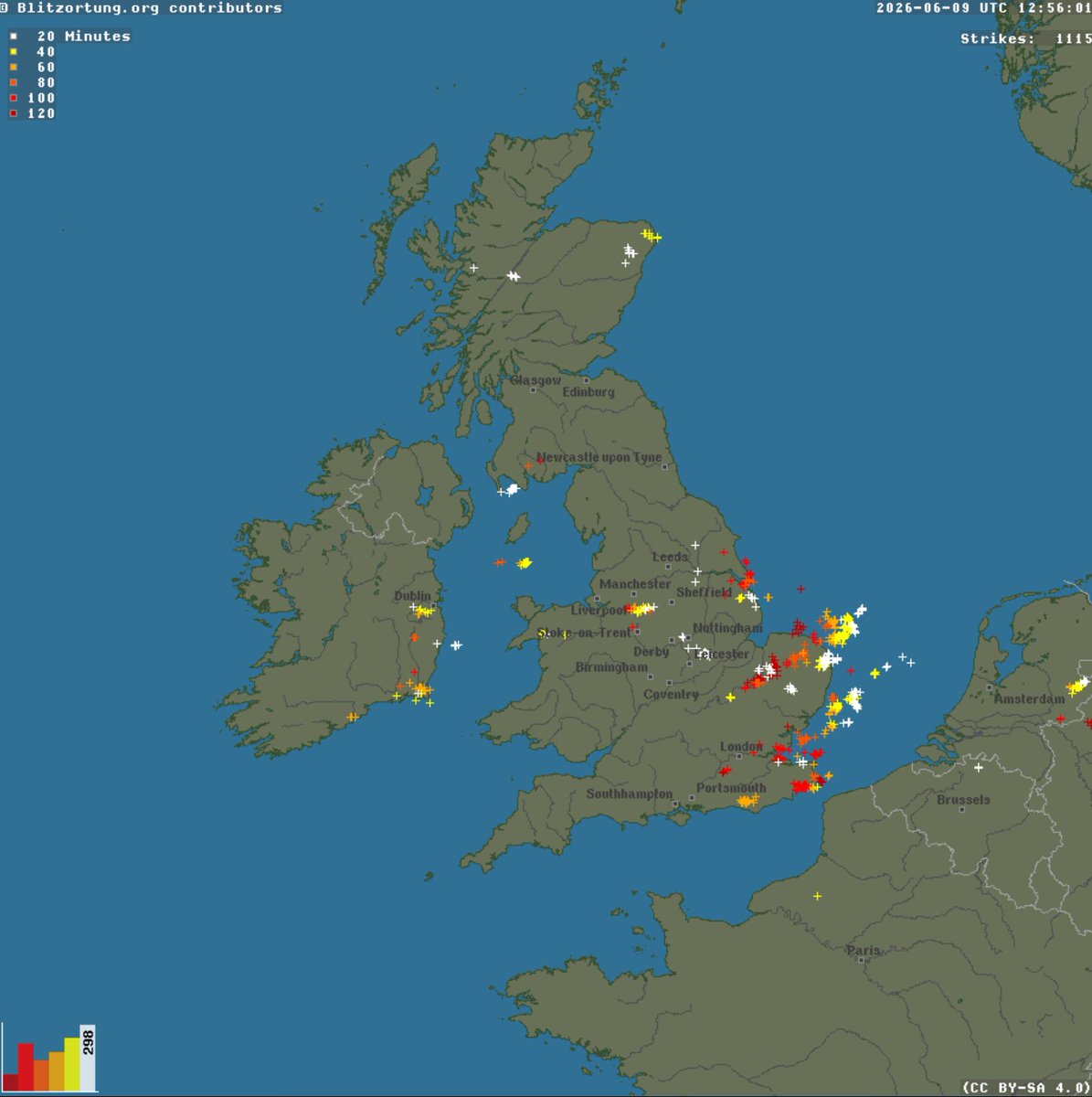
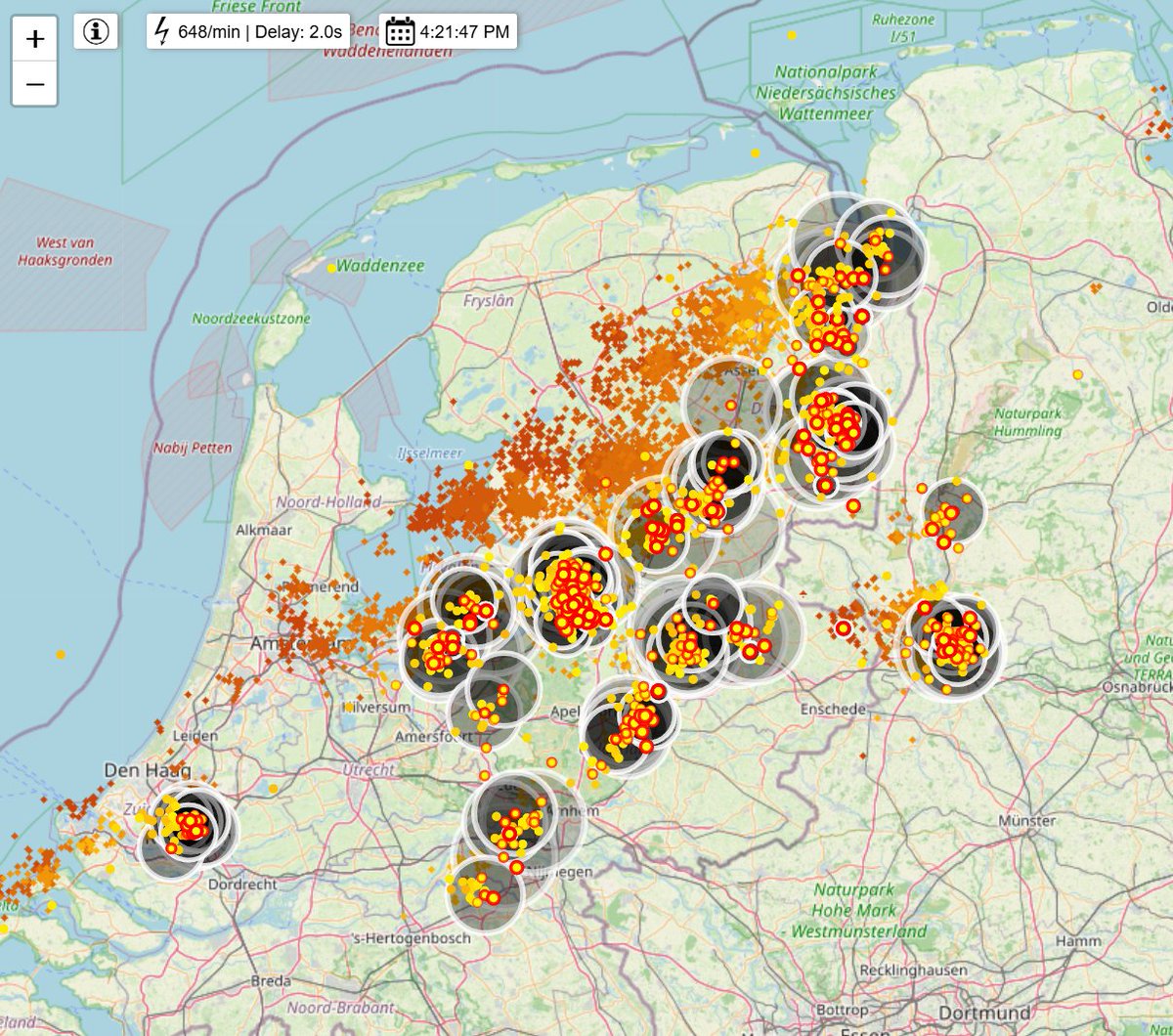
A pretty active lightning map at 2pm this afternoon - plenty of thunderstorms have developed over central and eastern England with a few in Wales and Scotland. These showers/thunderstorms will continue to drift east through the day and may bring small hail and gusty winds.
5
36
1,912
UK Thunderstorm Updates retweeted

Can confirm this was a monster. WiFi knocked out.
1
1
9
3,288
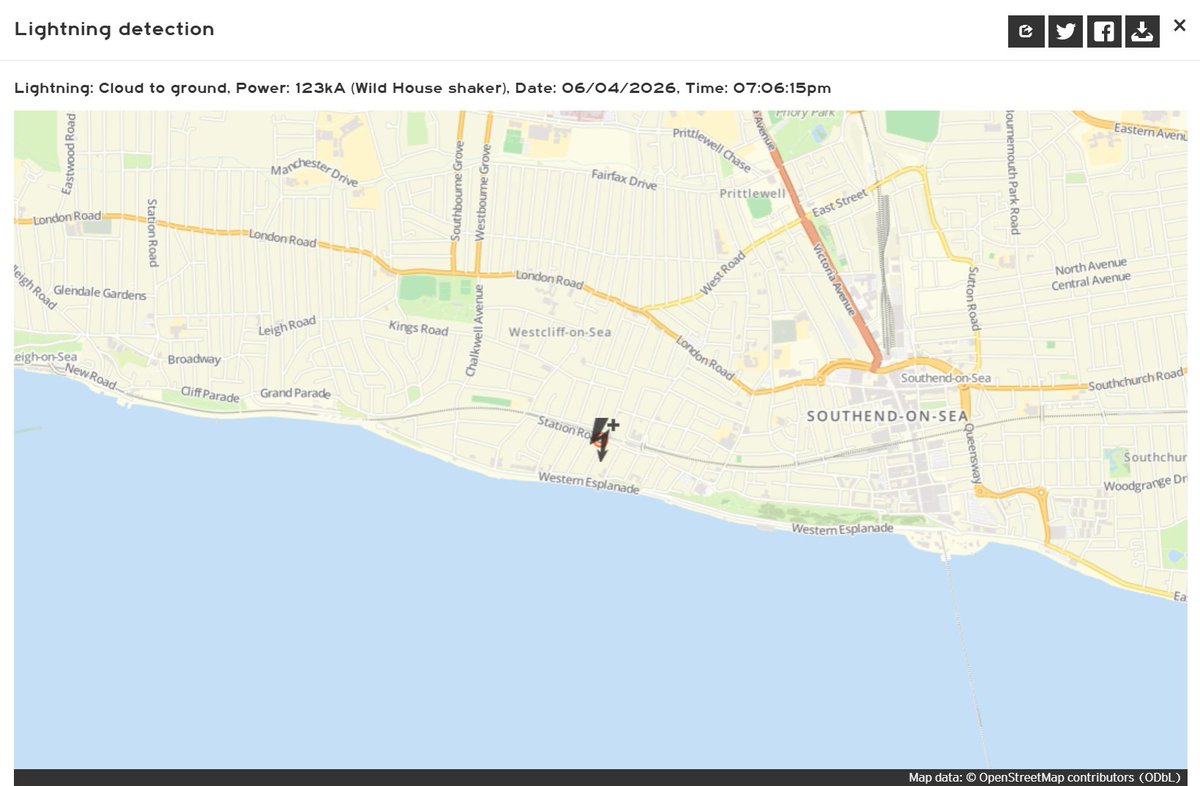
123kA lightning strike
Location: Westcliff-on-Sea, Essex
Time: 7:06pm
meteologix.com/uk/lightning/…
1
1
17
1,769

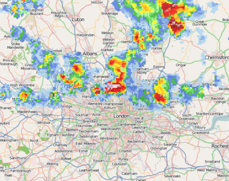
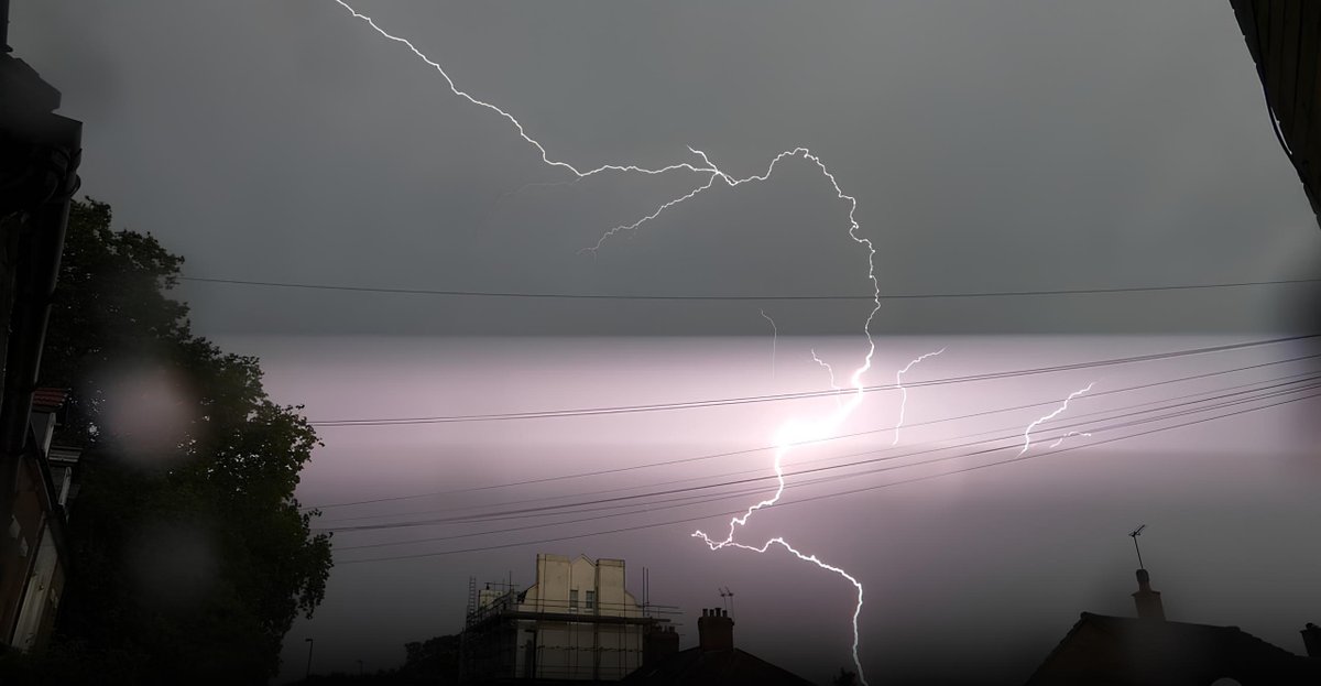
Thunderstorm over North London, moving east.
Lightning map: lightningmaps.org
Radar: netweather.tv/live-weather/r…
3
38
2,474
115kA lightning strike
Location: Tannington, Suffolk
Time: 4:44pm
meteologix.com/uk/lightning/…
16
1,140
UK Thunderstorm Updates retweeted

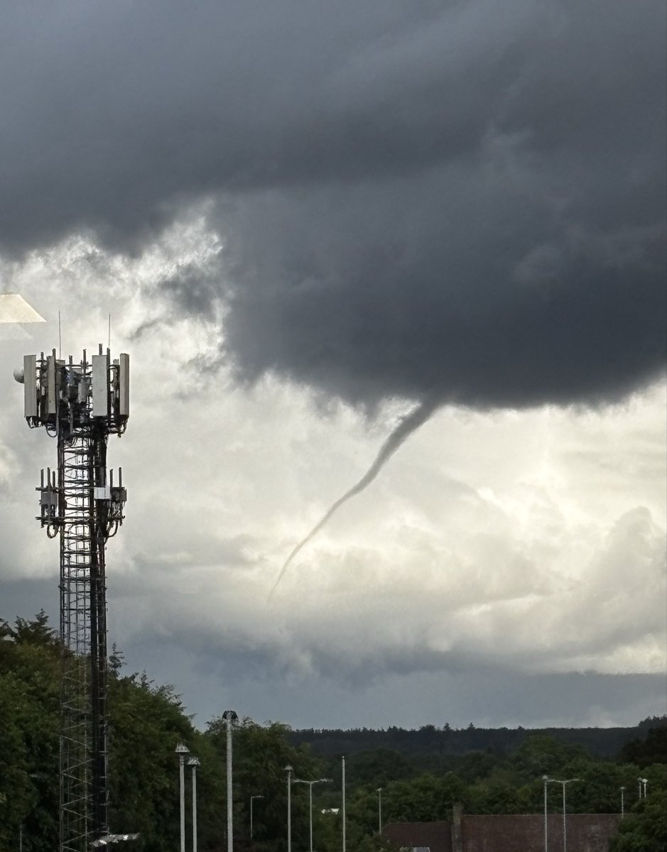
Credit from family for sending this funnel cloud looking NE from Perth at 1310 today.
@TorroUK
1
15
86
4,343
UK Thunderstorm Updates retweeted

Jun 4
Convection is already off over Gatwick.
1
7
986
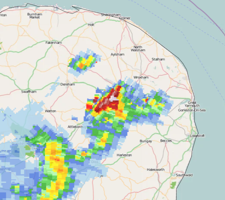
Thunderstorm over Norwich right now, moving NE into the North Sea.
1
22
1,392
UK Thunderstorm Updates retweeted

Jun 3
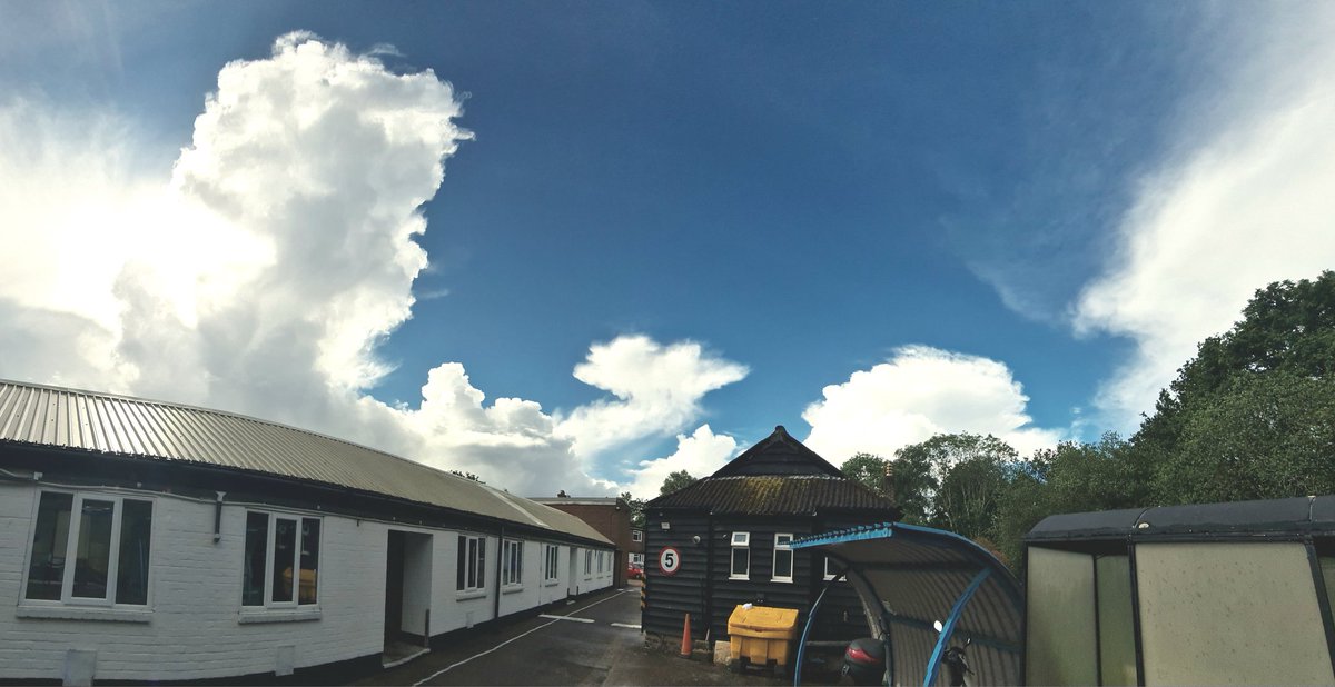
View to the east and the west!
1
2
9
1,132
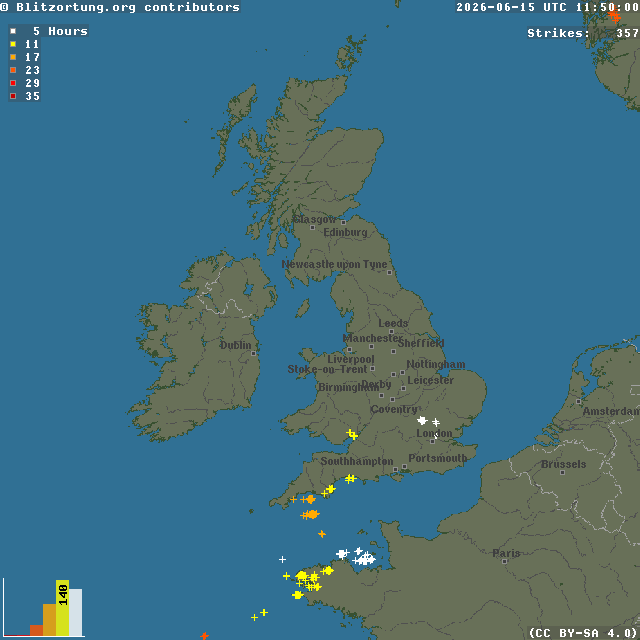
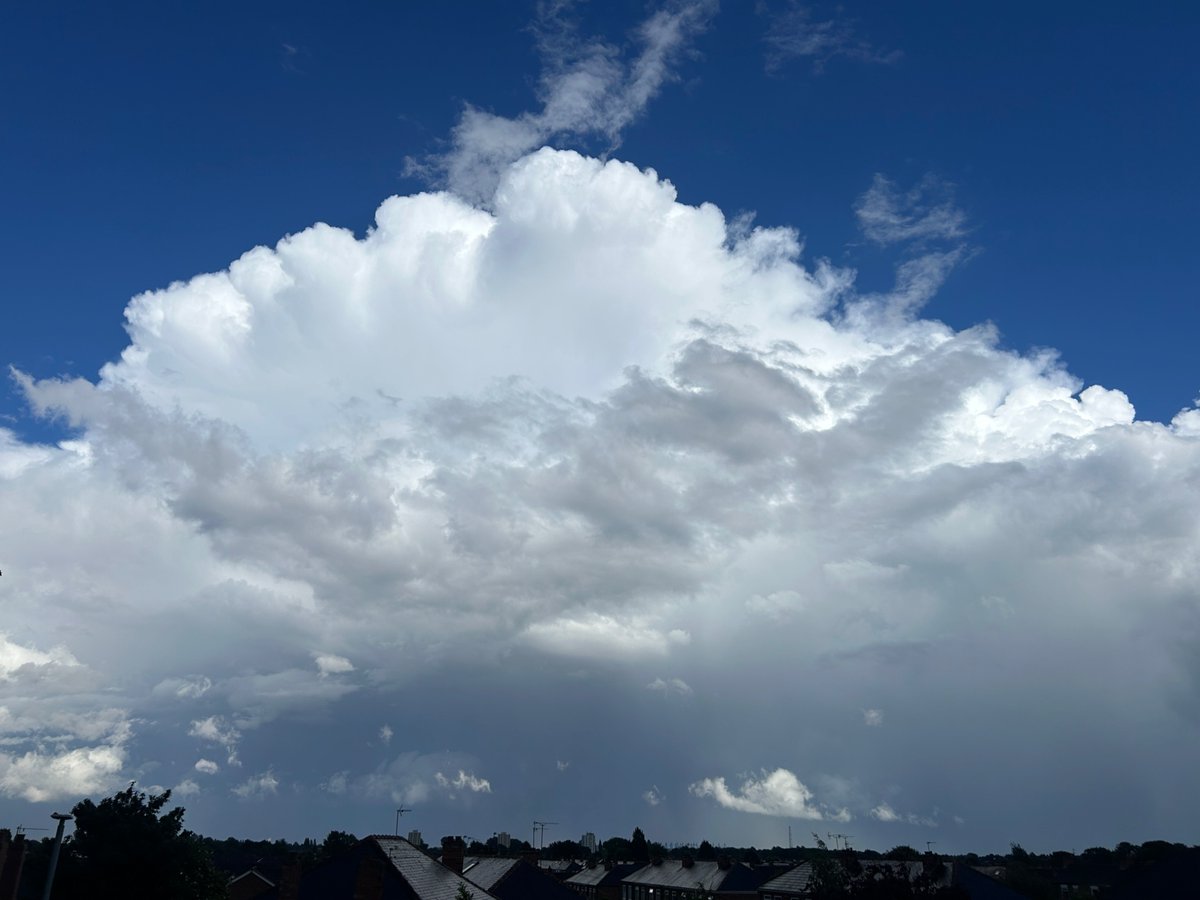
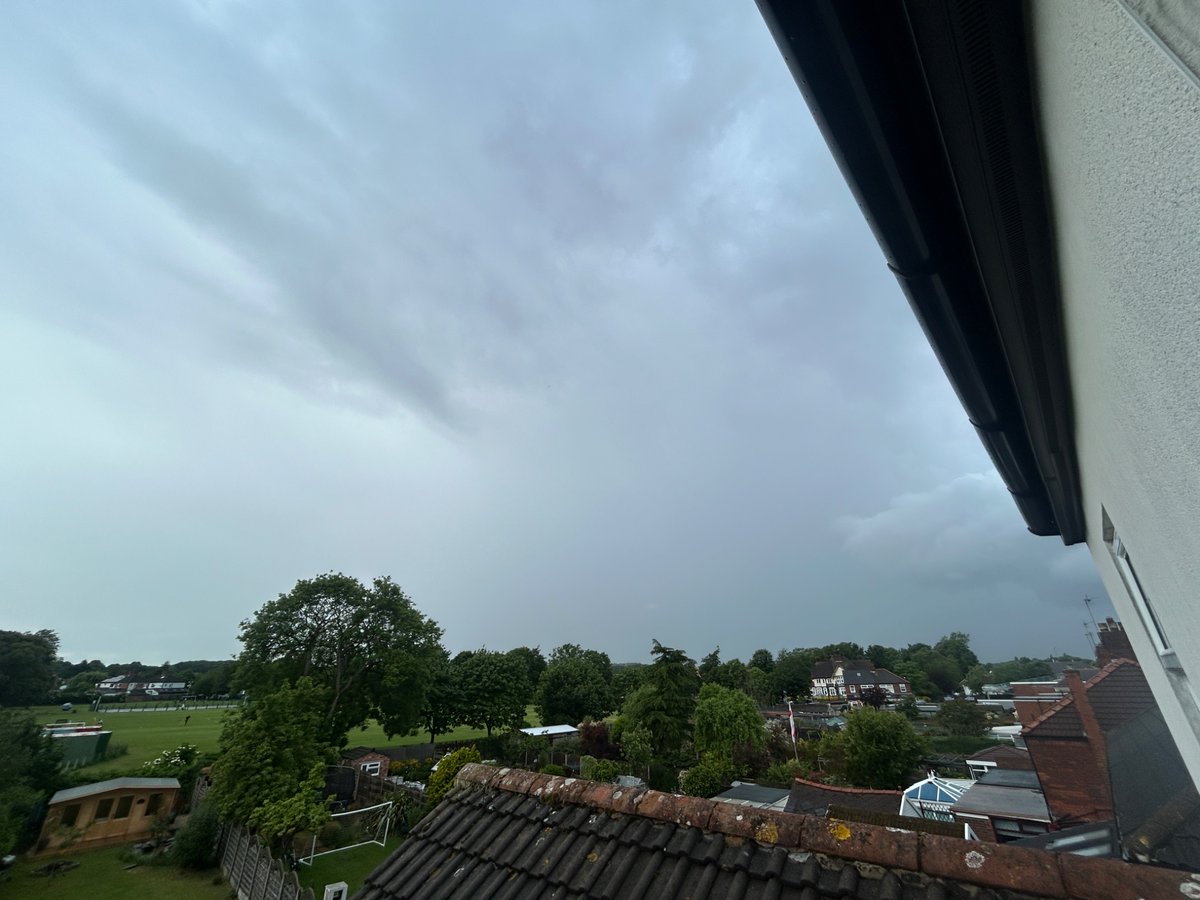
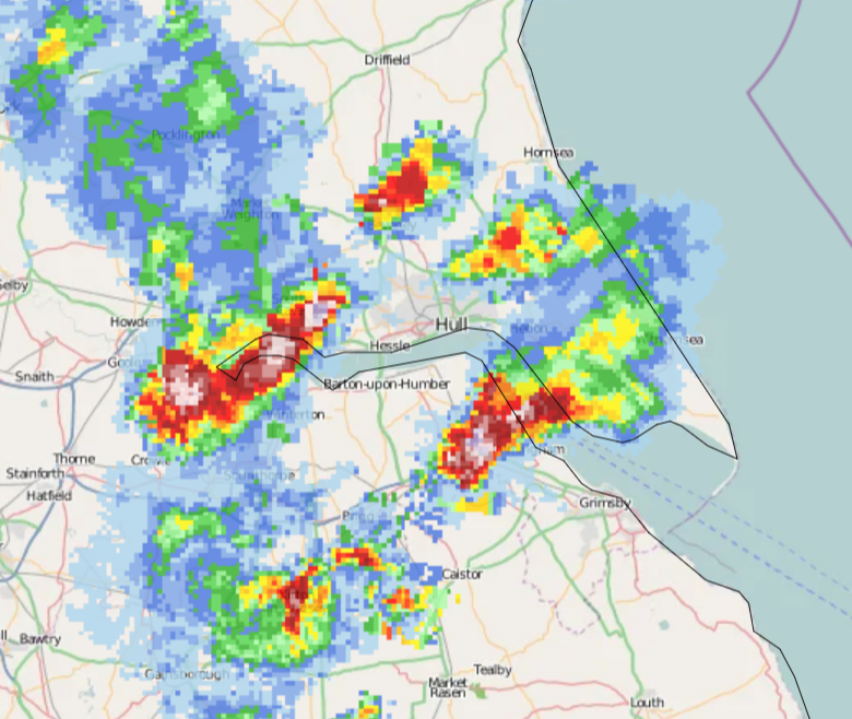
Thunder is very likely being heard in Hull right now from two storms to the west and south-east.
Lightning map: lightningmaps.org
Radar: netweather.tv/live-weather/r…
1
27
2,362
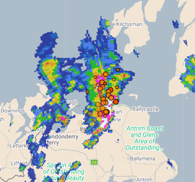
Numerous thunderstorms have developed over Ireland/N.I. this afternoon, now moving NE towards Scotland and N England. Small hail and gusty winds could accompany these storms ⛈️
27
1,359
UK Thunderstorm Updates retweeted

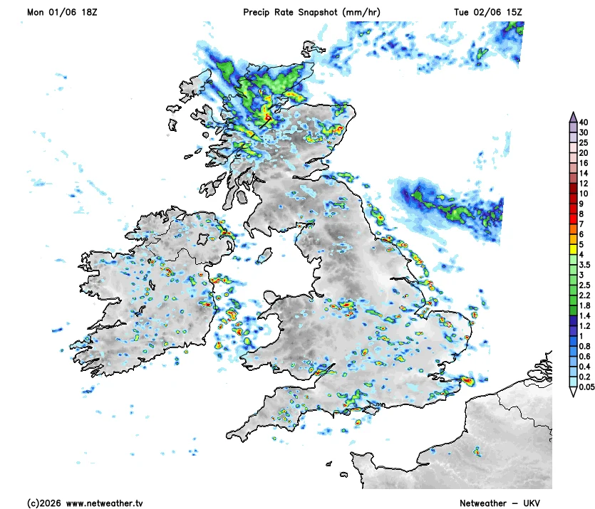
Lightning storms over South London (02/06/2026)
3
3
27
2,101
UK Thunderstorm Updates retweeted

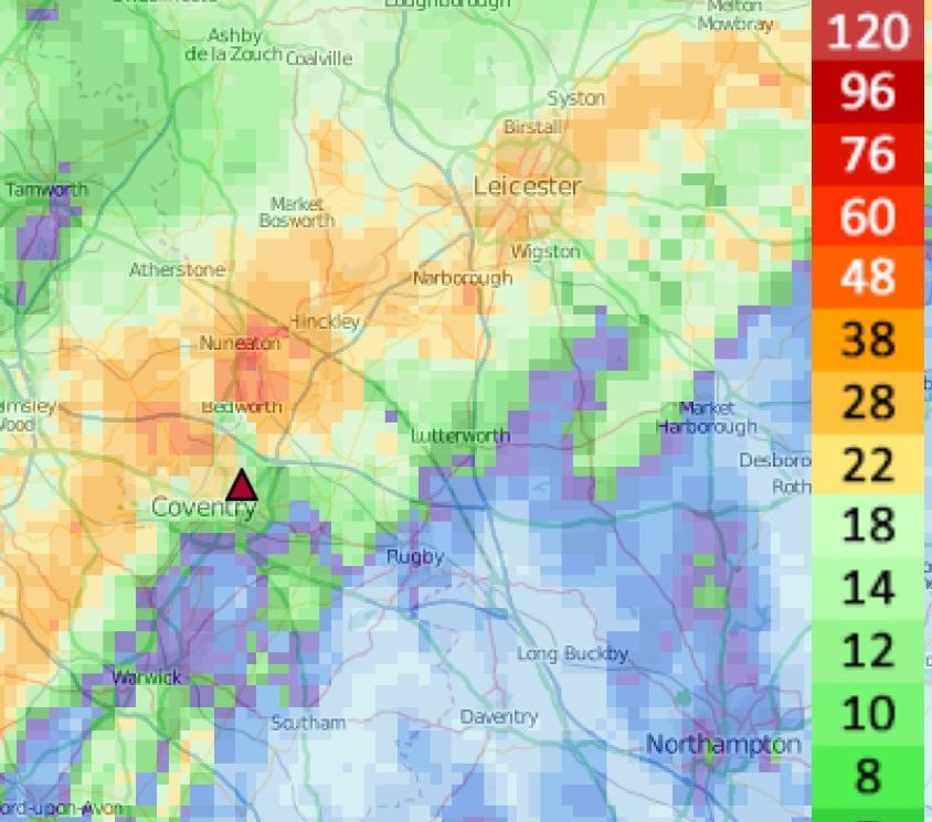
Exceptional rainfall accumulation recently in Nuenaton
Over the last 5 days it's believed to have accumulated close to 100mm of rain! 62mm from those violent overnight storms Thursday morning then locally upto 38mm combining last night and today with the storms too @Shefali_oza


1
1
15
1,082