Official account of the United Nations Satellite Centre - UNOSAT, UNITAR, imagery analysis, #satellite solutions, #GIS
Joined May 2010
- Tweets 7,387
- Following 871
- Followers 13,124
- Likes 6,710
3,089 Photos and videos


🌍 UN Satellite Centre rosters are open:
🛰️ Geospatial Analysts (GVA)
bit.ly/4cWy5N9
🧠 QA/QC & Training Specialists (GVA) bit.ly/42h4OGX
🛰️ Geospatial Analysts (Remote) bit.ly/3QM9bY6
🧠 QA/QC & Training Specialists (Remote) bit.ly/4eyHWdg
3
5
397

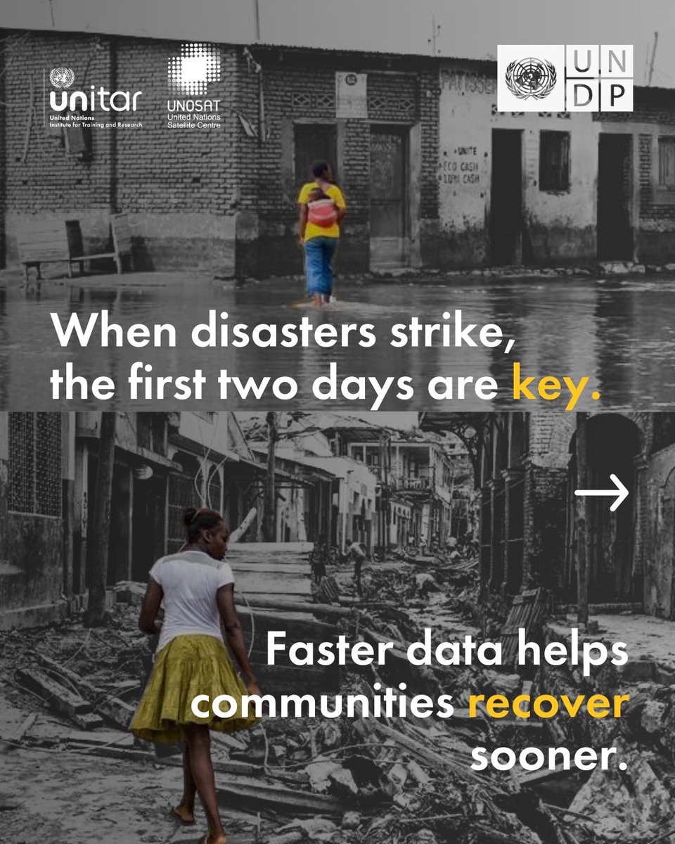
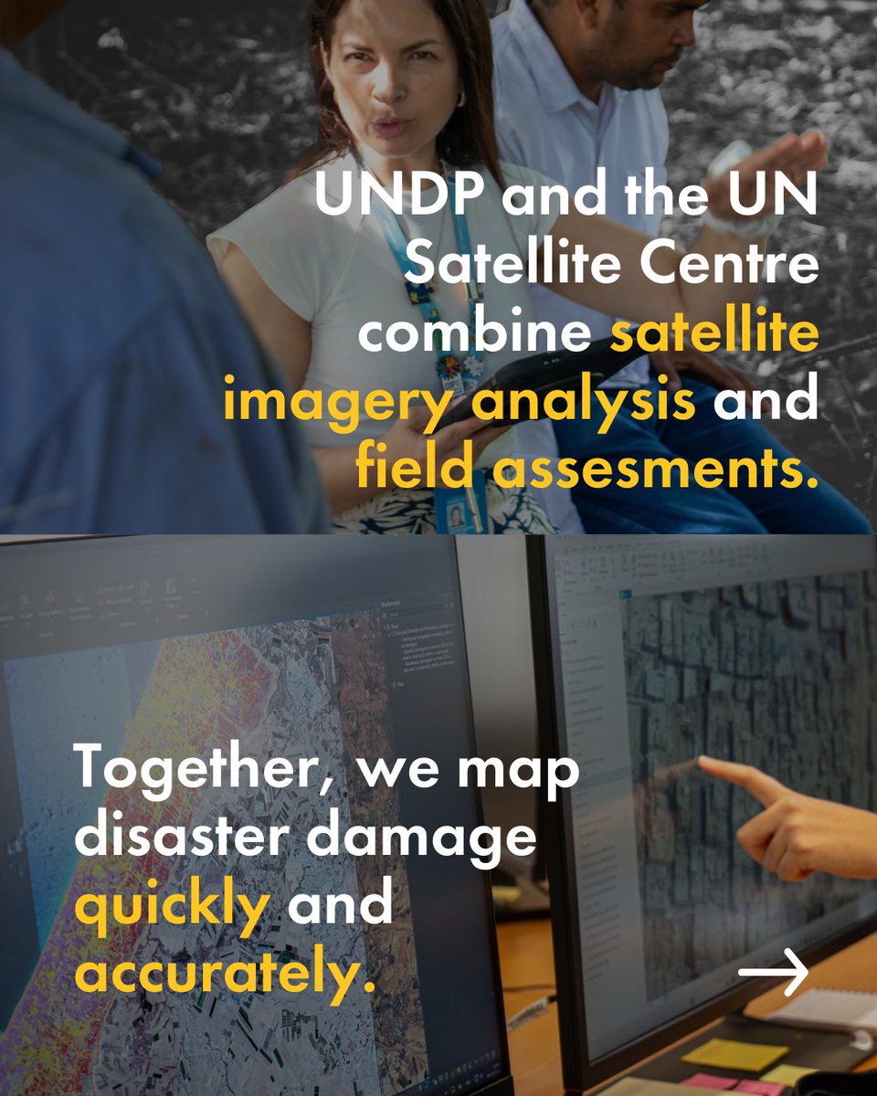
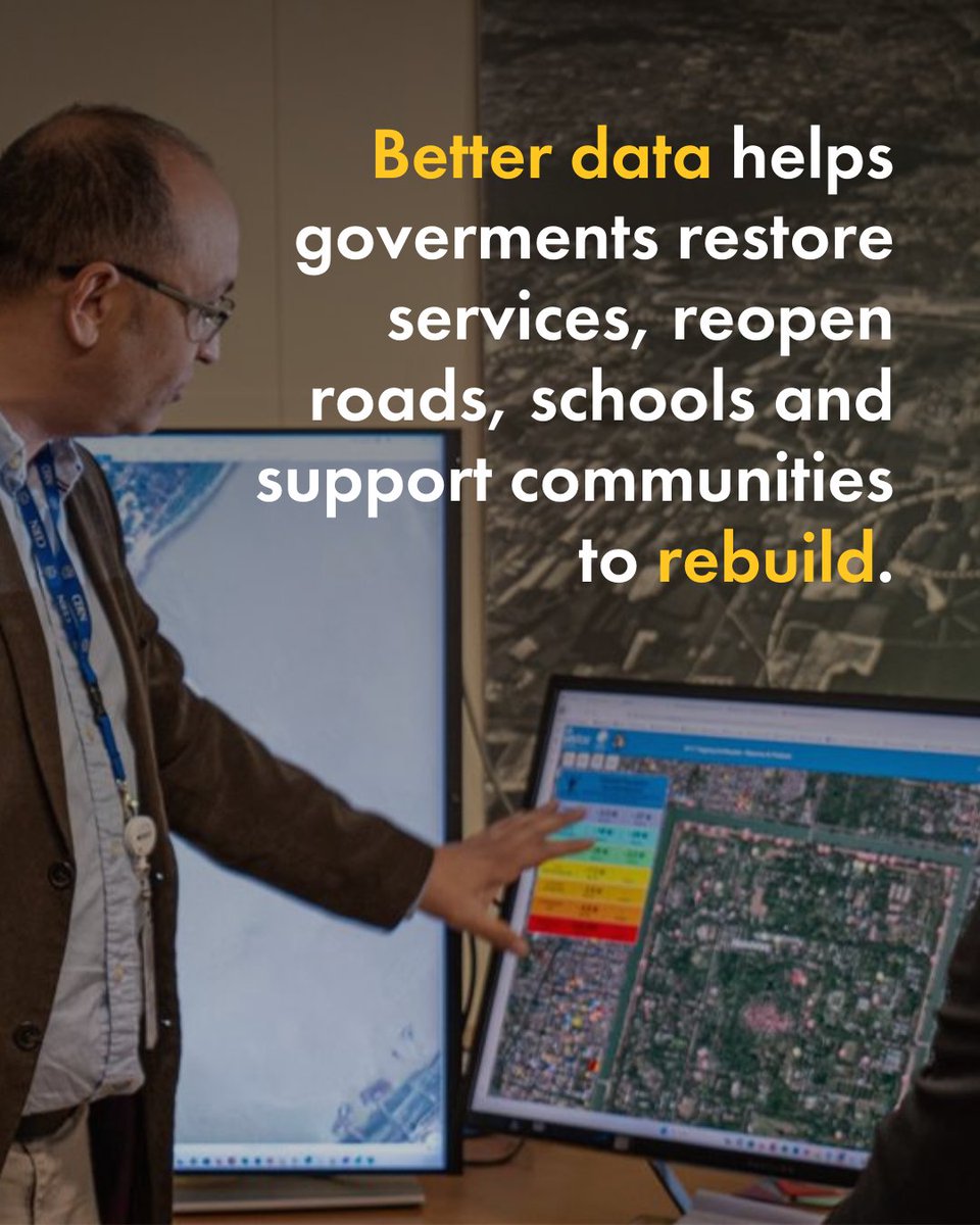
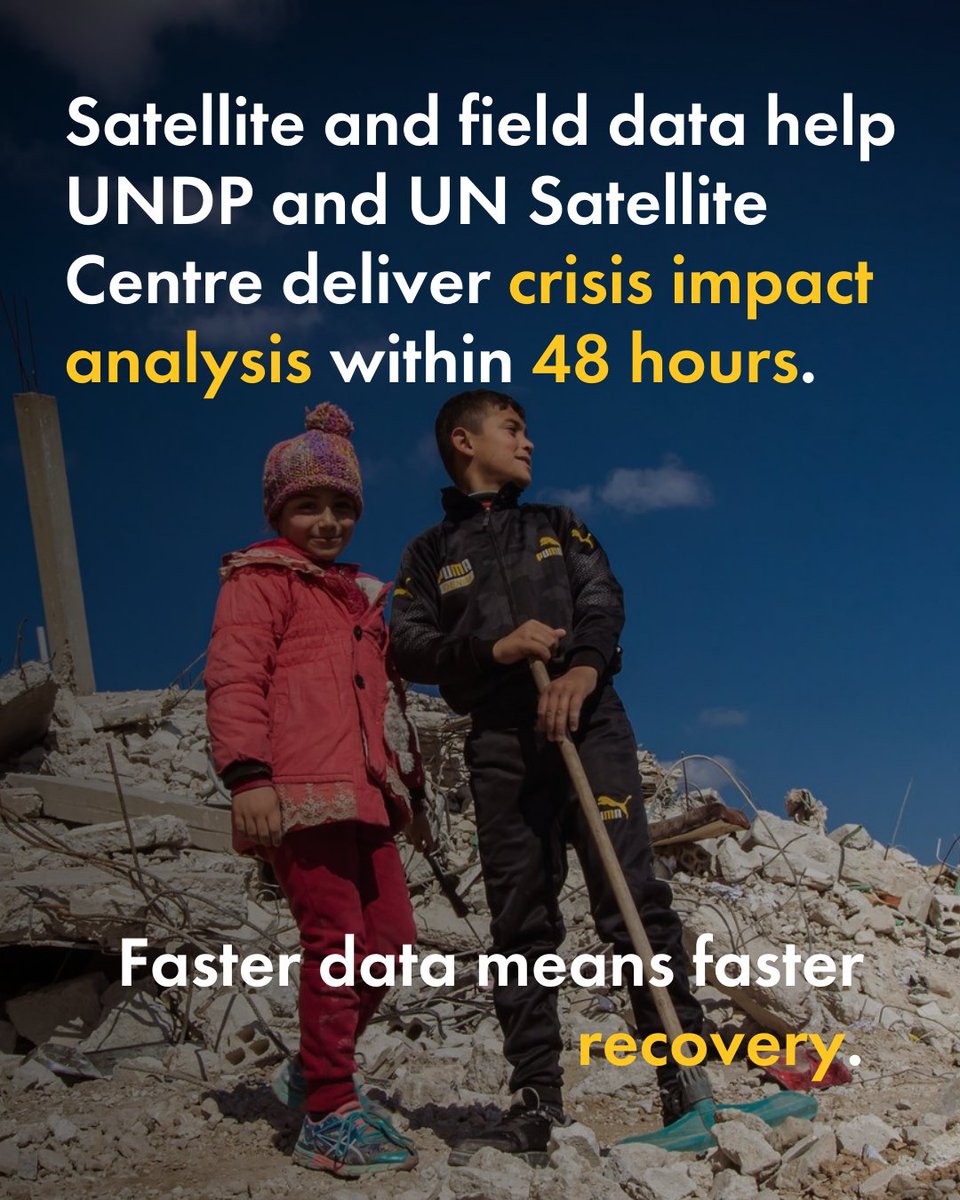
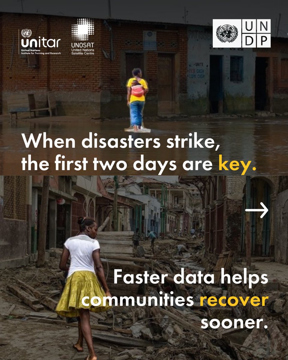
First 48 hrs after a crisis matter.
Today in Geneva, Shoko Noda @shokonoda & Michelle Gyles-McDonnough @UNITAR_ED launch a strengthened partnership between @UNDP and @UNOSAT to deliver impact analysis in 48 hrs.
Faster data = faster recovery
#DisasterResponse #SatelliteImagery
1
3
7
541
UNOSAT retweeted

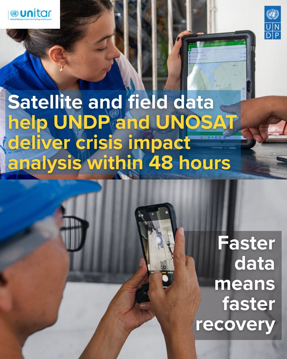
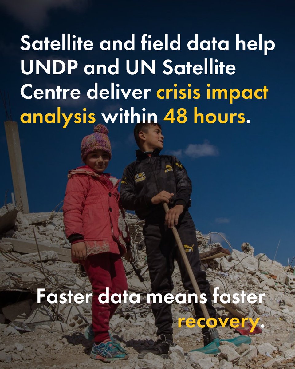
When crises strike, the first 48 hours are key.
Today in Geneva, @shokonoda & Michelle Gyles-McDonnough @UNITAR_ED launch a strengthened partnership between @UNDP and @UNOSAT to deliver impact analysis in 48 hrs.
Faster data = faster recovery.
🛰️ go.undp.org/5ye
4
8
389
UNOSAT retweeted

Mar 10
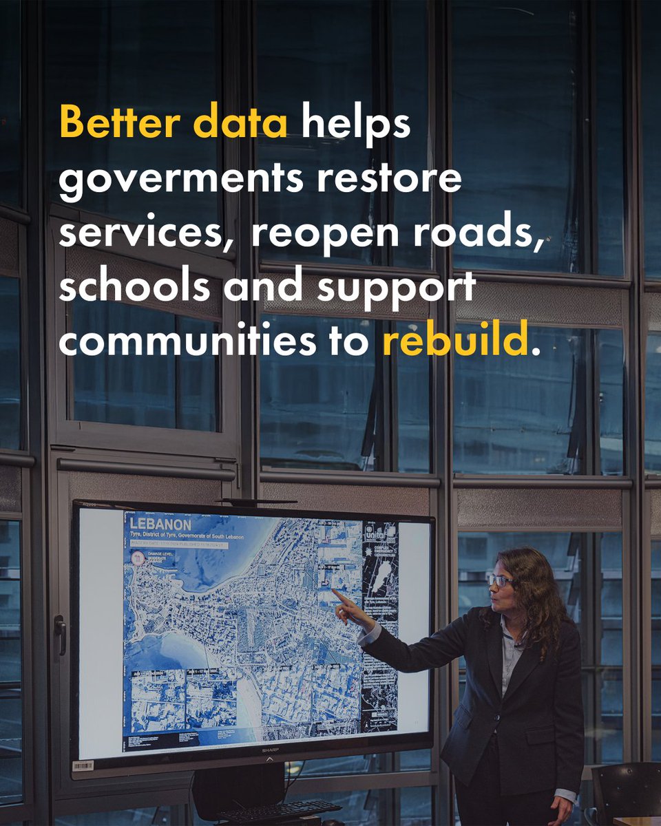
Timely satellite data helps accelerate recovery.
Today in Geneva, @shokonoda and Michelle Gyles-McDonnough @UNITAR_ED marked a strengthened collaboration between @UNDP and @UNOSAT to deliver rapid impact analysis within the first 48 hours after a crisis.
🛰️go.undp.org/5ye

2
5
281
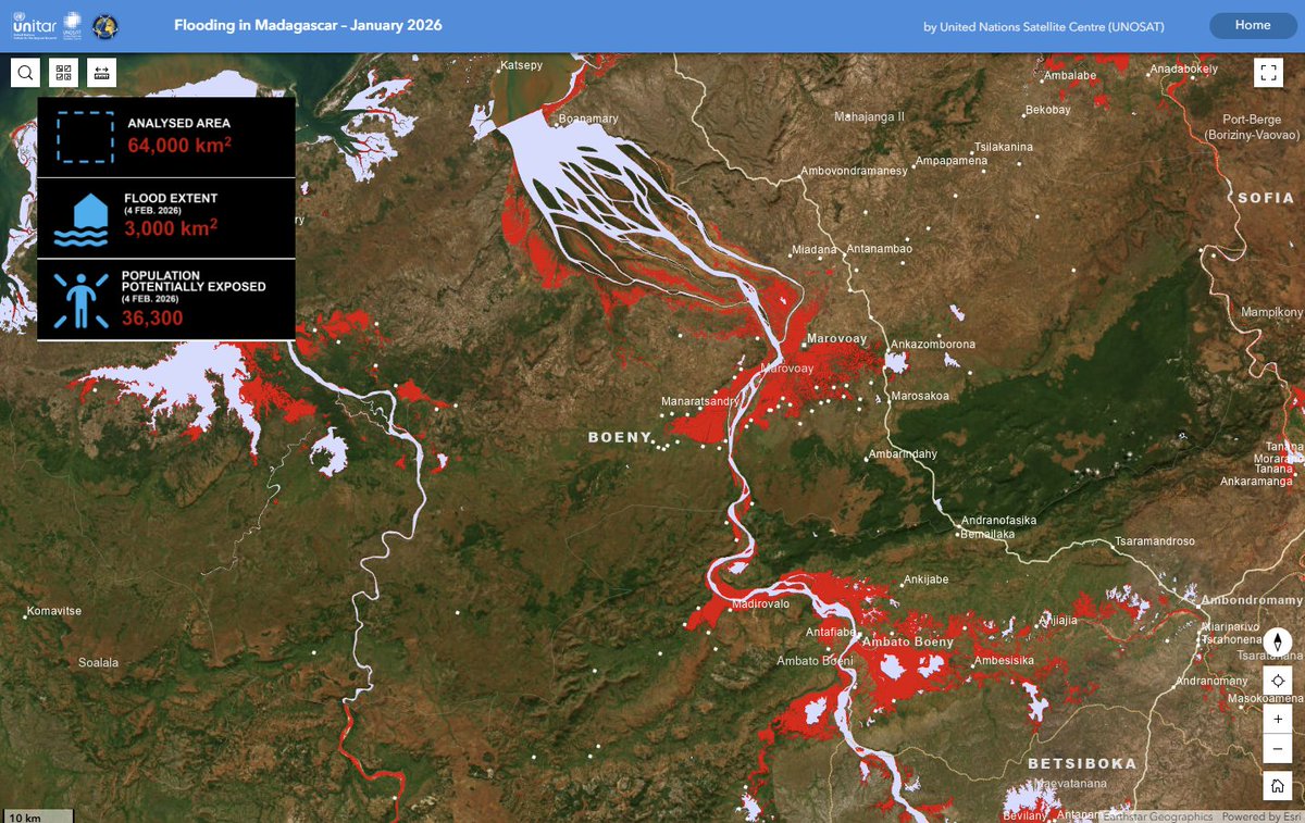
Consult the latest analysis for #floods in Boeny Region, #Madagascar from our web map:
~3,000 km² of land appears to be affected by floodwaters
~36,300 people are potentially exposed to or living close to flooded areas
➡️unosat.org/products/4234
2
10
1,194


UNOSAT retweeted

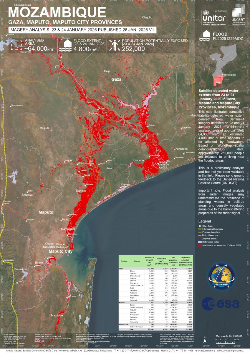
The Charter has been activated to provide satellite data over the flood in Mozambique: bit.ly/49ZYcjD
Our first maps of the disaster use #Sentinel1 data to estimate flooded areas.
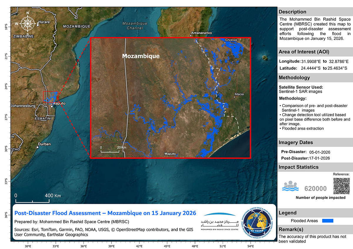
ALT Flood map of Mozambique. The map uses Sentinel-1 data acquired on 17 January to estimate flooded areas.
ALT Flood map of the Gaza and Maputo Provinces in Mozambique. The map uses Sentinel-1 data acquired on 23 and 24 January to estimate flooded areas.
6
29
3,808
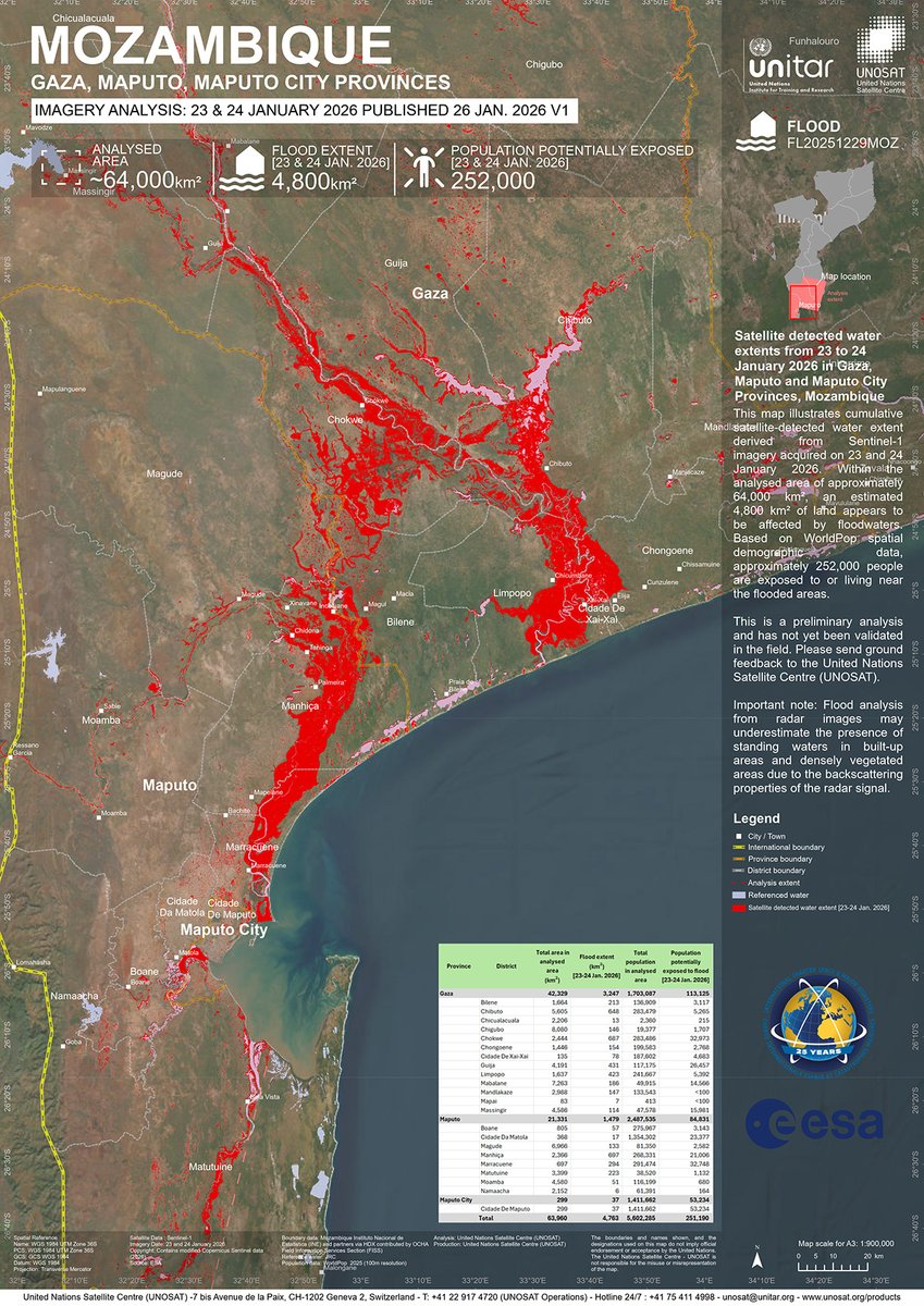
Consult the latest analysis for #floods in #Gaza, #Maputo & Maputo City Provinces, #Mozambique from our web map:
~4,800 km² of land appears to be affected by floodwaters
~252,000 people are exposed to or living close to flooded areas
➡️unosat.org/products/4232
1
7
629
UNOSAT retweeted

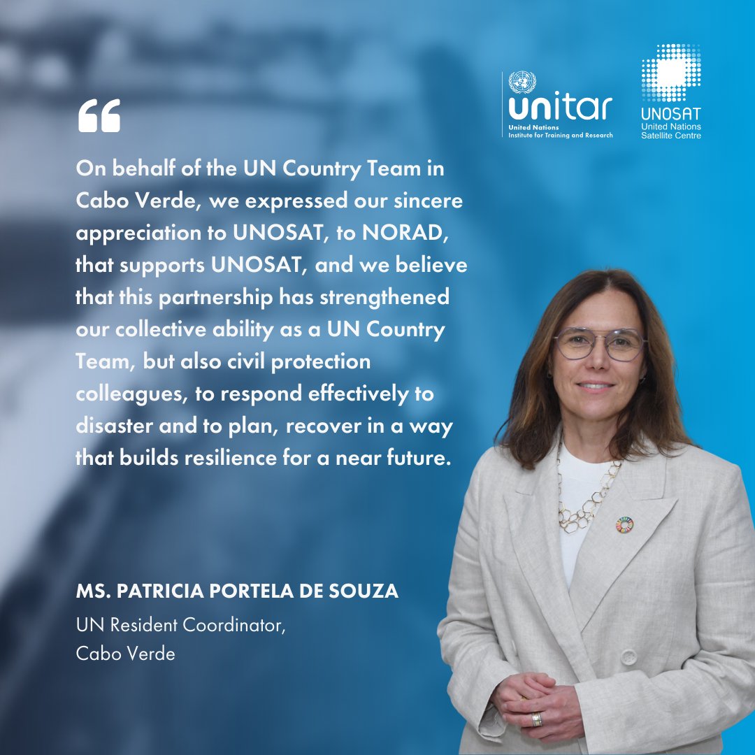
When severe storms hit Cabo Verde 🇨🇻 in 2025, @UNCaboVerde mobilized global expertise to support a rapid, evidence-based response. Satellite analysis from @UNOSAT, @UNITAR centre, helped guide emergency action and informed national recovery planning.
More bit.ly/3MPIgZk

3
6
300
In 2005 we received the UN21 Award for Team Productivity, & it is still today at the core of our engagement for an efficient UN system working for the Peoples of the United Nations: strategic engagement, sound technical expertise, innovation, partnerships, synergies & dedication.
1
3
580
Did you know about our collaboration with the UNCT in Cabo Verde following severe storms last summer? See our exchange with @PatPortelaSouza highlighting how we supported the full disaster cycle from emergency response to recovery and long-term resilience: bit.ly/3MPIgZk
2
7
545
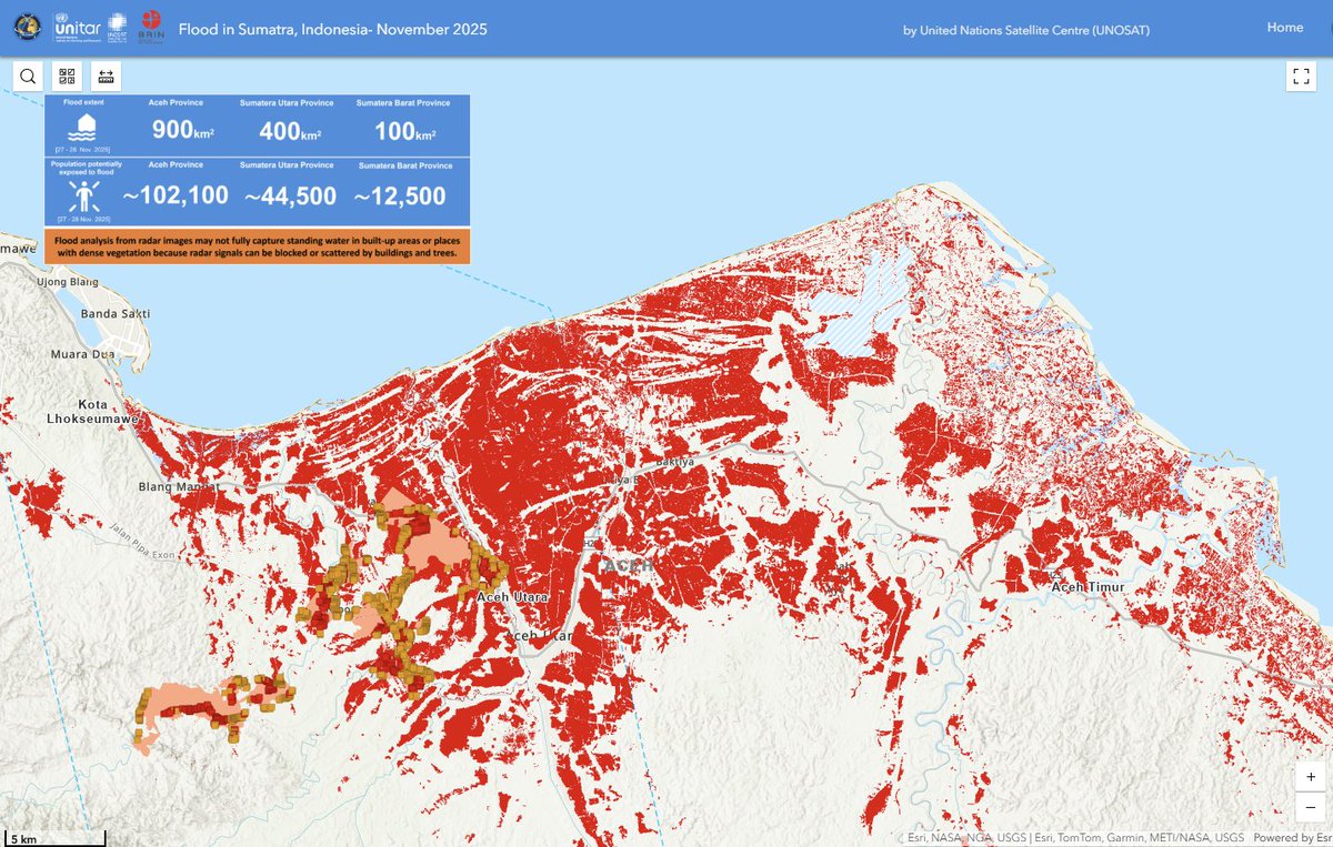
Our Emergency mapping service has been activated to monitor #floods in #Sumatra, #Indonesia.
➡️Access the live webmap here: unosat.org/products/4224
13
37
2,298
Consult the latest analysis for #floods and #landslides in #SriLanka from our live webmap:
➡️unosat.org/products/4223
@SLUNGeneva
1
323
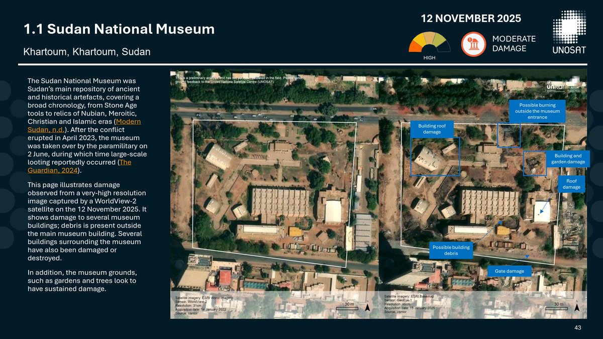
In support of NCAM, we have published a damage assessment report of #heritage in #Sudan covering 2023-now. Further analysis is required of additional cultural heritage sites across Sudan, and continued monitoring is essential.
➡️unosat.org/products/4225
1
2
3
432
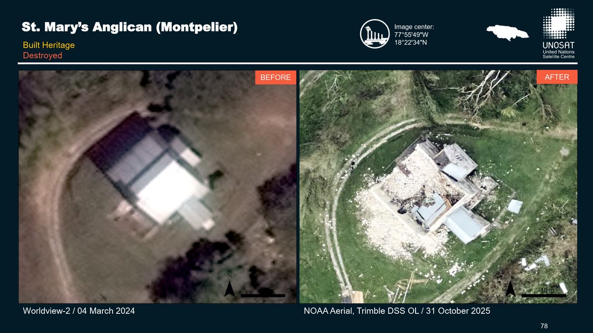
#HurricaneMelissa damaged Jamaica’s #culturalheritage, including #historic buildings and #churches across the island.
➡️A new PDF report provides information on more than 200 locations: unosat.org/products/4222
3
5
560
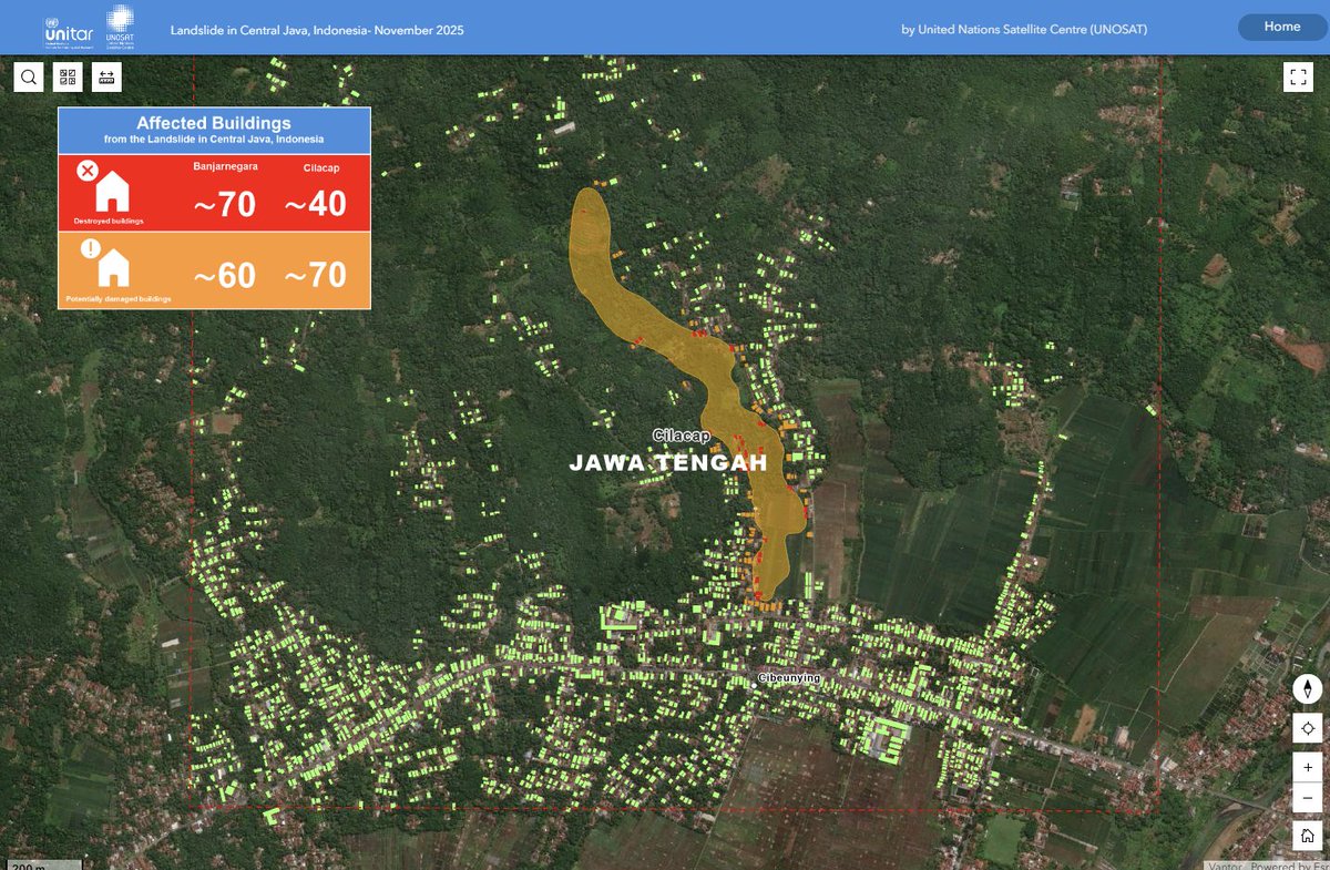
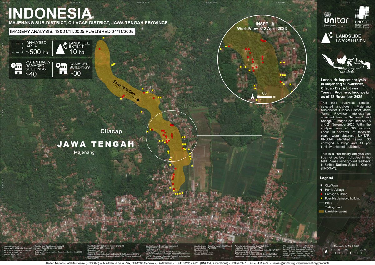
#Indonesia update: Satellite analysis (18–21 Nov 2025) detected landslides in Majenang (~10 ha; 30 damaged buildings / 40 at risk) and Pandanarum (~30 ha; 70 damaged buildings/ 60 at risk) in Jawa Tengah Province.
➡️unosat.org/products/4221
➡️unosat.org/products/4220
2
2
1
427
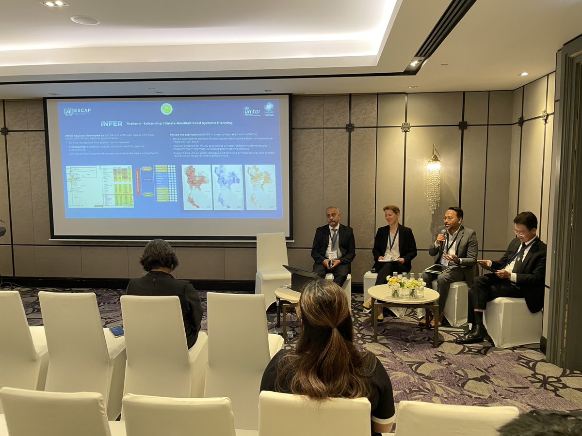
UNOSAT joined today’s panel on climate-resilient food systems, sharing how geospatial analytics reveal vulnerability hotspots and strengthen food security & safety. Thailand’s INFER risk mapping demonstrates a scalable model for ASEAN-wide climate and food system resilience.

1
374
Following a request from @WFP, our Emergency Mapping Service has been activated to monitor landslides in Central #Java, #Indonesia.
➡️Access the map here: unosat.org/products/4219
1
10
568