
Geography and Sustainability Department at @utknoxville. A student-centered department where one can VOLUNTEER to explore, study, and make a better world 🌎
Joined July 2013
- Tweets 2,637
- Following 673
- Followers 2,167
- Likes 1,996
1,022 Photos and videos


Pinned Tweet

19 Nov 2025
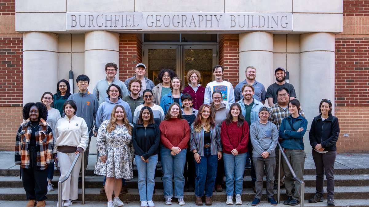
Meet our 2025-2026 graduate students! 🧡🌎 Got our traditional picture outside of BGB just in time for #GeographyAwarenessWeek!
2
5
669
UTK Geography & Sustainability retweeted

Jun 10
I am very excited to release GeoLibre v1.0 🌍
GeoLibre is a free and open-source, lightweight, cloud-native GIS platform for visualizing, exploring, and analyzing geospatial data. One application that runs everywhere: in your web browser, as a native desktop app, on your phone, and inside a Jupyter notebook. No account, no server, no cost. Everything runs locally and your data stays private.
In this video, I walk through GeoLibre 1.0 step by step: how to install and run it, load vector and raster data, stream gigabyte-scale cloud-native datasets without downloading them, edit attributes and geometry, work with PMTiles, 3D tiles, LiDAR point clouds, and DuckDB, and share your projects as static links.
GeoLibre is built on MapLibre GL JS, React TypeScript, Tauri (Rust), DuckDB, and deck.gl.
Try it: geolibre.app
GitHub: github.com/opengeos/GeoLibre
Full video tutorial: youtu.be/87Cm0QagtxI
If you have feature requests or run into bugs, leave a comment or open an issue on GitHub. And if you find GeoLibre useful, please give it a star.
#GIS #OpenSource #Geospatial #MapLibre #Python #DataVisualization #GeoLibre
16
128
720
37,447
UTK Geography & Sustainability retweeted

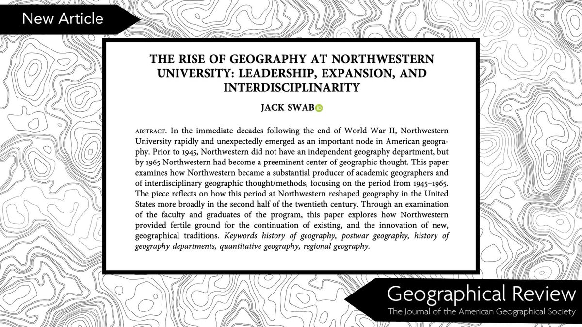
A recent article in the GR by Jack Swab explores #Northwestern University as a preeminent center for geographic thought in the U.S. Read it here: tandfonline.com/doi/full/10.…
@UTKGeography @AmericanGeo
1
2
105
Dr. Derek Alderman (@MLKStreet) was quoted in this recent @nytimes article, offering insight into Nauru’s decision to officially adopt the name “Naoero” — a change that better reflects what the island’s people have long called it.
nytimes.com/2026/05/18/world…
2
3
134
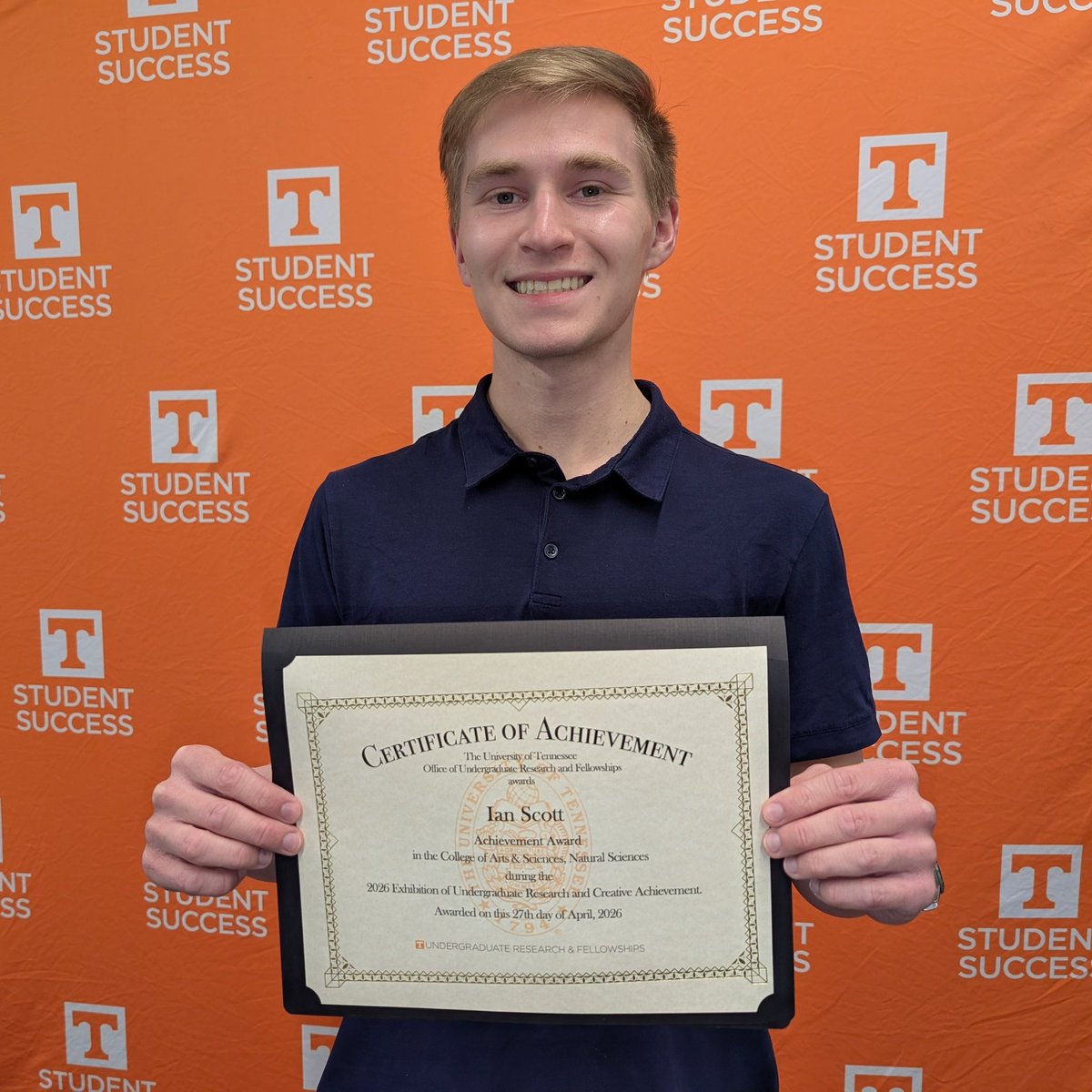
Congratulations to Ian Scott, who received an Achievement Award in Natural Sciences 2026 Exhibit of Undergraduate Research and Creative Achievement (EURECA). Ian worked with Professor Sally Horn to develop a long-term fire history from a lake sediment core. • • 📸: Sally Horn
2
101
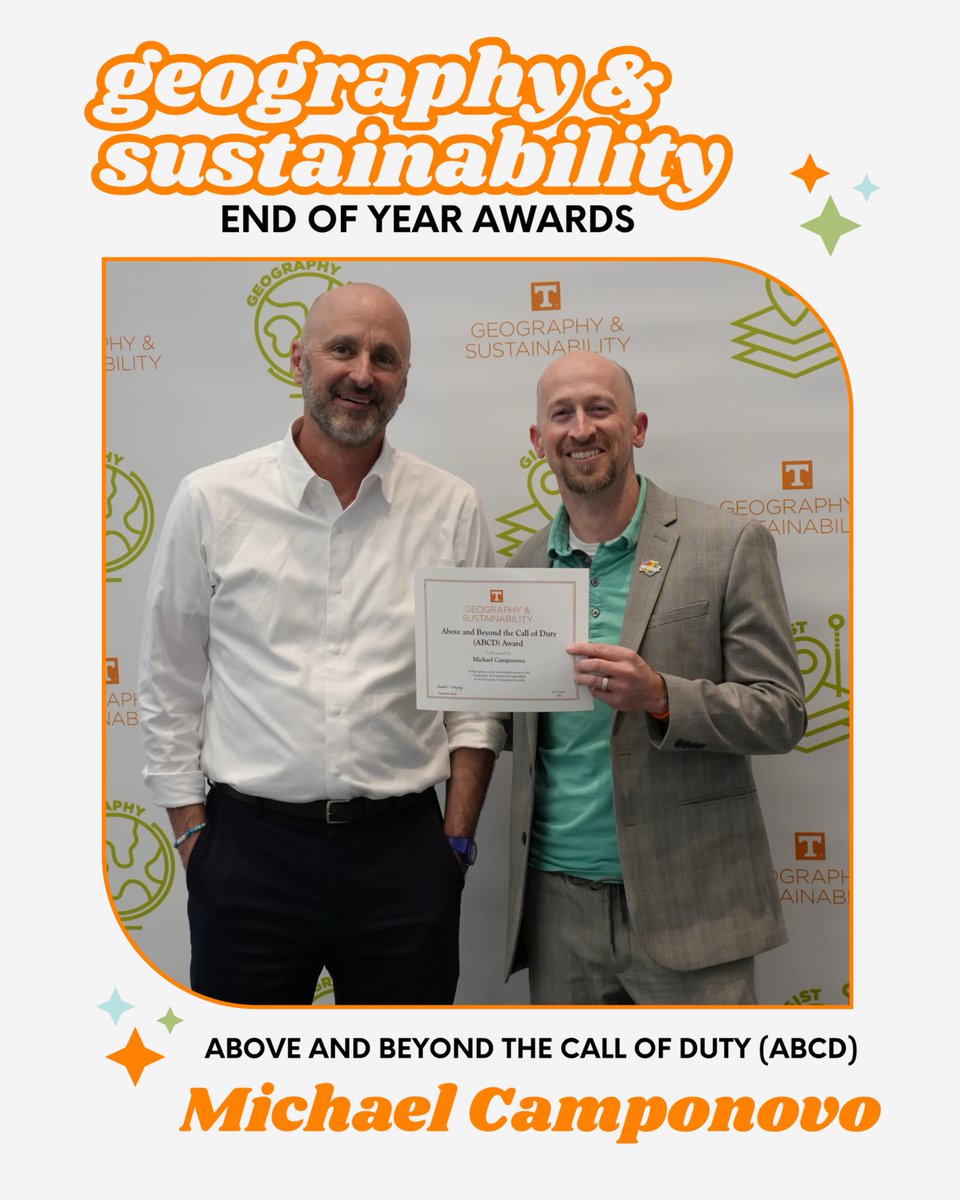
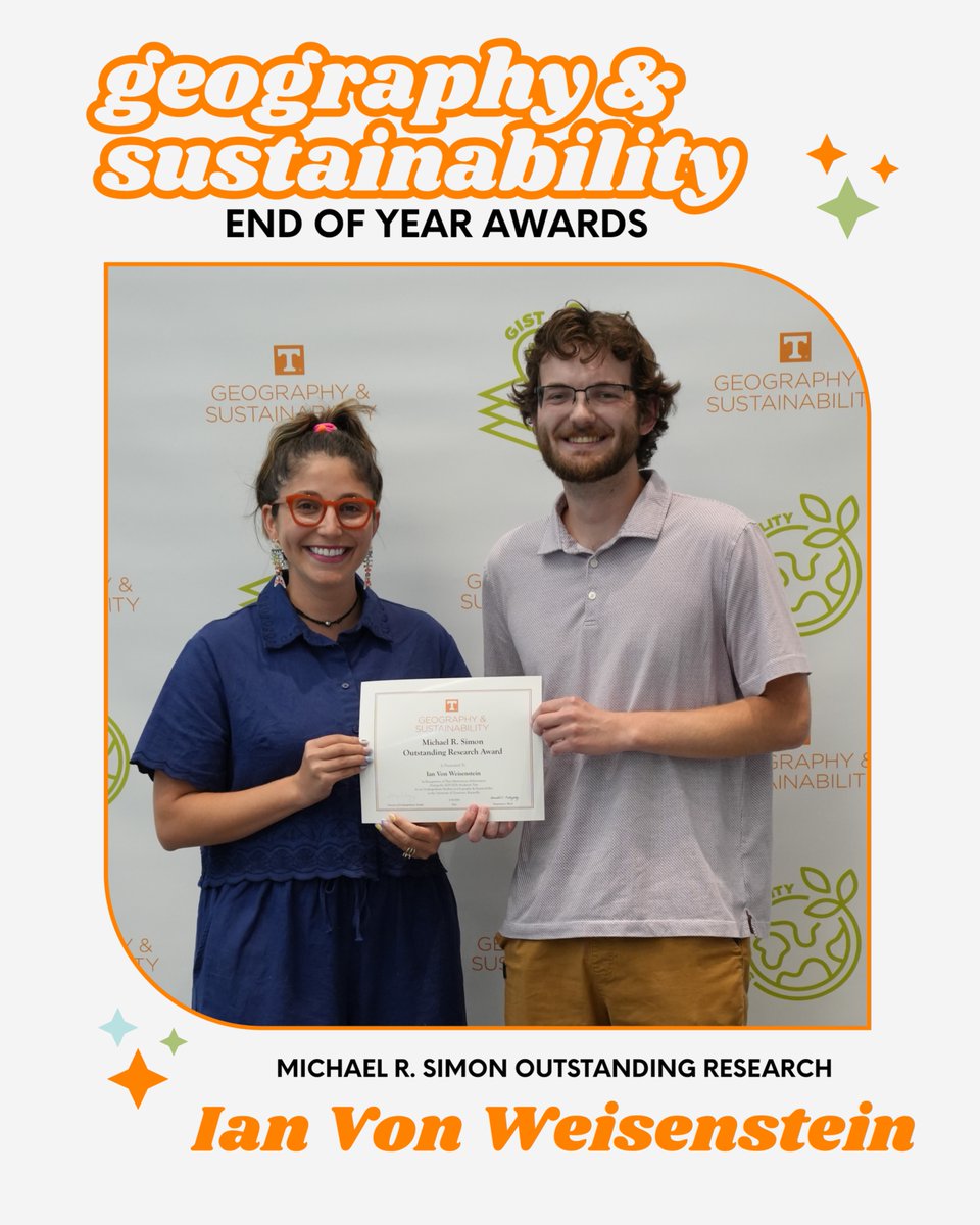
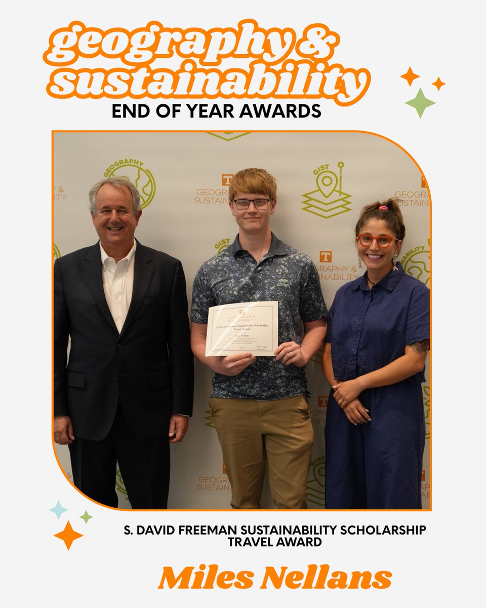
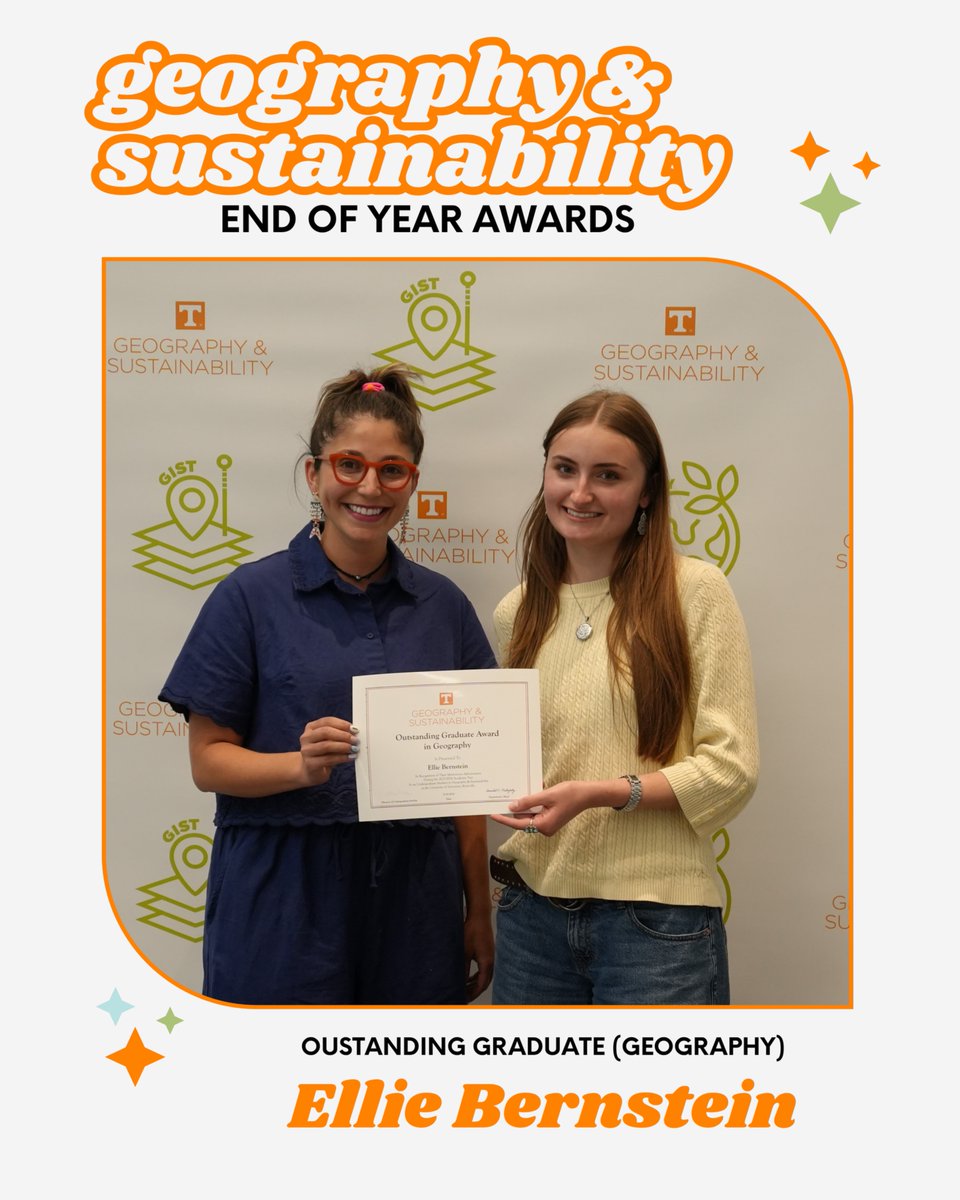
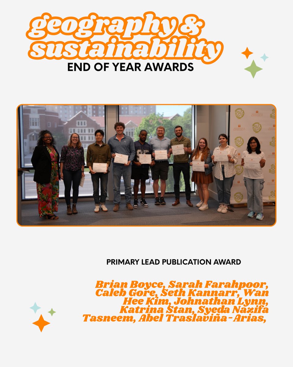
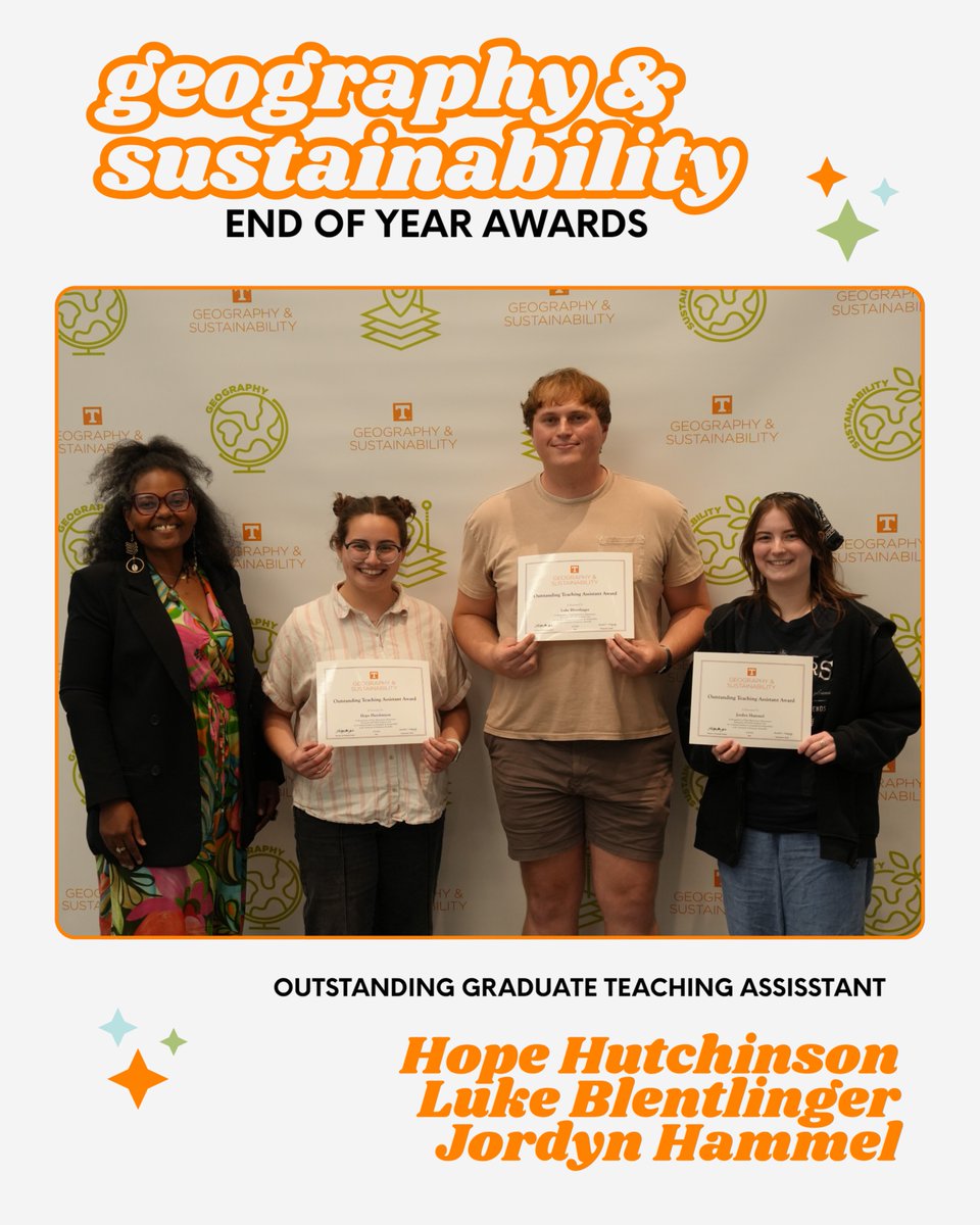
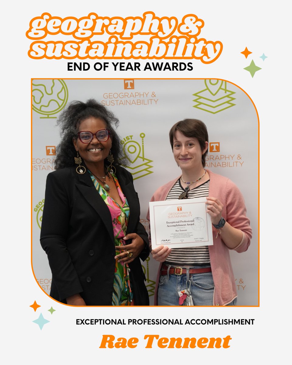
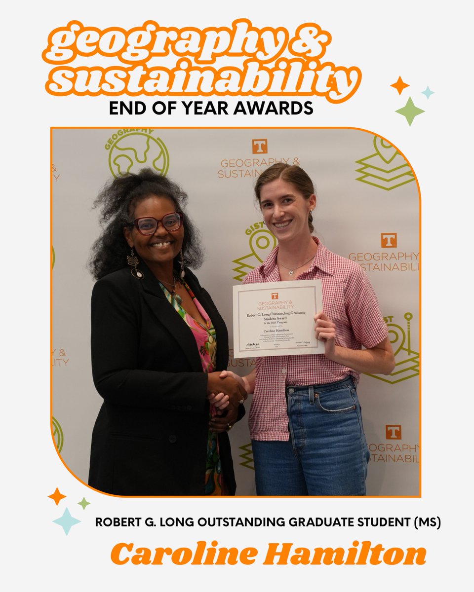
Congratulations to everyone recognized at this year’s department awards ceremony! ✨🌎🧡 Scroll this 🧵 to see this year’s graduate, undergraduate and faculty awards recipients!
1
1
52
🎓 Outstanding Graduate Advocate: LaToya Eaves
🍎 Outstanding Faculty Teaching (Undergraduate): Jack Swab

1
14
🚀 Above and Beyond the Call of Duty (ABCD): Michael Camponovo
13
UTK Geography & Sustainability retweeted

Renaissance fairs began as a refuge for artists blacklisted during the Red Scare. Now they're a multimillion-dollar industry grappling with their countercultural origins. Cultural geographers explore how the spirit of the fairs has changed:
theconversation.com/as-renai…
2
4
264
UTK Geography & Sustainability retweeted

Apr 21
Hurricanes devastated Florida’s East Coast, then seagrass made an unexpected comeback. Another great contribution to @ConversationUS from @UTKGeography @ArtsSciencesUT. Well done, Drs. Hannah Herrero @hvherrero & Stephanie Insalaco-Wyner @SouthwesternU theconversation.com/hurrican…
1
114
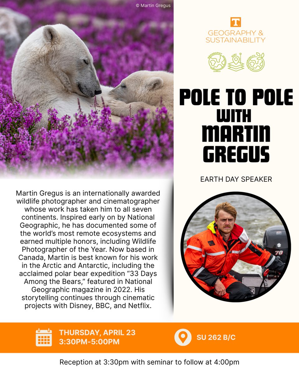
Join us for our Lunch & Learn with our Earth Day speaker, National Geographic Photographer and BBC Cinematographer Martin Gregus!
📅 Thursday, April 23
🕦 11:30AM-1:00PM
📍 Frieson Black Cultural Center 102/103
🍛 Catered by Tarik's North African
1
79
Join us on Thursday for our Earth Day Speaker, National Geographic Photographer and BBC Cinematographer Martin Gregus!
📅Thursday, April 23
🕞 Reception at 3:30pm with seminar to follow at 4:00pm
📍 SU 262 B/C
1
1
84
UTK Geography & Sustainability retweeted
Apr 17
As renaissance fairs become big business, can they retain their counterculture roots? Cultural geographers Katrina Stack & Reagan Yessler @theAAG @UTKGeography contribute to the public's understanding of these fairs as spaces of escape and comfort theconversation.com/as-renai…
3
4
352