
Sustainability, conservation and direct environmental action. Working to build a future where people can live in harmony with nature.
Joined September 2010
- Tweets 9,481
- Following 281
- Followers 32,183
- Likes 888
3,695 Photos and videos


Jun 12
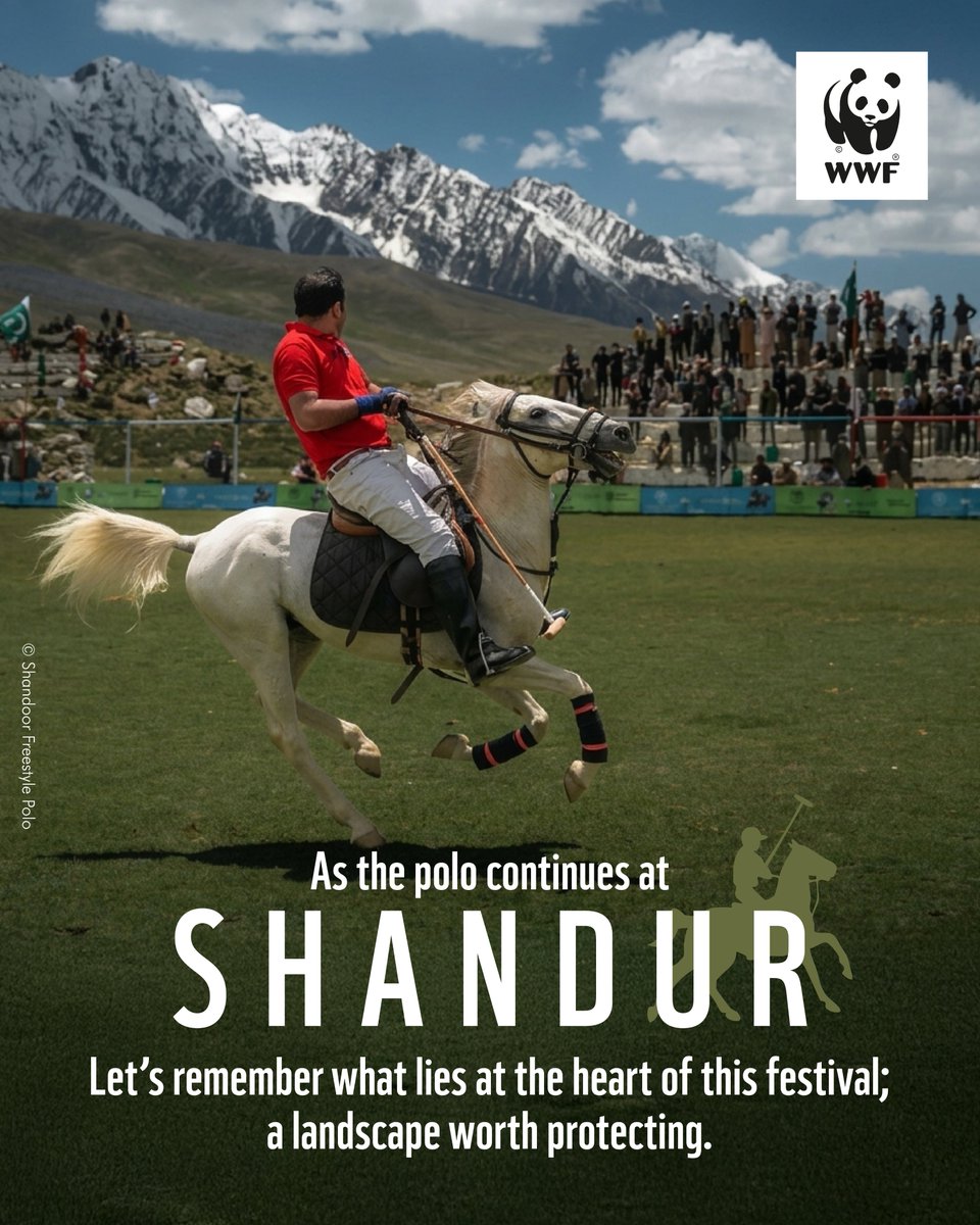
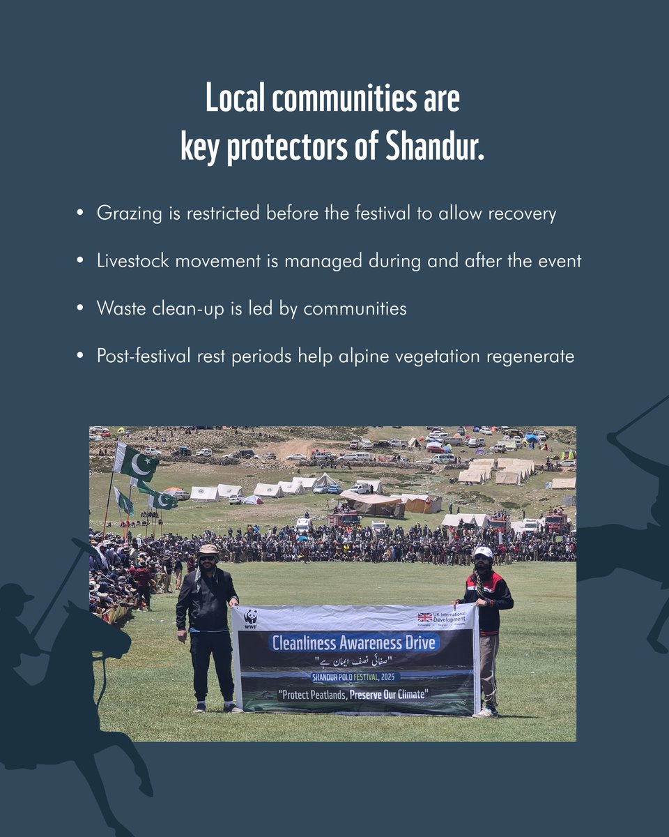
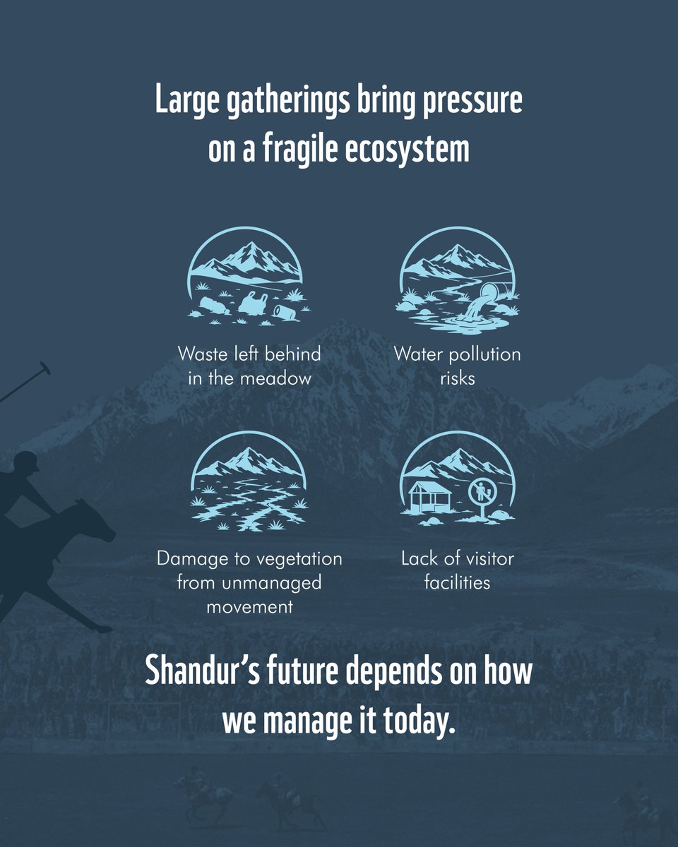
#Shandur is known globally for its iconic polo festival, but behind the celebration lies a fragile high-altitude ecosystem that is increasingly under pressure.
From grazing lands and freshwater sources to medicinal plants and alpine meadows, the plateau is a lifeline for both nature and local communities. Yet rising tourism, waste accumulation, and changing climate patterns are testing its resilience.
Local communities continue to play a vital role, managing grazing, guiding restoration periods, and leading post-festival clean-ups in collaboration with WWF-Pakistan and other partners.
Shandur reminds us that nature is not just a backdrop to events, it is the foundation that makes them possible.

1
3
16
361
Jun 11
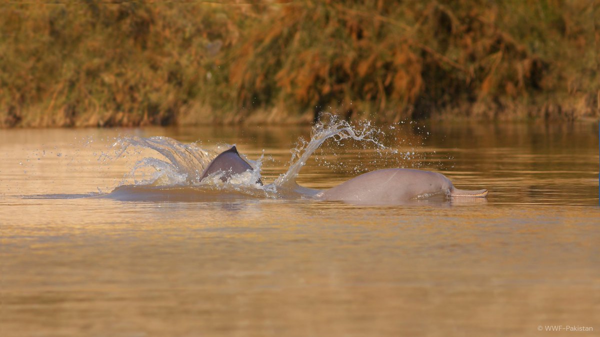
WWF-Pakistan welcomes the notification by @PunjabWildlife and @GovtofPunjabPK declaring the stretch of the Indus River with the highest density of Indus River dolphins in Punjab as the Punjnad Indus River Dolphin Wildlife Sanctuary.
This is a major milestone for dolphin conservation and the protection of the Indus ecosystem. The designation strengthens Pakistan’s network of protected areas and reflects the country’s commitment to biodiversity conservation ahead of CBD COP17.
We appreciate the efforts of Senior Minister @Marriyum_A in making this happen.
The Indus River is Pakistan’s lifeline and home to the endangered Indus River dolphin, one of the world’s rarest freshwater dolphins. With only around 2,000 dolphins remaining in the wild, protecting their habitat is critical for the species’ long-term survival.
WWF-Pakistan has worked for decades with government, key partners, and local communities to conserve this remarkable species and its habitat.
2
12
47
908
Jun 10
Water is at the heart of livelihoods, food security, and climate resilience in Chitral.
Watch how communities are strengthening water management through nature-based solutions, helping improve resilience to climate-related challenges while supporting sustainable development.
Under the Water Resource Accountability Project (WRAP), with the support of Foreign, Commonwealth & Development Office (@FCDOGovUK), the documentary showcases local efforts, community-driven solutions, and the impact of working with nature to secure water resources for the future.
Watch here: youtu.be/glEyhARuDZQ
#Chitral #NatureBasedSolutions #WaterManagement #ClimateResilience #SustainableDevelopment #Pakistan
5
10
161
Jun 9
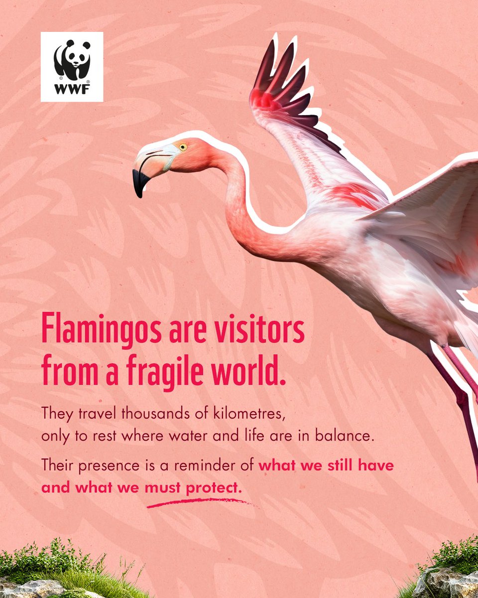
Flamingos are among the world’s most iconic birds. Yet these striking birds face growing threats from poaching, habitat degradation, pollution, human disturbance, and the impacts of climate change.
As wetlands and other critical feeding, breeding, and wintering habitats become increasingly vulnerable, flamingo populations face mounting challenges that are affecting their survival and migration patterns.
Let’s work together to ensure that future generations continue to witness these remarkable birds in the wild.
#Flamingos #Wetlands #Biodiversity #Conservation #NatureMatters
10
50
842
Jun 8
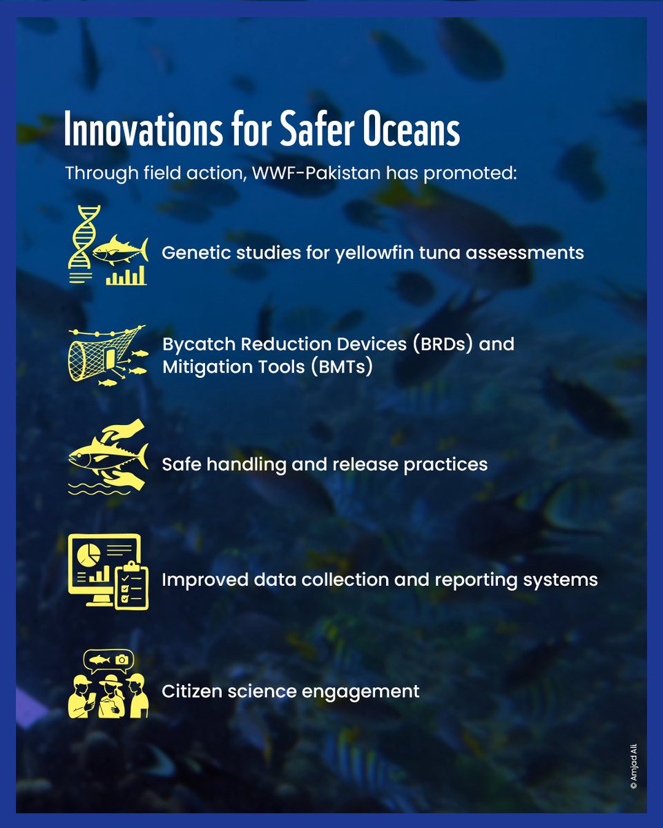
Protecting our oceans is not just about conservation; it is about the future of food security, supporting livelihoods, and blue economy growth, along with habitat and species recovery, for the flagship species.
Pakistan is one of the important coastal states that has diverse marine natural resources, stretching over 1,000 km of coastline and supporting rich ecosystems from mangrove forests to coral reefs and offshore waters.
These waters are home to a range of commercially important fisheries, including tuna species, and endangered marine species such as dolphins and whales, sharks and rays, and foraging areas for all five tropical marine turtle species and mangrove forests along 50 species of coral species, making them vital for biodiversity, food security, and coastal livelihoods.
WWF-Pakistan is working with fishing communities to promote regenerative conservation and sustainable fisheries and co-management of the marine natural resources and healthy oceans.


4
20
308
WWF-Pakistan retweeted

Environmental challenges do not begin in isolation, and neither do the solutions.
This #WorldEnvironmentDay, students, faculty, and practitioners gathered at Gomal University, D.I. Khan to discuss climate resilience, environmental stewardship, and the role of collective action.
3
1
193
Jun 6
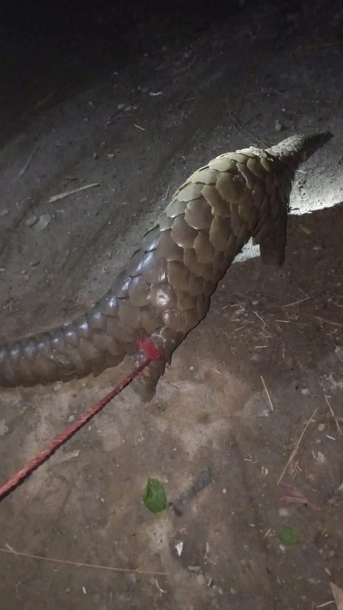
A pangolin recently being illegally offered for sale through social media was successfully traced and recovered through the coordinated efforts of WWF-Pakistan, with the support of the Mardan Wildlife Division.
The offender was apprehended and fined in accordance with wildlife protection laws.
This incident highlights the ongoing threat of illegal wildlife trade, which continues to endanger Pakistan’s unique biodiversity and vulnerable species. Pangolins are among the world’s most trafficked mammals and play an important role in maintaining healthy ecosystems.
Timely intervention and strong collaboration between conservation organizations and wildlife authorities are critical to combating wildlife crime and ensuring the protection of species that belong in the wild.
Note: The pangolin shown in the image was found tied by its leg by the offender. It is currently undergoing veterinary examination and will be released back into its natural habitat once it has been declared fit.
#WWFPakistan #PangolinConservation #IllegalWildlifeTrade #ProtectWildlife
2
7
43
664
Jun 6
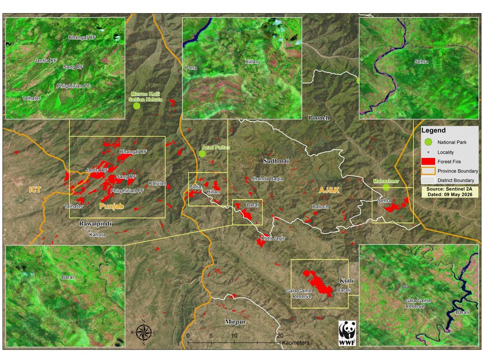
WWF-Pakistan has analysed satellite imagery following the recent forest fires in Kotli Sattian, revealing that the scale of the wildfire crisis is significantly larger than initially reported.
Satellite observations from May 2026 identified active fire hotspots and burn scars affecting nearly 9,000 hectares of forested landscape across more than 50 locations in Rawalpindi District and the Kotli and Sudhnoti districts of Azad Jammu & Kashmir. The affected areas include ecologically important forests near Phirphirian, Bhangal, Jantra, Talhater, Pona, Hillan, Kotli Jagir, Baloch, Baral, Barali, and Sehra.
These fires have impacted critical Chir Pine and subtropical scrub forests within and around the Murree–Kotli Sattian–Kahuta National Park and Azad Pattan National Park, threatening biodiversity, watershed functions, and the climate resilience of the region. Beyond the immediate loss of forest cover, such fires can degrade wildlife habitat, increase soil erosion, and compromise the ecosystem services upon which local communities depend.
The findings underscore the urgent need to strengthen early warning systems, satellite-based fire monitoring, firefighting capacity, and community awareness. WWF-Pakistan also calls for enhanced coordination among forest, environmental, disaster management, and local government institutions to reduce future wildfire risks and safeguard these valuable ecosystems.
1
5
21
684
Jun 5
Every milestone in conservation begins with a vision.
This World Environment Day, join WWF-Pakistan Director General, Hammad Naqi Khan, as he reflects on WWF-Pakistan’s journey from a small office established in 1970 to one of the country's leading conservation organisations.
Through decades of protecting wildlife, restoring ecosystems, empowering communities, advancing sustainable practices, and building resilience to climate change, the journey reflects what can be achieved when people and nature thrive together.
As environmental challenges continue to grow, this story serves as a reminder that conservation is not a destination. It is a continuous commitment to securing a sustainable future for Pakistan.
#WorldEnvironmentDay #WWFPakistan #ClimateAction #Conservation #Sustainability #Pakistan
2
18
263
Jun 4
Lahore is not just growing. It is heating up.
This animation shows 15 years of nighttime land surface temperature data from Lahore, revealing how rising urbanization and the loss of green spaces are reshaping the city's climate.
As we mark World Environment Day, this serves as a reminder that trees, parks, farmland, and urban green spaces are not luxuries. They are among our strongest natural defences against extreme heat.
To know more, read here: wwfpak.org/knowledge_hub_/ww…
#WorldEnvironmentDay #WWFPakistan #ClimateAction #Lahore #UrbanHeat #GIS
36
44
1,445
Jun 3
Forest fires are a natural ecological phenomenon in many forest ecosystems; however, their frequency, intensity, and scale have increased significantly in recent decades. This rise is being driven by rising temperatures, prolonged dry spells, and the accelerating impacts of climate change. Alongside these climate pressures, a considerable proportion of forest fires are also linked to human activity, including land-use practices and, in some cases, deliberate burning, making prevention and responsible management more critical than ever.
Against this backdrop, WWF-Pakistan raises concern about the recent forest fire incident reported in Kotli Sattian, which has resulted in extensive damage to forest cover across a large area of an ecologically sensitive landscape. These forests are vital for hosting biodiversity, supporting fragile habitats, maintaining watersheds, and providing essential ecosystem services to surrounding communities.
Such large-scale losses highlight the urgent need to strengthen forest fire prevention systems, improve early response mechanisms, and promote community awareness to reduce human-induced risks. WWF-Pakistan calls on relevant authorities to prioritize forest protection as a key climate and conservation priority before such incidents lead to irreversible ecological damage.
1
4
17
520
Jun 3
Once a seasonal refuge for flamingoes, Namal Lake in Mianwali has largely dried up, pushing these graceful migratory birds to seek new habitat at Jhlar Lake in the Soon Valley.
While their arrival at Jhlar is a spectacular sight, it also tells a deeper story.
Wetlands are among Pakistan's most valuable ecosystems, supporting biodiversity, regulating water systems, and providing critical habitat for migratory species. As these water bodies shrink, the wildlife that depends on them is left with fewer places to survive.
Watch the clip to witness the flamingoes and reflect on what their journey reveals about the changing state of our wetlands.
Credits: Umer Bin Khalid | WWF-Pakistan
#WWFPakistan #Wetlands #Biodiversity #Flamingoes #SoonValley #NamalLake
2
35
74
2,146
WWF-Pakistan retweeted

Don't let 50° be the NEW NORMAL
@UNEP @UN @WWF @WWFPak @ClimateCha2209 @GovtofPakistan @uet_lhr @BACentreofExcel @PnDDPb @GovtofPunjabPK @VilledeParis @MaryamNSharif @Marriyum_A
#NowForClimate #WorldEnvironmentDay #50@50° #beattheheat #coolcoalition
2
2
152
Jun 2
Can pests be controlled without relying heavily on chemical pesticides?
From naturally occurring plants on sand dunes to eco-friendly pest management approaches, farmers are finding innovative ways to reduce pest populations while supporting biodiversity and farm resilience.
Watch how WWF-Pakistan and the Sapphire Textile Group are helping bring these solutions to the field.
#WWFPakistan #SapphireRegenerativeCottonProject #RegenerativeCotton #SustainableAgriculture
2
6
191
May 25
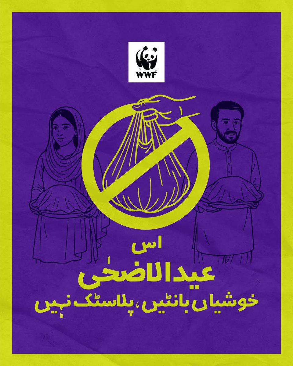
This Eid al-Adha, share blessings, not plastic!
Swap out single-use plastic bags for reusable containers or eco-friendly alternatives when distributing sacrificial meat.
Celebrate Eid with compassion-for people, animals, and the planet.
#EidAlAdha #PlasticFreeEid #SustainableEid #BeatPlasticPollution #WWFPakistan #ActForNature #GreenEid #EidForThePlanet
3
10
269
May 24
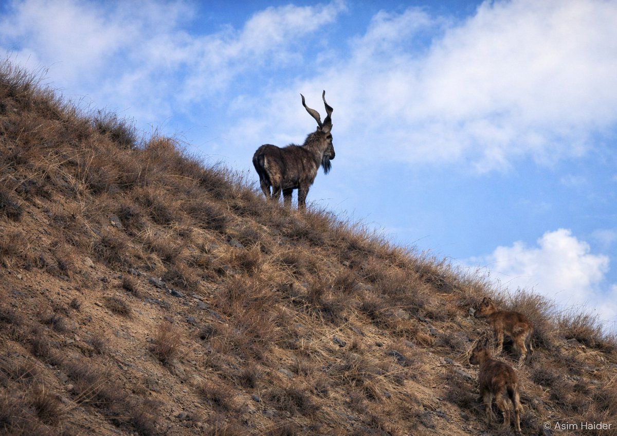
On International Day of the Markhor, we celebrate Pakistan’s national animal, a majestic species that plays a vital role in maintaining the ecological balance of fragile mountain ecosystems.
Here is a glimpse of the Markhor in the rugged landscapes of Chitral. During recent field surveys, teams recorded sightings of the Kashmir Markhor (Capra falconeri cashmiriensis), a flagship species of Pakistan’s northern mountains.
Once listed as Endangered on the IUCN Red List and now classified as Near Threatened, the Markhor stands as a powerful example of how long-term conservation efforts, community stewardship, and wildlife protection can support species recovery.
These photographs were captured during surveys conducted in Chitral Gol National Park and the Toshi-Shasha Conservancy, where teams assessed wildlife movement corridors and identified suitable locations for AI camera systems to support conservation efforts and help mitigate human-wildlife conflict.


1
27
80
2,155
May 23
On World Turtle Day, watch our expert from Taunsa release rescued freshwater turtles back into the river where they belong. 🐢💧
Did you know? Freshwater turtles in Pakistan face growing threats from illegal poaching, habitat loss, and water pollution. These important aquatic scavengers play a vital role in maintaining healthy river ecosystems, yet their populations continue to decline.
Protecting freshwater turtles means protecting our rivers and the life they support.
8
33
547
May 22
From the depths of the Indus River to the immersive experience of our Taunsa Information Centre, biodiversity comes alive through deeper connection, awareness, and action for the natural world around us.
This International Day for Biological Diversity, we celebrate the rich web of life sustained by Pakistan’s rivers and wetlands, and the species that depend on these fragile ecosystems to survive.
#BiodiversityDay #WWFPakistan #IndusRiver #BiologicalDiversity #NatureConservation
Animation Credits: @vizbybux
10
20
407
May 21
The Islamabad Wildlife Management Board (@WildlifeBoard) plays a critical role in shaping the future of conservation and protected area management in the federal capital. It is therefore important that its composition reflects the spirit of inclusive, science-based, and participatory governance envisioned under the governing Act.
In this context, WWF-Pakistan expresses concern on the recent re-constitution of the Board; particularly the lack of representation of civil society, independent conservation experts, and technical specialists; despite the intent outlined in the Act.
WWF-Pakistan also believes that the Chair of the Board must be a senior technical representative of the Ministry of Climate Change (@ClimateChangePK) to ensure stronger policy alignment, institutional coordination, and strategic oversight on national conservation priorities.
As Pakistan faces increasingly complex biodiversity challenges, it is essential that conservation governance reflects diverse expertise, public representation, and collaborative decision-making. WWF-Pakistan remains committed to supporting transparent, inclusive, and science-based conservation governance, and looks forward to constructive engagement for stronger environmental stewardship in Pakistan.
6
21
552