
Joined September 2018
- Tweets 11,720
- Following 550
- Followers 4,155
- Likes 100,663
5,665 Photos and videos


Pinned Tweet

9 Mar 2025
With significant external threats to NOAA, I figured it may be pertinent to discuss what TC forecasting looked like a mere half century ago. All images used in this thread come from the NHC — I will be focusing on 1974’s Hurricane Fifi, at 00z on September 19th.

9
66
400
47,383
Jun 8
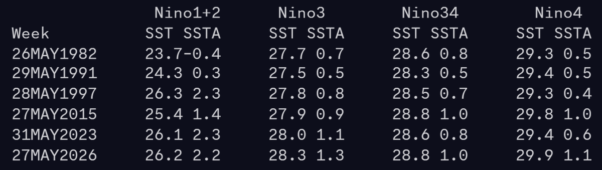
“Everyone” is not wrong about this hurricane season; the NOAA/CSU/etc forecasts are all reasonable with their expectations of a quiet year. You are not being lied to or misled — El Niño favors less activity and particularly so in the West Atlantic.

3
21
1,171
Jun 8
Strong storms are harder to come by during ENSO events anyway, given broadly unfavorable conditions. Sure it only takes one storm to make a hurricane season memorable, but rolling the dice 20 times rather than 10 increases the odds of that happening by a significant amount!!
1
10
524
Jun 8
Gulf SSTs aren’t really correlated with TC activity in the Gulf of Mexico anyway. Just a bunch of easily verifiable misconceptions being peddled (successfully!) for engagement
1
13
466
Jun 8
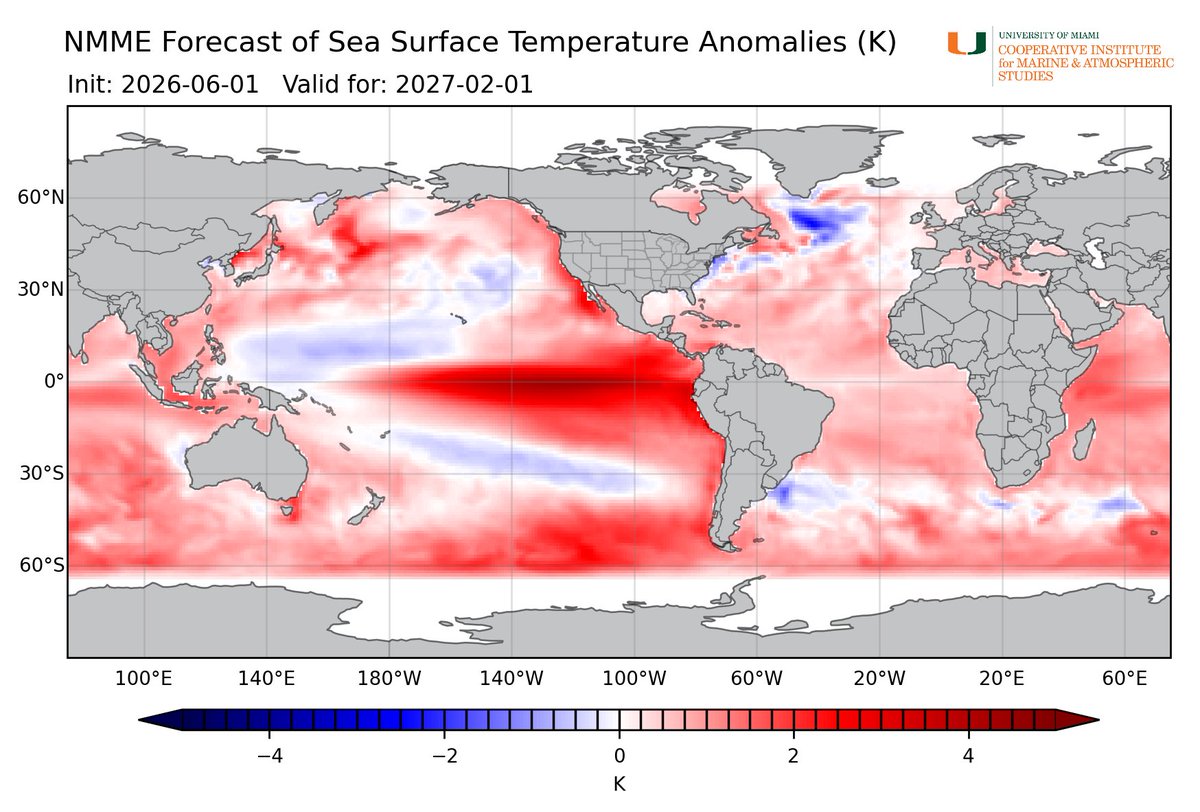
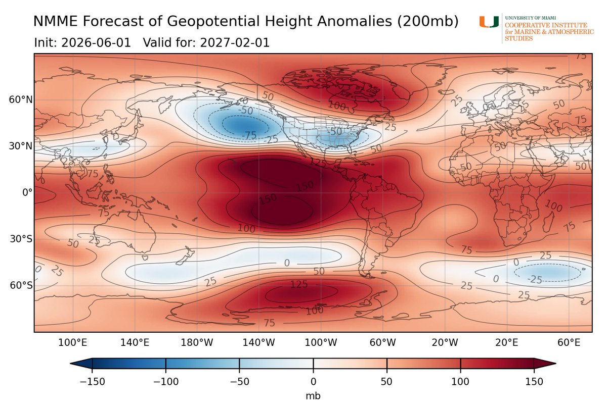
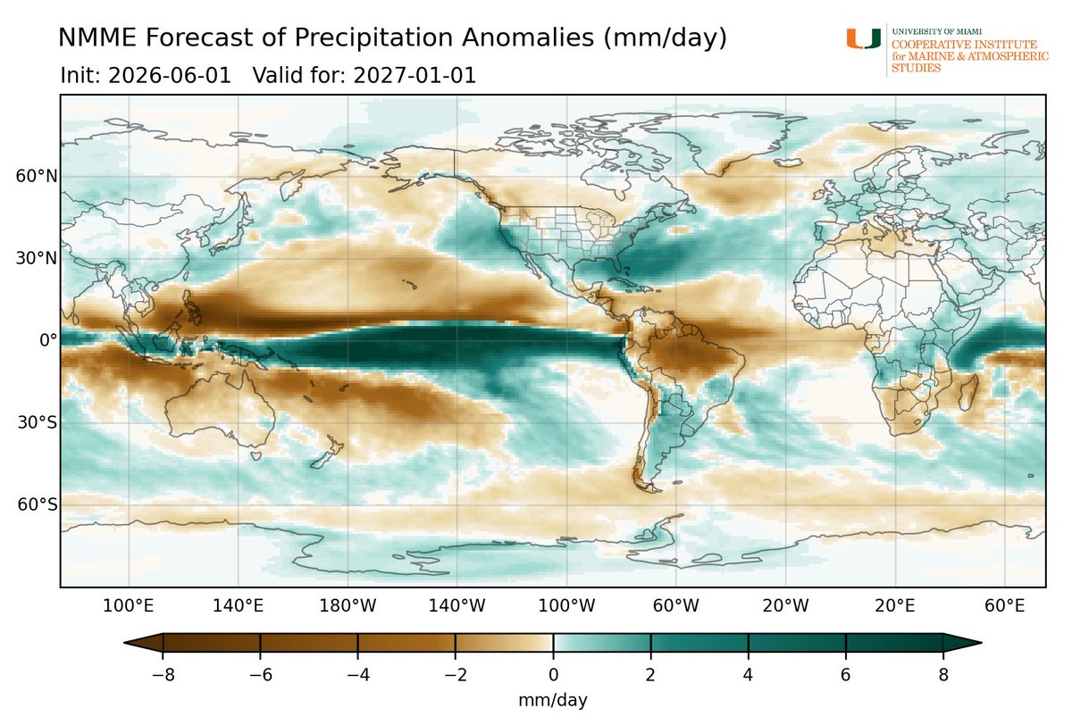
No real questions as to what will be driving the global circulation come this winter:
1
9
88
6,109
Deelan Jariwala retweeted

Jun 7
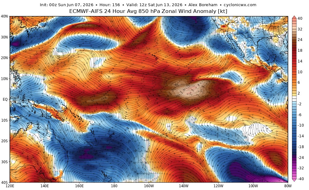
Incredible east Pacific westerly wind event projected in AIFS centered around June 13. The absolute strength of those westerlies won't be like those of the west Pacific weeks ago, (so less cooling evaporation), but the east Pacific thermocline will drop like a rock.
8
27
167
15,664
Jun 5
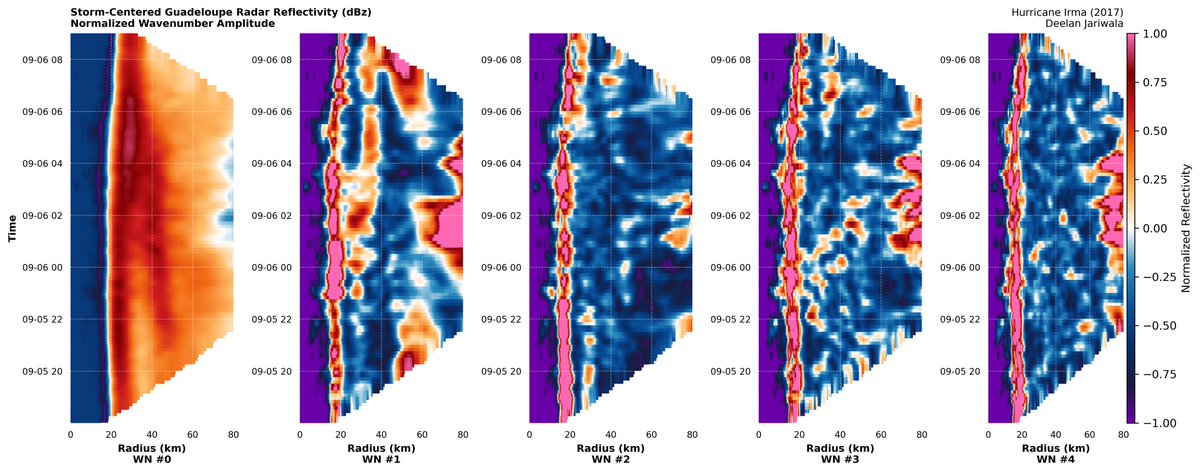
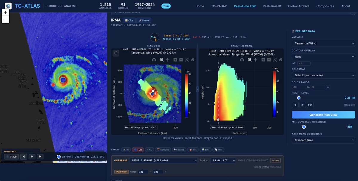
Radar loop of Irma (2017) during an interesting EWRC as seen from the radar on Guadeloupe. Tried to see if any of the higher wavenumber modes were contributing to the unusual behavior, but it doesn't really seem like it. Clearly dominated by the (a)symmetric components (0 and 1).
3
6
41
2,384
May 29
Overnight, convection associated with this feature was able to push upshear and tried to align the tilted vortex. The initial burst of convection has since collapsed due to continued ventilation, but with favorable thermodynamics, this shouldn’t be an issue for long.

May 29

Fascinating loop of a mesoscale swirl embedded within the broader circulation of #Jangmi rotating towards the mid-level center of circulation, where it spawns some intense convection. The resultant vortical hot tower will generate vorticity that’ll help spin up the cyclone.
19
1,040
May 29
Fascinating loop of a mesoscale swirl embedded within the broader circulation of #Jangmi rotating towards the mid-level center of circulation, where it spawns some intense convection. The resultant vortical hot tower will generate vorticity that’ll help spin up the cyclone.
1
6
31
1,971
Deelan Jariwala retweeted

May 28
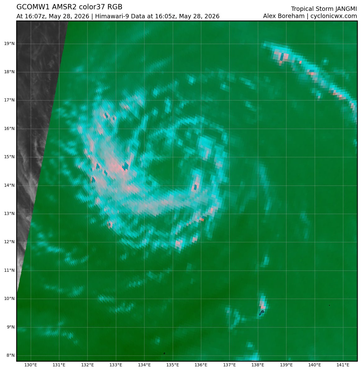
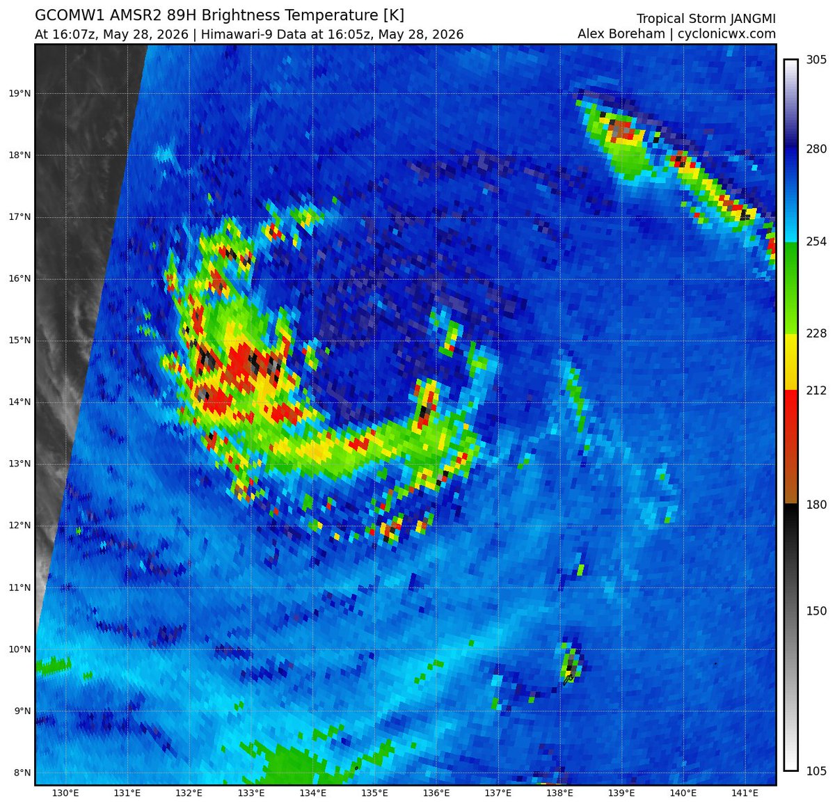
I've added a long-awaited feature: microwave imagery! Now you can see the structure of tropical cyclones from the GMI, SSMIS, and AMSR2 sensors! It's all on the satellite page, in the new microwave tab. Here's how #Jangmi looks:


9
19
84
13,368
Deelan Jariwala retweeted

May 25
Some random thoughts on the new era:
As AI steadily creeps into our work in the fields of meteorology and programming, there is an inevitable uneasiness associated with "losing control" and "becoming obsolete" as human developers and scientists. It's a fear I've occasionally felt, anyway, and I know I'm not alone. I used quotes because, while these are valid feelings, I don't think they must be reality.
The process of performing work is evolving as agents do more of it, but the impetus for that work is unchanged. We are the driving force of inspiration and curiosity that births our work in the first place. Taking ownership is the way to preserve autonomy and hard skills, and we're entering an era where that must be a personal, conscious choice.
If you're a student, you must pursue knowledge and stay hungry, lest silicon crutches leave you with passing grades but no ability. Harness AI to enhance your learning process, but never yield your understanding to it. Only you can ensure that.
If you're a programmer, AI is a dramatic accelerant - use it! It is the future of software. But insist on retaining ownership of your projects. Be a nosy manager, a steering influence on design decisions, and an intentional critic. The dopamine hit of pressing <Enter> will eventually wrest authorship from you otherwise.
If you're a scientist, AI is either expert-level in your field or will be someday. But science is still advanced by PIs, not AIs. Curiosity about the universe is a defining human trait - keep your curious hands on the rudder. Find the cutting edge and ride it; chances are you will advance the boundary with AI assistance far more than AI will alone.
Much about this new era is intimidating, but also exciting. I say grab it all by the horns and harness these capabilities for doing good in the world and your own life. Just choose continuously to protect your own sovereignty and humanity. Life is ours to live.
#NotWrittenByABot
21
61
445
42,418
May 24
Does anyone know what controls when the Google DeepMind ensemble starts clustering storms by invest as opposed to their (not great) internal system grouping? There’s been a WPAC invest for a few cycles, but this seemingly hasn’t manifested in the file yet.
1
6
506
May 20
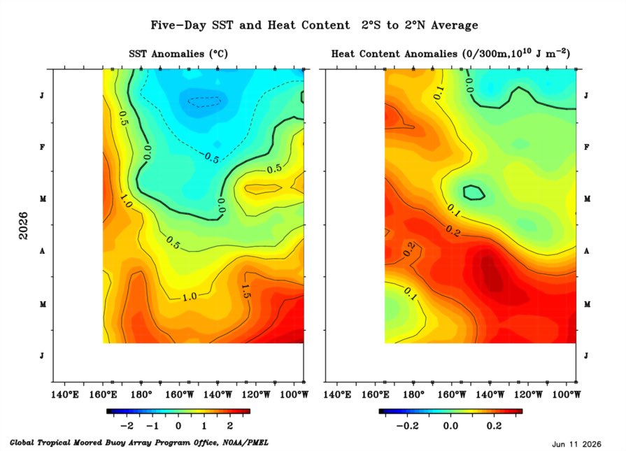
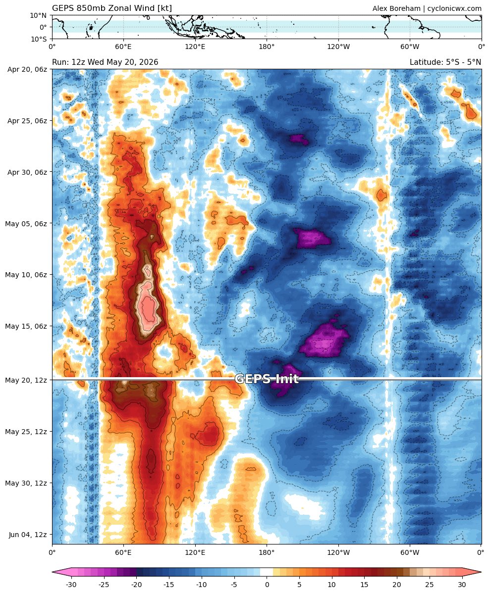
Vast amounts of heat have been transported into the eastern parts of the Pacific. The heat content in the WPAC is far from being exhausted though, having only been reduced to (roughly) average. There is a lot more heat to be moved still, and the upcoming WWB will likely aid this.

1
9
49
1,957
May 20
I suspect that the ultimate ceiling of this event may be the highest of any ENSO event in recent history as a result of the sheer amount of heat stored in the ocean over the last several years, because of both AGW and consecutive La Niñas. Remains to be seen if we get there.

2
3
11
637
Deelan Jariwala retweeted

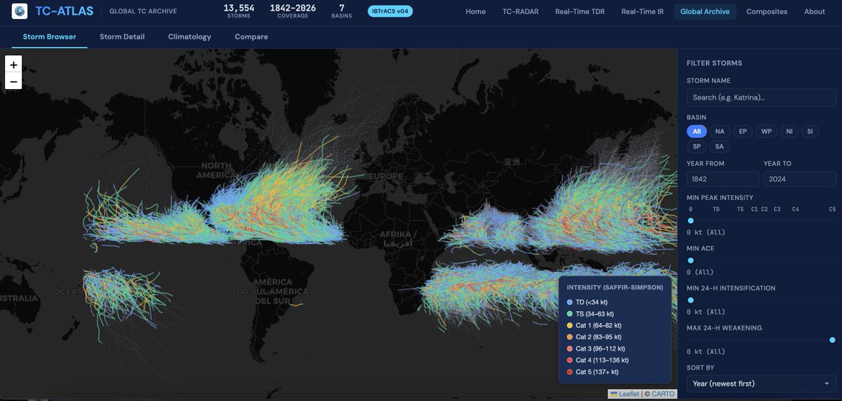
TC-ATLAS now features real-time subseasonal and seasonal monitoring pages with interactive diagnostics. Compare how the ongoing evolution differs from historical events and discover their impacts on hurricane activity here: michaelfischerwx.github.io/T…
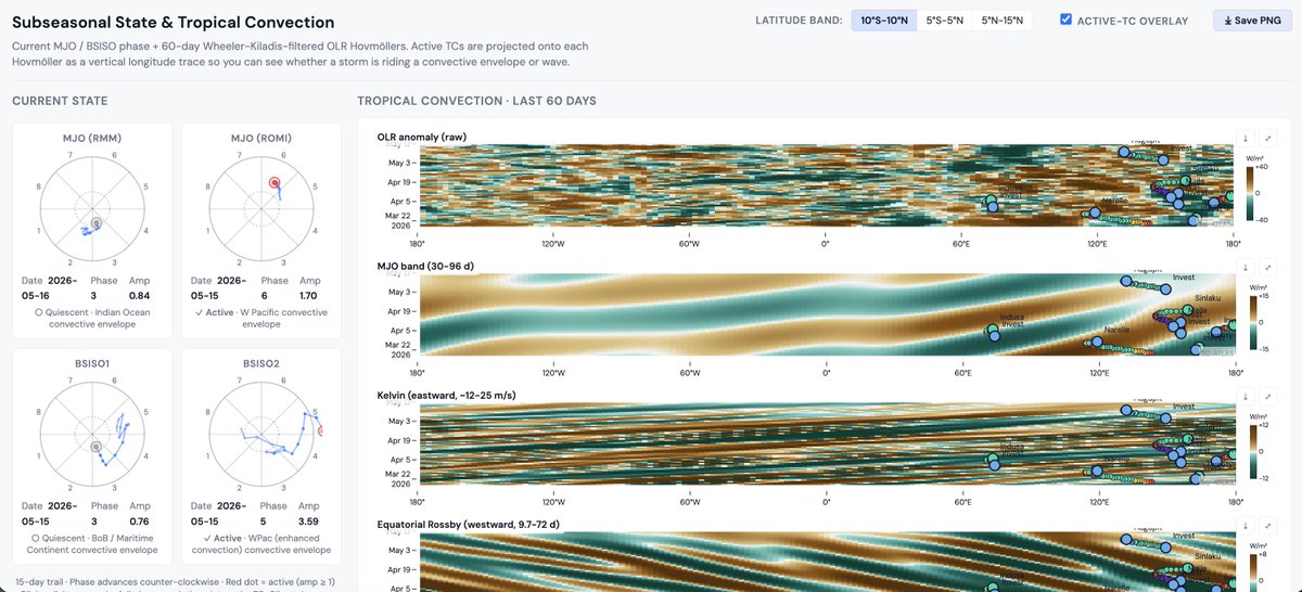
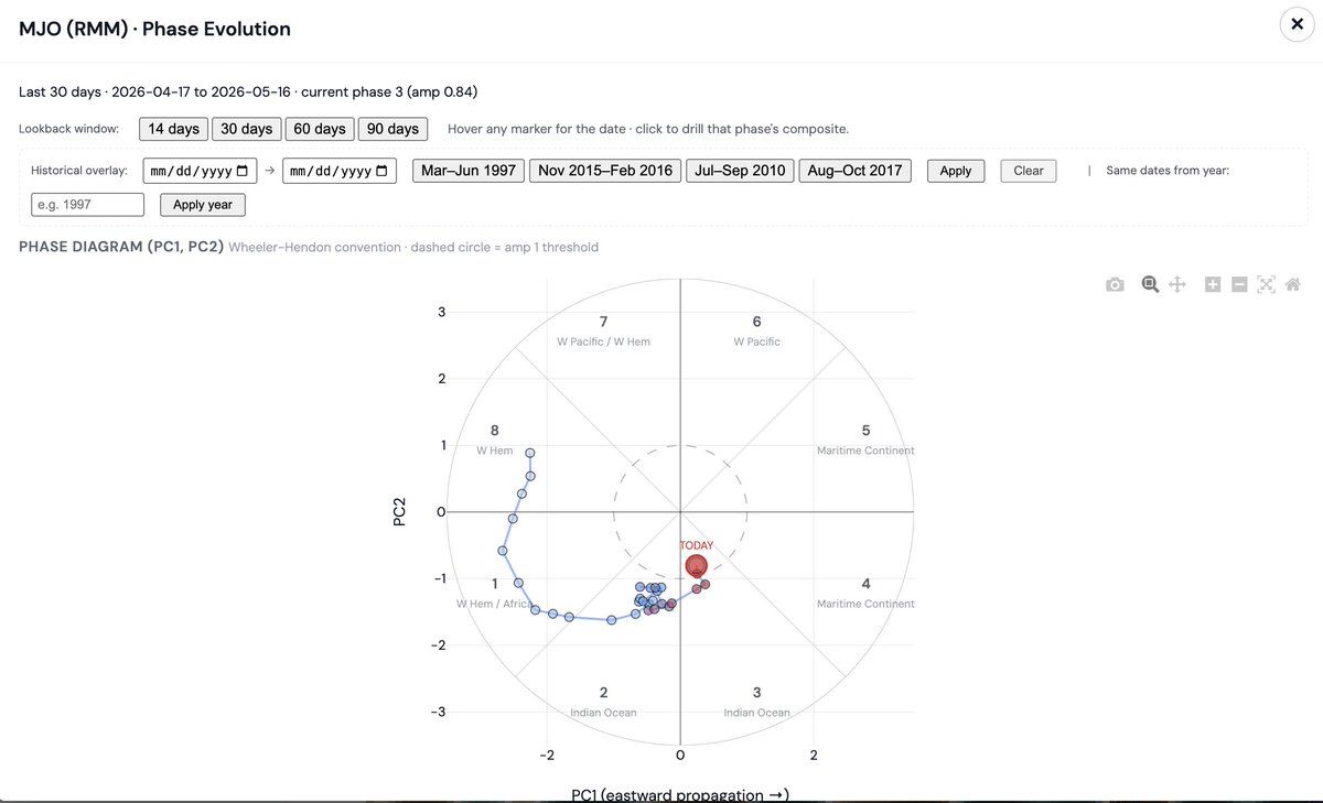
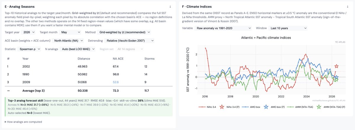
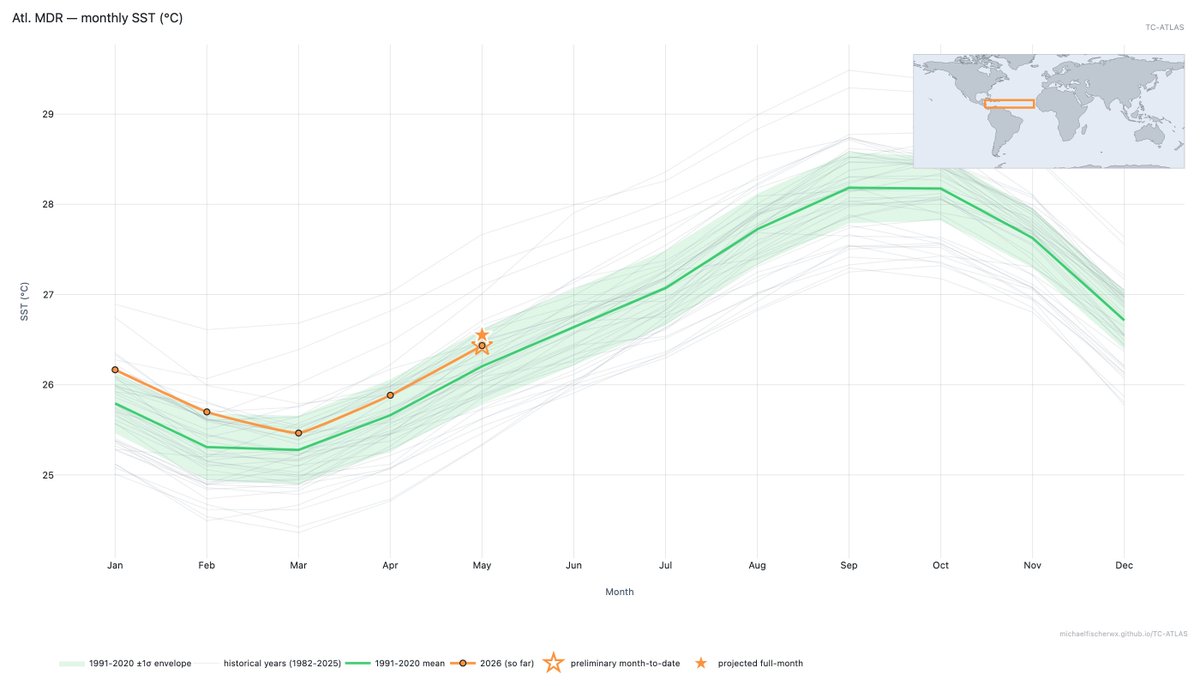

Interested in hurricanes? I want to introduce TC-ATLAS: the Tropical Cyclone Analysis Tool for Live and Archived Structure. Explore live or past storms without writing a line of code or downloading a data file, building on the capabilities of TC-RADAR: michaelfischerwx.github.io/T…
5
34
7,658
Deelan Jariwala retweeted

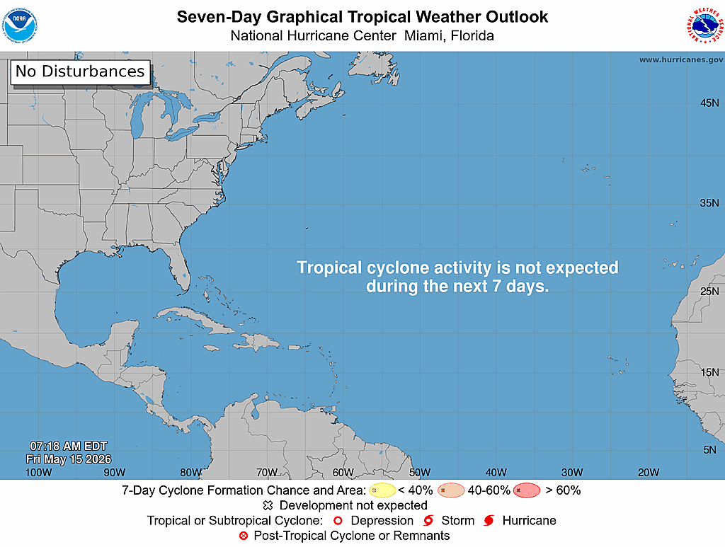
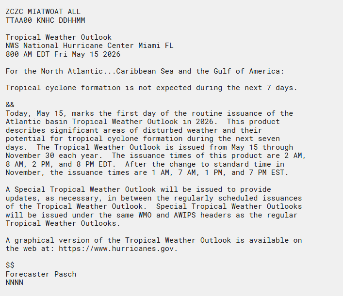
The first Atlantic Tropical Weather Outlook of 2026 is out.
Good news: No tropical cyclone formation is expected over the next 7 days across the Atlantic, Caribbean Sea, or Gulf.
Today (May 15) marks the start of daily Tropical Weather Outlooks, issued through Nov 30 at 2 AM, 8 AM, 2 PM, and 8 PM EDT.
Stay informed all season long: hurricanes.gov
19
392
1,350
130,277
May 9
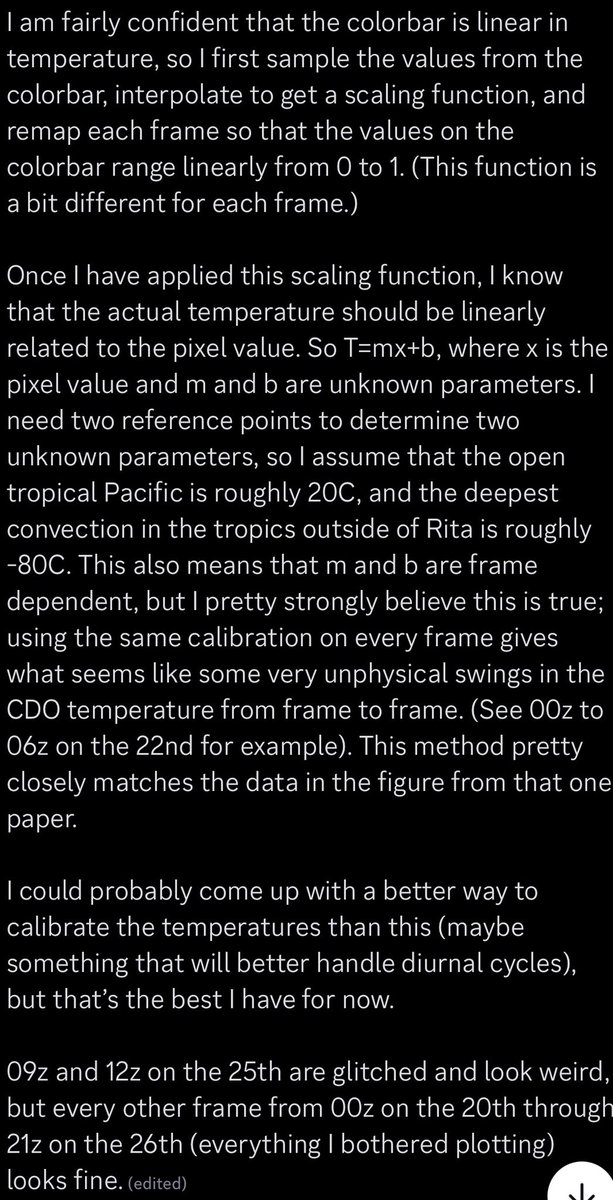
True! Someone I know (who is much smarter than I am) has been hard at work trying to derive brightness temperature data from the BMPs, using an old JMA paper as a reference. The results are pretty incredible — Rita ‘78 is clearly one of the greatest TCs in the satellite era.
May 9

Don't forget @WxTca, he's the one who actually contacted JMA and got the data initially.
3
5
100
7,114
May 9
Important note on their methodology:
The images the JMA provided lacked any real metadata and were merely scanned in microfilm.
1
8
885
May 10
A storm centered loop made by the same person. The diurnal pulsing of the cirrus canopy and banding is pretty much textbook. Worth noting that there are significant error bars on the actual estimated brightness temperatures; the gif should be interpreted qualitatively at best.
13
618