
Joined August 2013
- Tweets 9,504
- Following 540
- Followers 3,279
- Likes 12,038
1,402 Photos and videos


Jun 14
Looking for advice from the bike gurus.
13 going on 14yr olf youngster has outgrown his older CRF110F.
Natural progression is probably CRF125FB big wheel, but what are the thoughts on a XR150L?
General farm mustering and trail riding. He's not a racer by any means.
Thoughts?
13
3
9
5,053
Ben McTaggart retweeted

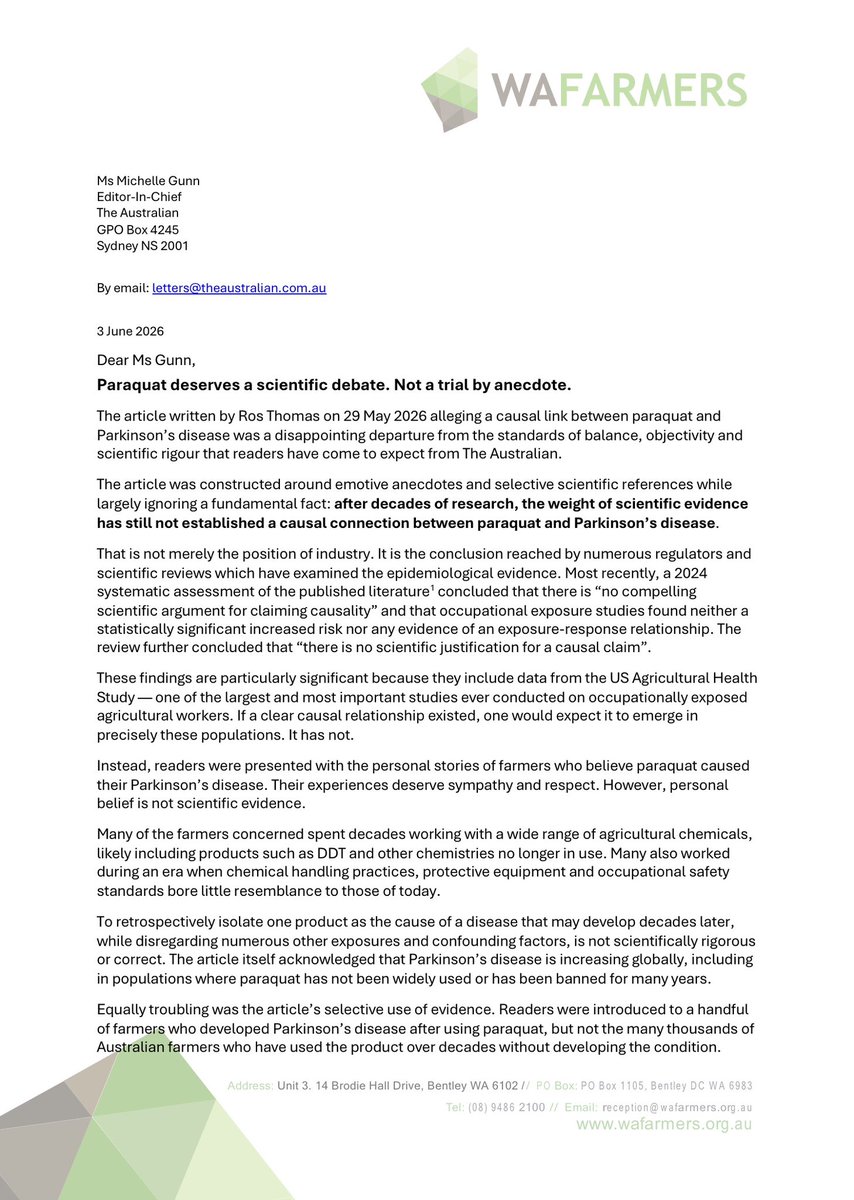
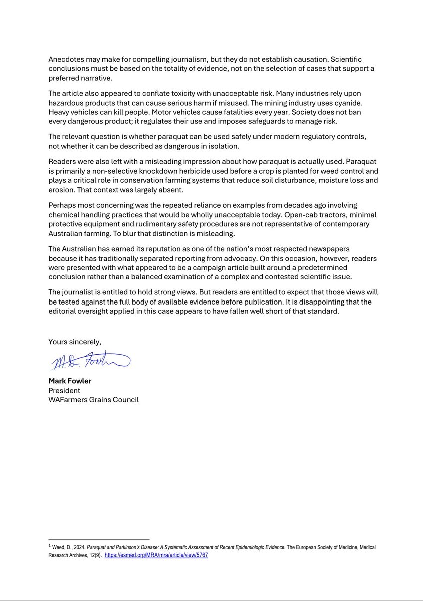
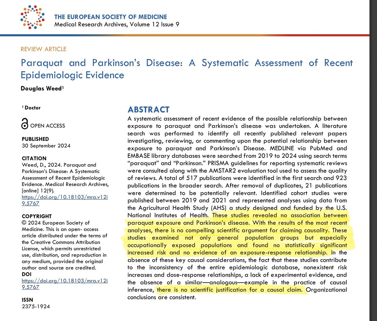
Here is the @WAFarmersGrains letter to the editor of the @australian regarding Ros Thomas’ article on paraquat. We have asked for the opportunity to respond in this weekend’s paper with our own op-ed on this important issue. @DavidPocock
May 30

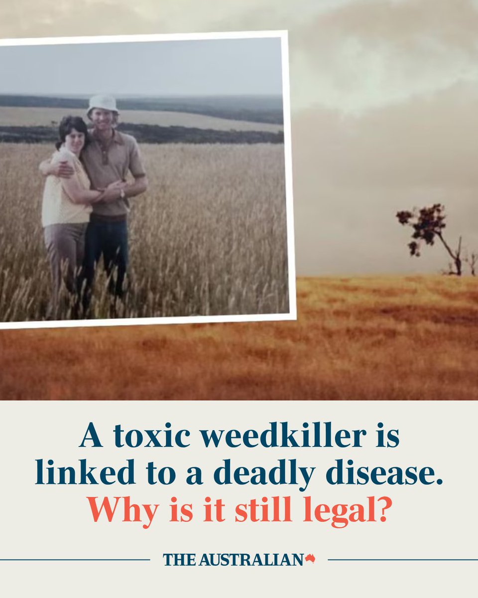
Paraquat was hailed as a wonder poison for Australian farmers but 60 years since its introduction, those stricken with Parkinson’s disease are counting the cost. Read the full story: bit.ly/4nX2Llj
7
17
50
4,888
Ben McTaggart retweeted

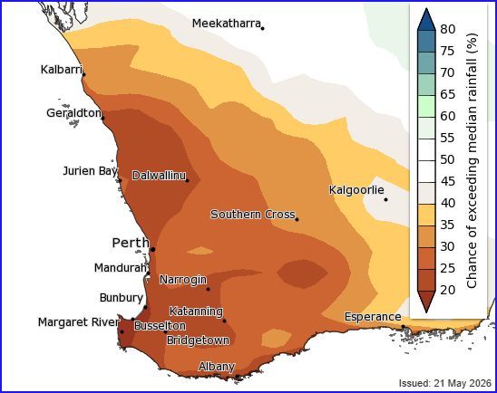
Below average winter rainfall likely
The Bureau have released their long range rainfall summary for AU, and for the South West Land Division its not painting a great picture.
After some solid starting rains for much of the region post TC Narelle and other rounds of thunderstorm activity, May has not delivered much if at all, and the next 3 months we are looking at a 60% to 80% chance that rainfall is likely to be below average for south-western AU. The dry signal over the three‑month period is heavily driven by stronger probabilities of below‑average rainfall emerging later in the season more so than earlier in the winter season. This is evident when analysing the monthly chance of above median for June and July, which is signally generally average rainfall for the month.
Over south-west, this rainfall forecast from the Bureau's ACCESS-S model is generally consistent with forecasts from most international models, which also show drier than average rainfall. However, the extent of the dry signal is generally larger in other models.
What are your thoughts on these long range forecasts and how might it affect you?
5
6
20
2,930
Ben McTaggart retweeted

May 21
Living Farm's Graduate Research Agronomist Program is now open!
Join a dynamic, innovative team driving agricultural research in WA. To apply, submit your CV, cover letter and referees by 6:00pm, Friday 19th June 2026.
Apply here livingfarm.com.au/graduate-p…

1
5
15
532
Ben McTaggart retweeted

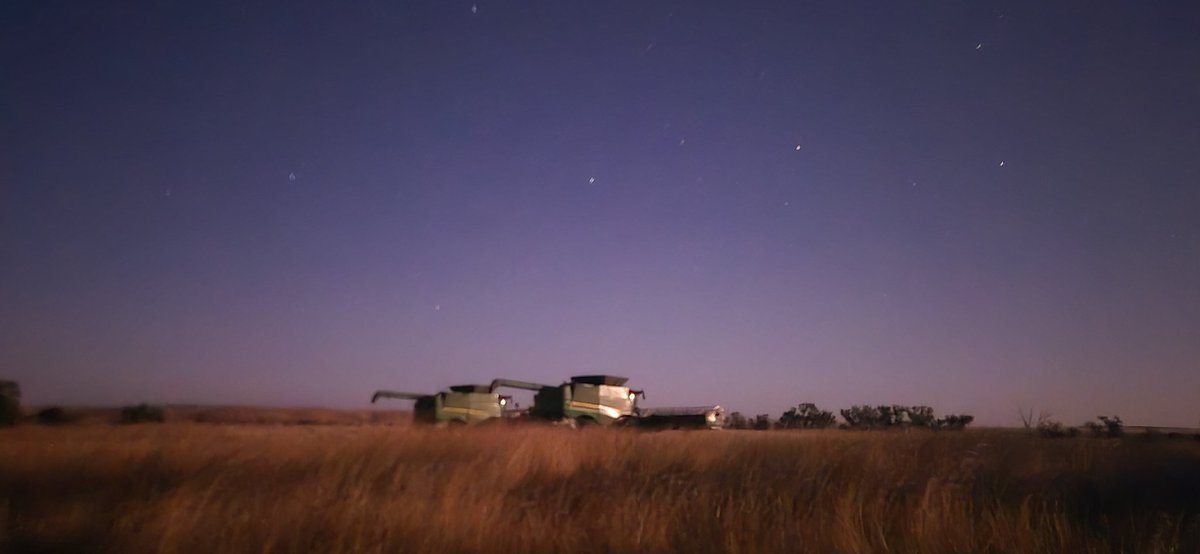
May 18
Mice have beaten us here. Harvest fire left 4 ton of sterile wheat on the ground. Had 3kg ZP50 and I think we’re going to try plow the burnt grain in, hopefully killing lots of mice at the same time and reseed.
Should be 3 leaf barley


5
8
47
6,513

May 14
Bit unpleasant in the hay shed at the moment. The baits do work though, and its interesting that they still hunt them out, even when there's free grain around
4
3
44
8,091
May 8
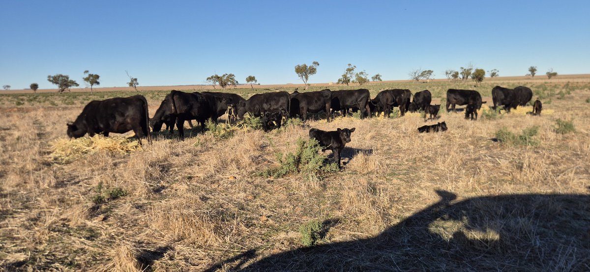
Been selecting for more GL bulls for a number of years, and its pleasing to see the results on ground. 1st calvers are roughly 25% done, 3 days before 1st due date
2
10
1,321
Ben McTaggart retweeted

Apr 22
Burnt and sown to canola. 3 days later footage taken. Think the mice have a taste for canola seeds… 1kg of 25gai ain’t going to cut it here. Hoping it’s not a re seed...@APVMA @MouseAlert


10
14
70
15,135
Ben McTaggart retweeted

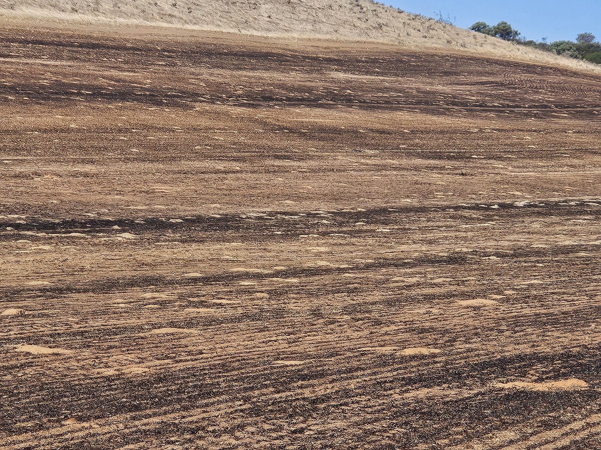
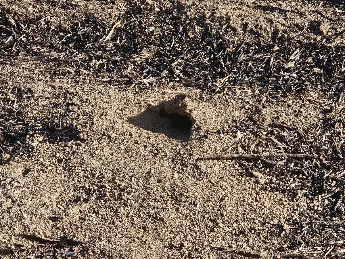
This is a paddock that we burnt 2 weeks ago. All the little mounds of dirt in the first picture are mouse holes. ZP50 permits please @APVMA
3
12
51
7,225
Ben McTaggart retweeted

Apr 16
The mouse population in parts of wa is out of hand @APVMA seems to not have an interest in doing anything about an emergency permit for us. All knowing full well that 25 g active mouse bait is not effective. The numbers we have are the worst I’ve seen.
7
20
76
9,955
Ben McTaggart retweeted

The AgCAREERSTART team is calling on farmers to sign-up to its popular gap-year program.
“If you can provide a paid, safe learning environment for the next generation, please reach out to the team,” NFF President Hamish McIntyre said.
Dozens of eager participants have been shortlisted and are ready to begin on‑farm roles.
@AgCAREERSTART
More info: buff.ly/bHisiyv
7
13
930
Ben McTaggart retweeted

Apr 6
My thoughts on the lessons & impacts from the recent action by @CSBPfertilisers and @summitfertz to declare force majeure on supply contracts.
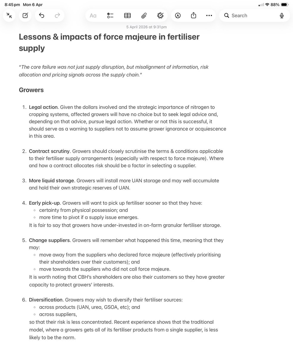
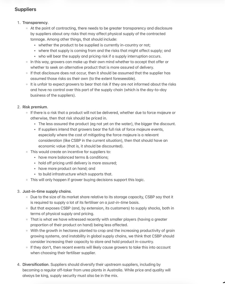
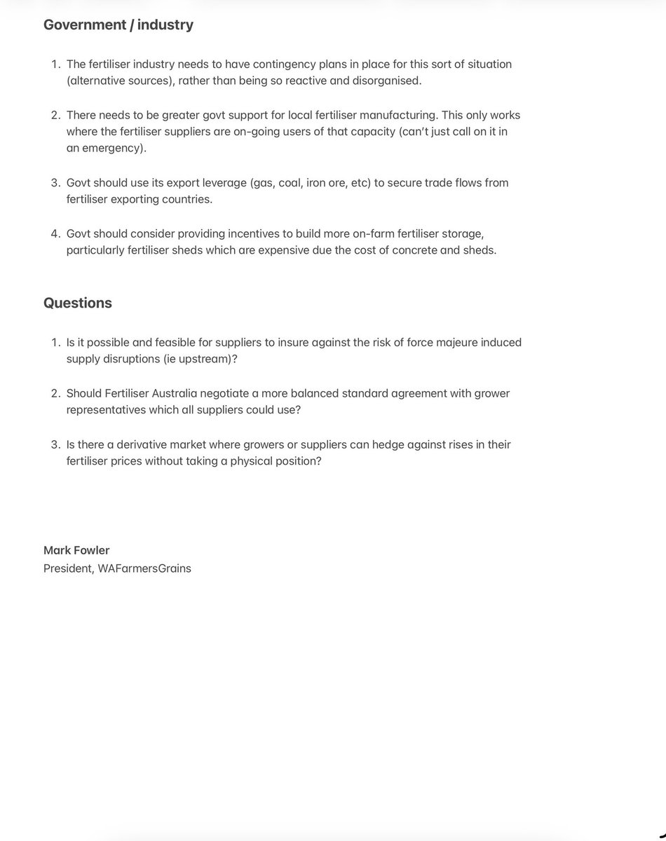
2
7
51
7,111
Ben McTaggart retweeted

Apr 5
My video piece for tonight's @abcnews in which I suggest that childcare and kinder be nationalised, and made free. That is, free education should be extended to kids under 5.
youtube.com/watch?v=harEUDTv…
347
415
1,453
64,887
Ben McTaggart retweeted
Apr 2
Anyone wrecking an 1830 bar? Ideally wide press wheels on 12.5” spacing. Chasing a 6 wheel press wheel gang
1
2
1
1,662
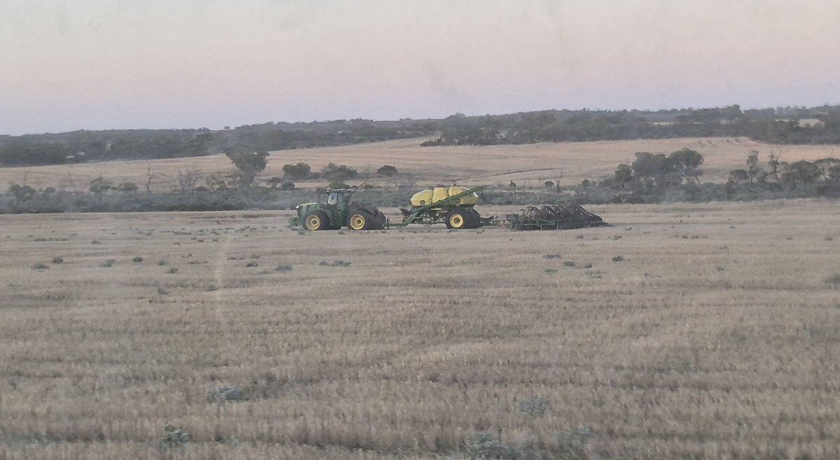
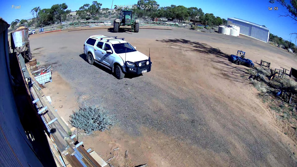
Mar 31
Possibly the definition of April Fools.
A chilly morning and seeding into moisture in April is a bit weird.
4
5
59
4,825
Mar 29
💯 🎯

I say this as a Nats party member, the opposition will stay in opposition until they have some sort of vision and plan.
Screaming Net Zero in response to every issue will guarantee their position in opposition.
1
671
Ben McTaggart retweeted

Mar 27
.@DPIRDbroadacre researchers hope their #EasyDiesel Calculator can support farmers with understanding the financial impact of deep ripping based on current diesel prices: soilswest.org.au/easydiesel-… @wayneparker13 @BindiIsbister @GRDCWest #soilnews #soilscience #soilresearch
5
11
860
Ben McTaggart retweeted

Mar 25
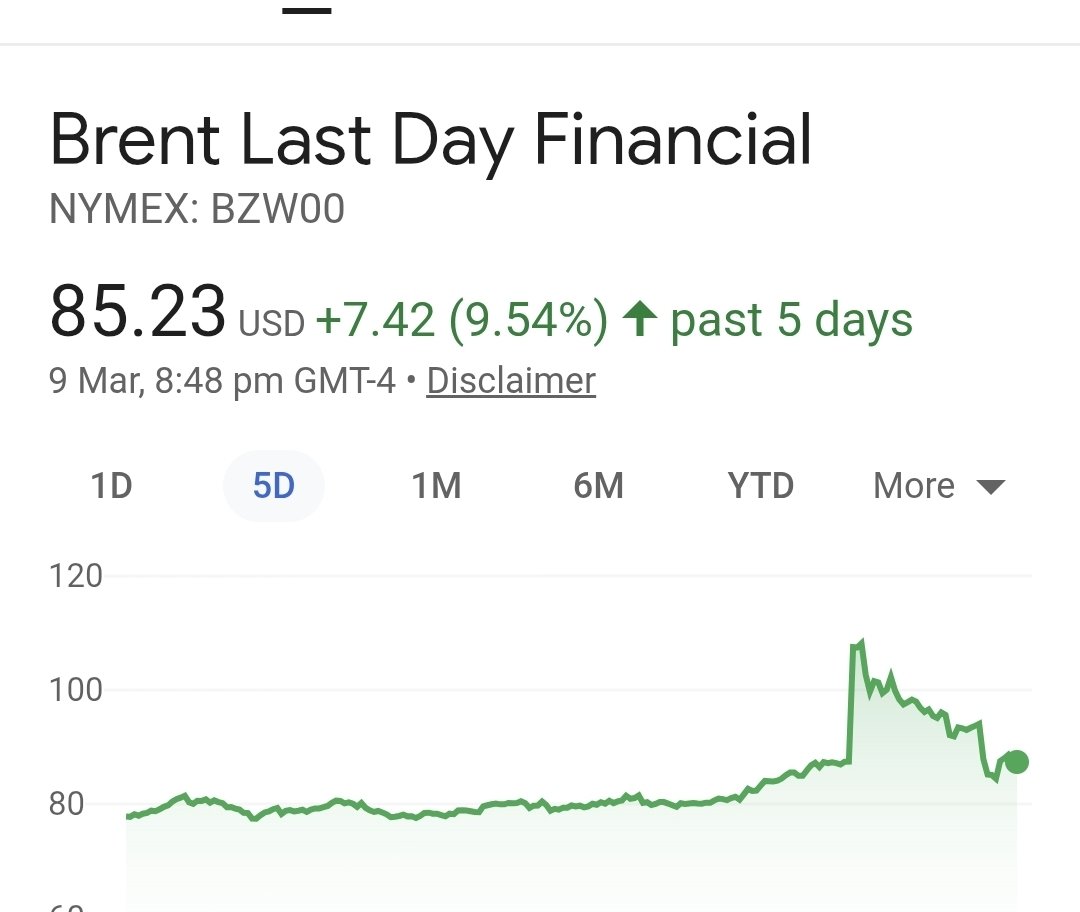
If you were wondering why directing diesel to regional Australia is in the national interest:
All the operations behind the astounding productivity growth in ag - are the things that have stopped with the parked up tractors right now.

2
15
39
2,948