
AMS Certified Broadcast Meteorologist (CBM) and Storm Chaser at KFOR-TV (NBC) in OKC. facebook.com/emilyrsutton Insta/TikTok: emilyrsutton
Joined March 2009
- Tweets 27,159
- Following 746
- Followers 77,555
- Likes 16,543
15,731 Photos and videos


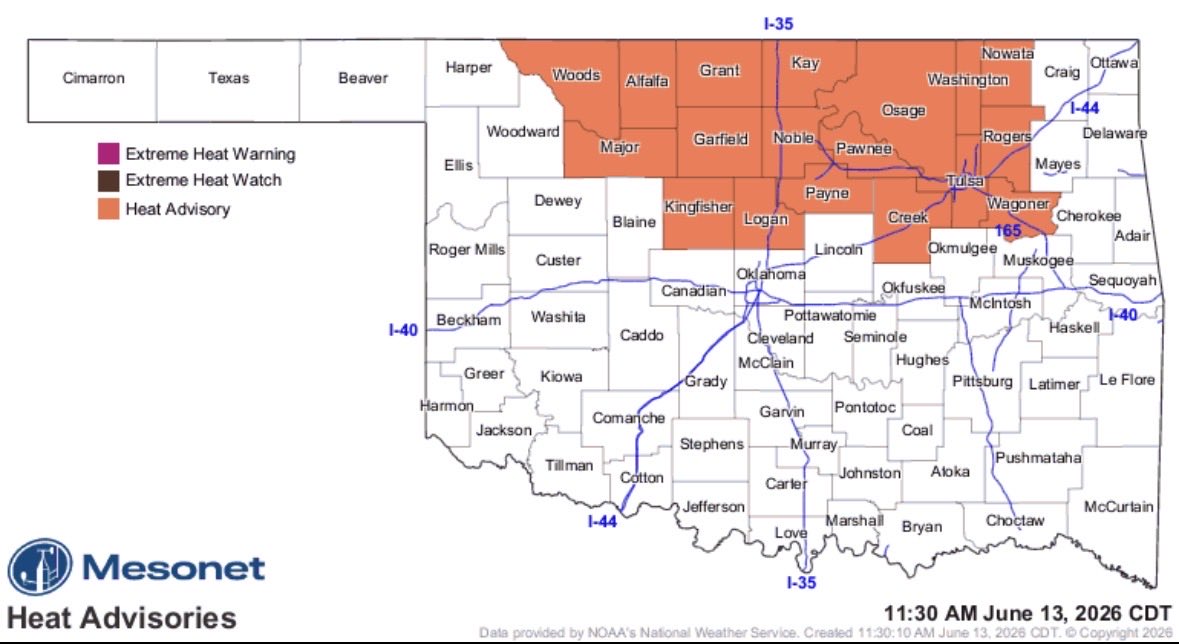


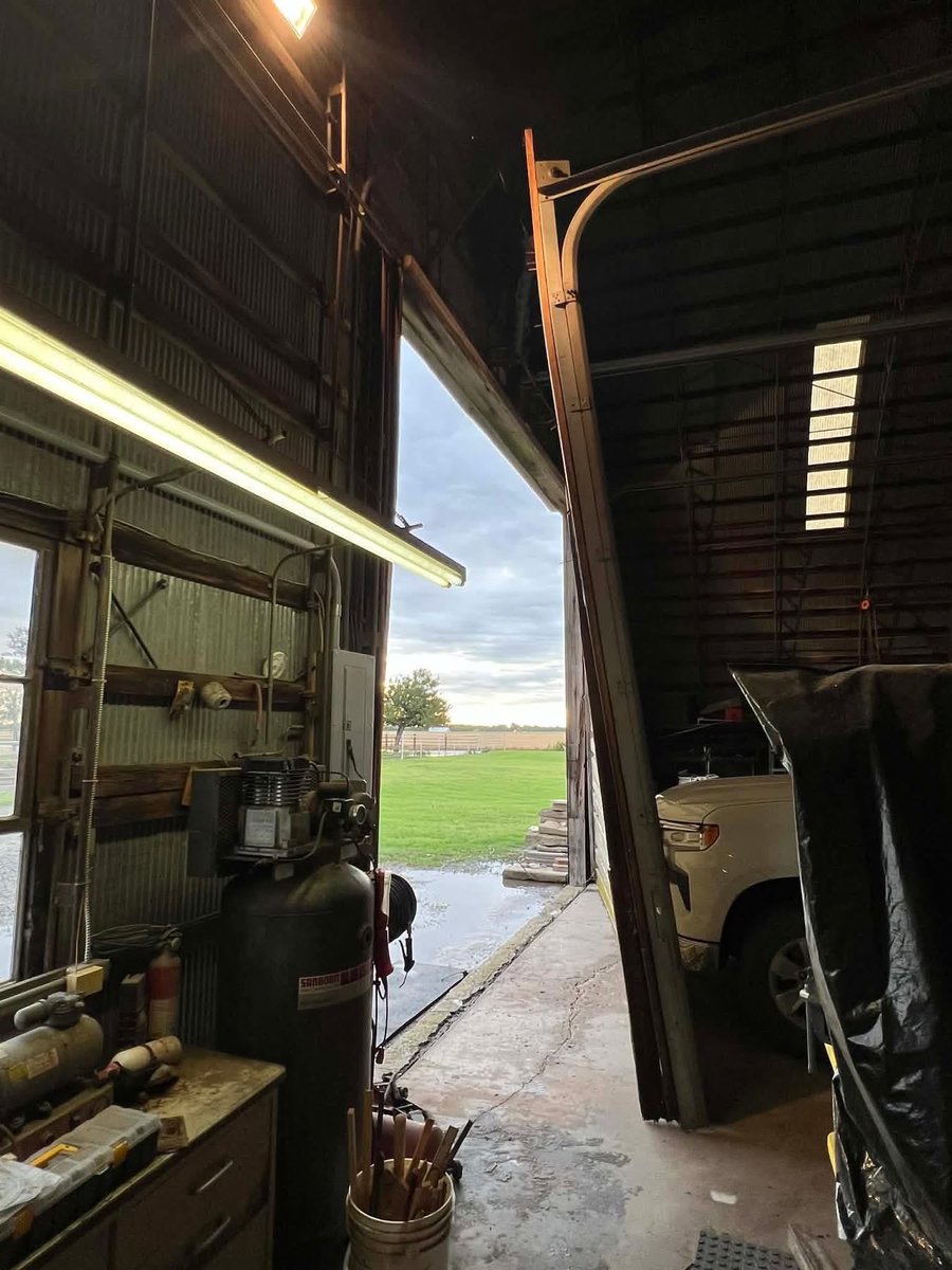
Jun 14
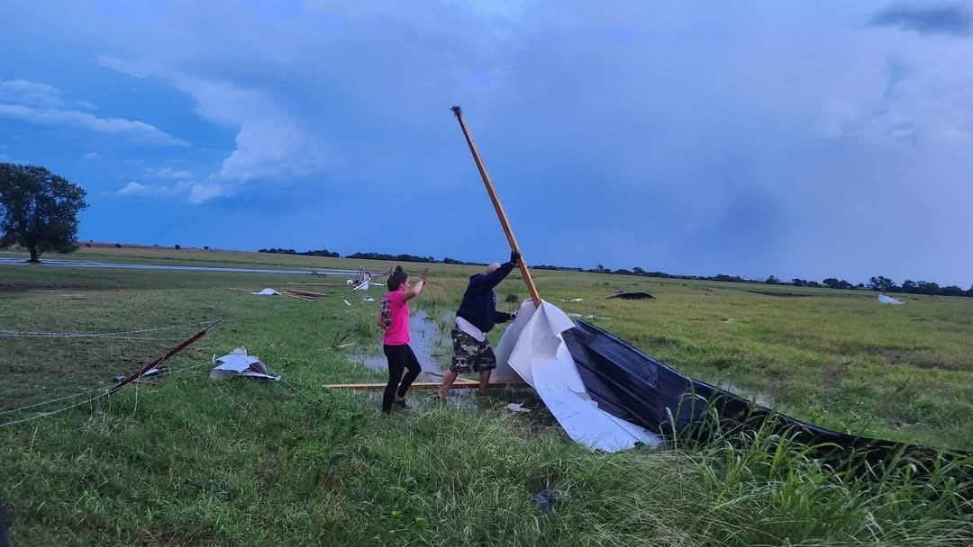
Damage pics from just south of Blackwell, OK from Saturday’s high winds and possible tornado.
📸: 1: Haley Kurfmann, 2 & 3: Tyler Weese, via @kfor storm tracker @CoreyInmon #okwx #stormdamage @NWSNorman
8
946
Jun 14
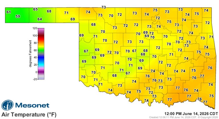
Check out the heat burst that just happened in Seiling, OK. Dry air from the mid levels of a decaying storm caused rain to evaporate, that cool air rushed to the ground, compressed & spiked temps. It jumped to 97 with sharp drop in dew points. This can cause high gusts.
11PM Sat
2
13
1,219
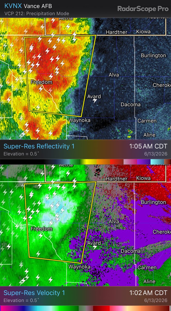
Jun 14
The Newkirk @okmesonet site reported a 76 mph gust. Up to 80 mph winds are heading into Ponca City!
10PM Sat @kfor #okwx
8
1,045
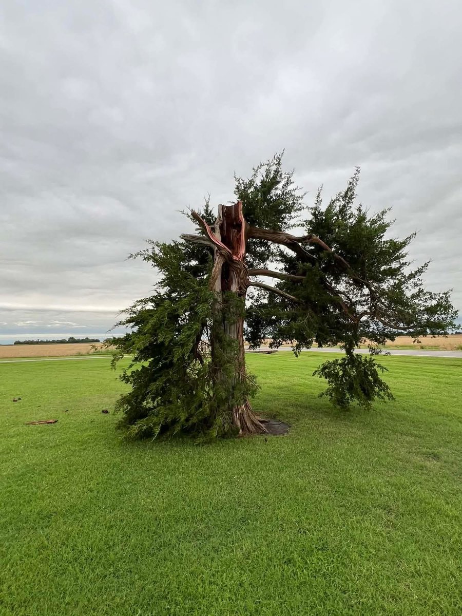
Emily Sutton retweeted

Jun 14
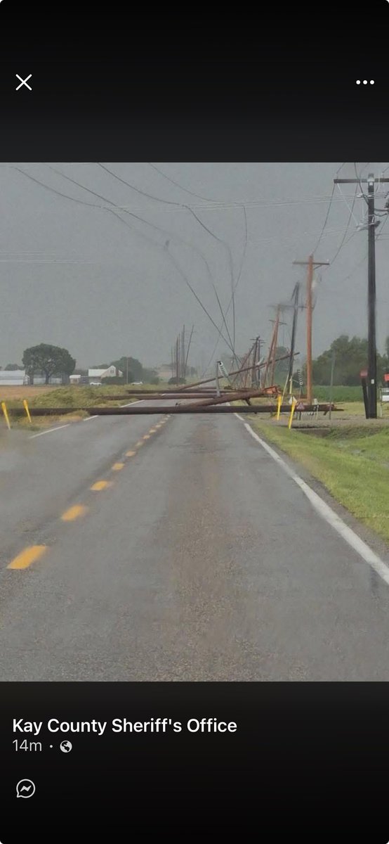
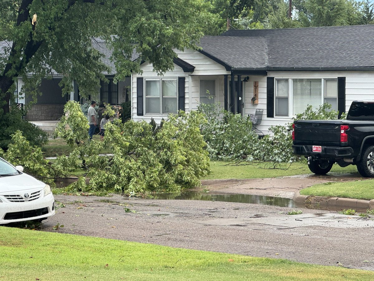
Lots of damage across Kay County this evening. Tree pic is from Blackwell, power poles are south of. Blackwell. Pics courtesy of Jim Inmon and Kay Co Sheriffs Office #okwx @NWSNorman @MikeMorganKFOR @Aaron_Brackett @emilyrsutton
1
2
12
2,448
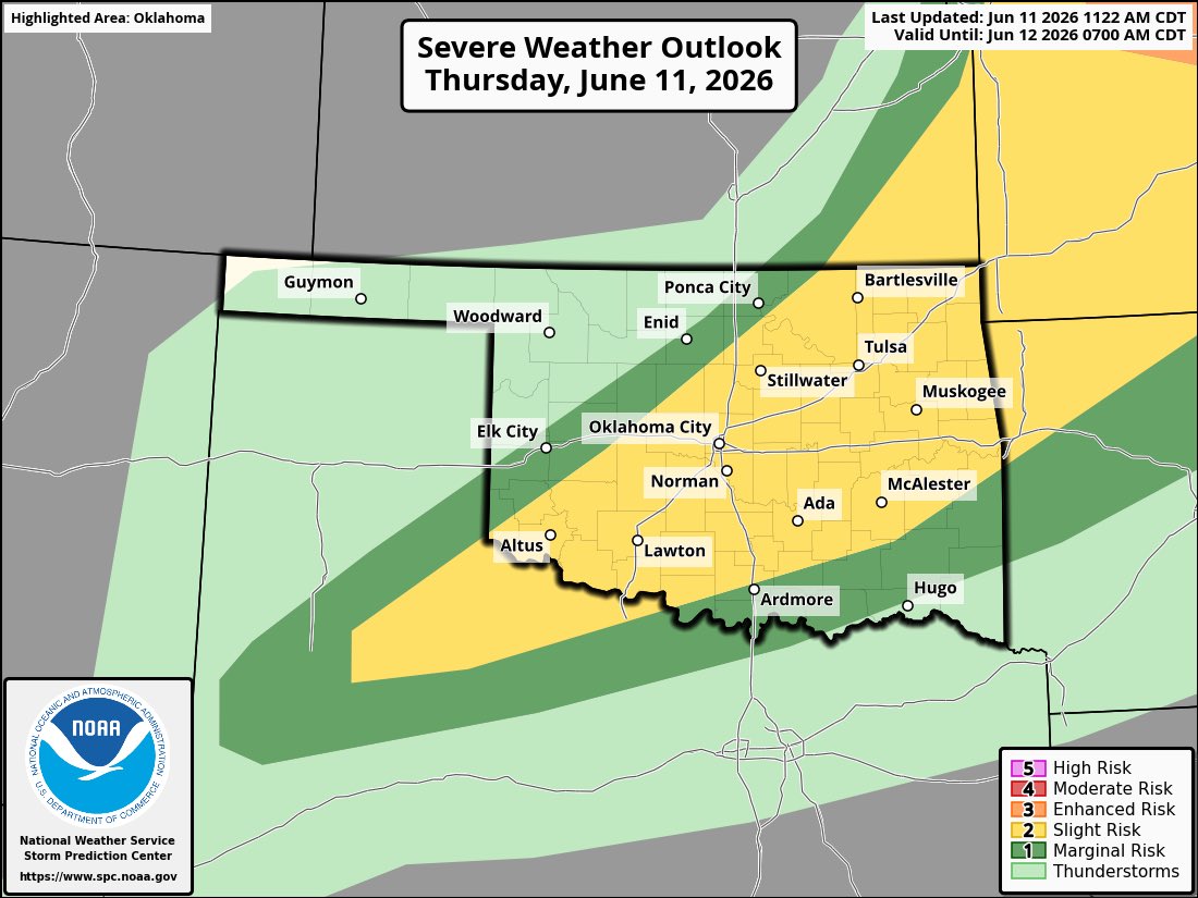
Emily Sutton retweeted

Jun 12
Quick edit showing some of the intense moments today while documenting 8 tornadoes in northern Illinois into Indiana. Massive shoutout to @skydrama for nailing the forecast in the warm sector. Hands down the craziest tornado outbreak I've ever documented.
Full video will be released in the near future on the @thestormreel YouTube page.
#ilwx #inwx #tornado #outbreak
99
999
6,910
600,988
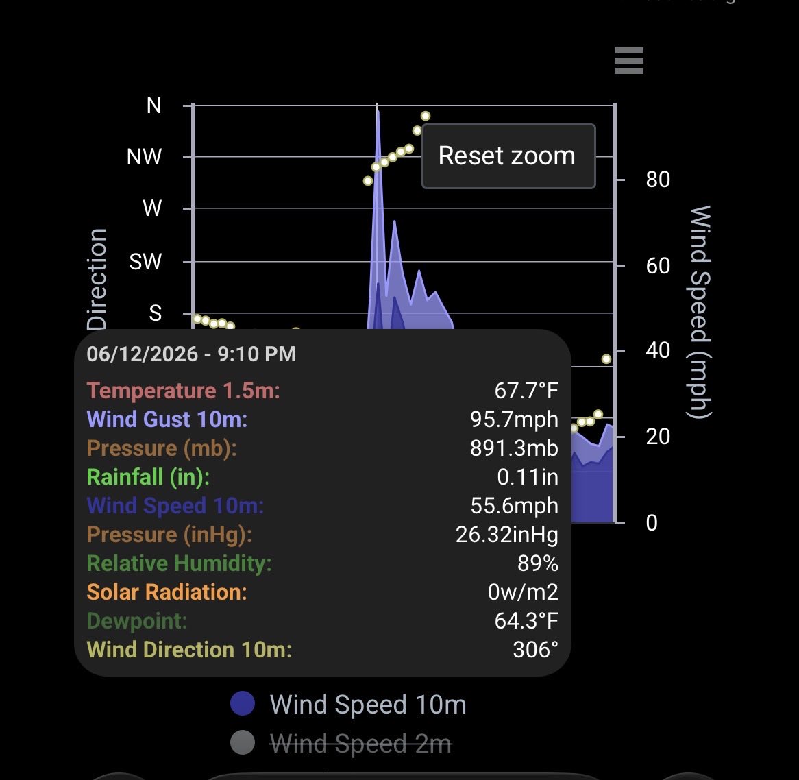
Jun 13
Holy Moly- the Eva @okmesonet site reported a 96 mph gust as a bowing line segment moved through around 9PM Friday!
@kfor #okwx
7
808
Jun 13
The storm moving into Buffalo is marginally severe with up to 60 mph winds and quarter size hail possible.
12:04AM Sat #okwx
1
644

Honored and humbled to be featured alongside incredible female scientists and storm chasers. I am so happy to see more women represented in the field versus when I started, 20 years ago!
@GirlsWhoChase @HannahCov #okwx #StormChaser #womeninSTEM
huffpost.com/entry/women-sto…
2
18
1,074