
Joined June 2020
- Tweets 100
- Following 80
- Followers 321
- Likes 133
31 Photos and videos
Pinned Tweet

14 Sep 2020
We spent a year building a system to precisely map vegetation fuels across #California—down to nearly each tree.
For decades the #forest mgmt, #wildfire, & emergency response communities were stuck using out-of-date and coarse maps.
That changes today: forestobservatory.com
3
11
23
27 Jun 2022
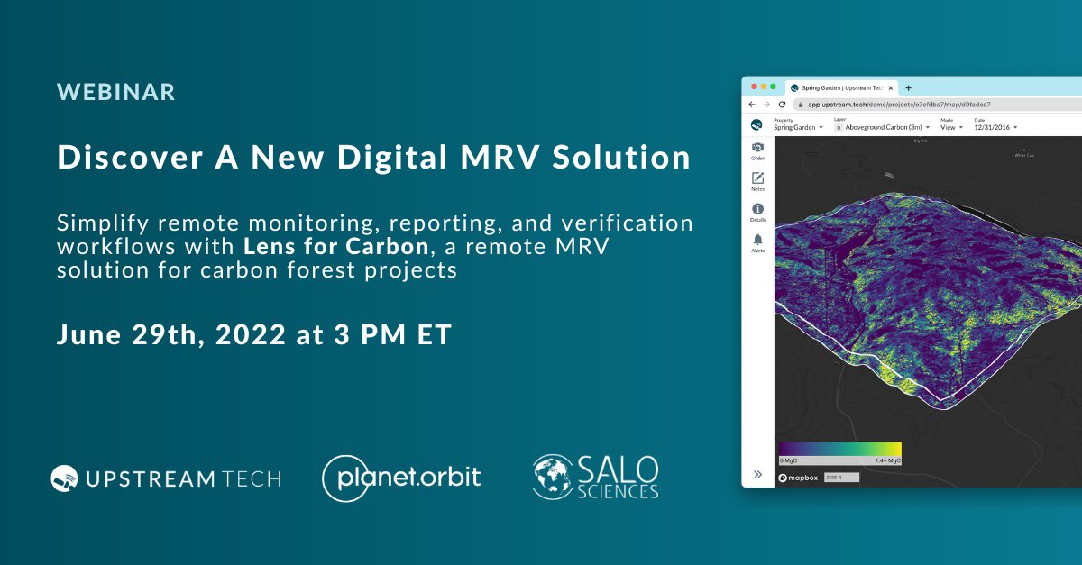
See how data produced by the Forest Observatory is used in a new forest carbon focused product from @SaloSciences
27 Jun 2022

Excited to partner with @upstream_tech to launch a new digital MRV solution for reforestation & other forest carbon projects
Lens for Carbon provides simple, turnkey MRV at a fraction the cost of traditional monitoring. Join us Thursday at 12pm PST bit.ly/3QmISCQ
2
17 Nov 2021
Great to hear about this new conservation acquisition that will be largely open to the public!
Explore the landscape ahead of your trip using our forest mapping platform.
17 Nov 2021

Fantastic!! Hooray The Wildlands Conservancy!!
Here's a look at tree heights in the property from @forestobs (interact with it and all the other layers like canopy cover and ladder fuel density here: tinyurl.com/yhlqxn8b)
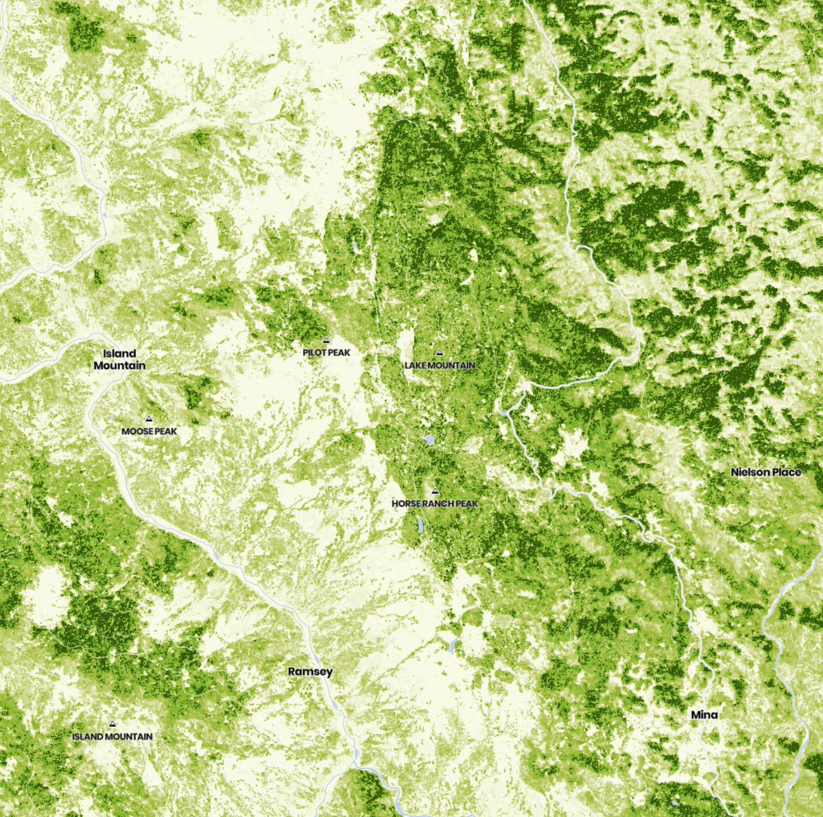
ALT 3m resolution tree heights along the Eel River site of the future Eel River Canyon Preserve (former Lone Pine Ranch)
1
2
17 Nov 2021
Read the great article on the fantastic new park from @kurtisalexander in @sfchronicle
Journalists looking for add'l article content on CA landscapes can use Forest Observatory for free
Email info@forestobservatory.com for help or visit forestobservatory.com for direct access
2
California Forest Observatory retweeted

4 Nov 2021
Great overview from @Planet of how the @forestobs contributes to better wildfire resilience in CA. Salo takes it even further by simulating 100s of millions of fires to create the highest res & most up-to-date maps of fire hazard ever created.
📖 bit.ly/2ZRvMIg
#Cop26
5
11
3 Nov 2021
DM or email us at info@forestobservatory.com to learn how to use our free data to improve forest & wildfire resilience in your region.
1 Nov 2021
Forests play a crucial role in removing atmospheric CO2. To reach the 1.5°C target of @cop26, we need better mapping, monitoring, & mgmt. of forests on a global scale. We’re building tech to meet the need—1st in CA w/ @forestobvs & bigger expansions to come.
#TogetherForOurPlanet
1
3
California Forest Observatory retweeted
28 Oct 2021
Ahead of @cop26, we’re proud to see our forest & wildfire monitoring tech featured in "10 Tech Solutions Curbing Climate Change" by @X4Impact 🌍
#TogetherForOurPlanet | #ClimateAction
bit.ly/3pLswsJ
2
6
6 Aug 2021
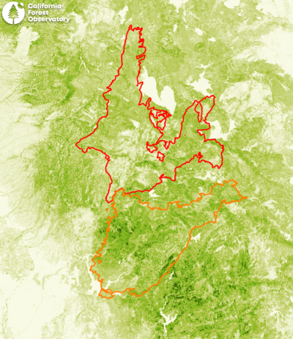
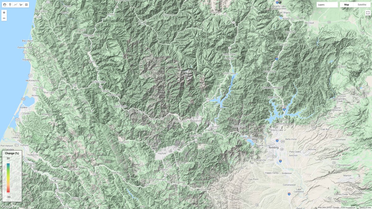
At 322,000 acres and growing with no end in sight, the #DixieFire (red) has surpassed last year's #NorthComplex (orange)
The scale of these #wildfires is just enormous
(base layer is our 3-meter resolution tree height; darker green = taller trees) #CAfire #CAwx
ALT perimeters from two major wildfires on a map of tree height from the california forest observatory
1
7
9
6 Aug 2021
.@CAL_FIRE now pegging it at 361,000 acres
x.com/CAL_FIRE/status/142347…

#DixieFire off Above the Cresta Dam, Feather River Canyon in Butte County is 361,812 acres and 35% contained. Unified Command: @CALFIRE_ButteCo and
@LassenNF
fire.ca.gov/incidents/2021/7…


5 Aug 2021
Help us scale this next-generation #forest monitoring system beyond California. Hurry up and apply soon, or pass along this notice to your networks!
30 Jul 2021
Salo Sciences is hiring for 3 new positions:
* Geospatial #DataScientist
* Project Manager
* #CloudComputing Engineer
Come join us to reduce catastrophic #wildfire and conserve forests as a means to fight #ClimateChange
salo.ai/careers
California Forest Observatory retweeted

26 Jul 2021
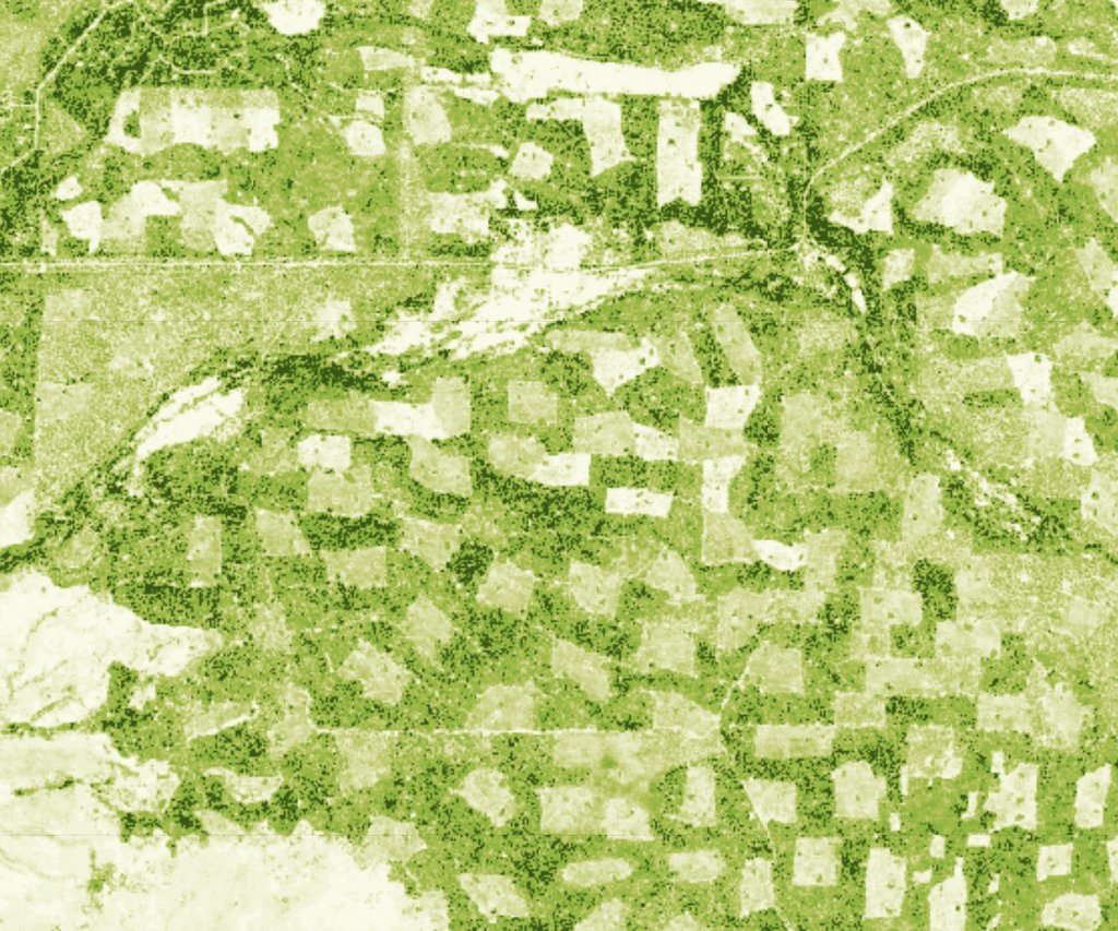
The Moonlight Fire area has had a lot of salvage, and there is not much canopy cover across these areas, so if we got some clear air, we could potentially make a lot of hay with air tankers in this area. Canopy cover data from @forestobs forestobservatory.com/ #DixieFire
2
2
19
18 May 2021
Watch @planet's co-founder @schingler discuss the Forest Observatory during today's congressional subcommittee hearing on NASA’s Earth Science and Climate Change Activities
youtube.com/watch?v=qJPlN45y…
1
6
14
California Forest Observatory retweeted

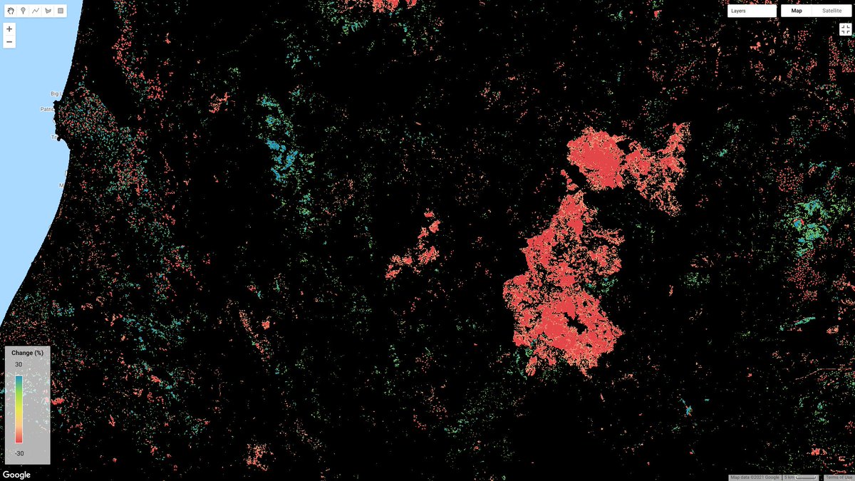
4 Feb 2021
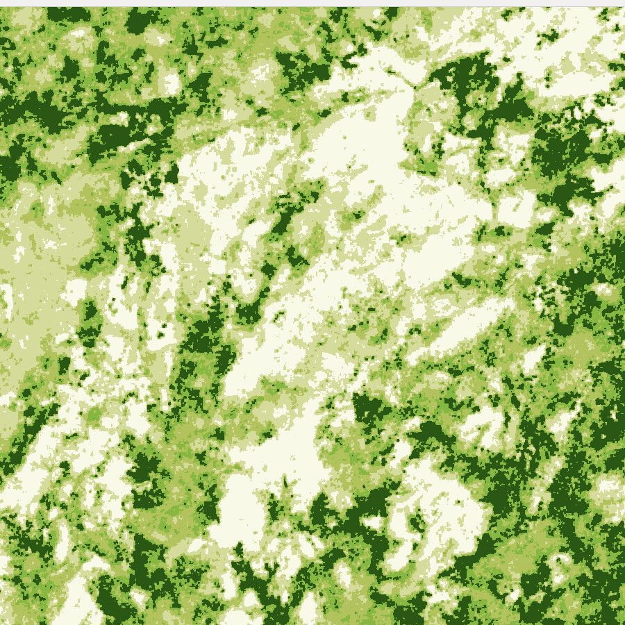
Hey everyone, we're way overdue for several @forestobs updates (including Earth Engine integration).
Until then, here's a map of canopy cover change, 2016-2020. Warm colors->loss, cool colors->gain .
The big blob is the Carr fire. Check out the harvest and regrowth patterns
1
5
20
California Forest Observatory retweeted
9 Feb 2021
To my fellow forest nerds:
First we built a forest monitoring system in the cloud.
Now we're sharing our guide to working with Forest Observatory data using cloud-based geospatial software.
Check it out!🌲🧡🌤️
salo.ai/blog/2021/02/cfo-clo…
2
11
42
29 Jan 2021
.@POTUS "Executive Order on Tackling the Climate Crisis..." is a big step towards science-based #ClimateCrisis response. bit.ly/3cjD5MZ #forestfriday
Especially this part...
1
2
2
29 Jan 2021
"...development of a consolidated Federal geographic mapping service that can facilitate public access to climate-related information that will assist Federal, State, local, and Tribal governments in climate planning and resilience activities."
Sounds familiar.
3
25 Dec 2020
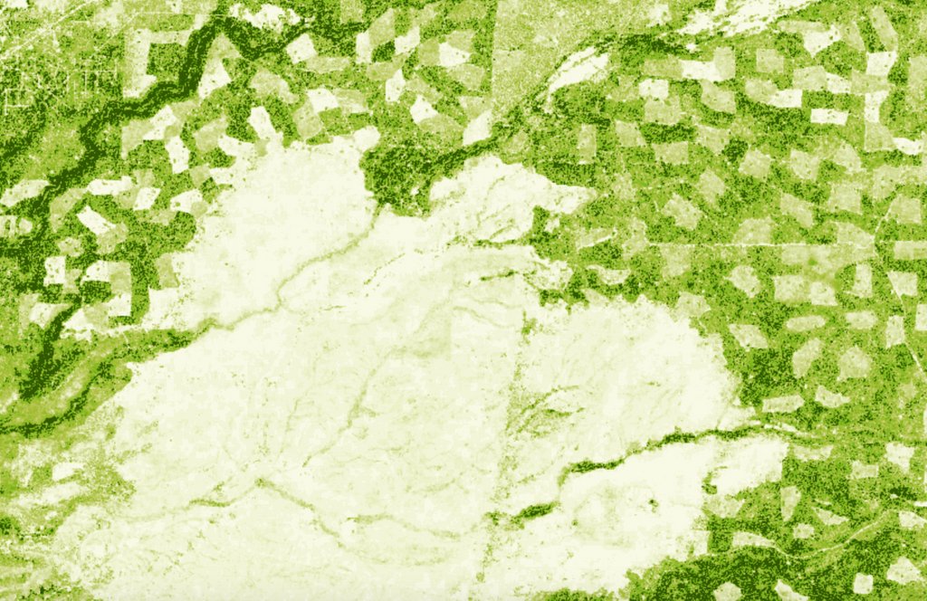
Do you know where your #ChristmasTree came from? Here is a collection of tree farms on the west slope of Lassen Peak, all at different stages of growth when this tree height data was collected in 2020. #ForestFriday
#HappyHolidays to all!
1
6
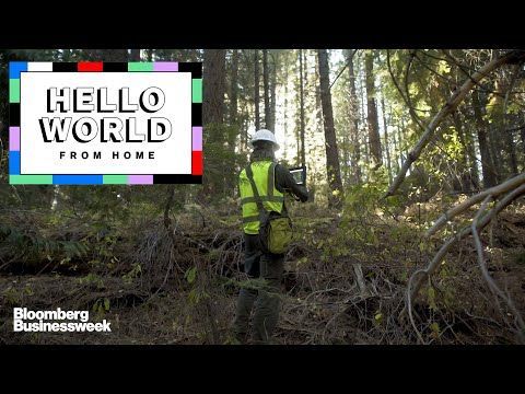
4 Dec 2020
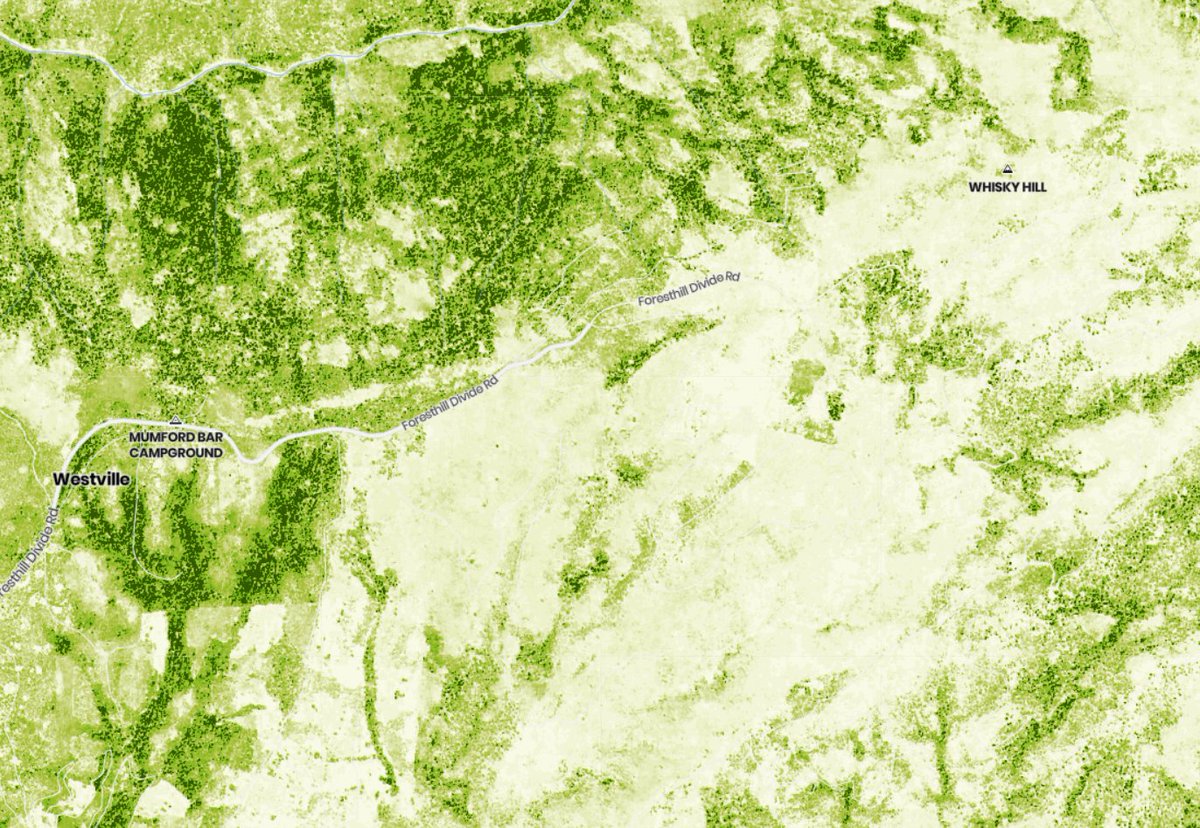
Whisky Hill, the site of @SaloSciences latest field trip, is in the dramatic burn scar of the 2013 American Fire. The team spent two days in the surrounding area doing field validation on CFO data, filming for @BW and of course, drinking whisky (Old Forester)
#forestfriday

3
12
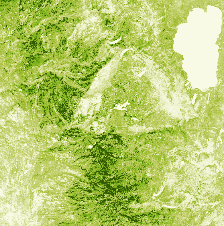
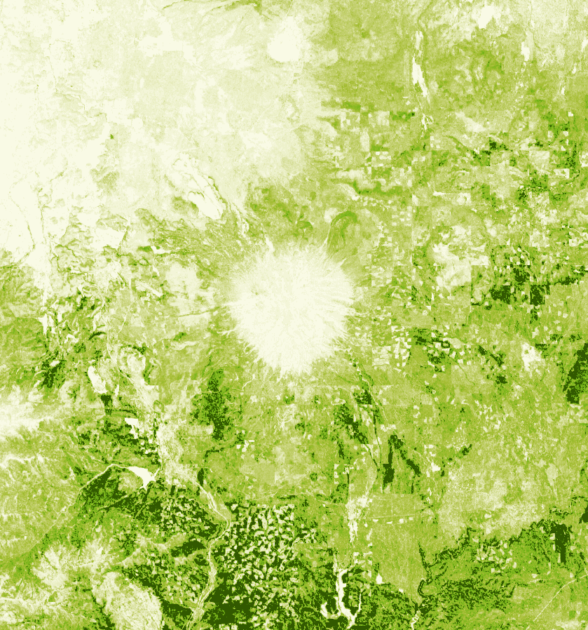
27 Nov 2020
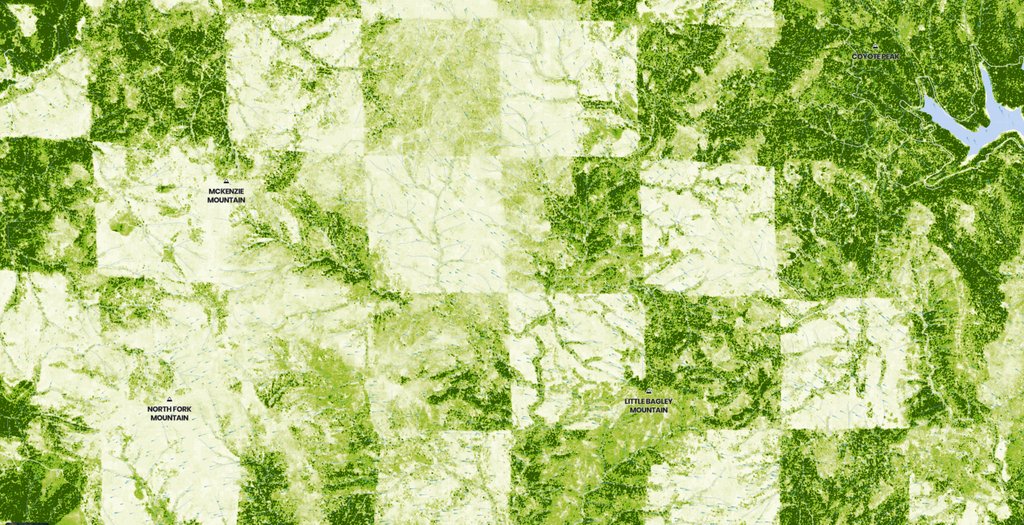
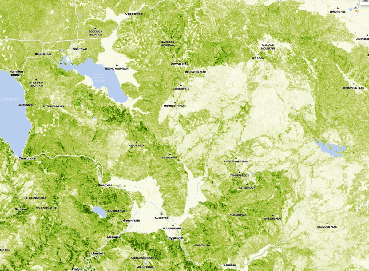
Time for another round of California landmarks! Do you know where this tree height map comes from? Check your answer on @forestobs: buff.ly/3q9199B
#ForestFriday
3
20 Nov 2020
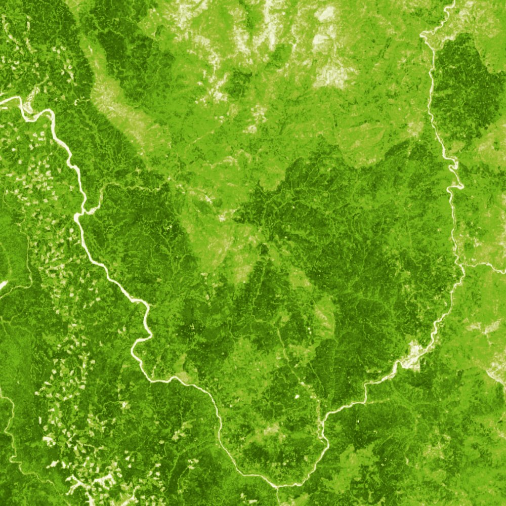
After years of organized action by the Karuk & Yurok tribes, the Klamath River dams are scheduled to be demolished—a major victory for indigenous communities & the freshwater ecosystem.
Explore the Klamath: buff.ly/2Ktz38X & op-ed: buff.ly/2UHP8K2
#ForestFriday
1
3
3
13 Nov 2020
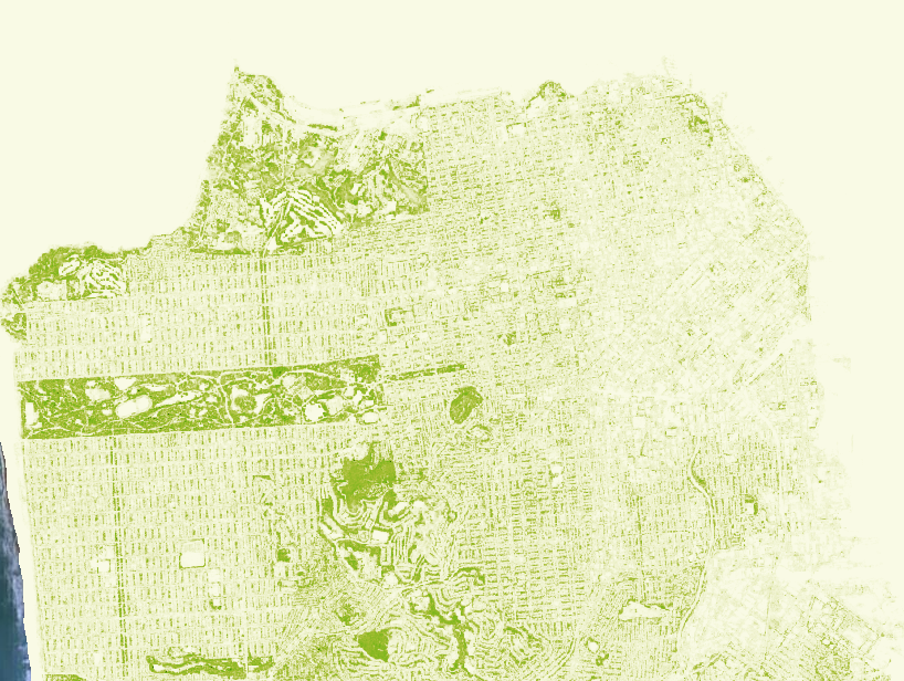
"One day if I go to heaven...I’ll look around & say, ‘It ain’t bad, but it ain’t #SanFrancisco.’" - Herb Caen
Big part of the city’s charm—aside from @KarlTheFog—is the trees & parks seen here without buildings or roads. Explore #SF greenery: buff.ly/35tRCBR
#ForestFriday
1
6