
27 Dec 2024
Data News- More than a dozen Level 1, 2, and 3 data products from NASA's Tropospheric Emissions: Monitoring of Pollution (TEMPO) Version 03 collection are now available at provisional maturity. #ASDCDAAC
#airquality
➡️Learn more: go.nasa.gov/41WTSiR
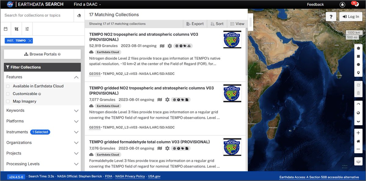
ALT NASA Earthdata Search screenshot showing results for the new provisionally validated TEMPO datasets.
1
9
44
1,812
12 Nov 2024
Level 0 data from NASA's Polar Radiant Energy in the Far-InfraRed Experiment (PREFIRE) mission are now publicly available at NASA's #ASDCDAAC. Access data: go.nasa.gov/4fDrypL
Learn about PREFIRE data at NASA's Atmospheric Science Data Center: go.nasa.gov/4fkJOEb
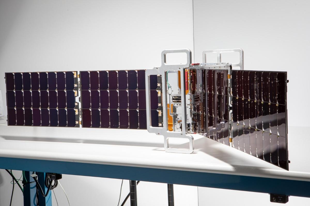
ALT This image shows one of two shoebox-size CubeSats that make up NASA's PREFIRE.
1
3
14
877
7 Feb 2024
NASA's Sub-Orbital Order Tool (SOOT) now offers a new merge service. Users can now align data to a common time base for easier comparison between files. The SOOT Power User Interface and merge service are shown in this ArcGIS StoryMap. #ASDCDAAC go.nasa.gov/3OxdUsw

ALT Sub-Orbital Order Tool graphic icon that shows multiple suborbital platforms (e.g. vessel, aircraft) in a circular graphic with the words Sub-Orbital Order Tool at the top and the acronym SOOT at the bottom.
6
22
1,359
17 Dec 2021
Five NASA DAACs, IMPACT, @Openscapes collaborated for the 2021 Cloud Hackathon—a virtual 5-day inclusive #OpenScience event to help data users learn how to transition their Earth data workflows to the cloud. #PODAAC #LPDAAC #NSIDCDAAC #ASDCDAAC #GESDISC go.nasa.gov/3q12i3R
3
5
16 Dec 2021
Five NASA DAACs partnered with Openscapes for the 2021 Cloud Hackathon—a virtual 5-day collaborative open science event to help data users learn how to transition their Earth data workflows to the cloud. #PODAAC #LPDAAC #NSIDCDAAC #ASDCDAAC #GESDISC go.nasa.gov/3q12i3R
1
2 Dec 2021
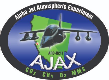
New Alpha Jet Atmospheric eXperiment (AJAX) in situ trace gas observations over California, Nevada, and the coastal Pacific are available at the NASA Atmospheric Science Data Center DAAC (#ASDCDAAC). Learn more: go.nasa.gov/3DaZ8ze Mission: go.nasa.gov/3y08JrP
1
20 Jul 2020
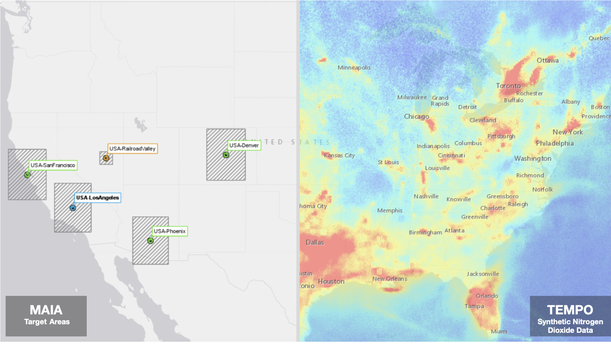
Upcoming NASA missions could revolutionize #airquality & #pollution monitoring from space. MAIA will observe global particulate matter, & TEMPO will observe hourly CONUS #ozone & nitrogen dioxide. Learn more in this StoryMap created by the #ASDCDAAC, arcg.is/XyPma
13
29

20 Jun 2018
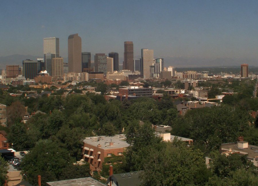
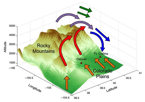
A rising problem: Denver, Colorado, has struggled to reduce its air pollution. Why does ozone remain so hard to control?
goo.gl/gVvdu6 @NASAEarthdata @NASA_Langley @lknaranjo #airpollution #airquality #ozone #ASDCDAAC

2