4 Jun 2025
🚨 Incident Update – 6:00 AM | June 4 🚨
Firefighters continue to make progress on two lightning-caused vegetation fires in the Poverty Hills area of Inyo County:
🔥 Fish Fire
📍 2 acres | 🔥 20% contained
✅ Forward progress stopped
✅ Hose line around the fire
🛠 Dozer line constructed within 50’ of 80% of the perimeter (remaining edge inaccessible)
🌙 Little to no fire activity overnight
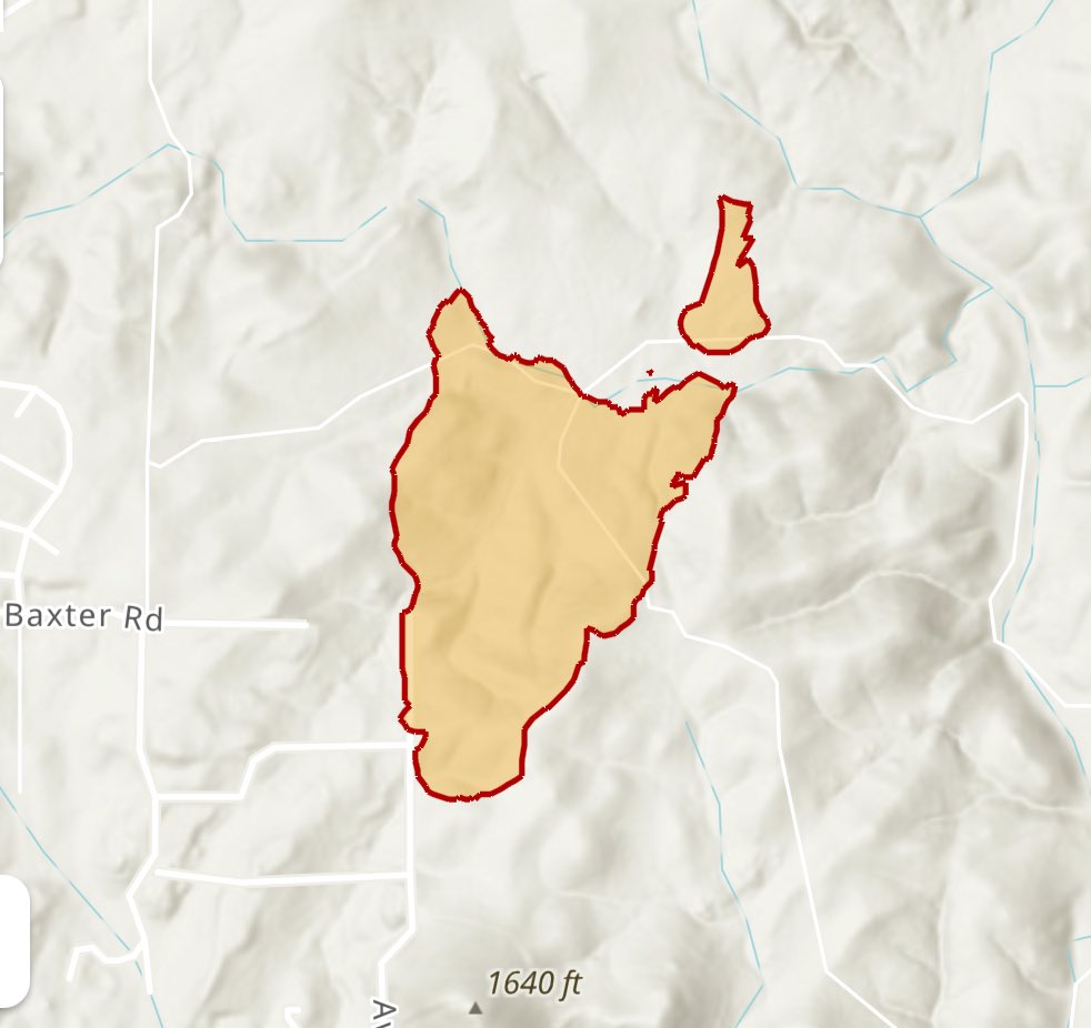
🔥 Baxter Fire
📍 32 acres | 🔥 10% contained
✅ Forward progress stopped; fire held to retardant lines
🚫 No hose line yet due to access/water limitations
🌧 Received 30–60 minutes of light precipitation overnight
🛠 Dozer line indirect due to rocky terrain; crews built handline through the night
🚫 Engines unable to access; approx. 3 miles of hose would be needed to wrap fire
⚠️ Challenging terrain, limited mobility
⚡️ Thunderstorms remain in the area with a high chance of holdover fires due to lightning.
🏡 Fires remain a threat to the communities of Birch Creek, Baxter Ranch, and Fish Springs.
🚨 Evacuation orders remain in place
✅ No reported injuries or equipment damage
Air resources are expected to return this morning for continued reconnaissance and suppression support.
#CALFIRE #FishFire #BaxterFire #InyoCounty #LightningFires #WildfireUpdate #FireWeather #EvacuationsInEffect

ALT Sunrise
2
14
1,330
4 Jun 2025
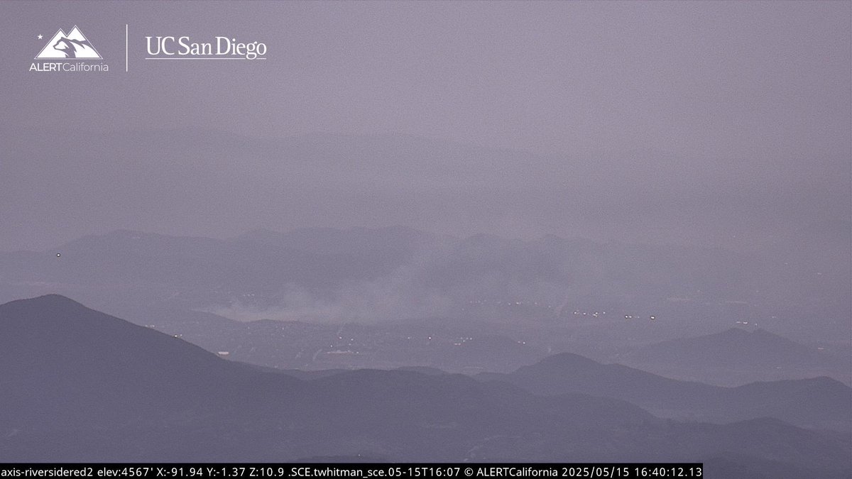
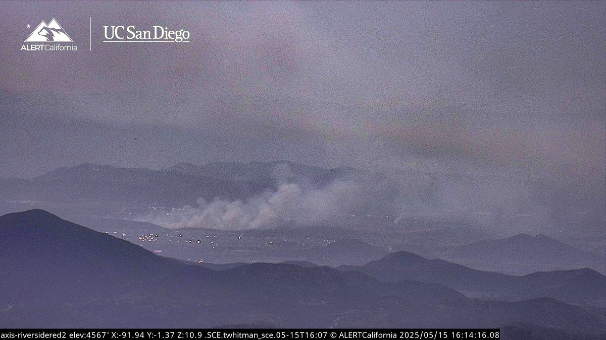
🚨 Incident Update – Inyo County 🚨
Firefighters are working two separate vegetation fires in the Poverty Hills area, both sparked by multiple lightning strikes:
🔥 Fish Fire – 2 acres, 15% contained
🔥 Baxter Fire – 30 acres, 5% contained
Initially, both fires were being managed as a single incident. However, due to the time and distance between the lightning strikes, the second fire has been designated as a separate incident and named the Baxter Fire.
Crews will remain on scene through the evening to strengthen containment lines. Aircraft are expected to return in the morning for reconnaissance flights.
#CALFIRE #FishFire #BaxterFire #LightningCaused #InyoCounty #WildfireUpdate #FireWeather

ALT Thunderstorms
ALT Thunder
3
16
1,427

16 May 2025
#BaxterFIRE [FINAL UPDATE 5/16 7:00A.M.]: Firefighters made great progress over yesterday evening and the fire is 100% contained.
1
13
1,509
16 May 2025
#BaxterFIRE [UPDATE 8:00 P.M.]: The fire is 90% contained. Crews will remain on-scene for an additional four hours continuing mop-up, and will patrol the fire tomorrow morning checking for any hit spots within the containment lines. This will be the final update of the evening unless significant activity occurs.
4
4
1,749
16 May 2025
#BaxterFIRE [UPDATE 5:30PM]: The evacuation WARNING area has been lifted. Any residents who have left the area may return. Fire resources remain on-scene working on full containment.
3
2
21
2,635
16 May 2025
#BaxterFIRE [UPDATE 5:20 PM]: The fire is 59.5 acres and is now 30% contained. The forward rate of progress has been stopped.
1
3
17
2,040
16 May 2025
#BaxterFIRE [UPDATE 5:18PM]: The forward progress of the fire has been stopped at 59.5 acres and the fire is 30% contained. The evacuation warning for zone RVC-1896 remains in place.
3
10
1,147

16 May 2025
#BaxterFire Forward Progress has been stopped at 59 acres, the Evacuation Warning will be getting lifted in the next few minutes, Copters will remain overhead, all 4 Tankers are released.
1
1
6
516

16 May 2025
#BaxterFire Forward progress stopped at 59.5 acres, lifting evacuations in 15 minutes.
1
2
98
16 May 2025
#BaxterFire Dozers and Aircraft are working another Spot Fire that crossed the Head.
16 May 2025

#BaxterFire The Fire was mapped at 59 acres, Both flanks and the head of the Fire are surrounded with Retardant, Air Tankers 71 and 90 are released.
1
5
818
16 May 2025
#BaxterFire The Fire was mapped at 59 acres, Both flanks and the head of the Fire are surrounded with Retardant, Air Tankers 71 and 90 are released.
2
6
1,320
16 May 2025
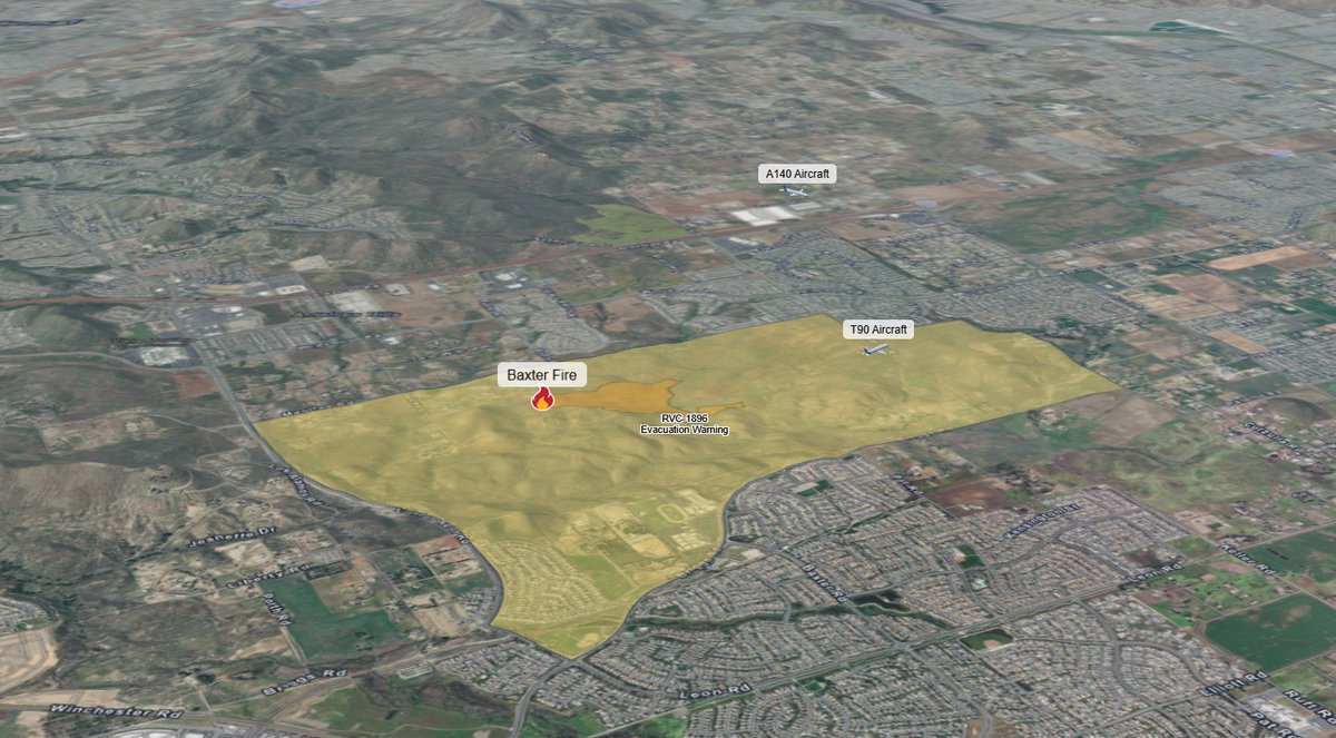
#BaxterFIRE [UPDATE]: The fire is in the unincorporated Riverside County area, outside of Menifee city limits.
1
2
10
1,482


15 May 2025
#BaxterFIRE [UPDATE 4:48PM]: An evacuation WARNING area has been established for RVC-1896. The streets are:
North of Clinton Keith Road
South of Golden Jay Lane
West of Briggs Road
East of Menifee Road
5
5
1,786
15 May 2025
#BaxterFire OES Intel 24 has mapped the Fire at 40 acres, the Fire jumped the greenbelt Air Tankers are continuing to drop retardant around the spot fire.
2
6
645
15 May 2025
#BaxterFire Aircraft Assisting.
Air Attack 140, Copters 608, 609.
Air Tankers 71, 72, 73, 90.
The Fire is 25-30 acres, the Fire jumped the greenbelt air tankers are dropping on the left flank.

2
2
12
1,005

15 May 2025
Fire is now 30 acres and has jumped the greenbelt making a run on the right shoulder. #BaxterFire #Menfee
1
3
8
1,200