

Jun 12
The future belongs to those who prepare for it today.
Learn. Grow. Lead.
This Youth Month, turn your potential into purpose and your skills into opportunities.
#YouthMonth #TheFutureIsOurs #SkillsCreateOpportunities #YouthDevelopment #BuildTomorrow #IronWILL

2


Jun 1
It’s Camp season! ☀️ Ready to work this summer, compete against the best, and showcase my skills. ⚡️
Here is my official June schedule:
📍 June 2: Kennesaw State (@KSUFBRecruiting) 🦉
📍 June 17: Tulane University (@GreenWaveFB) 🌊
📍 June 19-22: Nike Nationals @ Oregon (@DuckSwag) 🦆
📍 June 25-28: Florida FBU (@FBUAllAmerican) 🐊
3.9 GPA | WR/DB | C/O 2029
5’11 | 170lbs 💪
Let’s get to work! 🛠️
#BuiltToDominate
#WorkTodayGetNoticed
#BuildTomorrow
@CalebSisk_ @CoachSBeamer
@CoachBrentKeyGT
@KirbySmartUGA
@CoachHughFreeze
@Coachtimbeck
@CollinsHillFB @SwickONE8 @braydenbrez @SCOOBZILLA730
@CoachBlack10 @StanDrayton_ @CoachClaytonW @Coach_Norvell @FBCoachJSmith
@CoachSantucci
@CoachJCrawford
@CoachSchuUGA
@CoachNixon_Cuse @CoachDJ_ @CoachDavila @CoachGoebbel @CoachPerrone @viv4usc @AuburnMade @CFBscoutdesk @RecruitingBh @RecruitGeorgia
6
12
461

Its Camp season Ready to work this summer! ⚡️ Looking forward to competing, learning from the best, and showcasing.
Here is my official June schedule:
📍 June 8: @CoachSBeamer 🐔
📍 June 9: @CoachBrentKeyGT 🐝
📍 June 10: @KirbySmartUGA 🐶
📍 June 11: @CoachHughFreeze 🦅
📍 June 18: @CoachCParrott 🌊
4.1 GPA LB/EGDE/RB | C/O 2028
6'0" 215 Ibs 💪🏾
Let’s get to work! ⚒️
#BuiltToDominate #WorkTodayGetNoticed BuildTomorrow
@CoachSBeamer
@CoachBrentKeyGT
@KirbySmartUGA
@CoachHughFreeze
@Coachtimbeck
@CoachBlack10 @StanDrayton_ @CoachClaytonW @Coach_Norvell @FBCoachJSmith
@CoachSantucci
@CoachJCrawford
@CoachSchuUGA
@CoachNixon_Cuse @CoachDJ_ @CoachDavila @CoachGoebbel @KSUFBRecruiting @CoachPerrone @viv4usc @AuburnMade @CFBscoutdesk @RecruitingBh @RecruitGeorgia

4
10
872

May 22
TGIF : another opportunity to invest in the future you want. 🏗️✨
Every solid structure begins with a smart decision today. Build with vision. Invest with purpose.
Brook Assets & Resources Limited
#TGIF #BrookAssets #RealEstateNigeria #SmartInvestment #BuildTomorrow

6
18
54

May 9
ACFAL exists to empower lives and transform communities through compassion and sustainable solutions.
We don’t just dream of change — we create it. Join us: acfal.org
#ACFAL #BuildTomorrow #HumanityFirst
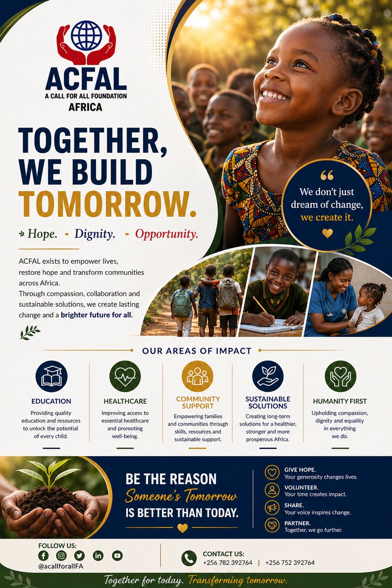
May 9

💙 Children are the future—and the future starts with us.
Support ACFAL in creating opportunities, restoring hope, and building a better tomorrow. Every act of kindness makes a difference.

2
2
83

Apr 22
Metalign Technology is officially an @ethfantoken company.
We look forward to contributing to the most groundbreaking collaboration between healthcare, finance & technology to date.
Together, we will drive meaningful innovation at this critical intersection.
#BuildTomorrow
1
26
49
3,251


14 Nov 2025
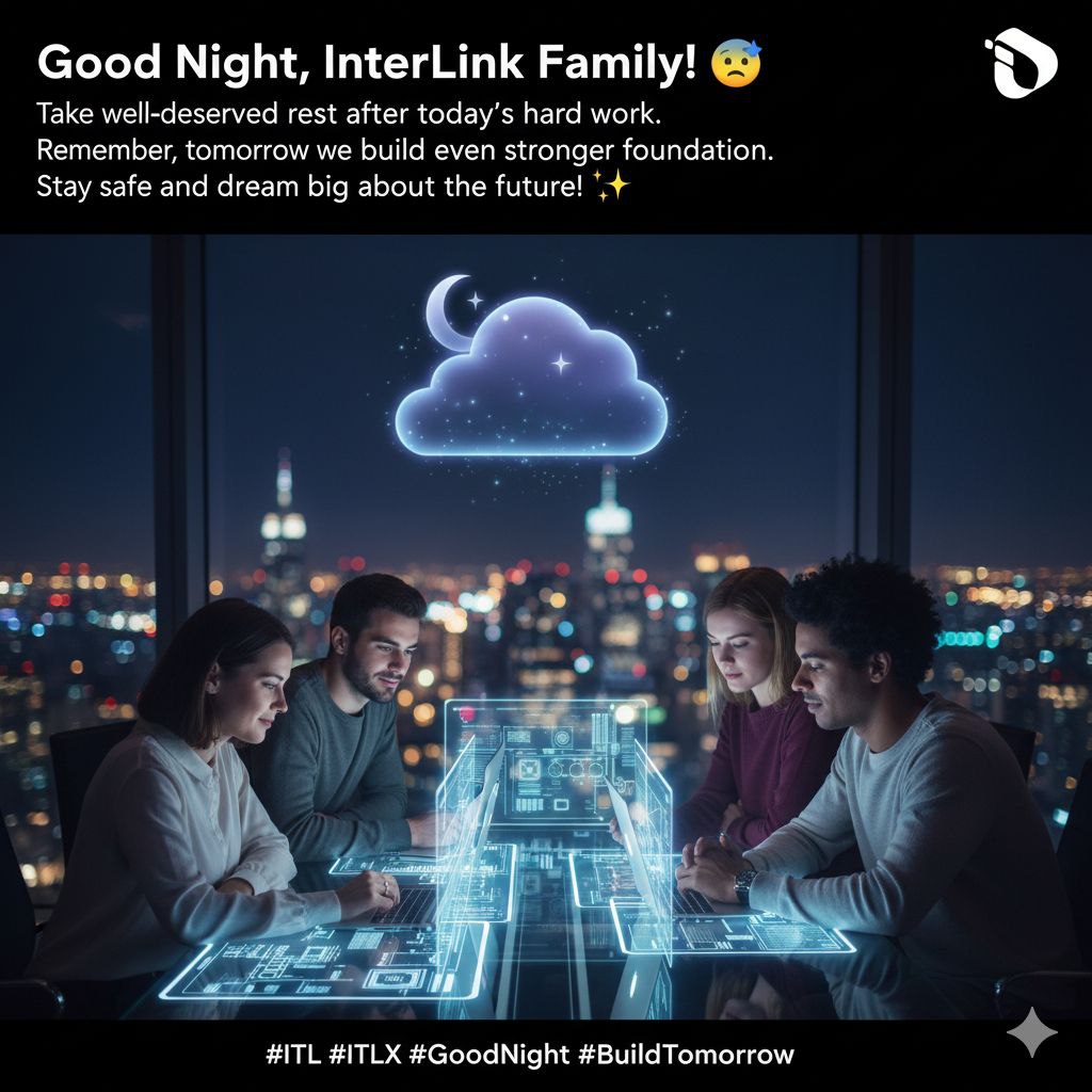
Good Night @inter_link Family! 😴
Take a well-deserved rest after today's hard work. Remember, tomorrow we build an even stronger foundation. Stay safe and dream big about the future! ✨
#ITL #ITLX #GoodNight #BuildTomorrow #ITLG #InterLink @kv_interlink @reina_itl @TheManofLord
1
1
4
28

9 Sep 2025
🌌 GN Web3 legends
@On_Veera is embedding Web3 into every browser tab unlocking 70 dApps without downloads and gifting real tokens for daily quests
@zeebuofficial has powered $6.3 B in live settlements this quarter alone, and seasons of InfoFi quests are fueling actual telecom rails
Drop a gn🌠 if you’re building the future tonight!
#GoodNight #Veera #Zeebu #Web3Dreamers #BuildTomorrow

5
1
5
7,716

19 Aug 2025
Hurricane Erin exploded from a tropical storm to a Category 4 hurricane in just 24 hours.
Winds surged from 70 to 145 mph, more than doubling overnight.
An exemplary case of rapid intensification.
That kind of transformation isn’t just meteorological. It’s a forecasting challenge.
When storms intensify this quickly, the margin for accurate prediction gets razor-thin.
This weekend, our team captured Erin’s evolution using Tomorrow.io’s satellite sounders. Our sounders scanned Erin 22 times between August 14–18, including 3 during its rapid intensification.
That frequency provides a detailed, real-time view that could help improve forecasts of hurricane strength.
This is exactly the kind of problem we’re inviting you to solve.
Our first open challenge for Build Tomorrow asks:
How do we build better models to predict rapid intensification?
Hurricane Erin may not have yet threatened land, but it underscored how quickly conditions can change.
That makes improving rapid intensification forecasting one of the most urgent frontiers in weather science.
Have ideas?
Head to build.tomorrow.io and help us push the science forward.
#BuildTomorrow #HurricaneErin
1
2
401

15 Aug 2025
At @projects_today , we extend warm wishes on India’s 79th Independence Day - May the spirit of freedom drive innovation, nation‑building, and the projects that shape tomorrow. Happy Independence Day!
#IndependenceDay2025 #HappyIndependenceDay #ProjectsToday #IndiaRising #development #ProudToBeIndian #Innovation #BuildTomorrow

2
164

Today, Ethiopia begins its most ambitious construction reform ever. CITI is a generational shift uniting all stakeholders to build better, faster, smarter. Be part of the change. #CITI2025 #BuildTomorrow

1
3
37

On this #InternationalYouthDay, we acknowledge the struggles young people face around the world and celebrate their strength, resilience, and potential.
Wishing every youth a meaningful and empowering day!
#youthday2025 #YouthEmpowerment #BuildTomorrow #centurymedia360

25
6
16
227
25 Jul 2025
Can your ML model close the $B weather gap?
Join Build Tomorrow for rare satellite data, Fortune 500 visibility, and rapid deployment on Tomorrow.io’s Resilience Platform.
First challenge: hurricane intensification opens next month. build.tomorrow.io
#BuildTomorrow
3
520

13 Jul 2025
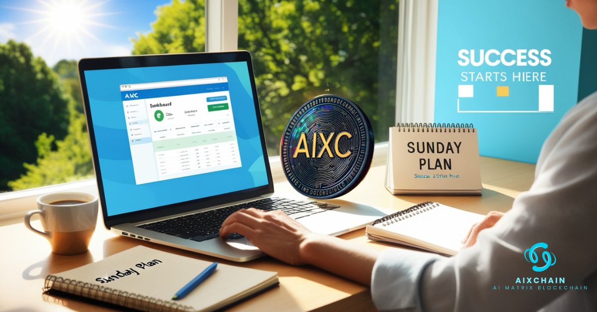
🌞 Sunday Plan: Secure Your Future with AIXC COIN🚀
📢 AIXCHAIN Official : t.me/AIXCHAIN1
Wallet : explorer.aixchain.com/
🌐 Website: aixchain.com/
#SundayPlan #SmartWeekend #FutureWealth #CryptoGoals #BuildTomorrow #AIXChain #Web3Life #NextWeekSuccess #AI
2
22

25 Jun 2025
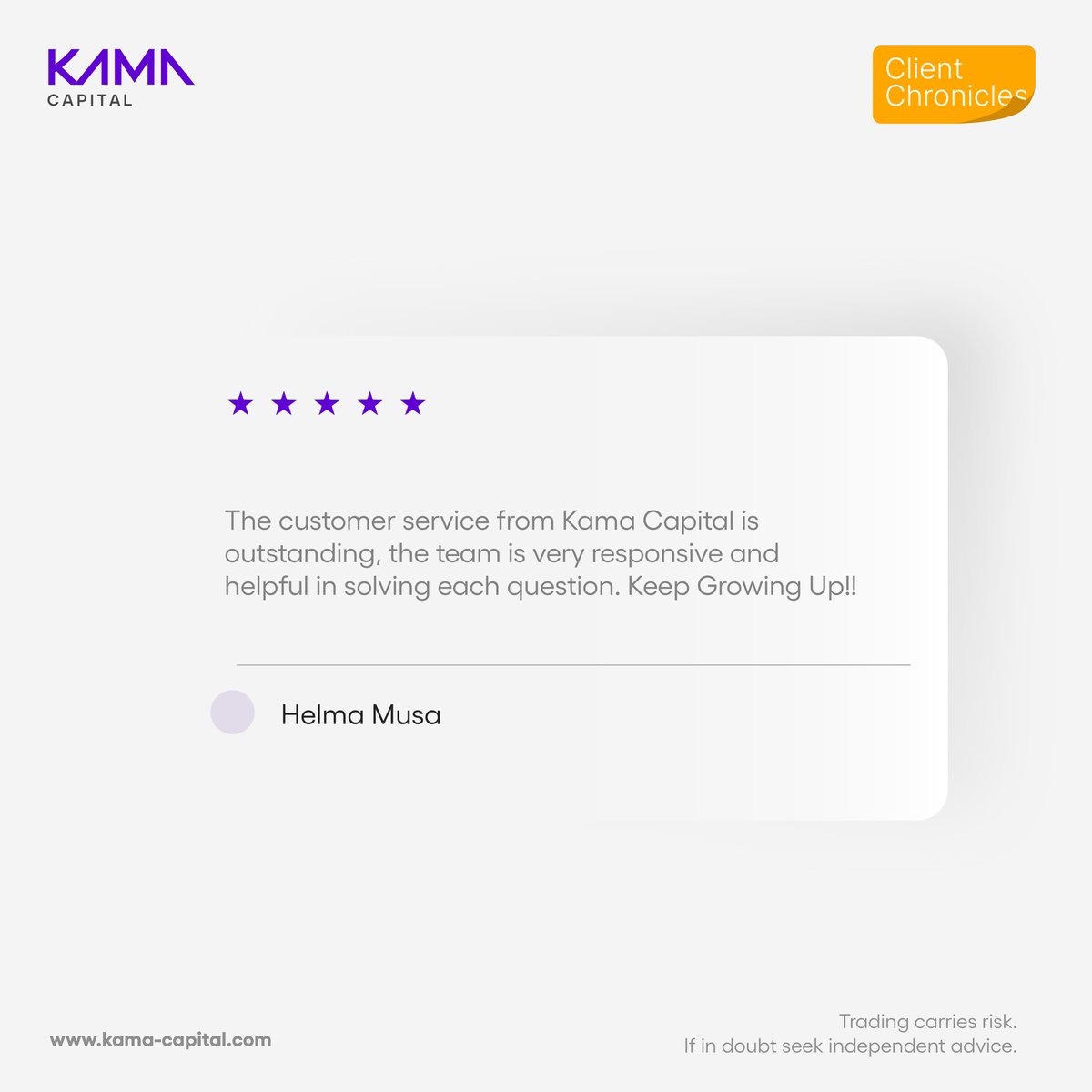
#ClientChronicles
🌟 Another kind word, another reason we do what we do. We’re grateful for the positive Google review.
Register: bit.ly/40MXhjn
#Investing #MoneyMatters #KamaCapital #InvestToday #BuildTomorrow #ClientLove #GoogleReview #TrustedByMany
1
3
29,653
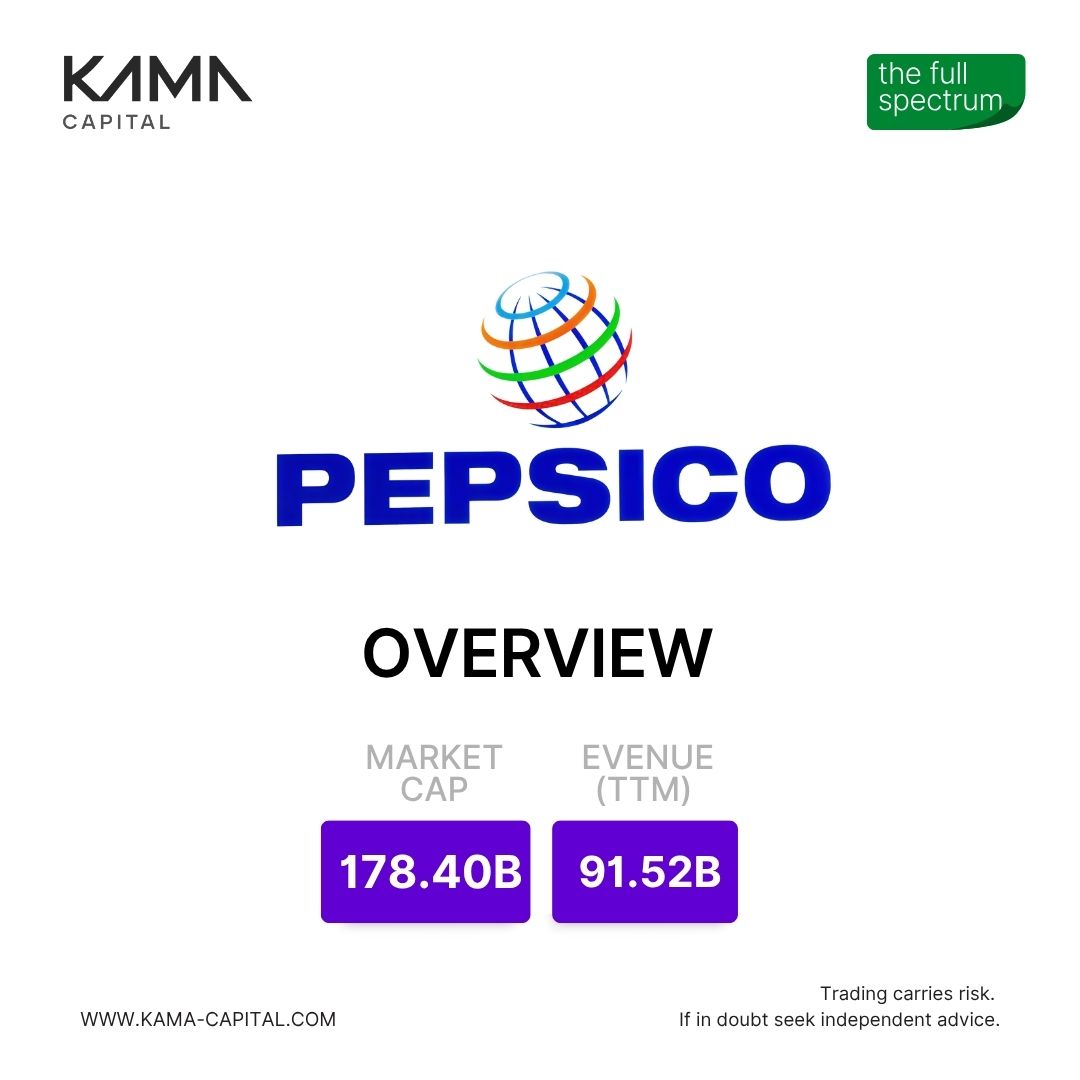
24 Jun 2025
#TheFullSpectrum
PepsiCo Stock Check: More Than Just Bubbles!
With a $178 Bn market cap and a 4.37% dividend yield, PEP provides steady income.
Register: bit.ly/40MXhjn
#Investing #MoneyMatters #KamaCapital #InvestToday #BuildTomorrow #PepsiCo


5
48,246
17 Jun 2025
The world’s most advanced satellite weather data is no longer reserved for governments.
With Build Tomorrow, we’re opening up access to our satellite constellation observations for builders, researchers, and innovators around the world.
Now you have high-frequency, high-revisit data at your fingertips. Use it to train models, test ideas, and build something that matters.
Real data. Real problems. Real impact.
Explore what you can build: buildtomorrow.io/
#BuildTomorrow
1
3
309