May 12
Code 👇
"""""""
import cv2
from ultralytics import solutions
cap = cv2.VideoCapture("path/to/video.mp4")
assert cap.isOpened(), "Error reading video file"
# Video writer
w, h, fps = (int(cap.get(x)) for x in (cv2.CAP_PROP_FRAME_WIDTH, cv2.CAP_PROP_FRAME_HEIGHT, cv2.CAP_PROP_FPS))
video_writer = cv2.VideoWriter("distance_output.avi", cv2.VideoWriter_fourcc(*"mp4v"), fps, (w, h))
# Initialize distance calculation object
distancecalculator = solutions.DistanceCalculation(
model="yolo26n.pt", # path to the YOLO26 model file.
show=True, # display the output
)
# Process video
while cap.isOpened():
success, im0 = cap.read()
if not success:
print("Video frame is empty or processing is complete.")
break
results = distancecalculator(im0)
print(results) # access the output
video_writer.write(results.plot_im) # write the processed frame.
cap.release()
video_writer.release()
cv2.destroyAllWindows() # destroy all opened windows
"""""""
5
353

May 6
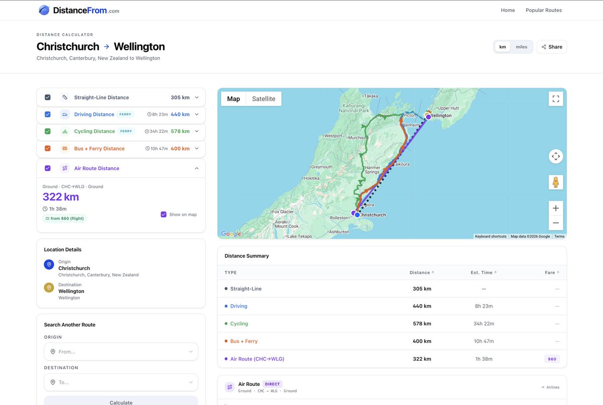
Just launched a new site on DistanceFrom.com.
The idea is simple.
Enter any two places, and it helps you figure out how to get from A to B.
Not just straight-line distance.
Not just driving distance.
But possible routes across different transportation methods, including walking, driving, cycling, public transit, trains, metro, ferries, and flights.
I originally built this because I always had this problem when planning trips.
For example, last year when I was researching how to travel from Christchurch to Wellington in New Zealand, I had to check many different sources to understand the options.
Now this page can show the answer in seconds:
distancefrom.com/christchurc…
You can fly. Or you can drive across the South Island, take the ferry, and continue to Wellington.
It even shows estimated time and price information when available.
There are still many things I want to improve, especially long-distance cruise routes.
But at this stage, I think it can already solve around 70–80% of common route-planning questions.
For example, if I want to know how to get from Seattle to Bainbridge Island (@BainbridgeIsl), DistanceFrom.com can give me the answer in seconds too: distancefrom.com/seattle-to-…
You can drive, cycle, or even walk part of the route and take the ferry across the water.
Try it here: distancefrom.com
Any feedback or suggestions would be much appreciated!
#DomainDrivenDevelopment #TravelPlanning #DistanceCalculator
14
4
112
3,557

17 Apr 2024
Testing Challenge #DailyCodingConcepts
Great ideas on testing distance calculation! Here's one approach using Flutter & Mockito:
1. Create a `DistanceCalculator` class with a `calculateDistance` method.
2. Write unit tests mocking location data using Mockito.
1
3
88

1 Dec 2022
A nice tool for the back pocket. 👖🧮📡 📏
#distancecalculator #everthingrf #RFtools #antenna #calculator
everythingrf.com/rf-calculat…

2
1
3

20 Oct 2022
What's your favorite tool for building a quick-n-dirty NEIGHBOR JOINING TREE? #evolution #bioinformatics
Alignment: 6000 seqs X 8000 bp.
Failed attempts:
— @iluvMEGA #MEGA11 crashes on my Mac
— @Biopython DistanceCalculator fails to finish after 6 hours

1
2
1 Sep 2022
A nice tool for the back pocket. 👖🧮📡 📏
#distancecalculator #everthingrf #RFtools #antenna #calculator
everythingrf.com/rf-calculat…
1
6
13 Jun 2022
A nice tool for the back pocket. 👖🧮📡 📏
#distancecalculator #everthingrf #RFtools #antenna #calculator
everythingrf.com/rf-calculat…

1
4
27 May 2022
A nice tool for the back pocket. 👖🧮📡 📏
#distancecalculator #everthingrf #RFtools #antenna #calculator
everythingrf.com/rf-calculat…
2
1

2 Sep 2020
یه اپ پیدا کردم بینظیر
مسیر رو نقطه به نقطه روش میزنی مسافت رو بهت میده، یه مسیر رو با چند تا جاده فرعی وارد کردم برای یه مقصد، کلی مسافت رو کوتاه کرد.
#distanceCalculator
فقط امیدوارم گم نشم :)
6

Check-distance
>> check-distance.com
distance calculator for US cities with driving/flying distance between cities, mileage, gas cost calculator and route on map
#mileage #driving #GPS #distancecalculator
1
3

30 Aug 2019
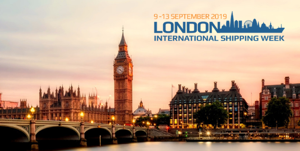
Searoutes will be part of the startup corner at #LISW19 Thanks @lionzan @LISWOfficial @InmarsatGlobal
Come and meet us to talk about #distancecalculator #weatherrouting #fuelconsumption #carbonfootprint #shipping #greenshipping
2
7

27 Mar 2018
Looking to calculate your distance for any journey.. simply visit DistanceCalculator.co.za #distancecalculator
1

4 Jun 2017
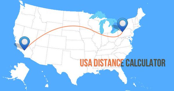
Here's an easy solution to know the #distance between cities in #USA!
#distancecalculator
ow.ly/NO0630chv2r
2

8 Jan 2017
It's time to hit the road! ⛷️🙂 distancecalculator.net/count… #distancecalculator photo: @zellersamuel

1

16 Nov 2016
5 Secret #BusinessBenefits that Real-time #SalesforceTracking can Offer :
Business Benefits: 1)#DistanceCalculator
astiinfotech.com/blogs/sales…

2
2 Oct 2016
#Motorcycle is a good way to explore distances! 🏍 😃 distancecalculator.net/ photo by Francisco Requena @unsplash #DistanceCalculator

27 Jul 2016
"Prague never lets you go… this dear little mother has sharp claws" #franzkafka #prague distancecalculator.net/count… #distancecalculator
1
24 May 2016
"I will cherish my visit here in memory as long as I live" distancecalculator.net/city/… #distancecalculator #romanholiday

4 May 2016
#Distance from #Japan to major cities are right here: distancecalculator.net/count… #girls #distancecalculator #tokyo