

Rajesh Dogra retweeted

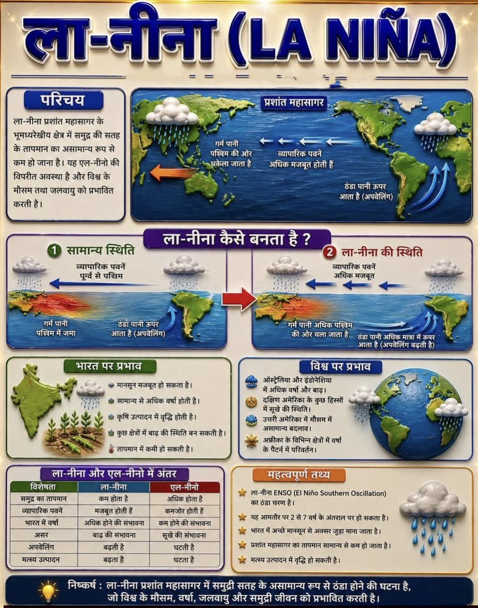
ला-नीना (La Niña)
🔹 ला-नीना ENSO (El Niño Southern Oscillation) का ठंडा चरण है, जिसमें मध्य और पूर्वी भूमध्यरेखीय प्रशांत महासागर का समुद्री सतह तापमान सामान्य से कम हो जाता है।
🔹 कारण:
व्यापारिक पवनें (Trade Winds) अधिक मजबूत हो जाती हैं।
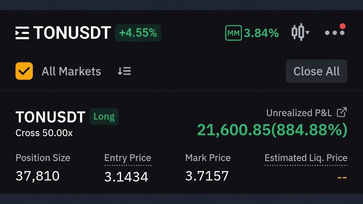
27
159
2,985


🌎 NOAA has officially declared the onset of El Niño
El Niño is the warm phase of ENSO, during which surface waters in the central and eastern tropical Pacific become warmer than usual.
As the distribution of warm water in the Pacific shifts, atmospheric circulation also changes, including the position of the jet stream and storm tracks. This can influence temperatures and rainfall thousands of kilometres away.
Current seasonal forecasts suggest that El Niño will continue to strengthen through the rest of the year. According to NOAA, there is a 60% chance that sea surface temperature anomalies in the central and eastern tropical Pacific will exceed 2 °C by the end of the year. This episode could therefore become very strong and rank among the strongest events on record.
Typical impacts of El Niño:
• globally: an increase in the planet’s average temperature
• more rainfall: western and southern South America, parts of East Africa, and the southern United States
• drier conditions: northern and eastern Australia, Indonesia, parts of Southeast Asia, southern Africa, and parts of Central America
• South Asia: the southwest monsoon is often weaker
• tropical cyclones: less favourable conditions in the Atlantic, a more active eastern and central Pacific, and typhoon formation in the western North Pacific often shifting farther east
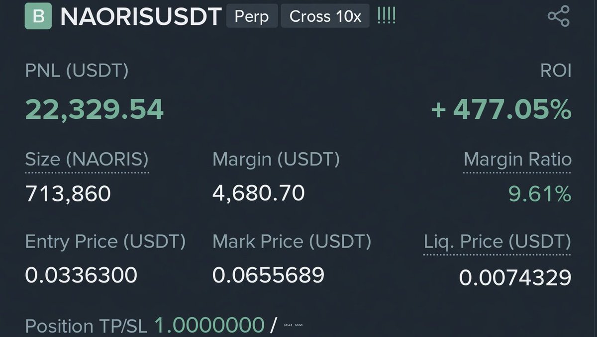
11
160
478
36,749

ला-नीना (La Niña)
🔹 ला-नीना ENSO (El Niño Southern Oscillation) का ठंडा चरण है, जिसमें मध्य और पूर्वी भूमध्यरेखीय प्रशांत महासागर का समुद्री सतह तापमान सामान्य से कम हो जाता है।
🔹 कारण:
व्यापारिक पवनें (Trade Winds) अधिक मजबूत हो जाती हैं।

1
3

