
6 Dec 2023
it's information (GisDatabase) which are represented to scale on a clean surface for proper understanding.
There are branches of Surveying and Geoinformatics ranging from 1)Cadastral 2)Bathymetric 3)Topograpic 4)Engineering 5)Mining etc
1
3
191
6 Dec 2023
it's information (GisDatabase) which are represented to scale on a clean surface for proper understanding.
1
1
2
40

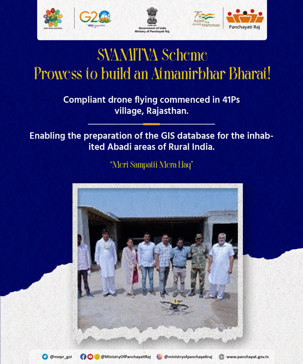
Under the #SVAMITVA_Scheme, a successful #DroneFlying has started in #41Ps village, #Sri Ganganagar district, #Rajasthan, greatly assisting in the preparation of the #GISdatabase for the inhabited Abadi areas of #RuralIndia.
#स्वामित्व_योजना
#MeriSampattiMeraHaq
1
4
493

27 Sep 2022
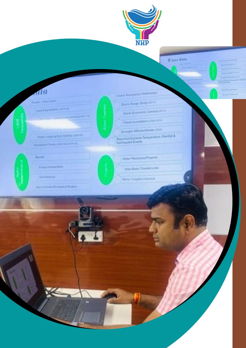
A #training session was organized by @NationalWaterI1 on the #GISDatabase of #India-WRIS for #NHP implementing agencies on23.09.22.The interactive session consisted of a presentation by a live demonstration of the modules by theExpert.
@MoJSDoWRRDGR @CWCOfficial_GoI @csmrsdelhi
5
10

2 Dec 2019
Thanks @i6Ra71m for your good training of last week; you are GIS monster of #Zanzibar. I really appreciate your efforts. #QGIS #GISDataBase
Zanzibar, the place to be for geospatial activities!


1
6

15 Nov 2019
13th NOV marked the international day of #GIS technology. It is safe to say that this technology has come a long way since 1960!
#locationintelligence #locationmapping #maptechnology #gis #gisdatabase
cio.economictimes.indiatimes…
1
2

28 Nov 2017
Inizio lavori del pomeriggio con #tianjin #historical #building #portfolio #gisdatabase #renovation #wef2017 #astorhotel
2

13 Dec 2016
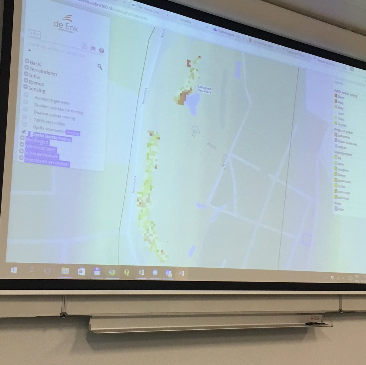
Always learning @enk_groenengolf presision turf management @HAShogeschool #GISdatabase day 3 #sensing #robots #future #greendeal

3
2