
May 20
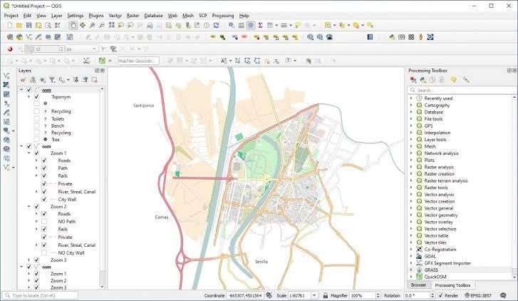
WMS. WFS. WCS. You have seen the acronyms. Here is what they actually mean — and why they matter for your work.
WMS (Web Map Service) — serves map images. Your application requests a map, the server renders and returns it. Read-only.
WFS (Web Feature Service) — serves the actual geometries and attributes as data you can query, filter, and download. Read and write.
WCS (Web Coverage Service) — serves raster data (satellite imagery, DEMs). Pull raw pixel values, not just rendered images.
Why this matters:
If your tools and data are OGC-compliant, they talk to each other — regardless of vendor. Your QGIS connects to your cloud GIS. Your web application pulls from your data hub. Everything is interoperable.
If they're not — you're locked in.
OrionGIS and the OrionSpatial Data Hub are fully OGC-compliant. Connect them to QGIS, ArcGIS, or any standards-based application directly.
Try it today today: orionterrametrics.com
Save this. Share it with your team.
#GIS #OGC #WMS #WFS #OpenStandards #QGIS #ArcGIS #OrionGIS #GeospatialTech

1
6
240
May 19
WMS. WFS. WCS. You have seen the acronyms. Here is what they actually mean — and why they matter for your work.
WMS (Web Map Service) — serves map images. Your application requests a map, the server renders and returns it. Read-only.
WFS (Web Feature Service) — serves the actual geometries and attributes as data you can query, filter, and download. Read and write.
WCS (Web Coverage Service) — serves raster data (satellite imagery, DEMs). Pull raw pixel values, not just rendered images.
Why this matters:
If your tools and data are OGC-compliant, they talk to each other — regardless of vendor. Your QGIS connects to your cloud GIS. Your web application pulls from your data hub. Everything is interoperable.
If they're not — you're locked in.
OrionGIS and the OrionSpatial Data Hub are fully OGC-compliant. Connect them to QGIS, ArcGIS, or any standards-based application directly.
Try it today today: orionterrametrics.com
Save this. Share it with your team.
#GIS #OGC #WMS #WFS #OpenStandards #QGIS #ArcGIS #OrionGIS #GeospatialTech
1
4
22
937

May 11
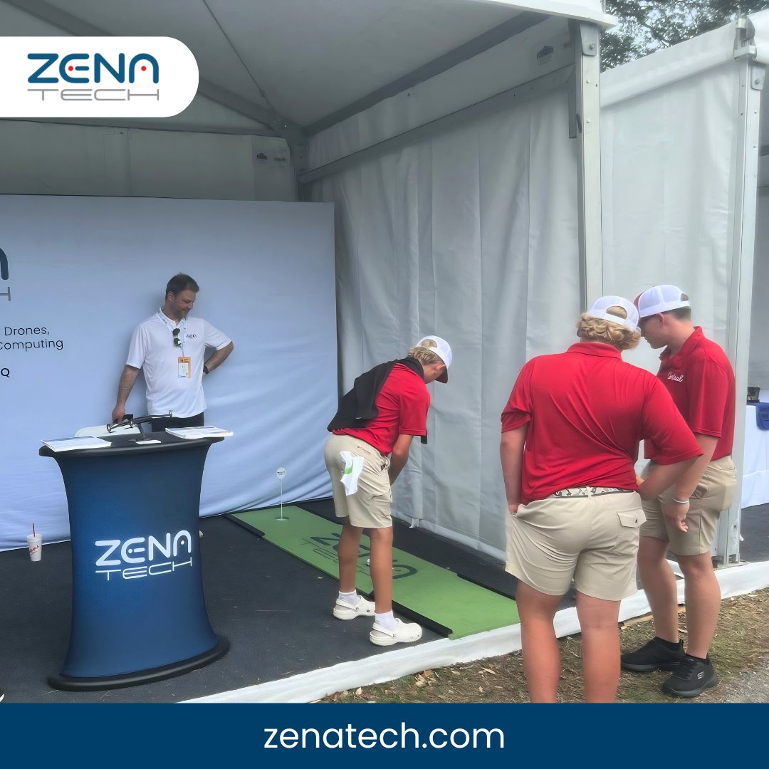
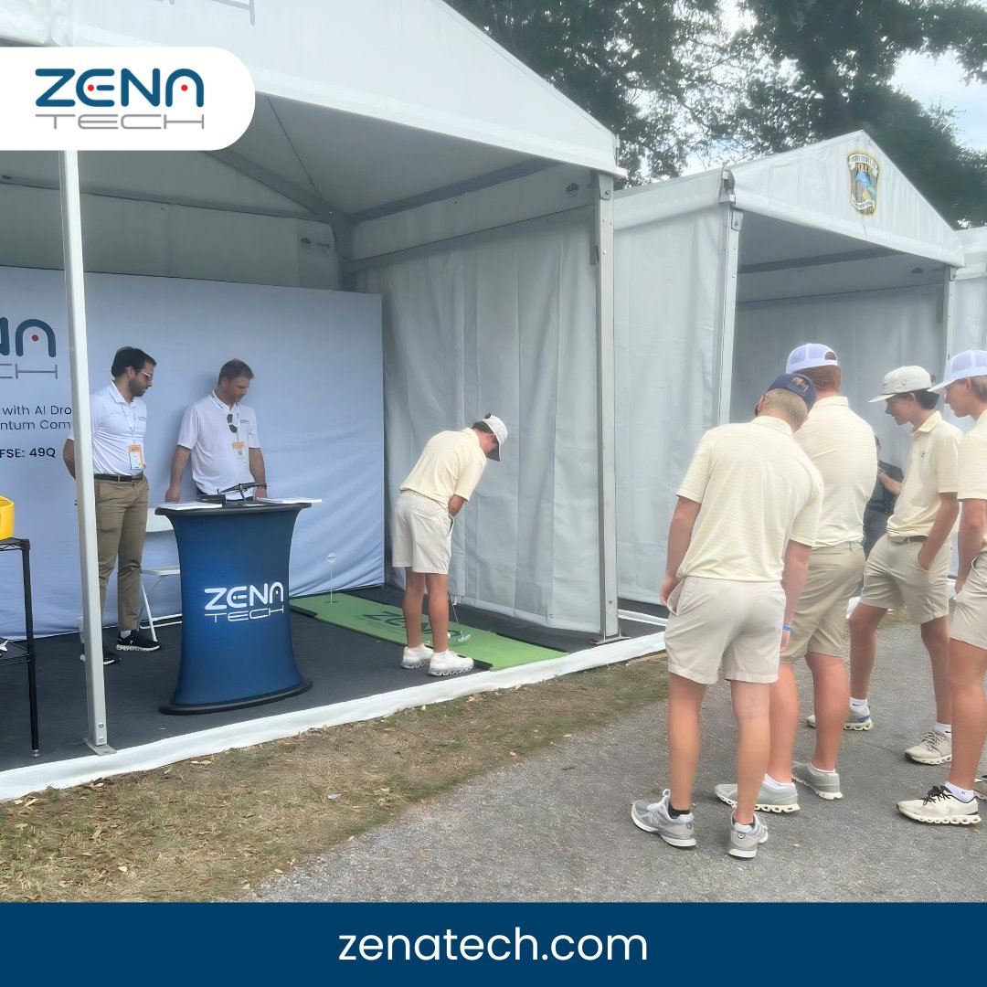
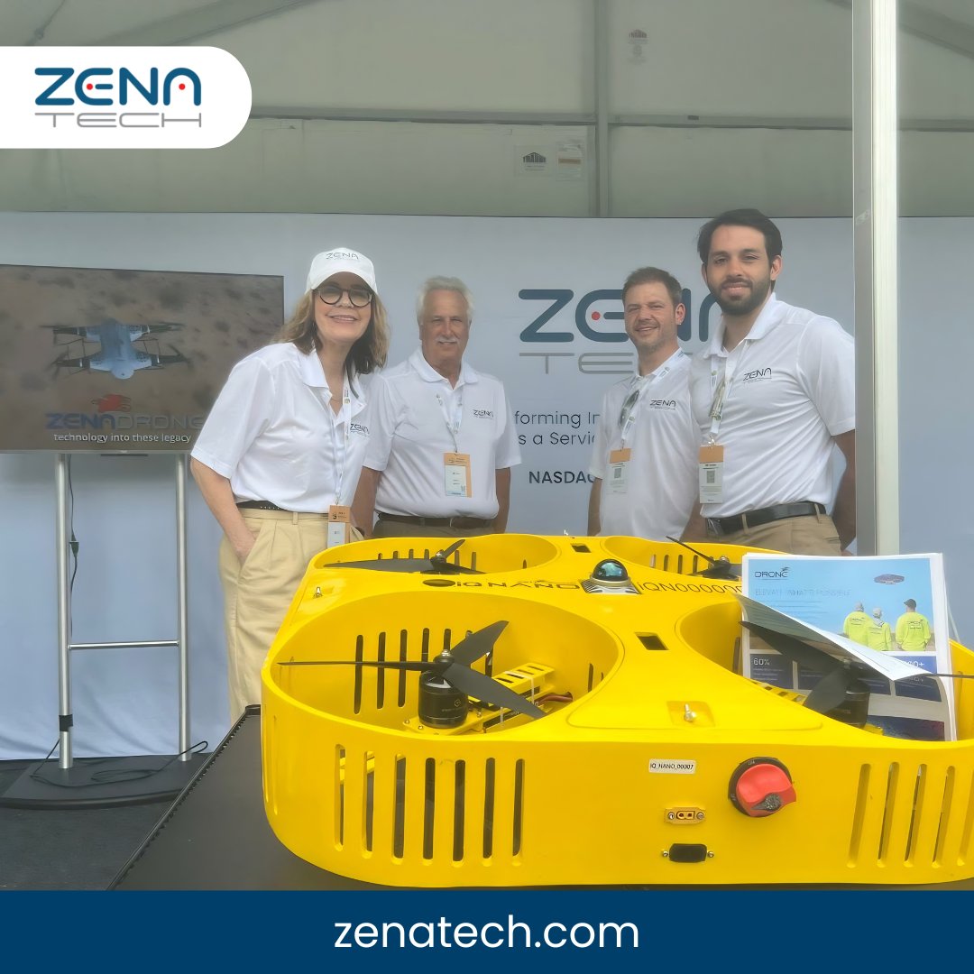
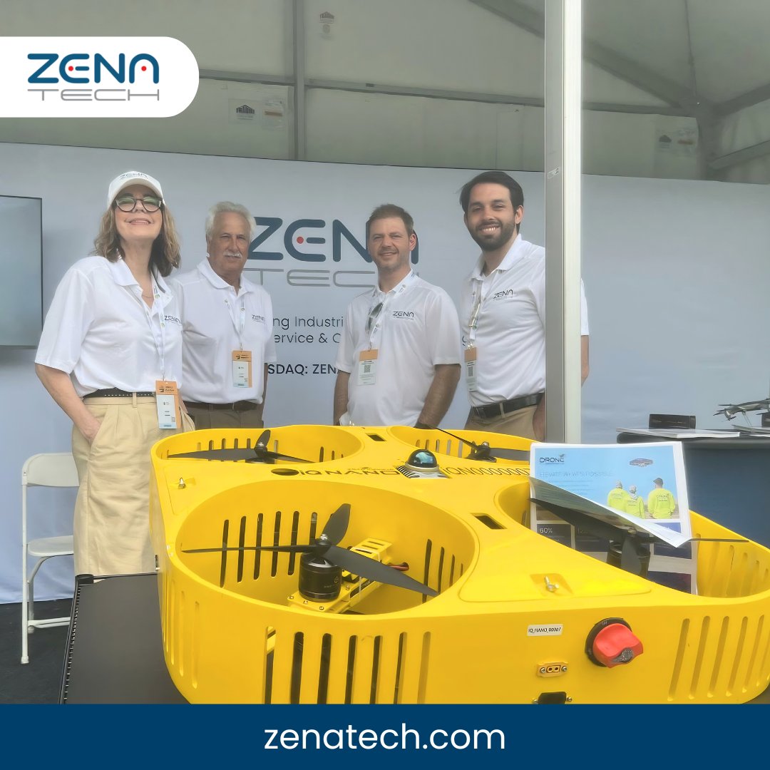
ZenaTech VP of Corporate Development & Investor Relations Linda Montgomery(@lindamont3) and Drone as a Service (@daasplatform) Marketing Director Tom Bellis, along with the team, attended the PGA TOUR’s ONEflight Myrtle Beach Classic (@MyrtleBeachCl), showcasing the @ZenadroneInc IQ Nano and its potential for golf course surveying.
These engagements reflect ZenaTech’s ongoing commitment to engaging with industry stakeholders and exploring future applications of its Drone as a Service offering.
To learn more about ZenaTech, contact investor@zenatech.com.
$ZENA $49Q $ZENA $49Q #Zenatech #DroneasaService #DaaS #DroneTechnology #AerialSurveying #GolfTech #SportsInnovation #GeospatialTech #DigitalTransformation #EmergingTech #TechInnovation
1
4
14
855

🌍 EU-wide positioning just got a massive upgrade! 🚀 New ionospheric model slashes convergence time by 37.7% (horizontal) & 34.2% (vertical) vs legacy—with 59.6% lower error! 🔍 Adaptive uncertainty grids cut time even more (42.1%/28.8%)! 1114 views & counting—game-changer for wide-area PPP! #PrecisePointPositioning #GNSS #IonosphereHacks #GeospatialTech Link[doi.org/10.1080/10095020.202…]
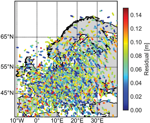
ALT Figure 11. Satellite-wise differences of slant ionospheric delay between modeled values and PPP-AR-derived values for all selected reference stations at 14:00–14:15 on DOY 113, 2023.
1
4
213

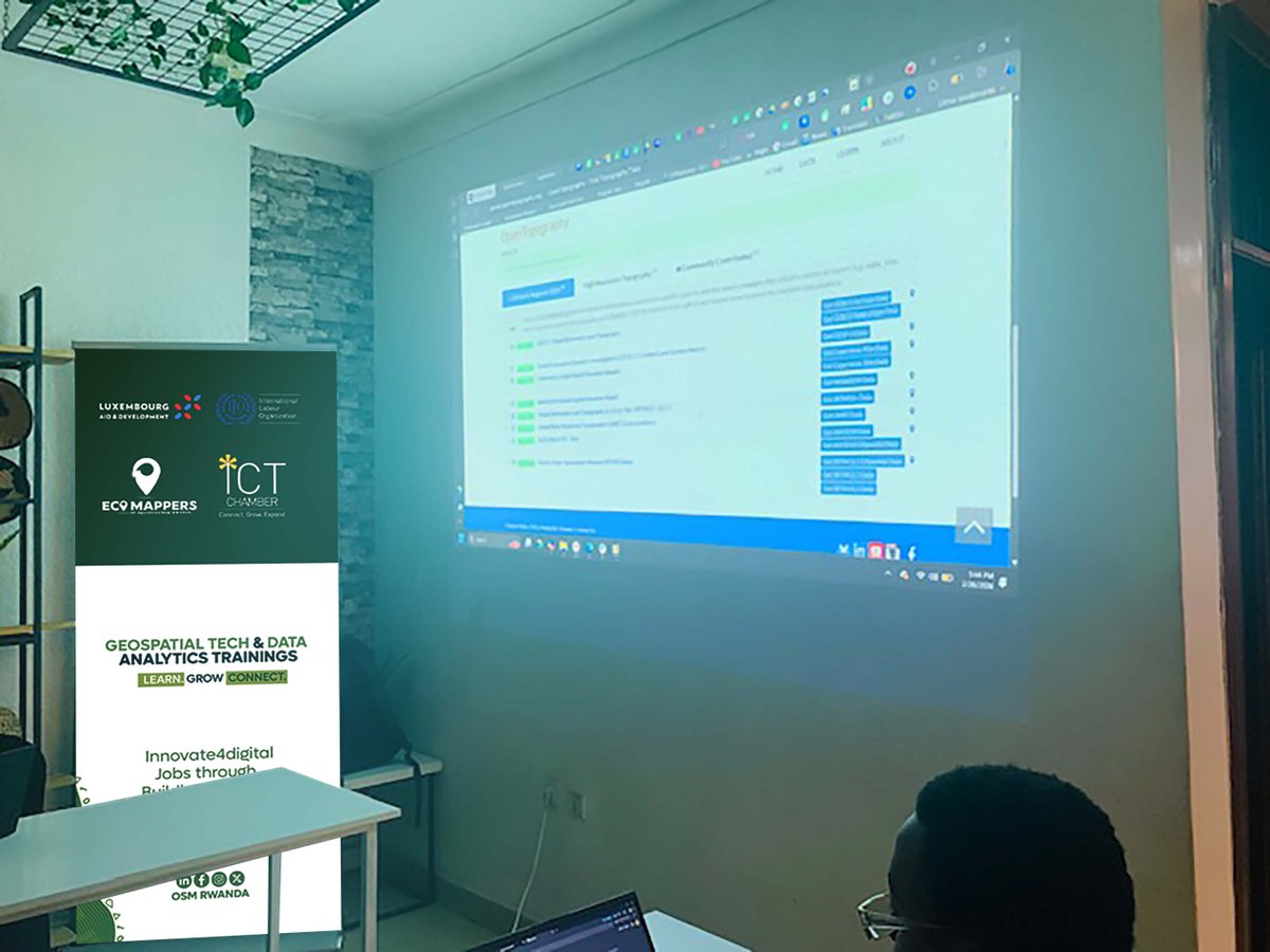
Trainings continues as we explore and navigate new features in GeospatialTech. It’s truly inspiring to see participants excelling and growing, moving from beginners to the next level with confidence.Shout out to @Luxembourg Aid and Development
@rwictchamber
@ilo
#Innov4digital

1
1
6
121
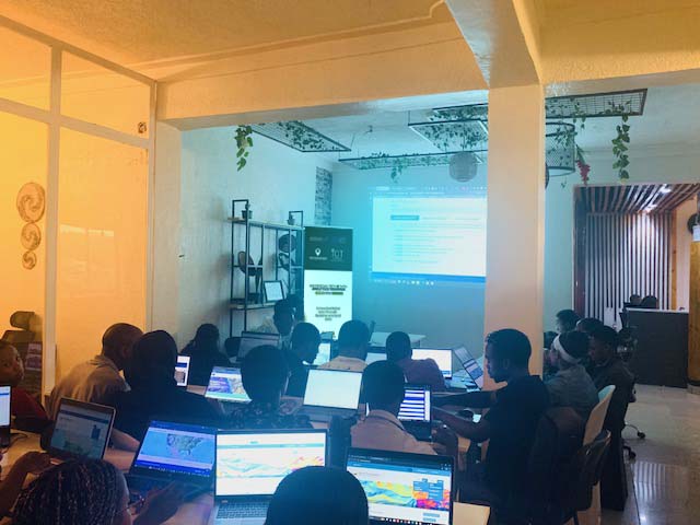
Today’s session is lit! We are excited to be with Engineer Obed as we dive into point pattern analysis, spatial interpolation, and suitability modelling, shout-out to @Luxembourg aid and development, the @ilodaressalaam and @rwictchamber #Innov4DigJobs #Geospatialtech

6
97

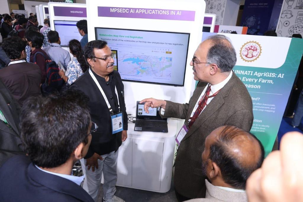
Dr. Abhilaksh Likhi, Union Secretary, Department of Fisheries, along with Shri Ajay Srivastava, Economic Advisor, visited the AI Impact Summit 2026 at Bharat Mandapam, New Delhi today. Dr. Likhi engaged with the Madhya Pradesh State Electronics Development Corporation (MPSEDC) stall, which demonstrated an AI-based application for mapping water bodies, including ponds and reservoirs. He explored possible collaborations with MPSEDC's AI applications in the Fisheries and Aquaculture sector.
#AIImpactSummit2026 #EmergingTech #Quantum #GeoSpatialTech #ModernizingAquaculture

4
11
499

Feb 3
Geospatial Technology Set to Boost Coordination, Speed, and Efficiency in Bihar Infrastructure Planning
#Bihar #GatiShakti #GeospatialTech #Infrastructure #BISAGN patnapress.com/bihar-geospat…
4
54

Jan 25
Building innovative solutions to fight corruption using geospatial technology—like mapping illicit deals and boosting transparency. Who's in? 🚀🌍 #GeospatialTech #AntiCorruption #Innovation #connect #innovation2025
4
148

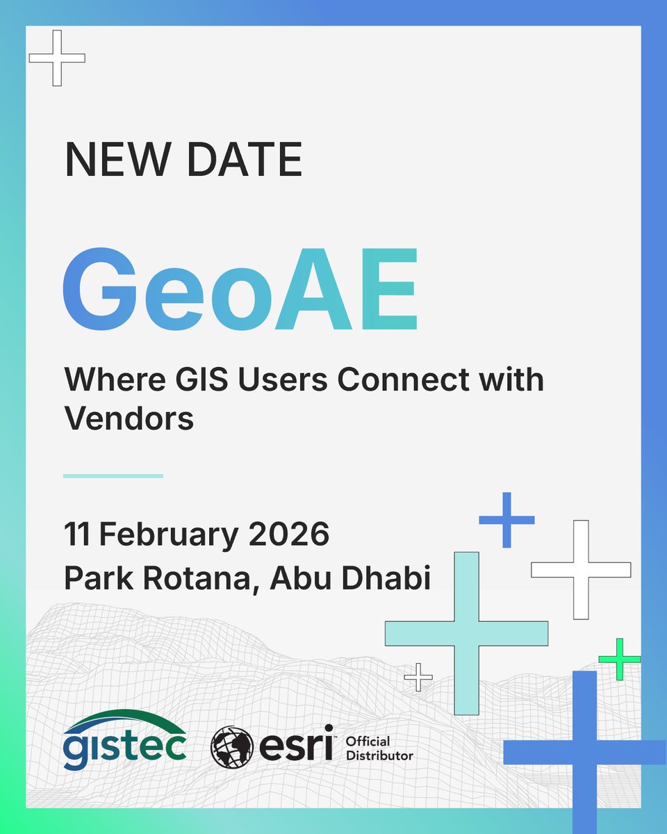
📢 GeoAE 2026 – Where GIS users connect with vendors!
📆 11 Feb 2026 | 📍 Park Rotana, Abu Dhabi
One-day event for GIS users, vendors, data providers & more. Explore, exhibit, network!
🔗 Register: shorturl.at/3WHCq
#GeoAE #GIScommunity #GeospatialTech #gistec #AbuDhabi
2
29

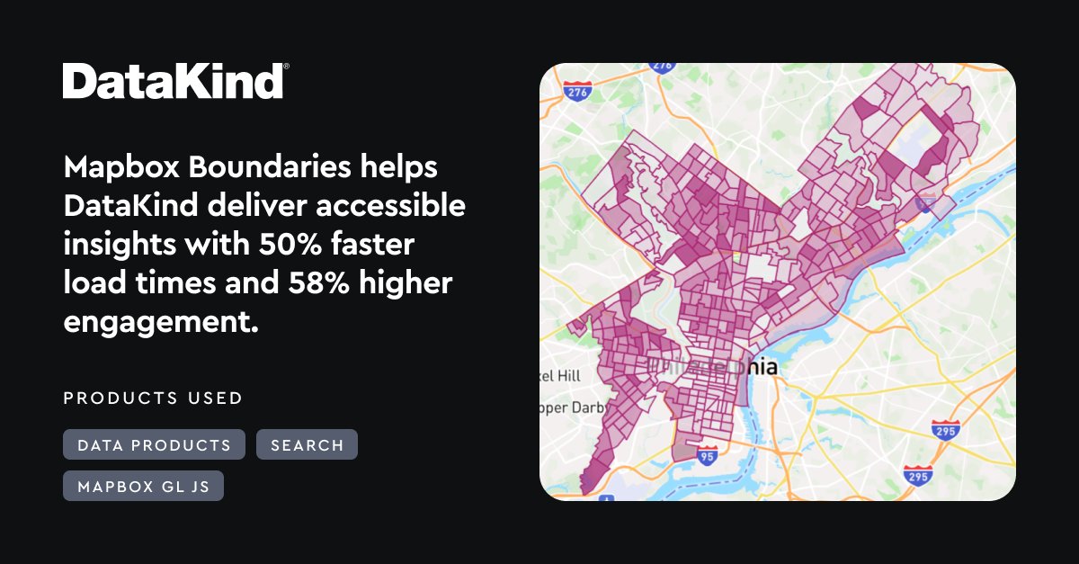
Speed and precision matter when data guides decisions on the front lines.
That’s why @DataKind turned to Mapbox.
Mapbox Boundaries now powers fast, accurate rendering of census tracts, ZIP codes, counties, and congressional districts—eliminating performance bottlenecks caused by slow TIGERweb calls. With Mapbox Search Geocoding, wayfinding and address lookups are dramatically faster and easier.
The shift from static scripts to interactive, map-first insight is helping DataKind deliver clearer, more actionable tools for the nonprofits they support.
See how DataKind builds with Mapbox: mapbox.com/showcase/datakind
#BuiltWithMapbox #DataForGood #GeospatialTech
3
18
1,995

27 Dec 2025
AI meets GIS 🌐🤖 GeoAI is making geospatial data smarter and more accessible, enabling digital twins, predictive infrastructure maintenance, and faster, more precise mapping.
Read more: geoweeknews.com/sponsored/ge…
#Geoawesome #GeoAI #GeospatialTech
18
88
4,415
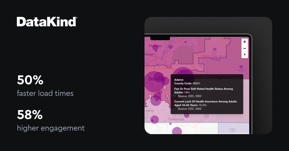
📊 50% faster load times.
📈 58% increase in monthly active users.
✔️ 15% rendering error eliminated.
Mapbox Boundaries has been transformative for @DataKind, powering more inclusive and effective data tools for the nonprofits they serve.
DataKind applies data science and AI to some of the world’s toughest challenges—from education and economic opportunity to frontline health and humanitarian response. Their products help resource-constrained teams turn complex data into usable insight for the communities they support.
With reliable, high-resolution administrative boundaries and smooth performance at scale, Mapbox helps DataKind deliver tools that truly make a difference.
Learn how DataKind builds with Mapbox: mapbox.com/showcase/datakind
#BuiltwithMapbox #DataForGood #GeospatialTech
1
9
1,638

29 Nov 2025
🛰️ Ceinsys Tech bags ₹2.02 Cr soil mapping order from MRSAC
👉🏻 Received additional work order from Maharashtra Remote Sensing Application Centre (MRSAC) for Detailed Soil Survey & Mapping in #Nashik district under the National Soil Mapping Programme (NSMP)
👉🏻 Execution period: 4 months
👉🏻 Total order value from MRSAC now: ₹7.06 Cr
👉🏻 Project to support data-driven soil resource management for the state
#CeinsysTech #MRSAC #SoilMapping #GIS #GeospatialTech

2
662

28 Nov 2025
@tech_mahindra will be at GeoSmart India 2025 at Bharat Mandapam, Delhi, contributing to key discussions on geospatial technology and national progress.
On 1 December, from 14:30 to 15:00, Rajanikanth Muppalla will join the #CXOSummit to share insights on the export potential of geospatial solutions. On 2 December, he will speak during the Mainstage Plenary Session on how collaborative business models can elevate turnkey solutions.
Industry experts Nitin Pande and Shashikant Bagul will also deliver perspectives on drones, mobile GIS, AI/ML, IoT, and digital twins in governance and utilities.
👉 Know more: geospatialworld.net/gsi/2025…
#ScaleAtSpeed #GeoSmartIndia2025 #DigitalTransformation #GIS #GeospatialTech #SpatialIntelligence #SmartInfrastructure

1
3
312

[PARTNERED]
GIS Day 2025 showed how GIS is moving from maps to enterprise intelligence, driving utilities, sustainability, engineering and environmental planning.
#GISDay2025 #GeospatialTech #Infrastructure
1
828

22 Nov 2025
#GeospatialTech and #GIS were crucial in tracking the #COVID19 pandemic, with Johns Hopkins Medical Centre's dashboard as a key resource for #global stakeholders: @Shravishtha_ajaykumar or-f.org/35082
1
315

20 Nov 2025
يشارك #مركز_القطر_للتدريب بملتقى GIS DAY 2025 بجامعة الملك سعود، مستعرضًا برامجه المتخصصة مطلقاً مبادرة "تأهيل سفراء القطاع الجيومكاني".حيث يقدّم خصمًا مقداره 70% لطلاب الجامعة ومنسوبيها دعمًا لتنمية الكفاءات الوطنية.
#GISDay2025 #Geospatial #GIS #AlQotrTraining #GeospatialTech

2
75
[PARTNERED]
Tomorrow at #GISDay2025: A deep dive into how GIS connects ecology, climate risk, IoT, ERP, and AI to drive responsible utilities planning.
Panel:
Dr. Ninad Raut
Dr. Shrikant Gabale
Nikesh Regmi
Shailesh Deshpande
Details: special-initiatives.livemint…
#GISConnect2025 #SustainableUtilities #AI #GeospatialTech
1
1,628
13 Nov 2025
#GeospatialTech and #GIS were crucial in tracking the #COVID19 pandemic, with Johns Hopkins Medical Centre's dashboard as a key resource for #global stakeholders: @Shravishtha_ajaykumar or-f.org/35082
368