
30 May 2024
The latest two releases in the @UK_CEH Land Cover Map (LCM) series, (LCM2022) and LCM2023
Produced by classifying satellite images from the respective years, each new LCM comprises geospatial datasets describing the UK land surface
#remotesensing #LandCoverMap
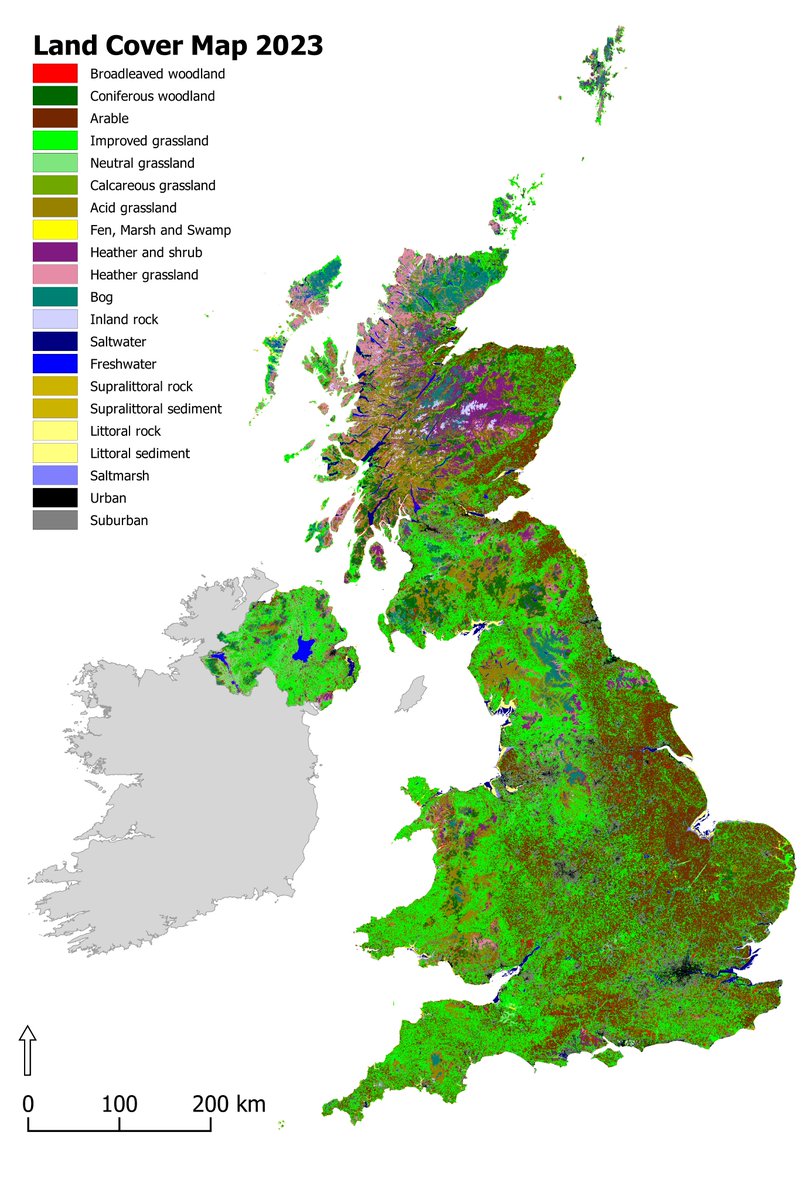

UPDATE: The UKCEH Land Cover Maps for 2022 and 2023 have been released. These additions to our LCM series describe the physical material on the surface of the country, using high-resolution satellite imagery.
Discover the collection: catalogue.ceh.ac.uk/document…
#LandCover #GIS

ALT Land Cover Map 2023 with key indicating broad habitat classifications
1
1
6
1,296

22 Mar 2023
The @EPAIreland & @TailteEireann have launched a National #LandCoverMap of Ireland that categorises over 10million landscape features for the 1st time. It'll help govt & organisations understand (and act on) development, habitat loss & #climatechange. bit.ly/42s2E64
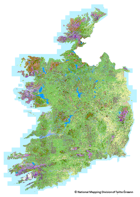
ALT Map of Ireland with a variety of coloured markings
1
12
21
3,719
11 Aug 2022
Latest @UK_CEH Land Cover Maps for GB and Northern Ireland available from @EIDC_data, led by @DrChrisMarston1 and @ClareRowland_UK
Data is available at 10m, 25m and vector formats
catalogue.ceh.ac.uk/document…
#RemoteSensing #LandCover #LandCoverMap #GoogleEarthEngine #GEE
11 Aug 2022

The latest version of UKCEH's land cover map has just been published.
You can download the Land Cover Map 2021 for Great Britain and Northern Ireland from our data catalogue
catalogue.ceh.ac.uk/document…
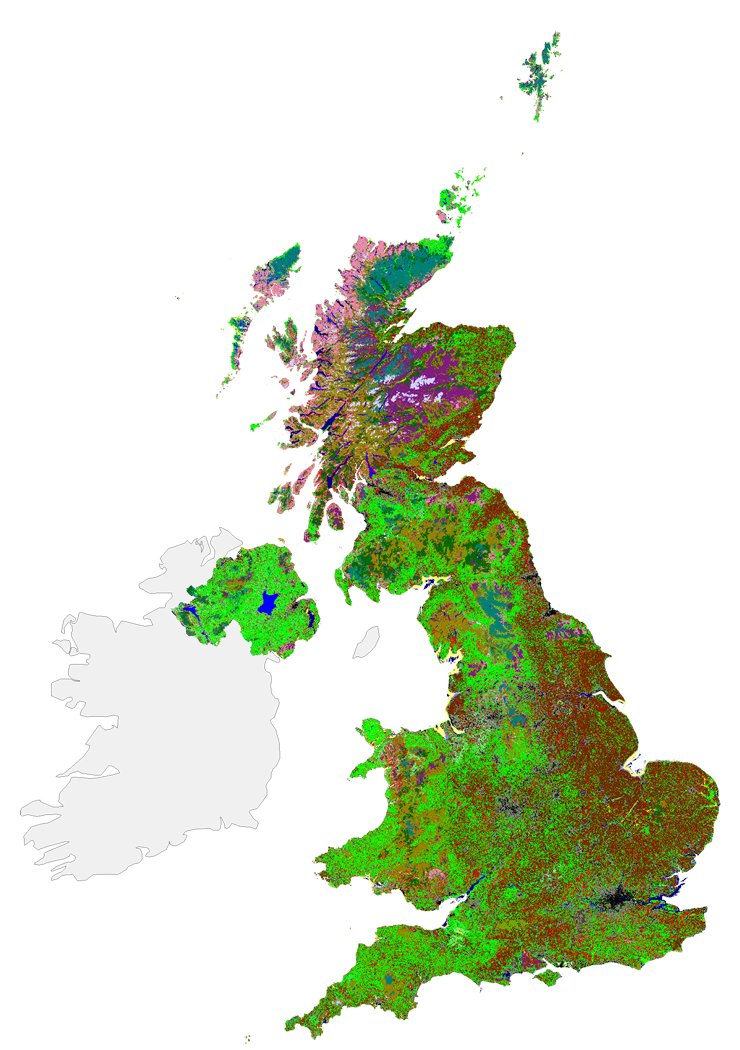
ALT Land cover map 2021
1
6

4 Sep 2021
#Esri реализира първата по рода си Глобална карта на земното покритие с висока резолюция! Тя може да се комбинира с други данни за откриване и проследяване на настъпили промени на земната повърхност. Разгледайте картата: livingatlas.arcgis.com/landc…
#гис #LandCoverMap
2
25 Feb 2020
Our #LandCoverMap development paper is a @RemoteSens_MDPI's #RSHighlyCitedPaper!
Using @USGSLandsat and Sentinel-1 & 2 data from @CopernicusEU to provide a great foundation for #LCM2019, due out later this year
@UK_CEH @UKCEHPapers #ukscape #GoogleEarthEngine #RemoteSensing
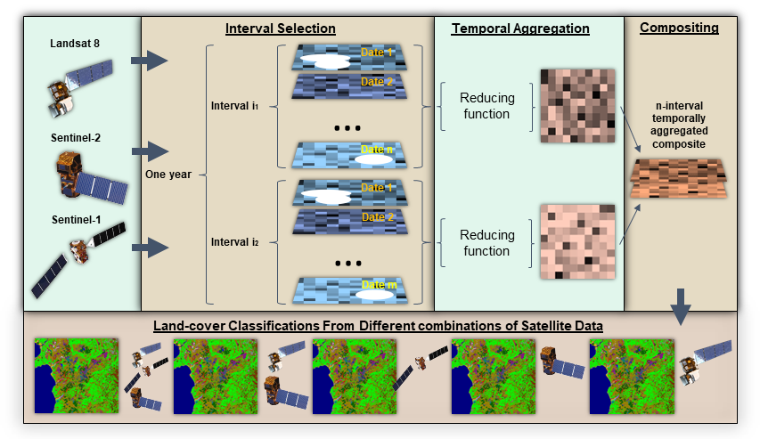
24 Feb 2020

#RSHighlyCitedPaper
Evaluating Combinations of Temporally Aggregated #Sentinel-1, Sentinel-2 and #Landsat 8 for #LandCover Mapping with #GoogleEarthEngine
By Luis Carrasco, Aneurin W. O’Neil, et al.
👉mdpi.com/2072-4292/11/3/288/…
#remotesensing
#cloudcomputing
#datafusion
#radar
2
2
10