
4 Dec 2025
🗺 DAY 4 and Closing Session of the UN Maps Clinics 🗺
Today's session focused on 3D Tools and Features 💻, and Ways Forward ⏭
#UNMapsConference #unitednations #geospatial #UNMaps #UNMappers #openstreetmap #GIS #peacekeeping #UNGSC #opendata #maps #UNgeospatial #mapservices
1
2
295
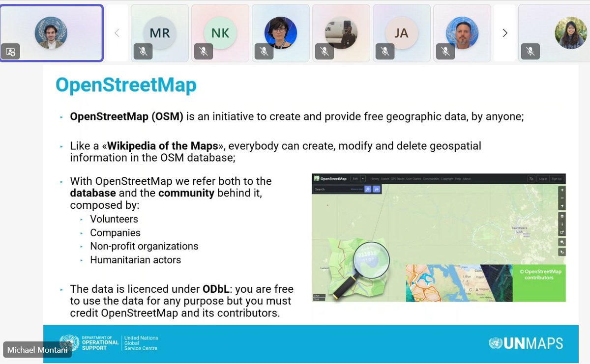
3 Dec 2025
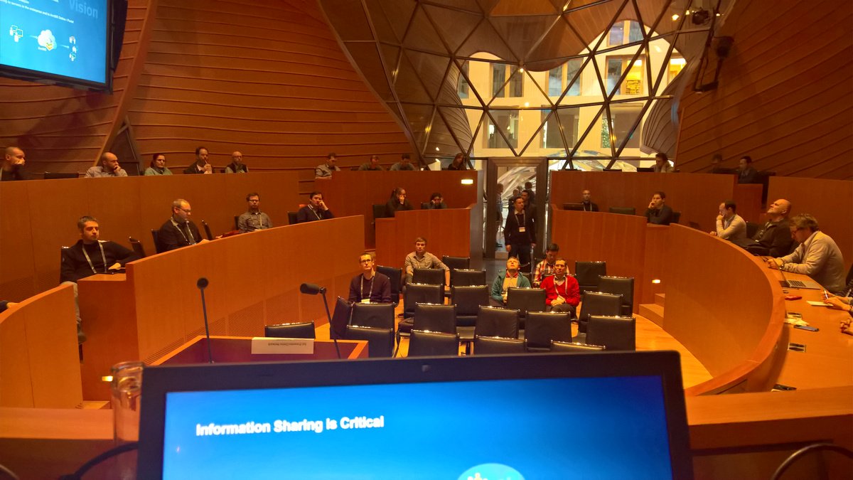
🔎Mr. Michael Montani, Community Engagement Coordinator, shared about field mapping and data validation using collaborative editing platforms such as #OpenStreetMap.
#UNMapsConference #unitednations #geospatial #UNMaps #UNMappers #openstreetmap #GIS #opendata #maps #mapservices
1
2
3
283
2 Dec 2025
🗺 DAY 2 of the UN Maps Clinics 🗺
Today's session focused on Geospatial Information and Mission Dashboards.
Conference Agenda here: 👉 maps.un.org/conference/2025
#UNMapsConference #unitednations #geospatial #UNMaps #GIS #peacekeeping #UNGSC #opendata #maps #mapping #mapservices
1
2
100

4 Sep 2022
Neshan Maps Platform is an alternative to Google Maps Platform in Middle East
medium.com/@reza.kabiri/nesh…
@NeshanMaps
#maps #navigation #Neshan #MapsAPI #MapServices #NeshanMapsPlatform #نشان #پلتفرم_نشان #نقشه_نشان
3

28 Feb 2022
Certain abilities are needed for the internal system I'm working on.
We're stuck because the ArcGIS JS API can't display raster files as is and arcgis mapservices can't be dynamically adjusted for our needs.
I'll throw around the option to use GeoServer in a meeting tomorrow.
2
3

14 Jan 2020
Please consider attending our #AMS2020 #RealEarth presentation: Earth, air, fire, and water: integrating visualization of weather and land processes with mapservices today Tuesday, January 14, 2020 at 11:30-11:45 EST
1
4

25 Jul 2019
Danke an das Team mit @KaiSattler1 für den tollen Artikel und die Entwicklung unserer innovativen Mapservices Suite, die nicht vergleichbar ist mit anderen Tools am Markt. Im Einsatz mit unserem Wasserressourcenmanagement ein weiteres Novum🚀 @PASSnews #Digitalisierung #Logistik
1
2

5 Jul 2019
Lovell Johns have a range of skills in digital mapping services, from simply taking the printed map into the online environment to developing intuitive and editable open source digital map interfaces.
ed.gr/bol13
#webmapping #GIS #mapservices
1

17 Apr 2019
We have just released the new version of the Digital Observatory for Protected Areas @EU_DOPA Explorer 3.1. Many new features and faster #mapservices! Check it out at dopa.jrc.ec.europa.eu/explor…

4
12

14 Mar 2018
Yesterday's SeaGIS 2.0 final seminar provided a variety of interesting presentations, including many BONUS BASMATI-relevant topics, such as #MSP, #EcosystemServices, and #MapServices. Presentations (in Swedish and Finnish) can be seen here: seagis.org/
4
5

7 Dec 2016
Interesting presentation rooms for the techsessions at #DevSummit #Berlin, presenting on "Using and publishing mapservices"
2

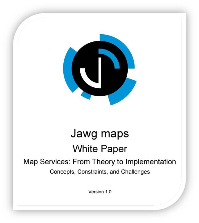
Our new #WhitePaper on #MapServices is out! Download it now and let us know what you think! jawg.io/en/white-paper-map-s…
3

10 Sep 2015
Cast these 10 spells to get your #mapservices working like magic! Details in the #GeoZone Blog bit.ly/1O3WnDQ

1
1

20 Dec 2014
Totally forgot I could turn polygon MapServices to points with a renderer jsbin.com/foxex/1/edit?js,ou… #esrijs
5