
Build powerful web maps without vendor lock‑in. Learn how open source tools like OpenStreetMap, Leaflet, and Python libraries let you create flexible, transparent mapping apps at zero cost. #WebMapping #OpenSource #GIS
🔗 ow.ly/qXcm50YWeA7

2
170

New code sample!
Learn how to build a route planner with draggable waypoints using Leaflet and the Geoapify Routing API. Add, move, and optimize stops directly on the map.
Source code 👇
github.com/geoapify/geoapify…
#LeafletJS #WebMapping #Routing #GIS #Geoapify
31
Build powerful web maps without vendor lock‑in. Learn how open source tools like OpenStreetMap, Leaflet, and Python libraries let you create flexible, transparent mapping apps at zero cost. #WebMapping #OpenSource #GIS
🔗 ow.ly/qXcm50YWeA7

100

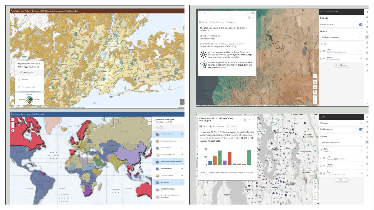
Why rebuild your app from zero when your web map already has everything?🗺️💡
ArcGIS Instant Apps inherits pop-ups, bookmarks, charts, and forms directly from your map, no extra configuration needed.
esri.com/arcgis-blog/product…
#Geoawesome #GIS #ArcGIS #InstantApps #WebMapping #Esri
7
19
1,592

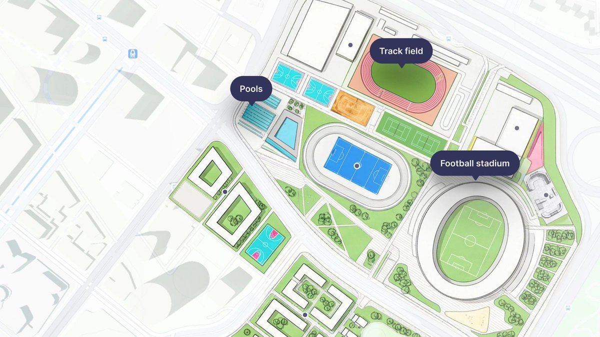
Build a map-based Android app step-by-step.
This tutorial walks you through creating a coffee shop finder using GeoJSON data, custom markers, and a polished UI with a slide-up detail sheet and selected marker states.
It’s a proven pattern: keep your data separate, layer it on top of Mapbox Standard, and focus on building your experience, not the basemap.
Start building: docs.mapbox.com/help/tutoria…
#BuiltWithMapbox #AndroidDev #Kotlin #GeoJSON #MapsSDK #webmapping #jetpackcompose
1
4
43
3,440

Our new Georeferencer eliminates the technical friction of manual file conversion for five major formats: PNG, JPEG, PDF, TIFF, and WebP. It allows you to define the location of your geodata effortlessly.
Find out more: maptiler.link/41v8MLM
#MapTiler #Geodata #WebMapping
9
64
3,699
Build powerful web maps without vendor lock‑in. Learn how open source tools like OpenStreetMap, Leaflet, and Python libraries let you create flexible, transparent mapping apps at zero cost. #WebMapping #OpenSource #GIS
🔗 ow.ly/qXcm50YWeA7

2
159
Introducing Mapbox Atlas v3: self-hosted maps without the infrastructure burden.
Atlas v3 is a complete rearchitecture of Atlas — built to dramatically reduce operational overhead while delivering high-quality maps, search, and navigation in secure or disconnected environments.
From air-gapped networks to in-vehicle deployments, bring modern mapping to your applications faster and with less complexity.
Learn more: mapbox.com/blog/introducing-…
#BuiltWithMapbox #maps #locationintelligence #selfhosted #webmapping
3
30
331
20,040

Mar 23
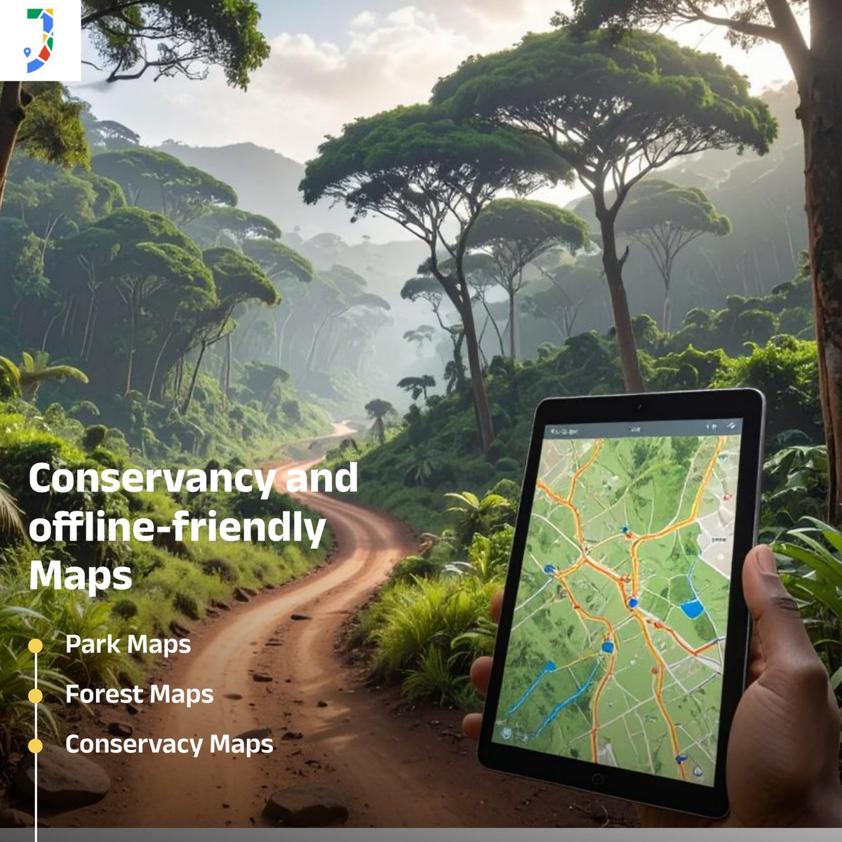
Smart maps. Better conservation.
Web GIS is redefining how we design and manage conservancies.
#GIS #WebMapping #Conservancy #GeoTech #Sustainability #JapakGIS #DigitalMaps #MappingInnovation
1
2
63

Mar 18
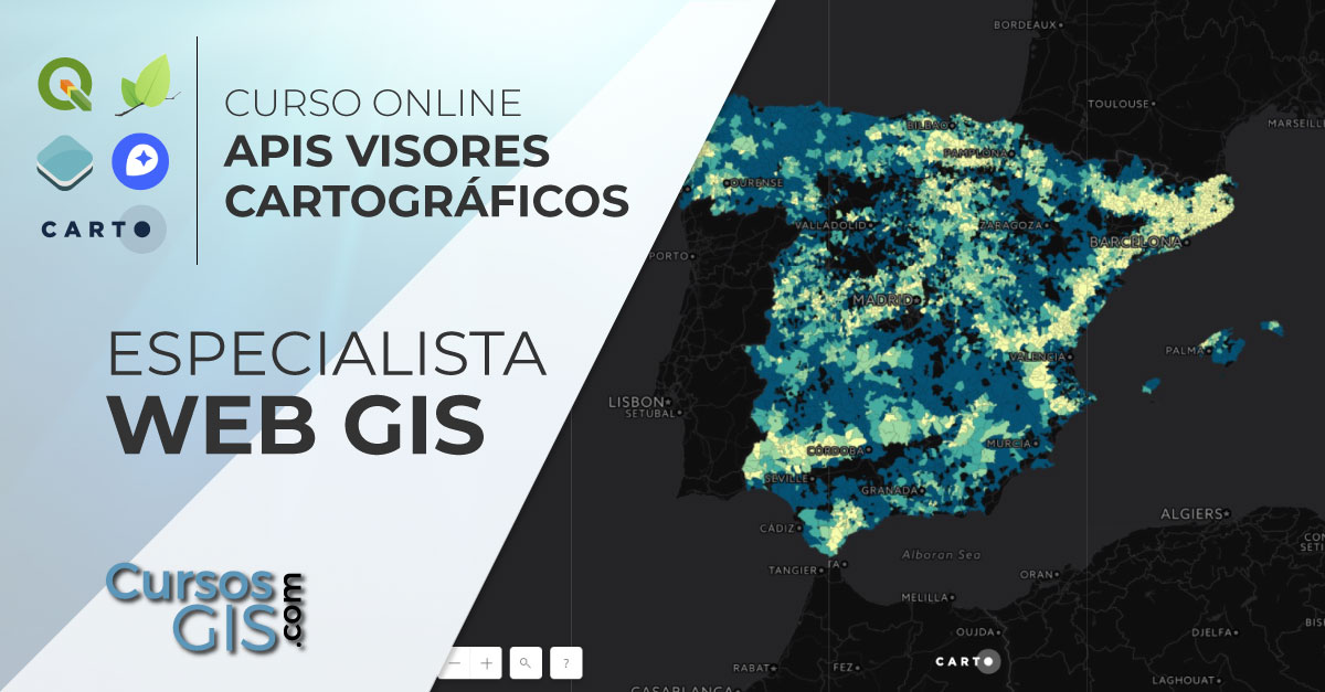
🌍 Este curso ofrece al alumno una completa formación y especialización en Web GIS.
🔗 Web: bit.ly/Curso_Web-GIS_Especia…
💻 Online
📅 8 de abril
🕘 240h
✅ Descuentos
ℹ Inscripción: bit.ly/Form_Web-GIS_Especial…
📧 formacion@tycgis.com
#WebGIS #QGIS #leaflet #mapbox #WebMapping #cursos
1
4
110

Mar 17
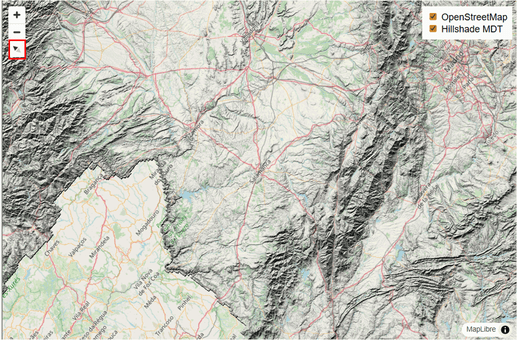
Limitations: BIM alignment is approximate due to Revit origin discrepancies.Revit materials don't carry over to web cleanly, so colours are assigned manually in code. Production fix planned.
#WebMapping #GIS #ThreeJS #PointCloud #BIM #Photogrammetry #Revit
2
3
94
The map runs entirely in the browser.
Upload a CSV file with launch data and the map populates instantly, no backend needed.
There’s also a built-in demo dataset if you want to explore the interface before uploading your own.
#GIS #WebMapping #Leaflet
2
3
34

Mar 3
7
19
1,360

Feb 24
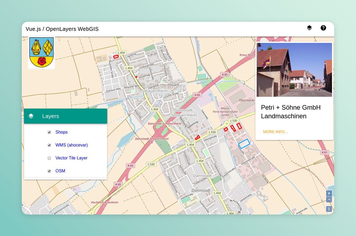
Wegue offers a template and components for webmapping apps with OpenLayers & Vue.js / @vuetifyjs 🌐 - madewithvuejs.com/wegue
4
5
887
Feb 20
Nuevo curso online de webmapping, ahora con MapLibre
mappinggis.com/2026/02/nuevo…
15
95
3,762

Feb 18
🏫 Own your campus maps & data! Join the ISPRS 2026 full-day tutorial on web-based campus routing & event management using open-source GIS.
Limited spots, register or update now!
isprs2026toronto.com/congres…
#WebMapping #GIS #GeoEducation #OpenSource

1
2
44
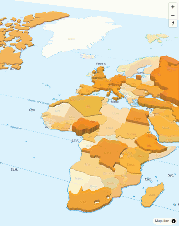
Now you can make web #maps look as beautiful as an atlas with a few quick clicks. We’ve added professional-quality color ramps and hillshades to our design tool so you can apply them to your map styles. Find out more: maptiler.link/4rgBDhR
#WebMapping
2
8
639
Jan 13
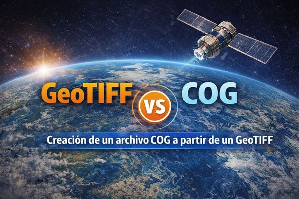
Por qué deberías dejar de servir GeoTIFF clásicos y empezar a usar COG⁉️
Comparamos el #GeoTIFF 🆚 #COG orientado al #webmapping.
Crearemos un archivo COG a partir de un TIFF y los insertaremos en un mapa web para ver su comportamiento.
mappinggis.com/2026/01/por-q…
16
47
2,153

25 Nov 2025
#30DayMapChallenge Day 8: Urban
Inspired by the Morphocode Explorer, I’m building a Freiburg-focused remix using open data.
Tech: OSM, Freiburg Open Data · #Svelte · MapLibre · Turf.js · Tileserver-GL
#Urban #UrbanData #WebMapping #Geospatial #GIS #DataViz
3
180
3 Nov 2025
Seguimos actualizando nuestro curso online de desarrollo de aplicaciones webmapping a las últimas versiones: Geoserver 2.28 OpenLayers 10.6.
Un curso que mimamos mucho.
¡Últimas 4 plazas disponibles!
Descuento para estudiantes y desempleados.
mappinggis.com/cursos/aplica…
2
18
1,017