
From classroom to CEO and back again.
SCET’s Amazoogle course, led by @shomit since 2018, teaches data-driven business in the age of AI. Recently, alumni founders @bailey_farren of @PerimeterMap and @ekberndt of @TensrLabs returned to share their journey.
#ucberkeley


80

Feb 21
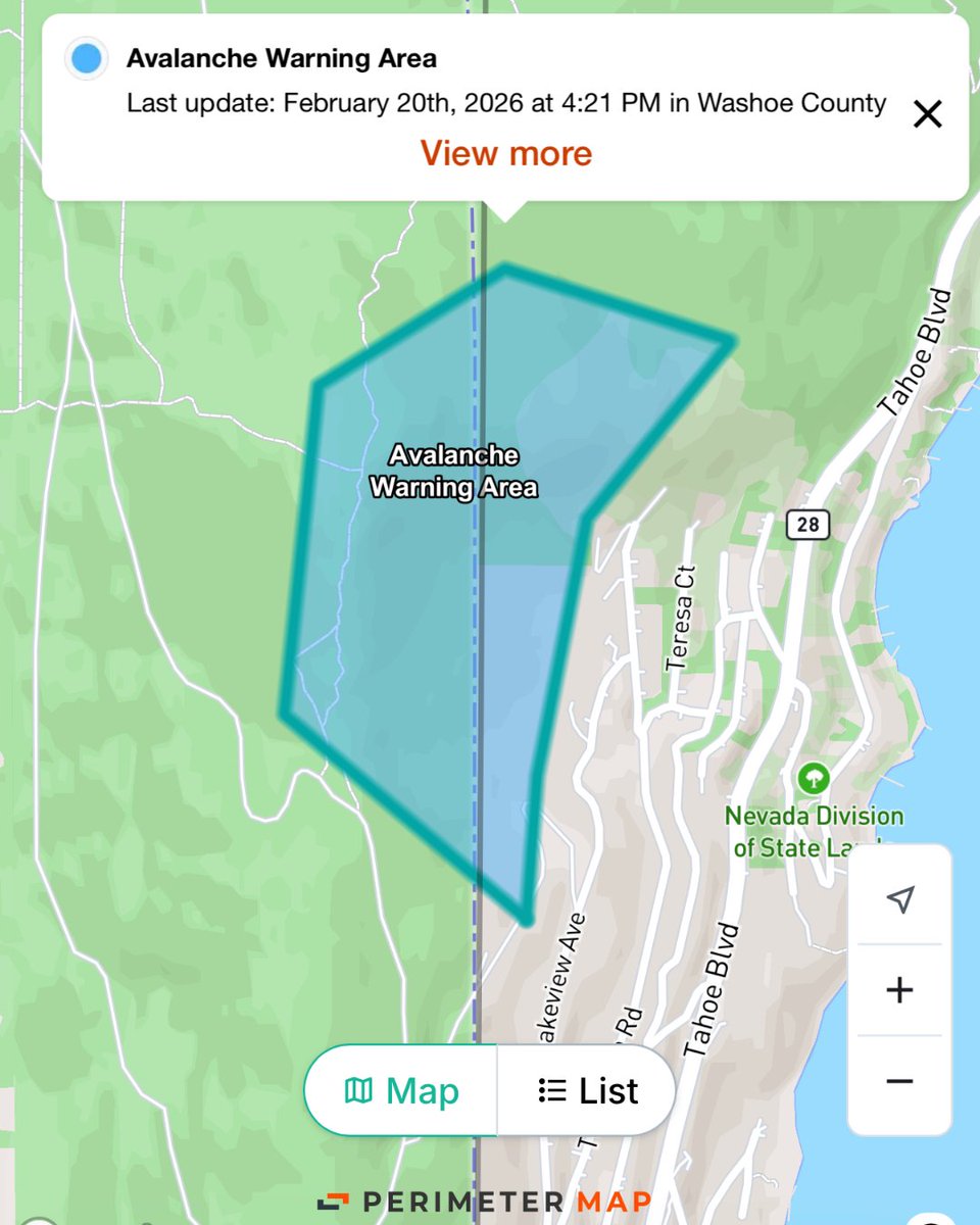
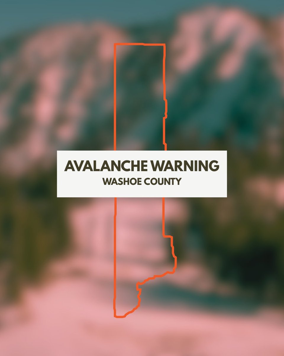
Washoe County published an Avalanche Warning & public notice on Perimeter. The map shows a clear visual boundary and timely updates in real time. Before heading into the backcountry, check perimetermap.com ! #emergencymanagement #perimetermap
1
33
Jan 26
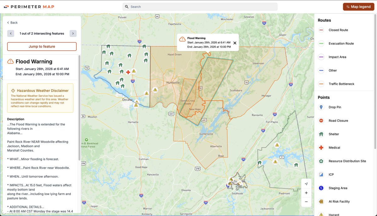
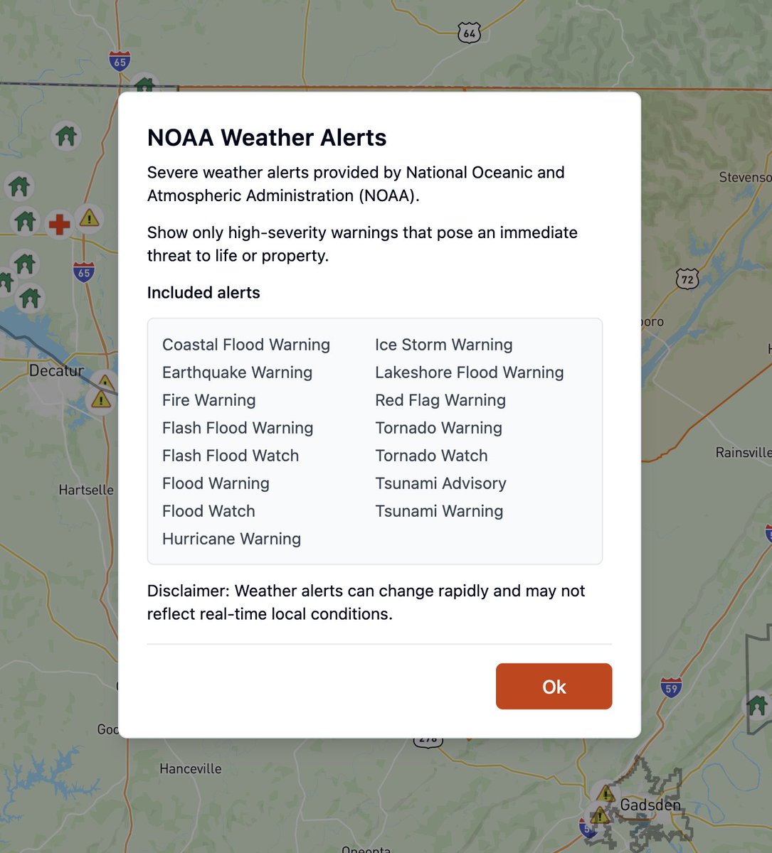
Hear sirens? We’ve integrated high-severity @NOAA alerts making Perimeter Map a go-to resource for every US resident. Bad weather heading your way, check the map to see active warnings for high-impact weather events.
Visit Perimetermap.com
#PublicSafety #PerimeterMap
1
6
Jan 22
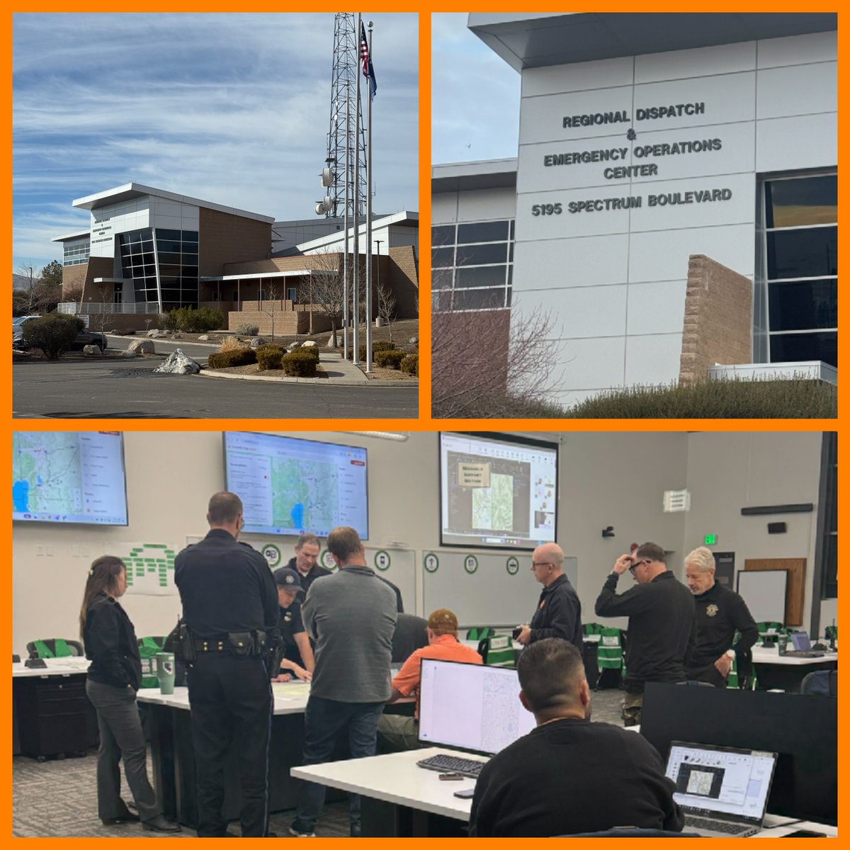
We're proud to collaborate with the Washoe County, NV EMA and their Swift Exit partners to build evacuation zones, the foundation for a broader evacuation planning and modeling. We’re excited to support this work with our newest solution, Perimeter Plan.
#PerimeterMap #Evacuation
16
Jan 15
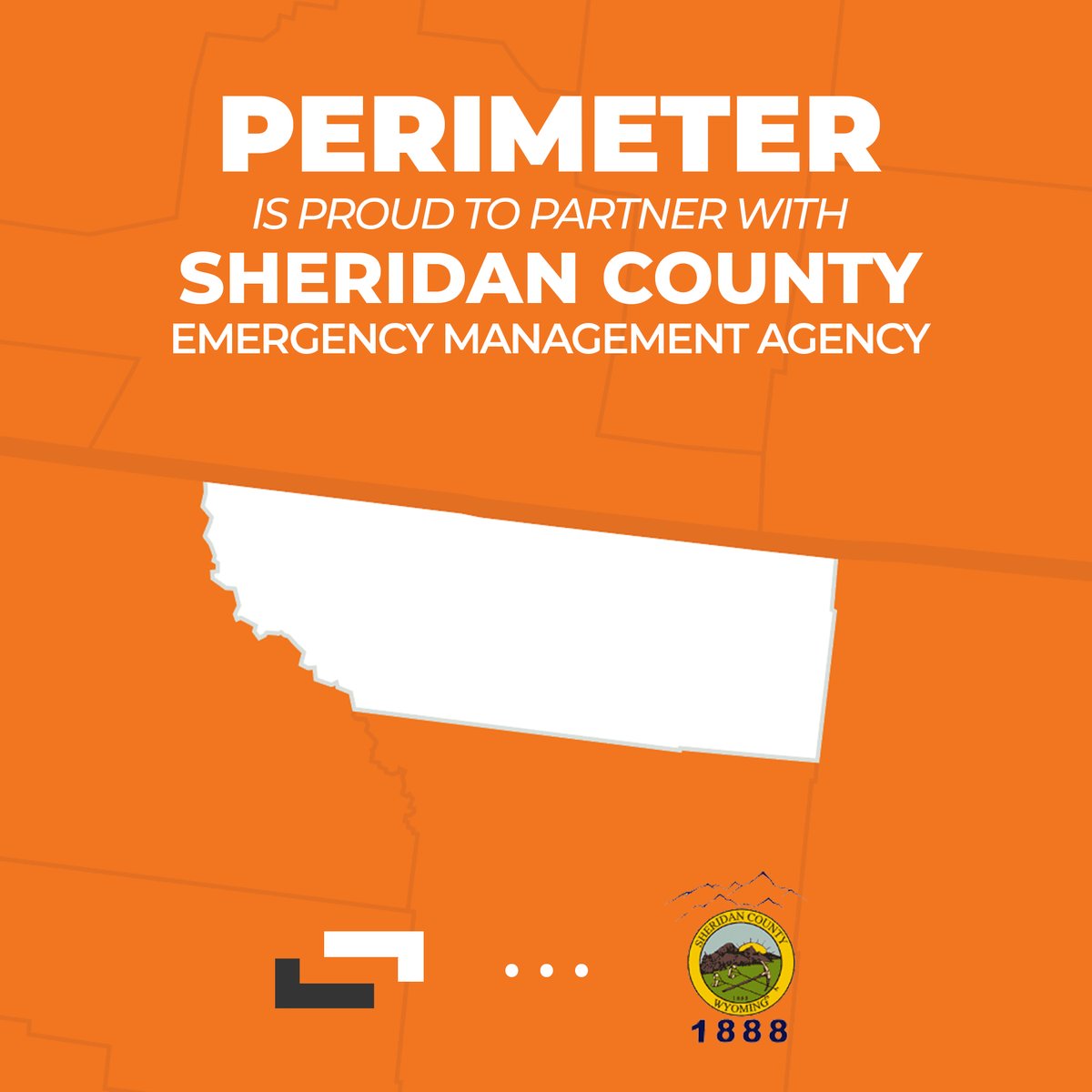
Proud to partner with Sheridan County, Wyoming, our first deployment in the state! Bringing next-gen, real-time emergency situational mapping, perimetermap.com, to public safety teams and residents. We're honored to support your communities! #Perimetermap #SheridanCounty
1
7
Jan 14
Proud to partner with Douglas County, Oregon to bring next-generation real-time emergency situational mapping to the region’s public safety teams and residents. We're honored to help you and your communities!
#Perimetermap #DouglasCounty

1
11
Jan 13
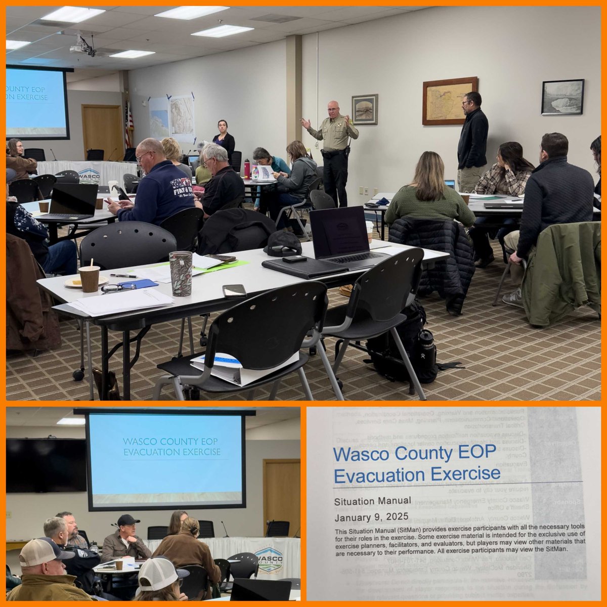
Honored to support the Wasco County, OR tabletop exercise on Jan 9 with the City of The Dalles. Training together builds one map, one voice, and more public trust. Thank you to all the agencies that joined.
@WascoCoSheriff #PerimeterMap #EmergencyManagement
1
16
Jan 13
Proud to partner with Maury County, Tennessee, our first deployment in the state, to bring next-generation real-time emergency situational mapping to the region’s public safety teams and residents. We're honored to help you and your communities!
#Perimetermap #MauryCounty

1
11

10 Dec 2025
Congratulations Bailey Farren and @PerimeterMap for winning the TSI 2025 Startup Shark Tank audience vote! It was a great pitch! #iafcTSI2025! perimeterplatform.com @iafc

1

26 Nov 2025
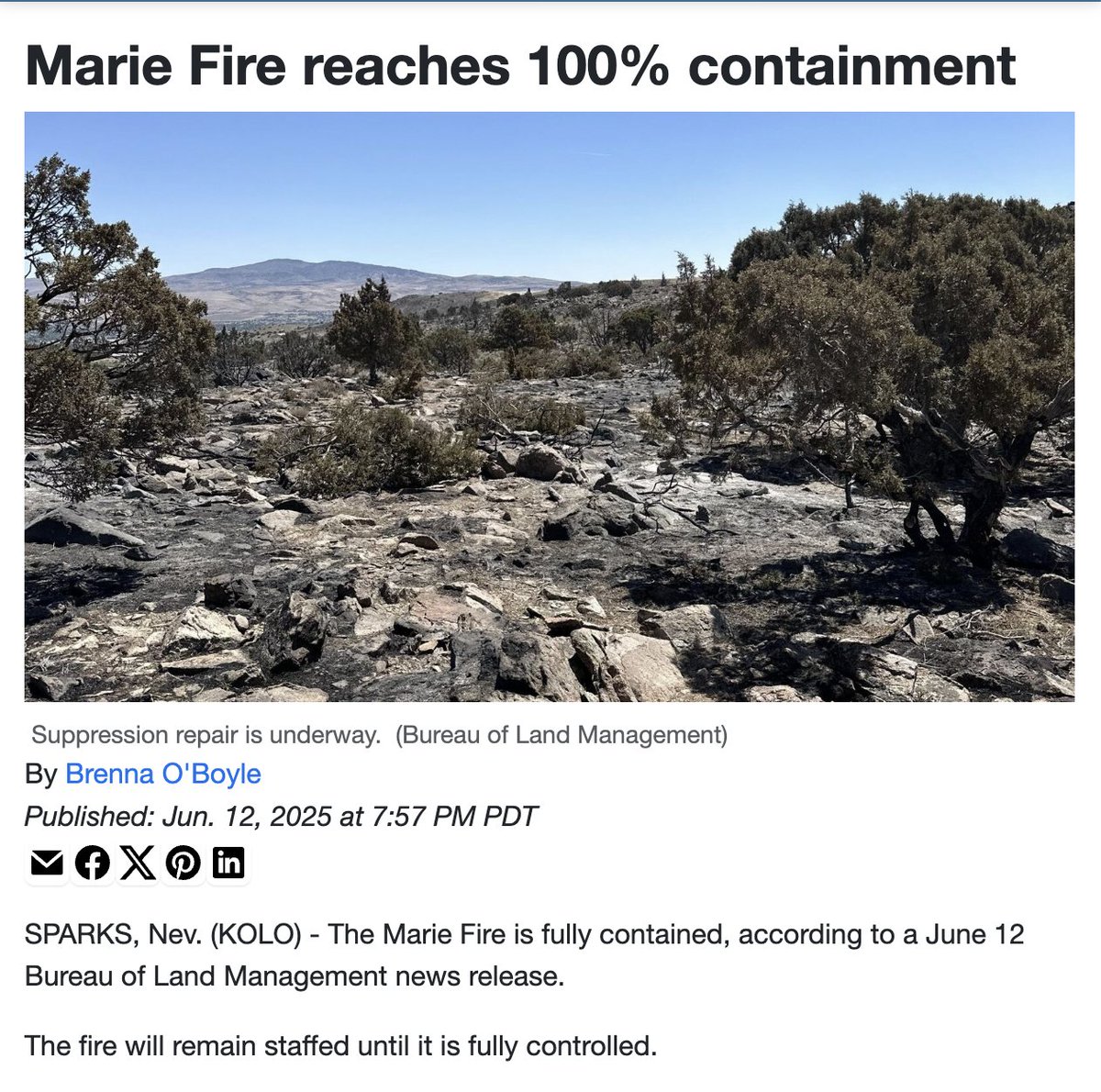
The Marie Fire covered 115 acres in Spanish Springs, NV, and forced hundreds of residents to evacuate. As crews worked to contain the incident, more than 10,000 people relied on @PerimeterMap for clear, real-time information.
#emergencymanagement #publicsafety
13
21 Nov 2025
The Barber Fire burned more than 17,000 acres after lightning struck the desert. Thousands of people relied on @PerimeterMap to understand where the fire was, which zones were under evacuation, and where to go.
#emergencymanagement #publicsafety
9
15 Nov 2025
Every year, Hot August Nights draws thousands of visitors to Reno. Washoe County Emergency Management used @PerimeterMap to share real-time updates, road closures, and safety information.
#emergencymanagement #publicsafety

10
11 Nov 2025
Wasco County Emergency Management used @PerimeterMap to keep residents and first responders connected to the same critical information during the Black Rock Fire. We're proud to support their leadership in public safety.
#emergencymanagement #publicsafety
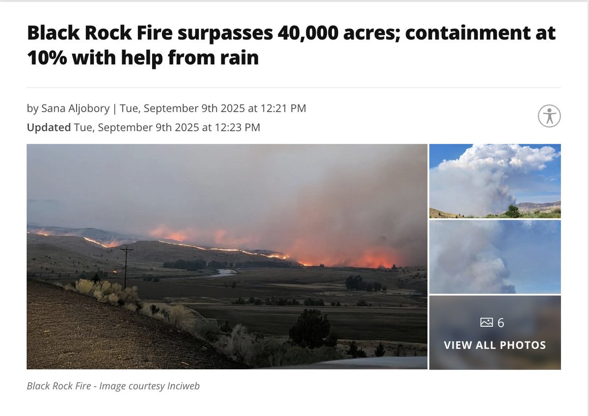
22
5 Nov 2025
We’ve just teamed up with Macon-Bibb County, Georgia, to bring real-time situational mapping to their public-safety teams. A big step forward together! #perimetermap #publicsafety #macon-bibb
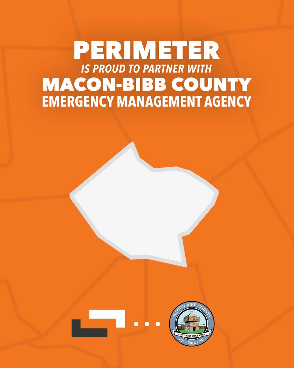
63
7 Oct 2025
Perimeter is proud to partner with Limestone County, AL!
Together, we’re giving emergency managers real-time mapping tools that deliver clarity and trusted info to the public when every second counts.
#PerimeterMap #LimestoneCounty @LimestoneEMA
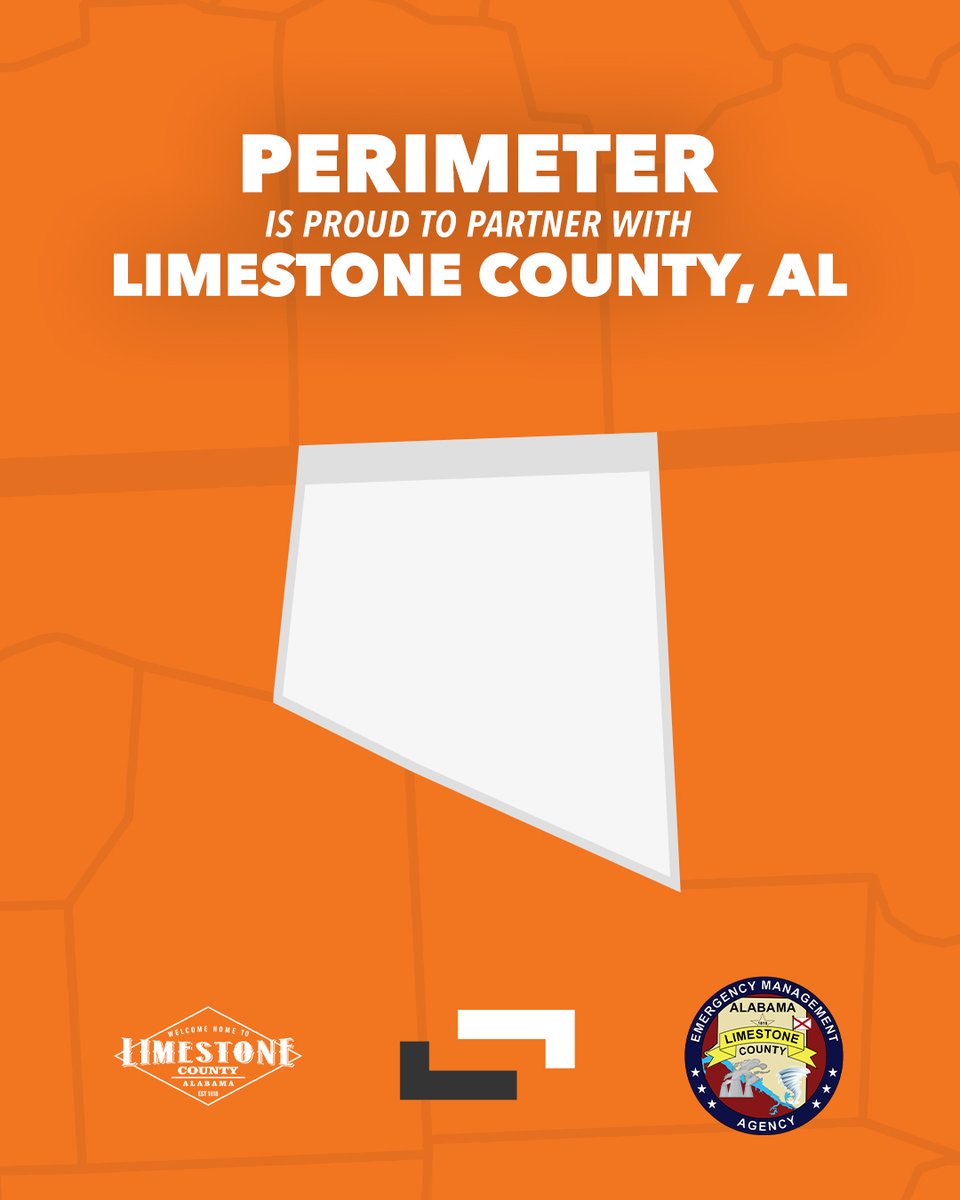
16

25 Aug 2025
What happens when you get the alert text? You have to figure it out yourself. Pair it with @PerimeterMap and give your residents clear, actionable insights. Remove the guess work, and save more lives!
25 Aug 2025

In just 48 hours during the Coyote Fire, more than 40,000 people in El Dorado County used Perimeter for clear, reliable updates. That’s thousands guided by one live source of truth, and protected from the confusion that so often follows emergencies #perimetermap #coyotefire
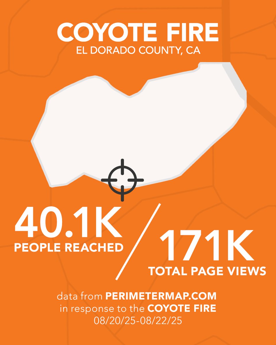
428
25 Aug 2025
In just 48 hours during the Coyote Fire, more than 40,000 people in El Dorado County used Perimeter for clear, reliable updates. That’s thousands guided by one live source of truth, and protected from the confusion that so often follows emergencies #perimetermap #coyotefire
1
476
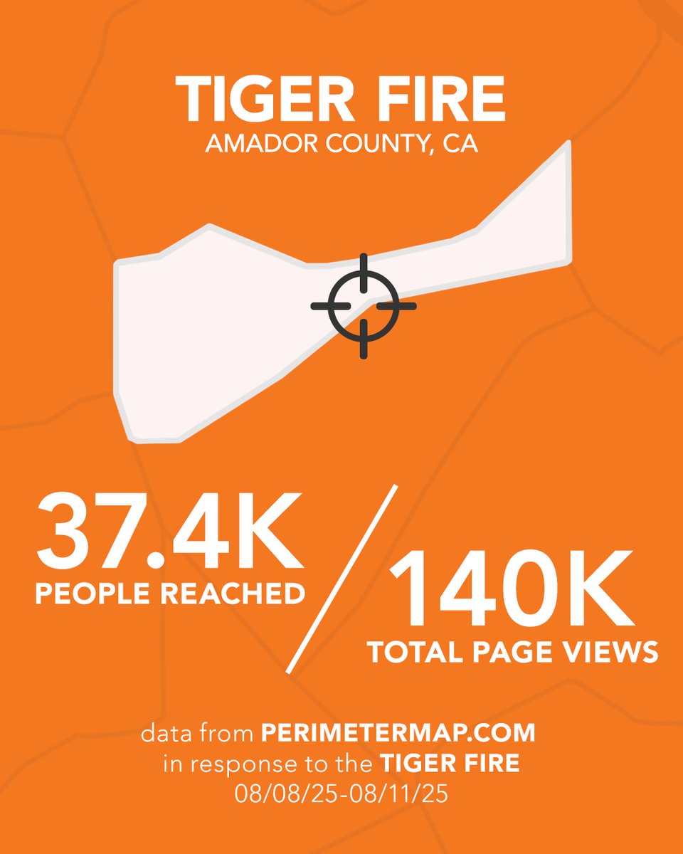
15 Aug 2025
In 72 hours, 92.5% of Amador County, CA residents used Perimeter for real-time Tiger Fire updates. Proud to support Amador County OES in keeping people informed and safe.
#perimetermap #tigerfire
2
123
12 Aug 2025
Climate Change isn’t going to fight itself, so it's up to us to do something. Until the problem is solved, Perimeter will continue to equip public safety with the tools to help mitigate the effects of these events
bit.ly/4mIOzdZ
#perimetermap #publicsafety #climatechange

1
34
6 Aug 2025
Emergency management is not easy work, so we're eternally thankful for those who sacrifice long hours to keep us safe! We hope they get those vacations very soon, too! #perimetermap #publicsafety
1
22