
NOAA provides science, service and stewardship to protect life, property & Earth's natural resources. An agency of @CommerceGov. Join us on Instagram & Facebook
- Tweets 20,868
- Following 158
- Followers 1,318,275
- Likes 327


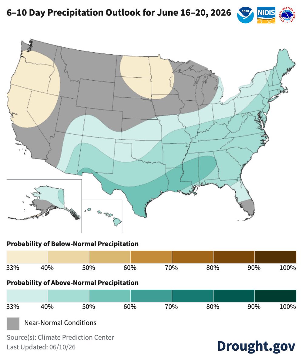
ALT NOAA's 6-10 Day Precipitation Outlook map for June 16–20, 2026. It shows shading indicating a probability of above-normal precipitation stretching from Texas and the Southern Plains eastward across the Gulf Coast, Southeast, Mid-Atlantic, and Northeast, as well as Alaska and Hawaii. Shading for below-normal precipitation covers the Pacific Northwest, northern California, Idaho, and a pocket over the Northern Plains centered on the Dakotas and Minnesota. The Southwest and parts of the Intermountain West show near-normal conditions.
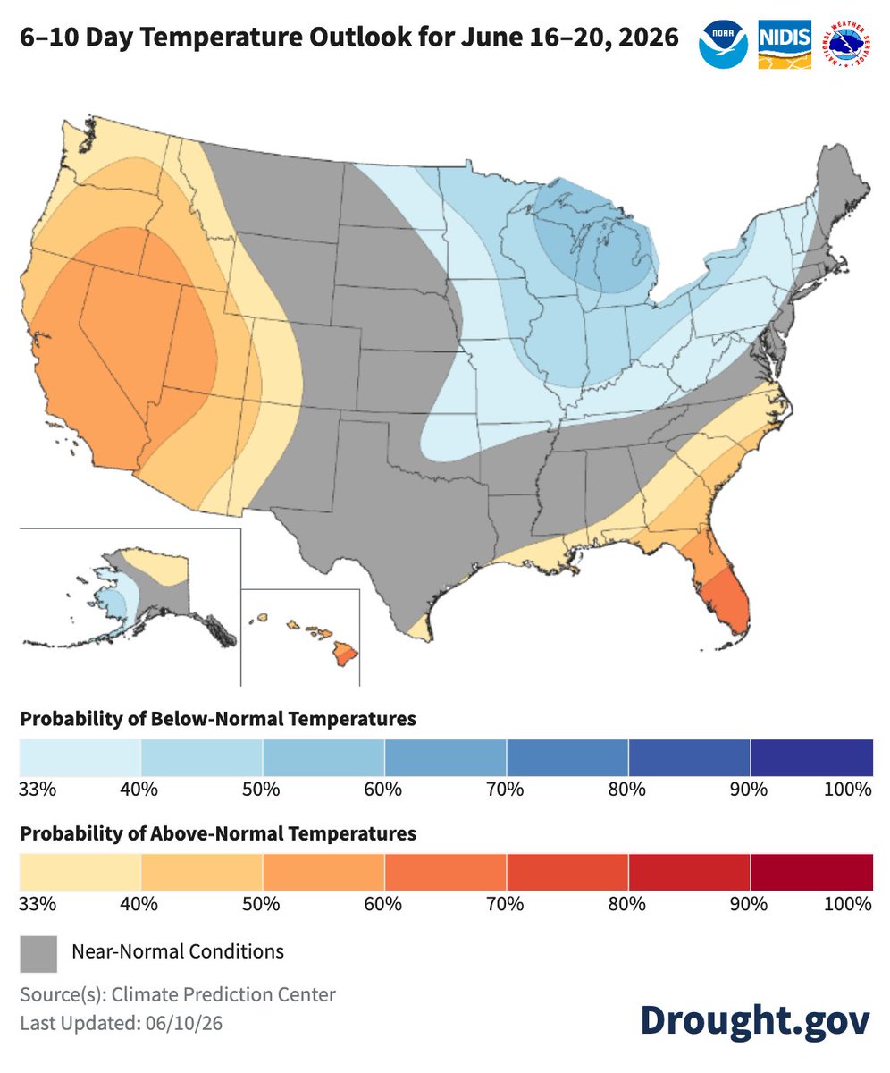
ALT NOAA's 6-10 Day Temperature Outlook map for June 16–20, 2026. It displays a strong probability of above-normal temperatures covering the western half of the United States (including California, Oregon, Washington, Nevada, Idaho, Utah, and Arizona), Florida, and Hawaii. Shading for below-normal temperatures covers the Great Lakes, Upper Midwest, and parts of the Northeast, as well as Alaska. A diagonal swath across the central Plains and parts of the South shows near-normal conditions.

ALT The June 9 U.S. Drought Monitor shows 46.9% of the United States Puerto Rico in drought. Extreme or Exceptional Drought (D3/D4) is present in Oregon, Idaho, Nevada, Montana, Wyoming, Utah, Colorado, New Mexico, Texas, Oklahoma, Kansas, Nebraska, Arkansas, Mississippi, and Louisiana, as well as in each state on the Atlantic Coast from Florida to New Jersey.


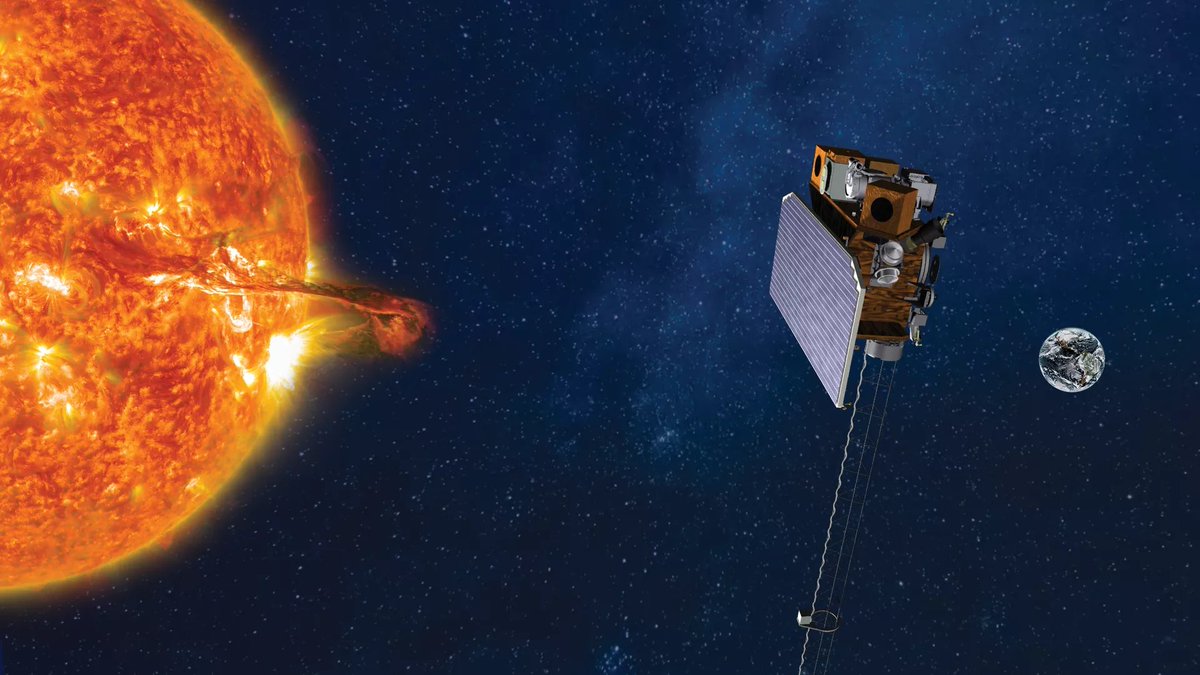
ALT Visualization of SOLAR-1 in space with the sun and Earth in the background.


ALT Map of the global temperature percentiles for May 2026 with warmer areas in gradients of red and orange, cooler areas in gradients of blue and gray indicates that it tied with more than 10% of the record.

ALT Map of world showing locations of temperature highlights in May 2026 with text describing each event and title at top stating “Notable Weather and Climate Events: May 2026”.

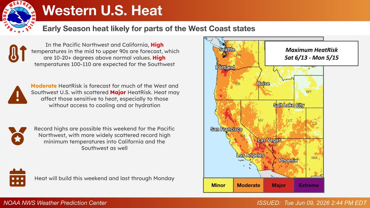
ALT Heat will be on the rise for parts of the West and Southwest later this week and this weekend. Practice heat safety by limiting outside time and staying hydrated!


ALT An underwater close-up of an white abalone resting on the ocean floor. Its oval shell is heavily camouflaged, covered in sediment and small tufts of red and pink algae. It is surrounded by marine kelp and vibrant red seaweed.

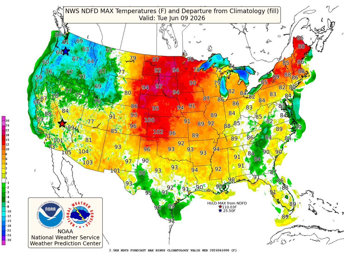
ALT Map showing forecast high temperature departures from normal for the contiguous U.S. The highest departures above normal lie in the central and northern Plains.
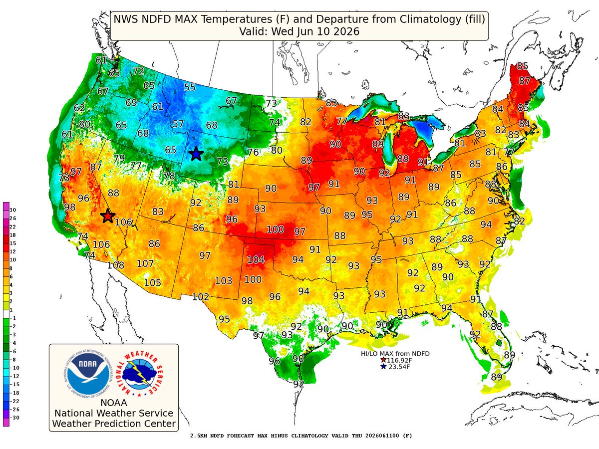
ALT Map showing forecast high temperature departures from normal for the contiguous U.S. The highest departures above normal lie from the Plains, to the Midwest to the NE.

ALT Map showing forecast high temperature departures from normal for the contiguous U.S. The highest departures above normal lie from the Midwest to the NE and Mid-Atlantic.
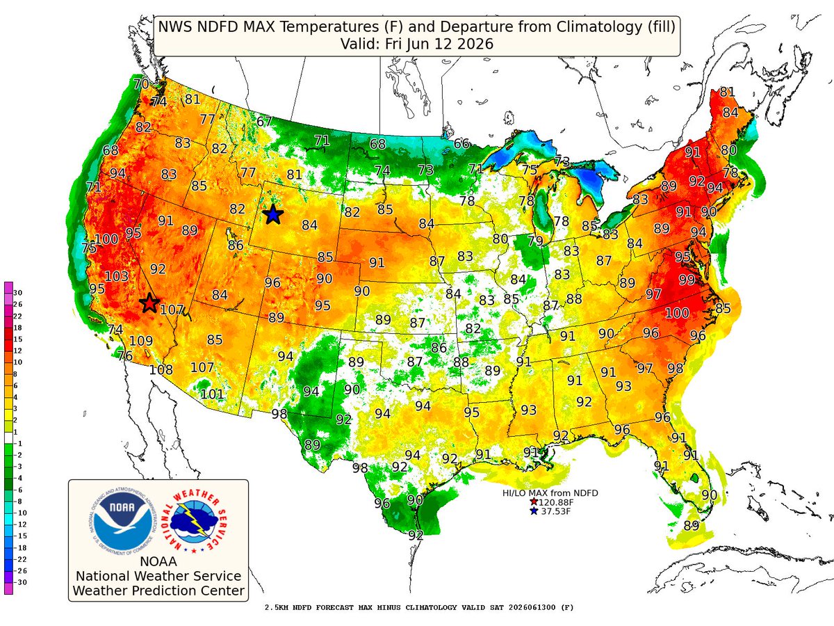
ALT Map showing forecast high temperature departures from normal for the contiguous U.S. The highest departures above normal lie in the NE and Mid-Atlantic.


ALT The inner harbor of the Port of Corpus Christi, Texas.
