
We have released a promotional video for Spatial ID, a common identifier that uniquely identifies space across the Earth—including the air, the ground, the underground, indoors, and the sea.
#SpatialID #Identifier #DigitalTwin
youtu.be/Zr73R1Qc-ok
4
7
11,903

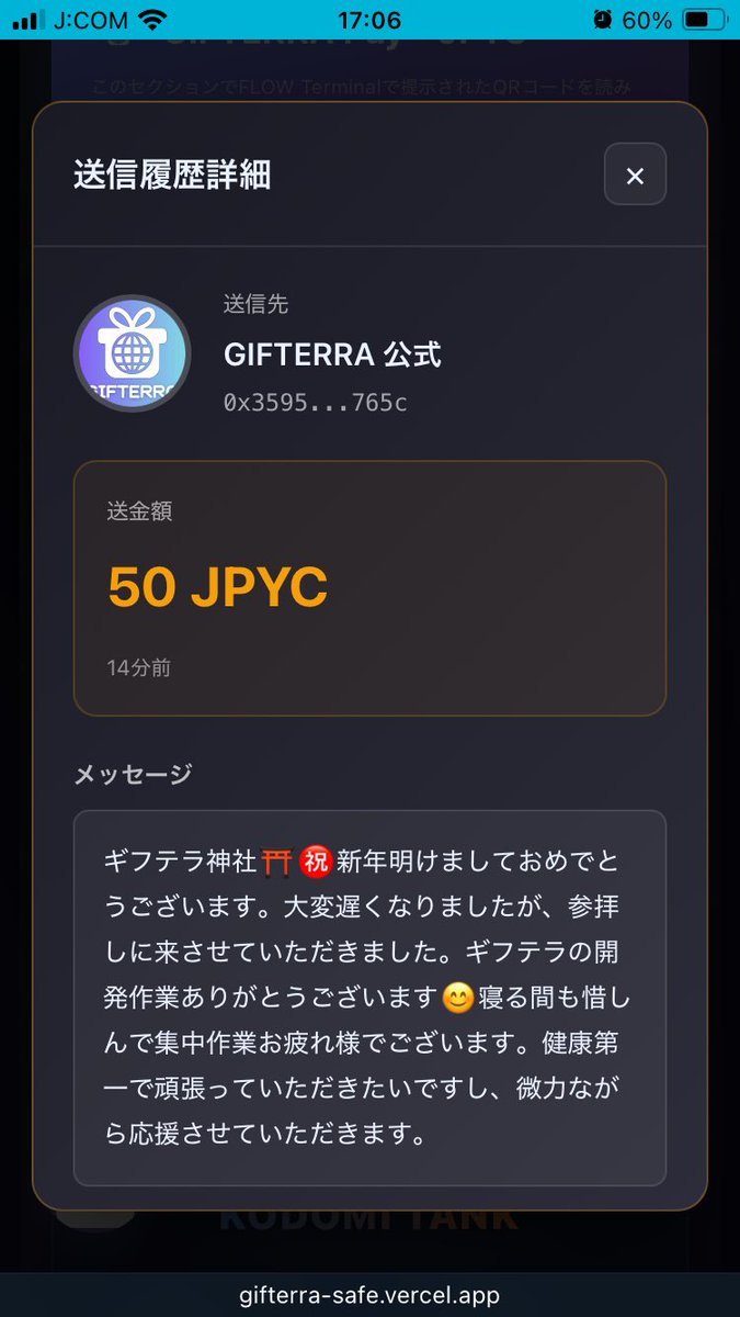
ヒロ / Mai_M Art Projectさん、こんばんは。
お疲れ様でございます♪
遅くなりましたが、
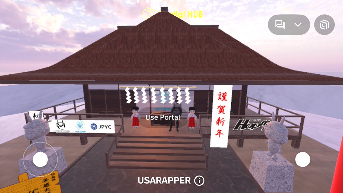
2026年初詣参拝クエスト2回目に、
参加させていただきます。
画像を添付させていただきます。
ご確認をよろしくお願いいたします🙇♀️
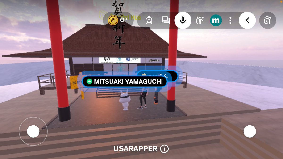
Spatial名:masayoshi
SpatialID:@masayoshi
#GIFTERRA #ギフテラ #JPYC #メタバース #POL #ステーブルコイン #Spatial #NHT #SBT #拡散希望


#ギフテラ #JPYC #メタバース
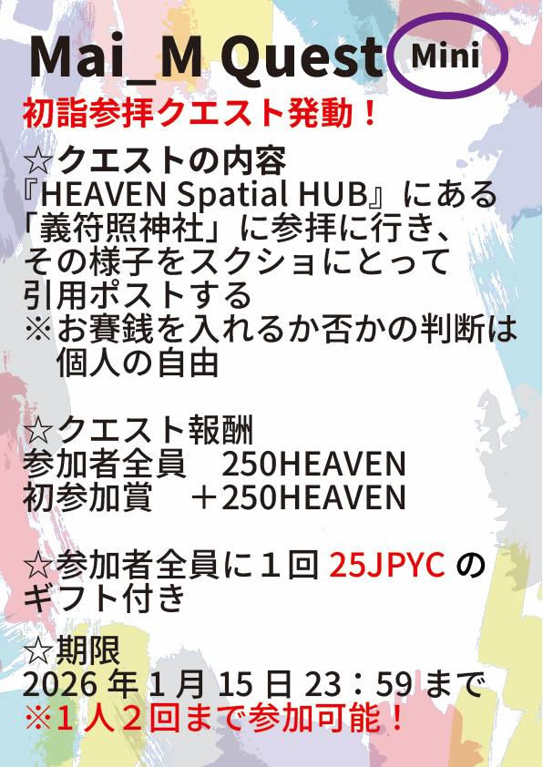
初詣参拝クエストやってます!✨
回答はこちらのポストを引用してお願いします!
期限は1/15…つまり明日の23:59までとなっておりますので、できるだけ声を掛け合って皆さんで参拝してくださいね😊
クエスト報酬・参加ギフトのJPYCはギフテラの一括送信機能でお送りいたします!
※ちなみに東日本は7日までが初詣と言われていますが、西日本では15日か、節分までの参拝が初詣とされている地域が多いそうですよ!
1
3
185
ヒロ / Mai_M Art Projectさん、
お疲れ様でございます。
大変遅くなりましたが、
2026年初詣参拝クエスト参加させていただきます。
添付画像をご確認をお願いいたします。
今年も、どうぞよろしくお願いいたします🙇♀️
Spatial名:masayoshi
SpatialID:@masayoshi
#GIFTERRA #ギフテラ #JPYC #メタバース #POL #ステーブルコイン #Spatial #NHT #SBT
#ギフテラ #JPYC #メタバース
先日より初詣参拝クエストやってます!✨
回答はこちらのポストを引用してお願いします!
今回の期限は1/15の23:59までとなっておりますので、できるだけ声を掛け合って皆さんで参拝してくださいね😊
クエスト報酬・参加ギフトのJPYCはギフテラの一括送信機能でお送りいたします!
※ちなみに東日本は7日までが初詣と言われていますが、西日本では15日か、節分までの参拝が初詣とされている地域が多いそうですよ!

2
2
8
267
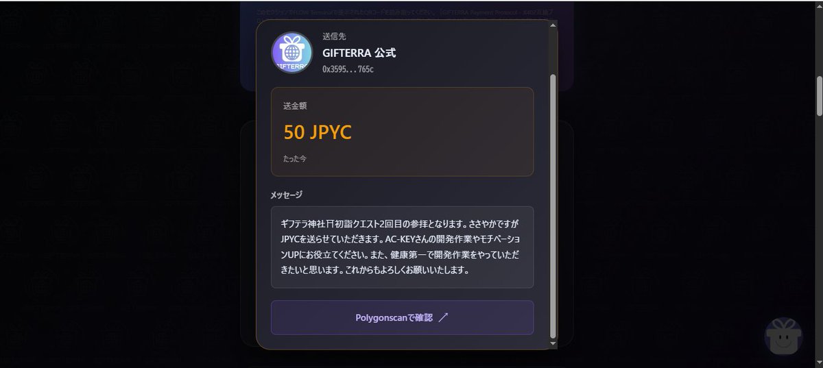
ヒロ / Mai_M Art Projectさん、こんばんは。
第2弾・年越大祓参拝クエスト参加させていただきます。
添付画像をご確認をお願いいたします。
Spatial名:masayoshi
SpatialID:@masayoshi
Spatialでもよろしくお願いいたします。
友達申請していただけたら嬉しいです。
必ず、後ほど友達申請バックさせていただきます。
#GIFTERRA #ギフテラ #JPYC #メタバース #POL #ステーブルコイン #Spatial #NHT #SBT

27 Dec 2025
#ギフテラ #JPYC #メタバース
本日より第2弾・年越大祓参拝クエストスタートです!✨
回答はこちらのポストを引用してお願いします!
今回の期限は12/31の23:59までとなっておりますので、できるだけ声を掛け合って皆さんで年越大祓に参拝してくださいね😊
クエスト報酬・参加ギフトのJPYCはギフテラの一括送信機能でお送りいたします!
※第1弾参加済みの方も、期間内にもう1度参加できます!

1
1
8
209

23 Oct 2025
🚀 Discover how VoxMessenger is revolutionizing communication with seamless crypto payments and top-notch data privacy! 🌐 With 300k users, it's a game changer! 🔒💸 #Crypto #DataPrivacy #VoxMessenger #Innovation #SpatialID #SpatialScan3D
calendly.com/akuma-engines/3…
2
50
22 Oct 2025
Protect your digital self! 🔒 Vox Messenger's 3D Spatial ID defeats deepfakes with cutting-edge tech. Plus, it’s ready for the quantum future! Watch now! #Deepfake #Cybersecurity #VoxMessenger #SpatialID #SpatialScan3D
calendly.com/akuma-engines/3…
4
333

9 Sep 2025
週末に東京で開催された Fuori 3DGeoInfo イベント(いわゆる非公式だけど関連企画)「OGC Japan Forum / OSGeo.JP 合同Meetup」での FOSS4G LT で登壇した空間IDについての古橋発表内容を公開しました。
発表当日にエイヤッと作った資料ですが、自分の頭の中を整理するのにも効果的で、古橋としてもOGCへのコミットに今まで以上に取り組んでいこうと考えております。
speakerdeck.com/mapconcierge…
#空間ID #SpatialID #PLATEAU #OGCJapanForum #OGC #FOSS4Gj #3DGeoInfo #FuruhashiLab #古橋研究室 #AoyamaGSC #青学

1
4
8
952

28 Jul 2025
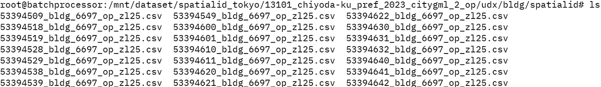
8月1日より、塚田研究室は東京23区の #空間ID(#SpatialID、ZL25)データセットの配信を開始します!
最新の #CityGML から生成された約125GBのデータで、ディレクトリ構造&命名規則は元データとほぼ同じ。
研究や開発にぜひご活用ください〜
#PLATEAU #VoxelData #都市データ #MLIT
1
2
14
3,018
11 Apr 2025
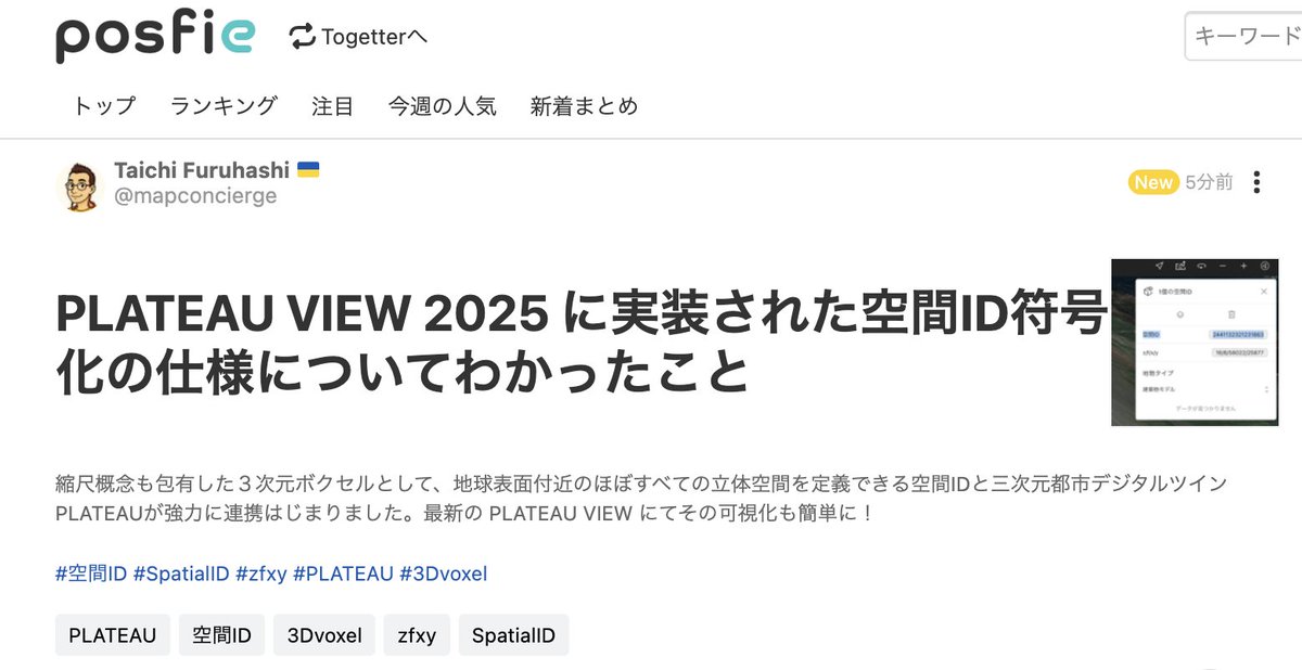
最新の PLATEAU VIEW に実装された空間ID可視化ツールの符号化IDについて整理しました。
この符号化が実装されたことで、Google の S2 などと良い勝負できるようになったと思います!
関係者各位に感謝! あと GitHub リポジトリとしてのソース公開とドキュメンテーション大事。
posfie.com/@mapconcierge/p/2…
#空間ID #SpatialID #zfxy #PLATEAU #3Dvoxel #Ouranos
#FuruhashiLab #古橋研究室
@asahina820 @ra0kley @geosanak @anotherbrain
9
22
1,513
11 Apr 2025
この GitHub リポジトリですべて解決!!!
関係者の集合知すばらしい!
github.com/reearth/spatial-i…
#PLATEAU #PLATEAUVIEW #SpatialID #zfxy
1
3
102
13 Mar 2025
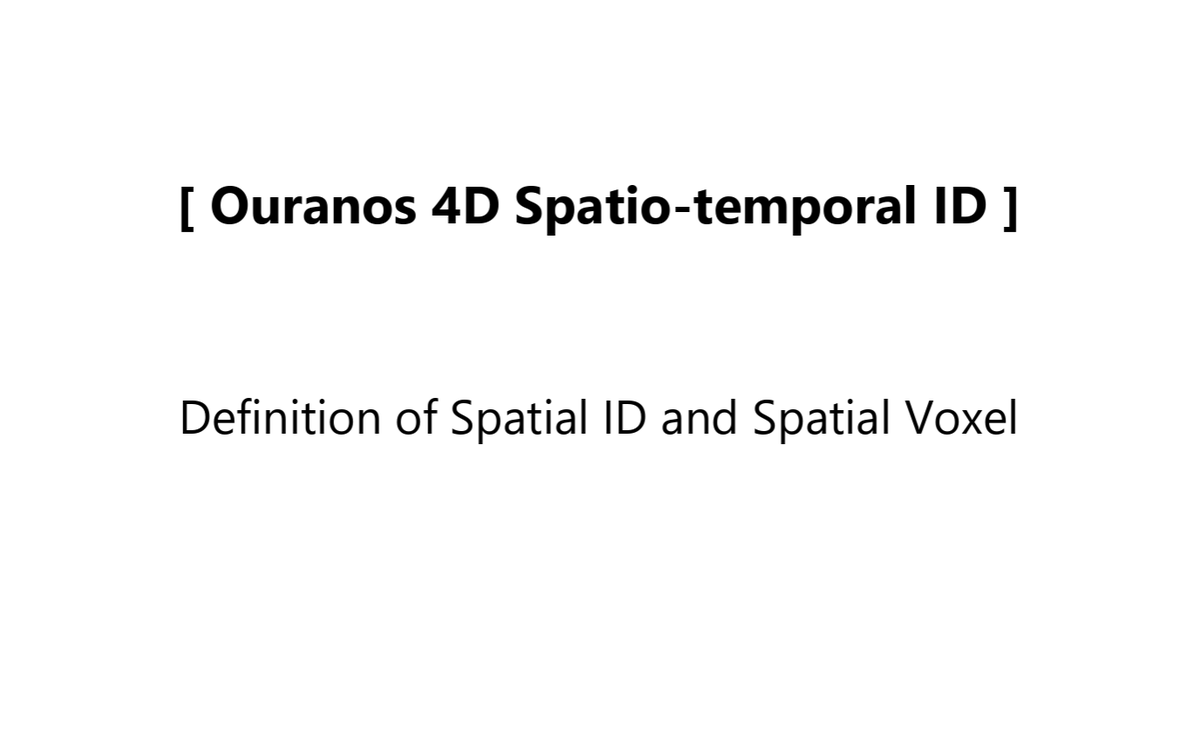
The Japanese government has been publishing the **3D Spatial ID Architecture Guidelines**, which enable the unique (non-overlapping) identification of specific spatial regions. Recently, the **English version** summarizing its overview and definitions has been released.
The official English name is **"Spatial ID and Spatial Voxel"**, but since this name is somewhat cumbersome as a proper noun, I personally refer to it as **"ZFXY Spatial ID"**, inspired by the **zfxy voxel** algorithm from the **UN OpenGIS Initiative**.
To implement **3D digital twins of cities** in society, it is essential to conceptualize **spatial IDs that define voxel regions in three-dimensional space with zoom level concepts**. I hope that this spatial ID will evolve into a **key infrastructure** supporting the distribution of geospatial information.
日本政府は、空間上の特定の領域を一意に(重複なく)識別するための3次元空間IDアーキテクチャガイドラインを公開してきました。このたび、その概要と定義をまとめた英語版が公開されました。
正式な英語名称は "Spatial ID and Spatial Voxel" ですが、この名称は固有名詞として扱いにくいため、アルゴリズムの基盤となっている UN OpenGIS Initiative の zfxy ボクセル にちなんで、個人的に 「ZFXY空間ID」 という愛称で呼ぶことにします。
都市の3次元デジタルツインを社会実装するためには、三次元空間におけるボクセル領域をズームレベルの概念を持つ空間IDとして定義できる発想が求められます。この空間IDが、地理空間情報の流通を支える重要なインフラとして発展していくことを期待しています。
* Definition of Spatial ID and Spatial Voxel:
ipa.go.jp/digital/architectu…
* zfxy-spec: ZFXY specifications
github.com/unvt/zfxy-spec
#DigitalTwin #SpatialID #zfxy #UNOpenGIS #SmartMaps #OuranosEcosystem #PLATEAU #FuruhashiLab #古橋研究室 #AoyamaGSC #青学 #GEOlab #PoliMI

7
377

29 Apr 2024
The #Trust gap between employers & workers tinyurl.com/pu4jp9r8 #HumanExperience #HX #CustServ #CustExp #EmployeeExperience #EX #ServiceDesign #ExperienceDesign #FutureOfWork #FutureOfHumanity #Humanism #DesignThinking #InfiniteJourneys #GenAI #AGI #HybridIntelligence #DigitalIntelligence #ExplainableAI #xai #uai #Trust #TrustByDesign #HyperTrust #AIEthics #AIOps #ML #DecisionManagement #RealTimeDecisioning #rtd #NextBestAction #NBA #BeyondDigital #TransformationthatWorks #ExperiencePwCsg #TheNewEquation #CommunityOfSolvers #Web3 #Metaverse #VirtualWorld #SpatialComputing #SpatialID
2
24
29 Apr 2024
Consumer #Trust levels continue to decline.. tinyurl.com/3mvsdntn #HumanExperience #HX #CustServ #CustExp #EmployeeExperience #EX #ServiceDesign #ExperienceDesign #FutureOfWork #FutureOfHumanity #Humanism #DesignThinking #InfiniteJourneys #GenAI #AGI #HybridIntelligence #DigitalIntelligence #ExplainableAI #xai #uai #Trust #TrustByDesign #HyperTrust #AIEthics #AIOps #ML #DecisionManagement #RealTimeDecisioning #rtd #NextBestAction #NBA #BeyondDigital #TransformationthatWorks #ExperiencePwCsg #TheNewEquation #CommunityOfSolvers #Web3 #Metaverse #VirtualWorld #SpatialComputing #SpatialID
2
29
9 Jan 2024
What 3 things should Web3 founders think about in 2024? tinyurl.com/3mp8h8m5 #HumanExperience #HX #CustServ #CustExp #EmployeeExperience #EX #ServiceDesign #ExperienceDesign #FutureOfWork #FutureOfHumanity #Humanism #DesignThinking #InfiniteJourneys #GenAI #AGI #HybridIntelligence #DigitalIntelligence #ExplainableAI #xai #uai #Trust #TrustByDesign #HyperTrust #AIEthics #AIOps #ML #DecisionManagement #RealTimeDecisioning #rtd #NextBestAction #NBA #BeyondDigital #TransformationthatWorks #ExperiencePwCsg #TheNewEquation #CommunityOfSolvers #Web3 #Metaverse #VirtualWorld #SpatialComputing #SpatialID
1
2
69
9 Jan 2024
How retailers can make brick-and-mortar consumers' first choice tinyurl.com/2zdjcw3m #HumanExperience #HX #CustServ #CustExp #EmployeeExperience #EX #ServiceDesign #ExperienceDesign #FutureOfWork #FutureOfHumanity #Humanism #DesignThinking #InfiniteJourneys #GenAI #AGI #HybridIntelligence #DigitalIntelligence #ExplainableAI #xai #uai #Trust #TrustByDesign #HyperTrust #AIEthics #AIOps #ML #DecisionManagement #RealTimeDecisioning #rtd #NextBestAction #NBA #BeyondDigital #TransformationthatWorks #ExperiencePwCsg #TheNewEquation #CommunityOfSolvers #Web3 #Metaverse #VirtualWorld #SpatialComputing #SpatialID
10

25 Apr 2023
#SpatialID data sharing could improve the efficiency of #autonomous robots and #AR #navigation systems. Dynamic Map Platform, Softbank Corporation, and B-Bridge Corporation have shown a successful demonstration experiment in Tokyo.
pickool.net/streamlining-del…
1
2
81